|
|

|
thesweetcheat’s TMA Blog |
|
The Cotswold Way III – Winchcombe – Dowdeswell 6 April 2013
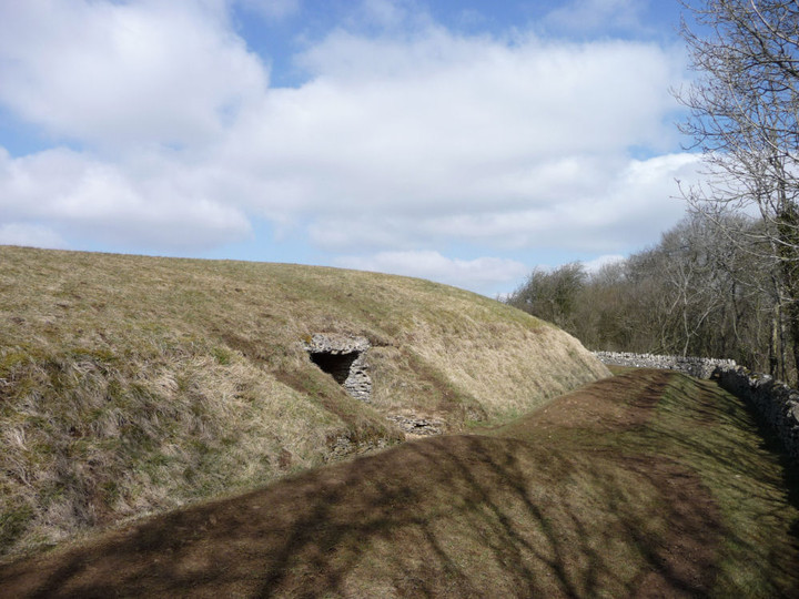
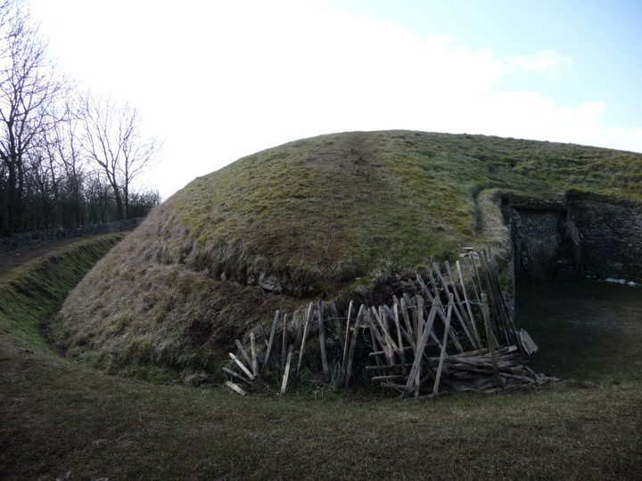
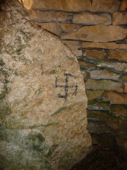
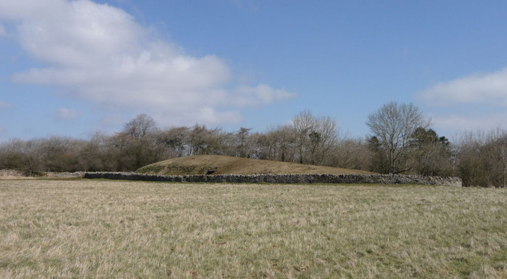
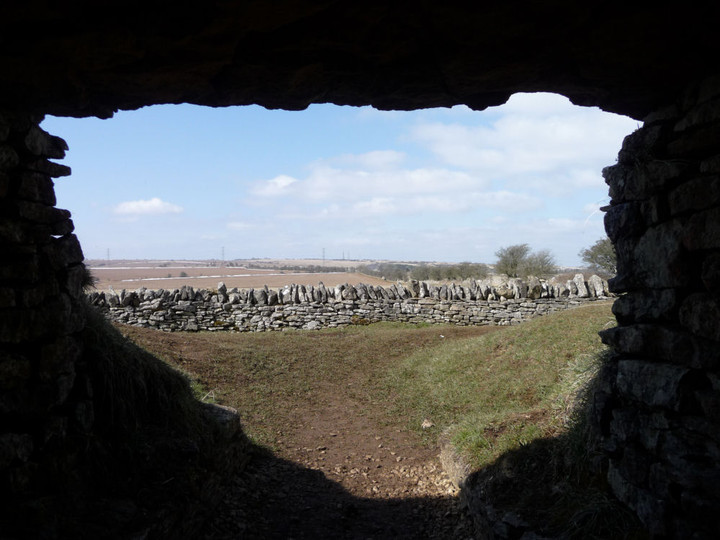
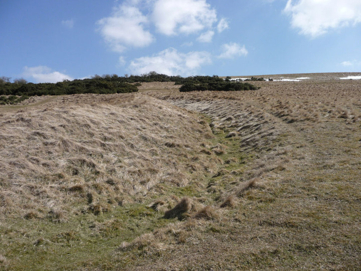
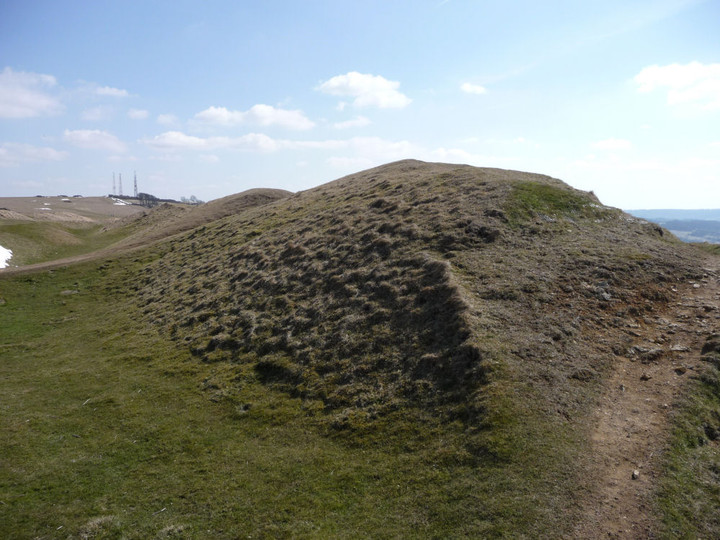
| A sunny Saturday is in the offing, but I’ve got this terrible cold coming on, so decline the charms of frozen Wales for another adventure close to home. Having been misled by on-line bus timetables into being in town with an hour to spare, I find myself in an outdoor shop succumbing, finally, to Gladman’s advice and buying some walking poles, in the hope that they might help my ongoing dodgy leg. Suitably equipped, I head off to Winchcombe, a bustling little town on this spring morning. After crossing the swift-flowing River Ishbourne, the Cotswold Way leaves the road and heads southwest. The ground is much firmer than it has been on the previous trips out, a dry week has drained much of the moisture from the mud that made walking such hard work. The biggest climb of the day is early on in this section, past disinterested horses and into the trees near Corndean Hall. Climbing up through the woods and fields towards today’s key site, I meet several pairs of walkers. This is obviously going to be a popular stretch; no lonely hills these. It’s quite a steep ascent up towards Belas Knap, a little more than 200 vertical metres above my start point in Winchcombe. Belas Knap — Fieldnotes14.04.13ceI’m excited to be coming back to Belas Knap. It’s been over three years since I last came up here, when the mound was buried under snow as deep and pristine as Christmas cake icing. In contrast, today is a proper spring day. The late winter has left some snow in the hedges and verges, but the twitter and trill of birdsong and the sunshine slanting through the trees on the approach instils a sense of renewal and rebirth. I don’t have the place entirely to myself on arrival, but the two walkers I meet are readying to leave and I’m soon alone. This is a wonderful monument; the restoration work detracts not at all from the splendour of curved forecourt, whaleback mound and welcoming chambers. What does detract however, is to be confronted with a swastika daubed on one of the stones in the NE chamber. It’s never nice to see damage of any sort at an ancient site, but the fact that some meat-headed moron has chosen to bring their far-right idiocy here is doubly upsetting. The swastika is black, it’s not clear what has been used, although it’s not paint – perhaps charcoal. Ugly, in every sense. More people arrive, but the mound is so big that it’s possible to feel alone here even when you’re not. I come across another swastika in the western chamber, which I manage to partially wash off with water from my bottle. Looking out from the chamber, I realise that the masts on the top of Cleeve Hill are visible. The last two times I came here, visibility was reduced by hillfog, so it’s great to be able to see so far. There is some temporary wooden fencing at the eastern tip of the horned forecourt, where people climbing up onto the mound have eroded the earthwork. It looks as though some repair work is underway here, from the little pile of stacked limestone pieces. I return to the NE chamber and find to my sadness two further swastikas that I hadn’t seen the first time. Awful. Emerging back into the sun, I meet three guys from Edinburgh, who turn out to be actors come down to Stratford for a play. They tell me that they usually come out to the Cotswolds for a walk on their trips down here, showing what a pull this area exerts far and wide. We chat for a bit and they head off towards Brockhampton, leaving me alone in the sunshine for a while longer. Before eventually leaving, I have a quick look at the almost-gone round barrow in the field to the WSW. Like the similarly denuded example at nearby Crippetts, it was obviously placed here in a relationship with the earlier long barrow, but is so reduced as to almost escape notice, even if you are looking for it. Although I’m considerably saddened by the neo-Nazi nonsense I’ve found here today, I’ve nevertheless enjoyed the re-visit to Belas Knap greatly. A fine example of how sympathetic restoration can really work, I’m lucky to have such a wonderful site so close to home. Adieu, for I shall surely return. Belas Knap — Images16.04.13ce
From here, my aging map shows the Cotswold Way route heading up onto the ridge of Cleeve Hill, but waymarkers indicate that it has now been re-routed down to Postlip Manor. As this involves a steep descent through woods, I opt to follow the former route, which stays on the higher ground and will offer better views. The views open out to the north and interestingly Belas Knap stays in sight for much of the way. At 330m, the top of Cleeve Hill is the highest point in Gloucestershire, today offering good updraughts for the paragliders. I’d not realised previously that Belas Knap is still visible from here. Belas Knap — Images16.04.13ce
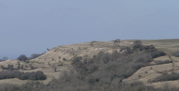
I continue along the old Cotswold Way route, a steady descent past disused quarries alongside a beautifully clear stream running over the limestone, down to Postlip Warren. Here I rejoin the current route, as well as the first runners of some kind of long distance race. The path re-ascends steadily onto the edge of the escarpment, where great views of Langley Hill and hillforted Nottingham Hill unfold. Nottingham Hill — Images16.04.13ce
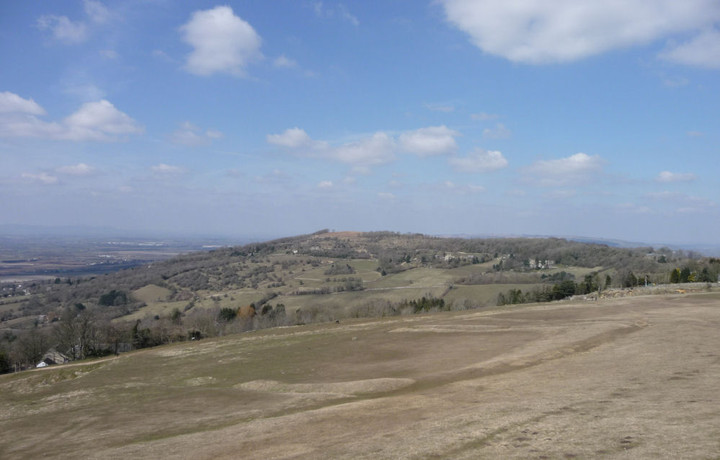
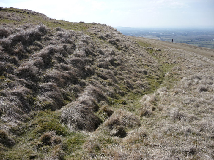
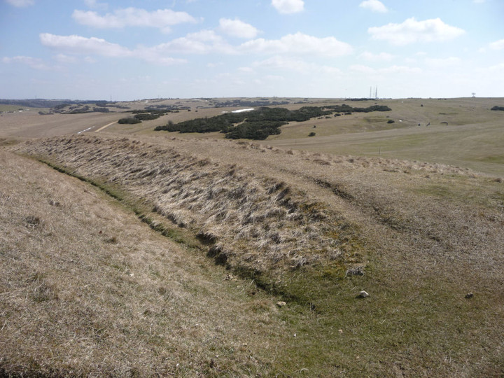
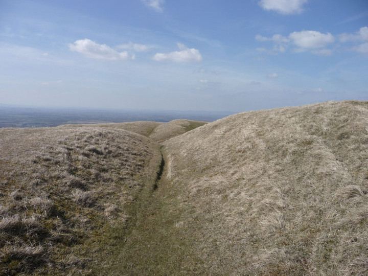
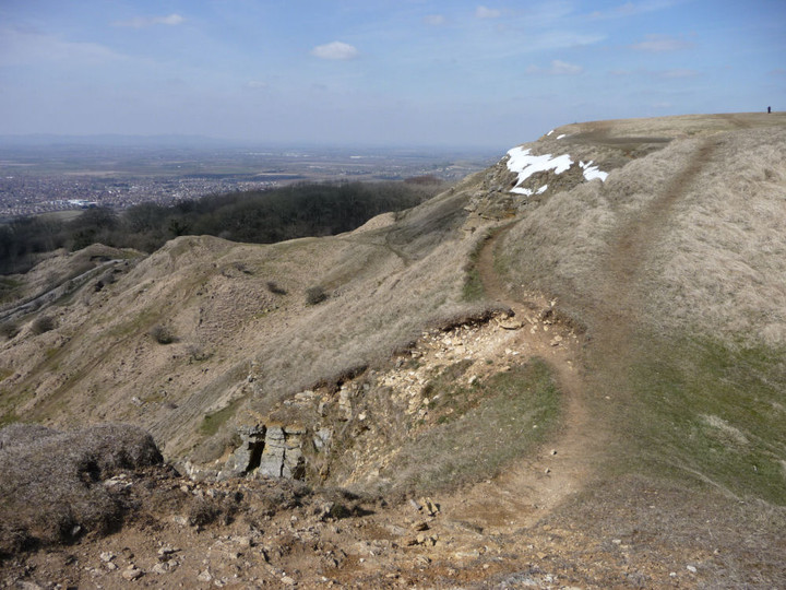
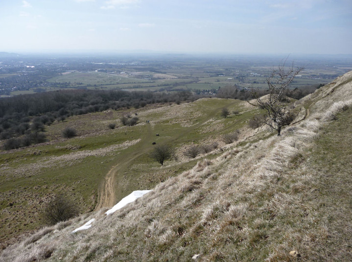
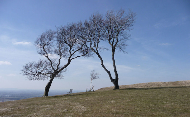
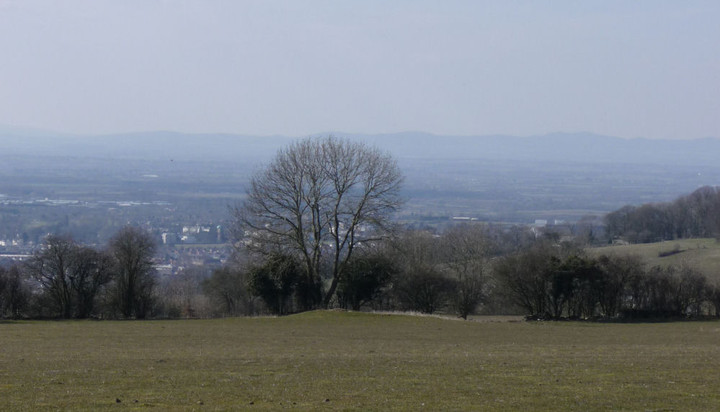
Cleeve Cloud — Fieldnotes14.04.13ceCleeve Hill has a wealth of Iron Age remains, as well as some possibly earlier monuments. Unfortunately, much of the hill has been badly damaged by limestone quarrying, to build the pretty Cotswolds villages and towns that so attract the tourists. The northwestern part is particularly badly affected, where the quarries have dug straight into the scarp face of the hill. But there is still enough to see, including a rectilinear enclosure that shows up particularly well in today’s light. The Ring is a small oval enclosure, set on steeply sloping ground. What function it served is unclear, maybe a stock pen or homestead site. The interior has been flattened into a platform for a now-vanished golf tee, but the surrounding bank and ditch are pretty well preserved and clear. An adjacent mound to the east has been tentatively identified as a hut circle, although there is also a possibility that it was a round barrow. The Cotswold Way passes right next to these two sites, so no excuse for not indulging in a brief re-visit. There is a very fine view of Nottingham Hill fort from here as well. The path then steepens to approach the northern summit of the hill, which has several separate summits, strung across its mile or so of top. Although not the highest, this one provides the best views, as reflected in a topograph. The Malverns and May Hill are clear today, but the Forest of Dean and Wales beyond are reduced to hazy smudges on the horizon. It’s busy here on such a lovely day, golfers, strollers and runners vying for position. I head south, crossing the remains of the Iron Age cross dyke that encircles this part of the hill, following the contour and largely unaffected by the quarries. The path now hugs the top of the escarpment, with artificially created cliffs dropping away vertiginously to my right. It’s quite cold up here on the edge, snow still clings to the scarps below me and the wind serves up a reminder that the late winter is only just receding. A number of the benches up here are festooned with brightly coloured ribbons, very similar to what you find at sacred wells across the country. Clearly this hilltop still represents a sacred place for locals. With the views stretching away across the vale below, to the mini-mountain range of the Malverns, it’s not difficult to understand why. The final prehistoric stop-off of the day is the once-impressive Cleeve Cloud fort. Three lines of defensive banks and ditches cut the interior off from the rest of the hill, but sadly the western half of the fort is gone, another victim of the inexorable need for building stone. To add insult to grievous injury, a golf green has been inserted into the northern ramparts of the fort. Bah. Despite all of this, it is a fine site still, the defences that remain are substantial and the views are immense. A good spot to stop off for a while and contemplate the route ahead, aided by what’s left of my lunch. The Ring, Cleeve Hill — Images16.04.13ce
Cleeve Common cross dyke — Images16.04.13ce
Cleeve Cloud — Images17.04.13ce
At some point I will have to decide whether to abandon the path above Prestbury and drop steeply down to that village, but for now I carry on along the escarpment, past the three trees (one a spindly replacement) known as the Three Sisters and down through Bill Smyllies Nature Reserve, a haven for many rare butterflies that favour the vegetation growing up from the limestone. There’s a fine retrospective view of Cleeve Cloud fort from here. Cleeve Cloud — Images17.04.13ce
I pass a beautiful sun-dappled copse of mature beach trees, sadly enmeshed in barbed wire and festooned with signs warning of CCTV and the list of possible crimes you might wish to avoid committing. Such a shame that southern England is so cursed with this need to bar and barricade, to stamp ownership and restrictions all over everything. Looking at the map, I decide to ignore the lures of Prestbury. Stopping here would make for an unnecessary climb at the start of the next walk, which I’m keen to avoid. Instead I press on, past Wood Farm round barrow (I don’t stop today, sorry). Wood Farm — Images17.04.13ce
|
 Posted by thesweetcheat
14th April 2013ce Edited 14th November 2021ce
thesweetcheat's TMA Blog
Latest TMA Blog Posts
|
Comments (0) |
|
| You must be logged in to add a comment | |