|
|

|
thesweetcheat’s TMA Blog |
|
Offa’s Dyke VI – Chirk Castle Mill – Oswestry 2 April 2011
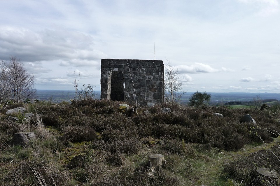
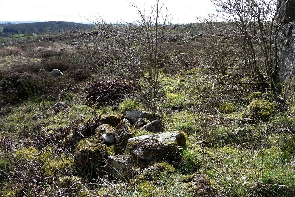
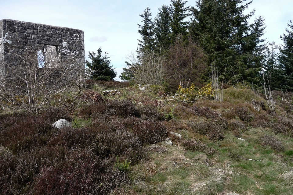
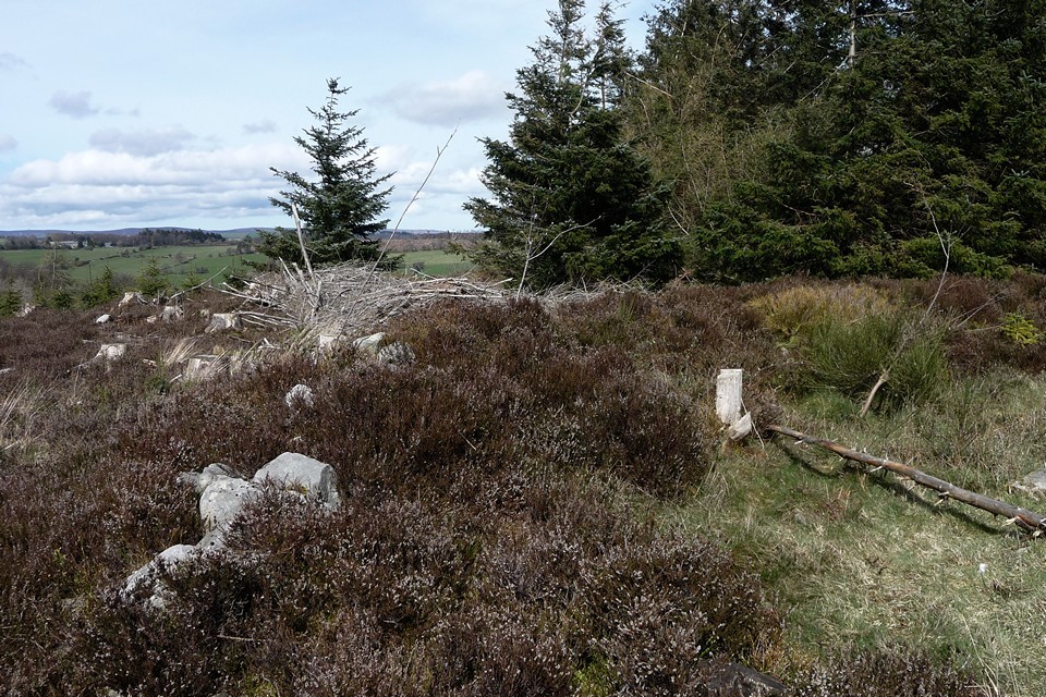
| It seems like ages since our last trip took us across the Dee to finally meet Offa’s Dyke itself. If that river crossing represented an important landmark in our North-South crawl down the Welsh border, today will throw in a few lesser ones. For a start, we’re now on our third map (Explorer 240 – Oswestry, Ordnance Survey fans). Rather more significantly, we will leave Wales for the first time. This is the first section of Offa’s Dyke Path we’ve attempted in a daytrip, rather than having to arrange accommodation. This is possible due to the relative proximity of the railway, so that we can get the train to Chirk and finish at Gobowen, about 7 miles plus a short bus trip at the end (albeit only 5 miles on the Dyke Path itself). Weatherwise, the contrast to our last walk, in misty February, is stark. Spring has come to the Marches and the sun is shining on semi-industrial Chirk. We walk up from the station to the castle, as a permissive route across the grounds has just re-opened for the Spring. This takes us past an extraordinary set of wrought iron gates, then round to the castle itself, a fine example of an Edward I stronghold designed to keep the Welsh in their place. We rejoin the Path as it drops down to the Afon Ceiriog, the next in the long series of waterways that we will cross on our route. The Ceiriog starts its journey on the slopes of Moel Fferna, the be-cairned mountain we visited on a memorable (not entirely in a good way) walk back in February. By the time it reaches us on the Path, it has flowed past numerous hilltop barrows and the hillfort at Cerrig Gwynion and will soon be joining the Dee on the other side of Chirk. For us it marks the crossing, for the first time, of the border between England and Wales. The border follows Offa’s Dyke itself, but the frontier was contested long after the Mercian king had shuffled off. Close to our crossing, a skirmish known as the Battle of Crogen took place in 1165, when a force led by Welsh king Owain Gwynedd attacked the Angevin Henry II’s army. Henry was fortunate to escape with his life, but soon after abandoned his plans to conquer Wales and went back to dealing with turbulent priests instead. A plaque on the bridge commemorates the action. Climbing up from the valley on its south side, a sign welcomes us into Shropshire. The Dyke forms the border all the way past Selattyn Hill, so we will be treading the frontier for a few miles now. I grew up in the Marches and crossing into Shropshire is starting to have the feel of heading home, for all that my heart generally lies in Wales these days. Once we’ve climbed back out of the valley, there is a great view of Chirk castle behind us and also of some prominent hills to the northeast, which I think must be the Mid-Cheshire Ridge and Beeston Crag, but our way lies southwest. The Dyke here is really impressive, especially compared to what we’ve seen up until now, with a deep ditch on the west (Welsh) side. It must be said that the path would benefit from being taken off the earthwork itself though, the erosion is not good. The Path drops steeply into Nanteris, then up stairs on the other side. Once back up onto the hillside above, there is a terrific view across North Shropshire and Cheshire, while the impressive section of Dyke continues onward. Over on a hillside to our west we can make out at least one of the cairns on Graig Wea, too distant and lacking in public access for a practical detour on this trip. After passing Plas Crogen, the countryside ahead of us emerges as a rolling patchwork of hills and fields, with the views opening up to the southeast across Shropshire, towards the Long Mynd and Brown Clee, which must be about 40 or so miles away. We stop for lunch and metallic tea at a roadside picnic area after passing some well-preserved old lime kilns at Craignant, where the daffs are in full, splendid bloom. Selattyn Hill — Fieldnotes16.09.13ceNow comes the biggest hill of the day, one I’m looking forward to greatly as it boasts the first prehistoric site we’ve been to since leaving Castell Dinas Bran. It only requires a short diversion off the Path to reach it, through an area of recently felled forestry. Standing at a reasonable 372m, the summit of Selattyn Hill is high enough to command excellent views into Shropshire, as well as of the Berwyns to our west and (I think) the Breiddins to the south. Seeing the former gives me much pleasure, as we sure didn’t see much when we were on them! The monument here is a ring cairn, sadly much trashed by the plonking of a stupid Victorian tower (now itself ruined) in its centre. However, traces of the stonework that comprised the ring can still be seen protruding through a heather covering. The construction is a wide bank of large blocks of stone, and would have been pretty impressive without the tower. It is best seen on the northern arc, the southern being very overgrown. It’s a great spot though, now that the surrounding forestry has been felled to open up the views, and should be even better once the resulting debris has started to break down. There is another cairn (Orsedd Wen) on the next hill to the west, but we can’t make this out today. It is also noticeable how few footpaths there are on the Welsh side of the border here. Whatever the post-Roman politics of the Welsh border, Selattyn represents a natural frontier, as the last hill above 1,000 ft before the drop down to the Cheshire/North Shropshire plain to the east. Certainly a worthy place for the twelve urns containing burnt human bone, found here when the tower was built. At length we head off south, alongside an ancient field boundary composed of huge boulders and an equally large field clearance heap. I find a small sliver of flint on the path, apparently worked (but broken) and certainly not native to this part of Shropshire. Selattyn Hill — Images06.04.11ce
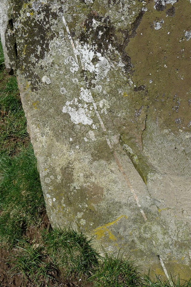
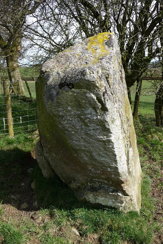
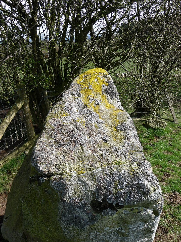
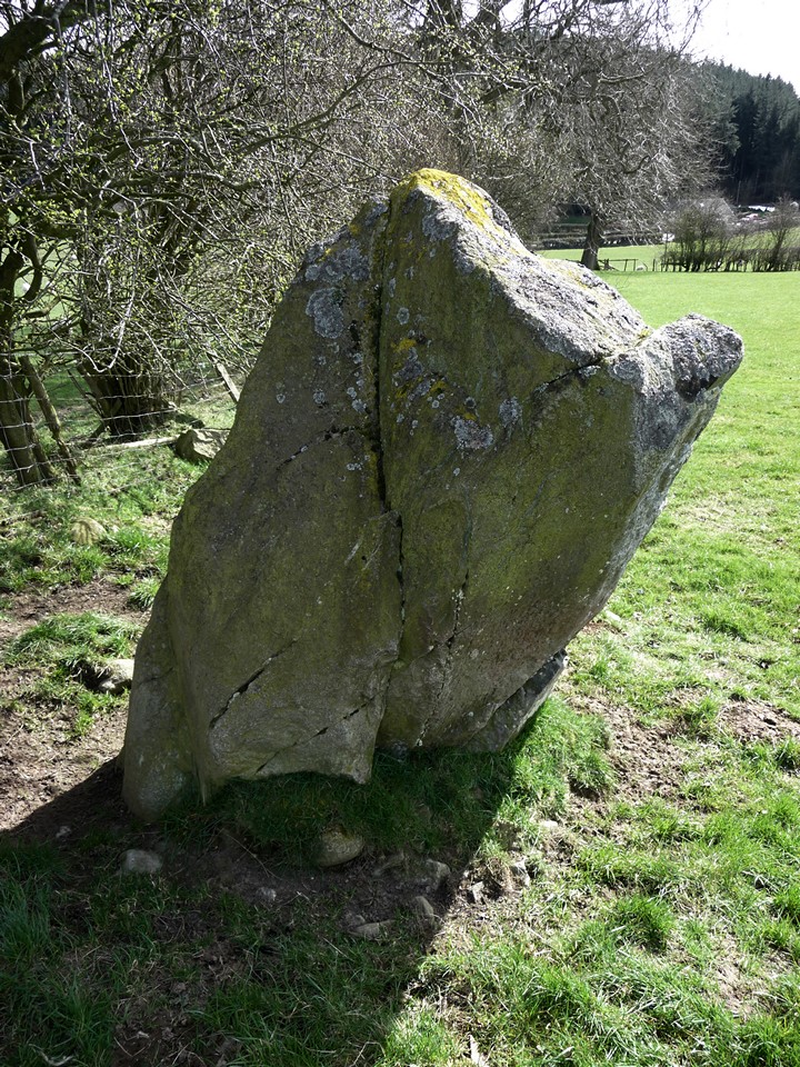
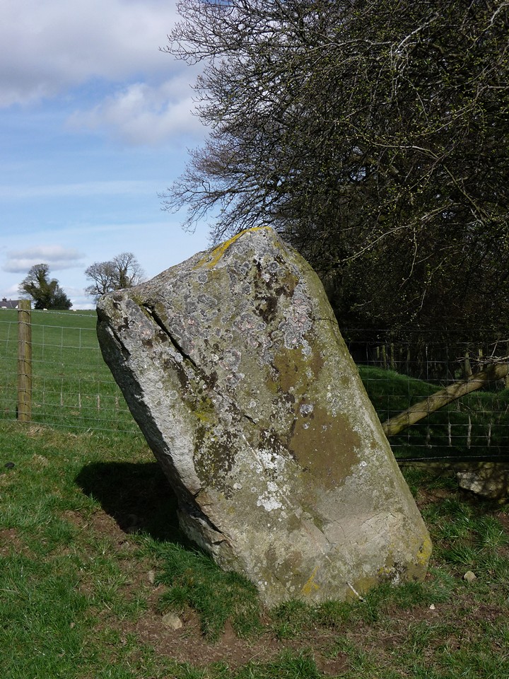
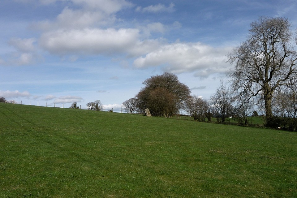
Carreg y Big (Selattyn) — Fieldnotes16.09.13ceThe Path rejoins the Dyke south of Orsedd Wen. The next section of the earthwork is once again particularly fine. Just after it passes through a little wood, a footpath heads off eastwards and will take us to the second Bronze Age treat of the day, which can be seen from the Dyke. Standing 2m tall, Carreg-y-Big is probably Shropshire’s tallest standing stone, just topping the large pillar at Mitchell’s Fold to the south. The name looks like it should mean “The Big Stone”*. Damn accurate with their names, these Welsh folk (I know, it’s not in Wales). I was mainly aware of this one from Postie’s lovely snow-bound pictures from a year and a bit earlier, but it looks equally impressive in watery Spring sunlight. I’m particularly taken with the quartz vein running through the stone, being a sucker for a bit of quartz. There is also evidence of packing at the stone’s base. The positioning is slightly obscured from the east due to a hedge, but otherwise the stone would be prominent and just the kind of thing that could be used as a way marker, perhaps pointing the way to nearby Selattyn Hill ring cairn. Cynynion, a further, very similar, stone lies a mile and a half SSW. Carreg y Big (Selattyn) — Images06.04.11ce
Although we’ve only managed another 5 miles of Path, this takes us just over the 50-mile mark overall. The southwards progress feels palpable now that we’ve reached Shropshire and are heading towards countryside I know (or at least once knew). Rather than the tail between legs retreat of Henry II, we can stride onward with renewed confidence. Our next trip will take us to one of Shropshire’s - and indeed England’s - premier hillforts, so there’s much to look forward to. ---------- *Not true, sadly. Rhiannon suggests "Peak(y)/Point(y) Stone", which seems more likely. |
 Posted by thesweetcheat
16th September 2013ce Edited 16th September 2013ce
thesweetcheat's TMA Blog
Latest TMA Blog Posts
|


Comments (0) |
|
| You must be logged in to add a comment | |