|
|

|
pure joy’s TMA Blog |
|
Kernow again - Part 2 - Land of the Giants
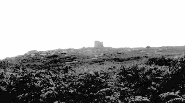
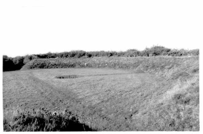
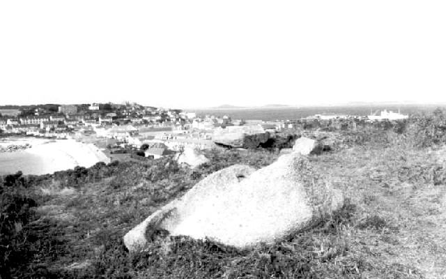
Wednesday was due to be a cracker, despite the first bit of bad weather. Carn Brea is a great big hill just outside Redruth, and is currently the second oldest excavated and dated occupation site in the county. It's not easy to see much here, but is well worth it for the view and the vibe.Carn Brea — Fieldnotes09.10.03ceCarn Brea - 1st October 2003 Carn Brea is a great big hill just outside Redruth, and is currently the second oldest excavated and dated occupation site in the county. After hauling my ass up to the top of this hill, I discover a track/road and parked cars on the other side of the summit. Well, I do like walking uphill so I won't complain, but if you want to take the easy way up, I guess the top can be reached by car from Carnkie. I noticed a car park on the map at the south side of the hill (at the bottom - around SW681412). I couldn't see any road signs towards it so I drove via Carn Brea Village and the furthest I could get was a small layby at SW686412, which already had one burnt out car in it. But it is a decent (but not signposted) place to park because two paths up the hill start from close by. One path is wide and goes around and up the east side of the hill and the other is more overgrown and goes up the hill into the middle of the Neolithic enclosure, through what is believed to be the ancient entrance. It's not easy to see much of the ancient bits on the hill though (even with the detailed drawing in Cornovia), but is well worth it for the view and the vibe. Not surprisingly the view from the top is amazing, including a good view across to St.Agnes Beacon. Carn Brea — Images22.10.03ce
Carn Brea — Images22.10.03ce
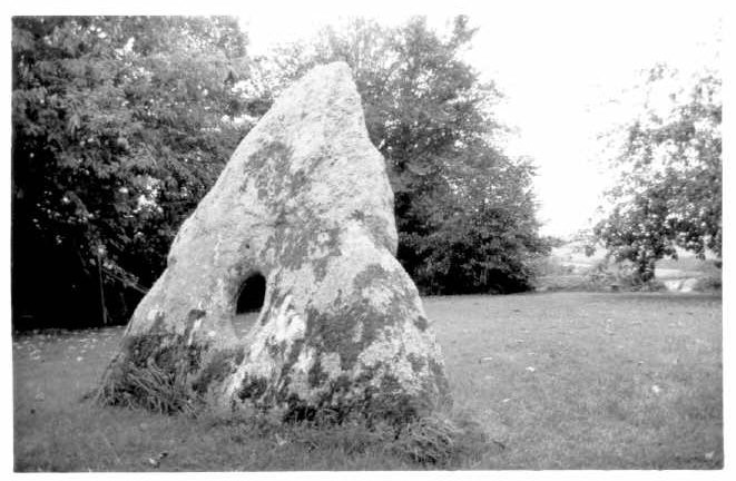
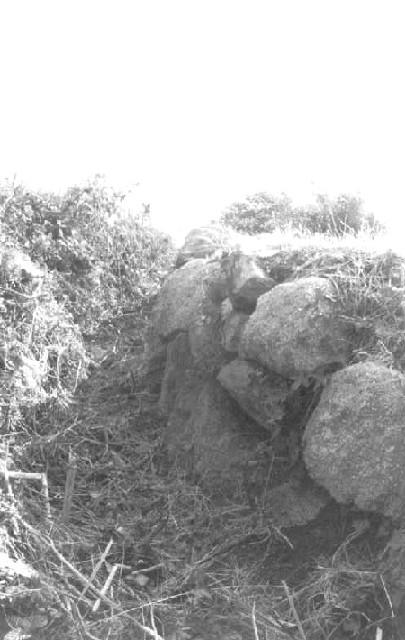
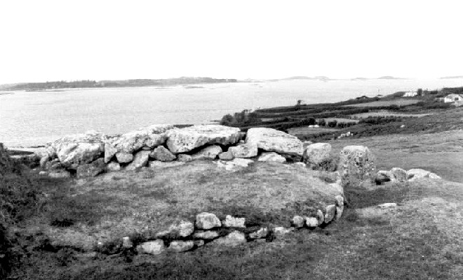
What's left of the Wendron Stone Circles were one of only two circles in my week (I've visited most on previous trips) and is easy to find. Nine Maidens (Troon) — Fieldnotes07.10.03ceWendron Stone Circles - 1st October 2003 What's left of the circles are situated just to the east of the B3297, 800 metres south of the junction with the B3280, around two fields behind a house situated on the rise in the road. There is a lay-by opposite for about 3 cars, although it is quite dangerous to get out of given its situation just under the top of the hill. Directly to the left of the house is an unmarked public footpath that leads towards that back of the house. 2 stones from what was a circle are part of the field wall, apparently still in situ (i.e. they weren't moved, but were conveniently used as part of the field wall). See Cornovia for a diagram. The other circle is mainly in the next field over (except for one in the field wall - at the viewing point - that is believed to be from the circle), but there is a convenient viewing point at the wall, and it's obvious that loads of people have climbed over the wall. I was like a kid waiting for Christmas because I knew that I'd see the Tolvan Stone today, and it was just as cool as expected, although I always manage to build up pictures of places in my head and they are never quite the same. Tolvan Holed Stone — Fieldnotes07.10.03ceThe Tolvan - 1st October 2003 Just as cool as expected, although I always manage to build up pictures of places in my head and they are never quite the same. I don't know why but I didn't quite expect the road the cottage is on to be a country lane, or to be next to the rolling countryside. The area is also surprisingly close to the water (The Helford River is barely 1km away). Just in case you didn't know the Tolvan is situated in the back garden of Tolvan Cross Cottage, which is 800m north of Gweek. From Gweek, the main road bends slightly right, whereas the road for the Tolvan is straight on as you get to the Spar / Post Office. The current owners are a lovely young couple, and although they obviously retain the right for people to view at their discretion, they are very flexible and don't mind people turning up unannounced. Or you can, as I did, give some prior warning in case they are out, away etc. They get about 5-6 people a year at the moment, and unless those number rise dramatically they don't see it as a problem at all. The stone is all I expected. Big and enigmatic. One thing that I hadn't noticed on pics was a small circular hole on the left hand side. Wonder what that is all about? NB - their 'front door' is at the back, next to the stone. Tolvan Holed Stone — Images22.10.03ce
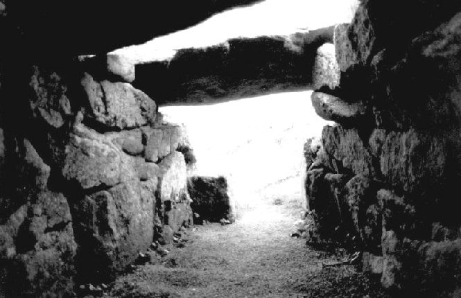
Then onto a wet Halligye Fogou which everyone should see. Everyone! The whole place is just great. Feel the quality of the workmanship. But the fogou didn't want its picture taken. I managed to smash my old compact camera on the way out by getting tangled in its strap and accidentally thrashing it about. Halliggye Fogou — Fieldnotes07.10.03ceHalligye Fogou - 1st October 2003 Amazing. Without having seen all the other fogous, this and the Carn Euny fogou must be the cream of the crop. Everyone should see this. Everyone! Despite the changes over time (the current entrance is believed to be wrong, and a hole now exists in the main passageway thus letting in light) this is still in very good condition, and with public access for much of the year. I felt the hole might be deliberate to let light into the main passage and make it safer to be in. Just a total guess though. It wasn't clear from the OS map exactly where the entrance to the Trelowarren Estate was, so it was a good surprise to see a brown (tourist) sign at the roundabout linking Garras, Mawgan and Rosevear (at SW701243). The turn off to the estate is then marked by a bright modern sign a few hundred metres towards Garras, with the actual estate entrance another 400 metres on at SW705242. After 1km through the estate there is a sign to the fogou and parking for 3-4 cars at SW713241. A short walk up the track takes you to the gates of Halliggye Farm. A marked footpath to the right takes you into an enclosure and you are there, at this amazing structure. I went in every bit of the fogou, including the tiny original entrance, which I felt was the most stunningly claustrophobic and well engineered. The whole place is just great. Feel the quality of the workmanship. But the fogou didn't want its picture taken. Not only was the rain getting heavy now, but I managed to smash my old compact camera on the way out by getting tangled in its strap and accidentally thrashing it about. I'd taken pics with this because it had a flash, whereas my Pentax SLR didn't. So to try to re-create the now lost pics I went back and took pics again with the Pentax on a fixed shutter speed and trying to use the flash from the compact as a flash. It didn't work! NB - The entrance to the estate had a sign saying that all permissive footpaths on the estate were closed between 1st October and ..um...didn't write the end date down (probably around Easter - I was too busy slapping my head and shouting doh at coming on 1st October!). Despite my fears it didn't affect me getting to the fogou and I imagine it shouldn't cause any problems for others because the fogou is an English Heritage site, and up a farm track rather than a footpath. Also the fogou is closed for the winter anyway (currently November to March inclusive). Halliggye Fogou — Images22.10.03ce
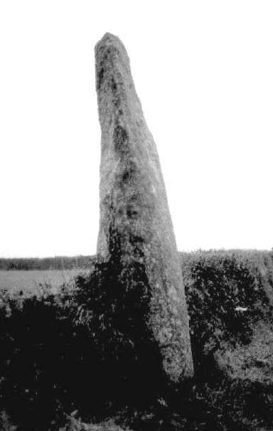
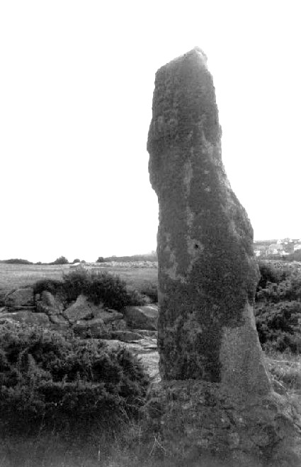
Then just a quick stop at the Prospidnick Menhir on the way home, a thin and sexy beast virtually on the roadside. Prospidnick Longstone — Fieldnotes07.10.03ceProspidnick Menhir - 1st October 2003 It's not easy to describe exactly how to get here through the variety of lanes. Probably best to get an OS map. Or try this. On the B3297 just north of Helston, take the first left after the golf course (signposted 'Coverack Bridges'; and others). Pass the red phone box at Coverack Bridges and continue along the lane, past the school. Take the next right at a small triangular junction. This lane takes you past the farm at Chyreen. Just past Halvance Farm there is a small junction. Go right (signposted 'Releath' and the sexy menhir is then clearly in view on your right. This slim but tall stone lies in the field wall on the roadside. There is space almost opposite to park for a short while. Prospidnick Longstone — Images22.10.03ce
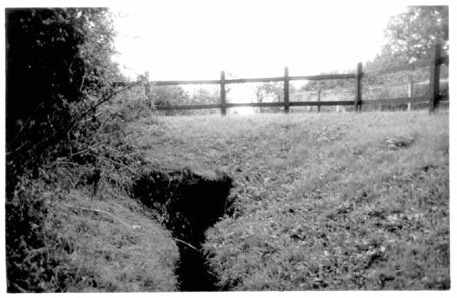
The next day was a rest day and I just visited a few sites local to Perranporth, starting with the picture perfect and historically important St.Piran's Round, before heading for the Bolster Bank and St.Agnes Beacon area with it's folklore and stunning views from the Beacon. Piran's Round — Fieldnotes07.10.03ceSt.Piran's Round - 2nd October 2003 Although it's not signposted it is relatively easy to find 1.2km along the B3285 from Goonhavern (towards Perranporth), on the north side of the road, just off a small lane opposite a pink house. You can park a car discreetly on the side of the lane, just off the main road. There is open access to the land. There is a stile into the enclosure where the earthwork stands and a flagstone entrance into the interior. A small sign gives the following statement, "This St.Piran's Round is protected as a monument of national importance under the Ancient Monuments Acts 1913-53: Department of the Environment". The earthwork is 'perfect'. Well kept, a perfect circle, with two opposite entrances, equal height banks, and a decent (if overgrown) ditch on the outside. Birds fluttered and it was all so idyllic, almost too idyllic! The ladle shaped depression is way cool. I can just imagine it being used in the medieval miracle plays. Piran's Round — Images22.10.03ce
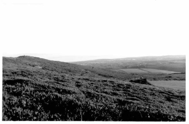
Bolster Bank — Fieldnotes07.10.03ceBolster Bank - 2nd October 2003 I wouldn't agree with Craig Weatherhill, in "Cornovia: Ancient Sites of Cornwall & Scilly" (Cornwall Books - 1985, revised 1997 & 2000) who says the best place to view the dyke is where it abuts the south side of the road between the west side of St.Agnes and Goonvrea (at about SW717501). Yes, there is a public footpath at that point but it is separated from the dyke by highish hedge, and there is no obvious way to see the dyke close up. I didn't try viewing the bank (up close) from a different place. The obvious place to try would be where the bank crosses the road from St.Agnes Beacon to Towan Cross (around Goonvrea Farm, at SW 713496). Instead, I got a pretty good overview from the top of St.Agnes Beacon although it does take a few moments to get your bearings; the dyke is hardly the Wall of China and takes a bit of spotting. It is believed that originally this Dyke enclosed the whole of the coastal area around the hill, cutting it off from the surrounding land. The reason for the bank is not obvious, and nor is the date. Craig Weatherhill, in Cornovia, writes that "It could date from anytime between 500BC and 1000AD, but opinion leans in favour of a post-Roman date, probably fifth or sixth century AD". St. Agnes Beacon — Fieldnotes07.10.03ceSt.Agnes Beacon Cairns - 2nd October 2003 Can't really miss this hill, just west of St.Agnes village. Easy to reach, via numerous public footpaths around the area. National Trust openland. Closest place to park is at SW706507, facing a metal farm building, with room for about 8 cars. But you can also park at many other places in the area and walk to the beacon via footpaths or roads. The OS map shows 3 cairns on the summit. Two towards the highest point (at the south east end of the summit) and one at the north west end of the summit area. All are in light gorse, with the most southerly one the deepest amongst the thorns. None stand out massively, and there are many other similar mounds round the hill. I cannot believe that some of these aren't also burial cairns. The hill stands out for miles around, and the views from it are totally stunning. The highest point isn't actually a cairn, but the old beacon, which is topped with a panoramic plate showing you the landmarks for around 25kms around, including several windfarms, the china clay area around Roche (24km away) and Carn Brae (10km away). The Bolster Bank is visible to the south and southeast of the Beacon, but isn't totally obvious ( an OS map will help you orientate yourself). It is believed that originally this Dyke enclosed the whole of the coastal area around the hill, cutting it off from the surrounding land. St. Agnes Beacon — Images22.10.03ce
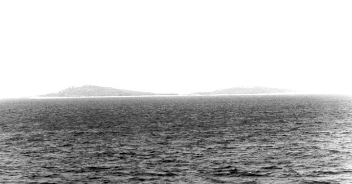
On my last full day I finally made it to the Isles of Scilly. The ferry may be slow (and only gives you four and a bit hours on the island for a day trip) but it's cheap and cheerful and a great way to not only see the south side of Penwith from the sea but also to have a perfect view of all of the coastline of St.Mary's (because it has a one way system meaning you enter one way and exit out the other). Samson — Images15.11.03ce
Giant's Castle — Images16.11.03ce
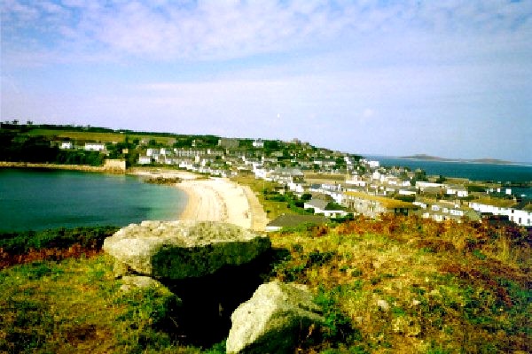
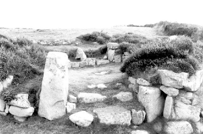
The Buzza Hill Entrance Graves are not as well known as the 'show graves' but it's well worth the short climb and gives you the best views back over Hugh Town. The Menhir at Harry's Walls is not too far away, but was a rather 'cold' place for me. Buzza Hill — Fieldnotes07.10.03ceBuzza Hill Entrance Graves - St.Mary's, Isles of Scilly - 3rd October 2003 Buzza Hill can be reached via a footpath up from the east end of Porthcressa Beach, or from just off Church Road (either a footpath from the Power Station, or via the Hospital Lane). It's well worth the short climb. Not only does the hill give you the best views back over Hugh Town but also it contains one existing entrance grave, one that was probably an entrance grave before a windmill was built on it in 1834 (and which is now 'King Edward's Tower' and lots of stones that might be some sort of chamber (between the two above ones). Compared to all the 'show graves' of the islands the entrance grave is not great (only one capstone in place), but the position is fantastic and it is a very enigmatic place. The Cornish Antiquarian William Borlase excavated two chambered cairns on the hill in the mid-18th century. He found neither pottery or human bones. The kerbed ring around the tower is excellent in places and I guess it would have a been a classic entrance grave in it's original form. Buzza Hill — Images30.10.03ce
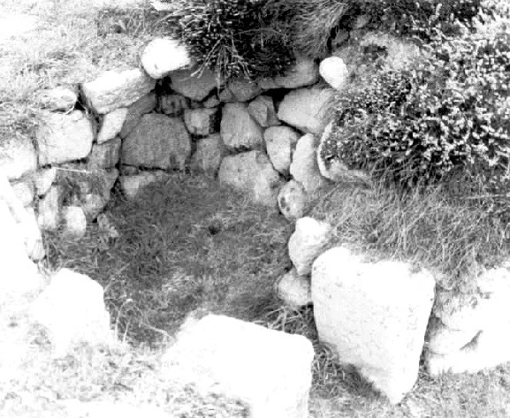
Harry's Walls — Fieldnotes07.10.03ceHarry's Walls Menhir - St.Mary's, Isles of Scilly - 3rd October 2003 Given that just by getting to St.Mary's, and presumably having a map, you have show a lot of initiative and commitment, I won't try to describe the minutiae of getting to sites on the island (but might just make a few comments). Most major sites are signposted, but I was disappointed (in general) at the poor signposting of paths, especially given that I have read others say that Scilly sites are well signposted, and the general fact that tourism is the main economy of the islands. This is obviously a strange one because of its location right next to an X shaped daymark (within an unfinished Tudor fort) and it being cemented in place, but seems to be recognised as a menhir. It was first recorded by Borlase in 1756 as sitting on a mound. Stones litter the immediate area possibly suggesting a previous cairn? Give all the above I felt the menhir was in a rather 'cold' place. Couldn't get much feeling of ancient history! Harry's Walls — Images16.11.03ce
Walking across to the other side of this stunning island brought me to the entrance graves at Innisidgen. The 'Higher' grave is a real beauty; it just screams perfection. I noticed a strange similarity to the rocky outcrop above it (as if it mimicked it), and I swear I saw someone move in the rocky outcrop whilst I took a picture of both. Spooky. Innisidgen — Fieldnotes07.10.03ceHigher Innisidgen Entrance Grave - St.Mary's, Isles of Scilly - 3rd October 2003 Given that just by getting to St.Mary's, and presumably having a map, you have shown a lot of initiative and commitment, I won't try to describe the minutiae of getting to sites on the island (but might just make a few comments). Most major sites are signposted, but I was disappointed (in general) at the poor signposting of paths, especially given that I have read others say that Scilly sites are well signposted, and the general fact that tourism is the main economy of the islands. A few snippets re location. If coming from the west on the track past Lenteverne and you want to get to Innisidgen via the coast, you need to take the path to the right (downhill). After 100metres you then continue on slightly left (instead of crossing a tiny gully to the right which takes you to the coast path for the south) and you will be on the coastal path. It is a 'lower' grave in terms of height above sea level rather than lower in terms of south from the higher (i.e. the lower grave is actually to the north of the higher grave). Both are on the footpath. If you approach the area from the West it is much easier, because the path to the higher grave is signposted (and that path runs past the lower grave anyway). 'Higher Innisidgen Carn' is a real 'show grave'. A beauty; in a beautiful location. It just screams perfection. I noticed a strange similarity to the rocky outcrop above it (as if it mimicked it), and I swear I saw someone move in the rocky outcrop whilst I took a picture of both. Spooky. For info on 'Lower Innisidgen Carn' see the separate page. There is another chambered cairn in the area, marked on the map at around SV923122. If I found it, then all I found was a few jumbled stones just off the higher cliff path. I think maybe I didn't find it. Didn't have enough time, and the undergrowth in the whole area was pretty fierce. Bant's Carn is similar, despite being eaten into the surrounding field walls. What a great place and great location. The chamber is higher than most and I can imagine that the entrance would have been pretty special in its full glory. It is also next to the evocative Halangy Down Settlement and makes the whole area an important multi-period site. Bant's Carn — Fieldnotes07.10.03ceBant's Carn - St.Mary's, Isles of Scilly - 3rd October 2003 Given that just by getting to St.Mary's, and presumably having a map, you have shown a lot of initiative and commitment, I won't try to describe the minutiae of getting to sites on the island (but might just make a few comments). Most major sites are signposted, but I was disappointed (in general) at the poor signposting of paths, especially given that I have read others say that Scilly sites are well signposted, and the general fact that tourism is the main economy of the islands. I have to say again that I was disappointed at the footpaths in the area. There doesn't seem to be a coastal path from the east, which was a disappointment. It was signposted from the large pylon but it was a shame to have to come inland and via a scabby pylon (and past a road that said 'Private Road') to get to one of the most important multi-period sites on the islands. Like the tomb at Higher Innisidgen, this is a real 'show grave', despite being eaten into the surrounding field walls. What a great place and great location. The chamber is higher than most and I can imagine that the entrance would have been pretty special in its full glory. Halangy Down — Fieldnotes07.10.03ceHalangy Down Settlement - St.Mary's, Isles of Scilly - 3rd October 2003 For directions and comment, see Bant's Carn. This was a really evocative site for me, and I could well imagine people living here. The courtyard house is excellent, although the rest of the settlement would require more time to explore to try to make more sense of it all. NB - It should be said that although there is evidence of settlement on the site going back to the Bronze Age, the settlement we now see probably belongs to the second to fourth centuries AD. Bant's Carn — Images16.11.03ce
Halangy Down — Images16.11.03ce
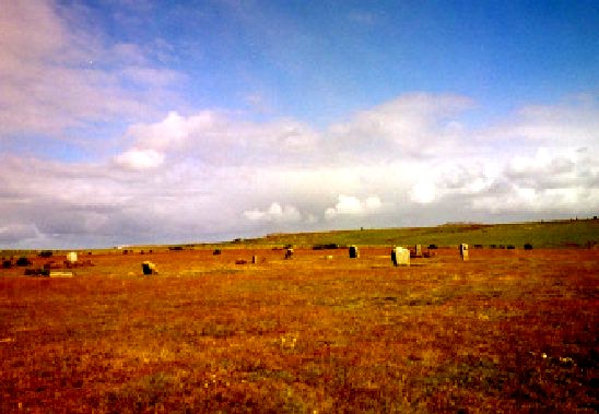
On the way back to London I stopped off at the Trippet Stones, a very easy to get to site on Bodmin Moor. Trippet Stones — Images30.10.03ce
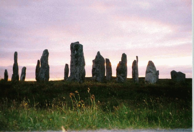
Callanish — Images28.08.01ce
|
 Posted by pure joy
7th October 2003ce Edited 21st March 2004ce
pure joy's TMA Blog
Latest TMA Blog Posts
|


Comments (0) |
|
| You must be logged in to add a comment | |