|
|

|
danielspaniel’s TMA Blog |
|
A Sussex Solstice
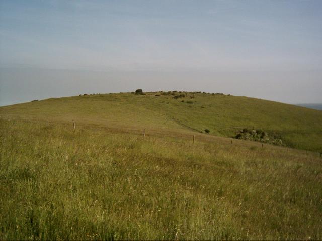
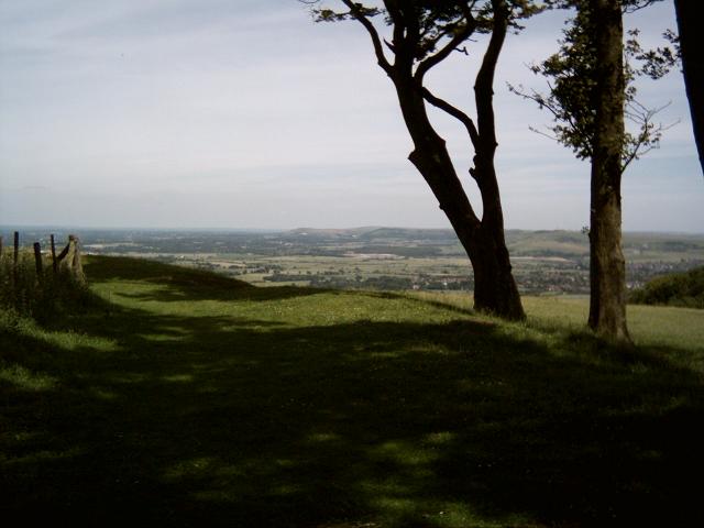
| I don't need much of an excuse to take the day off work, so this Summer Solstice I did just that. Here's what I got up to: Being a late riser, I really can't handle these summer sunrises, and despite my good intentions it is 6:45 am and well past sun up by the time I drag myself up Wolstonbury Hill. A glorious Solstice morning it is, nevertheless. I do my usual perambulation of my favourite henge, and greet an early morning dog walker going the other way. When I get round to the North entrance it looks like the dogs must have killed a rabbit. It lies with it's fur wet and neck broken, a solstice sacrifice to the fox and magpie. I play self portrait with the timer on my camera like the sad muppet that I am, and then rock over to check out a couple of the other earthworks on the hill. The cross ridge dyke, bowl barrow and platform barrow and that lie 310m to the south east of the main henge. Wolstonbury — Images06.07.05ce
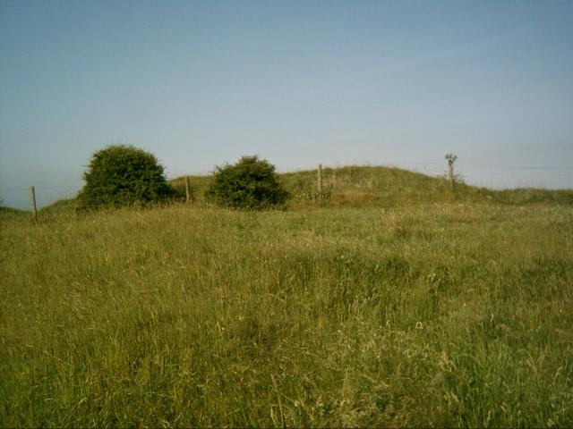
Wolstonbury Cross Ridge Dyke — Miscellaneous06.07.05ceThis linear earthwork appears to be one of the later prehistoric linear boundaries recorded from the southern chalklands. What exactly their purpose was has regularly defied interpretation. They have variously been referred to as; roads, defensive outworks, covered ways, barriers, toll bars or drove ways, 'Celtic' fields, ranch boundaries or pastoral enclosures. Even precise terminology is difficult. (I am using 'Dyke' on TMA for want of a better site type, but please do not take this as an implication of function.) Wolstonbury Cross Ridge Dyke — Fieldnotes06.07.05ceThis 'dyke' cuts across the southern spur neck of Wolstonbury Hill, and this morning I find myself wondering where the main point of access was (if one originally existed) on this linear earthwork. Could it be at the central kink in the dyke, where a round barrow now sits on the Northern bank, or the area where the modern track bisects the bank? I walk down the ditch to where the dyke peters out and the slope gets steeper. The date of construction remains unknown. It could relate to a late Bronze Age/ Early Iron Age period of cultivation. Or, it could represent a 'defensive outwork' to the (speculative) period of defensive remodelling of Enclosure 'C' on top of the hill. As yet, nobody knows. I turn back and follow the ditch up to the 'barrow'. Wolstonbury Bowl Barrow — Fieldnotes06.07.05ceLike so many, the apparent bowl barrow on Wolstonbury has been raided and flattened by the plough. It lies on farm land just to the east of the main track that leads to the hill from the south, at the kink in the 'cross ridge dyke'. While it seems to be sited across the northern bank of the linear ditch and so appears later than the dyke itself, this may be a false impression. The barrow has been so badly disrupted (presumably by an unrecorded antiquarian investigation) that it is possible that excavated soil has been thrown over the linear earthwork. It is also possible that the round mound could represent the mutilated remains of a later fire beacon mound. (But let's keep that quiet until someone proves it, eh?) Wolstonbury Bowl Barrow — Images06.07.05ce
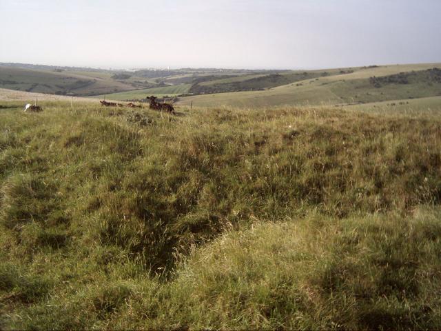
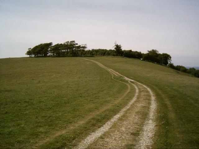
Wolstonbury Platform Barrow — Miscellaneous06.07.05ceThis interesting specimen is also situated on farm land, just to the NW of the bowl barrow. It is a long stretched out thing that runs down the slope to the west. Again it seems badly truncated, but it is the only platform barrow I have knowingly visited, so it is worth a look. Wolstonbury Barrows — Miscellaneous06.07.05ceIt should also be noted that William Hamper, in 1806, noted a barrow within the NW quadrant of the Wolstonbury hilltop enclosures. No clear trace of this exists, and it is possible that Hamper mistook quarry spoil for a barrow. However, if it was a barrow it is possible that some of the Roman coins recorded by Hamper and the other prestige items and weaponry alleged to be found within the enclosure may have originated from it as primary or secondary deposits. Later on, we go for a picnic to a place I haven't been before; Chanctonbury Ring. It is an interesting site with quite a bit of recent folklore attached to it, which always adds to the intrigue. Chanctonbury Ring — Fieldnotes06.07.05ceIf you park in the car park to the NE of the ring, it is a long climb up a 'bostal' path, and then you double back on yourself as you turn left at the top onto the South Downs Way. This is a bit of a drag, but better than trying to scramble more directly up the steep, wooded slopes. We tried coming down the 'quick way' but soon realised the only way down was on your backside! Alternatively you could park to the SW and take the South Downs Way east to the ring. I must admit to having a slightly strange sense of foreboding as we made the climb and I am not sure why. Maybe it was the vehicles we had seen parked up on the hill, or the spooky local folklore I had read (see links). When you get up here, you are rewarded with a fantastic view. Cissbury Ring and flint mines to the South with the blue sea as a backdrop and Wolstonbury jutting out sphinx-like to the East. An excellent vantage point. We were disappointed to discover 3 4WD's and parked next to the Ring, with their drivers were packing up after a nights camping. When I spotted them from the bottom of the hill I was expecting a wild Solstice free festival, but it was just some SUV driving muppets who didn't even give us the time of day. Quite what these individuals were doing up here on the midsummer's eve I don't know (black magic to bring petrol prices down perhaps?), but how lazy and disrespectful to bring your stinking vehicles across an area of outstanding natural beauty and park them next to an ancient monument. Needless to say we were happy to see them trundle off and then we had the place to ourselves. Most of the beech trees planted by Charles Goring in 1706 were indeed flattened in the storms of 1987. The ones that remain are on the south bank mostly, and provide some delicious shade. The interior of the Ring has been replanted, but is still quite scrubby and immature. We were surprised to find a barbed wire fence around the interior, but there is a well worn entrance at the east (close to the original entrance). I am always interested in places that the R*man's decided to build temples on. Maiden Castle is one of the most famous examples, and it always suggests an existing sacred function for the site. I ventured into the interior and it is a bit of a creepy wood with evidence of lots of campfires. It is so overgrown I couldn't see any evidence of the temple, which is apparently only a few inches below the surface. I did manage to get a bit lost in there and had a brief 'Blair Witch' moment when I was convinced I wasn't going to find my way out! I now put this down to the 8% Cider and an overactive imagination. There are also a couple of interesting cross ridge dykes, bowl, saucer, platform barrows and hlaews (rare Saxon Burial mounds) Click the Magic plug in on this page for more info on their locations. Check out the links on this page for more background and go and feel the vibes of this absorbing place for yourself. Chanctonbury Ring — Images06.07.05ce
All in all, it was a fun and sunny solstice. I am glad I took the day off! |
6th July 2005ce Edited 6th July 2005ce
danielspaniel's TMA Blog
Latest TMA Blog Posts
|
Comments (0) |
|
| You must be logged in to add a comment | |