|
|

|
thesweetcheat’s TMA Blog |
|
To be in England, in the summertime, with my love (2) Midsummer's Day
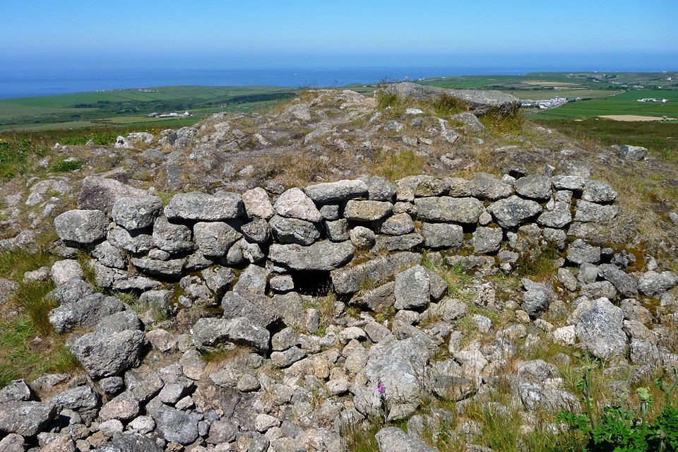
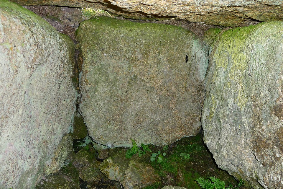
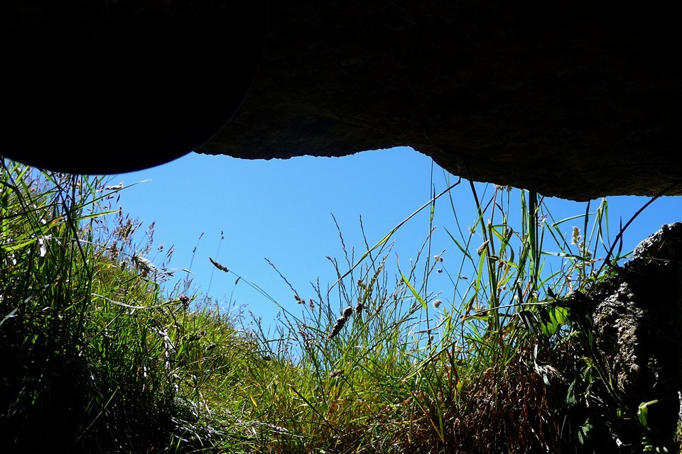
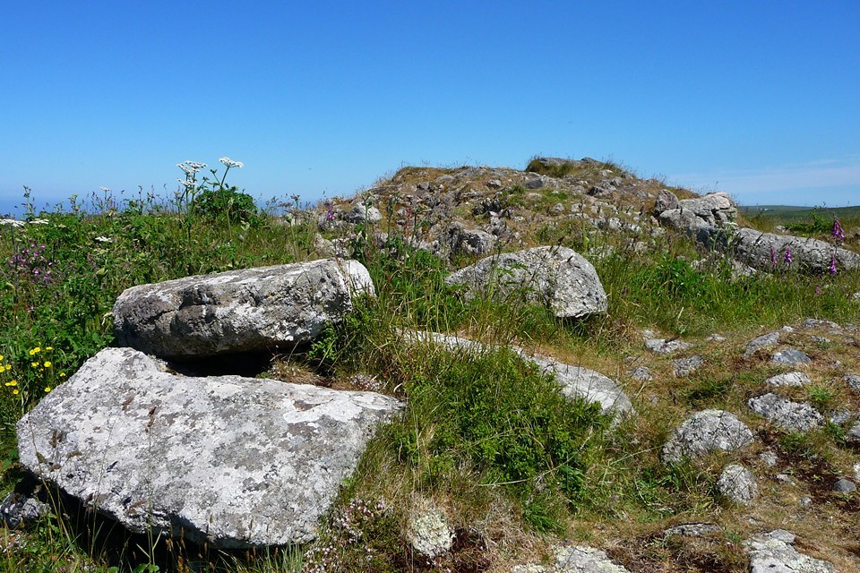
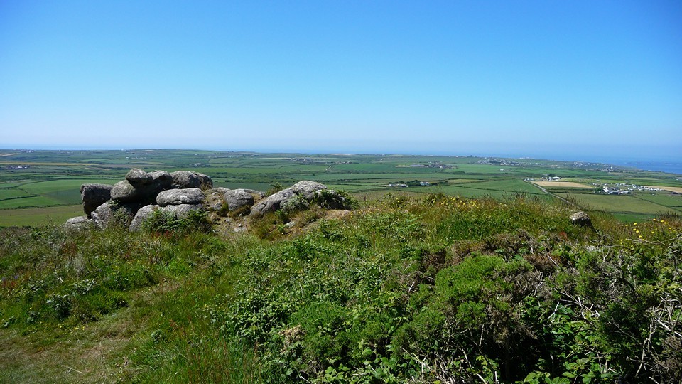
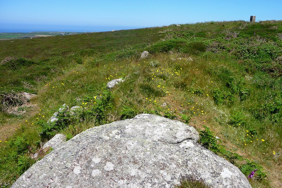
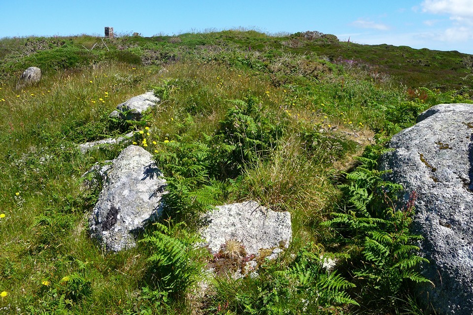
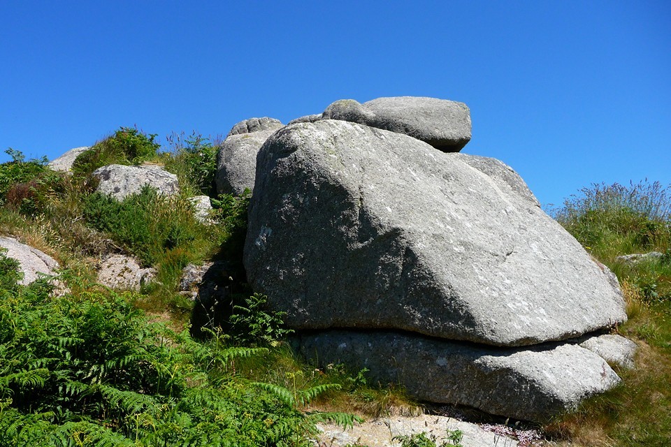
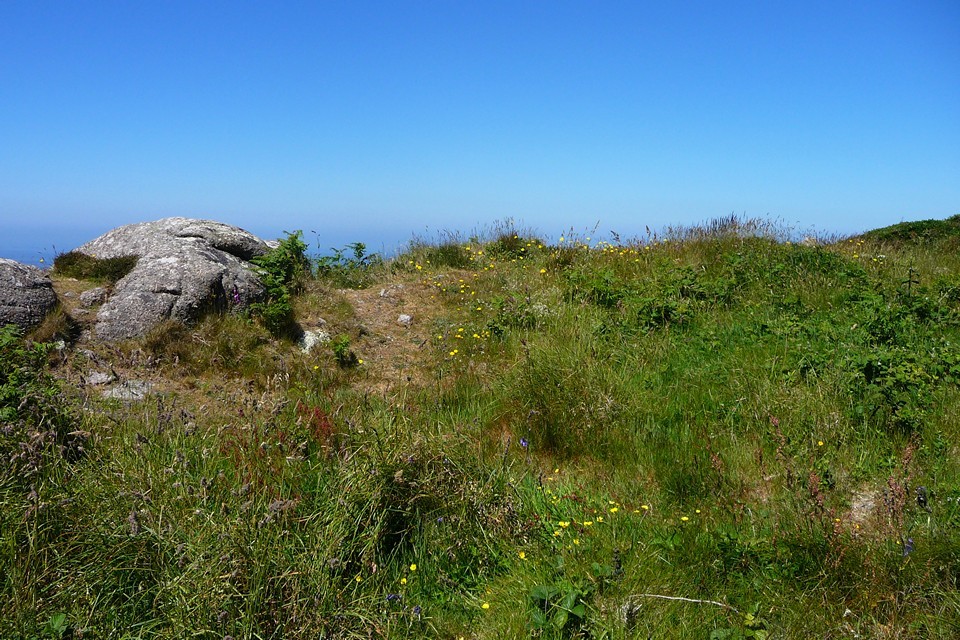
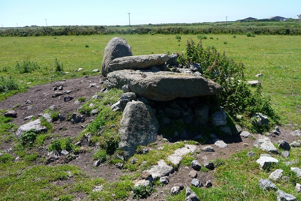
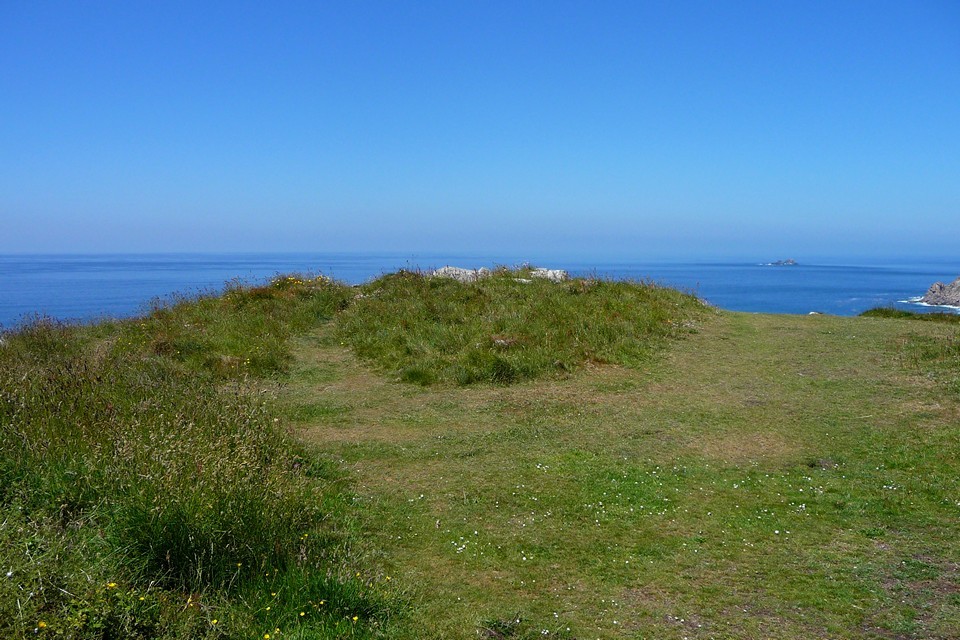
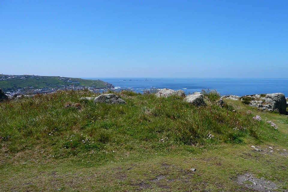
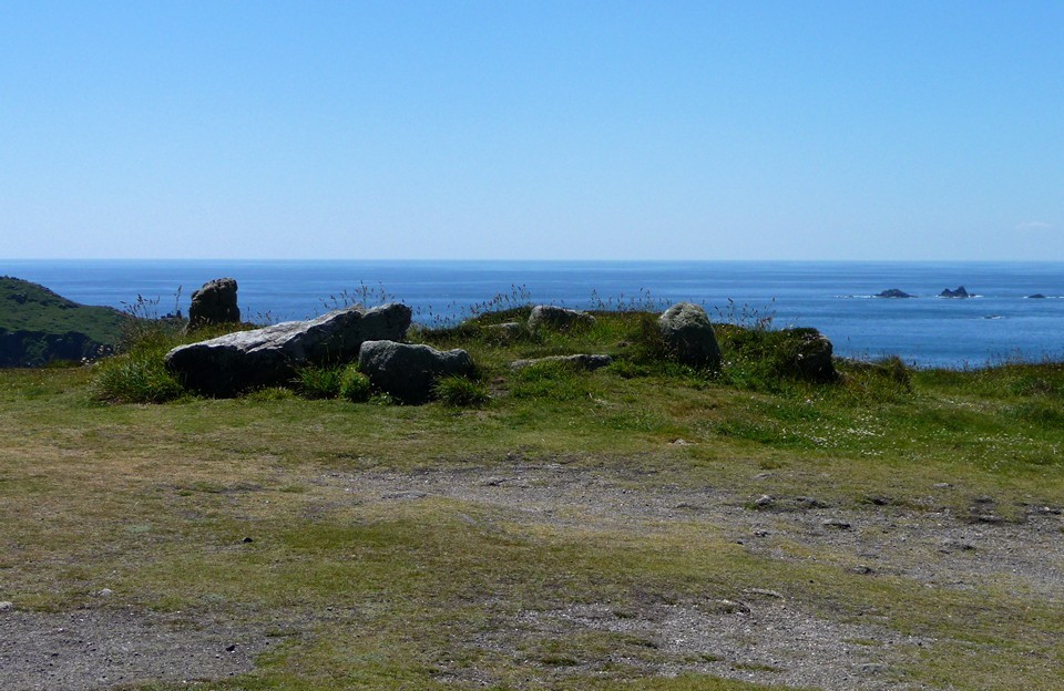
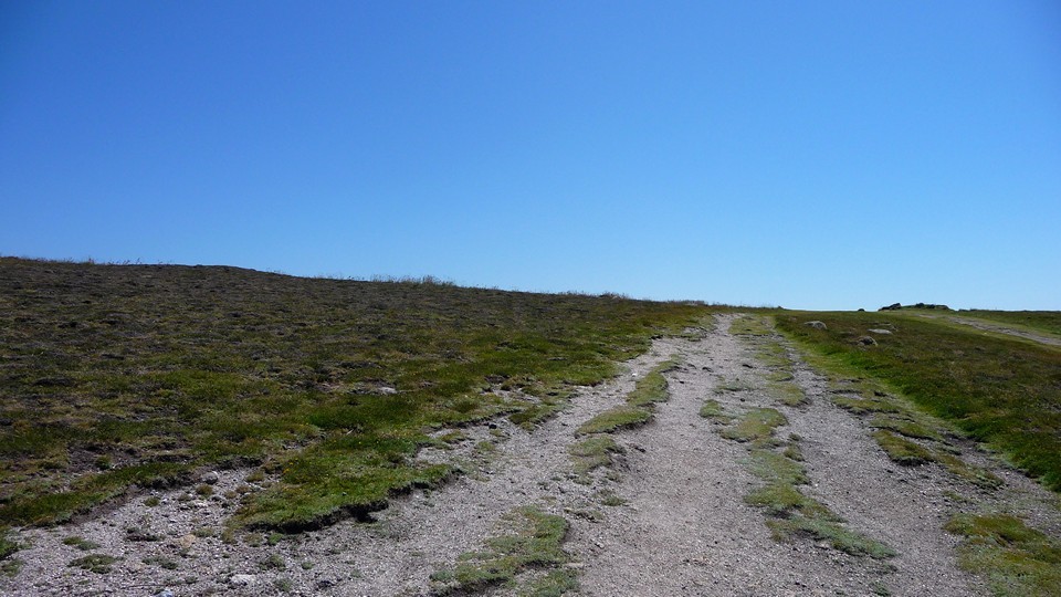
| 21 June 2010. As Midsummer is upon us and the weather continues to be hot and sunny, we plan a trip out to avoid the obvious solstice sites, particularly the stone circles. So we plump for the open-top Lands End bus, which follows the beautiful and scenic coast road round the north of the peninsula through Morvah, Pendeen and St Just, and get off at the aerodrome. From here, it's a fairly short stroll along a byroad to a path that leads up on to the top of Chapel Carn Brea, the "first and last" hill in England. It's been six years since we last came up here so a visit is long overdue. It seems to be a site frequented by dog walkers, as there's an easy parking place and certainly some doggy evidence along the path. Although at 200m it's not the tallest hill in the world, it commands terrific views in almost all directions (the exception being to the northeast), with a sea panorama that supposedly stretches further than any other in mainland England. There's a handy topograph on the summit, pointing out The Lizard (22 miles) and the nearer Penwithian landmarks including Carn Kenidjack. Sadly the Isles of Scilly (30 miles) are lost in the haze today. What is visible on the cliff-top to the northwest is the excellent chambered cairn of Ballowall barrow, a contemporary of the site we've come to see here. Chapel Carn Brea — Fieldnotes01.09.10ceThe main draw of the hill, apart from the extensive views, is the rather extraordinary chambered tomb and later cairn, which fills the hilltop and despite much subsequent damage (notably caused by the building of a medieval hermitage and then a radar observation post on top of it) still measures almost 20m across. The original Neolithic chambered tomb has been covered by the later, larger Bronze Age cairn, which accounts for most of the stonework still to be seen. The small intact chamber that can be seen is a secondary cist added when the Bronze Age mound was constructed. I manage to squeeze inside and get back out again without damage to the tomb or (more likely) myself. This is a terrific monument even in its damaged condition and definitely worth coming to visit. It provided us with the perfect location for Midsummer lunch and general chilling out. Chapel Carn Brea — Images21.07.10ce
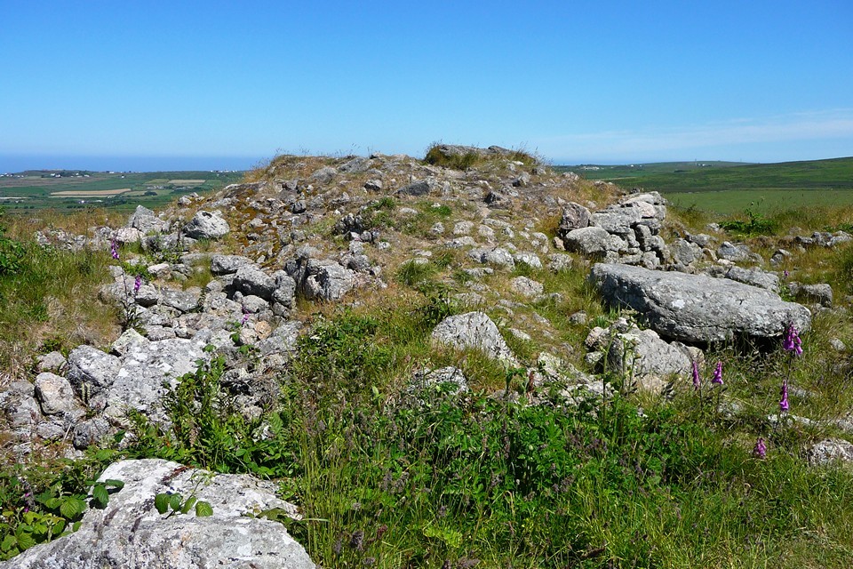
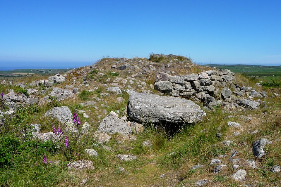
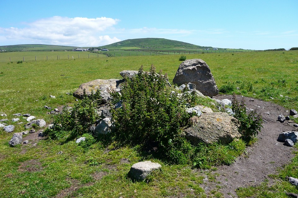
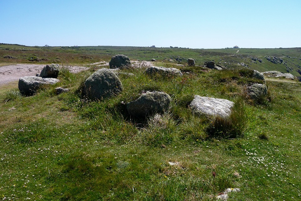
Chapel Carn Brea long cairn — Fieldnotes01.09.10cePast the topograph and to the southwest of the chambered tomb, there is an even rarer (and earlier) early Neolithic long cairn. Not many long cairns exist in Cornwall and I'm pretty sure this is the only one in Penwith. I didn't know it was here the first time we visited, but the new re-print of Cheryl Straffon's excellent A5 size "Ancient Sites In West Penwith" lists it, otherwise I still wouldn't be any the wiser. It would be very easy to miss this, as it looks pretty much like a natural rock outcrop. In truth, it appears that the natural rock and the contour of the hill have been incorporated into a long, low mound. The rocks form the south-eastern end of the mound. There are some stones along the sides of the mound, which may indicate that it once had some kind of retaining kerb. Chapel Carn Brea long cairn — Images22.07.10ce
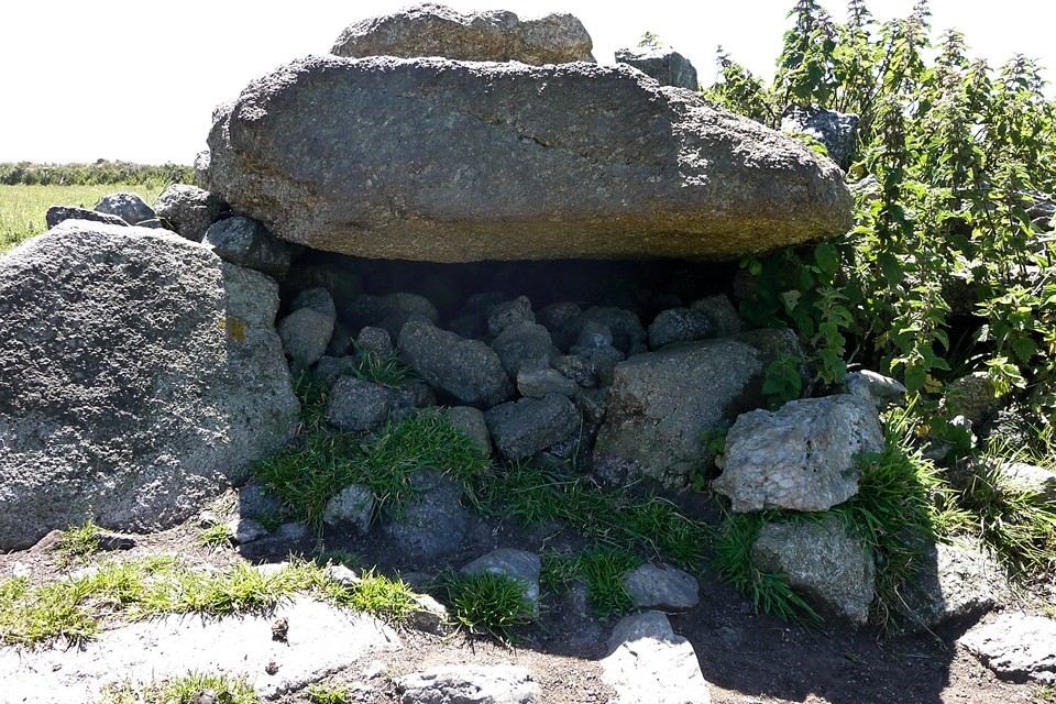
We head away along a path running southwest off the hill, which unfortunately takes us onto the A30 for a traffic-dodging section up to the junction with the St Just road, where get a good retrospective view of Chapel Carn Brea. At Higher Tregiffian, a footpath leads past a caravan site and into the small fields that are so typical of lowland Penwith farms. A couple of fields on and our next objective comes into view. Tregiffian Vean — Fieldnotes01.09.10ceI'm not hoping for much from Tregiffian Vean chambered tomb, having only seen the black and white photo in Craig Weatherhill's essential "Belerion", in which only the capstone appears above the ploughed surface of the field. In fact, I'm pleasantly surprised, as there is a visible mound and although the capstone is displaced it still rests on upright orthostats. The general shape of the tomb is apparent at any rate. On the downside, the chamber has been blocked with rubble and the top of the tomb has been used to dump what look to be assorted clearance stones. Perhaps not up there with the likes of Brane in terms of condition, but nevertheless a survivor and worthy of the time spent in a visit. Tregiffian Vean — Images22.07.10ce
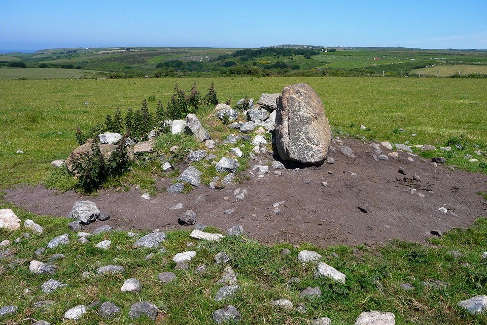
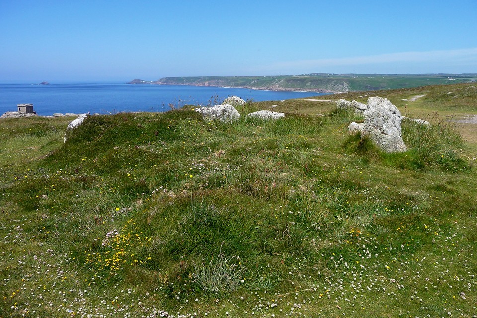
We carry on along the footpath until it reaches Tregiffian Farm, where a lazy herd of cows spares us barely a glance as we thread our way past them. The footpath disappears in the farmyard and we have to make a strategic gate clamber to carry on our way. Now we're heading for the sea and the cliffs. Penwith has a good collection of coastal cliff-top barrows, most of which are easily seen from the South West Coast path. But our next stop-off isn't one of these pathside barrows. Escalls Cliff — Fieldnotes01.09.10ceEscalls cairn sits atop the cliffs, with The Brisons visible offshore to the NNW. The coast path here runs along the base of the cliff, so this barrow is not much visited by the casual passerby, unlike Mayon Cliff for example. It is sited next to a granite outcrop and appears almost a natural feature itself, comprised of large slabs of granite which probably didn't come from very far away at all. When excavated by W.C. Borlase, a small cist was found containing an urn, together with flints and shells (shells may be local, but flint probably wasn't). There's no sign of any of that now, just the outer slabs. Worth a visit and a stop because of its lovely location, where the sky meets the sea and the sea washes the shore. I've come over all poetic, so it must be time to head onwards. Escalls Cliff — Images22.07.10ce
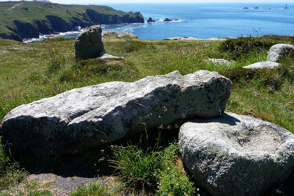
We make for Mayon Green, above the sands of Whitesand Bay and from where houses of Sennen Cove come into view. Barrow-ed out for the day, g/f heads off downhill to the village in search of shade and ice cream, while I carry on around the cliff-top for one last site. A cautionary notice on a barn warns me that there is a deaf cat in residence, but I don't see any sign of it and carry on towards Mayon Cliff. Mayon Cliff — Fieldnotes01.09.10ceThe last two barrows of the day bear no resemblance to each other. The well-known Mayon Cliff cairn, which the coast path passes right next to, is rather lovely. It has a retaining kerb of rounded boulders and the remains of a central cist. A huge longstone lies across the mound, presumably dismounted from a position covering the central burial. Lands End (and its tacky tourist park) is visible, as are the Longships with their lighthouse. By contrast, the round barrow to the NE (assuming I did find it) is simply a low mound, covered in heather and almost imperceptible unless you're really looking for it. It has no visible stonework at all but is in the correct place based on the OS map and Craig Weatherhill's "Belerion" description. It is intervisible with the better-preserved cairn. Mayon Cliff — Images22.07.10ce
A slightly undistinguished end to the day's stone-spotting perhaps, but as ever West Penwith leaves me very content. Here at the western tip of England, the last village on the longest day, life doesn't get much better. Unless you have an ice cream and someone to share it with, which is where I head off. |
 Posted by thesweetcheat
1st September 2010ce Edited 1st September 2010ce
thesweetcheat's TMA Blog
Latest TMA Blog Posts
|
Comments (0) |
|
| You must be logged in to add a comment | |