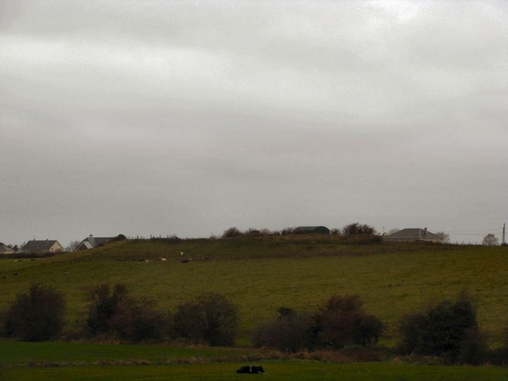
Tricky to see some of the remains at ground level but Westropp gives what I think sounds like a bit of a far fetched account of Clogher Hill and its surrounding assembly area / barrow cemetery.
There are barrows marked on the OS map however they are not that large and would require a complete fieldwalk of the area to record them all.
Here is Westropps account of the Clogher Hill assembly area below, it is very confusing.Oenach Culi Mna Nechtain or Clochair - The traveller who passes from Dublin to Cork, if he watches the beautiful changing views of the great Galtees and the Ballyhoura mountains in southern County Limerick, can also see two salient points of the the legendary battlefield of the High King, Cormac Mac Airt, and Fiacha Muillethan, King of Thomond. The long ridge, with the rugged peel tower of the O'Hurleys, near Knocklong Station and the great beech-clad mound of Aghadoon, on a slope beside the Morning Star River, the ancient Saimer, once an imposing river, now a small and shrunken stream. The ridge is the "Druim Damhgaire" (oxen ridge) and the mote the "Raithin an Imaraigh" where the opposing druids fought, with all the "high explosives of up-to-date magic".
Driving from Knocklong, not by the direct road, to the south east but by the road south of the ridge to the "Cross of the Tree" we pass, on the edge of a plateau, a little green tumulus, called Clogherbeg Mote. The name, with that of Clogher Hill, is all that the chief cemetery and assembly of the Dergthene, the tribe sprung from "Nia Segamain of the Siabra" or god race, from the great gods Lug Long Hand and Nuada Silver Hand, afterwards froming the branch (so famous in Irish history) of the Eoghanacht of Cashel and the Dal Cais, the tribes ruled by Brian Boroimhe.
May I be so far personal as to take my own case as an illustration of the merits of field survey? I was absolutely in ignorance when I recorded the remains at Slieveragh and Clogherbeg that I had at last found the Temair Erann, and was about to identify independently Oenach Culi. Mr P.J. Lynch had placed the latter correctly at Clogherbeg, but only on literary grounds, for he gave no note of the remains, and I had not recalled his brief paragraph. I unfortunately held (with O'Donovan, like Mr Orpen and Father Hogan) that Oenach Culi was at Monasteranenagh. The remains clearly marked a spot of the first importance; if so, what was this Clogher Hill and Clogherbeg? The ridge of Knockainey lies away to the north, the blue Galtees and purple Slievereagh to the south, in full view of Clogher Hill. The Mesca Ulad tells how Cu Chulaind, after he had gone up Knockainey to look round and identify the landmarks, led the Ulstermen southward, toward Cenn Febrat, coming to the Oenach Sen Clochair. The Agallamh tells how St Patrick coming from Cullen to Ardpatrick "skirted the Oenach of Nechtan's wife Cuil, not called the heifer-carrying Oenach Sen Clochair, past Cenn Febrat of Sliabh Caoin. These two lines as described cross each other at Clogherbeg. The charter of Prince John to Monasteranenagh Abbey, in about 1186, places Enaculi at Corbali, and the townland of Corbally adjoins the townlands in which the earthworks remain. Few ancient sites are better
identified.
Now the Senchas na Relec tells us in its account of "the chief cemeteries of Erin before the Faith" that Temair Erann was where "the Clann Deda - ie the race of Conaire and the Ernai (buried), at Temair Erann; the men of Mumhan i.e, the Derghene at Oenach Chuli and Oenach Colmain". Every outstanding name of note (hero or heroine, save Curoi, who was buried on Slieve Mish) appears in the list of graves on Cenn Febrat in MacCraith's poem (circa A.D. 900-1014). The question arises what princes of the Dergthene lay at Oenach Culi?
Legends give the following as buried elsewhere - Mog Neid, in a sod grave on Magh Tualaing in Ely O'Carroll, King's County, Eogan Mog Nuadat and his brother in law under two tumulit at Oeanach Colmain Elo (wherever it tlay) perhaps near Tullamore, in the same county, near Magh Leana. Oilioll Aulom was buried on the summit of Claire (on Slievereagh, probably in the curved wall, above his fort of Dun Claire), his seven sons near Magh Mucrimhe and Cormac Cass, in Duntryileague. Then we have no further account, so perhaps Oenach Culi was founded, or adopted, about A.D. 250 by Fiacha Muillethan. There, possibly, the Dal Cais princes, Mog Corb, Fer Corb, Aengus Tireach, Lugaid Meann, and Connel Eachluath, are laid, but there is not even legend. It has been asserted on the cited authority of the Dind Senchas that Lugaid was buried under a cairn a Ludden, further north, but (when we verify the statement) he made the cairn there to keep a tally of his men before his invasion of the present County Clare. His ordinary residence is there said to have been on Magh Femen.
Turning down from the "Cross of the Tree" towards Ballylanders to Galbally, we cross a stream and find a number of curious earthworks to the west of the road in the townland of Raheenamadra, on to the border of Mitchellstown-Down, Raheenamaddra, is a platform fort, a low mote, such as abound in this district; we have, at least fifteen, Rathbane or Bulgadin, Ligadoon, Aghadoon, Atheneasy, four in Knocklong, three in Cushand Ballinvreena at the foot of Slievereagh, Glenbrochain or Ballingarry Down; Rahanna and Raheenamaddra; "the dog's little fort.". Their number precludes the idea that they are inauguration mounds, or feudal castles, and scattered across such an extent they clearly belong to no one cemetery, they are most probably residential, and Glenbroghaun Mote, at the foot of Sliab Claire is more than probably the Rath of Broccan near Claire in the Tripartite Life.
In the first field on the S. E. plateau we find a long hollow, running N. and S., probably the boundary of the Oenach, the track of an old road runs E. and W. beside a low platform, hardly a yard high, with a shallow fosse, 6 feet to 9 feet wide, round it. The eastern angles are rounded, and it measures about 63 feet by 93 feet.
Another double track runs to two shallow hollows, evidently like the ponds at Tailltiu, a low mound stands between them. Another hollow way runs from them at right angles and toward the S.W. We cross the valley and stream in that direction, and climb the farther slope to the summit of the S.W. plateau called Knockaunataffiff, "the Bull's mount" which commands a beautiful view of the mountain. It is quite possible that it is a casual name, like "Stagpark" and "Bullpark" elsewhere, but when we consider the it is the principal height of this great Oenach, and the connection of supernatural animals with such sites, the name is worth reflection. The "Prison of (the holy horse) Liath Macha" remained in the Brugh and the fort of it and its companion steed, Dub Sainglenn at Raith na h echraide, lay between Dundalk and the sea. There was a horse oracle at Dunbin, W. from Dundalk, and weird creatures, the Luchduin, perhaps a giant fox, wolf, or even mouse the many-legged carapaced Mata and not a few others as we noted.
We passed a terrace, possibly natural, and find on the summit twin tumuli suggesting "the two breasts of the Morrigu" at Brugh - is it too daring to fancy these may have been called "the two breasts of Cuil, Nechtan's wife"? Being on a slope, they are from 10 feet to 13 feet higt to the eastm and 5 feet to 6 feet high to the west. A fence has been made between them, and the northern is in the long "screen" or plantation on the border of Mitchellstown Down. The southern mound is best preserved, a very shallow fosse delimits its base, and it rises in three stages, 5 feet, 5 feet, and 3 feet, in all 13 feet high, to the S., 10 feet to the N. end. The whole work is about 90 feet long, the summits were flat, 13 feet and 15 feet across. These command a view northward to Clogherbeg Mote. To the S.E, near the summit of the rise, is a small platform, 5 feet high, 6 feet across, with a fosse 12 feet wide, and a trace of an outer ring to the S.E. The long slope northward forms a natural amphitheatre commanding a view of any ceremonies performed at the conjoined mounds. A large shallow pond liews at the foot whence traces of two old roads run eastward. The conjoined mounds are very characteristic. They are 4 feet to 5 1/2 fett high, somewhat D-shaped, about 61 feet by 30 feet, and 78 feet by 81 feet, the first dimension being east and west. The western was walled with a drystone revetment of large slabs. It is not improbable that the mounds were dedicated to Nechtan and Cuil. The fosse is nearly obliterated in many parts; it is 9 feet wide, and had an outer ring, 6 feet thick, to the south of which the old road runs. About 200 feet awat is another circular platform of the same height, about 81 feet to 88 feet across, with a fosse. At 56 feet to the S.W. is a regular shallow, oval hollow, 3 feet feep and 18 feet to 25 feet across. Near it is a great block of stone, 3 feet 8 inches by 3 feet by 3 feet 6 inches. Another nearly buried block is to the N.E of the conjoined works.
|
 Posted by bawn79
2nd December 2008ce
Edited 3rd December 2008ce |