|
|

|
|
Parc-y-MeirwStone Row / Alignment
|
||||||||||||||||||||||||
|
|
|
Images (click to view fullsize) |
|


|
Fieldnotes |
|
| Visited 4.8.2011. Slightly disappointed, as so few of the stones were visible, even after clambering into the field. The lush summer growth of the hedge probably didn't help, or the fact that we'd walked for quite a distance up from the Cwm Gwaun valley to get here. |
 Posted by Squid Tempest
8th August 2011ce |
|
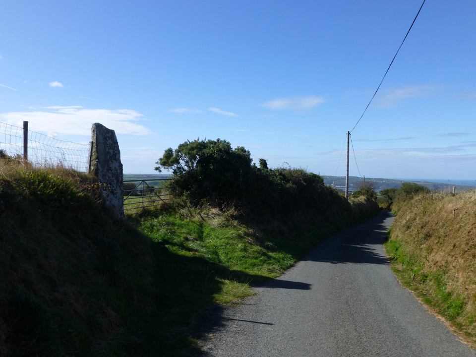
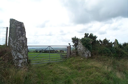
Visited 30.6.10. This was a lot easier to find than I expected it to be although I have to say I was a little disappointed by the site. I don't know why but I was expecting it to have more of a 'wow' factor. The only thing I can add is that one of the fallen stones built into the wall is under a telegraph pole. May make it a little easier to find? |
Posted by CARL 8th July 2010ce |
|
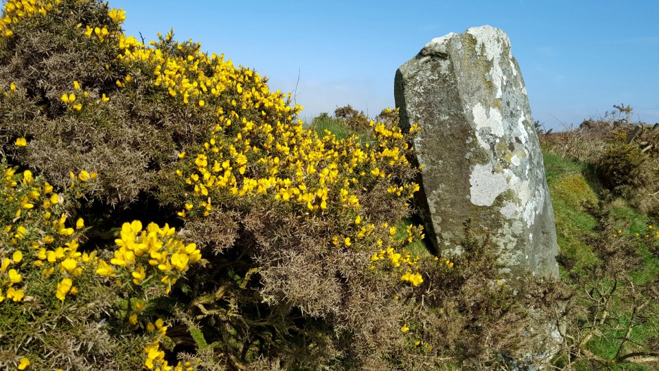
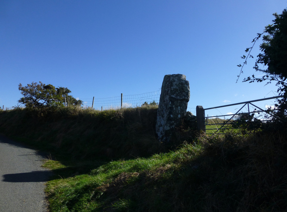
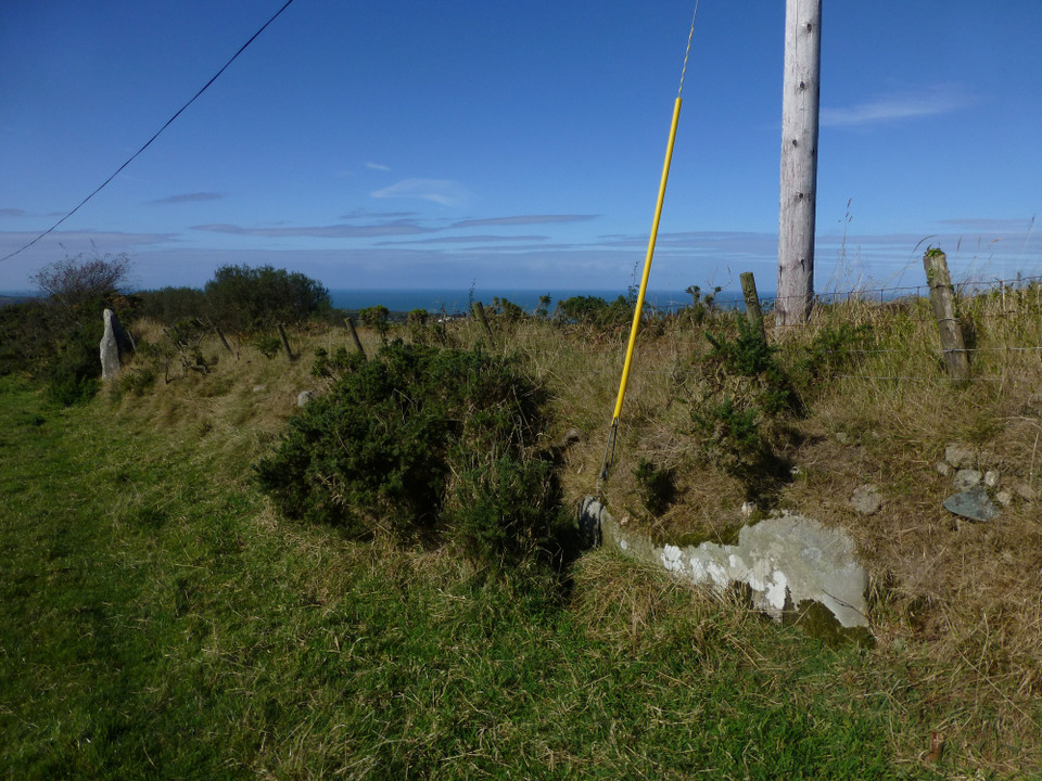
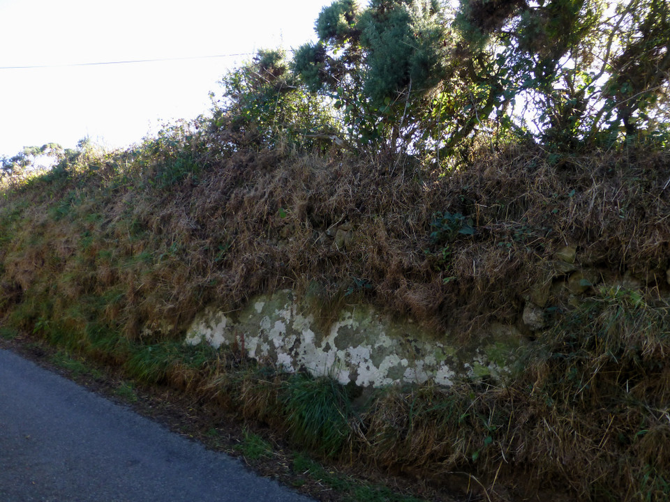
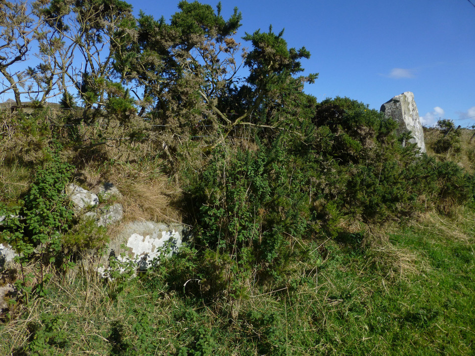
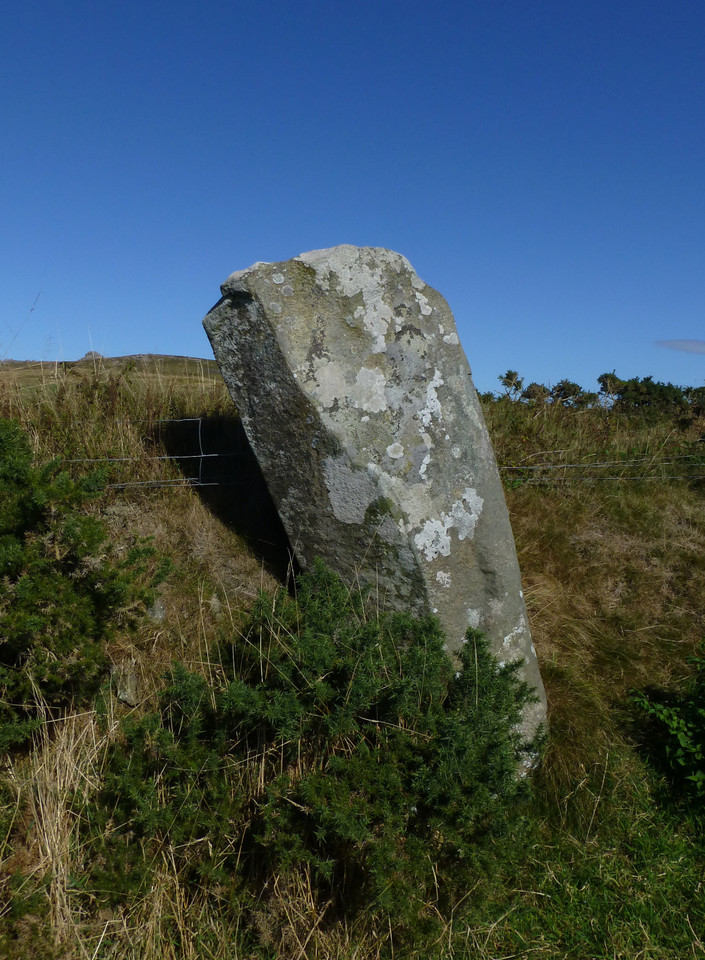
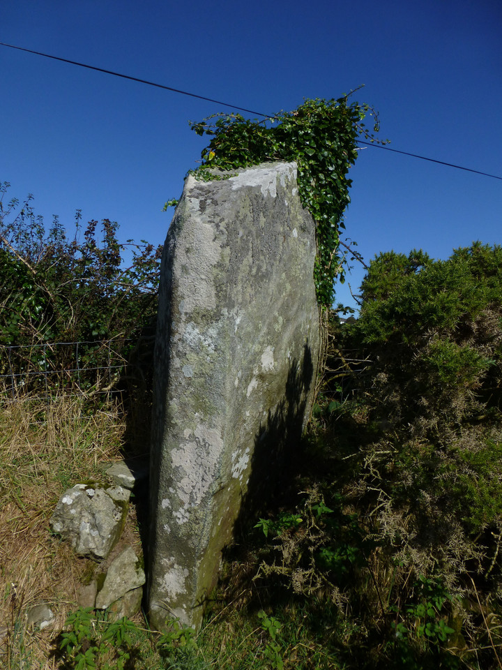
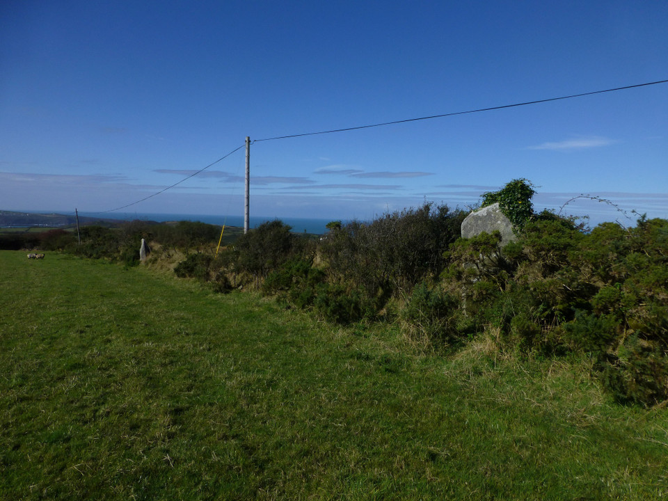
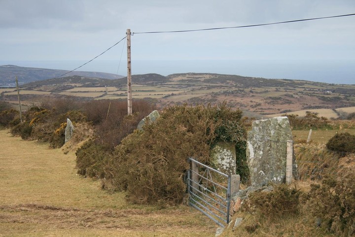
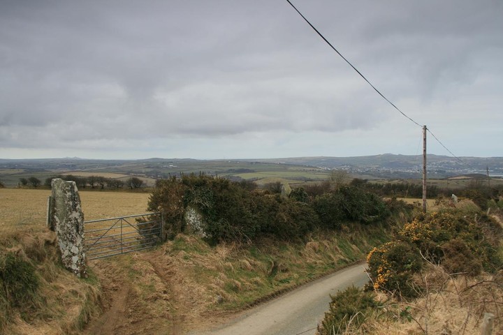
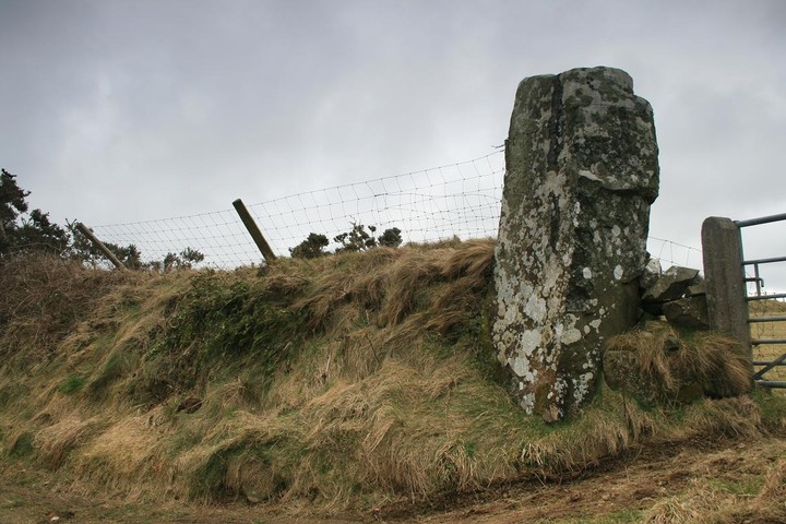
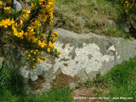
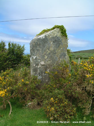
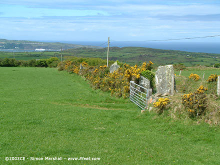
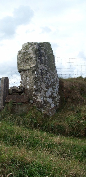
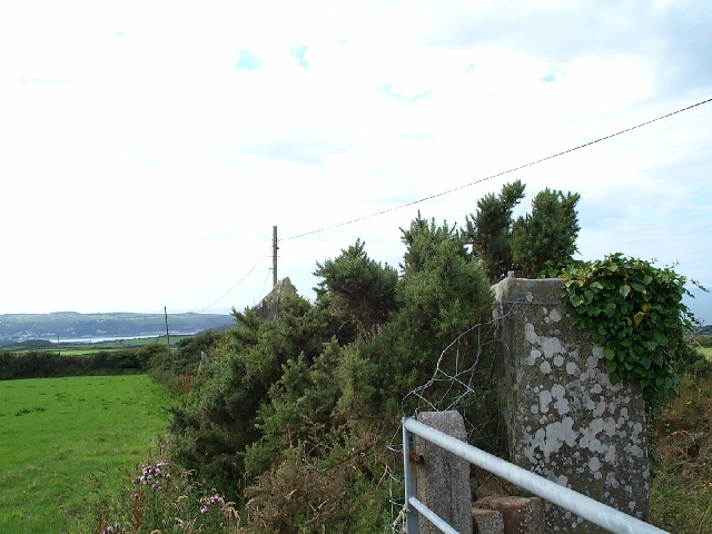
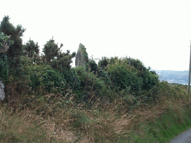
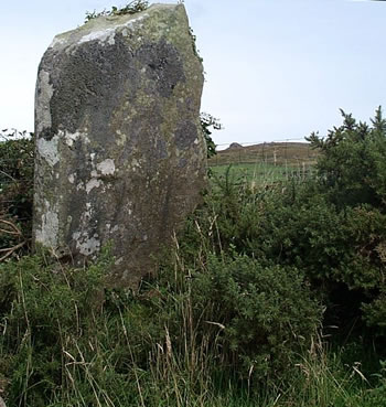
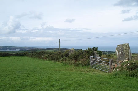
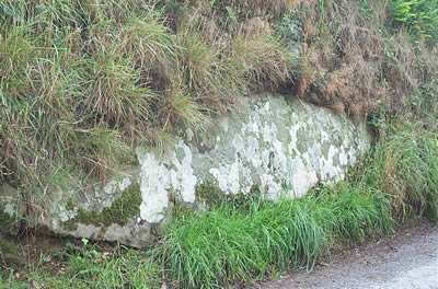
Delightfully close to the road is this terrific stone row, but parking is a nightmare, there is only room for one car and thats blocking a gate, but luckily the biggest stone is just 48inches away so you'll not be far away. The stones have a great view down to the coast and up to the rocky topped Garn Fawr and Carn Enoch, and just maybe a summer solstice sunset alignment. The telegraph pole marks the position of a large recumbent stone now mostly hidden under the earthern bank, the stone is halfway between two stones that are too far away from each other. Look back at one of the pictures from 2002 and see the difference in ivy growth between then and now, it'll be gone from view altogether in just another year or two, the hedge that preserves a good stone row also hides it completely, and i'm sure ivy isnt a good friend to rock. |
 Posted by postman
13th March 2010ce |
|
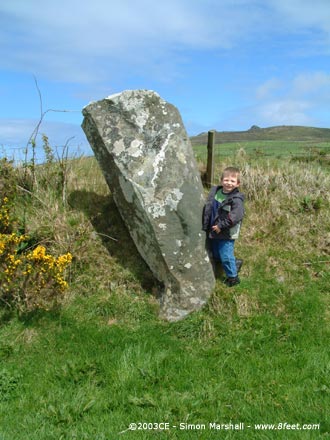
This lovely stone row is cunningly disguised as a hedge or field boundary, and in May is replendant with gorse, bluebells, red campion, kek, young green bracken fronds, foxgloves, white campion and buttercups. Really exceptionally pretty. Visited here with my sprogs and the lovely Kammer and his family. Scrambling up the steep rocky hedgerow at the top of the field you could clearly see the the stone row pointed at the promentary at Fishguard off in the distance about 5kms away, where a ferry to Ireland was moored up. My son and I walked down the length of the row and counted 4 standing stones, one used as a gatepost and 3, perhaps 4 fallen ones in the verdant undergrowth. But what a view! You could even see over to St Davids, way out to the west. The stone row seems to follow an ancient track, the lane is very sunken, implying great age. |
 Posted by Jane
31st May 2003ce Edited 31st May 2003ce |
|
Visited 24th May 2003: This is the first site we visited with Jane and her clan. All seven of us clambered into the field, and sat at the top looking down the row towards Fishguard. The weather was (unexpectedly) great, and it all looked vibrant with the gorse in flower and the stupidly lush pasture. There are definitely stones hidden in the hedge bank that were once part of the row, but only a couple of likely contenders are visible. The biggest recumbent stone is visible from the lane, and it's truly whopping. It's a shame that you can't really walk around the stones, and get the over-all picture of what the row might have originally looked like. |
 Posted by Kammer
29th May 2003ce Edited 4th August 2003ce |
Folklore |
|
On the Six Inch O.S. Map, Pembrokeshire, Sheet x, N.W. (second edition, 1908), within the parish of Llanllawer (for older Llanllawern), on the right hand side of the road going east from the parish church, and about three-quarters of a mile from the same, is a spot marked "Standing Stones", these being in the hedge of a field along the road, another field adjoining being called "Parc y Meirw".From notes in 'Parochiale Wallicanum; or, the names of churches, chapels, etc...' by Arthur Wade-Evans (1911). |
 Posted by Rhiannon
29th January 2012ce |
[A tradition is] connected with that remarkable line of tall stones near Fishguard marked on the ordnance map as Parc y Marw, or field of the dead, to avoid which the peasants after night make an enormous detour to the left as one goes through Newport.. the story of the Lady in White haunting these mysterious relics, although firmly believed, may be a comparatively later addition to an earlier superstition.From Proc. Som. Arch. Soc. 1875 (v21). |
Posted by Rhiannon 17th August 2005ce Edited 17th August 2005ce |
|
If you visit Parc-y-Meirw, it's worth walking half a mile down the road to the derelict church of Llanllawer and its associated holy well. The church, a Victorian restoration without any merit, was originally built on an ancient site: the churchyard which surrounds it being roughly circular and stones on either side of the entrance gate bearing rudely engraved crosses. The well in the adjoining field, accessible via a stile, is a shallow pool with a stone hood. The church (not accessible) has inside it a weeping stone, said always to be damp. The location of the this site is highly significant: above the river, close to the stone row and with a direct siteline to the 'nipple' of Mynydd Dinas, or Llanllawer Mountain. To quote from The Topographical Dictionary of Wales (1833): "On the side of Llanllawer mountain, which terminates in a rocky point, and is hence called the Maiden's Breast, numerous Druidical relics and carneddau are profusely scattered, which are supposed to have been places of ancient sepulture; and adjoining is a mineral well, formerly in high repute for its efficacy in the cure of ague and other diseases, but now neglected." It's no longer so neglected: modern pagans have adorned the gate across the well mouth, hooray! |
Posted by daisy 12th February 2005ce Edited 29th January 2012ce |
In his book Saints and Stones (ISBN 1-84323-124-7) Damien Walford Davies suggests that the name Parc-y-Meirw (meaning 'field of the dead') may date back to the battle of Mynydd Carn which is believed to have taken place nearby in 1081:During the course of the fighting, three Welsh princes - Trahaearn ap Caradog, Caradog ap Gruffudd and Meilyr ap Rhiwallon - were killed by the forces of Rhys ap Tewdwr of Deheubarth and Gruffudd ap Cynan, assisted by the Irish.Davies suggests that the death of these princes contributed towards the subsequent Norman invasion of south Wales. |
Posted by Kammer 10th June 2004ce |
Miscellaneous |
|
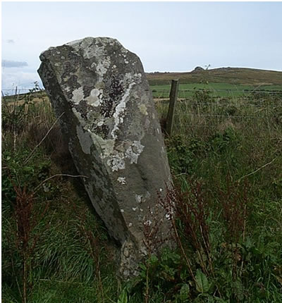
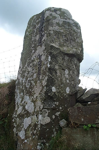
| With 6 standing stones (well, 4 still actually standing: two of those as gateposts, and two fallen over ) and covering 130ft+ this is the longest stone alignment in Wales, and the only stone row in south west Wales. There may have been 8 stones originally. |
Posted by Rhiannon 6th December 2002ce Edited 9th April 2003ce |