|
|

|
|
Twyn y Gaer (Crucorney)Hillfort
|
||||||||||||||||||||||||
|
|
|
Images (click to view fullsize) |
|
|
Fieldnotes |
|
|
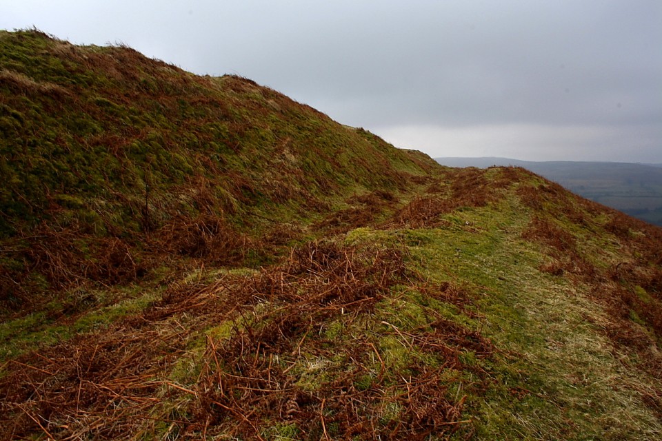
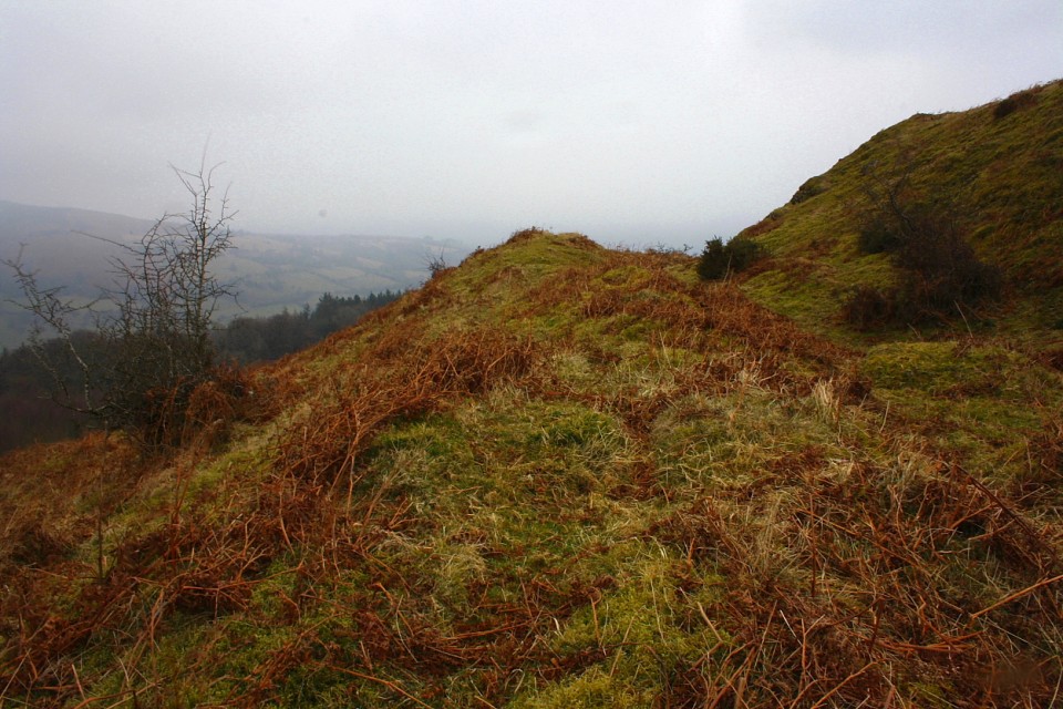
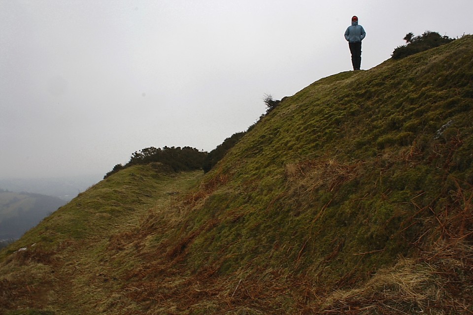
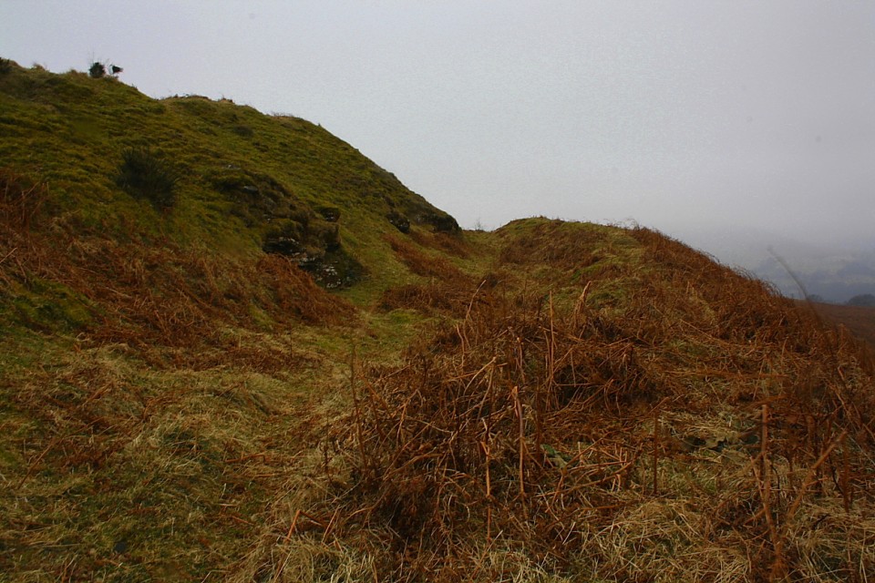
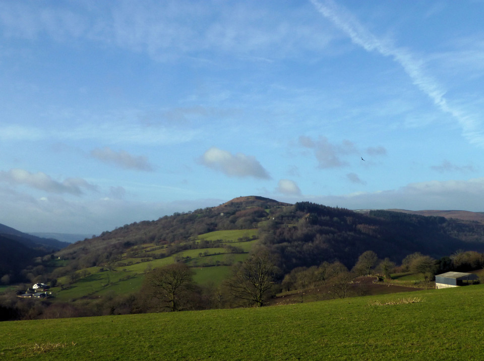
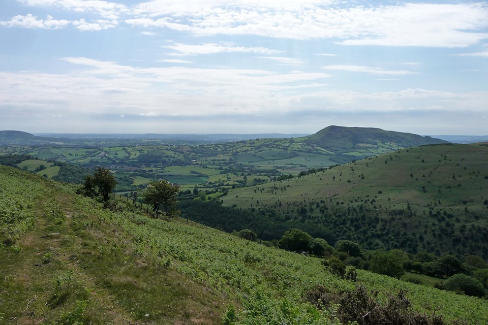
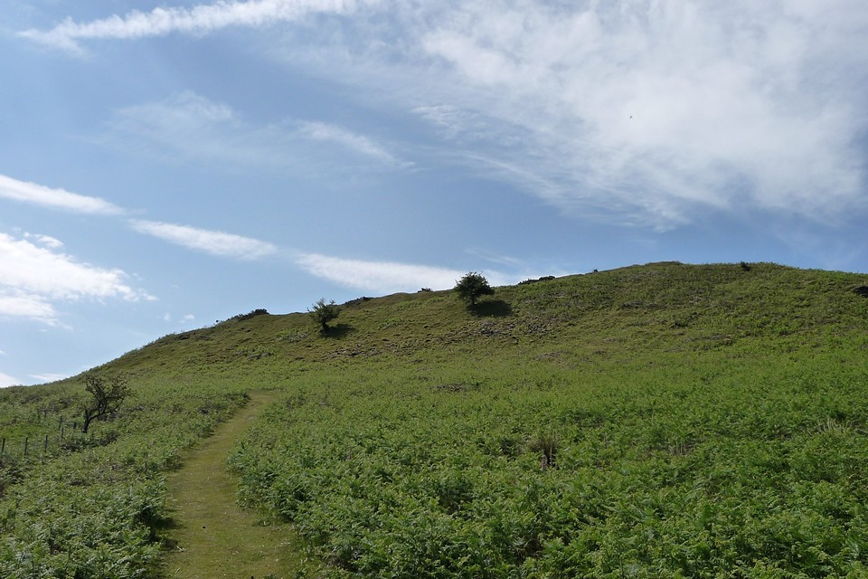
Visited 21.8.11 My second and last site of the day. This site proved to be the most difficult to access that I have experienced in quite a long time. I headed west along some very minor roads from where I had parked when visiting the near by Pen-Twyn Camp (Crucorney). This leads up hill to the north of the Hillfort (through trees). There is a space to pull over opposite an old rusty field gate. You can actually see the Hillfort from the gate – up above the tree line. Up and over the gate, across a field full of sheep and over a barbed wire fence on the opposite side – so far so good. Then the 'fun' began! I then came to what appeared to be some sort of overgrown 'orchard' – although I have no idea what the red berries hanging from the trees are? When I say overgrown – I mean overgrown: bushes, brambles, ferns and (I kid you not) head height nettles! It took quite a while to carefully make my way through the trees/nettles and eventually came out the other side. I was then confronted by my next 'challenge' – head height ferns! Although not as bad as head height nettles they were still tricky to walk through, particularly whilst going uphill. This really was hard going. I then came out onto a path running north to south through the ferns which didn't show on my O/S map. It could have all been so much easier! It was then a case of the last leg up to the hilltop summit which was so steep I had to go on all fours to get to the top. Finally, I reached the top, knackered and out of breath. Just as I was thinking 'I must be mad' I looked up and saw the view. In an instant it all became worthwhile – simply stunning. The single rock cut ditch/rampart of the Hillfort was easy to spot, being about 2 metres high. The whole of the site was covered in ferns and the dreaded gorse. All I had to do now is make my way back to the car………oh joy! Despite the access problems I had, if you were able to come via the 'path' through the ferns it shouldn't be too bad. It is worth the effort for the views alone although the Hillfort defences were pretty impressive. Best to follow TSC's directions for an easier life! |
Posted by CARL 23rd August 2011ce |
|
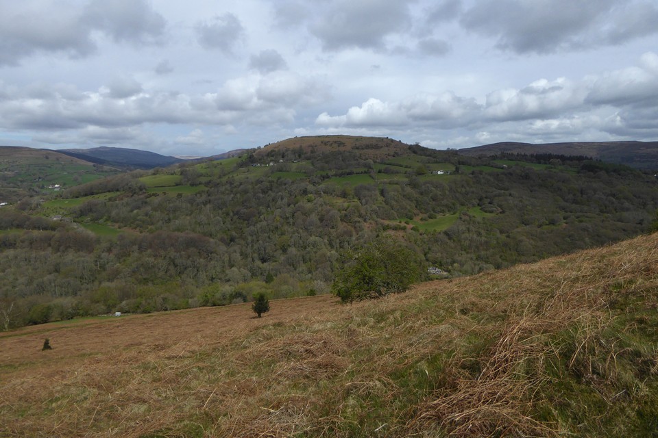
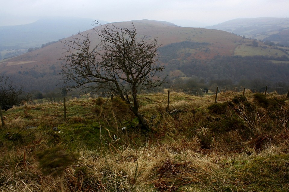
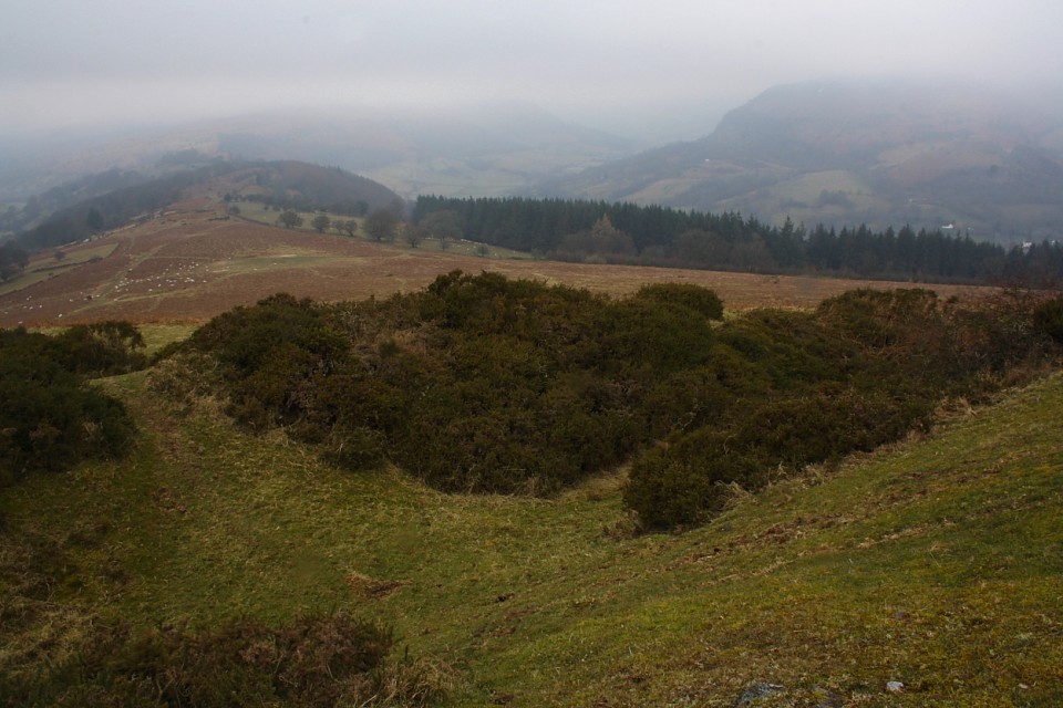
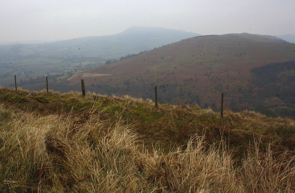
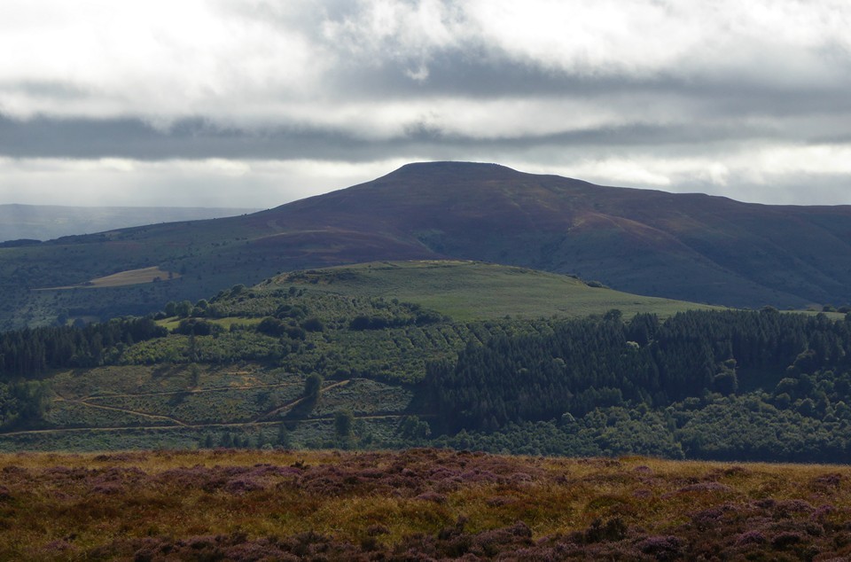
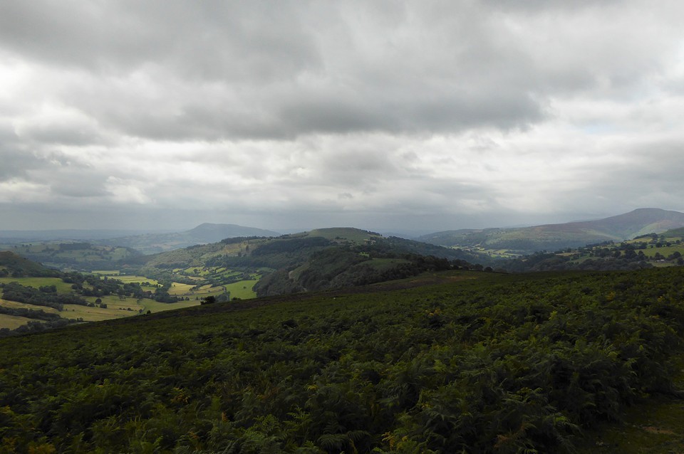
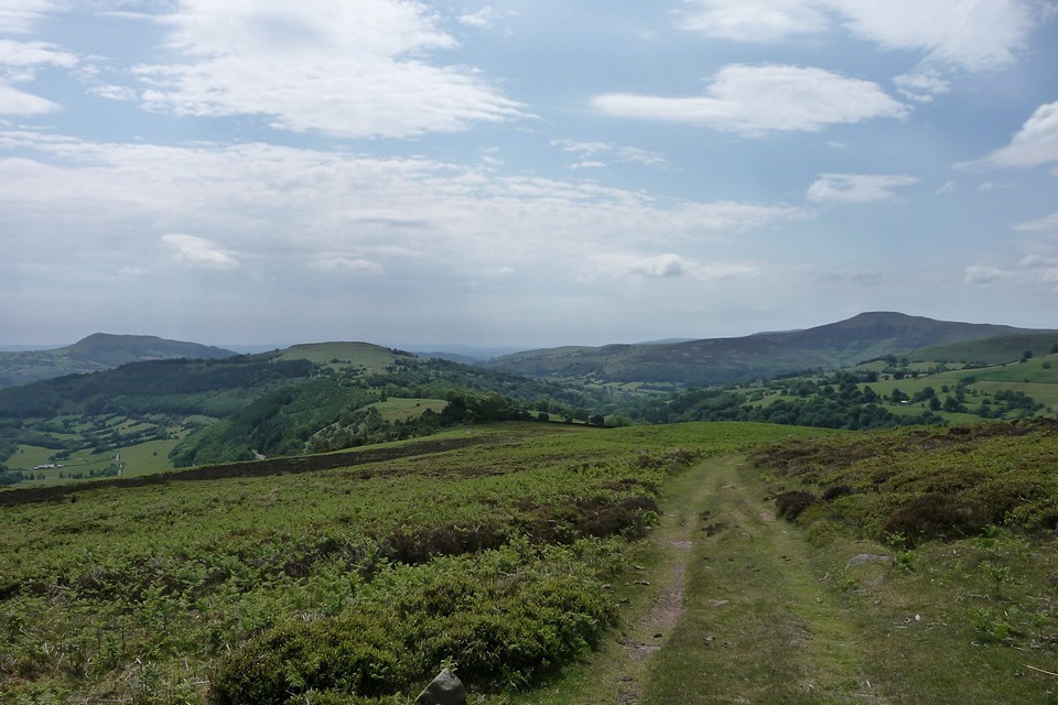
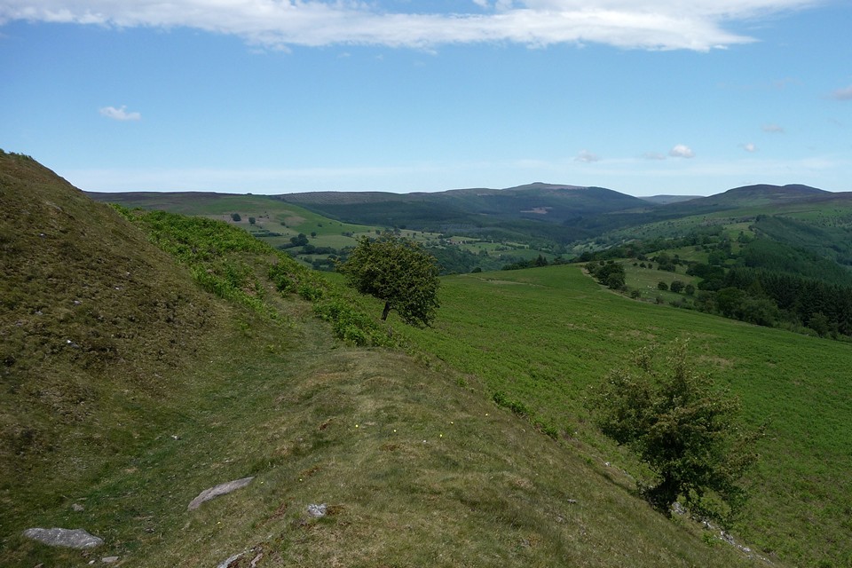
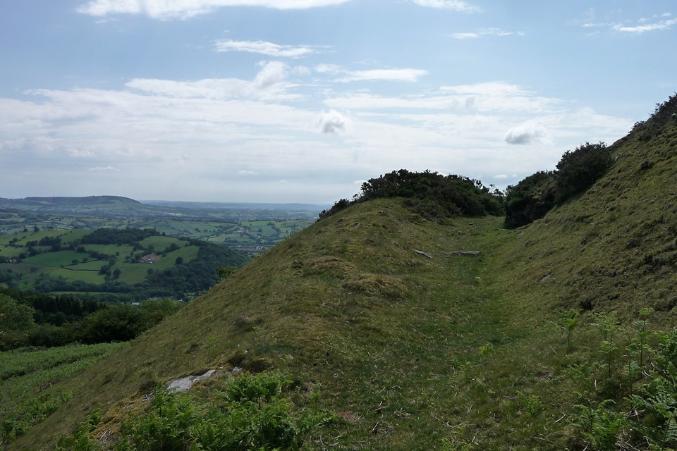
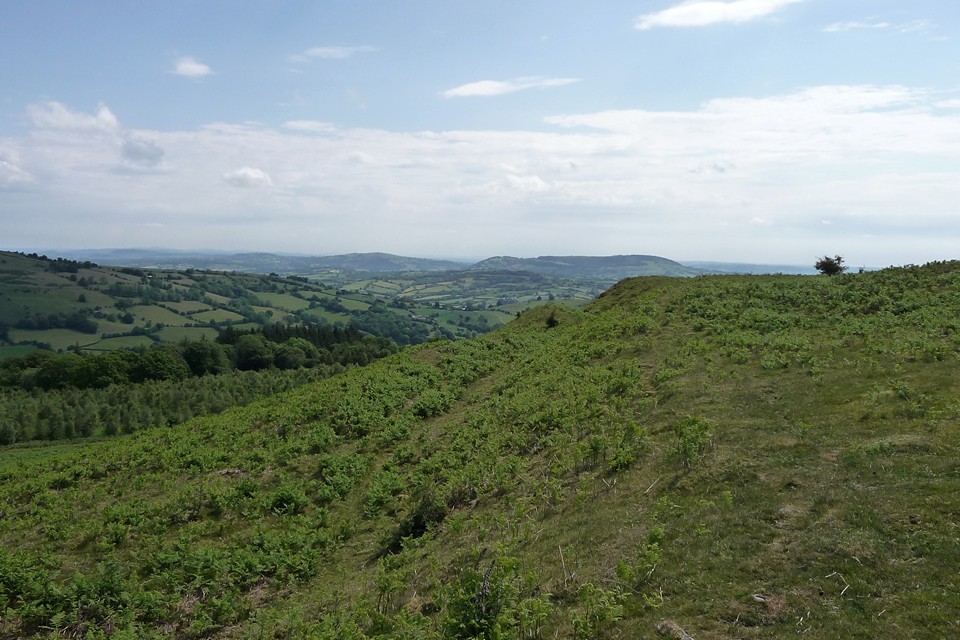
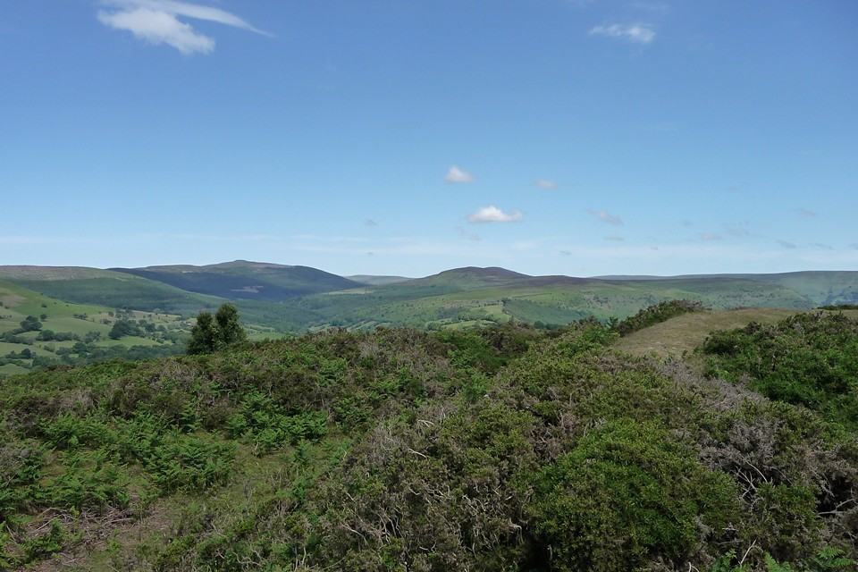
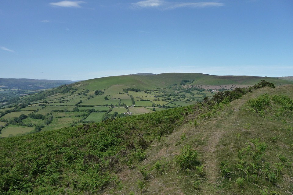
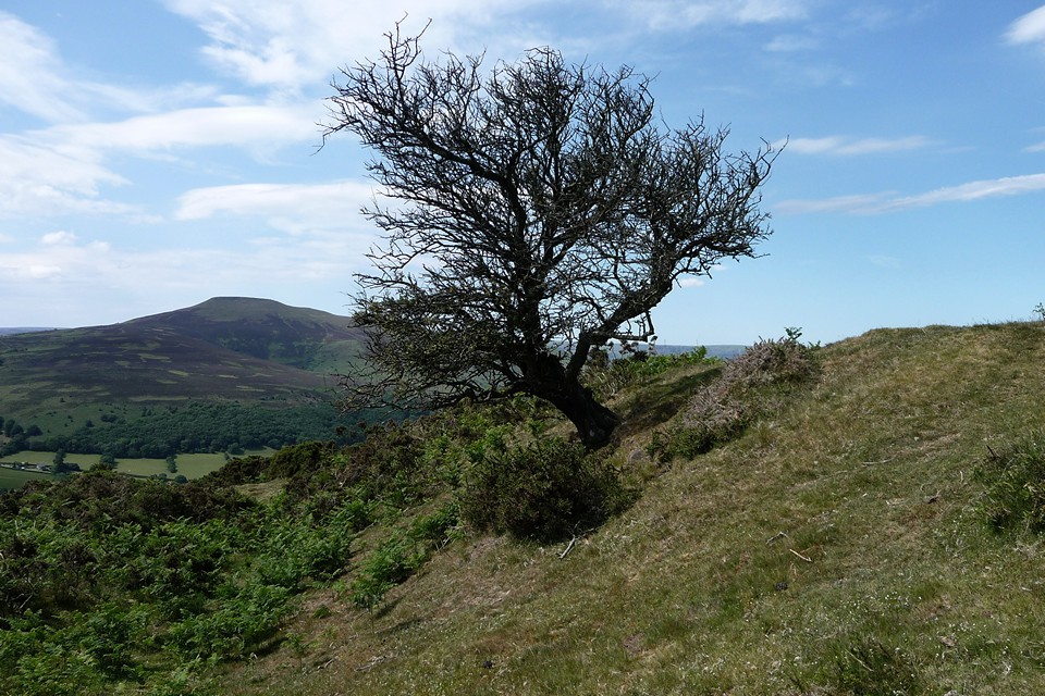
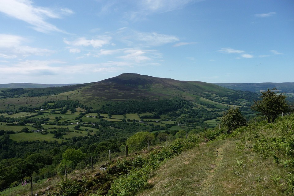
Walked up here from Llanfihangel Crucorney, home to the "Oldest Pub in Wales" if its sign is to be believed (4.6.2011). It's a walk along winding country lanes, a bit more traffic than comfortable but nice and easy going. For those who wish to visit by car, take the narrow and steeply climbing lane that's the first on the right after Stanton (opposite a pub and campsite), this leads up to a forestry parking place and the fort is a fairly short walk from there. It's worth at least walking along the lane from the forestry parking, as there are terrific views to be had to the north, taking in the central Black Mountains ridges and the village of Cwmyoy with its wonky church, through gaps in the foliage. Plus someone has built a little 'stone circle' (well, arc) thing near to Pen-Rhiw. On a hot day like my visit, the shady lane is a welcome break from the blazing sunshine too. The approach to the camp is across the access land to its north. The northern rampart is immediately visible, protecting the fort on its naturally weakest side. Following the curve of the slope round to the eastern entrance, it's here that the views really start to kick in. First of all the umistakable profile of Ysgyryd Fawr (The Skirrid), over to the southeast. Entering the fort at its eastern end and I'm presented with a beautiful vista, centred on Pen-y-Fal (The Sugarloaf). The rampart is much less formidable on the southern side, understandable given how sharply the hillside drops away to the farmland below. It's difficult to take my eyes off the view though. Before reaching the halfway point along the southern rampart, the fort is bisected by a bank dividing the eastern (higher) side from the western side. To the west the views keep on unfolding, taking in Crug Mawr, with the rounded summit of Pen Cerrig-calch just visible beyond. Then round to the northwest and the shapely summit of Pen-y-Gadair Fawr, clothed by the greenery of the Mynydd Du forest. Further NNW, the ridge of Chwarel y Fan, my ultimate objective for the day, seems a long way off. Onto the rampart along the north, noting that two separate earthworks cross the centre of the fort. Approaching the eastern end, the rampart bulges outwards, following the natural line of the slope. The lush Vale of Ewyas (home to Llanthony Priory) provides a contrast to the exposed, steep-sided ridges on either side. Breathtaking. The panoramic views all around, taking in much of the Black Mountains, belie the relatively modest height of the fort (although calling 427m a modest height depends on relative heights of the immediate surroundings!). Superbly sited, come on a clear and fine day to best appreciate its charms. I head north, towards Garn Wen and then onwards and upwards to Chwarel y Fan. |
 Posted by thesweetcheat
6th June 2011ce Edited 25th August 2011ce |
Miscellaneous |
|
|
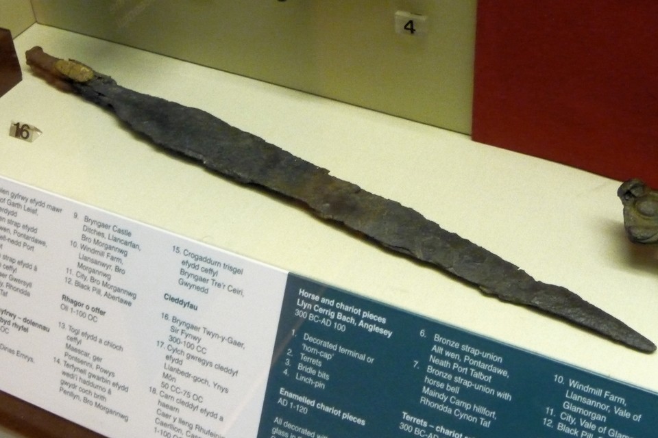
Coflein description of this wonderfully situated fort: Twn-y-Gaer Camp is a strongly embanked and ditched enclosure occupying the summit of an isolated and dramatic hill. It is an elongated oval in plan, roughly 226m by 84m, defined by a rampart with a ditch and counterscarp bank, except on the south where the hillslopes are at their steepest. There is a single inturned east-facing entrance. The interior is divided by two lines of east-facing ramparts and ditches, each with a central entrance. Excavation, from 1965, showed that the more easterly subdivision was the eastern front of the earliest enclosure. This enclosed an area of roughly 0.7ha. A second phase saw the enclosure expanded to its full extent, enclosing an area of about 1.54ha. In the final phase the enclosure was reduced to the part west of the western, stone-revetted, subdivision, an area of roughly 0.4ha. Finds included some pottery, including salt containers, iron and copper alloy objects, including brooches, glass beads, querns and iron working debris. The occupation producing this material had ended by the Roman period. Source: Probert 1976 'Twyn-y-Gaer: an interim assessment', in Wesh Antiquity (eds. Boon and Lewis), 105-19. |
Posted by thesweetcheat 5th June 2011ce |
Links |
|
National Museum WalesGlass beads from between the fourth and first centuries BC, which were probably made at the Meare Lake Village site in Somerset. |
 Posted by Rhiannon
6th June 2013ce Edited 6th June 2013ce |