The Modern Antiquarian
Log in
|
Register
Home
Latest Posts
Forums
Maps
Help
Browse Sites
News
Blog
Contributors
The Books
Select
-
Belgium
Denmark
Eire
France
Germany
Greece
Italy
The Netherlands
Norway
Portugal
Republic of Malta
Spain
Sweden
Switzerland
United Kingdom
County Limerick
Rathmore South
Standing Stone / Menhir
Rathmore South (Standing Stone / Menhir) on The Modern Antiquarian, the UK & Ireland's most popular megalithic community website. 2 images, 1 fieldnote, plus information on many more ancient sites nearby and across the UK & Ireland.
Image © Bawn79 © 2009
Nearest Town:
Croom (6km W)
OS Ref (IE):
R568408 /
Sheet: 65
Latitude:
52° 31' 1.09" N
Longitude:
8° 38' 11.2" W
Added by
bawn79
Images (2)
Fieldnotes (1)
0 discussions
Start a topic
Show |
Hide
Web searches for Rathmore South
Flickr
Google
Google Images
The Megalithic Portal
Bing
Stone Pages
Wikipedia
Show map
(inline Google Map)
- Sites within 20 km -
-
Tory Hill (4.02km W) (2 posts)
Rockbarton (5.06km E) (3 posts)
Grange Lios (6.38km E) (9 posts)
The Stone Of The Tree (6.49km E) (6 posts)
The Pillar Stone (6.57km ENE) (8 posts)
Knockfennel (6.89km ENE) (4 posts)
Knockfennel (6.98km ENE) (2 posts)
Knocktwo (7.05km SE) (3 posts)
Black Sow’s Bed (7.14km E) (6 posts)
Grange / Lios, Lough Gur (7.18km ENE) (87 posts)
Lough Gur Wedge Tomb (7.18km ENE) (26 posts)
Lough Gur C (7.18km ENE) (17 posts)
Lough Gur D (7.18km ENE) (6 posts)
Knockfennel North (7.22km ENE) (4 posts)
Ballinculloo (7.43km SSE) (4 posts)
Old Hags Chair (7.47km ENE) (2 posts)
Knockadoon Circle K (7.47km E) (5 posts)
Knockfennel (7.51km ENE) (3 posts)
Knockadoon Circles A + B (7.57km E) (1 post)
Bawnacouma (7.6km N) (1 post)
Bruff (7.65km ESE) (3 posts)
Knockadoon (7.67km ENE) (1 post)
Entrance to Tir Na Og (7.68km ENE) (3 posts)
Ballingoola B (7.73km ENE) (1 post)
Ballingoola C (7.79km ENE) (1 post)
Ballingoola A (7.81km ENE) (2 posts)
Ballingoola D (7.88km ENE) (0 posts)
Ballingoola (7.88km ENE) (1 post)
Ballingoola E (7.94km ENE) (1 post)
Grillagh (8.31km E) (0 posts)
Tynacocka (8.34km ESE) (2 posts)
Friarstown (8.36km N) (6 posts)
Carraig Aille (8.47km ENE) (4 posts)
Carraig Aille (8.47km ENE) (7 posts)
Lough Gur O (8.5km ENE) (8 posts)
Lough Gur P (8.53km ENE) (1 post)
Loughgur (8.68km E) (0 posts)
Stonepark (9.59km NE) (2 posts)
Knockroe (9.99km ENE) (3 posts)
Ballybricken West (10.04km NE) (3 posts)
Moohane (10.06km ENE) (4 posts)
Luddenmore (10.24km NE) (5 posts)
Luddenmore (10.24km NE) (3 posts)
Ballybricken East (10.59km NE) (2 posts)
Ballybricken East (10.63km NE) (3 posts)
Adare Manor (10.75km W) (8 posts)
Cnoc Aine (10.76km E) (2 posts)
Ballybricken East (10.79km NE) (4 posts)
Brufea (10.93km NE) (3 posts)
Cnoc Aine (11.06km E) (1 post)
Cnoc Aine (11.07km E) (3 posts)
Knockroe (11.07km NE) (2 posts)
Knockroe (11.21km NE) (2 posts)
Knockroe (11.37km NE) (7 posts)
Cnoc Aine (11.58km E) (7 posts)
Inch (11.59km NE) (5 posts)
Cnoc Aine (11.68km E) (6 posts)
Cloghaunainey (11.82km E) (1 post)
Inch St. Lawrence (12.08km NE) (7 posts)
Rootiagh (12.09km ENE) (3 posts)
Knockfeerina (12.18km WSW) (7 posts)
Bulgadenhall (12.43km ESE) (1 post)
Knockfeerina (12.44km WSW) (11 posts)
Buachaill Bréige (12.44km WSW) (7 posts)
Rootiagh (12.48km ENE) (1 post)
Highpark (12.71km NE) (4 posts)
Knocksouna (12.82km S) (1 post)
Ballynamona (12.86km E) (4 posts)
Highpark (12.9km NE) (3 posts)
Skahard (12.97km NE) (3 posts)
Highpark (13.08km NE) (2 posts)
Gorteennacreeagh (13.11km E) (2 posts)
Highpark (13.13km NE) (1 post)
Castlefarm (13.24km E) (4 posts)
Rathanny (14.09km E) (7 posts)
Clorhane (14.09km WNW) (2 posts)
Clorhane (14.09km WNW) (4 posts)
Castletown (14.17km SW) (4 posts)
Ballinscaula (14.53km ESE) (2 posts)
Ballinscaula (14.53km ESE) (6 posts)
Lodge (14.65km E) (4 posts)
Gotoon (14.73km E) (2 posts)
Coolalough (15.22km E) (2 posts)
Coolalough (15.32km E) (2 posts)
Ballinvana (15.4km ESE) (2 posts)
Elton (15.53km ESE) (6 posts)
Hospital (15.55km E) (2 posts)
Knockeen (16.04km NE) (1 post)
Longstone (16.14km ENE) (2 posts)
Cromwell Hill (16.25km E) (7 posts)
Coolalough (16.36km E) (5 posts)
Caherclogh (16.77km SW) (2 posts)
Curraghchase (17.34km W) (3 posts)
Knockroe (17.43km E) (1 post)
Cnoc Greine (18.72km ENE) (3 posts)
Knocsefin (18.85km ENE) (3 posts)
Clogher Hill (19.56km E) (2 posts)
Ballyvocogue (19.82km W) (1 post)
Cush (19.88km ESE) (5 posts)
- Add -
-
Add news
Add an image
Add fieldnotes
Add folklore
Add miscellaneous
Add a link
-
Add a site
Add a nearby facility
Add an alternative name/spelling
Images
(click to view fullsize)
Add an image
Fieldnotes
Add fieldnotes
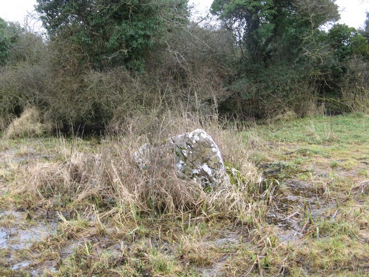
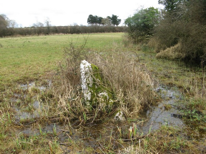
This is a rather sorry looking standing stone that is marked on the OS Map. However Ive seen many others that arent marked that look more convincing than this one. It is about 500mm high and only a few metres from a ringfort.
Comments (0)
|
Add a comment
|
Permalink
Posted by
bawn79
8th April 2009ce