|
|

|
|
Ysbyty CynfynChristianised Site
|
|
|
|
Images (click to view fullsize) |
|


|
Fieldnotes |
|
| Visited on 14.2.10. A really lovely site. Beautiful contryside with a lovely old grave yard inside a stone circle - what more could you want? Very easy to find and access - right next to the roadside (A4120) |
Posted by CARL 9th March 2010ce |
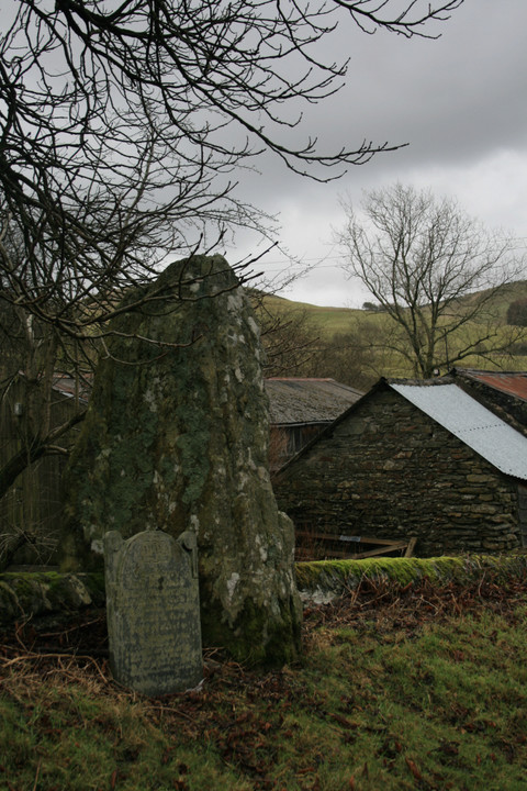
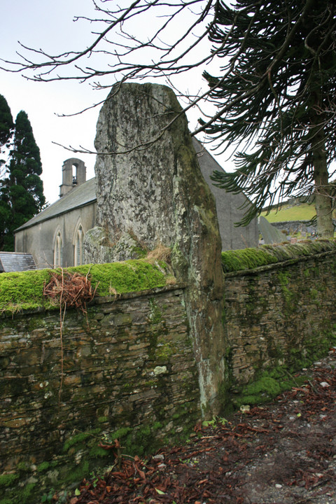
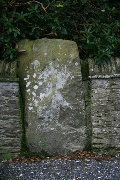
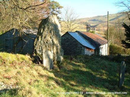
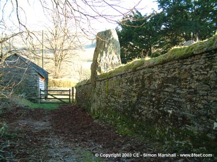
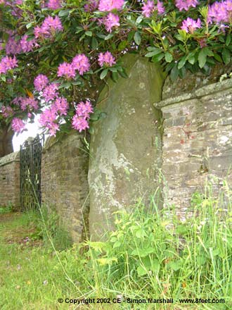
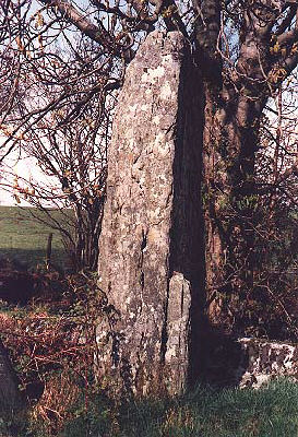
| The last time I came here it was high summer with T-shirts, so seeing as I was in the vicinity I thought I'd pop in. The best thing about a winter visit is the big stone is not covered by the tree next to it. The big stone is almost half buried inside the church yard and its true size is only apparent on the outside. If this was a stone circle and I believe it was, then the Christianizers didn't do a good job (see Grey Yauds stone circle - you cant 'cause it's completely gone). |
 Posted by postman
31st January 2008ce Edited 31st January 2008ce |
|
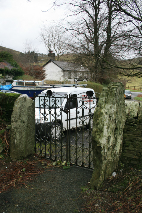
If you visit Ysbytty Cynfyn, you'll probably approach from the direction of the A4120, the road between Ponterwyd and Pontarfynach (Devil's Bridge). This is the obvious way to get there, but if you've got some time on your hands, and you're happy walking a few miles, try approaching from the west. This route gives you a real sense of pilgrimage, taking you past Dolgamfa and across the Rheidol gorge before reaching Ysbytty Cynfyn. The footpath is very well sign-posted (as Ceredigion footpaths go) but a map would be useful. Starting from the village of Ystumtuen, follow the footpath north-east, past some old mine shafts and a small disused mining reservoir. The path continues through a distinctive saddle shape in the hillside. From the top you can see the bell tower of the church at Ysbytty Cynfyn. As well as being good geographical feature for navigating on foot the pass may have had symbolic significance to the people who built Ysbytty Cynfyn and Dolgamfa. From here you head down-hill before reaching Dolgamfa, which sits on a small plateau about half way down the hill. There are good views across the Rheidol valley from here. Between Dolgamfa and Ysbytty Cynfyn is the river gorge, which is hidden from view by the ancient oak forest. Heading downhill from Dolgamfa you pass a farmstead and enter the forest (the trickiest terrain on the walk). At the bottom of the slope is the gorge (very impressive in the winter) and the crossing point, Parson's Bridge. The bridge (originally not much more than a log) is traditionally associated with a priest who worked between Ystumtuen and Ysbytty Cynfyn. I suspect that this crossing point dates back a lot further than this, possibly connecting the two megalithic sites when they were in use. From Parson's Bridge it's an uphill climb to get out of the gorge, and the forest. The path goes up a small hill before dropping down to Ysbytty Cynfyn itself. |
 Posted by Kammer
3rd July 2002ce Edited 17th May 2007ce |
Folklore |
|
In his book A Guide to the Stone Circles of Britain, Ireland and Brittany (ISBN: 0-300-06331-8) Aubrey Burl writes (citing Briggs as his source),It may be no more than coincidence that the church [Ysbytty Cynfyn] is only 1 and a half miles north Devil's Bridge over the River Mynach where the Devil was tricked by an old woman who saved her soul by sending her little dog to cross the bridge before her.I'm inclined to think that it is no more than coincidence, as the connection between Bronze Age Ysbytty Cynfyn and Devil's Bridge (Pontarfynach) is a bit tenuous. Cope makes a similar connection between the two places, but it's not clear why. |
Posted by Kammer 25th April 2004ce |
Miscellaneous |
|
|
If you're not a Welsh speaker it can be a bit tricky pronouncing some of the place names in this area, so at the risk of offending the purists, I thought I'd have a go at giving an indication of how the names are supposed to sound: Ysbyty Cynfyn: This is something very close to 'us-but-ee kunvin'. Ponterwyd: This is approximately 'pont-er-wid'. Pontarfynach: This village is called Devil's Bridge in English, but it's real name is pronounced 'pont-ar-vun-ach'. The 'ch' at the end of the name has no equivalent pronunciation in English, but it's similar to the sound at the end of the Scottish word 'loch'. It's not pronounced like the 'ch' in the word 'chicken'! Ystumtuen: This is pronounced 'us-tim-tee-en'. Dolgamfa: This is pronounced 'doll-gam-va'. |
Posted by Kammer 5th July 2002ce Edited 6th September 2005ce |
Links |
|
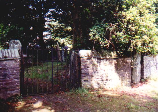
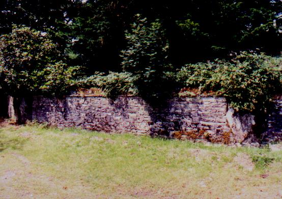
Aberystwyth and District Archaeological SocietyPhoto and description of the 'classic' site, with 5 monoliths (of a stone circle?) embedded in the wall of this churchyard. |
 Posted by Rhiannon
21st June 2002ce |