|
|

|
|
Y Garn, Nantlle RidgeCairn(s)
|
||||||||||||||||||||||||
|
|
|
Images (click to view fullsize) |
|


|
Fieldnotes |
|
|
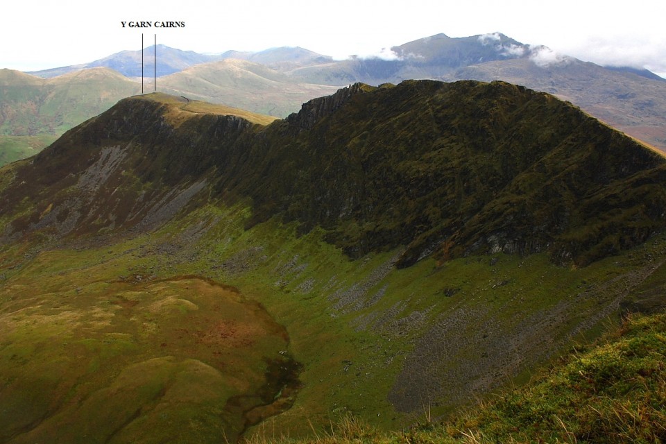
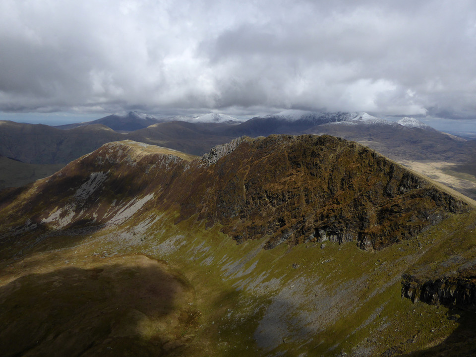
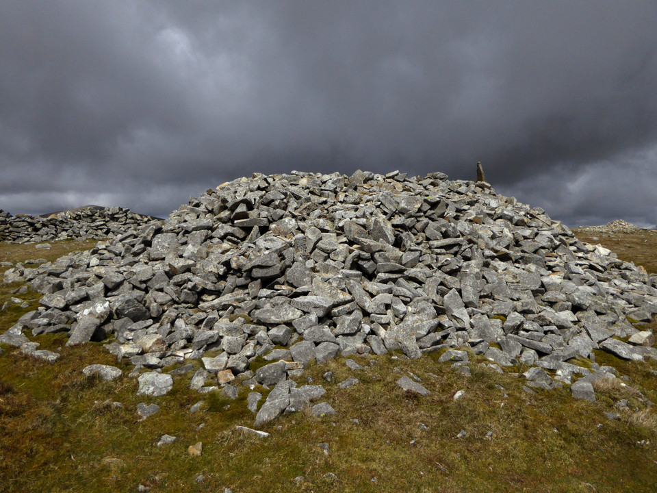
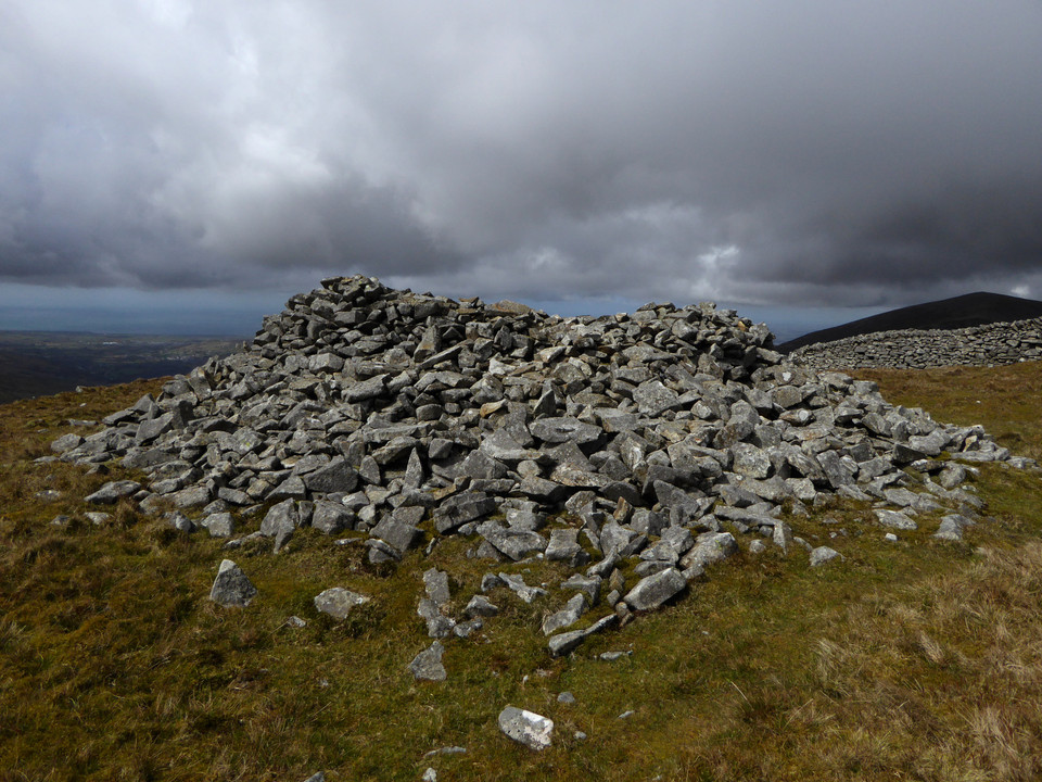
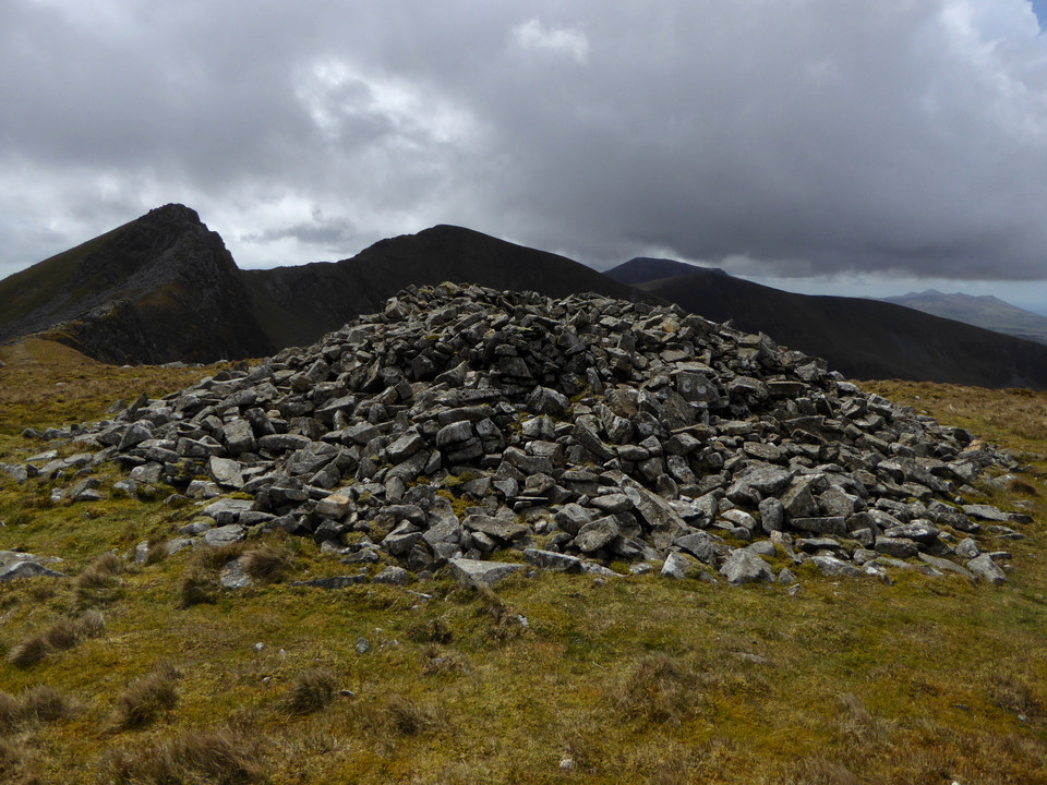
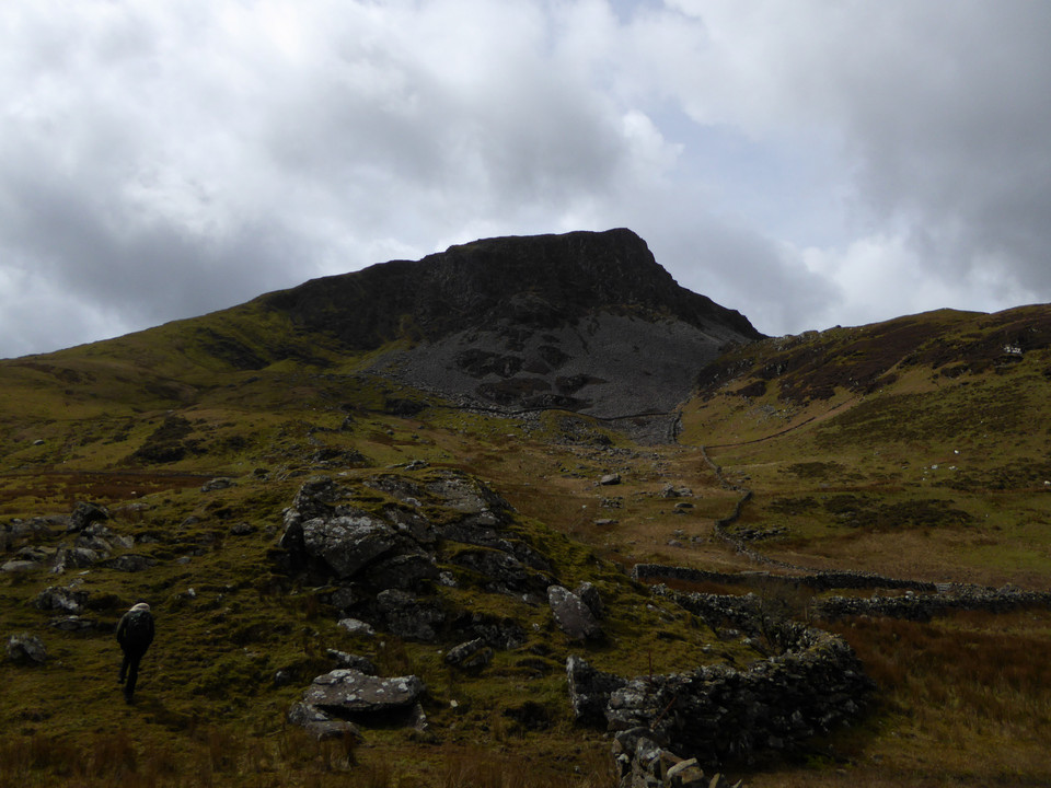
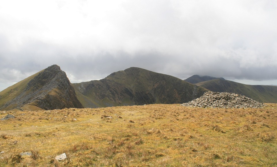
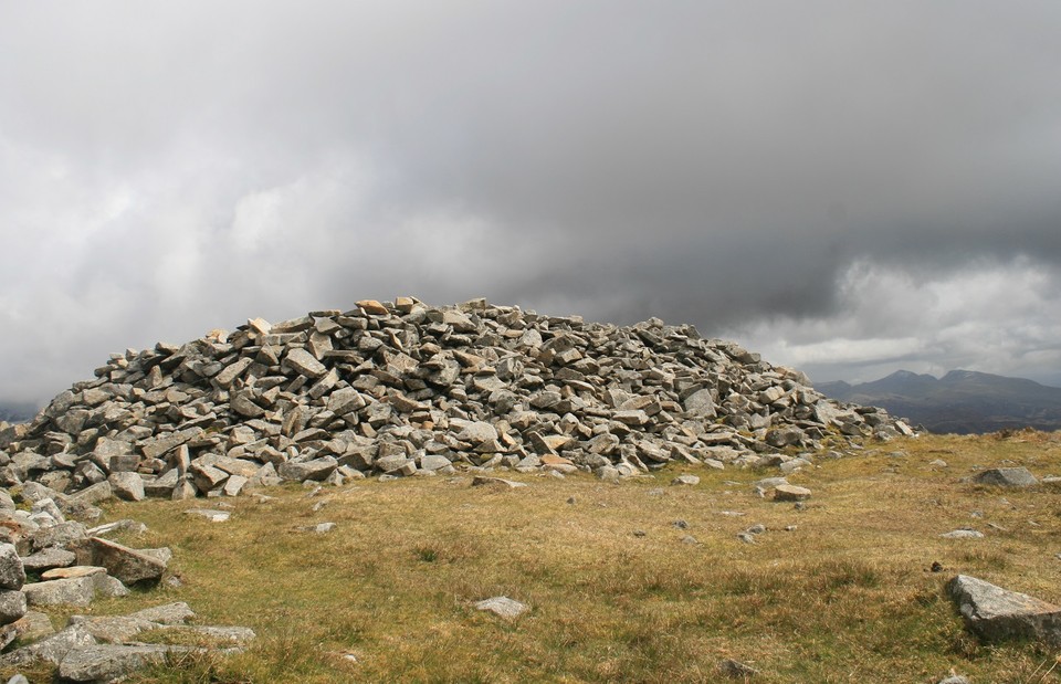
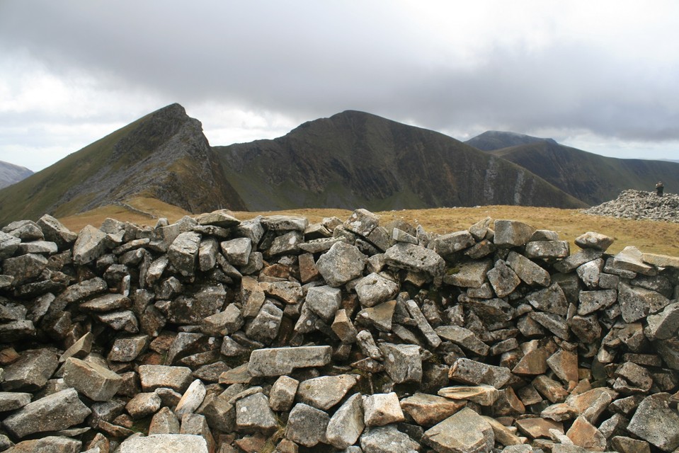
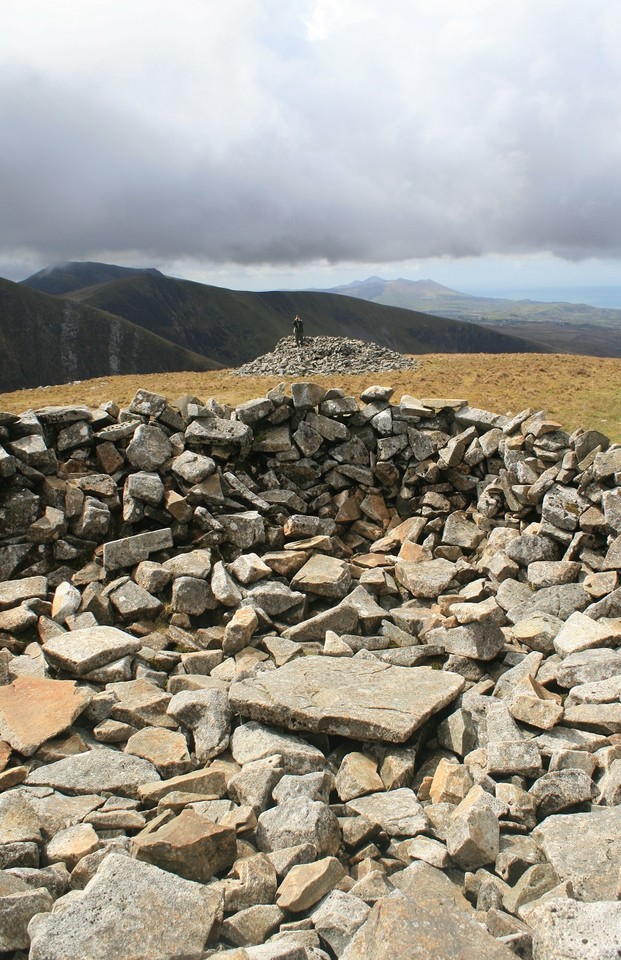
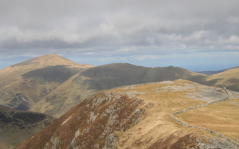
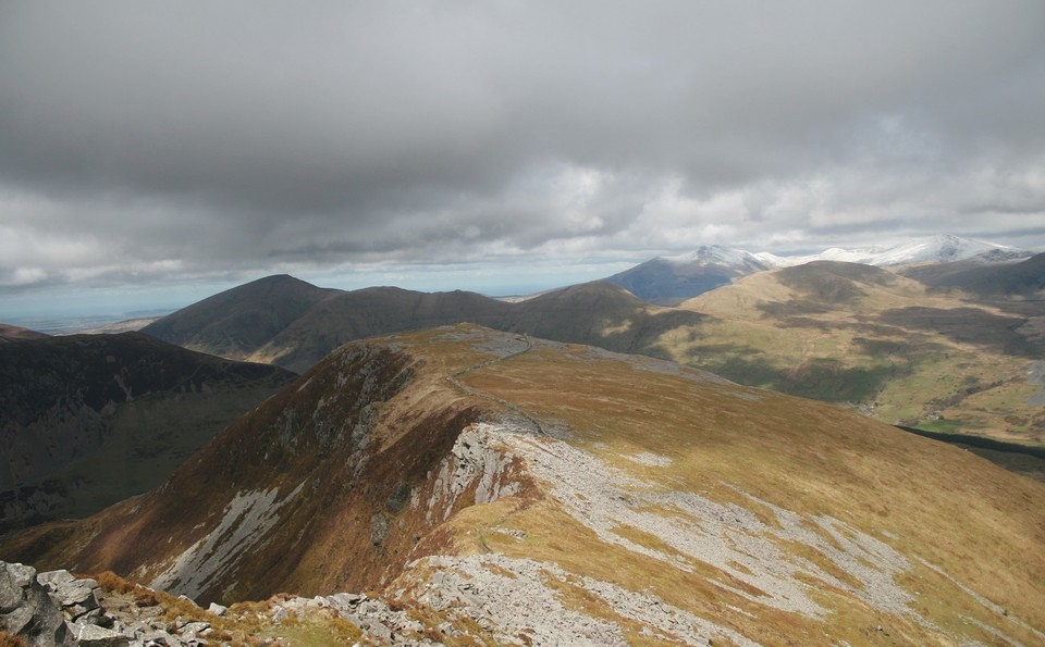
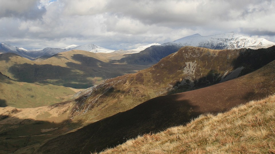
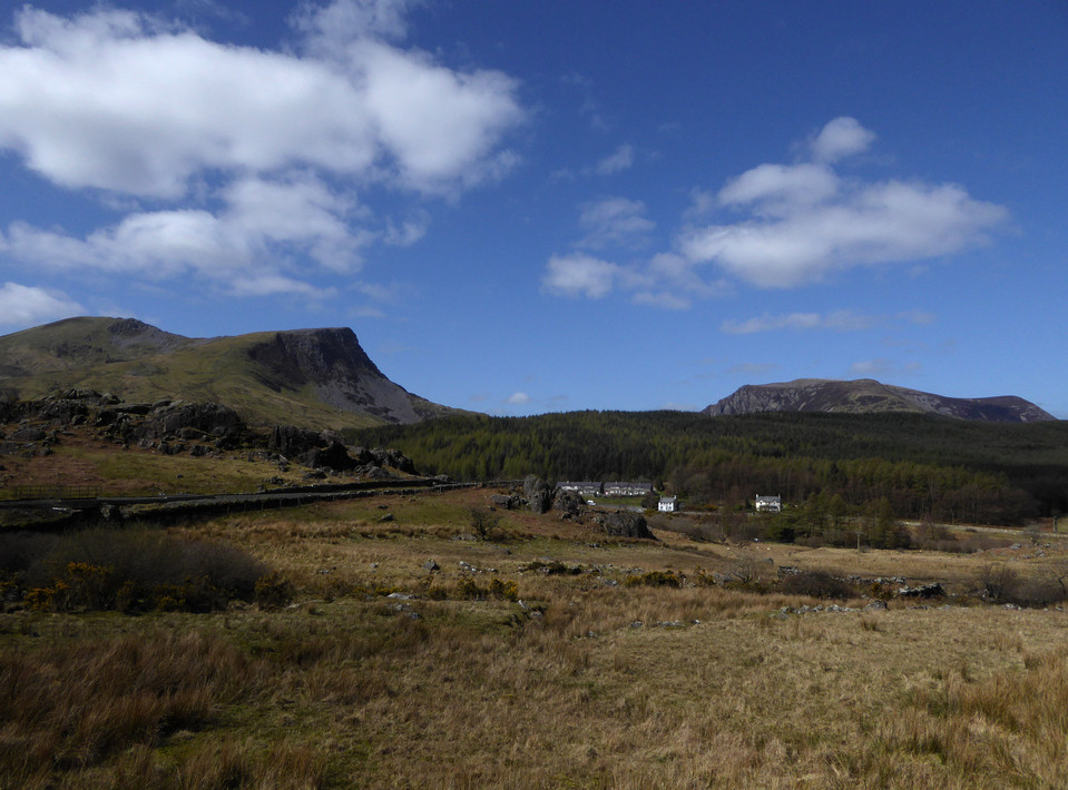
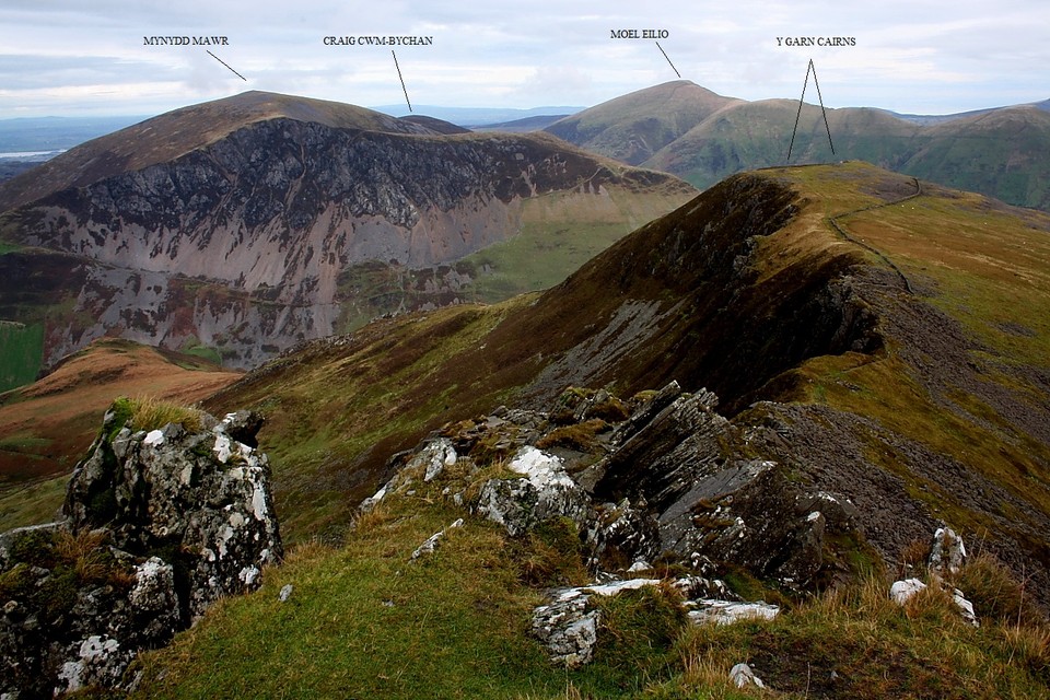
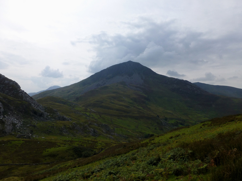
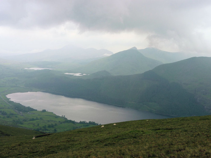
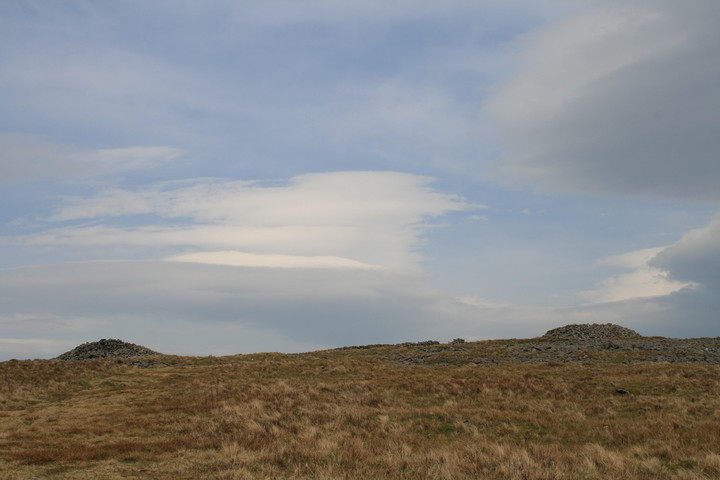
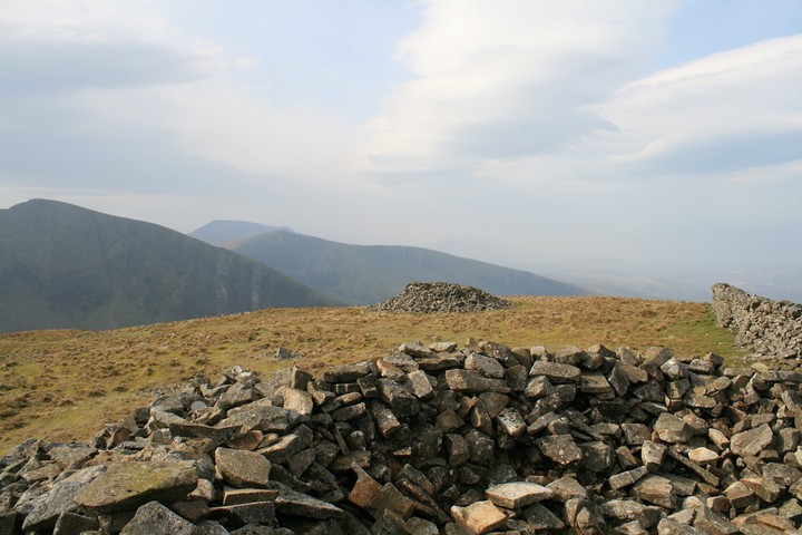
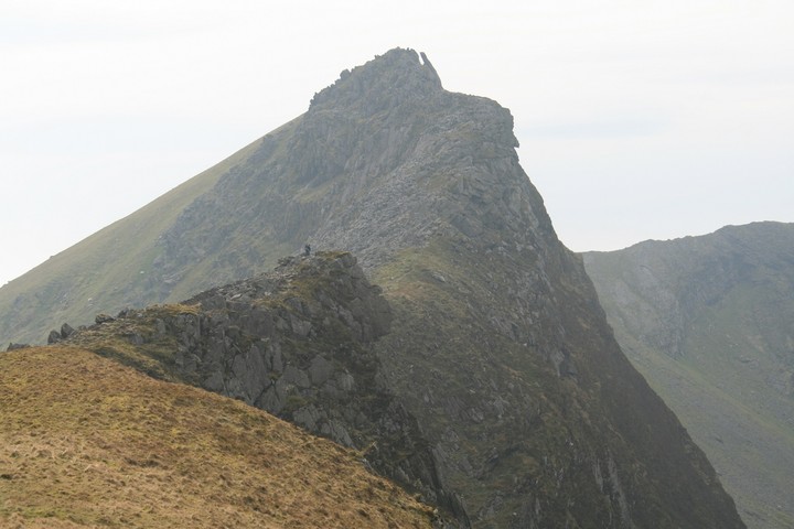
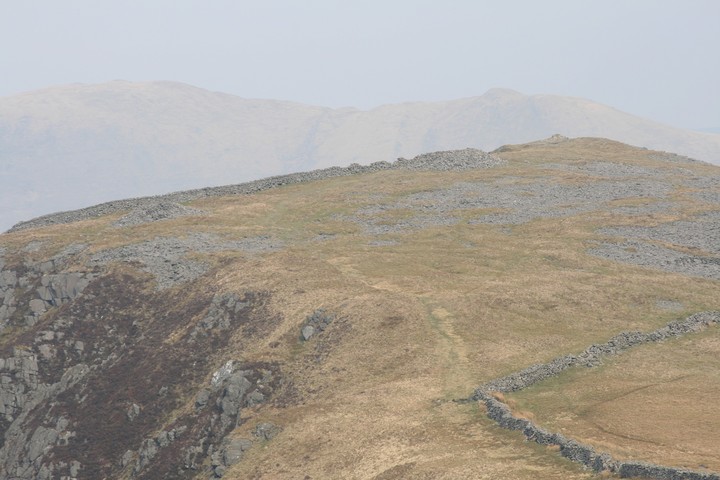
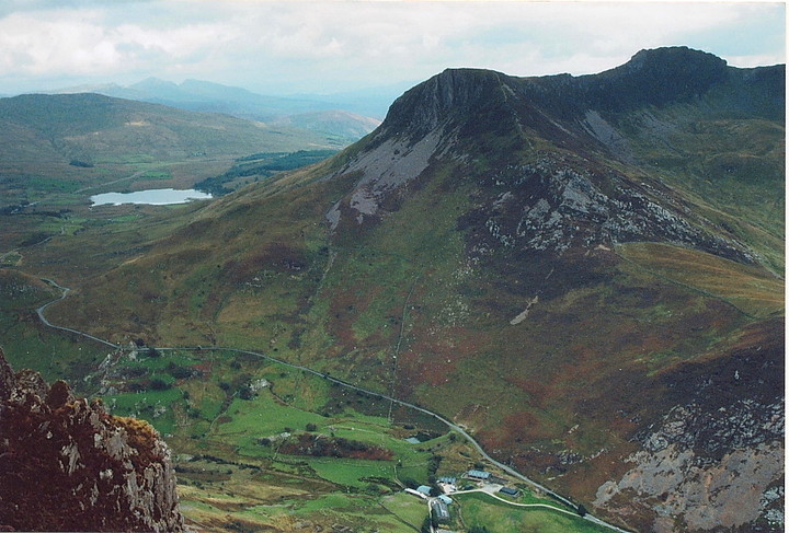
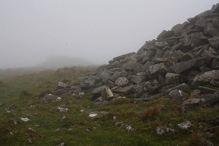
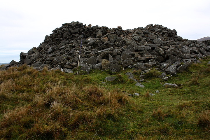
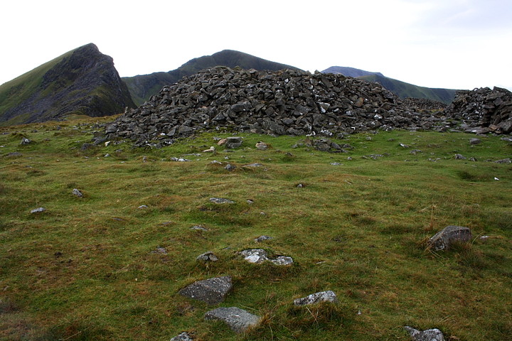
After a frankly brilliant early morning visit to the Llyn Brenig monuments, how would one top that on a hazy but sunny equinox morning, answer, climb a mountain, sans step ladders of course. Taking my que from Gladman as ever in Snowdonia, I started my climb from Rhyd Ddu, where there is parking for half a dozen cars on the road side. The footpath is clear and well trodden, the route visible right up to the top, though Gladders had mentioned twice how steep it is, I was still taken aback by how steep it is. The often rediculous path is sometimes barely two feet from the edge of a near vertical drop, twice vertigo got a grip of me and at the soonest opportunity I had to drop to the floor planting myself on the ground , then take lots of pictures to take my mind off just how scared of heights I can get, why oh why would someone who is afraid of heights climb a mountain, same answer as ever because it's there. But that's a daft answer, mostly iv'e come to see the cairns, and those views, those spine tingling jaw dropping goose bumping views that make you want to stay forever. Eventually the eastern cairn comes into view and a deep sigh of relief escapes me, I walk round the edge of the summit never daring to get too close to the edge. From up here it seems the whole national park is on offer, so many cairn topped mountains, Moel Hebog is south, Mynnydd Mawr is north, east is Yr Wyddfa and behind it Carnedd llewelyn, north east is Moel Eilio and west is Craig Cwm Silyn and the impossibly pretty Nantlle ridge, begging me to have a go even goading me in to having a little climb just try me out I don't bite....much. The cairns, oh yes the cairns, I knew there was something up here besides terrible beauty. They are both big and impressive, with all the scree around it would be a crime to have little barely there cairns. They are too far apart, i'd like to see them a bit closer together, perhaps they had their reasons, now unfathomable to us. They are both hollowed out to accept a couple of weary walkers, and you would be weary, and it's just such a damn good place to sit for a while, communing with the ancestors and for a short while becoming a part of something bigger than our lives back home. I leave the cairns behind and walk off in a daze almost towards the Nantlle ridge, I don't intend to get to the top, that day will have to wait till Iv'e a walking buddy to hold my hand and reassure me that it's okay. Every time I get a glimpse over the edge a dizzy nervous wonderment comes over me and I stare steadfastly at the ground beneath my feet and the way ahead. I make my way as far as I dare and take a pugh. An older gentleman is coming down, he must be twenty years older than me and sporting walking sticks, he asks me if i'm going all the way, I giggle idiotically and say "not today". As he goes on his way towards the cairns I keep looking up and asking myself how hard can it be? Harder than it seems or not i'm saving it for another day, maybe starting from the other side. But now it's back to the cairns, I could walk around all day here, but time has caught me up and it's time to bid a sad farewell.....for now. |
 Posted by postman
26th March 2012ce Edited 26th March 2012ce |
|
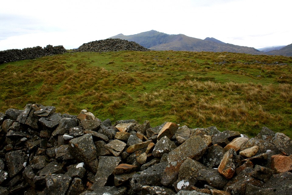
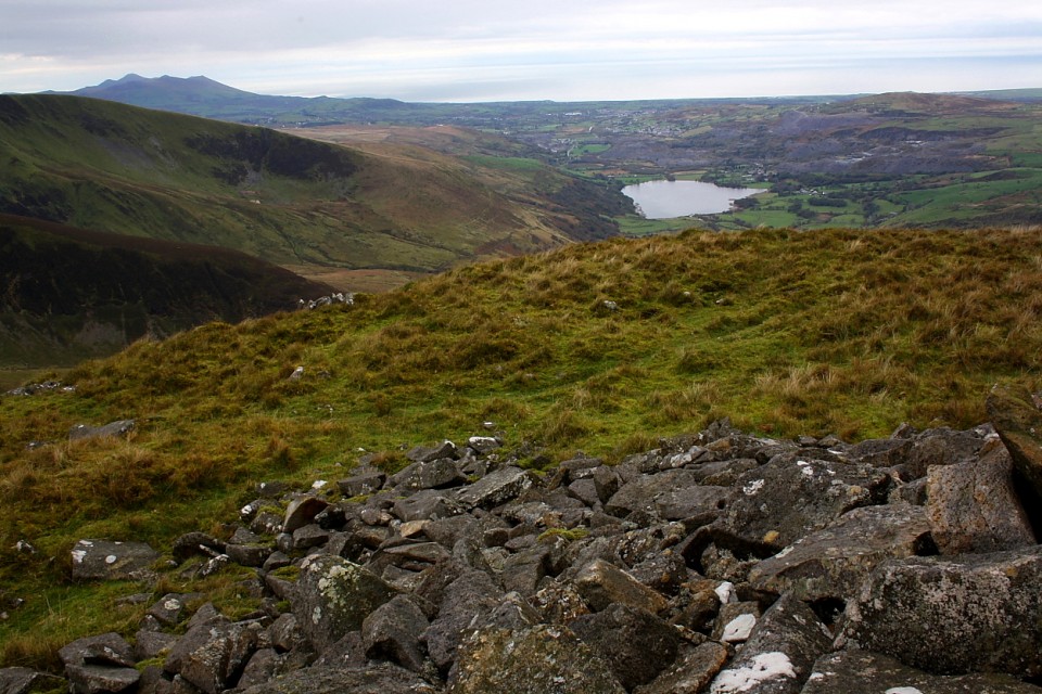
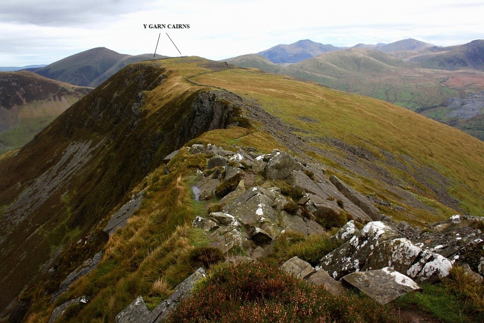
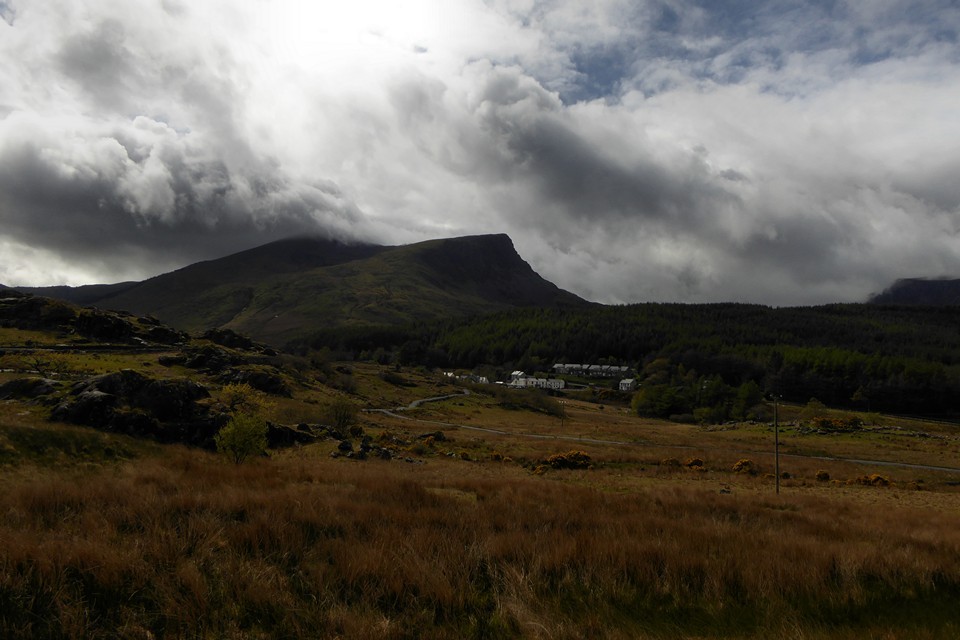
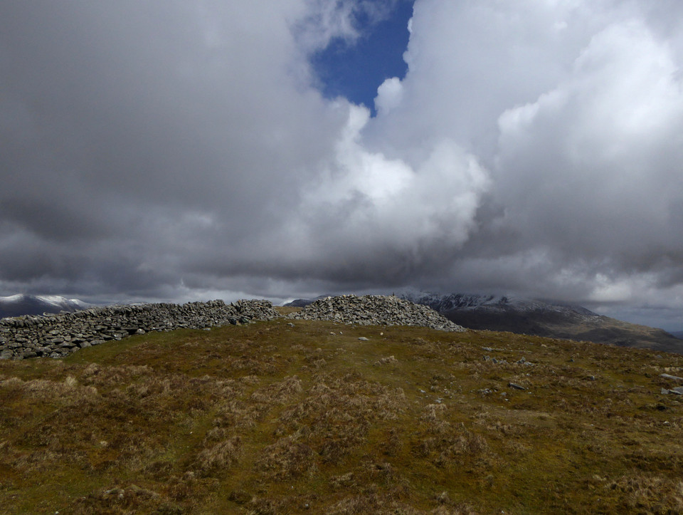
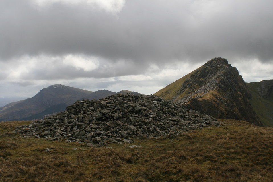
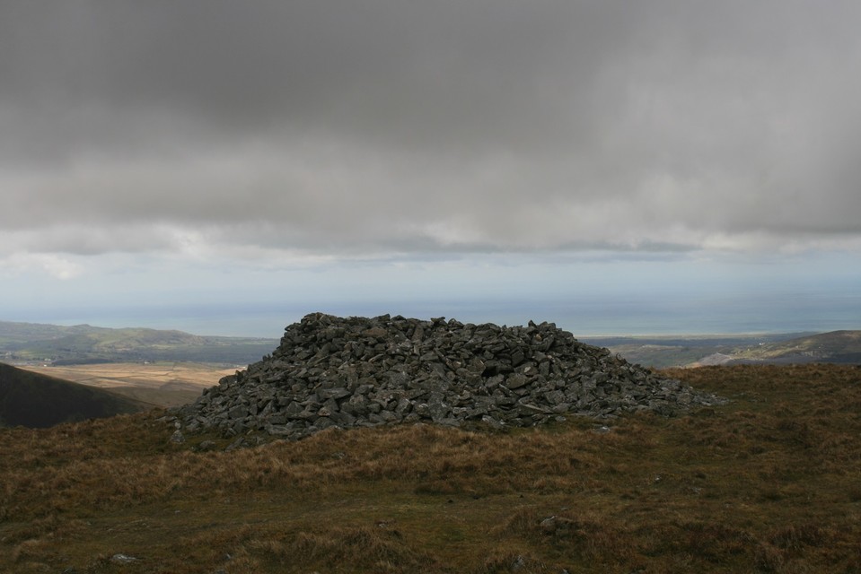
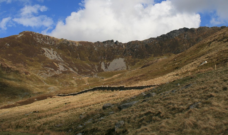
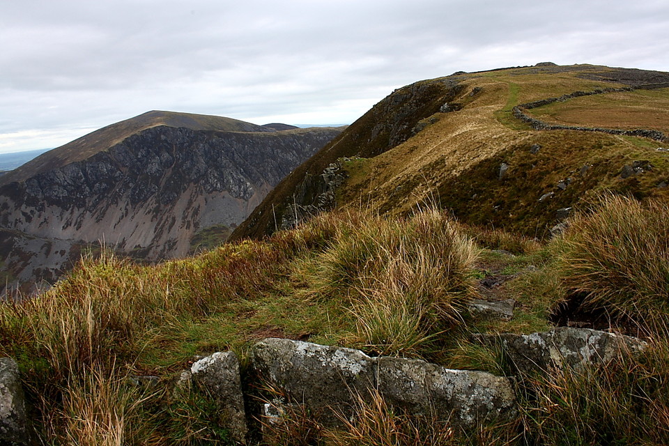
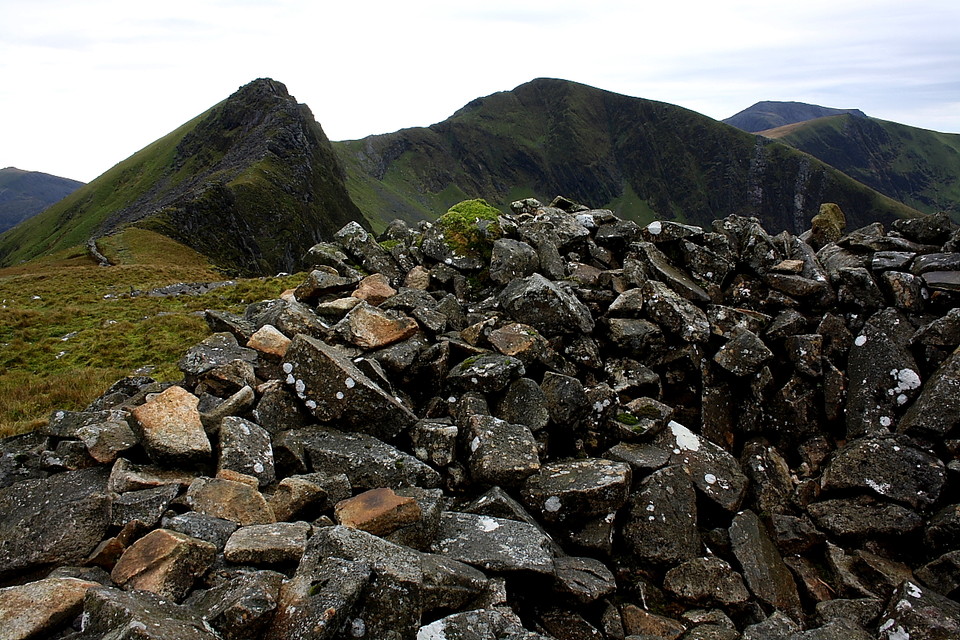
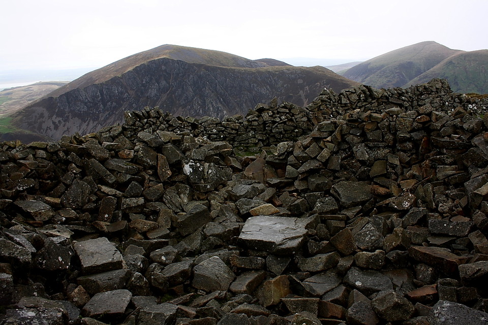
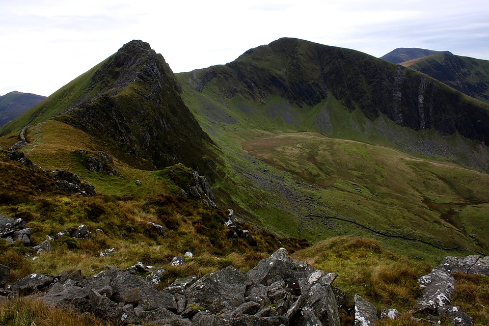
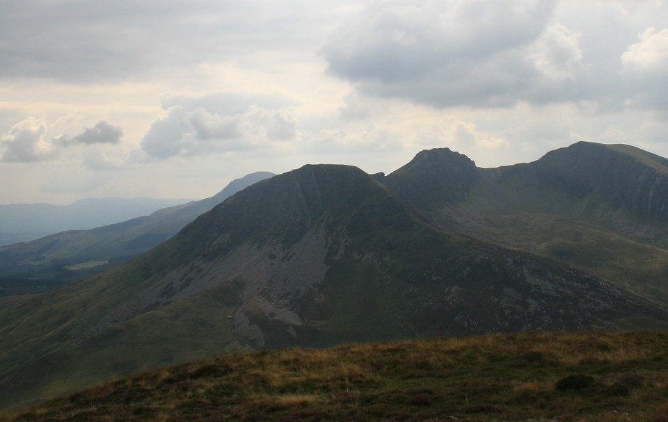
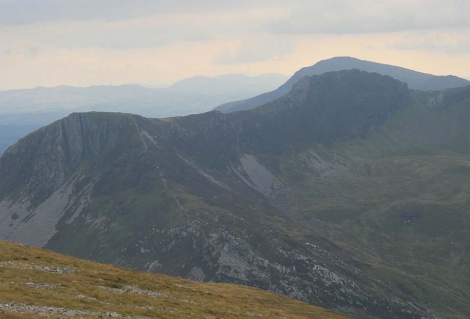
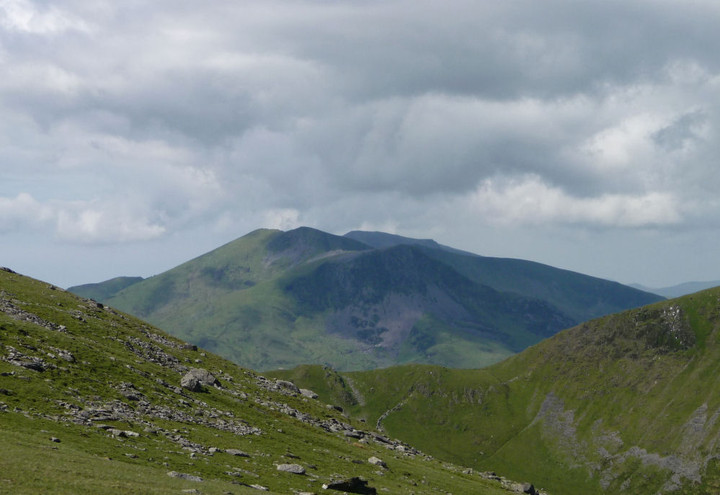
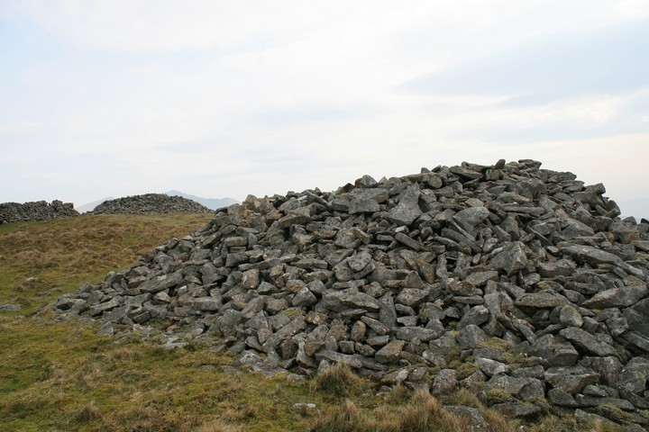
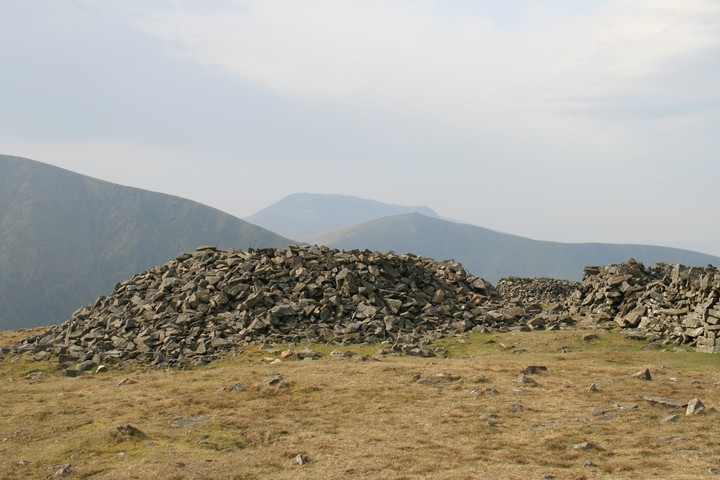
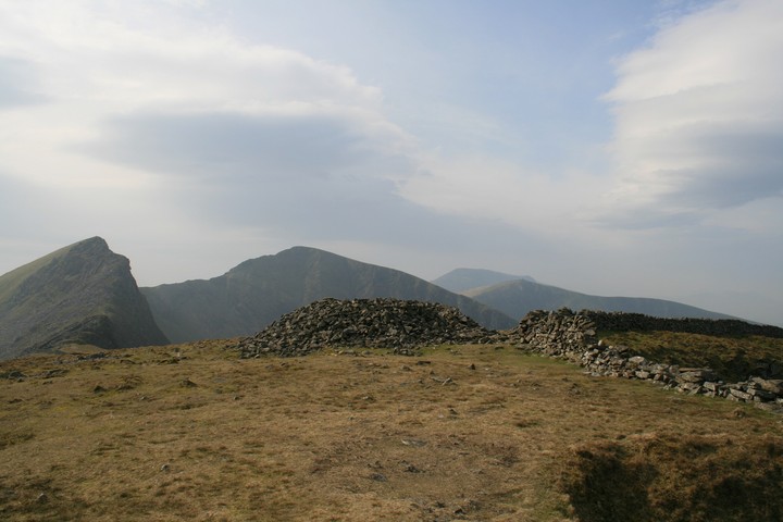
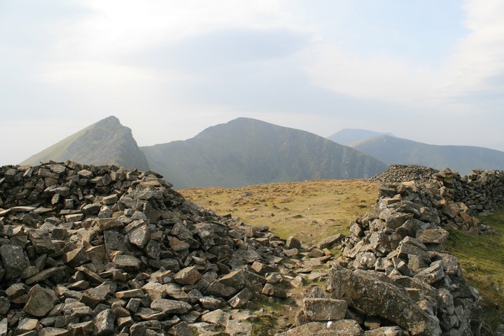
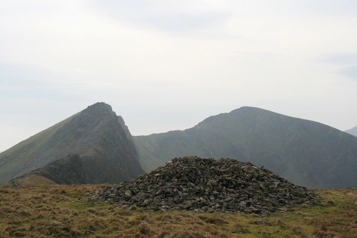
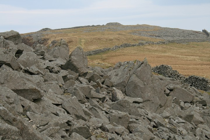
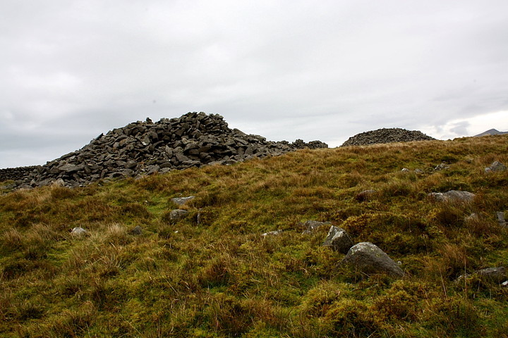
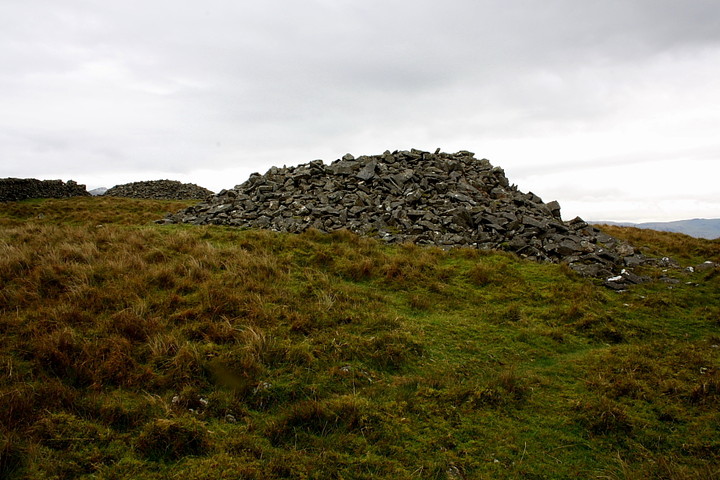
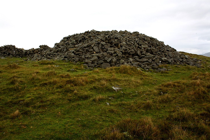
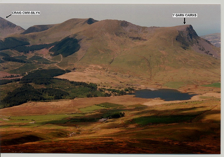
There's an old saying, isn't there? That first impressions count for everything.... however I'm not so sure. Perhaps we shouldn't be so hasty in making final judgements, take a moment or two to appreciate what may well not be readily apparent? Consider The Nantlle Ridge... a linear series of grassy summits set to the south-west of - and very much in the shadow of - the Snowdon Massif, rising over 1,000ft above. Hmm, it would appear at first glance that Nature has allocated very much a supporting role to these modest hills. However this is strictly not the case, connoisseurs of the Snowdonian landscape regularly citing The Nantlle Ridge as second only to the (frankly awesome) Crib Goch arete. What's more, and of great interest to armchair pre-historians and 'hands on' stoneheads alike, is the series of Bronze Age cairns located at the ridge's extremities..... something, of course, that the aforementioned Snowdon no longer possesses. Assuming it ever did, of course. Yeah, let's hear it for the underdog! The Nantlle Ridge rises to a respectable - although by no means excessive - 2,408ft at Craig Cwm Silyn, the summit crowned by the remains of one of the Bronze Age cairns alluded to above.... there is another upon Garnedd-Goch to the south-west. Paradoxically, however, it is the lowest summit (Y Garn ['The Cairn'], 2,077ft) at the extreme north-eastern apex which was chosen as the site for two of Central Snowdonia's most substantial (remaining) funerary cairns. Clearly placement was everything for the locals, the reasons lost in the mists of time, vapours which are not exactly infrequent nowadays in a far more literal sense. Maybe it was a tad warmer then, venturing up into the hills not such an extreme undertaking in those days? Perhaps. One thing is certain, however... Nature sure hasn't lost its wonder, its ability to take the human psyche to another level. Sheer theatre, created upon the biggest stage of all. Significantly the true summit of Y Garn (or Carn Mynydd Drws-y-Coed, if you prefer), with exquisite views across Drws-y-Coed to Mynydd Mawr and down to Llyn-y-Dywarchen (the lake incidentally cited in Welsh folklore as once possessing a magical 'floating island' - unfortunately the existing island is very much linked to terra-firma)... amongst other sweeping, mesmeric vistas... was, somehow, not deemed suitable, nowadays surmounted by nothing more than a rather small, modern cairn. 'Jeez.... what did it take to satisfy these people?', this traveller is probably entitled to ponder as he stands, fair foaming at the mouth at the beauty of this landscape? Clearly there were other, more important criteria to be taken into consideration, the pair of ancient cairns instead situated a little to the south, duly denied the views. But also denying a skyline profile to those down below. Hmm... Perhaps that was the whole point? Bronze Age elitism superseding Neolithic all-inclusion? So, the overwhelming presence of Yr Wyddfa Fawr (Snowdon) to the the north-east excepted, focus for visitors to the Y Garn cairns - then, as now - is firmly to the south.... The Nantlle Ridge itself. It is more than enough, the jagged crags of Mynydd Drws-y-Coed providing a deceptively difficult passage to the graceful arc and domed summit of Trum-y-Ddysgl rising beyond. Both Bronze Age cairns are large, albeit hollowed out to form the unforgivable - but completely predictable - 'storm shelter'. But why here? Follow the ridge to the south and I'm pretty sure all will become clear..... it would appear (to me, at least) that they were simply MEANT to be viewed from the castellated rock formations of Mynydd Drws-y-Coed, the latter a natural proto-temple, perhaps? The moment is worth the effort....risk, even... but please take great care, particularly if the rock is wet. Do not underestimate the danger and ensure every footfall is sure. I carry on to Trum-y-Ddysgl for lunch and gaze across to the be-cairned Moel Hebog, Craig Cwm-Silyn and Mynydd Mawr, amongst other great landscape features. As is often the case when upon such terrain, I feel completely humbled, privileged to be here - insignificant even - yet 100ft tall at the same time! Perhaps this is a predictable reaction to what is often felt to be 'soulless' modern living? Or perhaps this is the way it always was? The way it was simply meant to be. I decide to return the way I came, retrospective views highlighting an immense wall of grey vapour tracking my progress. The cloud finally engulfs me as I stand upon the ancient cairns once more, a claustrophobic, ethereal world where previously the boundaries stretched to infinity. Well, at least as far as the eye could see. The mind races, but the compass bearing is true and Llyn y Gader emerges reassuringly from the gloom, below to the east. Y Garn and its cairns are most directly reached by taking the Nantlle road from Rhyd Ddu... park roadside a little before Drws-y-Coed Uchaf farm and take the obvious, signed footpath leading up the mountainside to its left. This is very steep, but without technical difficulty. Persevere and the monuments will eventually be found beyond a transverse drystone wall, crossed by a ladder stile. If you decide to carry onto Trum-y-Ddysgl, there is an option to descend to the south and swing round back to Rhyd Ddu through forestry, via Bwlch-y-Ddwy-elor. Or, of course, if you have a car waiting at the other end, to walk the whole ridge and descend to Cwm Silyn. Needless to say a double traverse is a very serious undertaking and best left to the exceedingly fit, young or mad. |
 Posted by GLADMAN
20th December 2011ce Edited 22nd December 2011ce |
|
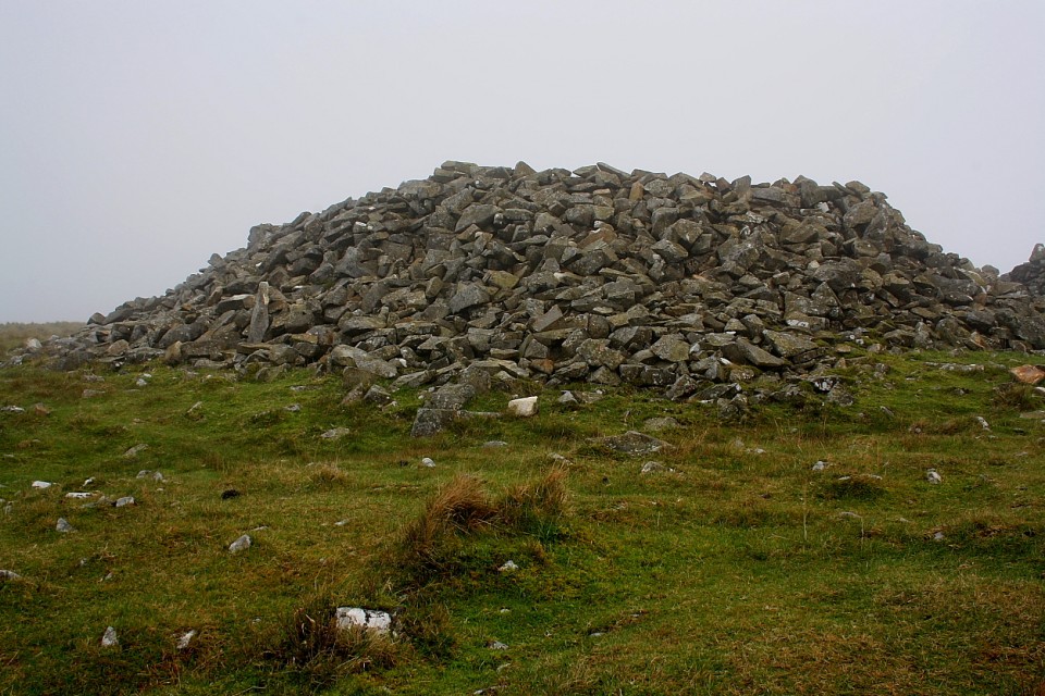
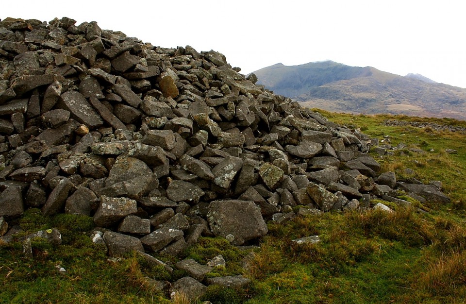
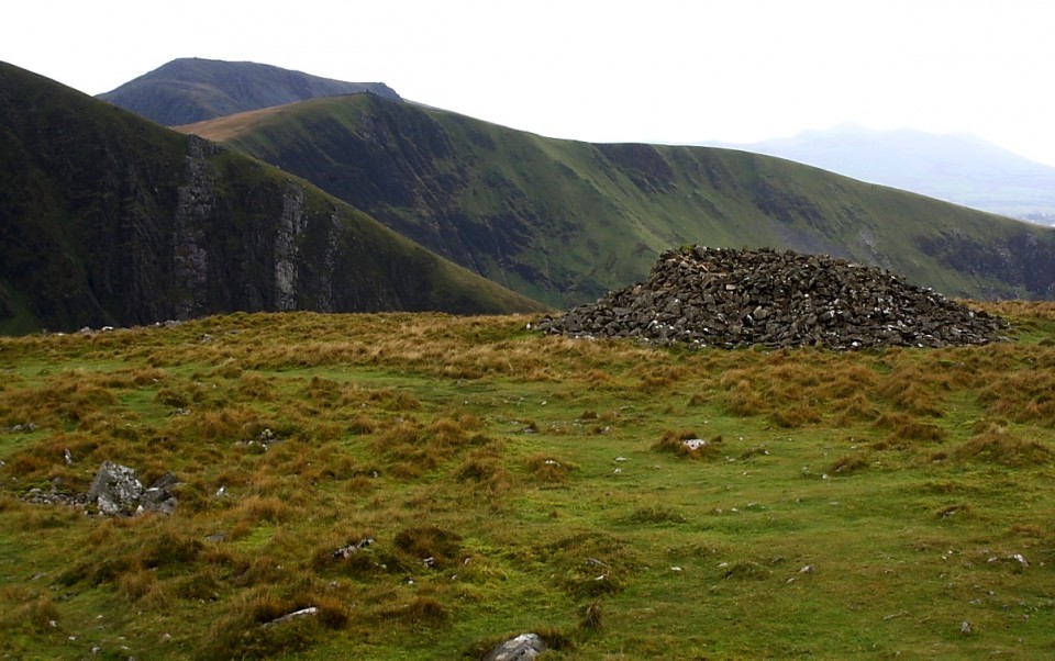
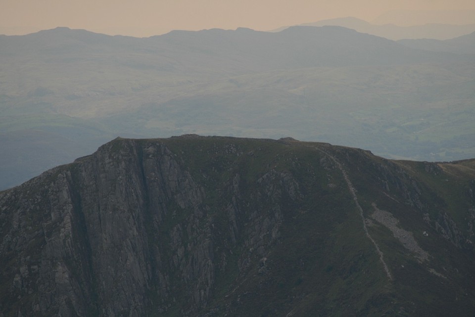
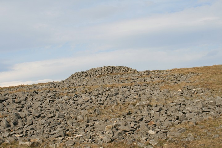
Y Garn stands at the northern apex of the wonderfully undulating Nantlle Ridge, separated from the great bulk of the adjacent Mynydd Mawr by the Drws-y-Coed pass and with fabulous views eastwards to the Snowdon Massif - Yr Eryri itself. This is a special place to come and hang out with just the wind for company. Evidently our Bronze Age ancestors shared the same opinion, since the 2,077ft summit plateau is crowned by two large burial cairns..... whoever was interred here hanging out for eternity upon this windswept mountain top. According to our friends at Coflein: "Two large cairns, probably dating to the Bronze Age and situated within open moorland on the summit of Y Garn. The stone built cairns are circular on plan and measure about 10m in diameter and up to about 2m in height. The cairns have both been disturbed in the past, with the construction of drystone shelters around hollows dug into the centres. Cairn A is the easternmost cairn (SH551526) and Cairn B is the westernmost of the pair." The most direct approach begins from the hamlet of Rhyd-ddu and is pretty obvious, to be honest - that is, straight up in an unremitting grind! The reward upon reaching the summit is not only one of the most expansive views in all Wales... but two large Bronze Age cairns to enjoy it from. It's too much, it really is. |
Posted by GLADMAN 5th October 2009ce |