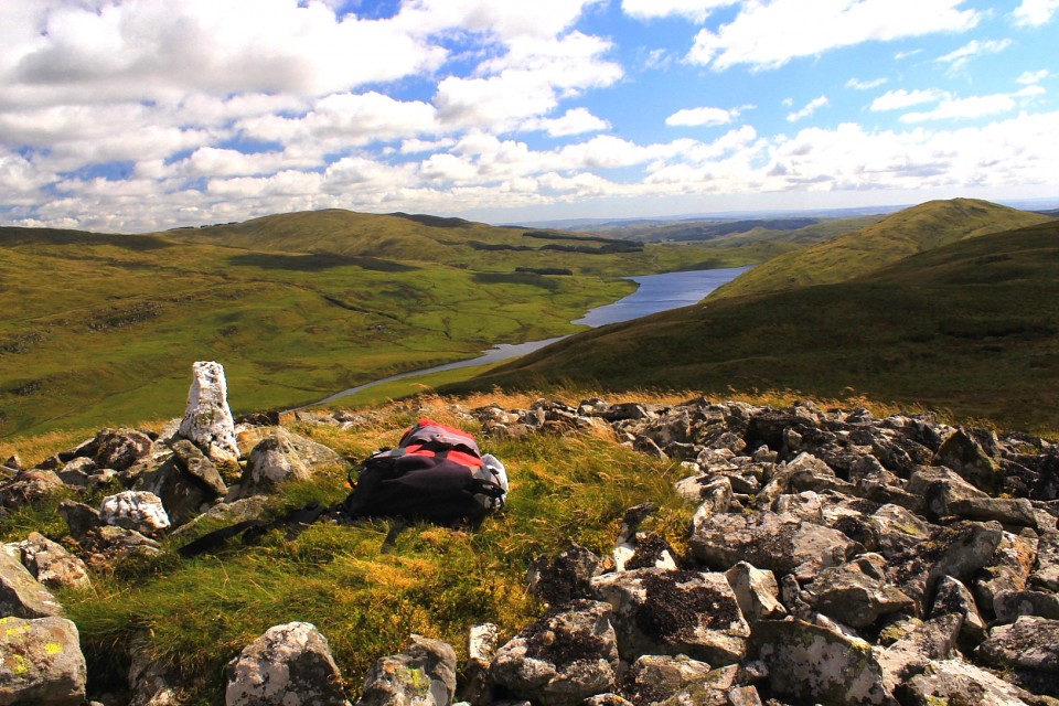
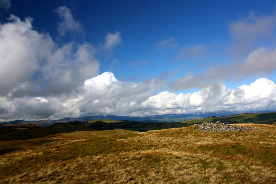
At 1,837ft Banc Llechwedd-mawr could be described as a minor satellite of the main Pumlumon ridge, complementing the marginally taller Carn Hyddgen rising across the bwlch carrying the main north-south route across this magical landscape. To my mind, however, that would be unfair. For one thing it is a superb viewpoint and... perhaps more to the point, particularly with reference to modern antiquarians... what it lacks in lofty pre-eminence is more than compensated for by its collection of ancient monuments. As you would probably expect here, its summit is crowned by a pair of Bronze Age cairns; in addition its eastern flank boasts two stone settings, not to mention the wondrously enigmantic quartzite blocks of Cerrig Cyfammod Glyndwr, although whether the latter were 'placed' in position by humankind, or the greatest power of all, is open to debate. Whatever the truth, clearly our forebears viewed this shapely hill as 'special'.... perhaps because the shining white beacons were already in situ? So much to ponder, then.
There would appear to be two practical main routes to Banc Llechwedd-mawr, the creation of the Nant-y-Moch reservoir having reduced available options by, er, 'adjusting' the original topography somewhat: the first is a rather long trek from the north-western tip of the reservoir, starting below Carn Owen and, assuming you have the 'puff' (not I), taking in the pair of large cairns crowning Drosgol; the second, my choice, heads north from the Maes Nant activity centre, but involves fording the Afon Hyddgen at some point. 'Horses for courses', as they say. But hey, be careful out there.
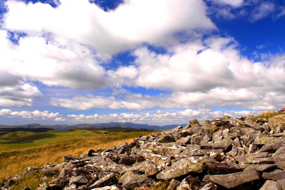
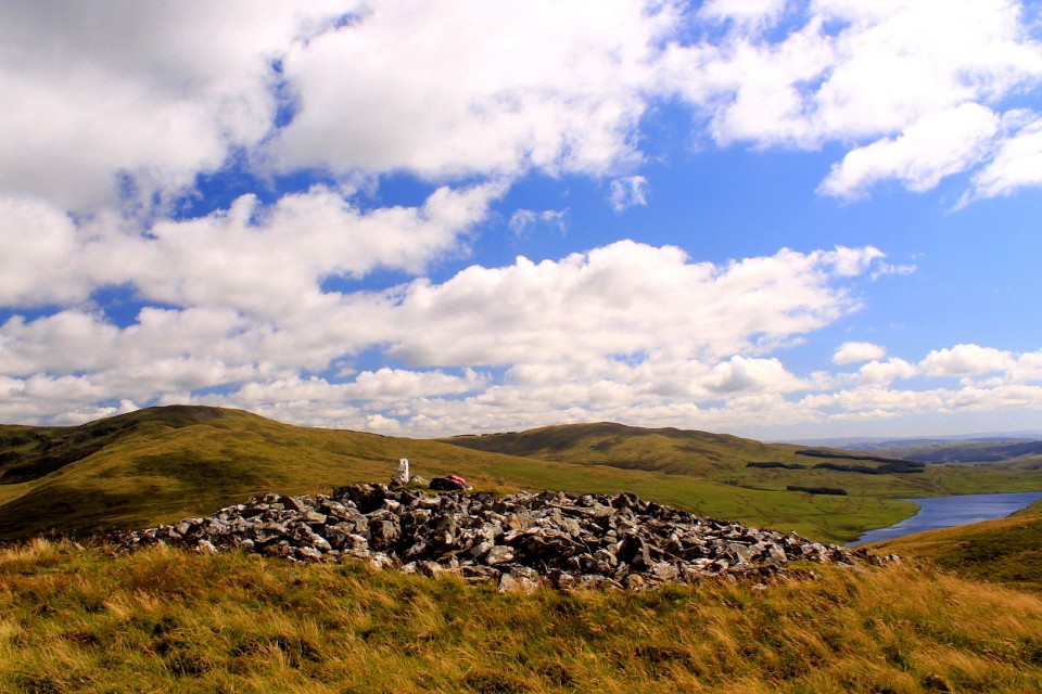
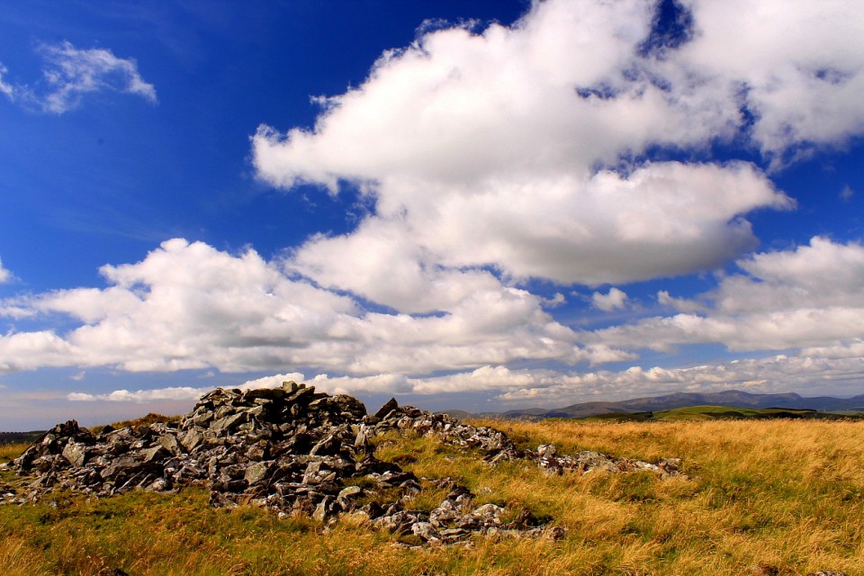
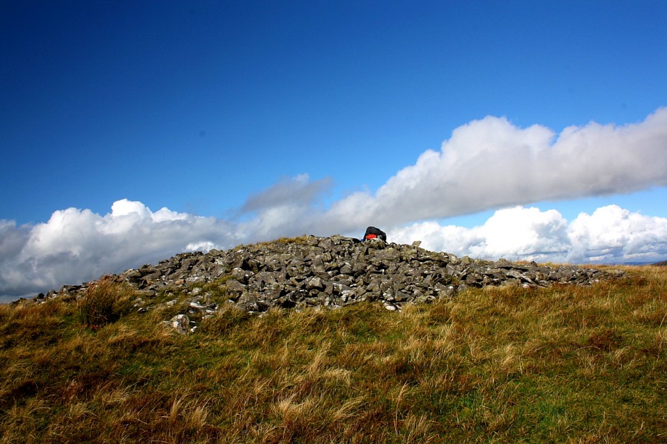
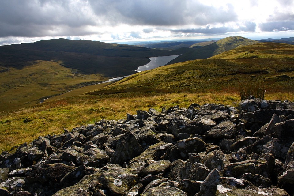
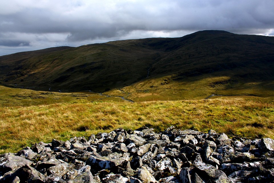
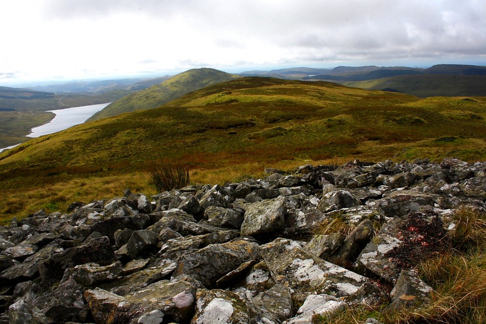
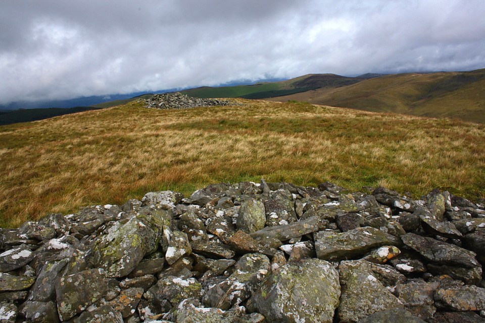
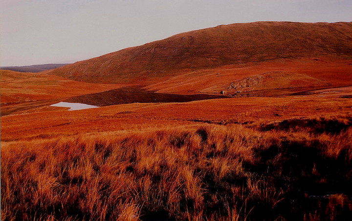
The summit of the peak is a steep, straight forward climb from the legendary Cerrig Cyfammod Glyndwr. There is, of course, no path. The reward, the vista from the top, is equally legendary with Cadair Idris and the vanguard of southern Snowdonia forming a seemingly impenetrable demarcation between North and Mid Wales. Nearer to hand, the aforementioned Drosgol towers above the waters of Nant-y-Moch to the approx south, Pen Pumlumon-Fawr rising to the left. Immediately opposite, the Afon Hengwm leads the eye toward Pen Pumlumon Arwystli and its trio of massive cairns, the sources of the Hafren (Severn) and Wye located to left and right respectively. Not to mention the source of the Afon Rheidol beneath the sentinel peak of the ridge. Then there is the pair of monuments upon Carn Hyddgen. Cairns, cairns, wherever one looks...... speaking of which, the cairns I've come to see at close quarters are, at the very least, worth the not inconsiderable effort. The southern is by far the best preserved, seemingly unviolated and occupying a classic upland position. Ok, it's not that large (relatively speaking), but perfectly formed. Think of it as Pumlumon's 'Kylie', perhaps? Its partner to the north is much more ragged by comparison. However it incorporates additional dry stone features which are difficult to explain by reference to the usual destructive activities of muppet 'walkers' or husbandry of sheep. In fact Coflein - see miscellaneous entry - suggests these may be original? If so that is yet another reason for the serious Citizen Cairn'd to venture here.
As I sit and take in the vibe, overlooking the presumed site of Glyndwr's 'Battle of Hyddgen' in 1401... hey, that was only yesterday in the scheme of things... the Pumlumon weather decides to show what it can do. When it can be bothered, that is. All of a sudden gone is the dull, drizzly, overcast.... overwhelmingly grey... sky, replaced by a vital, sunlit canopy which utterly transforms the colour palette defining the underlying landscape. Sitting here I believe I can see what Turner was trying to capture with his great skyscapes. If you are attempting to relate what it feels like to contemplate the biggest questions of all, why not use the biggest canvas of all? Makes sense to me.
Carn Hyddgen suddenly looks far more appealing than before. Well, you know how it is? The itinery is scrapped, visits to the two additional stone settings shelved, and off we go. Note the presence of another quartzite block on the direct line of descent, which, for me, strengthens the case for the Cerrig Cyfammod Glyndwr being solely Nature's work. Or does it?
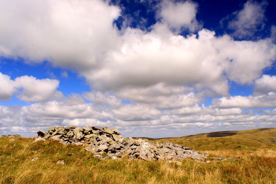
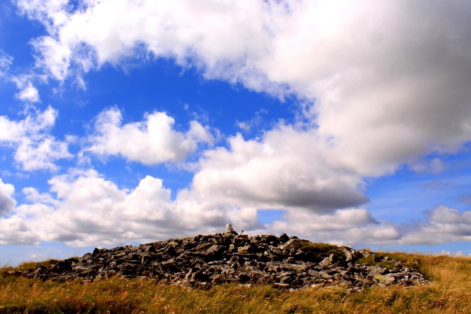
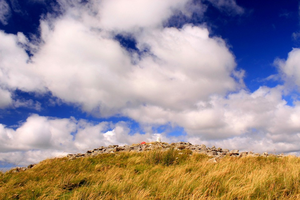
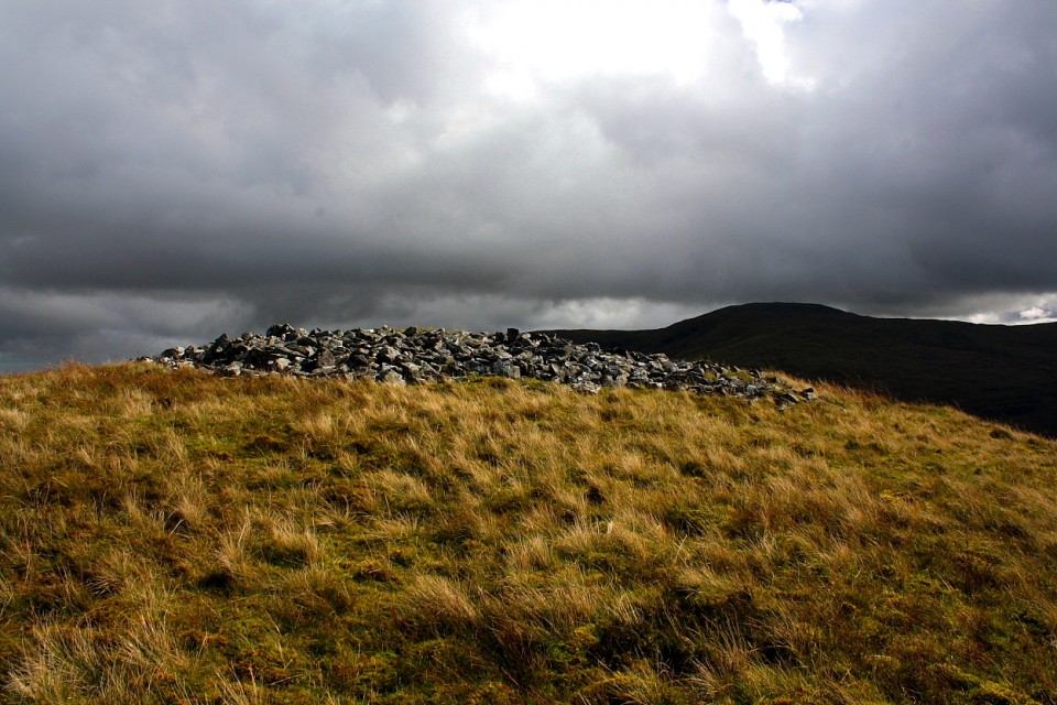
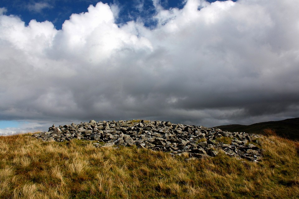
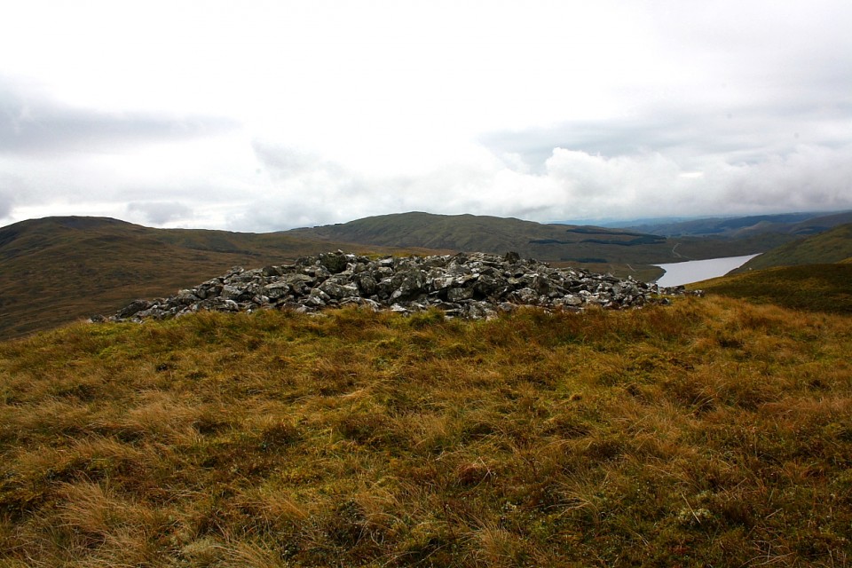
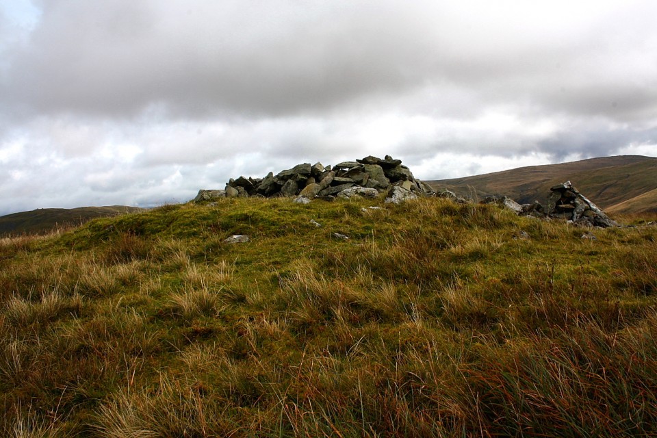
Banc Llechwedd-mawr is another subsidiary peak of the Pumlumon massif and - in common with many other hill/mountain tops in the vicinity - possesses Bronze Age burial cairns, in this case a pair sited towards the eastern end of its summit ridge.
According to Coflein these are:
'A well preserved, large summit cairn, which appears to be undisturbed. It measures approximately 11m in diameter and stands up to 0.5m high. It is one of a pair of cairns at this location, the other cairn stands c.30m to the north (and is also)…a large summit cairn…..it.. measures 6m in diameter, by up to 0.8m high. A later sheepfold has been inserted into the cairn (NPRN 285743). Two parallel lines of stone project eastwards out of the cairn, the southernmost being 7.5m long, by 1.5m wide, the northernmost being 4m long x 1.5m wide. There is a gap of 1.5m between the two lines of stone. It is not certain if these features are contemporary with the main cairn structure.'


 Artistic / Interpretive:
 Posted by GLADMAN