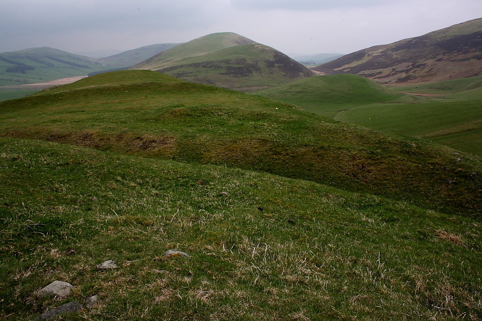
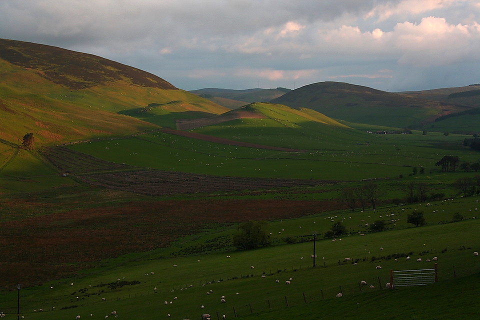
Cow Castle. Don't you just love the name? I mean, you wouldn't want to attempt to storm any high ground occupied by the cantankerous creatures... but at least you'd die laughing, the slapstick comic possibilities being endless. Now, as it happens, I've visited another Cow Castle, the one way down south upon Exmoor, the wondrous siting of which is probably - in my opinion - superior to this. But not by much. In short, the South Lanarkshire version is superb, even when such contemplation follows a visit to the spectacular Whiteside Hill earlier in the day.
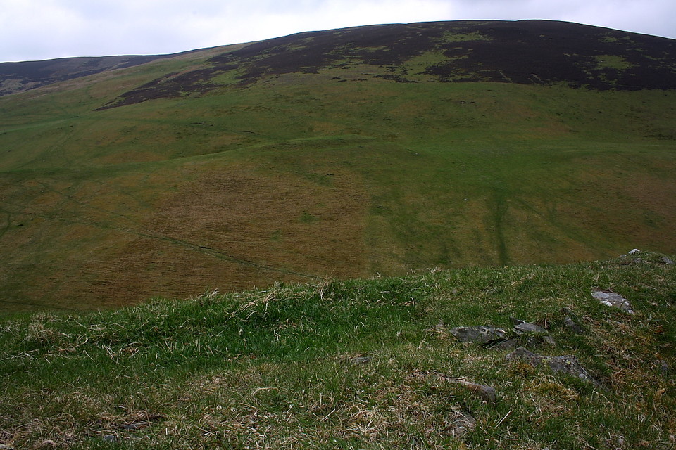
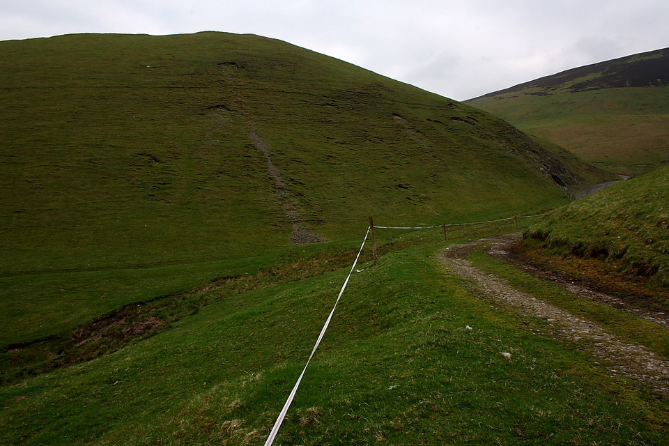
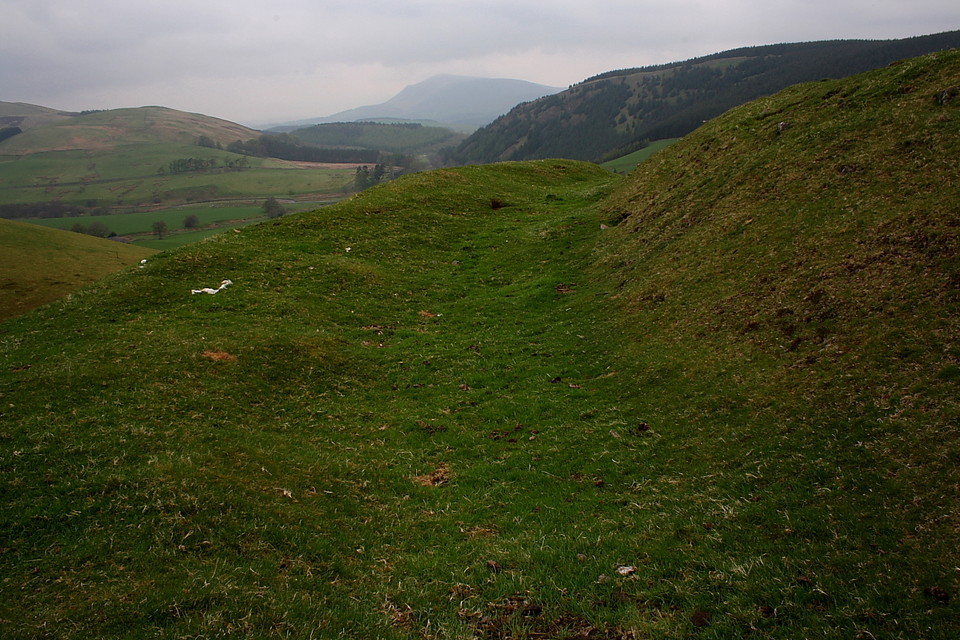
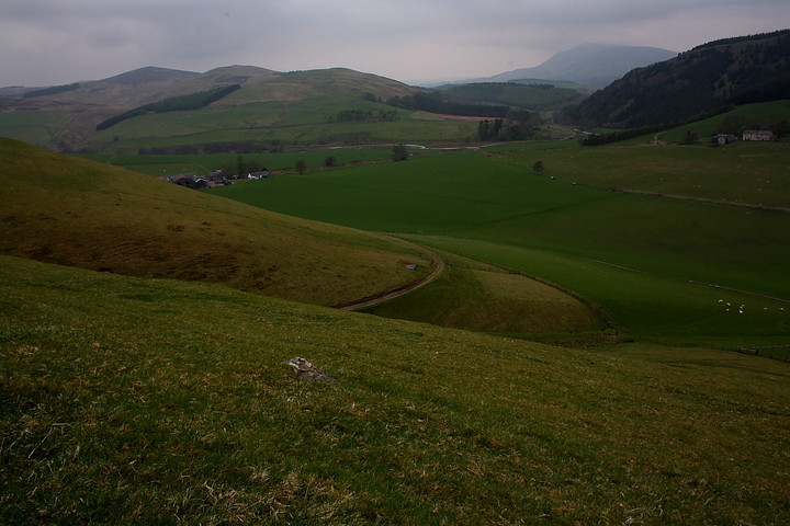
I approach from the west, from the village of Coulter, to be precise. Follow the minor road (approx SE) past the school and take the left hand fork beyond Snaip.... i.e not Birthwood Road... where Culter Water suddenly swings sharply, decisively south. I park here and walk down the narrow track to Nisbet Farm, although, judging by the cheery demeanour of the farmer, it might well be possible to park there with permission. The track continues beyond the farm, ascending the hillside to the left to subsequently fork right toward Cow Castle beckoning upon the skyline (incidentally this track eventually passes below Mitchelhill, site of another fabulous hillfort.... but that's another story). The slope, emphasising the defensibility of the location, is too steep to contemplate a full frontal assault, cows or no cows lining the ramparts. I'd therefore recommend persevering with the track a short while longer and ascending 'round the back, so to speak.
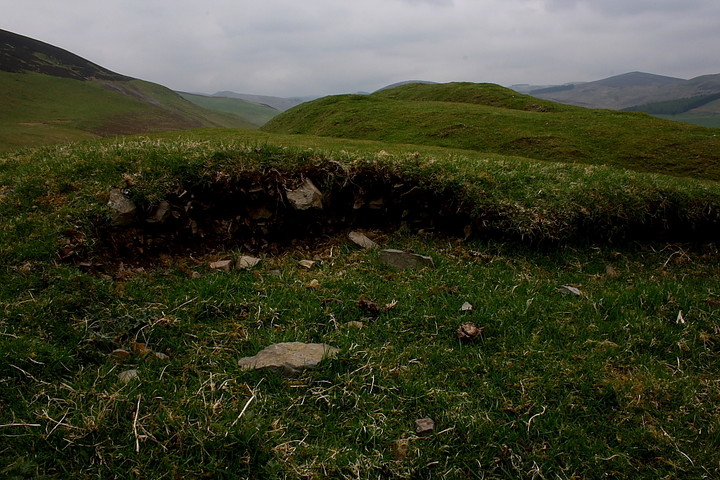
The defences are far more substantial than I supposed. According to Canmore:
"The complex remains have been damaged... and in consequence are difficult to interpret .. However, at least two structural periods seem to be involved... The earlier period is represented by two ramparts....which have enclosed a roughly oval area measuring about 85m by 46m. In a later phase the size of the fort was reduced by the construction of two new ramparts.. to enclose an area measuring 43m by 27m....best preserved on the SW [RCAHMS 1978]".
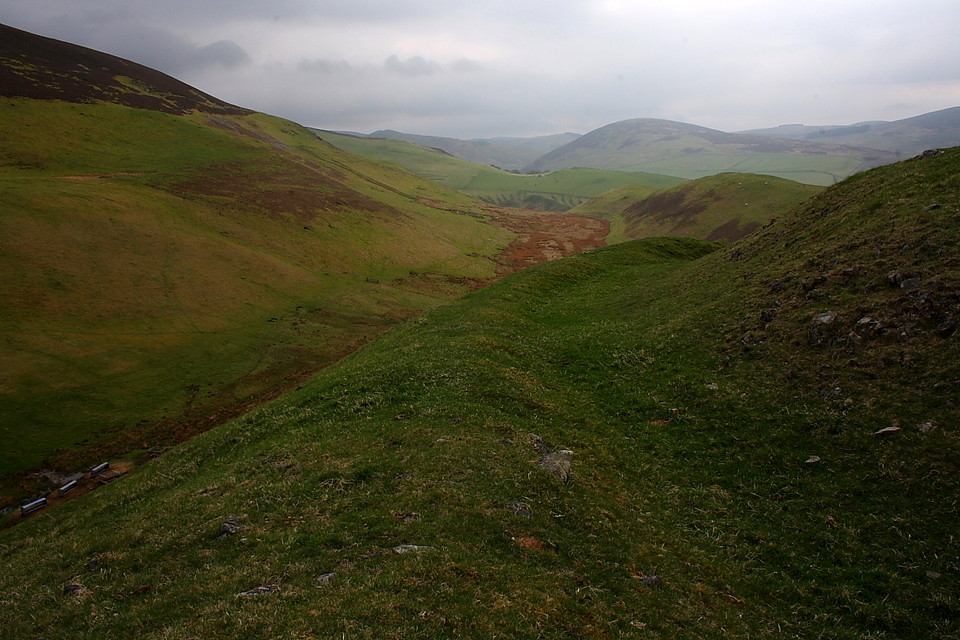
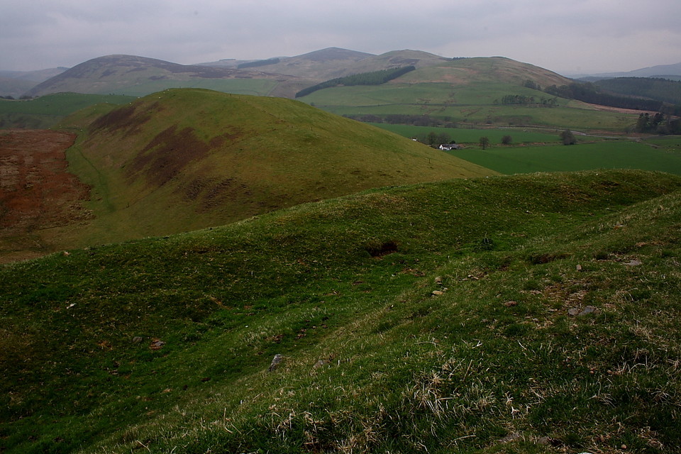
However, like its Somerset namesake, ancient archaeology very much plays second fiddle to the exquisite landscape context here. For starters it suddenly dawns upon me that the mountain rearing its massive bulk to the west is Tinto, home to, as far as I'm aware, the most massive upland cairn in all Scotland. Then, looking north-east past a small settlement, White Hill holds the eye, crowned by its own hillfort, whilst beyond Nisbet Farm can be seen Snaip Hill featuring... yep, another hill fort. Oh and just across the valley to the approx south-east is the small Langloch Knowe 'fort. There are others upon distant skylines, the whole forming perhaps the most concentrated and extensive area of Iron Age upland settlement I've yet come across.
What a great place to simply sit and watch people go about their daily business down below. The vibe is peaceful, the sun breaking through cloud cover glorious. In fact only the curiousity of seeing the Langloch Knowe and 'Nisbet' enclosures is just cause to eventually move on.
These camps are known in the country by the name of Cow or Kow castle. Mr. Sim was at first inclined to suppose that it had obtained this appellation from being a place of refuge for the cattle, but on further reflection thinks that it ought rather to be traced to the Scotch word, kow, the twigs of any shrub or plant cut and made into a bundle; thus we have broom kow, so well known to every curler, the heather kow, Cowden knowes, etc. I completely agree with this latter explanation, more especially as the Scotch for cattle would not be cow, but kye.
The valley to the west of this Cow castle, though it now consists of good cultivated fields, was in the memory of man an impassable morass, in which a curious place of security had been constructed. As all trace of it has now disappeared, I copy the description given of it in the statistical account: "A mound of oval shape, called the Green Knows, measuring about thirty yards by forty, rises about two or three feet above the surface of the surrounding bog. On penetrating into this elevated mass, it is found to consist of stones of all different kinds and sizes, which seem to have been tumbled promiscuously together without the least attempt at arrangement. Driven quite through this superincumbent mass are a number of piles, sharpened at the point, about three feet long, made of oak of the hardest kind, retaining the marks of the hatchet, and still wonderfully fresh. A causeway of large stones connects this mound with the firm ground. All around it is nothing but soft elastic moss, and beneath it too, for on cutting through the bed of stones, you immediately meet with the moss. Near the spot are the remains of some very large trees, and the whole morass may have been at one time a wood."
The RCAHMS record says you can spot the crannog as a slight mound. Or at least, they could in 1978 so who knows now. The fort itself has a rock cut ditch and is only easily accessible from the north east side.
From 'The Ancient Camps of the Upper Ward of Lanarkshire' by George Irving in the Journal of the British Archaeological Association (1854).


 Posted by GLADMAN
 Posted by Rhiannon