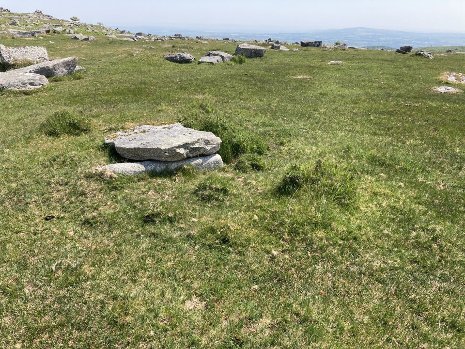
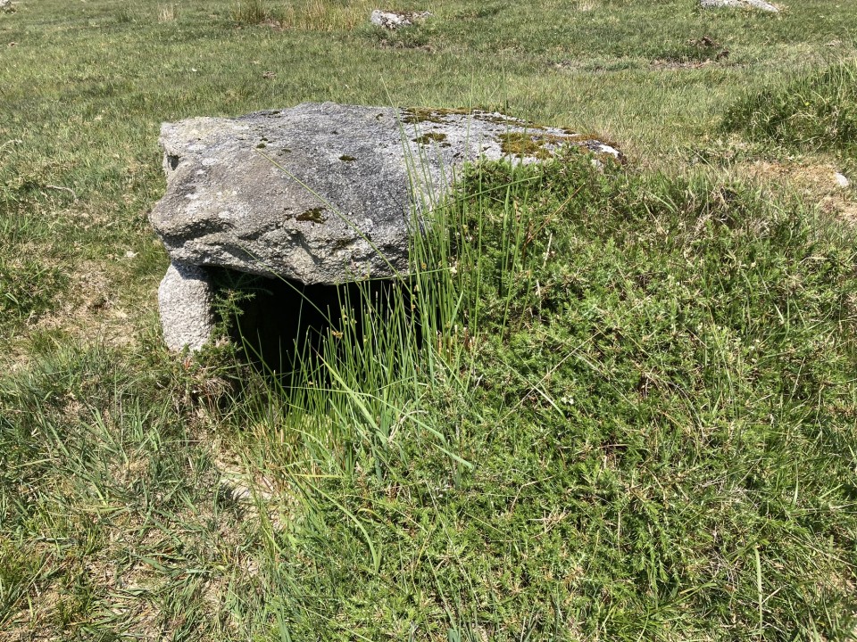
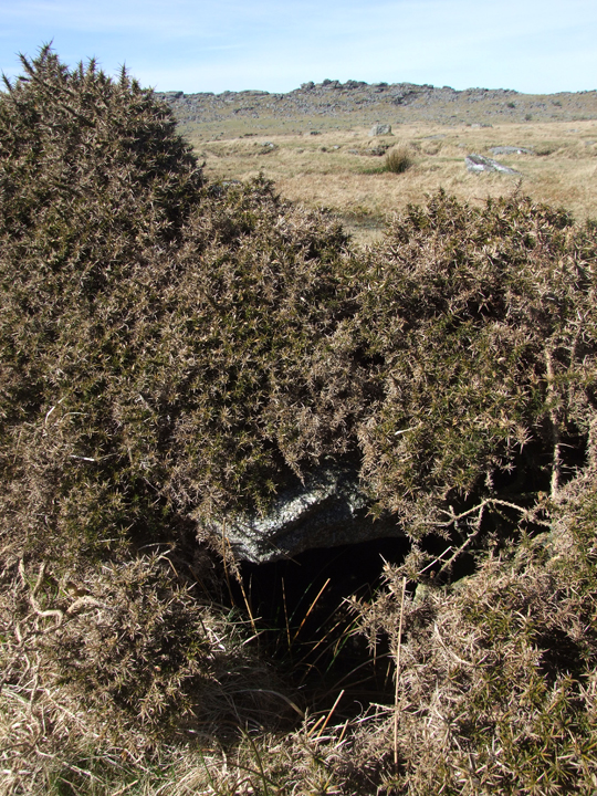
A walk on Twelve Men's Moor and its associated tors is always rewarded with a rich variety of antiquarian sites. On my recent visit I discovered that the Bearah Tramway Cist had been cleared of vegetation, giving an improved aspect to the site.
Don't know how I have not gone looking for this one before....walked the area loads of times. Marked as a cairn on OS maps, this little cist is hidden under a gorse bush beside the old tramway that runs west from Bearah Quarry.
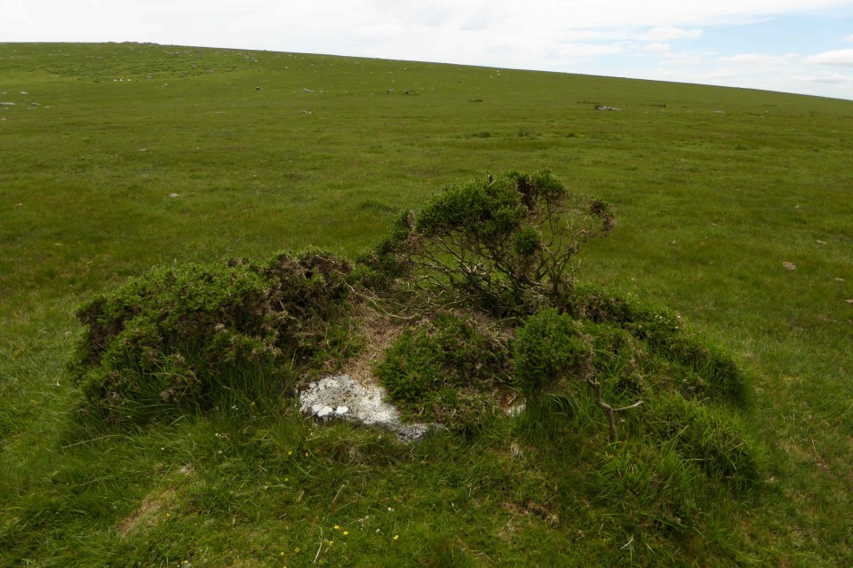
Apart from the capstone there is very little above ground...hardly a cairn in the Bodmin Moor scheme of things.
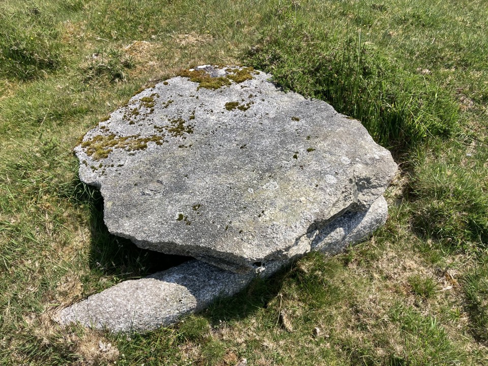
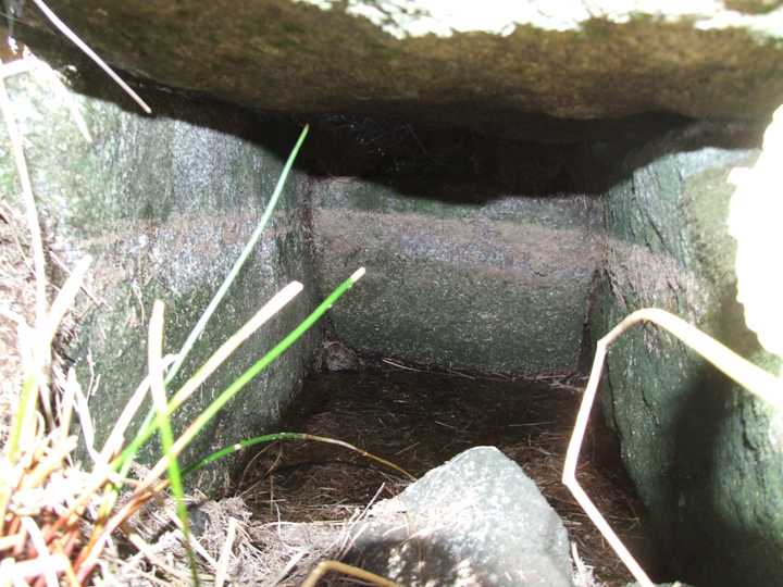
Too dark and too small to take a look inside so had to rely on the camera to get a photo. It looks very tidy inside with banding on the stones suggesting where the earth/water level once was?
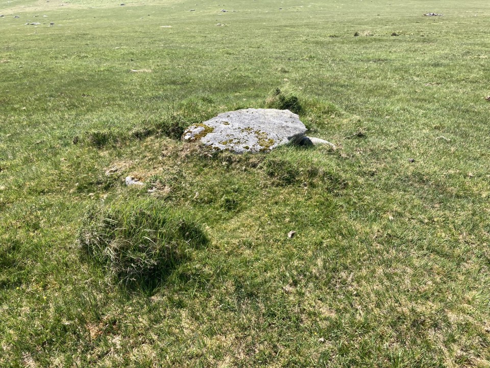
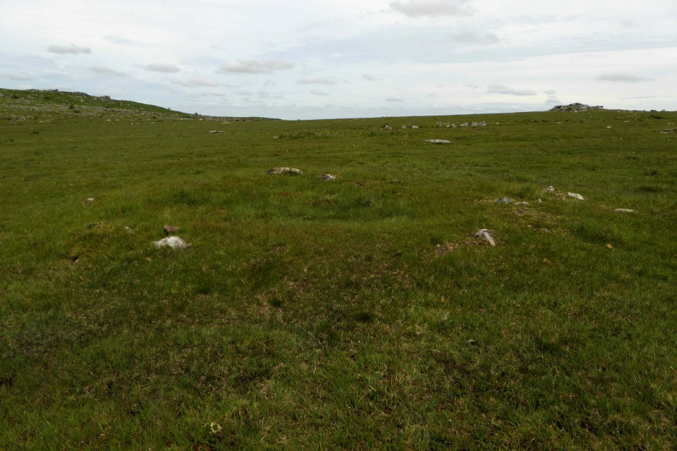
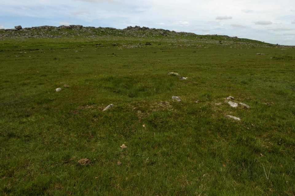
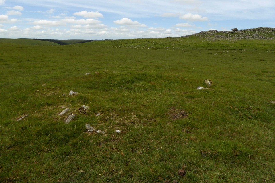
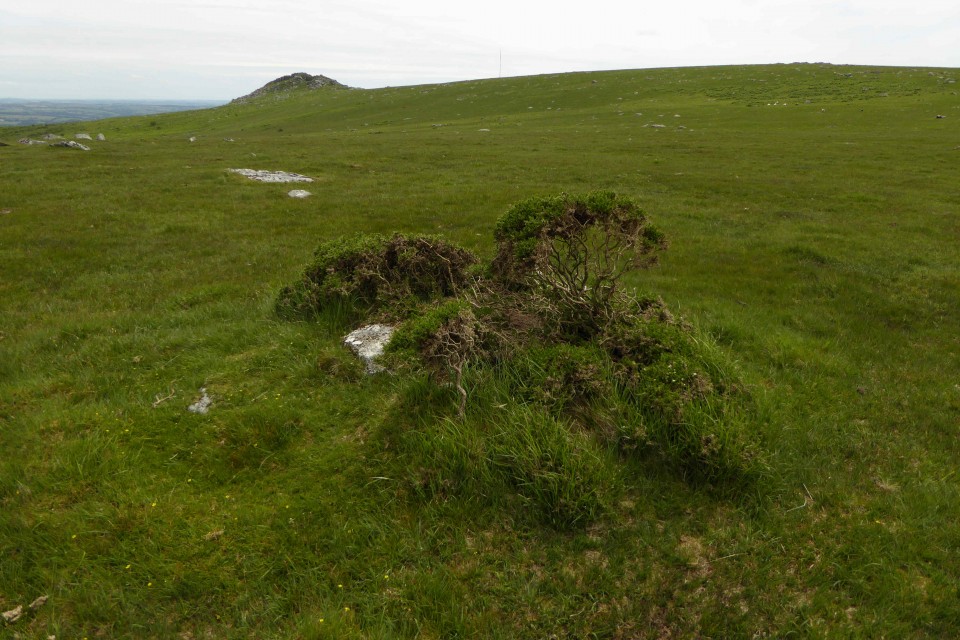
Two cairns here, on a flattish saddle surrounded on three sides by rising ground - the granite outcrops of Kilmar Tor to the north, Bearah Tor to the east and the more gentle Langstone Downs to the south.
Descriptions from Cornwall & Scilly HER:
Platform cairn at SX 2532 7430
A rimmed platform cairn in enclosed moorland to the west of Bearah Tor, on a very slight western slope. It was discovered by the RCHME surveyor during field investigation and surveyed onto the 1:2500 air photo plot. It is a turf covered cairn, 9.3m in diameter and 0.4m high. It has a slightly dished interior, the centre being 0.2m above the natural ground level, and a perimeter rim 0.1m high. Four stones about 0.3m across protrude 0.1m to 0.2m from the top of the rim bank but these are widely spaced and do not seem to be part of a retaining wall or structure. The cairn is situated 4.0m to the north of the Bearah Tor reave, at a point where the reave appears to have been stripped of much of its stone content. It would, however, be exceptional if the reave stone had been used for the cairn, particularly in view of the cairn to the east where the reverse seems to have taken place, and reaves generally seem to post-date cairns.
[Shown on the OS 1/25000 Explorer]
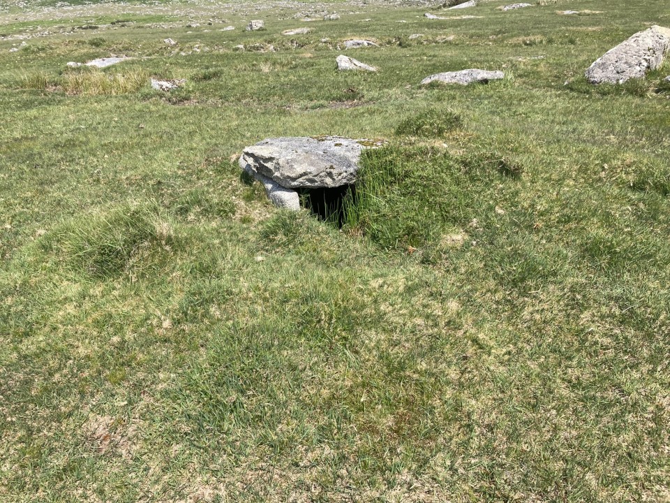
Cairn with cist at SX 2551 7426
A small round cairn with a central cist situated near other broadly contemporary cairns and a prehistoric linear boundary in the broad saddle between Bearah Tor and Langstone Downs. The cairn survives as a circular mound of heaped rubble, 5.3m in diameter and up to 0.5m high. The mound is covered by a thick peaty turf which has protected this cairn from earlier antiquarian discovery and disturbance. At the centre of the mound is a slab-built cist, rectangular in plan, with each side formed from a single slab 0.1m thick, giving an internal chamber measuring 1.1m long by 0.65m wide and 0.7m deep. The two side slabs and the end slab are upright. The cist's covering slab is sub-circular, 1.0m in diameter and 0.15m thick, and has had small angular facets along its edge which may result from a recent, unsuccessful, attempt to fashion it into a millstone.


 Posted by thesweetcheat