|
|

|
|
High WillhaysCairn(s)
|
||||||||||||||||||||||||
|
|
|
Images (click to view fullsize) |
|
|
Fieldnotes |
|
|
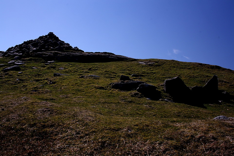
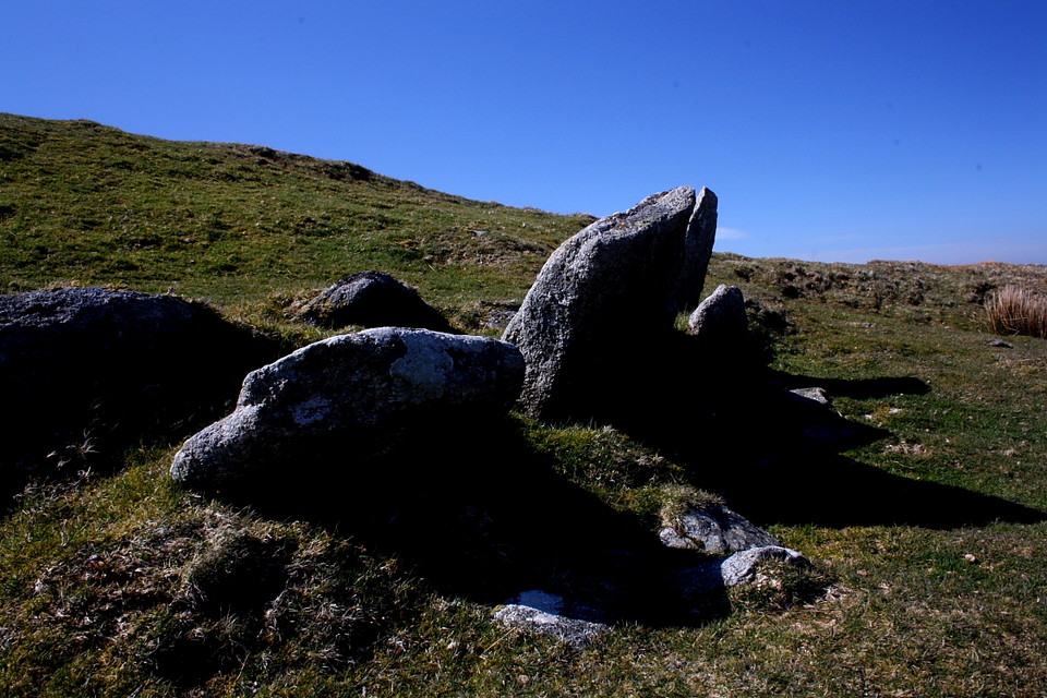
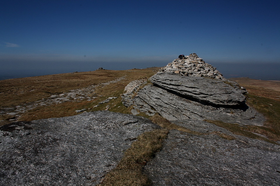
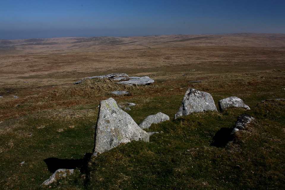
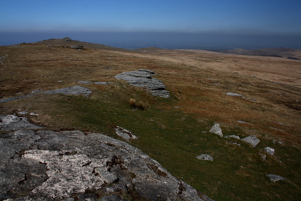
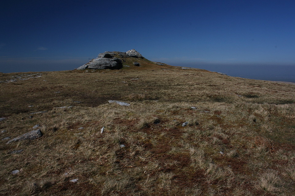
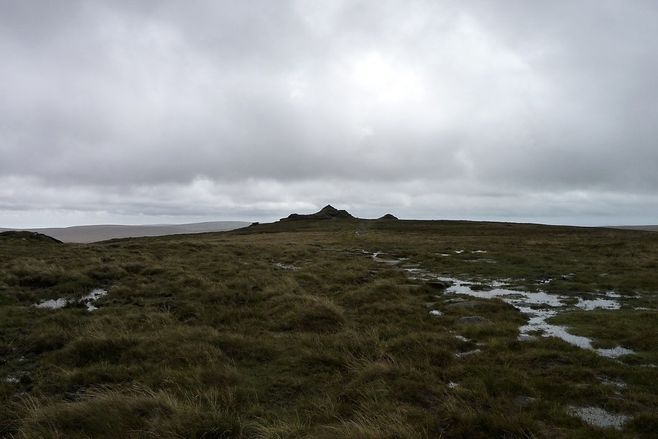
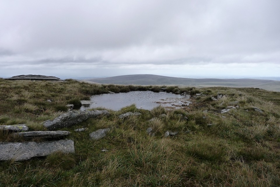
Heading approx south from the high crags of Yes Tor.... well, certainly 'high' for these parts, anyway.... the traveller will reach the marginally taller (2,039ft/621m) summit of High Willhays in 'round about half a mile of more-or-less level plodding enhanced by some fine medium/distant views. The topography of the summit plateau itself is (thankfully) enlivened by several granite outcrops - or 'tors' - exposed rock formations apparently laid down some 280 million years ago by the greatest powers of all. Now there's a number to make the head spin, assuming the climb up here doesn't cause the old knapper's gyroscope to malfunction first. If the current OS maps are to be taken at face value... well, that is that. However this being Dartmoor, where the remnants of past civilisations often appear (to me) to merge seamlessly with the very landscape itself, it can arguably pay dividends to sit down and let the subconscious do some observing before subsequently letting the conscious 'you' in on the secret. First up is TSC's 'revetted mound' adjoining the southern flank of the initial tor encountered at SX58028944. To be fair, if my experience is anything to go by, it is easily missed, not least since the construction is not something I've encountered elsewhere, at least in this upland context. So OK, although I'm not 100% convinced it is of prehistoric origin - my lack of Dartmoor expertise notwithstanding - it's nonetheless difficult to think of what else it could represent up here? The actual summit tor of the mountain is crowned by a rather pathetic attempt at a walker's cairn, seemingly so precariously sited as to be at the mercy of the next storm front. The intervals between which, I would assume, are not that excessive. However as I plonk myself down to take in the moment, not to mention some caffeine, I'm suddenly aware of an arc of what looks suspiciously like the remnants of a retaining kerb below to the near east at SX58038922. No, surely not? Closer inspection only serves to further convince me that these 'orthostats' can not be the result of natural outcropping and stand here as a result of human agency, that derisory summit cairn actually representing the lingering residue of a much more ancient monument (see Misc post). Yeah, that's better. And funnily enough EH agree, a retrospective search of Pastscape citing these standing stones as forming part of a possible ring cairn to complement the monument to the north. Seems Dartmoor's highest tor isn't so unaccountably devoid of archaeology as might initially be surmised. Bonus site. I can live with that. I can also live with descending back to the car via cairns sited at Fordsland Ledge and upon Longstone Hill. Not that I'm aware of the latter. Yet. |
 Posted by GLADMAN
7th July 2014ce Edited 7th July 2014ce |
Miscellaneous |
|
|
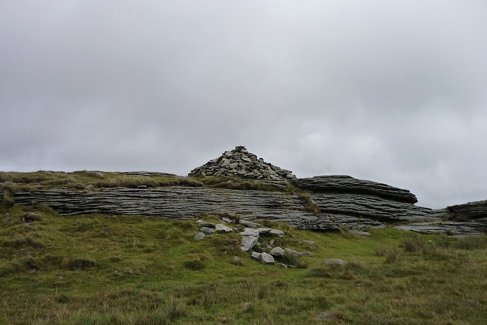
It would appear there was a lot more going on upon the summit plateau of High Willhays during prehistoric times than is readily apparent to today's casual visitor.... assuming any visit to south-western England's highest point can be termed 'casual', that is. In addition to the 'tor cairn' at SX58028944, an arc of conspicuous orthostats due east of the summit tor at SX58038922 caught the eye of this traveller. The summit crags themselves are crowned by an an almost impossibly tidy walker's cairn, a stone pile balanced upon the naked rock in a such a seemingly precarious fashion that a gust of wind might well send it crashing to the coarse grass below. So why the existance of several relatively substantial upright stones clearly standing vertical - well, more or less - as a result of human agency? My immediate theory was the arc may once have formed a section of kerb retaining a cairn of which the summit remnants are all that remain. Funnily enough at least one earlier, not to mention more experienced traveller, came to a not too dissimilar conclusion. To quote Pastscape: "A semi-circle of leaning orthostats adjacent to the E side of one of the outcrops forming High Willhays. The stones remain a maximum of 0.75m high and describe an arc some 9m in length. Small boulders and slabs are interspersed with the orthostats suggestive of a ring cairn, in this case attached to the tor. The outer ring... is visible as a slight scarp a maximum of 0.2m high curving around the NE quadrant of the inner ring. It may represent a second element to the cairn or, more likely, be the result of stone removal in the more recent past. The outcrop to which this cairn is attached is crowned by a recent walkers' cairn which presumably contains material derived from this feature. [Probert SAJ 15/9/2003, EH Field Investigation]" |
Posted by GLADMAN 3rd May 2014ce Edited 3rd May 2014ce |
|
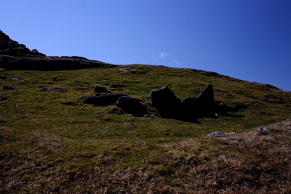
Possible prehistoric cairn on the summit of Dartmoor's (and southern England's*) highest mountain. Pastscape description: A revetted mound adjoins the south side of one of the granite outcrops at High Willhays. Measuring 19m east to west by 18m overall it stands around 0.8m high. The sides of the mound are formed by coursed granite slabs and boulders and the top is largely flat though a hollow has formed in the southern half. This feature must be regarded as a tor cairn though its construction is somewhat uncharacteristic of similar features. There is no evidence to suggest the presence of a cist or a more conventional kerb. *Arguably! See Gladman's comments on pic. |
 Posted by thesweetcheat
21st April 2011ce Edited 29th August 2011ce |