|
|

|
|
Peninnis HeadCairn(s)
|
||||||||||||||||||||||||
|
|
|
Images (click to view fullsize) |
|


|
Fieldnotes |
|
|
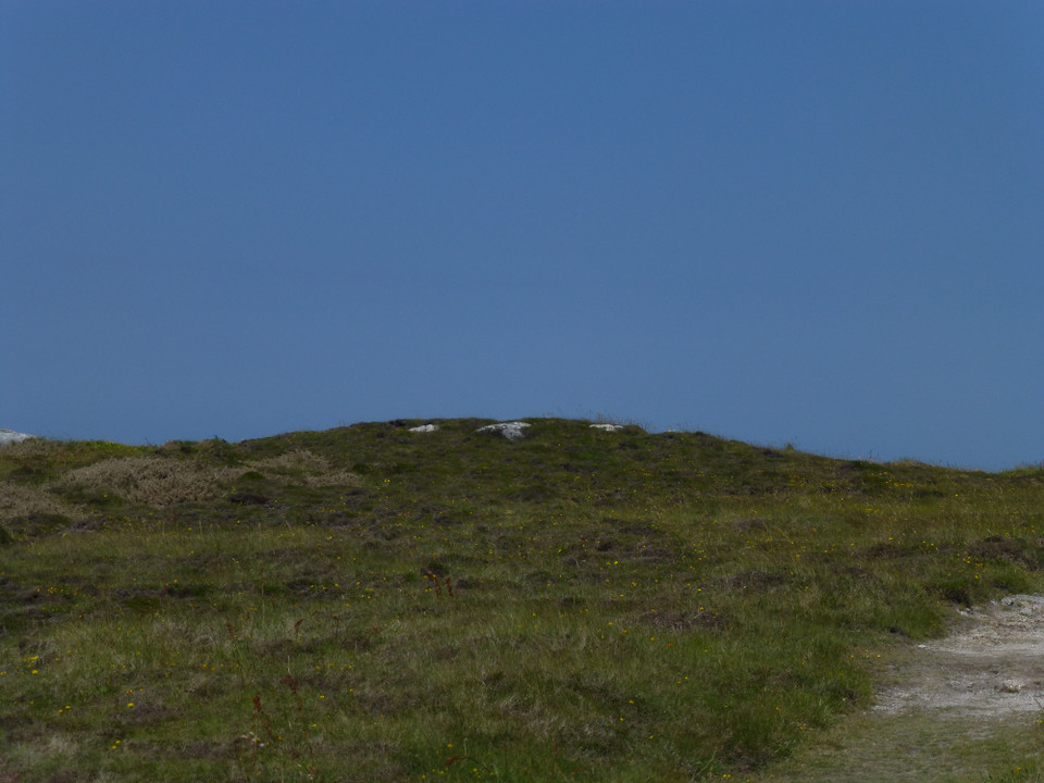
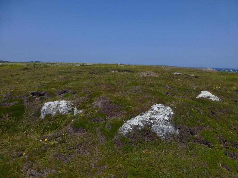
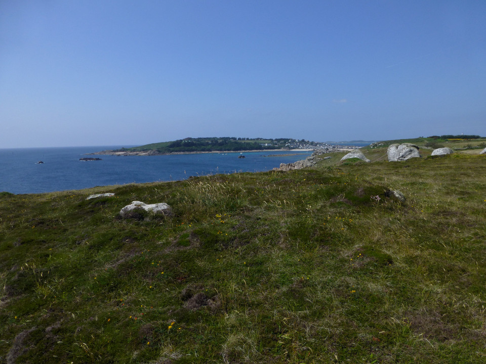
22.6.2011. The weather on this summer's Cornwall holiday has been anything but predictable, most days vary from heavy rain to blue skies and back again over the course of the days. But I am determined to get back over to the Isles at least once. Tickets for the Scillonian III can be bought on the day, so we head to Penzance, in the rain but hopeful that the weather is going to improve. The upshot of all of this is that the ferry journey (2hrs 40 or so) is something of a trial. This is the fourth time we have made the trip, but there's no flat calm today. Talk about peaks and troughs! Although we are both pretty good sailors, sharing a deck with a dozen people being noisily sick begins to upset the hardiest of stomachs - I head up on to the outside deck, preferring to brave the wet, while GF turns her ipod up and sits through the traumas. But we arrive at Hugh Town harbour on St Mary's in due course, all safe and sound. A last fleeting squall of rain accompanies our walk to the Old Town, then the sun is out. We haven't been to the southern tip of the island before, as there are few prehistoric remains and nothing to compare with the extraordinary chambered tombs that pepper the north and east coasts. Old Town church is worth a quick visit, but the first stoney treat is on the pebbly beach of Carn Leh Cove, where some enterprising artist(s) has stacked the beautifully smooth pebbles up into little piles, making the whole beach look like an outdoor art installation. From here the path climbs bracken-covered slopes onto Peninnis Head itself. We are greeted by some of the most bizarre and striking natural sculpture I have ever seen. The granite of Scilly, while still very hard, is more porous than its mainland cousin and lends itself to being carved into amazing crests and molar-like blocks, over millenia of assault from wind and salt-water. What an astonishing place! The cairns themselves are something of a disappointment. Only one is easily identifiable, just NW of the lighthouse and one particular rock that reminded me of the head and shoulders of a troll or goblin, emerging from the clifftop. The cairn has some visible stonework, possibly indicating the remains of a kerb. There are no chambers here though. A second, badly damaged cairn is just down the slope to the SW. A bit further down is a shallow scoop, which looks likely to be remains of quarrying or even a kelp pit, but isn't a cairn. We don't even see the most northerly of the group, missing it under the purple edging on the OS map (the edging indicates Isles of Scilly Wildlife Trust access). But the spot is a great one, wild and windswept. The extravagantly shaped stones of the headland more than make up for any disappointment in the cairns. From here we headed up Buzza Hill for a quick visit to the chambered tomb there. |
 Posted by thesweetcheat
17th July 2011ce Edited 17th July 2011ce |
Miscellaneous |
|
|
Pastscape info on cairns: On Peninnis Head at approximately 34.0m OD are four heather covered cairns. A: SV 91030957. A cairn of small stones 8.0m in diameter and 0.6m high on a north west slope. It is in an area of clitter, partly grasscovered, and more evident when viewed from the lower north west side. B: SV 91010947. Diameter 10.5m and 0.6m high, disturbed by desultory small diggings. C: SV 91020948. The best preserved in the group, 12.5m in diameter and 1.1m high. It incorporates one naturally sited boulder and at least two other large stones, all protruding to give the impression ofan inner wall or kerb. One upright slab exposed in the south west quadrant may be part of this or possibly the end of an off centre cist, oriented north east/south west. There is no kerb. D: SV 91160948. A small mound, 6.0m in diameter and 0.4m high with no visible ditch. E: A quarry pit and not a barrow or the site of one. Surveyed at 1:2500 on PFD. |
Posted by thesweetcheat 26th June 2011ce Edited 26th June 2011ce |