|
|

|
|
The BrynCairn(s)
|
|
|
|
Images (click to view fullsize) |
|
|
Fieldnotes |
|
|
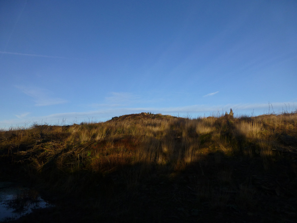
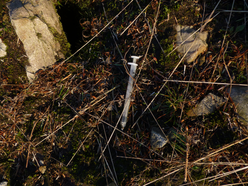
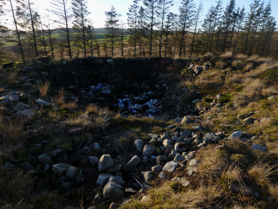
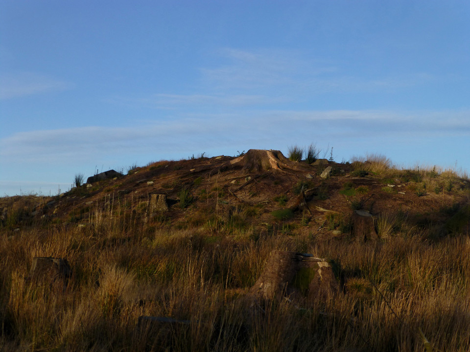
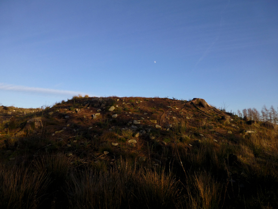
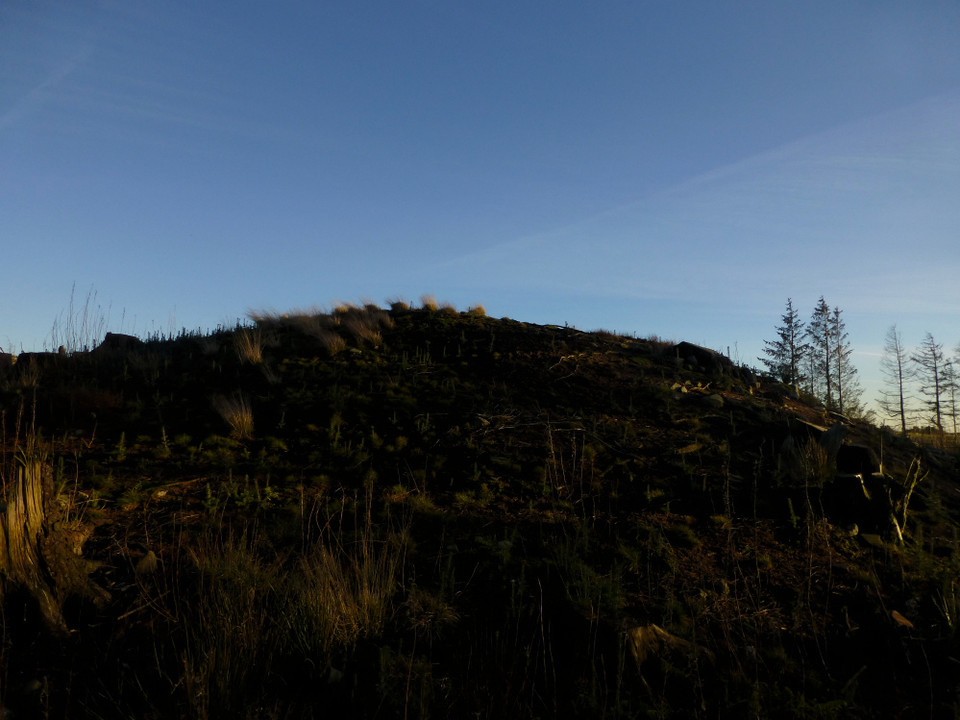
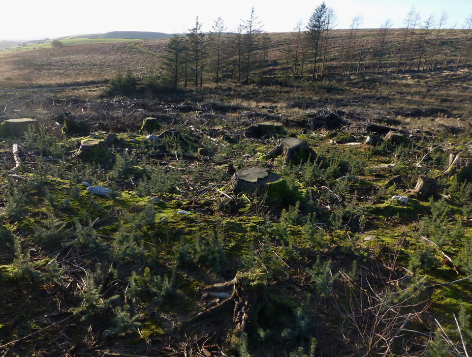
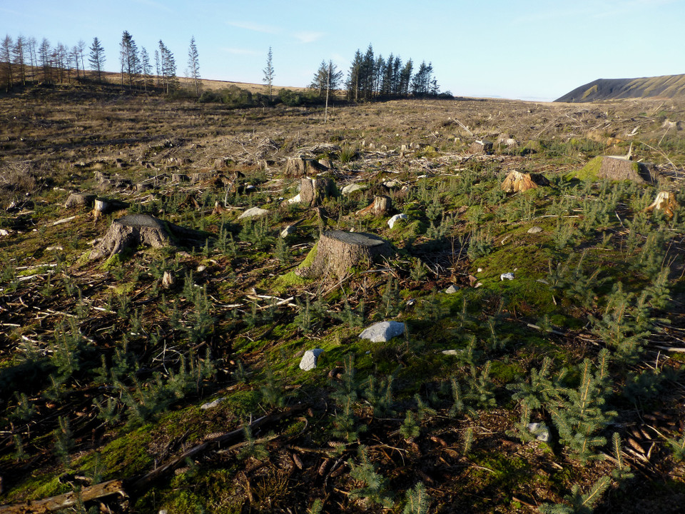
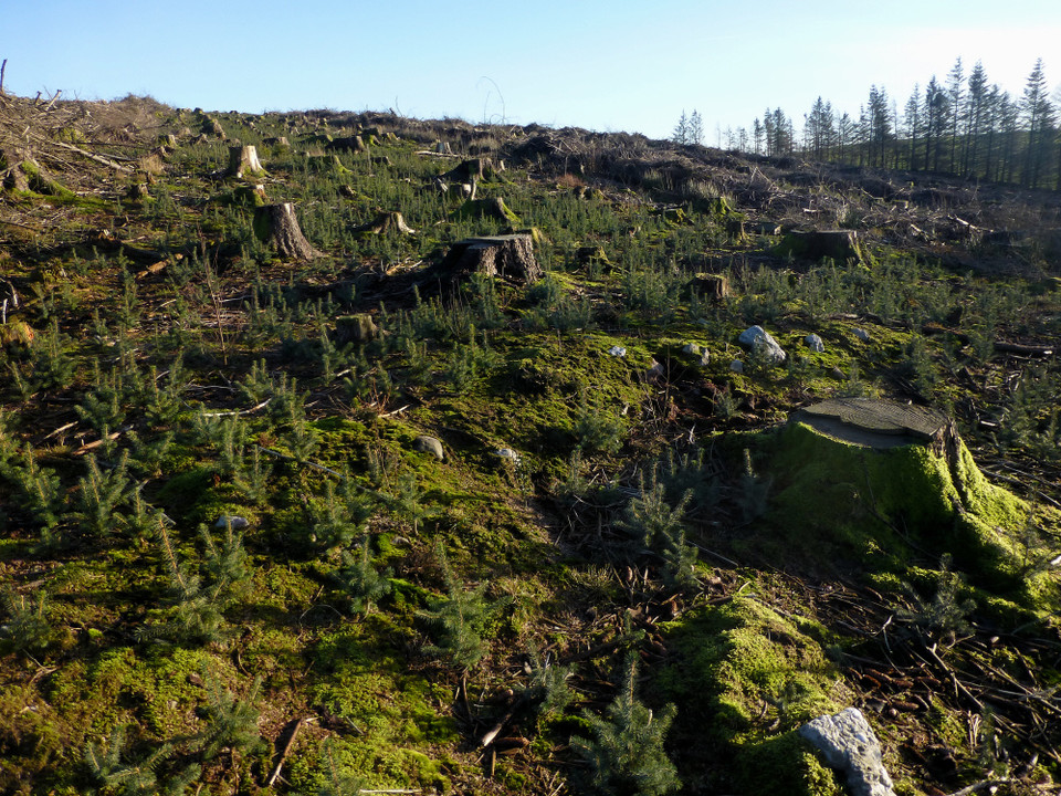
Visited 29.11.12 A day off work all to myself and not a cloud in the sky. Only one thing for it then – a bit of ‘old stoning’! Not much money and not much petrol so something close to home required. Looking at my Cardiff and Area O/S map I spot a couple of sites I haven’t had chance to visit yet. That’s that sorted then. The first of these are the two Cairns called as ‘The Bryn’ (The Hill) After eventually navigating my way through the maze of roads in Penyrheol (just outside Caerphilly) I park up on Heol Chwarrel Clark. ** Due to road changes you will need to enter Penyrheol from the east off the roundabout on the A468 and NOT the way I first tried, from the west off the B4263** Despite there being a heavy overnight frost I only needed a light jacket as the sun was shining and most importantly there wasn’t a breath of wind so it felt a lot warmer than it actually was. It took 10 minutes to walk up the steep road which leads to the farm only to discover that I could have driven all the way up and parked at the entrance to the Eglwysilan Common; just over the cattle grid. Still, it was a nice walk and the exercise won’t do me any harm! The Cairns are easy enough to find, all you have to do is follow the track used by the forestry people until you come to a padlocked metal field gate which gives access to the forestry plantation. Although my map shows a forest, it has now all been cut down and replanted with saplings – approx 6 inches high. This means spotting the larger of the two Cairns is an easy task. A further 15 min walk from the farm. Now, my friends, comes the bad news: I carefully walked over to the Cairn, not to step on the saplings, and climbed to the top. I then looked down in horror. The centre of the Cairn had been dug into so much it resembled a crater. But much, much worse was the fact that this ‘crater’ was being used as a bin. (Presumably by the people who cut the trees down as I can’t see how this much rubbish could have been generated by anyone else up here?) It was a complete and utter mess. Bags and bags full of beer and cider cans, food wrappers and the like. It would have taken a mini skip to have cleared this lot. It has clearly been used as a bin for quite some time. I could talk about people’s ignorance and contempt for ancient sites (particularly someone’s final resting place) but I would be wasting my breath. It is not often I feel anger – but I felt angry now. My anger was only matched by my shock and horror. The Cist slab which Coflein talks about was clearly not going to be seen by me today. I sat on a tree trunk and surveyed the situation. Here I was sat on a desecrated Cairn in the middle of a forestry plantation that had been taken to the saw. All around was the spoil of the ‘harvest’. The Cairn itself seemed to be wearing a crown of dead tree stumps – it seemed apt somehow. The who area felt ‘dead’ although no doubt once the new trees start to grow it will feel different? This was not a place to dwell for too long – far too sad. The smaller Cairn showing on the map I couldn’t even find. It must have been buried under the debris of the tree felling. The only positives I can take from my visit is that the Cairn has not been replanted with saplings and I did pick up a cross section of tree trunk which I took home for Dafydd to take to school to show his teacher and the children about how to date a tree from the number of rings. I guess most of the children won’t ever get out to these type of locations to see for themselves? Dafydd of course knows better! COFLEIN states: ‘Two cairns on ground falling gently to the west. The larger cairn is 24.4m in diameter and 2.5m high – centre deeply hollowed exposing a cist slab. 23m north is the smaller cairn, 4.5m in diameter and 0.3 to 0.9m high’. An E-Mail to CADW is in order to inform them of the state of the Cairn. Perhaps they can have a word with the forestry people? Certainly worth a visit but be prepared for the rubbish – unless of course it has been cleared up by then? |
Posted by CARL 30th November 2012ce |
Miscellaneous |
|
As well as the large cairn visited by Carl, there is a hard-to-find ring cairn to the NNW at ST13619105. Coflein has the following description:Almost circular cairn rim on ground which slopes NW, thereby ruling out the possibility of it being a hut circle. There are a few large stones in the interior. condition=Near Destroyed |
 Posted by thesweetcheat
13th March 2014ce |