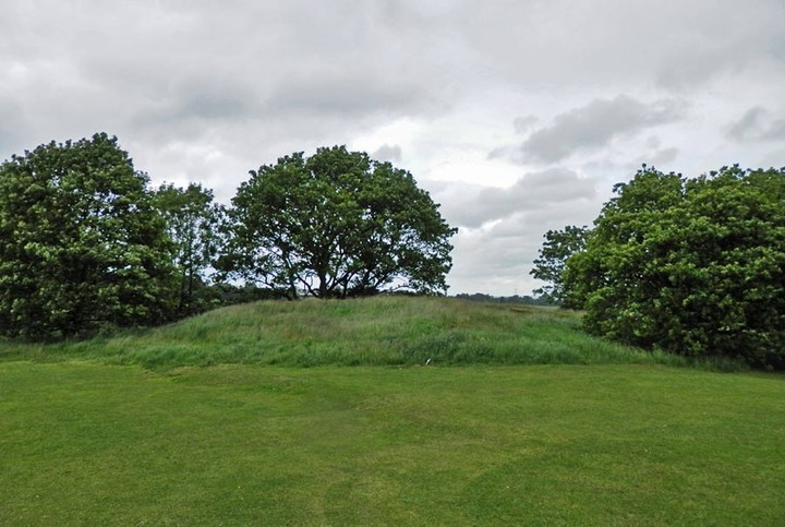
At the back of Aldridge church is a small tumulus. (1) A mound north of Aldridge church is supposed to be the burial place of a chief. (2) SK 06140101 - this mound is shown but not described on OS 6", 1913-38. It is 28.0 m. in average diameter and 2.2 m. high with traces of a ditch on the east and west. It has been mutilated by quarrying. It falls on high ground on the northern crest of an east-west ridge, at the edge of a playing-field. It is accepted locally as a barrow and is probably the feature referred to by the 19th c. literary references. Certain identification of the mound as a barrow is not possible in its present condition. (3) Mound situated in field known as Windmill Flat suggesting it is a mill mound. (4) Surveyed at 1/2500. (5) No change since reports of 8.10.58 and 16.8.74. 1:2500 survey still correct. (6)
Windmill field appears in undated extracts from medieval court rolls compiled for a 17th century brief. (7a) Many other 17th century references to Windmill field in deeds etc. (7)

 Posted by Chance