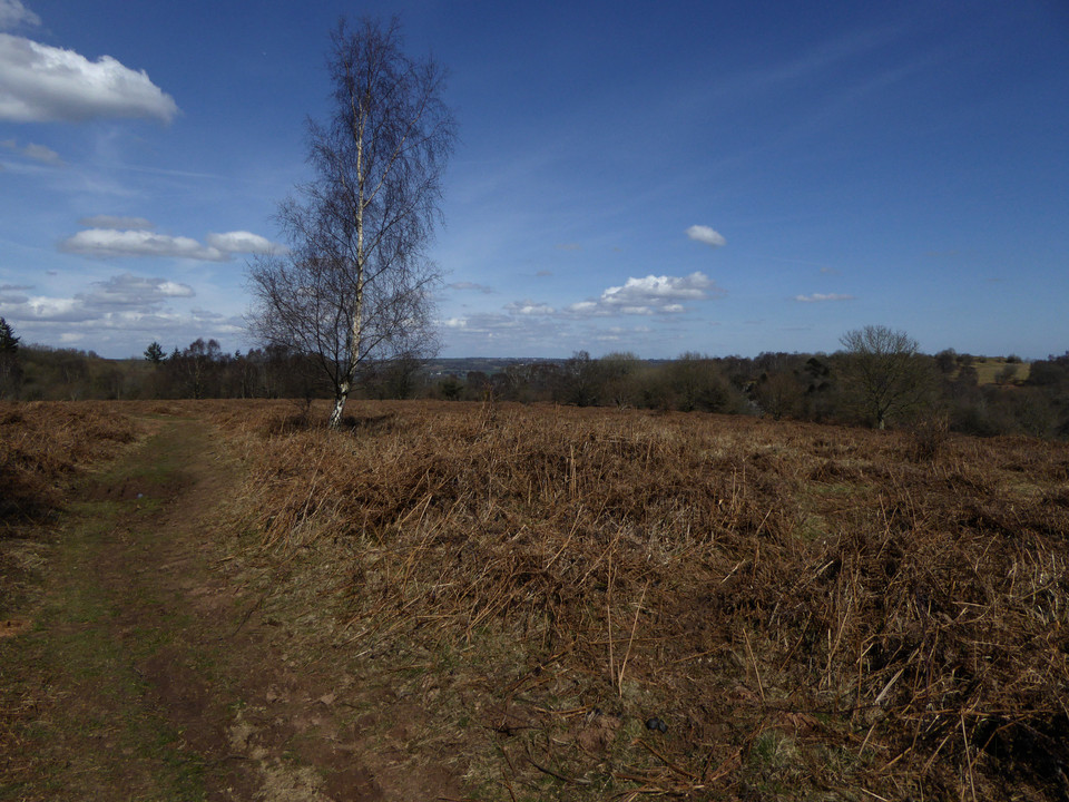
There are more barrows shown to the northeast, as well as another cave called Aveline’s Hole. I pass various deep sinkholes, glorying in the names Bos Swallet and Rod’s Pot. Some of these are huge scoops in the ground. As the path gives way to a metalled road, a proper look at the map shows Aveline’s Hole is actually on the other side of a steep gorge, so I reluctantly abandon any idea of a visit today. There are however three barrows (the OS shows one cairn and two tumuli) in an open area of common below the northern slopes of the moorland proper.
This area is deep with the brown stalks of last year’s bracken, which makes barrow hunting somewhat difficult, although not as much as it would be on a summer visit.
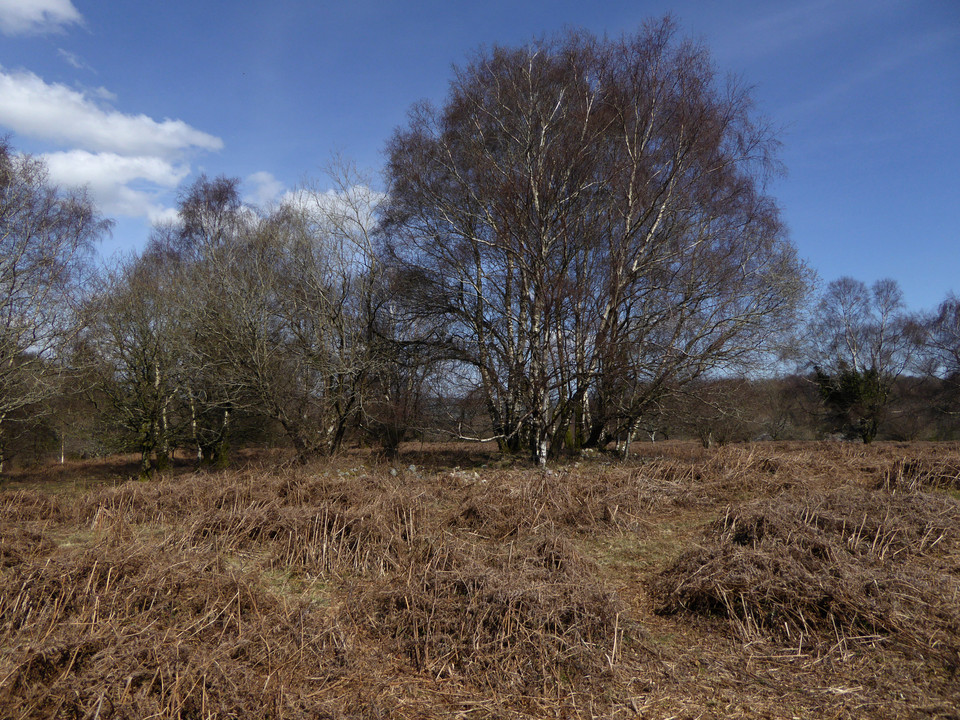
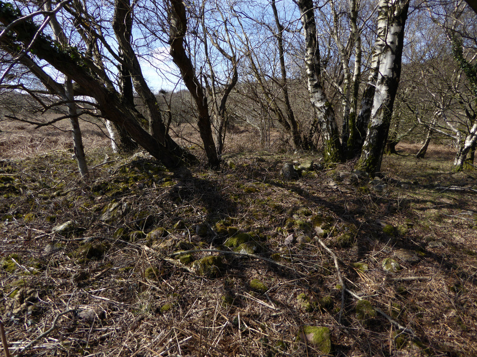
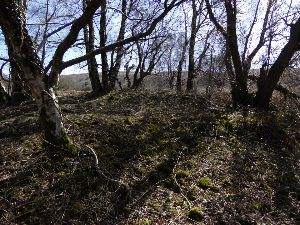
I start off looking for the cairn, the northern of the three monuments on the map. After foolishly hacking my way into and back out of a briar patch thinking it was the barrow, I realise that it’s actually a very prominent feature crowned with a stand of silver birch trees. On closer inspection it’s a beauty, lots of stonework and an crisp footprint (although no kerb as such). The trees are no doubt causing damage but enhance the atmosphere immensely, especially as the sun at its zenith is now beating down through a cloudless blue sky. Something of an unexpected highlight, and definitely worth the visit.
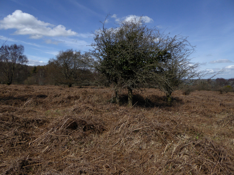
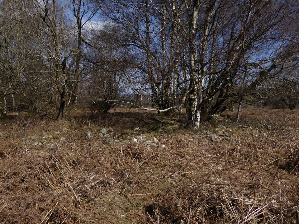
Heading south the other two marked barrows are less easy to find. The middle barrow is a low mound next to one of the many paths that criss-cross this open area. It’s misshapen and has hawthorn growing on it, assuming I’ve even found the right thing under all the bracken. I can’t find anything in the marked position of the southernmost barrow, although I think it’s likely to be somewhere near a single silver birch, as these trees seem to feature close to many of the barrows in this area. Either it’s deeply buried in bracken or the map has it in the wrong place.
This area of common north of Black Down is the site of an extensive Bronze Age cemetery of cairns and cremations. Beaker sherds were also found in Bos Swallet, a large sinkhole to the west of the cemetery. Details of the cairns that appear on the OS 1/25000, from the Somerset HER:
Burrington 1/T5 (ST4743058460)
Possible saucer barrow. Consists of a ring mound and an inner mound. Total diameter c41ft with mound 25ft diameter and 2.5ft high. Built of stones.
Excavated by H Taylor following R.F Read c1925 and 1950-6. Primary inhumation (inferred) with barbed wire type beaker (Clarke's Barbed-wire type no 784) in a grave 2ft 3ins by 3ft 7ins which also contained fragments of burnt bone. There were inner and outer ring-cairns or retaining circles. Secondary fragments included one accompanied by a food vessel, and a cremation with a primary series collared urn. On the W and SW margin of the barrow was a cremation cemetery.
Burrington 3/T6 (ST 47465836)
Possible saucer barrow total diameter 35ft and central mound about 1ft high.
Excavated by R.F Read in 1923 - primary cremation in stone cist 2ft by 1ft 8ins with fragment of polished flint implement. Mound truncated.
Section prior to excavation suggests a disc barrow. Cist was previously robbed.
Burrington 6c/T6c (ST 47435820)
Barrow 21ft diameter and 1.5ft high. One of several that occur locally but do not really fit into any category. Consists of a low mound roughly ring shaped with a gap in it communicating with the central depressed area. This area does not seem to be due to disturbance. The gap is to the S.


 Posted by thesweetcheat