|
|

|
|
South CreakePlateau Fort
|
||||||||||||||||||||||||
|
|
|
News |
|
Panels to Illustrate Archaeologists' DiscoveriesTo the untrained eye the Bloodgate Hill Iron Age hill fort at South Creake, near Fakenham, is nothing more than a circular mound in a grassy field... continues... |
 Posted by Rhiannon
24th June 2005ce Edited 24th June 2005ce |
Bone Bits Found At Fort(Not many) Human remains found at juamei's 'world's dullest fort'. Richard Parr EDP24 November 13, 2003 06:00 Fragments of human skull were found on the side of a ditch during an excavation of the site of an Iron Age hill fort in north-west Norfolk... continues... |
Posted by Rhiannon 13th November 2003ce Edited 20th November 2003ce |
Images (click to view fullsize) |
|
|
Fieldnotes |
|
|
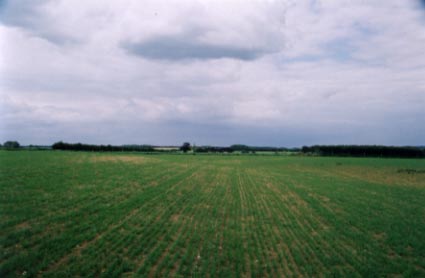
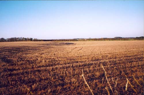
Visited 28.10.14 Direction: South-West of South Creake along a minor road. I wasn't expecting much from this site but I was pleasantly surprised. A decent car park, litter bin, benches/table and information boards. Access from the car park to the fort is via a wooden kissing gate. Despite being the end of October it felt more like summer. Clear blue sky, warm sunshine and feeling comfortable in shorts and t-shirt. Although most of the site has been ploughed away (one section survives to a height of about 1.5m) the information boards give a good idea of how it would have looked in its prime. An RAF jet roared overhead, twisting and turning as the pilot practiced their manouvers. I am sure the inhabitants of the hillfort would have appreciated having one of those when facing the mighty Roman Army! This is a great example of how a site can be both protected and made accessible for the public to visit Well done to Norfolk Archaeology Trust for their good work. Let's hope other parts of the country follow suite. |
Posted by CARL 29th October 2014ce |
|
The Norfolk Archaeological Trust bought this hillfort in 2003 to save it from any further damage by the plough. Nowadays it is grazed by sheep and has a dedicated carpark. Apart from that, I agree with the previous visitors; sadly, it has been almost completely flattened. |
 Posted by baza
1st September 2009ce |
| As juamei says, nothing much to be seen here. Slight traces of the ditches can still be just about made out, best viewed from the parking place a little way along the road, rather than the track. |
14th June 2004ce |
|
[visited 9/12/02] Possibly the dullest hillfort in the world, despite the fantastic roadname. Peering through the hedge from the road you can just see a bank & ditch circling away from you. This fort has been so ploughed that it can't be more than 3 metres top of bank to bottom of ditch & probbly more like 1.5 metres... Oh and you can't walk on it cos it has crops all over it. Unless you happen to be "passing", don't bother. |
 Posted by juamei
10th December 2002ce |
Folklore |
|
| The village sign shows Ye Ancient Britons and the nasty Danes in front of the hill fort. Legend has it that their battle was rather vicious, hence the rather disgusting name of the road down the hill - Bloodgate - down which all the blood from the slaughter flowed. Nasty. |
Posted by Rhiannon 12th April 2002ce |
Links |
|
Sue White, Archaeological IllustratorClickable images of the interpretation boards at South Creake. |
Posted by baza 2nd September 2009ce Edited 2nd September 2009ce |
The Norfolk Archaeological TrustThe owners' webpage for this hillfort. |
Posted by baza 1st September 2009ce |