|
|

|
|
Gibbet Moor NorthStone Circle
|
||||||||||||||||||||||||
|
|
|
Images (click to view fullsize) |
|
|
Fieldnotes |
|
|
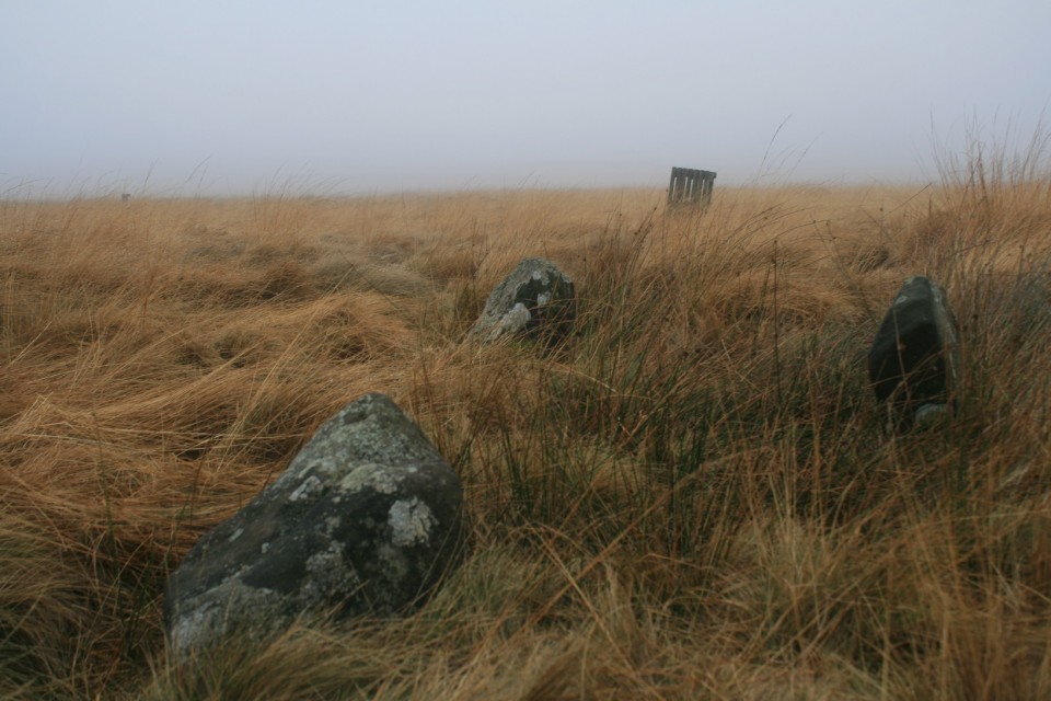
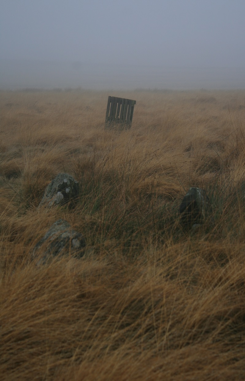
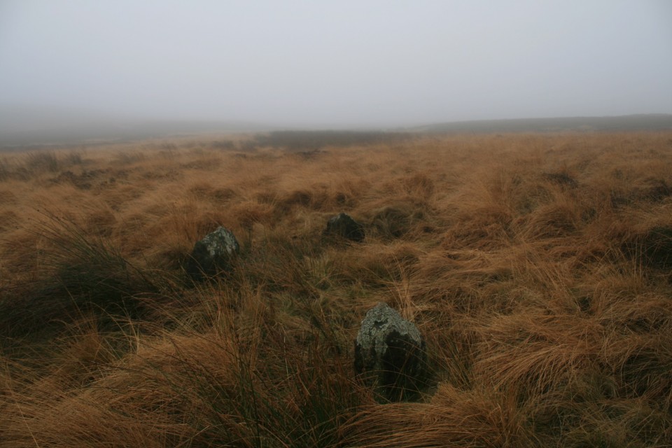
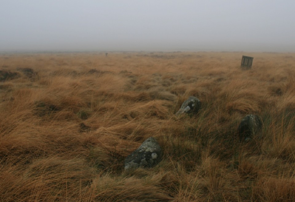
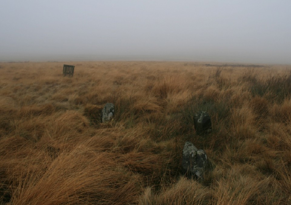
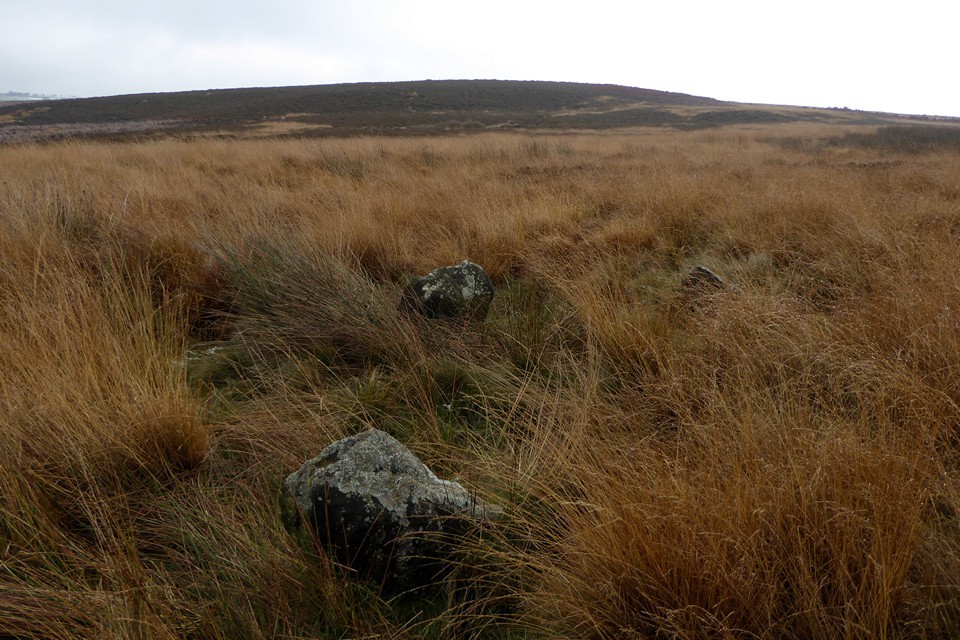
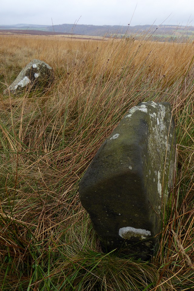
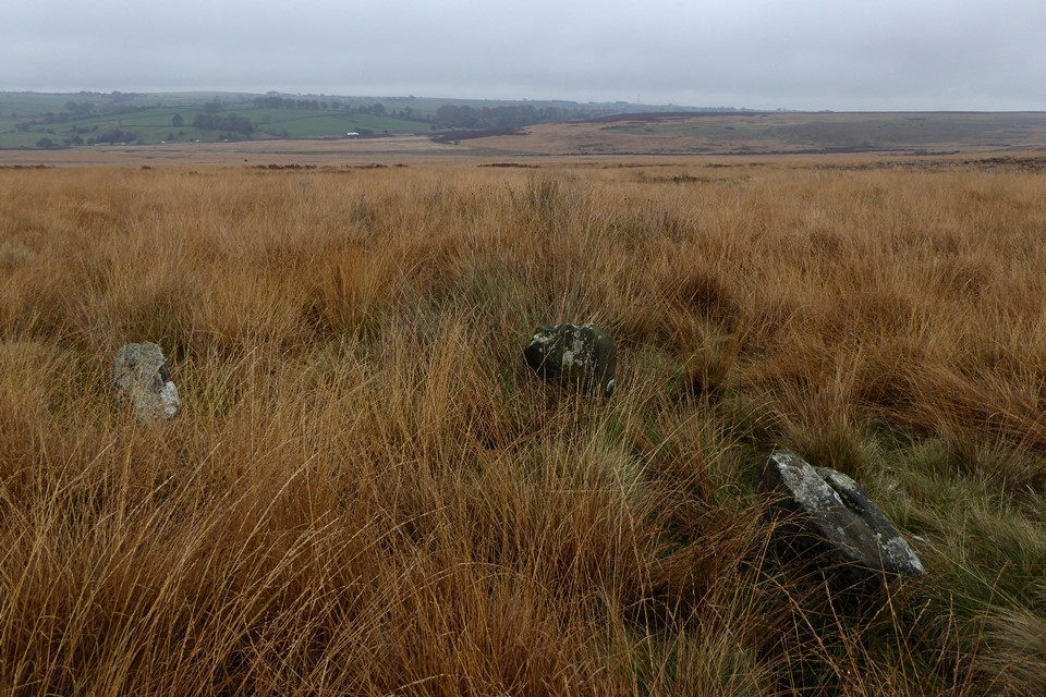
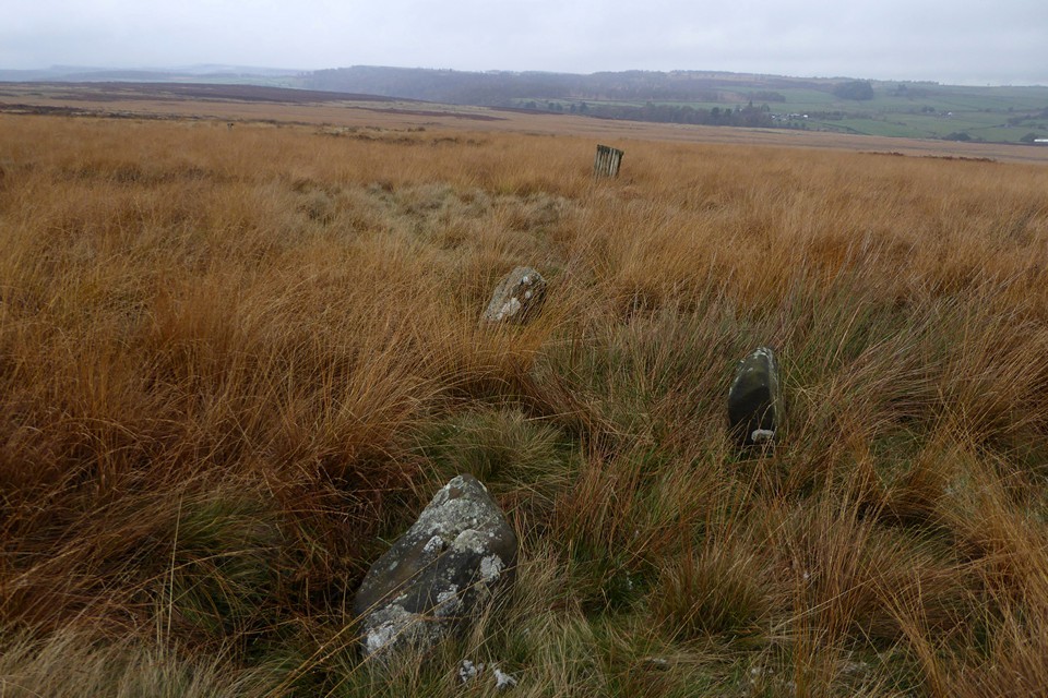
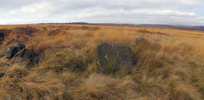
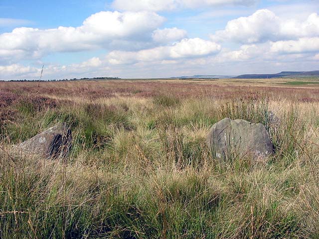
I first tried to find this little stone circle well over a decade ago, failed miserably too. But seeing as Alkens visit was so fruitful I decided to give it another go. Gibbet Moor is right across the road from Gardom's Edge, it could be loosely argued that this stone circle forms part of a vague linear thingy, that's the correct terminology I believe. Looking at the map there's stone circles and bunches of cairns stretching away to the north and the south. There was a lot going on round here in the past. Unlike today, the place is forlorn and ghostly, I have the moor and the mist entirely to myself. Daughter locked in the car, dozing under heaps of blankets, I start the long walk up the track, it seems to take forever, there should be a warning on maps, something like "places on the map may seem nearer than they really are". After an age or maybe two I reach the building on the map along the track. The tentative cross on my map suggests I walk east and slightly south from the farm building. So I do. It doesn't take long for the building to melt away into the mist, all landmarks have now gone and I begin to wonder how on earth I will find my way back never mind the precious stones I've come to see. I've photographed a few pictures off the screen at home with my phone in the hope they will be of some use in finding my way round but to no avail. Then I see the pallet standing up in the photo, then looking around desperately for a stood up pallet, still not availing. Then, and this is the last then, then I see the pallet. I stride towards it confident of finding stones, but there are none. Not far away is another stood up pallet, I wade over to it, it must be there. Nope From this pallet, I can see a fallen one, I imagine the line going further and find another fallen pallet, from here I can see one stood up, it must be there, nope. Vaguely through the mist another pallet, I wonder if it is here, or did I go the wrong way at the first pallet, over I go. The pallets have numbers on them, this is number 4, it must be here I seem to have reached the end of the pallet line. Explosive joy, I can see them, not twenty yards away, I squelch over to them. It should be renamed Pallet stone circle. If it is a stone circle. So here I am, no wonder I didn't find them last time, I think I was further along the track from here, and they are so low that I would never have seen them from where I was looking. I wonder if any actual investigation has ever been done here, beyond the odd stoner turning up for a quick visit. The addition of another stone would indeed make it a perfect four poster stone circle, but with just the three, it is only strongly suggestive. Taking into account the number of other similarly aged monuments, especially Hob Hurts house, a curious square barrow barely two kilometers south, tips the scale in our favour. I reckon. After a sit around and the obligatory tidy up I photograph the stones and take my leave. Rewinding my approach I notice the numbering on the pallets are nonsensical, they don't follow on. Just a small point. I liked it here, despite the mist and lack of view, despite the cold and wet, I got a good vibe from the place, that more than anything else sells it to me. |
 Posted by postman
31st December 2017ce |
|
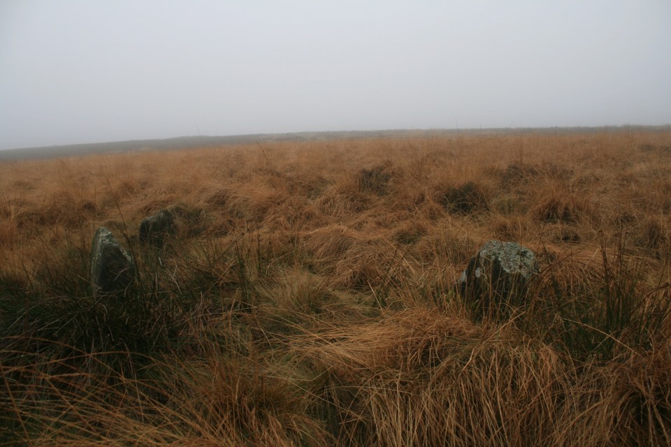
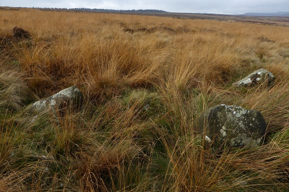
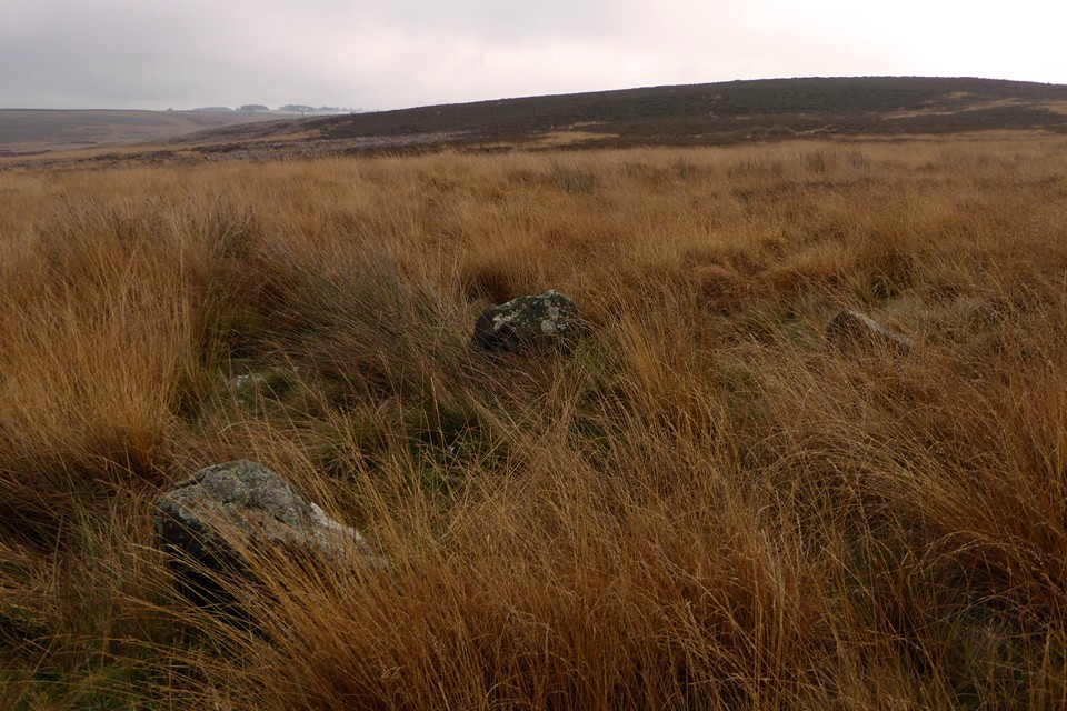
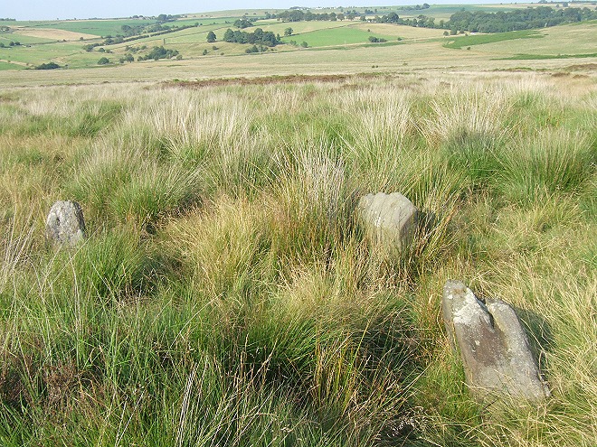
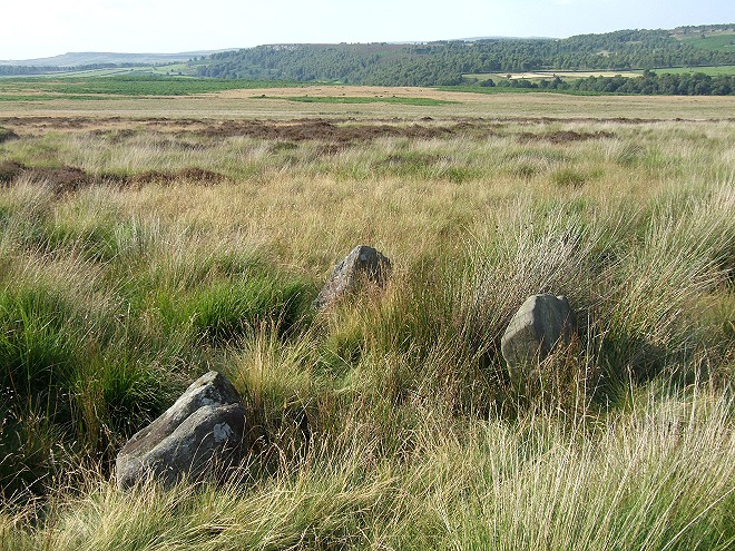
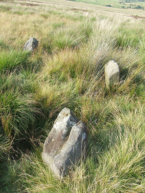
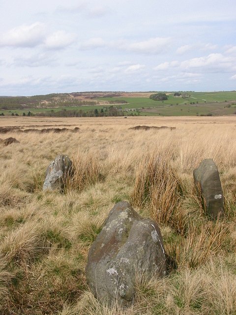
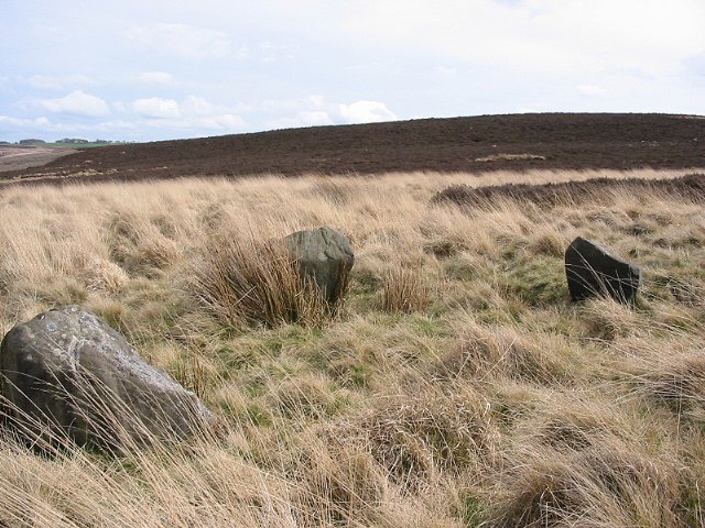
Gibbet Moor is access land, and we make our way uphill, along a sturdy track running southwest from where the road crosses Umberley Brook. TMA shows all sorts of sites up here, but I only have eyes for the stone circle, three stones remaining of what might be a rare non-Scottish example of a “four poster”. I know the circle is somewhere about 500m to the southeast of the point where the track meets a drystone wall. From here the tussocky, reedy grass and patches of heather look decidedly unappealing and lacking in paths, but this is where we need to go. Setting off into the slight unknown, the vegetation isn’t as bad as it looked, low enough to step through without snagging ankles and feet. But it is wet, and within 20 yards of leaving the track my feet are soaked in my old boots. Nice. We wander around the gently sloping hillside looking for small stones in every reed clump and heather swell. There are plenty of stones, little stones, bigger stones, outcrops and individual rocks. But nothing resembling three stones of a circle. At one point I head towards an odd looking line of upright pallets, but nothing leaps out from the grasses. We’ve been going around in circles for about 40 minutes before I finally decide to look properly at the photos on TMA. The first couple are by Stubob, one showing the recognisable dark swell of East Moor, the next looking north across the valley towards a distinctive clump of trees on the opposite hillside. The conditions are different to our dull grey skies and distant snow, but the landmarks are unchanged. Getting to a position where both photos match the view from where we are involves heading into a particularly soggy patch of reedy grass, close to one of the pallets I noticed earlier. And suddenly, there they are: three stones, unmistakeably slim and upright, their heads barely poking above grasses. Without Stu’s photos we’d probably still be there now, so much gratitude is due to the Peaks pioneer. The lengthening grasses are threatening to drag the stones under, appearing quite a bit taller than in the previous photos. But despite the soggy setting and the even soggier feet, despite the small size of the stones and the absence of a fourth stone, I really like this site. Perhaps it’s partly the sense of relief and satisfaction at actually finding the circle, but it has a lot of charm. The views to the northwest and north are fine, across the valley and out to the distant edges. At this time of year the reedy grasses are a lovely shade of orange, which sadly the recalcitrant sun fails to properly light while we’re here. The stones are well chosen, shapely and lightly tapering. Whether this ever was a four stone circle, or just a three stone setting, I guess we’ll never know. But it’s well worth a visit, just wear something waterproof on your feet. This post appears as part of the weblog entry Raving on the Moors Part I – Gibbet Moor 9 November 2016
|
 Posted by thesweetcheat
23rd November 2016ce Edited 23rd November 2016ce |
| A lovely little site set on a gentle northeast slope that leads down to Umberley Brook, there's a real sense of seclusion and isolation about these stones probably enhanced by the trek across the moor to reach them. All three are just over half a metre tall, about a couple of metres apart and with the axis of presumed square being northnortheast - southsouthwest, assuming of course there was ever a fourth stone. |
 Posted by Chris Collyer
4th August 2008ce |
|
Three lovely stones in a really remote location - it must have been great to rediscover them! GPS reading SK 28250 70868. The best directions I can suggest are to start at the wall junction at SK 2783 7072 and walk in a straight line towards the very obvious mast on Puddingpie Hill - in dry conditions in February it took me 500 paces until the stones suddenly appeared in a grassy/reedy area just beyond a small patch of heather. |
 Posted by Idwal
19th May 2007ce |
| Discovered in 1985 after the moors had been burnt back, these 3 standing stones are thought to be the remains of a 4 poster although no trace of a 4th stone has been found. Well hidden in the grass and heather. |
22nd April 2002ce |