|
|

|
|
Worsthorne HillStone Circle
|
||||||||||||||||||||||||
|
|
|
Images (click to view fullsize) |
|

|
Fieldnotes |
|
|
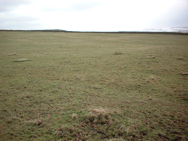
The trouble with tractors is that they move! The blue tractor (roller) is still there, but there was no sign today of a beige one. Following the track north, take the left fork when it bifurcates, and follow it for about 20 yards into the landfill area. Leave the track and walk over to the left, in the direction of the farmhouse - you'll find the stones quite easily. It's a small, but charming site. (I don't agree at all that it's a sorry site. Yes it is next to a landfill. Just look the other way - it's lovely.) I wonder whether the summit of Pendle Hill has some importance here - signalling sunset at the summer solstice perhaps?? |
25th March 2008ce Edited 26th March 2008ce |
|
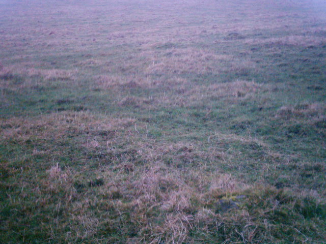
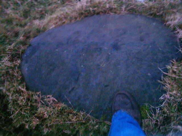
A very sorry site this at the edge of a landfill, with a quietly sad ambience about it, 2 large fallen kerbstones are visible at first glance. On closer inspection and with a little kicking of the turf 3 more smaller stones are revealed. I cant believe a landfill was authorised here, this area is so rich in history I say a few words and apologise and move on to my next site. The ringstones This post appears as part of the weblog entry One man and his Sausage Dog
|
 Posted by treehugger-uk
26th March 2004ce Edited 26th March 2004ce |
| Visited this site again on 2nd January a little more prepared and with a touch better local knowledge. There are two structures in the immediate area, one being Worsthorne Stone Circle (although it feels like a ring cairn to me). The second structure is the Ringstones in the next field on the same footpath. I also mentioned an enclosed circular area in my last field notes, which turned out to be modern. The landowner had made it to fly model aeroplanes in! Back to the circle itself though there are definately two clearly recognisable kerb shaped stones that have been toppled, but a little kicking back of the scrub revealed another three stones making five in all. Not much left to see really but this area is rich in history its well worth combining this site with a trip to Hameldon Pasture, the Ringstones or Delf Hill. |
Posted by treehugger-uk 4th January 2004ce Edited 3rd February 2004ce |
|
In the field so aptly described by Treehugger there are two areas that attracted my interest before finding what was actually the circle. Firstly a raised circular area, about 25 foot across right at the apex of two streams. This is not anything significant as it is on top of a area of landfill. But further to the north in the same field, next to the path is a circular banked area which looks quite interesting. I found the actual circle after reurning from the other sites in the area. There are three low stones (9 inches), two clearly visible whilst close and one covered in moss. According to another site there remains two other stones hidden and the stumps of a stone row. I will take another look. Fantastic views. Dave 25th November 2003 |
 Posted by daveyravey
26th November 2003ce Edited 26th November 2003ce |
|
I first visited this site in February of this year, but heard about more circles within a few hundred yards of this so decided to come back but the grass was so much longer this time. There are apparently three circles in this area and all of them very hard to find. I did find one though and I believe this to be the remains of Worsthorne Hill Stone Circle. There is another stone circle on the O.S. map (apparently next to it) that I could not find, although there was a fenced off area circular in shape and mowed in the first field to the left of the footpath (any ideas guys?). Crossing into the 2nd field looked more promising a series of banks and ditches appeared although on further inspection this turned out to be the remains of an old rubbish tip, complete with two ruined tractors (lovely!). Worsthorne Stone Circle is in this field, but it's hard to see when the grass is long because the stones are very low. Anyway I've posted photos of the circular enclosure and the remains of Worsthorne take a look and see what you think. DIRECTIONS Taking the road east through the village of Worsthome (TIP: if you go to the first pub on your right don't make a comment to the barmaid about how quiet the pub is!). The church is on your left hand side of the road. Take the left turn just before the church and follow the road down (it turns into a track). Go down the track a little, brown edge farm is on your right here. Park just after the farm. There is a gate with a stile next to it on your left - this is the first field with the circular ring in it. As I mentioned, this could be nothing, but it's a good indication that your in the right field. Follow the path into the next field and there's a blue ruined tractor/roller by the side of the path and also a ruined beige coloured one. Make a line from the blue to the beige tractor and keep going. In the field and you will see the remains of Worsthorne Stone Circle. Happy hunting! |
Posted by treehugger-uk 17th September 2003ce Edited 17th September 2003ce |