|
|

|
|
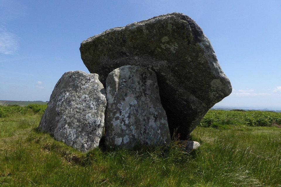
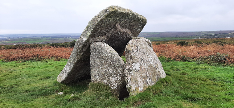
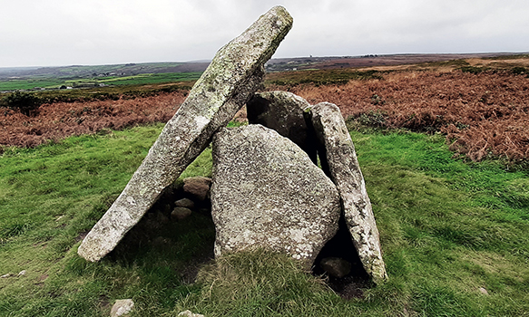
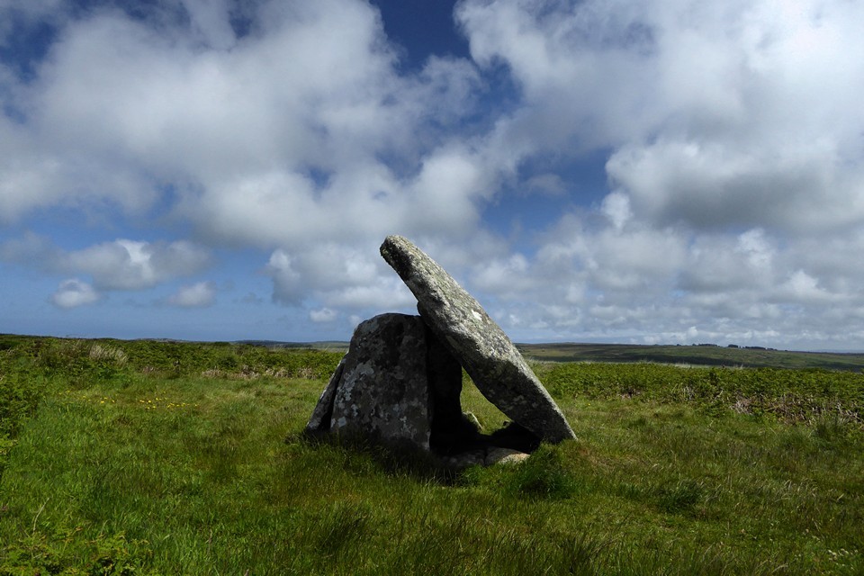
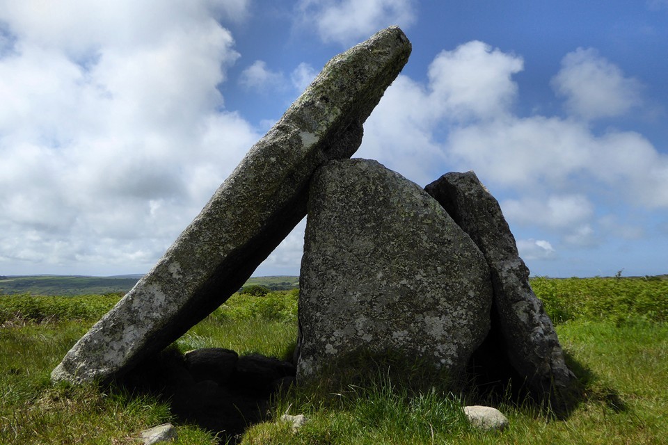
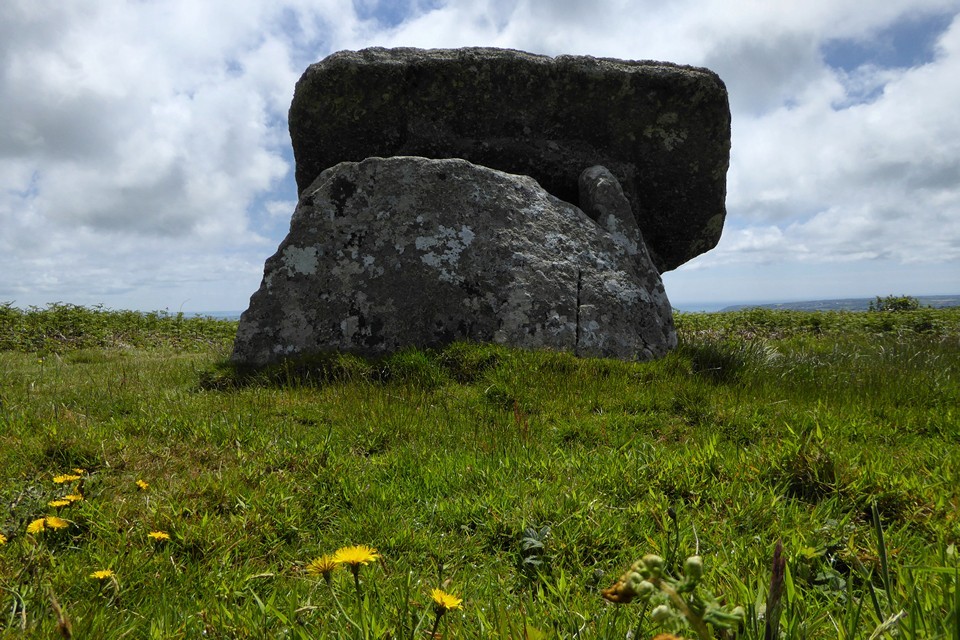
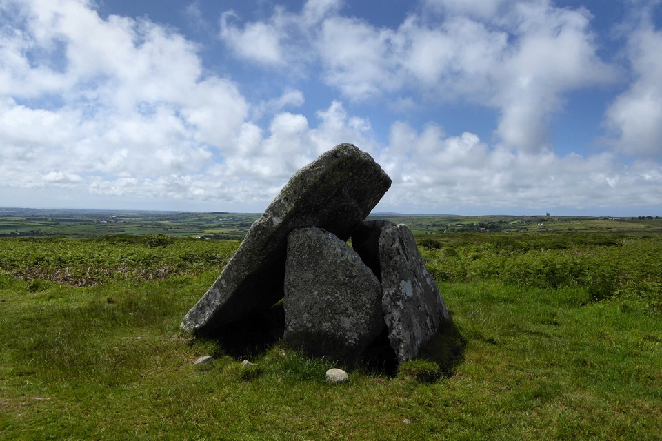
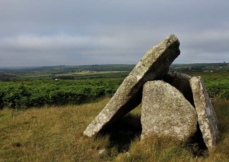
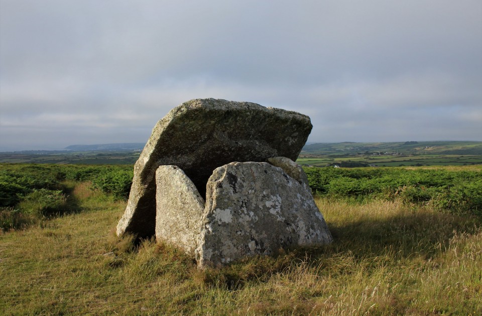
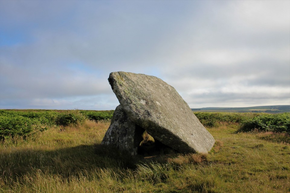
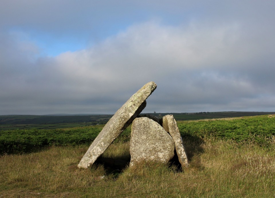
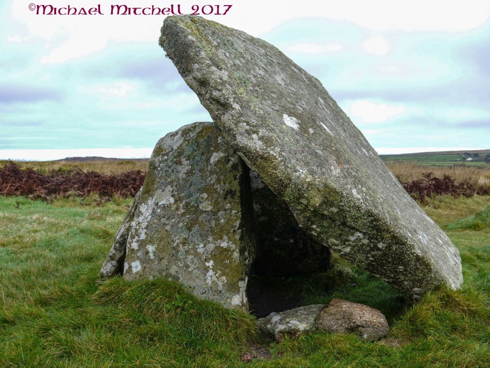
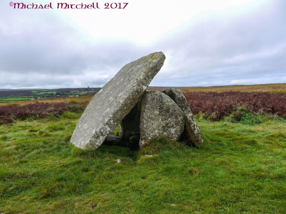
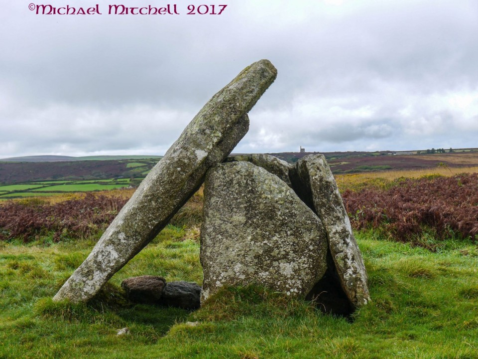
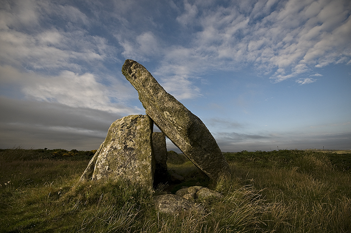
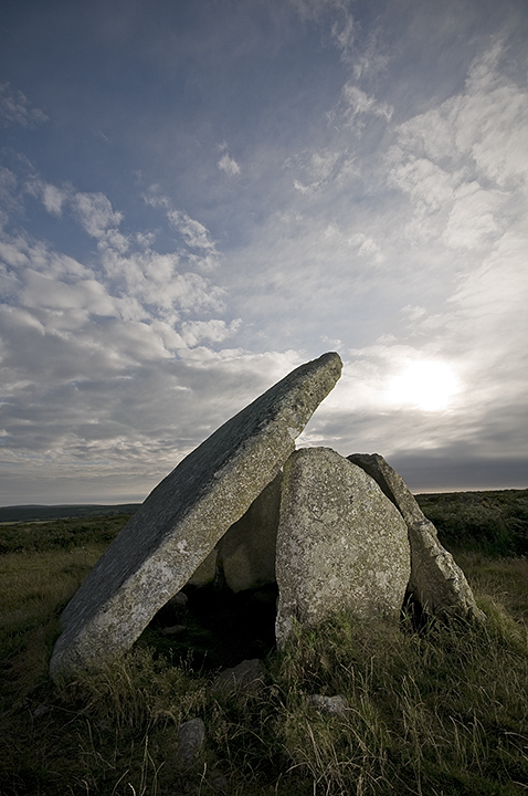
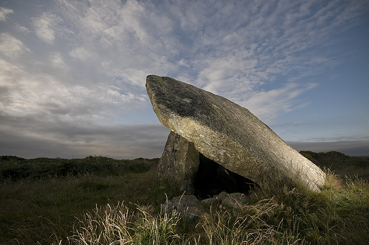
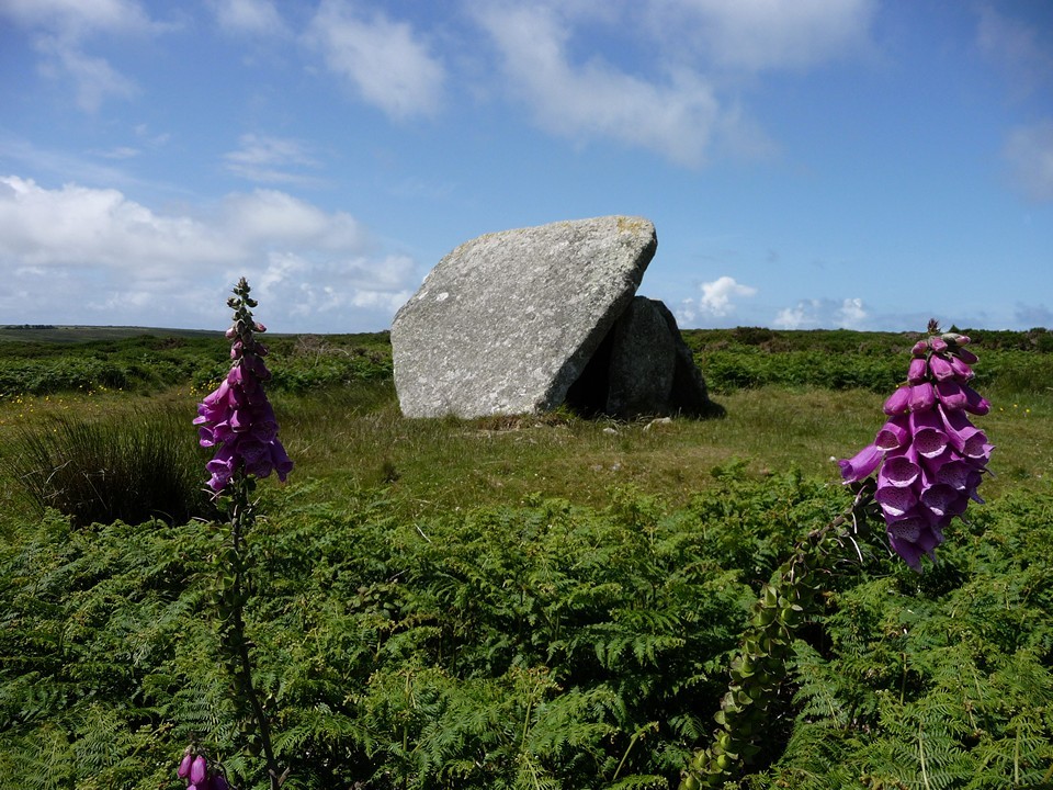
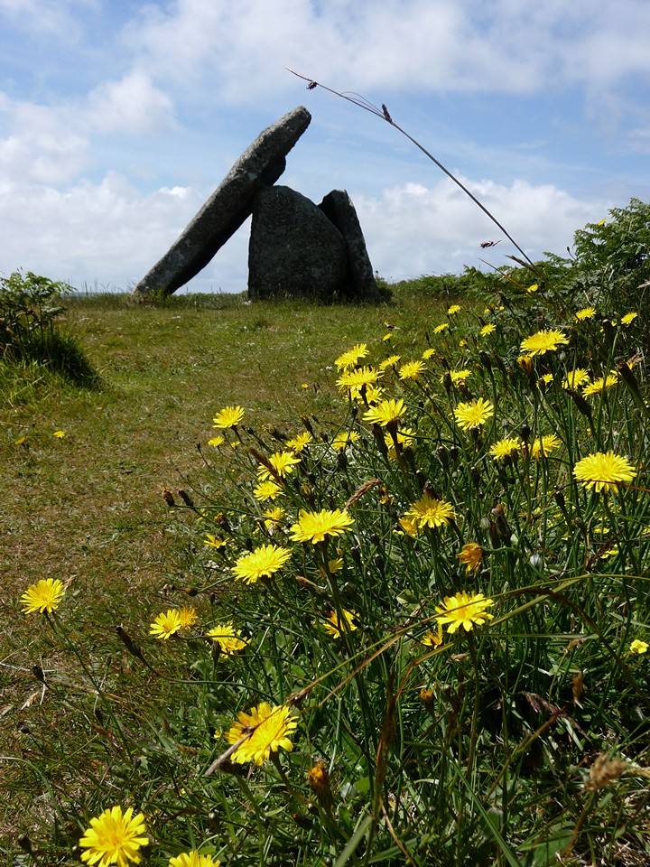
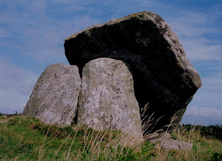
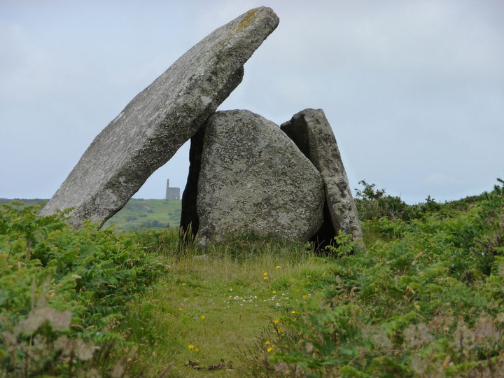
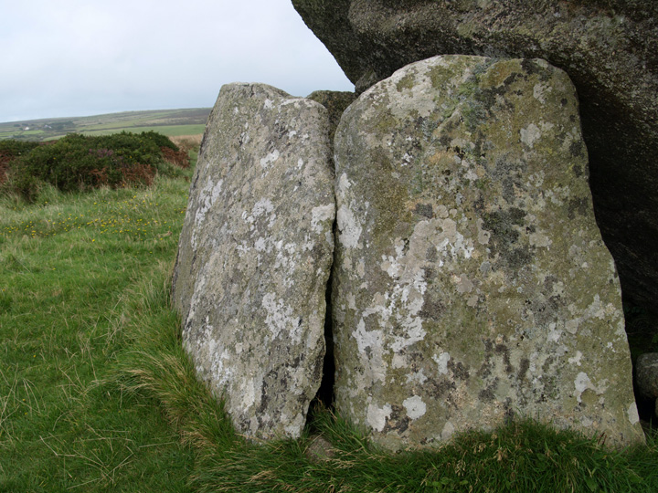
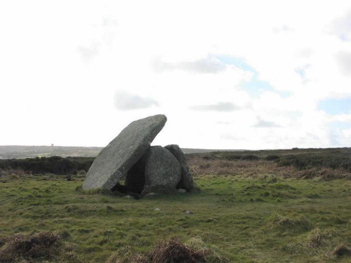
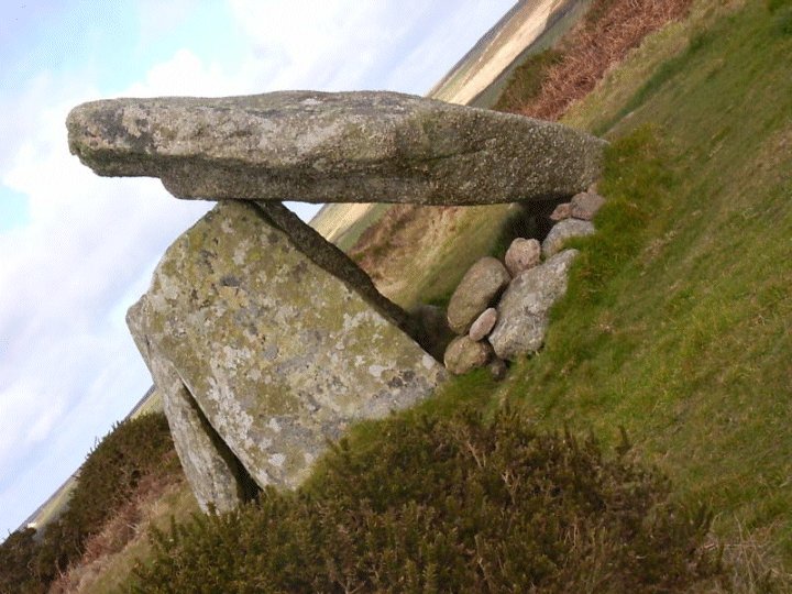
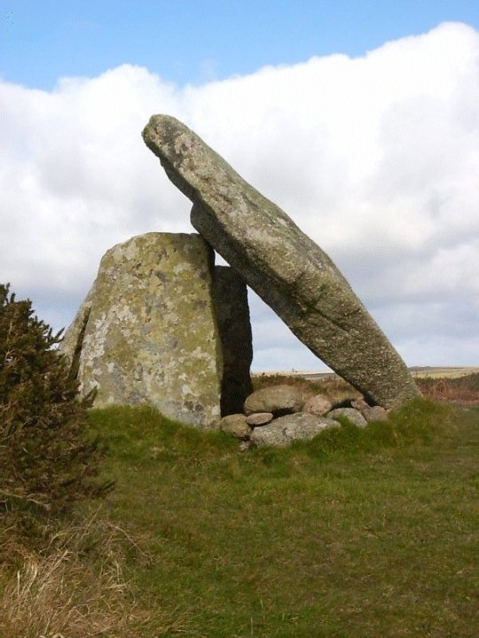
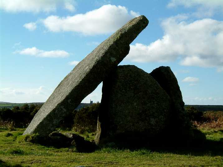
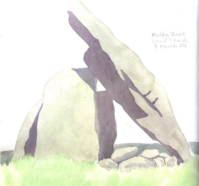
Mulfra QuoitDolmen / Quoit / Cromlech
|
|
|
|
News |
|
|
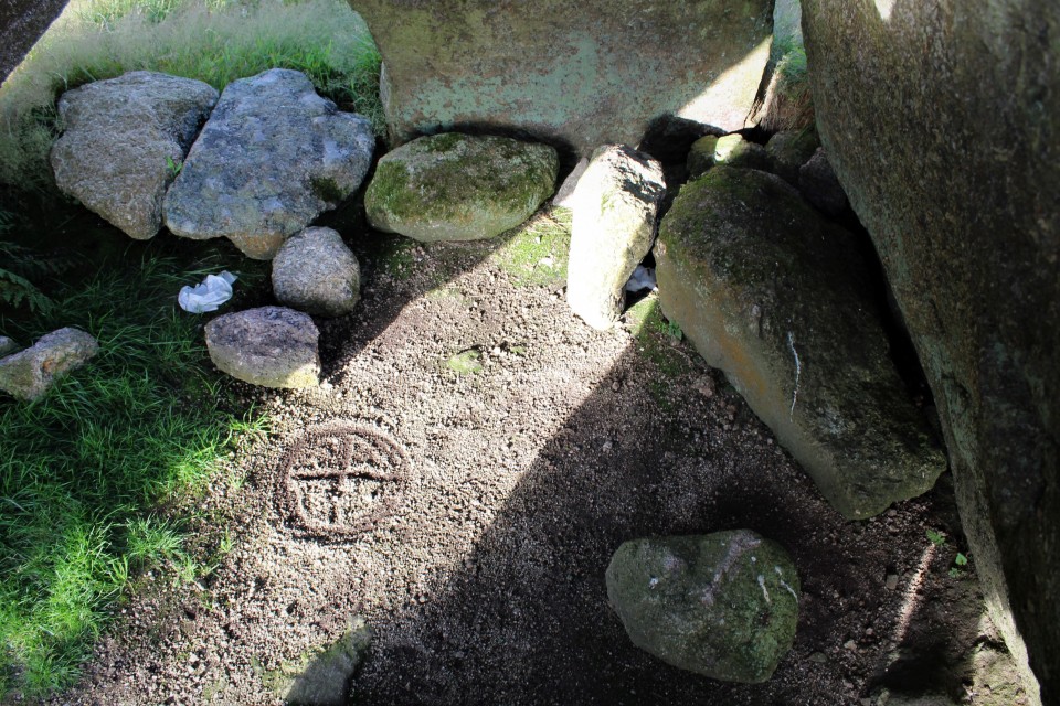
Mulfra Quoit vandalised with painting of aliens https://www.cornwalllive.com/news/cornwall-news/gallery/anger-aliens-appear-ancient-site-3717447.amp |
 Posted by thesweetcheat
10th January 2020ce |
Images (click to view fullsize) |
|
Photographs: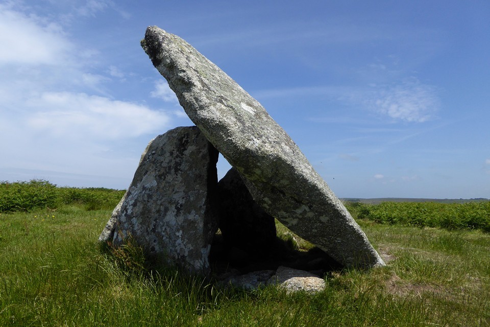

 Artistic / Interpretive:
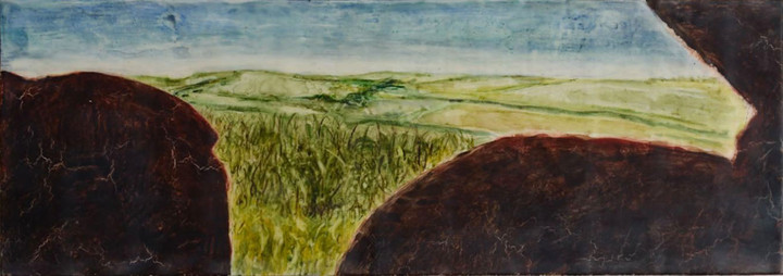
|
Fieldnotes |
|
|
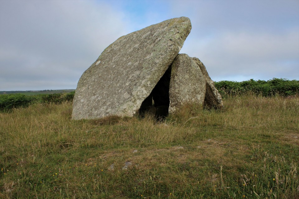
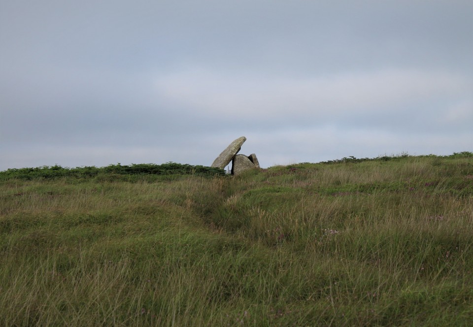
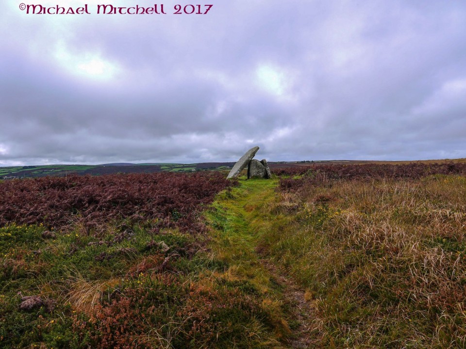
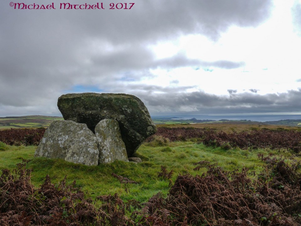
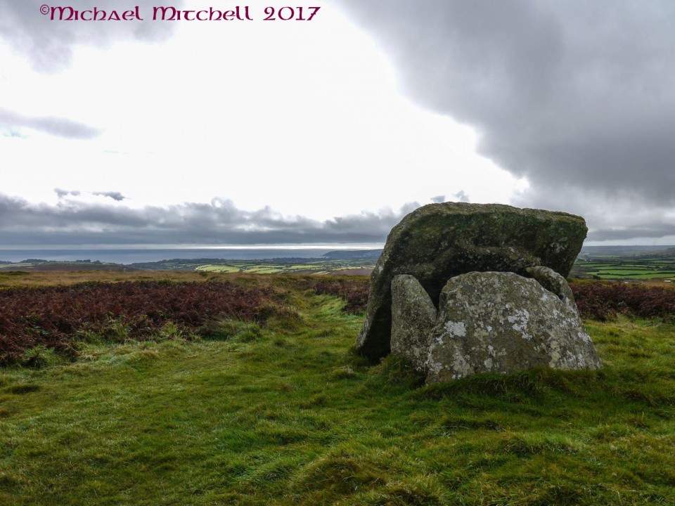
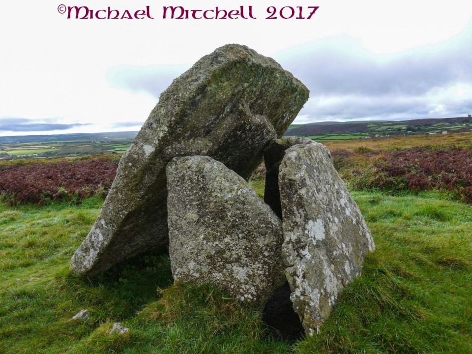
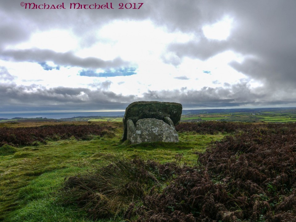
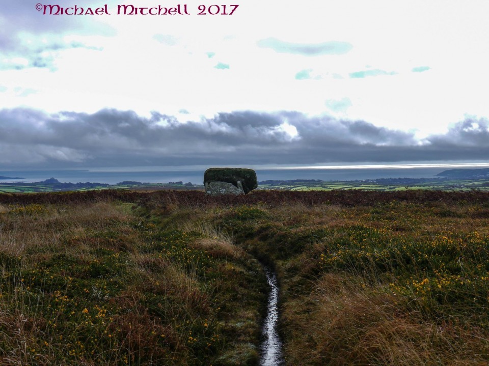
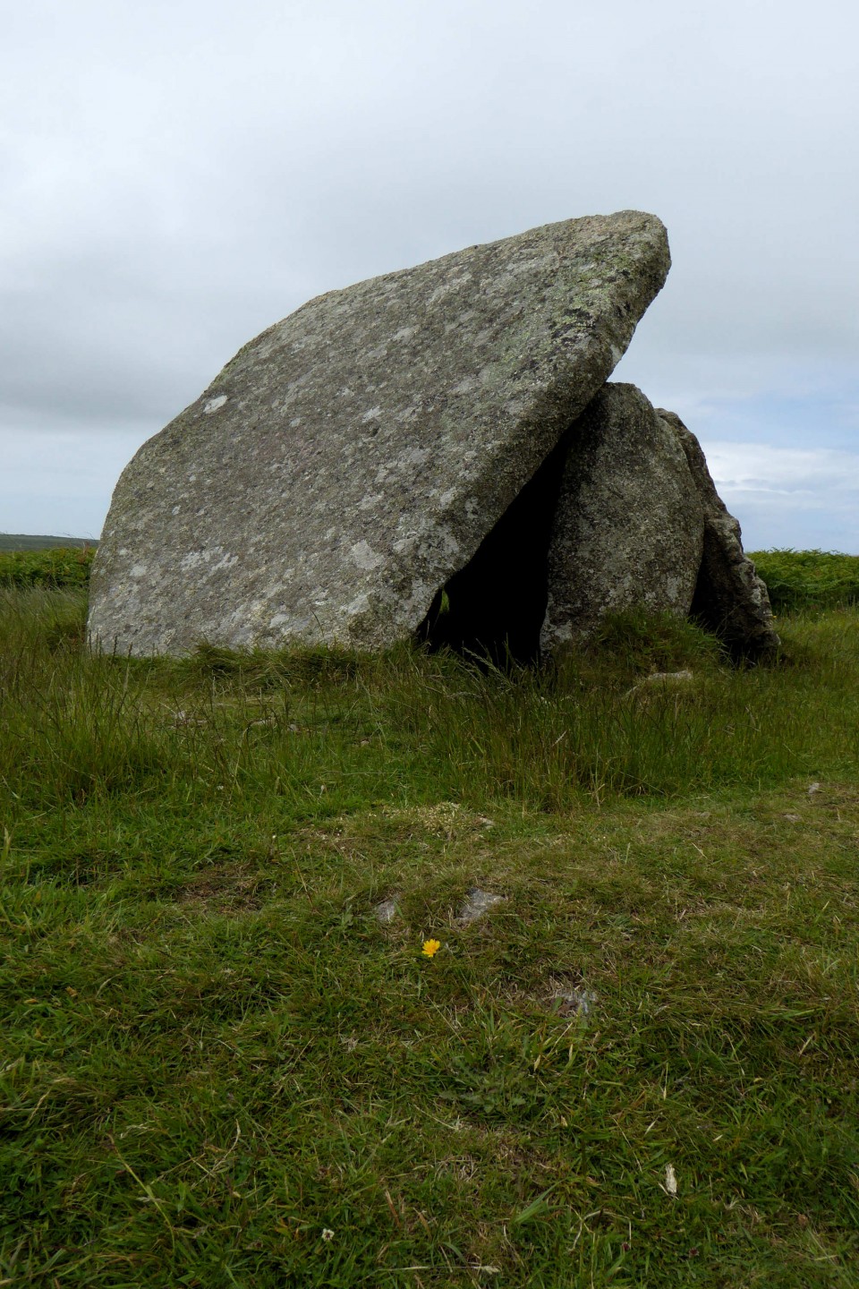
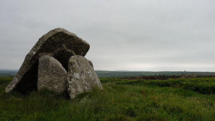
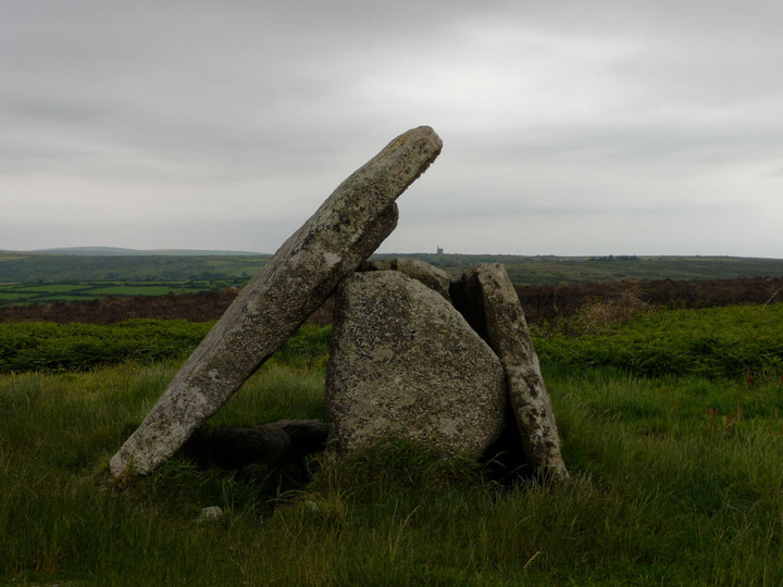
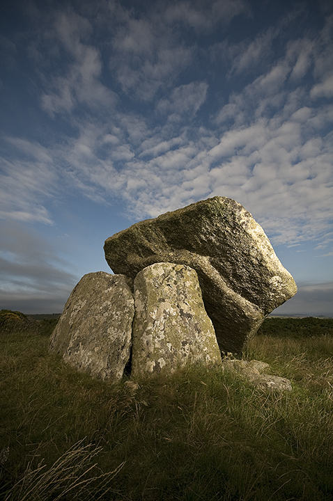
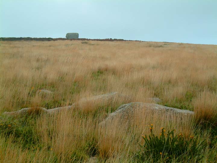
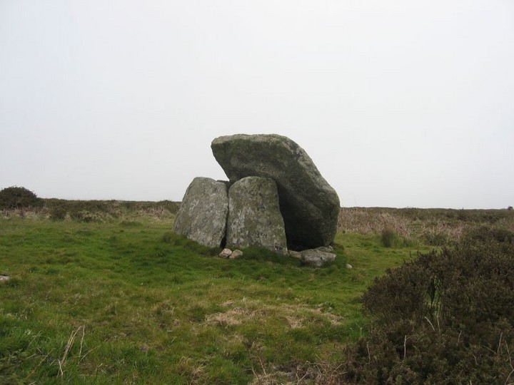
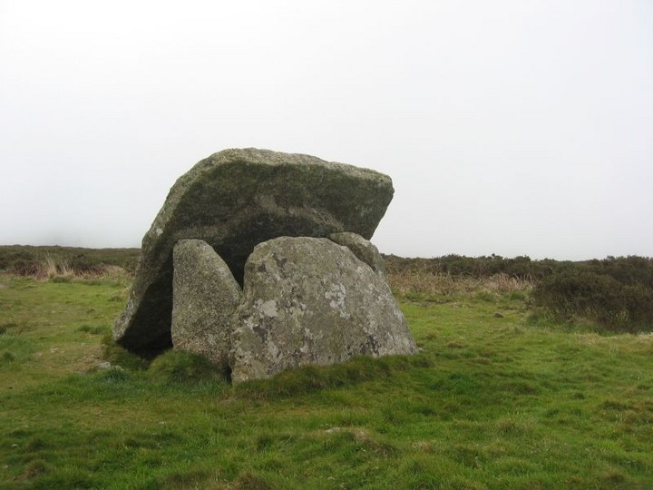
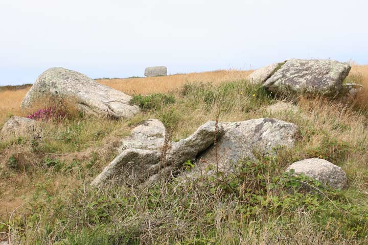
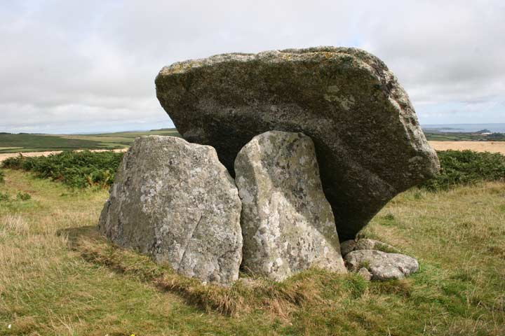
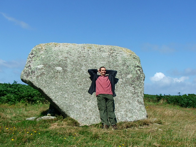
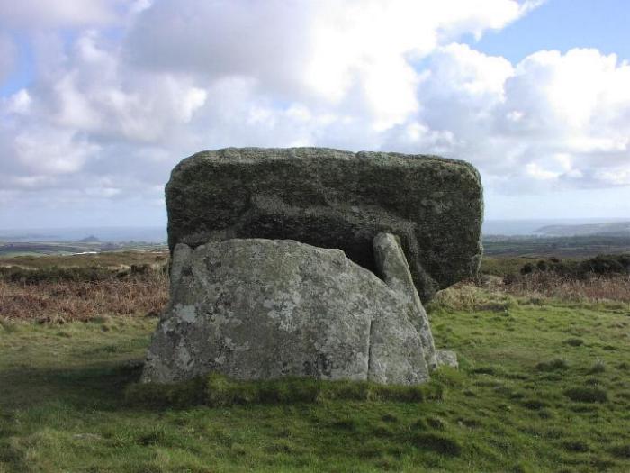
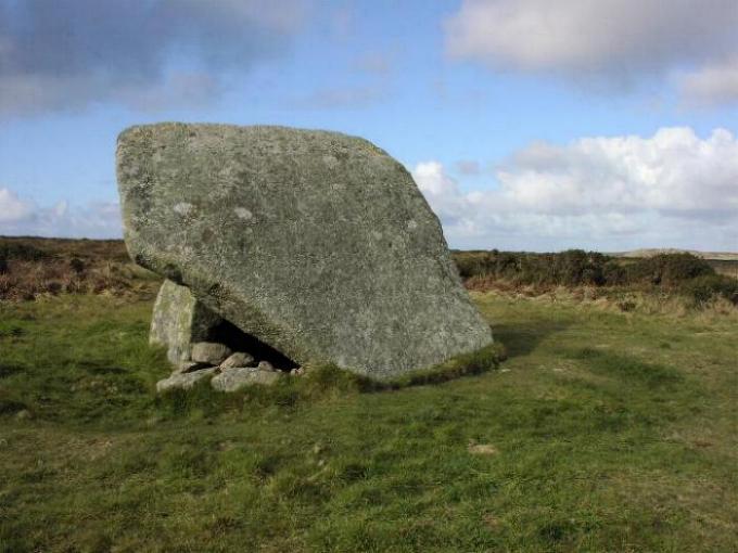
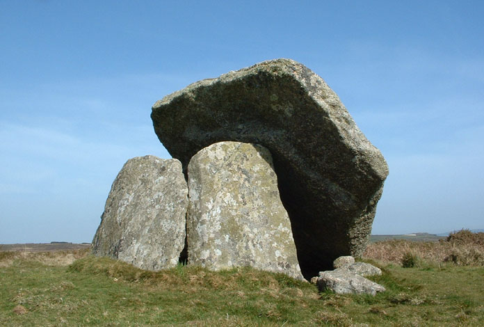
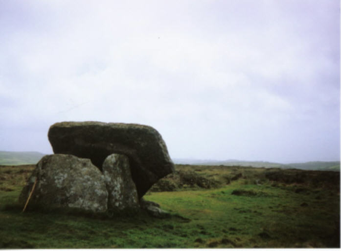
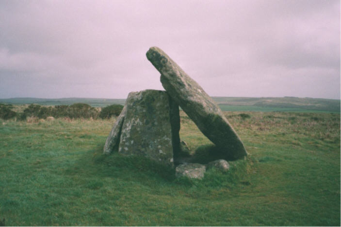
The footpath heads on up to the top of Mulfra Hill. You can't really miss the quoit, because it's right in front of you! The slipped capstone faces me on this approach. By now the sun is at its midday and indeed midsummer peak. Obligatory photos taken, I set my back against the capstone and eat the biggest vegetable pasty I've ever had. Yum! What a spot it is, with excellent views over Mount's Bay to the south, taking in St Michael's Mount. Castle-an-Dinas is prominent to the east. Over to the west the Nine Maidens ridge and Ding Dong engine house are clearly visible. Perfect. This post appears as part of the weblog entry A Crack In The Clouds (3) – Carfury to Gurnard's Head 23 June 2011
|
Posted by thesweetcheat 17th July 2011ce Edited 17th July 2011ce |
|
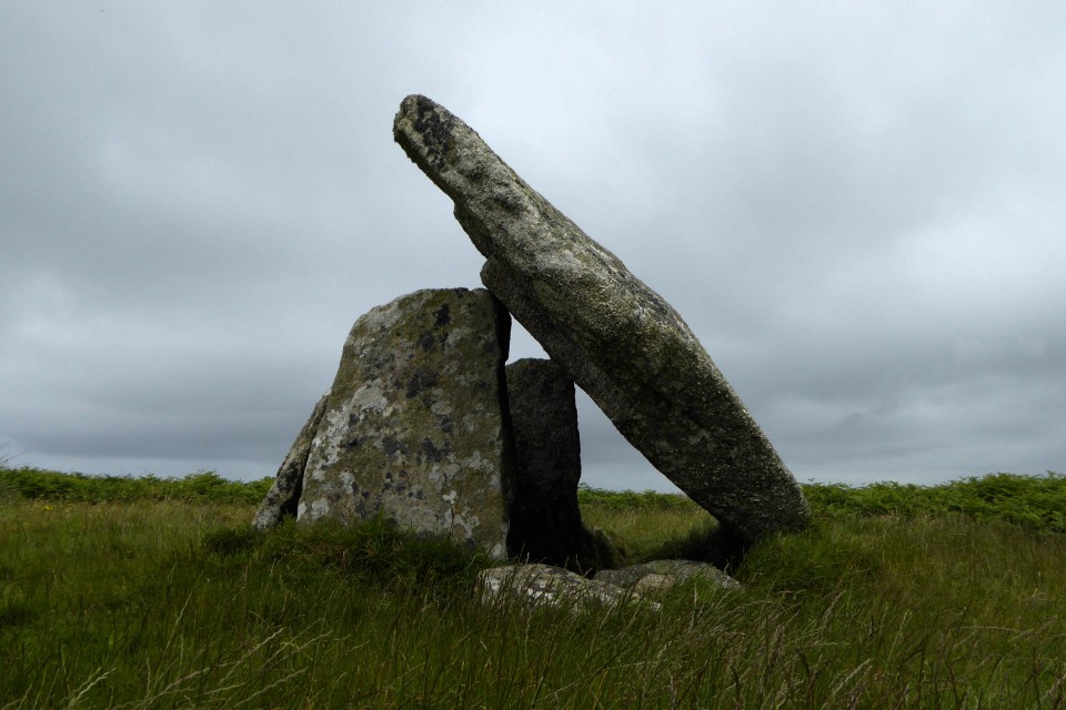
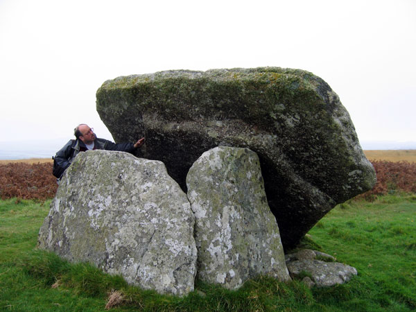
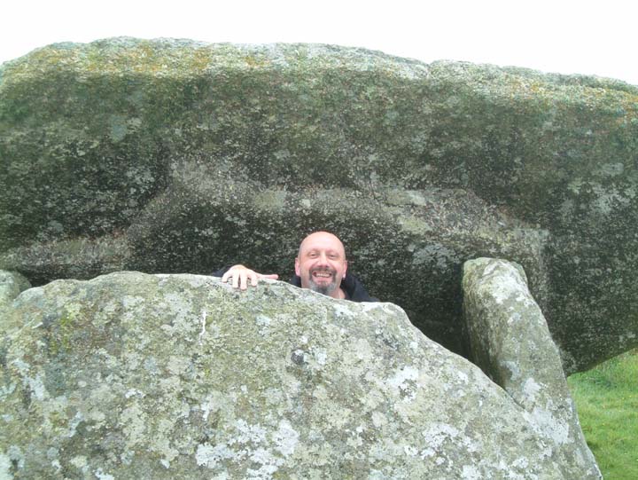
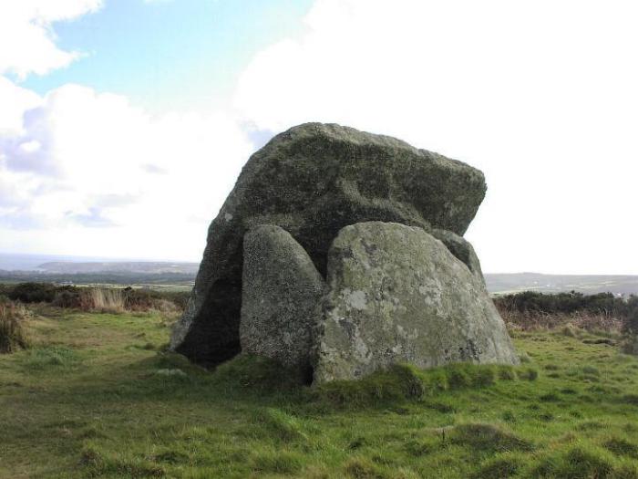
Visited 13.4.10. Park by farm house (small layby opposite house) and take the footpath straight up the hill. There have been 'steps' cut into the path, making the steep climb that bit easier. At this time of year the bracken and dreaded gorse wasn't too bad. The quoit only becomes visible as you approach the brow of the hill. The walk up the hill only takes about 10 minutes. The quoit is easy to get into (out of the wind!) and the slanting cap stone is very similar to Zennor quoit. There are good views to be had in all directions. |
Posted by CARL 22nd April 2010ce |
|
Whilst doing fieldwork for A-level courswork I pursuaded the family to drive me around Penwith so I could measure and photograph what my younger sister termed as "a pile of old rocks!". As it was our first visit to Mulfra, we firstly drove past the footpath, pulled over next to Try Farm, checked the map, turned around and parked in a layby just behind us. From there we followed a footpath up the hill, as it looked to be going the wrong way we turned off, and followed what turned out to be an animal track, that soon disapeared. Freezing cold wind didn't discourage us and we plouged on, shins scratched and bleeding by low lying gorse, we arrived on top of the hill to the fantastic site of Mulfra Quoit! The qouit itself is fantastic, big enough to squeeze inside for a moments rest and to open the flask of tea! The views in all directions are fantastic, and many photo's were taken. When hands and face was numb, we followed a clearer path back down to the car, was steeper going but much quicker. |
 Posted by Mirla
8th April 2008ce Edited 12th April 2008ce |
|
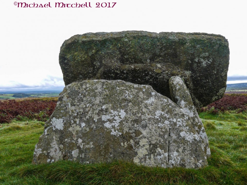
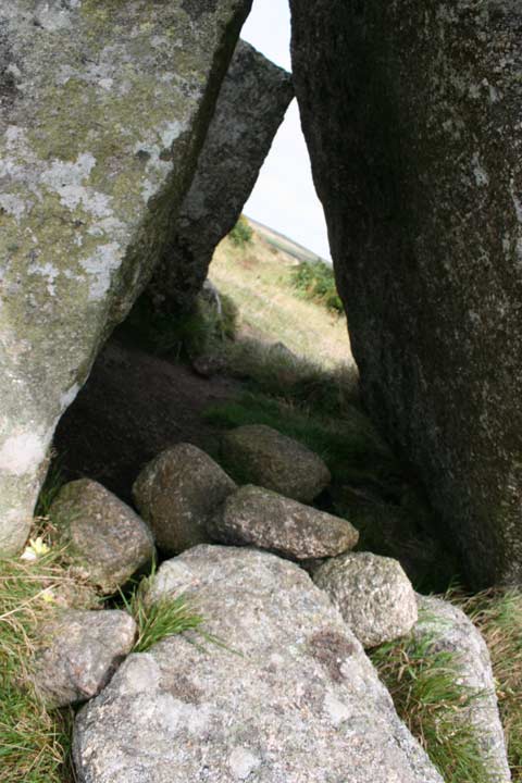
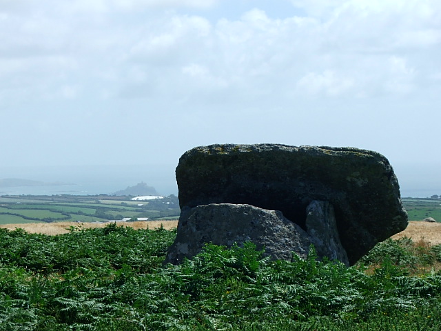
On holiday in Penwith last week, I'd agreed to meet Mr Hamhead for lunch in the Tinners Arms as he was also in the area. Suitable refreshed after a pint and a meal, we set off for our agreed target, Mulfra Quoit. I'd last visited the quoit some 3 years ago, and took the steep approach from Try Farm on that occasion. Today though, we took the much easier (but longer) approach from the north. After a couple of comedy pictures, we discussed the apparent moulding on the underside of the capstone, whether the quoit was ever 'whole', and the alignments with Chysauster and Castle an Dinas (and the time difference between the ages of the sites). Some of the gorse had been burnt off near the quoit, and investigation to the south uncovered some old field boundary walls, and a possible hut circle. As the weather was closing in from the south, we made our way back to the car, and the heavens opened as if to say "Get orff my hill!". We got. |
18th October 2006ce |
| We parked by a house in the Try valley to the east, in a one car grassy layby .Walk north to the footpath and climb the hill it was quite easy even the children didn't ask to be carried.Upon reaching the dolmen you cant look at it too long because the view is too demanding of your attention .Being up here you just know the view was important to the ancient's whether for beauties sake or as a territorial marker, either way we benifit |
 Posted by postman
4th August 2006ce |
|
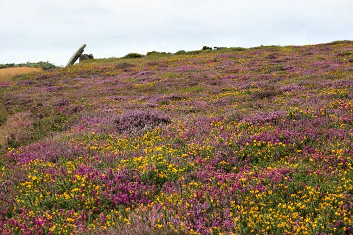
If you want views, then Mulfra's the place for you. From up here you can see St Michaels Mount, Ding Dong mine, Penzance, the hanging gardens of Babylon... Knowing my reluctance to walk distances, we chose the shortest route for us to reach it, up an incredibly steep slope, wading through the gorse and heather on something which could only loosely be called a path. But it IS worth the agro. This place is magic. The light was good on the crazy slanting capstone and I sketched as quickly as a could, but the paint was reluctant to dry, it was so cold. This would be a fantastic place to spend hours hanging out at. Come when its warm! |
 Posted by Jane
24th March 2004ce |
|
With the weather forecasters telling us that the whole country was to be in the grip of an Ice Age by mid week I headed for subtropical St Ives. My partner had a two day conference to go to so I thought I would join her and get in some walking at the same time. Tuesday 27th Jan 2004 Drove out of St Ives a couple of miles to the hamlet of Towednack. In the porch of the church on the right is a recumbent stone that according to Ian Cooke's guide to the Tinners Way came from Crete in 2000-1500BC.{{1,2,22}} Left the church and took the footpath heading west to Beagletodn. Just after the house a gate on the right (padlocked) has to be climbed over so a track can be followed. You will find in these two walks that I have not stuck to legal paths but made my own way over what is essentilly wild moorland. This is possible in mid January as the bracken has died down but even so I would reccomend wearing waterproof trousers and taking a stick. The track twists its way amongst boulders and water features untill you come to a gate near the Pump House featured on the OS map. Go through the gate and turn right. You will soon find yourself walking up between two walls (not for the last time that you will be following ancient trackways). At the top of this track you come to another gate, once the other side of it it is time to head out over the moors towards Sperris Quoit. {{3,4,5}}Known as one of the most elusive sites in Cornwall I battled my way through the bracken and gorse in a north westerly direction untill I saw the pile of rocks on the skyline. Don't be mistaken by Sperris Croft, a smaller pile but nethertheless named on the OS map. Reaching the rock piles you will get great views over to the coast and also of Zennor Hill. The quoit lays just to the south of the rocks and can be distinguished by one triangular upright. Even from here it is not easy to reach and requires some scrambling amongst the stones. Keep an eye out for the ancient stone wall that runs off to the SEast, did they use stones from the quoit in its construction? Leaving the rocks walk towards the ruined mine building. Wheal Sperris was a small mine started in the early 1800's, all around this area are open shafts, water channels and various holes in the ground. If you do leave the path, beware, it's pretty uneven ground. Zennor Quoit looms on the horizon to the SWest and the path is easy to follow. {{6,7}}Once there I was undecided as to which way to go next, down to Zennor and the Tinners Arms, or onto other sites. The fact that I could see Mulfra Quoit on the horizon weighted my decision and I decided to head south along the old trackway before turning west to the Bishop's Head and Foot boundry marker. This involved trudging through along muddy paths but the sense of space and the fact that the sun was shining made up for it. On the left hand side of the road beside Kerrowe Cottage is a stone with a nice carving on it, I don't believe it tobe very old and judging by the "standing stones" opposit possibly a residents artwork. Follow the tarmaced track to the road then carry on ahead to the "main" road. Cross the road and find the path that leads up over the northern saddle of Mulfra Hill. Yet again I decided to head out cross open moor and took myself off up the side of the hill. A couple of times I thought I had stuimbled across an unknown stone circle lying hidden in the gorse but decided my imagination was playing tricks. There is so much rock up there and at times you can trace a large arc between them, but never mind. Eventually I picked up a path and found the quoit.{{10,9}} I could not have asked for a better view, the Lizard stood out clear as a bell, St Michael's Mount sat below me and the sun caught the roofs of Newlyn giving them a silver coating. Time for a cup of coffee and a rest. I suddenly realised time was getting on and I was far from the car. A footpath supposedly runs east from here down to the road but somewhere along the way I lost it and just plunged down the hillside dwarfed by boulders before reaching a forest of Rhododendrons. I had thought of visiting the Tyre Menhir but time was getting on so I headed to Tyre Farm and turned left along another muddy footpath. Reaching a large Badger holt the path carries on cross a field to a gate beside a small pond (puddle!). In the next field a new fence has been eracted and the route of the path is not clear. However what is marked on the OS map as a round wall around a shaft interested me, is it just a round wall or is it a hillfort?{{11}} I climbed over the new fence at the far end of the field having decided there was no way through the hedge and skirted the pond before finding a rusty gate hidden in the undergrowth. It was impossible to open so I climbed over, disturbing a fox in the process. Turn left along the valley and you soon come back out onto the Kerrowe track, turn right. THe simple way back from here is to follow the bridleway around the south side of Amalveor Downs to Embla Vean then by road to Towednack. I chose a slightly longer route heading more to the south but this did not include any sites of TMA interest except for a couple of tumuli sat overgrown in fields. The walk took me about 5 hours including stops and it's not just a trudge between quoits it's a walk that offers lots more, space, views, and if like me you don't meet anyone all day, solitude. 28th January 2004 Started day 2 at the carpark beside the engine houses of Carn Galver mine (on the B3306). It was here that my love affair with Penwith began. On a blustery day in Feb 1987 a friend gave me my introduction to rock climbing, if you want to get close to this landscape try hanging on to it by your fingers whilst the waves crash 200ft below you. Today I head away from the sea, up the footpath/stream that runs along the west side of Carn Galver.{{12,13}} I have been up amongst the rocks before so today I carry on to the crest of the hill untill I come to a crossroads of paths. Turning right brings me to the field in which the Maen Scryfa stands.{{14}} Sadly the sun is right behind the stone so reading the inscription is not easy and photgraphing it impossible. I am struck by the contrast between lush green fields, stone walls and barren moorland. The dead bracken has turned much of the landscape a dull brown colour, only turning gold when the sun hits it at the right angle. From the maen Scryffa it is a short walk to the men-an-tol, all is good there and after a short rest I carry on in the direction of Greenburrow Engine House (commonly known as Ding Dong). Just after passing the little stream I noticed a pile of boulders on the right hand side. Amongst these and just beside the path is a square pit. Gorse and hawthorn grow out of it and it is full of water. I plunged my stick it and found it had a bottom, not far down. Like the "Hillfort" yesterday could this be an undiscovered cairn? or is it a mining relic, I will do some research and see what i can find out. Ding Dong reached and explored (I wont bore you with mining details) I headed back towards Boskedndan circle.{{15,16}} The footpath is thin and runs through gorse and bracken but by following the wall I found my way to a cairn on the south end of the ridge. This lays buried amongst gorse, but with most of the other bracken etc dead it was possible to make out the stones that form the cairn. The ridge runs north towards Carn Galvers mighty south peak and the stone circle is soon reached. It is rather a wet area in winter and a couple of times I was glad of my stick and high sides of my boots. I missed the standing stone but did explore the tumuli at the north end of the ridge before charging out across the moor to Little Galver, the rocky luump to the east. This was hard going! I wouldn't reccomend it but I had decided I wanted to visit the quoit at Bosporthennis. After a lot of hard work I reahed the walls that surround the quoit. Wow! this is a stoney landscape but imagine how many stones were used to build these walls? Up to 4ft thick inplaces and about 5ft tall we marvel at what it took to build the monuments but think how much work went into building these. And how old are they? who knows, some say the field patterns down here date back to the bronze age.{17,18,19,20}} Having visited the quoit I head back to the road down another vague footpath before following the road back to the car. Looks like I am in time for a pint and a bowl of fish soup at the Gurnards Head{{21}}. This post appears as part of the weblog entry The Quoits of Penwith
|
30th January 2004ce |
| It is best to approach the Quoit from the west, the footpath from the cottage disappears half way up the hill. If you park at the cross roads you can see the main path, it is very rutted and in the rain is a stream, but it is the best way I have found. |
 Posted by hamish
9th February 2003ce Edited 22nd April 2003ce |
|
Just to echo Pure Joy's notes, I tried to visit the site a few years ago and could find no trace of any footpath either. As it was nearing the end of the day and I had a friend and her two kids in tow it didn't seem fair dragging them over the hillside to see 'some more old stones'. I think they had enough of stones that day to last them a lifetime. Then the same thing happened to us as PJ - we got lost on the roads too... |
 Posted by Chris Collyer
18th January 2003ce |
|
Mulfra Quoit – 27.12.2002 The Eastside of Mulfra Hill was seriously overgrown when I tried to visit. I couldn’t find the Public Footpath marked on the map (from the road, at approx 454356) that should lead up to the Quoit, nor any other path up the hill. The brambles and undergrowth were ferocious. Bummer. I’ll try again another day and maybe another path…don’t know when…..some sunny day…..(I feel a song coming on). After Mulfra I got hideously lost amongst the roads. I really feel like I’m losing my mind, going up and down the same roads. Is someone trying to tell me something? |
 Posted by pure joy
17th January 2003ce |
| I was there in May 2002. The weather was as you [Gazza] described, but the site is stunning. |
Posted by hamish 11th August 2002ce Edited 26th November 2002ce |
| Now this is one for the memory... a trek up a boggy, featureless hillside in wind and drizzle put a bit of a cloud over this visit. Just when we were getting REALLY jizzed with the whole thing, Mulfra is there. The huge capstone pointing crazily upwards, and the view ... just sit on the hill, back to the quoit and drink in the view. There is everything from prehistory to now visible here, and it's just soooooooo beautiful up there. And then the sun came out ! The lands end peninsular is just mindblowing. |
Posted by Gazza 29th December 2000ce |
Folklore |
|
|
According to 'The Giants of Cornwall' by B. C. Spooner, the stones of Mulfra are said to be quoits from a giant's game. Folklore, Vol. 76, No. 1. (Spring, 1965), pp. 16-32. |
 Posted by Rhiannon
21st November 2006ce |
Miscellaneous |
|
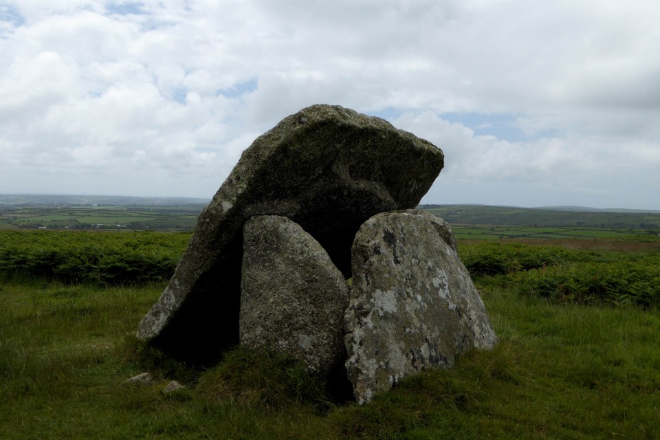
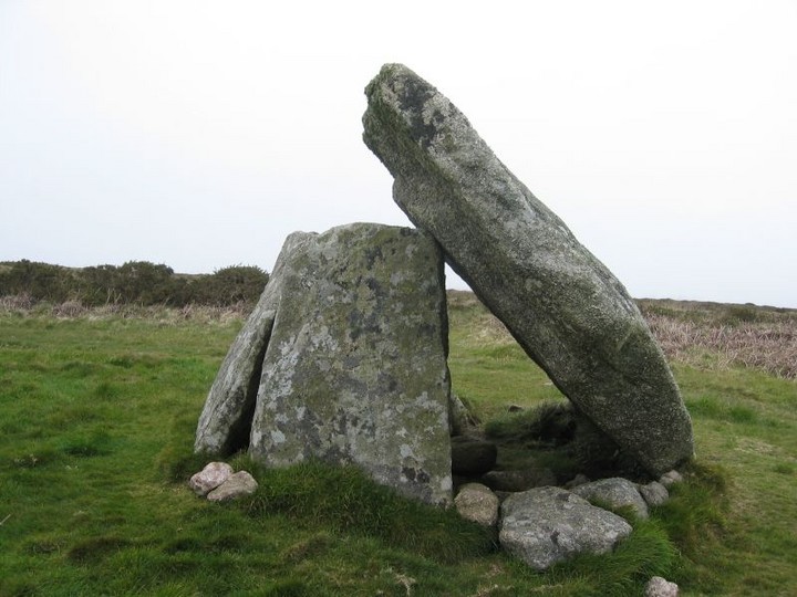
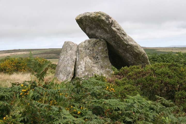
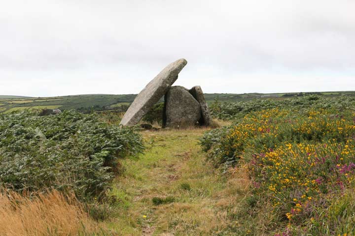
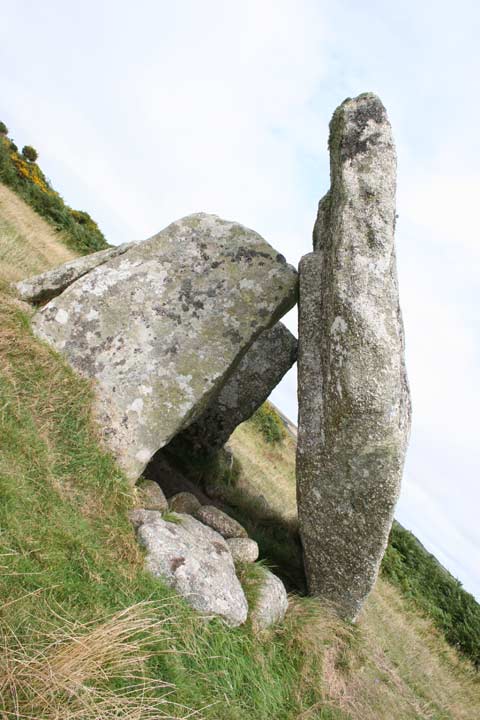
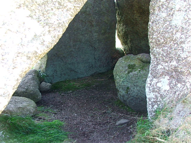
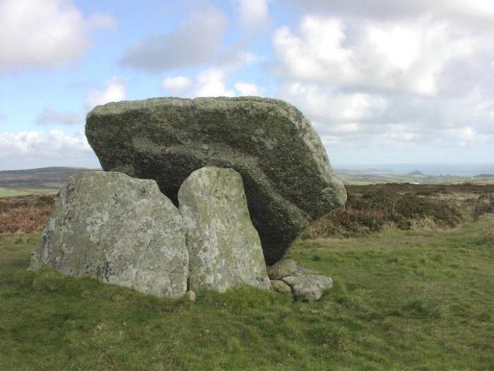
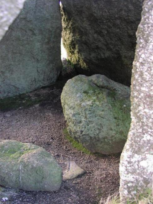
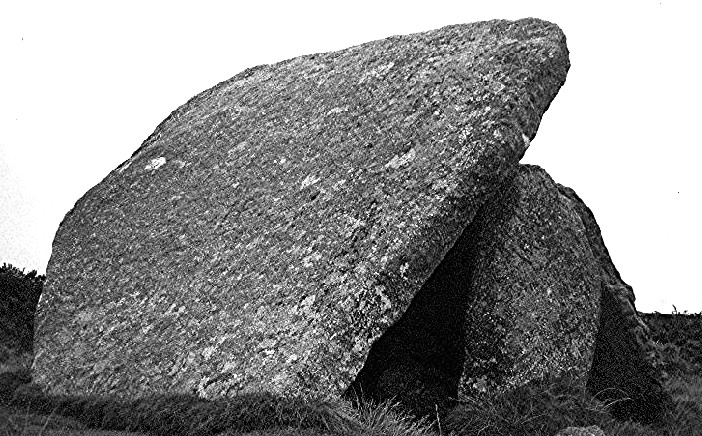
The cromlech on the top of Mulfra Hill, in Madron {although Mulfra Hill is part of Madron, it is detached from the rest of that parish by an intervening portion of Gulval}, is 3 1/2 miles north-north-west of Penzance. The cover-stone, according to Borlase, was 9 2/3 feet by 14 1/4, including a piece evidently broken off, and lying near it. Its present circumference scarcely exceeds that of Ch'un. The kist-vaen is 6 2/3 feet long, and 4 wide; the three slabs forming the two ends, and one of the sides, are about 5 feet high; the south supporter is gone, and on that side the cover stone has fallen, so as to rest on the ground at an angle of about 45 degrees.p27 of The Land's End District: Its Antiquities, Natural History, Natural Phenomena and Scenery. by Richard Edmonds. 1862. Online for perusal at Google Books. |
Posted by Rhiannon 12th March 2007ce Edited 12th March 2007ce |
| Etymology of Mulfra:- Late Cornish Moel Vrea, bare/domed hill. |
Posted by hamish 10th November 2002ce |