|
|

|
|
AchmoreStone Circle
|
|
|
|
Images (click to view fullsize) |
|
Photographs: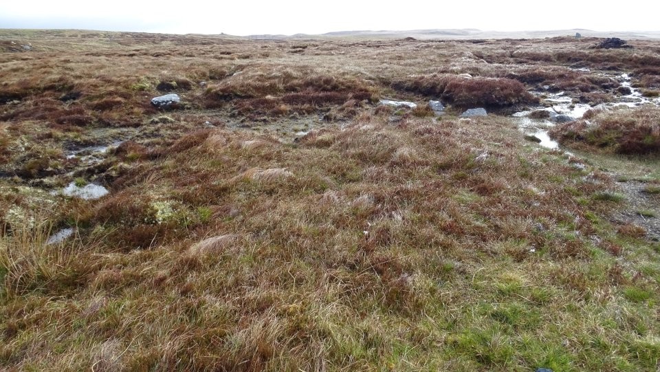


 Maps / Plans / Diagrams:
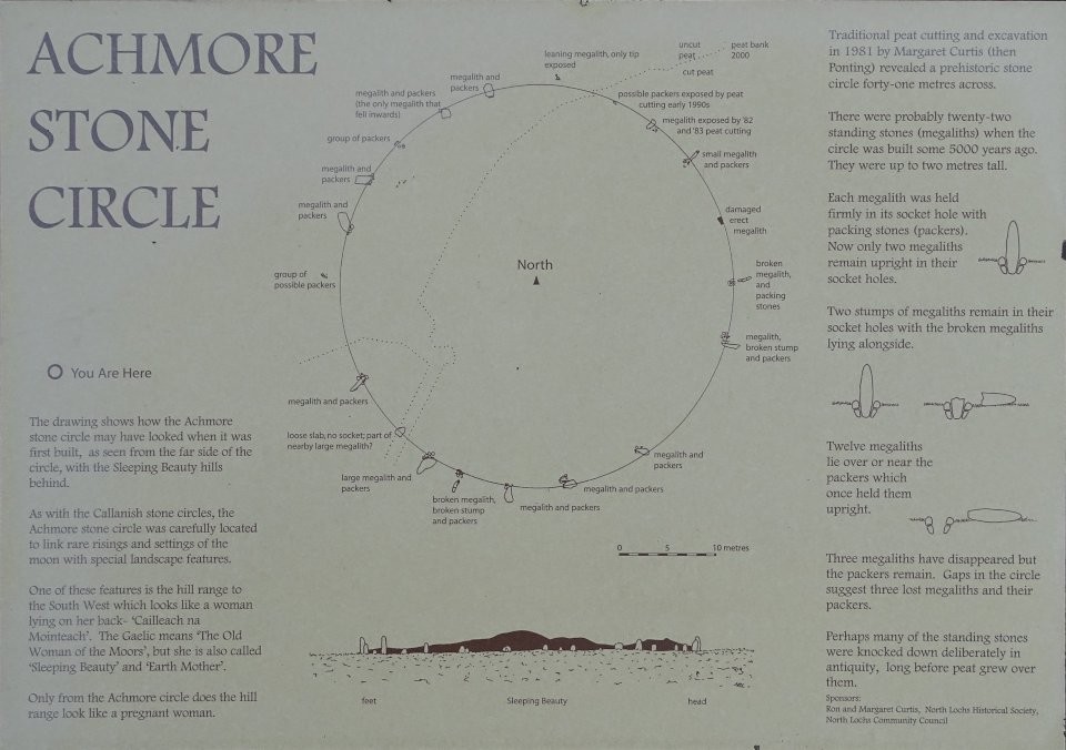
|
Fieldnotes |
|
|
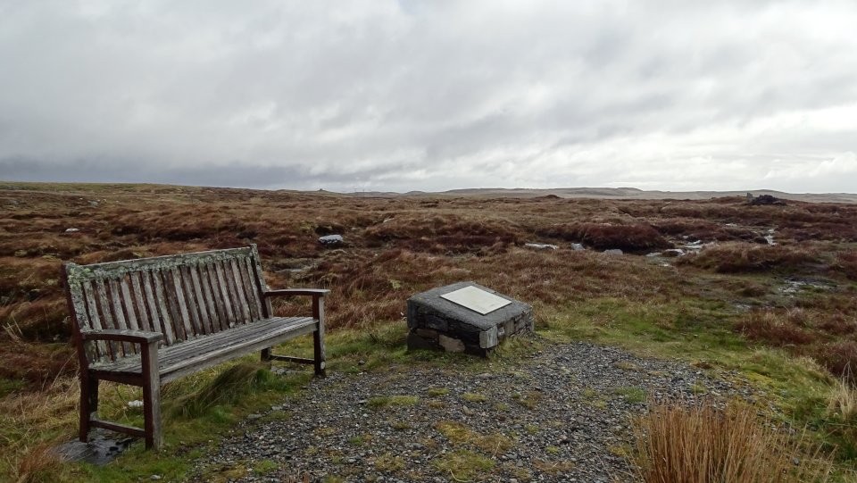
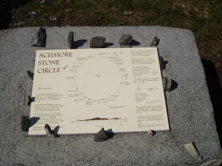
Visited today and someone had erected their own stone circle on the info board, which was a nice touch! I think this is one for the enthusiasts though. I enjoyed seeing the unexcavated site and trying to work out how it must've looked but, even on a boiling hot day, it was pretty wet and boggy, so come prepared! |
 Posted by Vicster
10th June 2006ce |
|
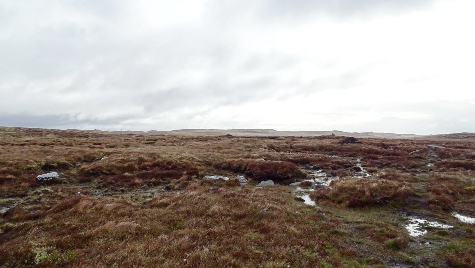
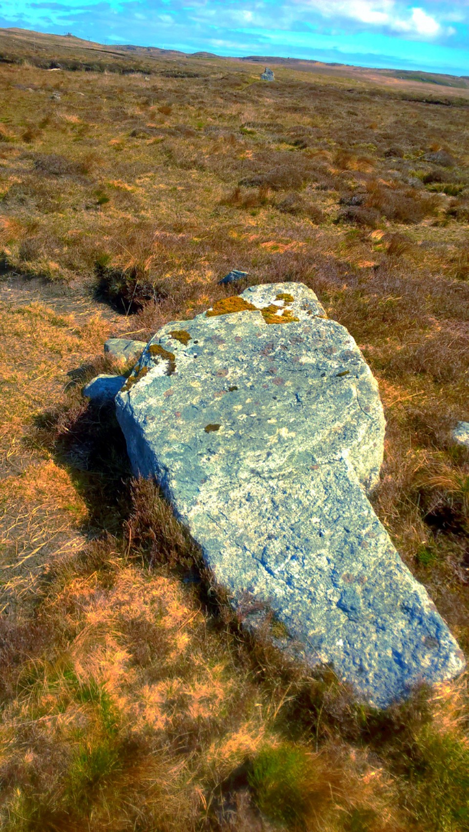
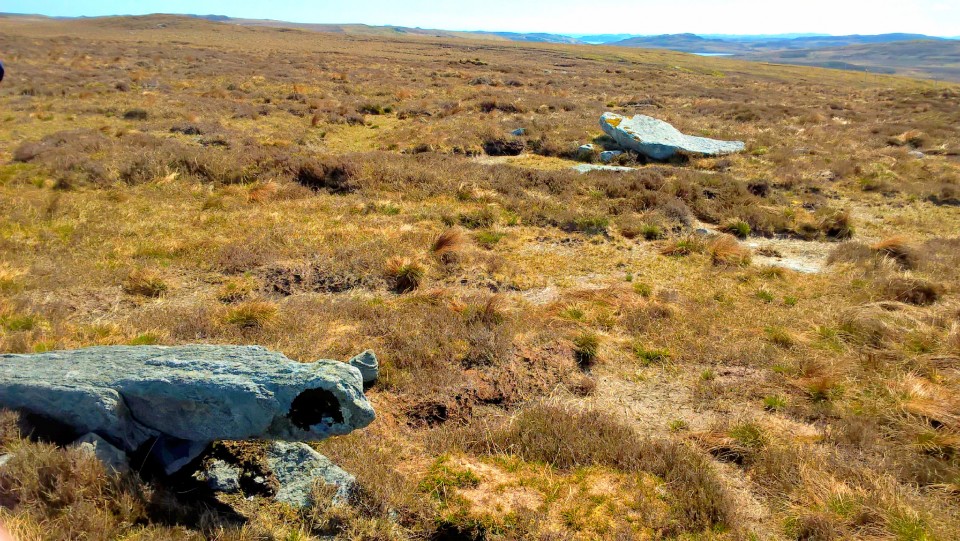
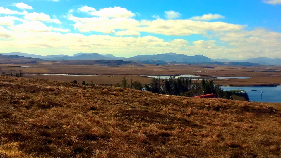
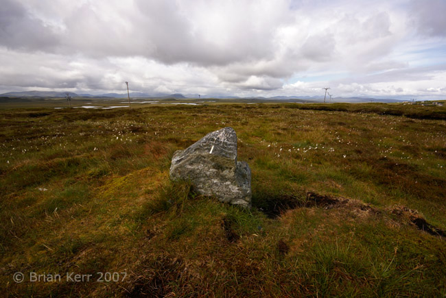
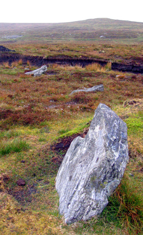
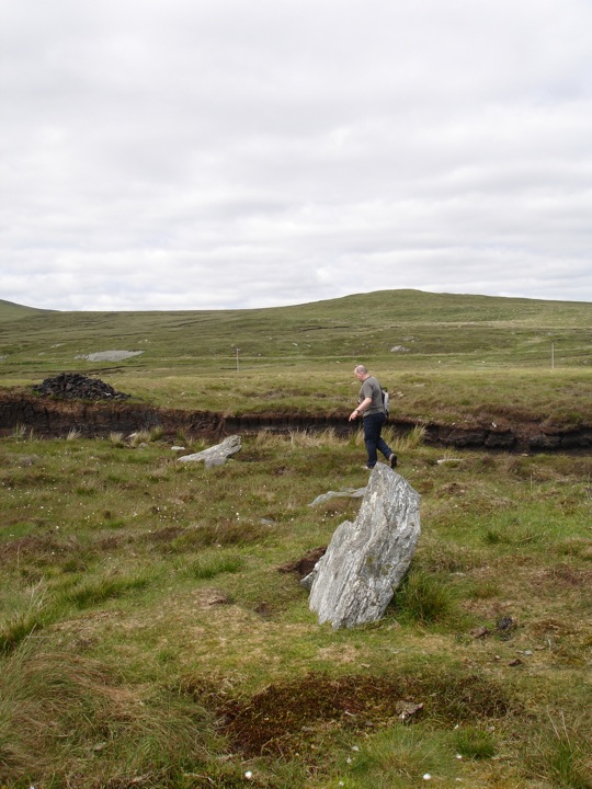
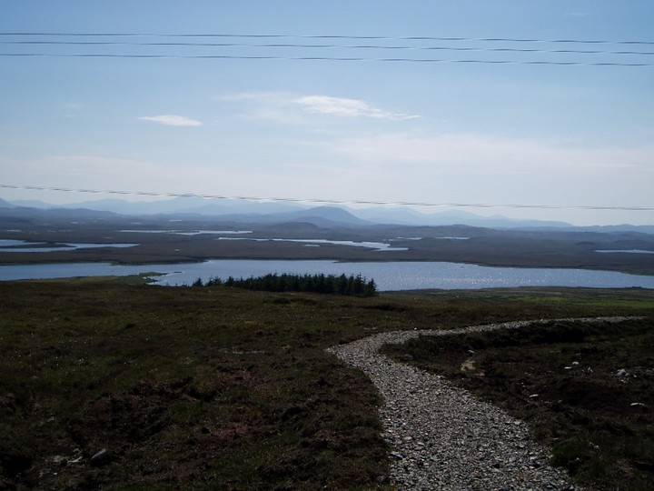
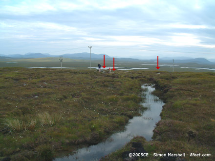
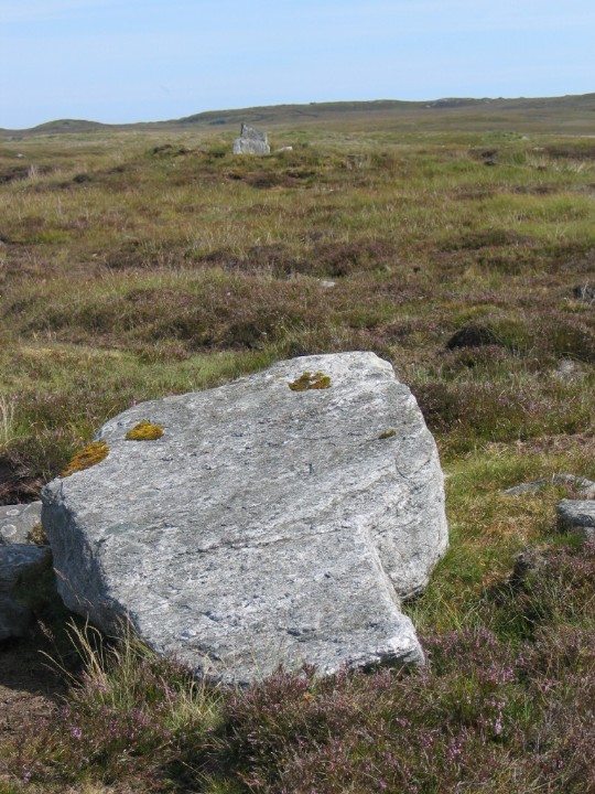
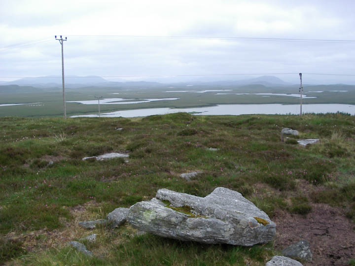
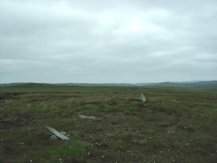
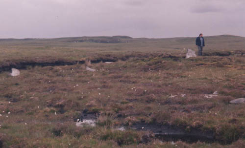
Visited 1st August 2004: Achmore is now signposted from the road, but there's a degree of guesswork involved. You need to go through the gate, then ascend the hill bearing right. From the gate you can't see it, but you're aiming for a bench and an information board. I'd strongly advise reading the information board before you leap off looking for stones. This isn't an easy site to interpret without a plan. The bench is a nice touch, with excellent views towards the pregnant 'Sleeping Beauty'. Achmore is great! I loved it. The stones that remain buried in the peat fascinated me. It's a real insight into how parts of Calanais would have looked before the peat clearance. As for the stones and sockets that are clearly visible, some are in very good condition. There are excellent examples of stone sockets that are extremely clear and easy to match with their accompanying stones (all now fallen). If you're interested in how standing stones were planted this is a fantastic place to visit. |
 Posted by Kammer
22nd February 2005ce Edited 22nd February 2005ce |
|
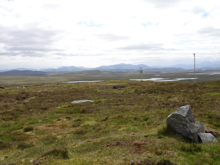
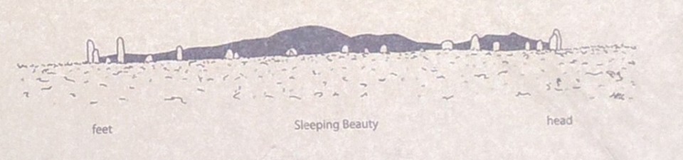
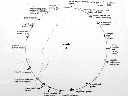
Great location with spectacular all-round views just a little spoiled by telegraph poles punctuating the view to the S. Two stones remain standing out of the 18 which formed a large true circle (41m diameter). The peat has been cleared from the fallen stones. Signposted from the road. Enter by the gate and head uphill to the right for the seat where there is an interpretation board. Sleeping Beauty is visible from the site and the board makes two interesting points. First, the stones are graded so that, when erect, the larger stones would have been at her head and feet (obviously this depends exactly where you stand to view it - there is no suggestion of a backmarker or outlier). Second, from this position, her profile is different from that seen at Callanish and the inclusion of another hill gives her the appearance of being pregnant. Visited 1 August 2004 |
 Posted by greywether
13th August 2004ce Edited 20th January 2005ce |