|
|

|
|
Na DromannanStone Circle
|
|
|
|
News |
|
|
Tour a lost stone circle on the Isle of Lewis that has not been seen for 4,000 years It was lost to layers of peat over thousands of years with the ancient site hidden from view. More info : https://www.scotsman.com/heritage-and-retro/heritage/tour-lost-stone-circle-isle-lewis-has-not-been-seen-4000-years-3040292 |
19th November 2020ce |
|
Spoil Heap At Callanish X Excavations at Callanish X last year which wrongly claimed this site to be a newly discovered stone circle have produced a unsightly spoil heap on the site. The position of the spoil heap is as such that it obscures the view observers would have of the valley, from the circle, where the moon re-appears during regleam thus denying the purpose of the circle. It is hoped that pressure can be brought on the relevant people to remove the spoil heap from the site. |
1st June 2004ce Edited 13th April 2005ce |
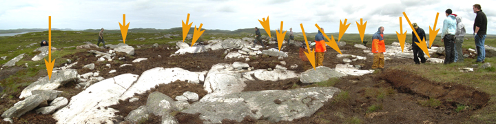
From the Stornoway GazetteArchaeologists from the University of Manchester have excavated a new stone circle in Callanish, Lewis, that is already widely acknowledged as being second only to Stonehenge. Although a destroyed circle was reported as far back as 1928, a team of eight archaeologists only recently excavated the site and have already uncovered 12 new stones... continues... |
 Posted by nickbrand
8th September 2003ce Edited 15th January 2004ce |
Images (click to view fullsize) |
|
Photographs: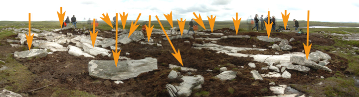
 Artistic / Interpretive:
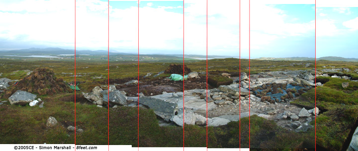
|
Fieldnotes |
|
|
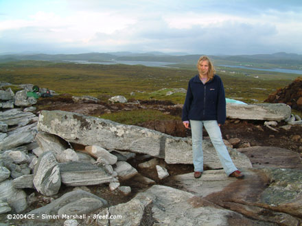
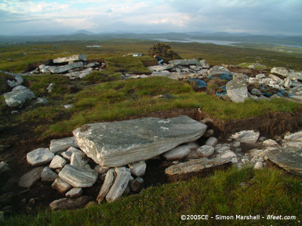
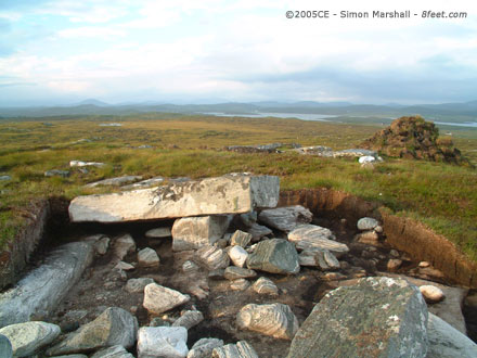
Visited 3rd and 6th August 2004: Lou and I visited Na Dromannan on two occasions, partly because I left the camera in the car on the first visit, but also because we were bowled over by the stones and their location. It's such a peaceful spot up on the hill overlooking the other big Callanish sites (most clearly Calanais itself). We took the opportunity to sit in quiet contemplation (in a Swarth Fell stylee). You've got to make this little pilgrimage if you're able! This route is not very exact, so use it as an aide rather than relying on it. I've based it on memory and some photos that I took. I wouldn't recommend the walk for anyone with limited mobility. Pushchairs or wheelchairs are out of the question because of the frequently changing levels of peat. Good footwear with ankle support is advisable, and if it's been raining be ready to get wet feet. Starting from the A858, park in the lay-by nearest to Cnoc Fillibhear Bheag. Cross the road and follow it, heading away from Calanais, until you are past the cottages on your left (I think you may cross over a cattle grid, but I'm not 100% sure). Here there's a gate taking you into a small paddock on the other of which is another gate. From this point on you're in open countryside. Keeping to the east of the little hill behind the cottages you should find a peat cutters track. This track starts off being well defined, but very uneven, leading off to the north-east. You can follow the path for about half a mile before it becomes almost impossible to distinguish from the heather and peat. At this point you should change course and head north towards high ground. You should have the lake off to your right at the point when you change course. This is where the going get tougher. You'll find yourself going from one heather covered island of peat to another. The 'valleys' between each island can get very wet very quickly if it rains. Wherever possible keep on the high ground. The first 'bump' to aim for has a couple of distinctive boulders on the summit which make it quite distinctive. Once you're on the top of that you can potentially see the bump that Na Dromannan sits on. We were lucky because the spoil heaps from the archaeological dig made for an excellent target, but once they're gone it could be tricky finding the site without a GPS or some top notch map reading. |
 Posted by Kammer
20th May 2005ce Edited 26th May 2005ce |
Miscellaneous |
|
|
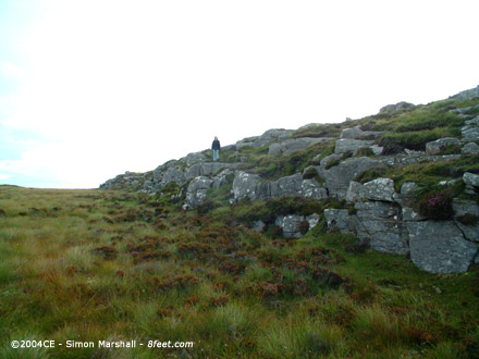
Na Dromannan consists of eleven large stones, which probably represent a fallen stone circle. Several of the stones are 3 metres in length and over a metre in breadth. A nearby rock face is probably the quarry that was used as a source for the stones for this site, and possibly the other Calanais monuments. An old theory was that the stones at Na Dromannan were never erected, but represented the remnants on building work on the other sites. Apparently the site is also known as Druim nan Eum, but only in error. The exact nature of this error isn't clear, and my Gaelic isn't really good enough to spot it. |
Posted by Kammer 3rd December 2002ce Edited 26th May 2005ce |
Links |
|
Breasclete Community Association - Calanais ExcavationsAn article by Dr Colin Richards about the University of Manchester excavation of Na Dromannan in 2002 and 2003. It includes four photos of the site taken during excavataion. |
Posted by Kammer 22nd June 2004ce Edited 13th April 2005ce |