|
|

|
|
Ogbourne St Andrew BarrowRound Barrow(s)
|
|
|
|
News |
|
|
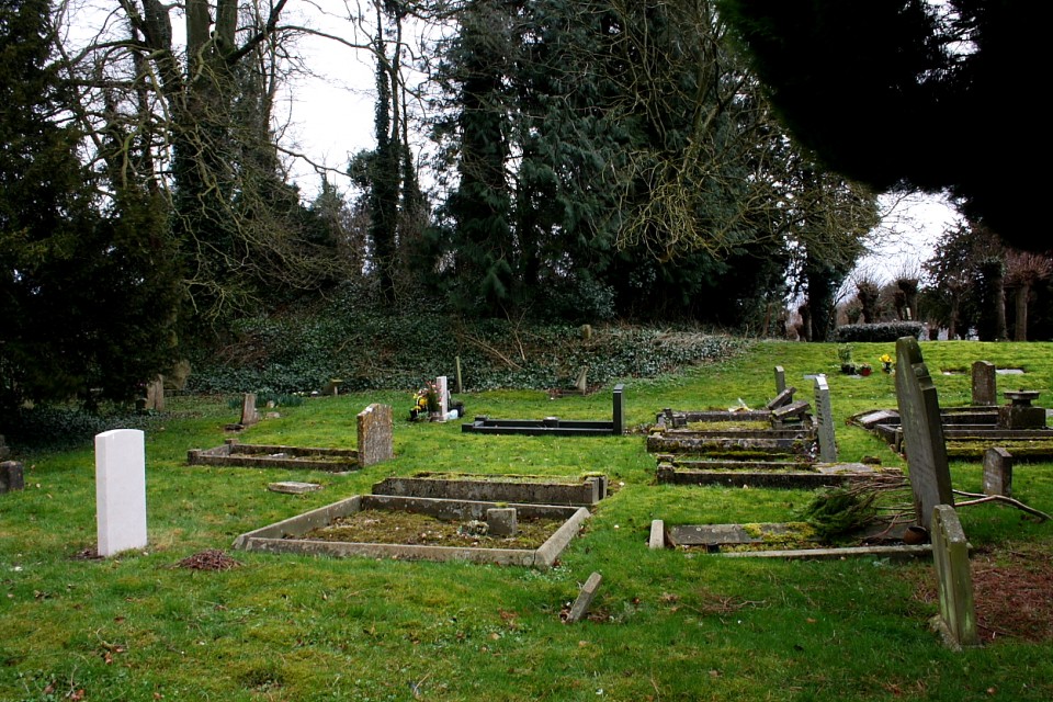
Bronze age mound at Ogbourne St Andrew being investigated Small fry compared to the West Kennet Avenue dig but I found this quite at exciting. Started a walk today from the church at Ogbourne St Andrew - a couple of archaeologists from Cranfield University were in the church-yard undertaking a geo-phys and mapping exercise of the Bronze Age mound which is in the churchyard. Apparently a small history group in the village had invited them in. I do hope the results will be published. |
 Posted by tjj
8th August 2013ce Edited 8th August 2013ce |
Images (click to view fullsize) |
|
Photographs: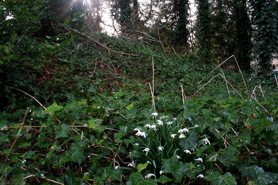

 Artistic / Interpretive:
|
Fieldnotes |
|
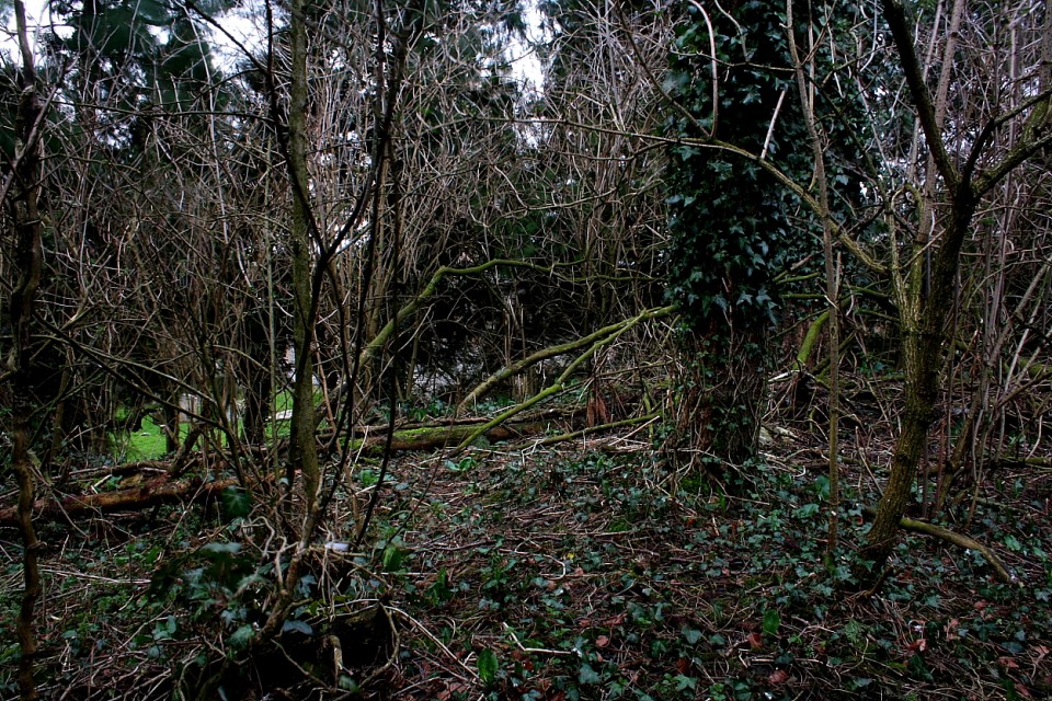
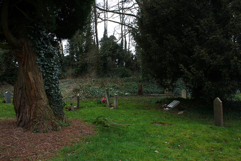
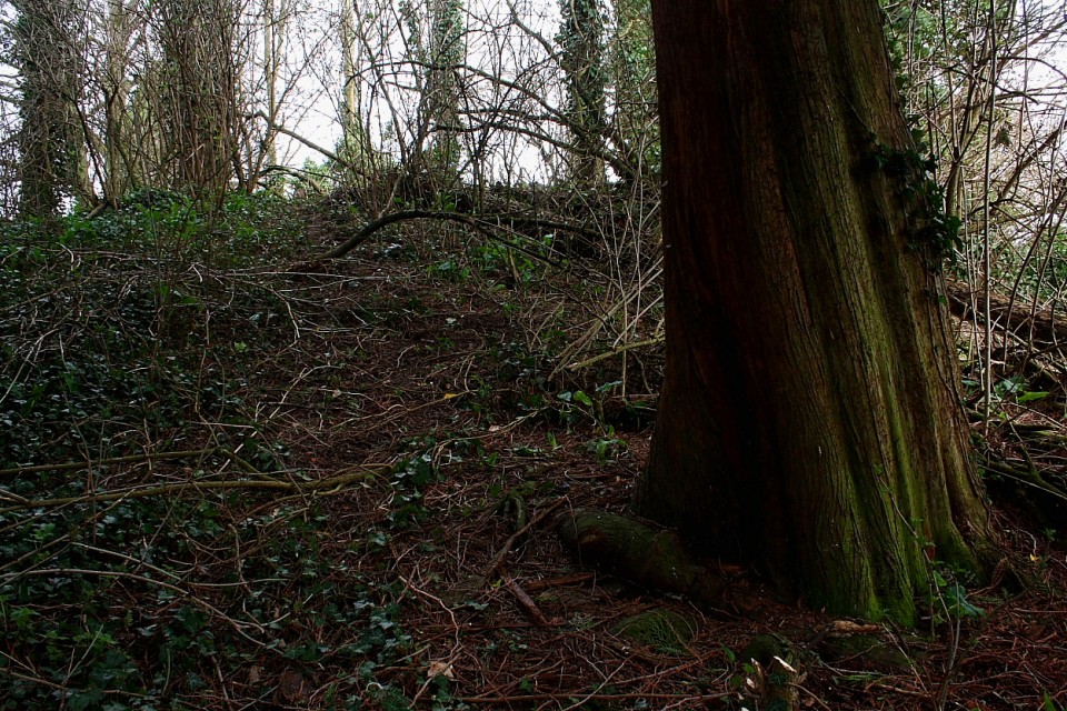
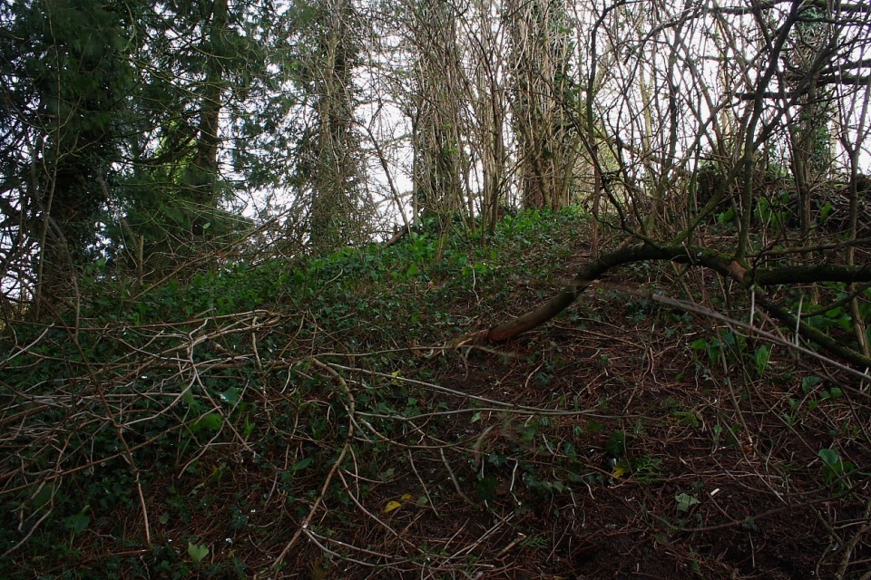
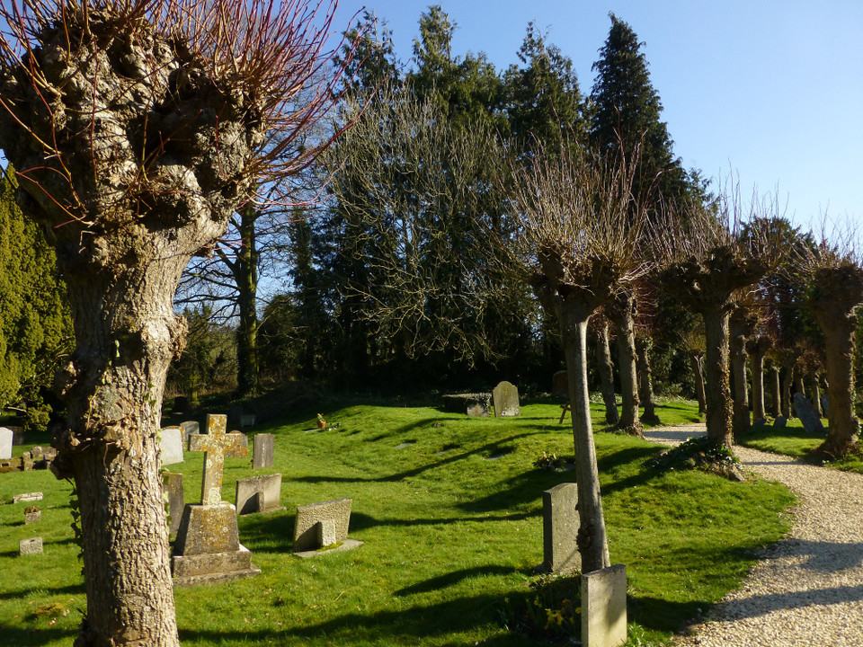
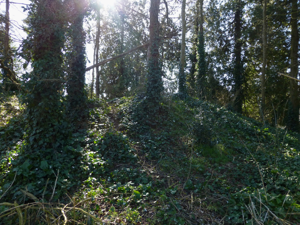
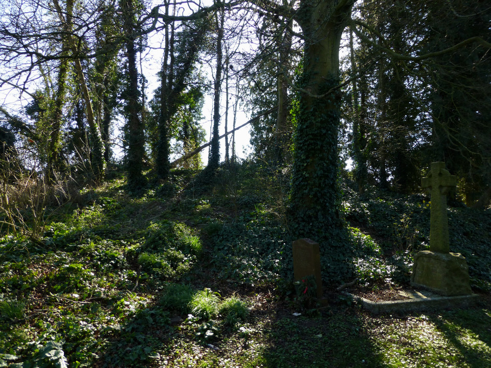
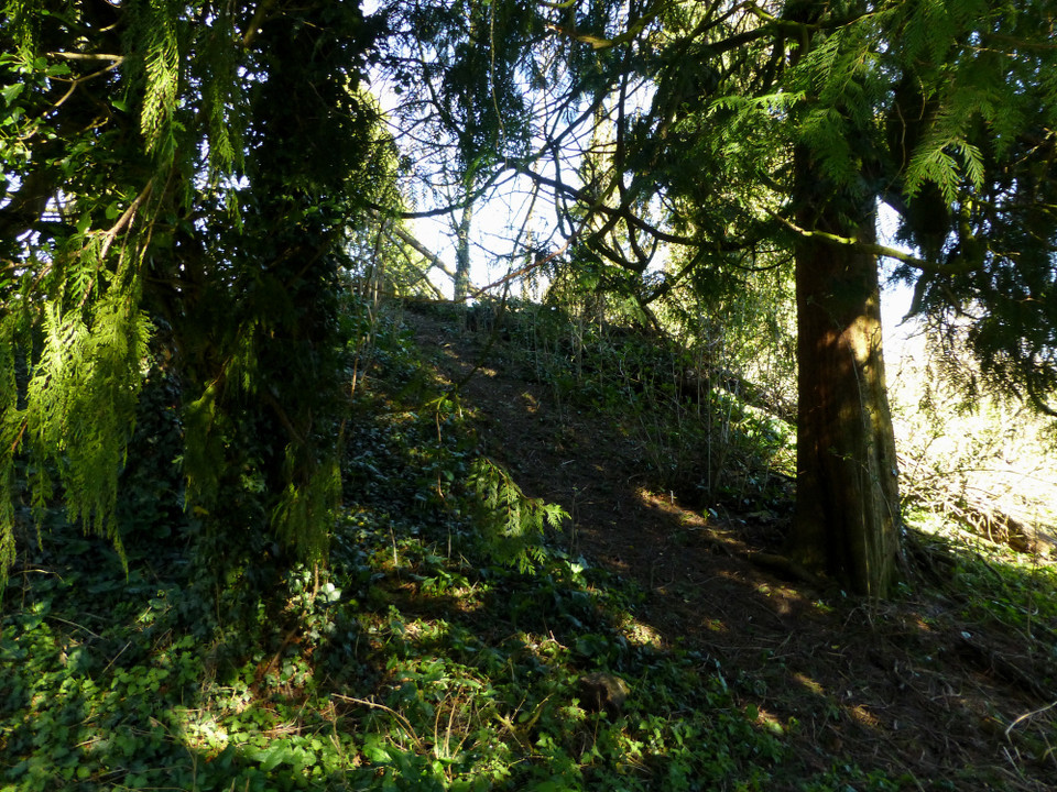
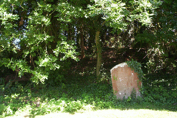
| Visited 27.3.10. Despite the hail stones I braved the elements and made the short walk up the path to the church - the barrow is covered with trees to the left. I climbed to the top and it looked like the site may have been dug into at some point in the past as it had a large depression in it. Access to the church is via keys - details given on church door. I forgot to check out the disputed standing stone - ah well, it gives me an excuse to visit again on my to Avebury! |
Posted by CARL 29th March 2010ce Edited 29th March 2010ce |
| Well this is really very curious. The mound is much bigger than I expected. My imaginative instinct is to compare it with the huge Wiltshire mounds near water ie Silbury etc. The water's even mentioned in the name of the place. But perhaps I should restrain myself - it's not that big. But it is big, and it is in a direct line with the church. I didn't see any 'venomous vipers' though I can believe they might frequent it. I did spot two (plastic) swords on the mound's summit, so the local children can't be that scared of them. |
 Posted by Rhiannon
31st August 2007ce Edited 31st August 2007ce |
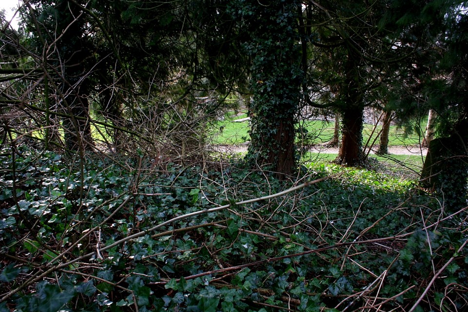
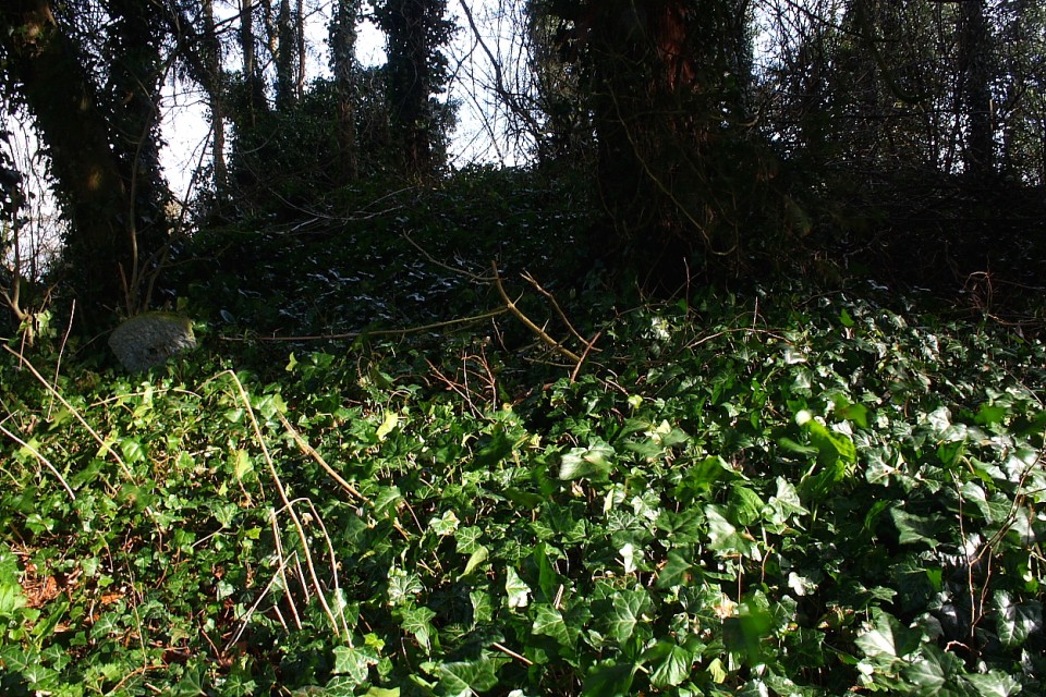
| This is difficult to photograph. If you are too far back it is just trees.If you are too near it is too dark. On the top is a depression, possibly the excavation site. |
 Posted by hamish
20th July 2006ce Edited 20th July 2006ce |
|
Brooding. The weather was wet. Raining and misty all at the same time. We parked outside the church, and like a div, I still hadn't spotted the barrow. When I did spot it, looming large next to the church, covered in trees, it was like , Wow! It's big, and the immediate impression I got was of darkness, as if it resented the church being there. Maybe that's why the children mentioned in Rhiannon's Folklore entry avoided the place? This post appears as part of the weblog entry Old and New Friends in Wiltshire
|
30th December 2003ce Edited 30th December 2003ce |
Folklore |
|
|
The round barrow in Ogbourne St Andrew churchyard was said to be avoided by children (in 1938*) as there was "a well-authenticated legend that it is the abode of venomous vipers". Perhaps it had a resident snake population - or could the idea possibly relate to serpents and dragons being symbolic to Christians of the devil? (*from the North Wilts Herald of Aug 19, 1938, and mentioned in volume 50 of the Wilts Arch journal.) Some might also take significance from the statement that the church (or the barrow itself?) is said to be one of the 'nodes' on the Michael/Mary ley line (the undulating ley line being likened to a serpent y'know) - see Miller and Broadhurst's account of following it across the country, 'The Sun and the Serpent'. The lines.. ..converged again in the churchyard at Ogbourne St Andrew.. There, a prehistoric mound was, along with the church, located within a circular raised bank. In the middle of the mound was [a] node. Trees swayed and tall wildflowers whispered gently in the breeze in another of those secret magical places that understate their true significance. Mary ran directly along the axis of the church into the mound and disappeared off across the Marlborough Downs.. Near the church is Poughcombe Farm - which presumably (this is purely my own speculation I hasten to add) derives from 'Puck Combe' - more links with supernatural weirdness.. |
Posted by Rhiannon 16th April 2003ce Edited 11th August 2014ce |
Miscellaneous |
|
|
Details of site on Pastscape A Bronze Age bowl barrow situated in the corner of Ogbourne St Andrew Churchyard. Excavations in 1885 by Henry Cunnington located primary Bronze Age cremation, an Anglo-Saxon inhumation and about twenty intrusive inhumations thought to be part of the medieval churchyard. In 1974 the barrow was visible as an earthwork 23 metres in diameter, 1.6 metres high with an 0.3 metre deep mutilation in the top. (SU 1888 7234) Tumulus (NR). (1) A round barrow in Ogbourne St Andrew churchyard, excavated by Henry Cunnington in 1885. He found about 20 skeletons in the top 2 or 3 feet; a skeleton in a fir-wood coffin with iron clamps, near the centre and 5 ft down; a cremation wrapped in a cloth and associated with a flint knife and a small 'food vessel' at 7 ft; and, at the old ground level, abundant traces of wood ash and cremations, irregularly scattered, and 'what appeared to be the side of a trench' some 6 or 7 ft in length and lined with wood. Other items found in the excavation were a fine leaf-shaped arrowhead just below the surface at the top of the barrow, and several 'interesting flint implements and rubbers of sarsen stone, turned up in the course of excavation'. Cunnington interpreted the 20 skeletons as medieval burials (probably of poor people as there were no traces of coffins); the skeleton in the coffin as probably Saxon; and the lower level remains as (inferentially) Bronze Age, with the trench feature possibly the remains of a (primary) burial pit. (2). Other authorities (3, 4, 5, 6) give summaries of the excavation without dissenting from Cunnington's conclusions. The cremation cloth is separately discussed (7). The skeleton and coffin are generally accepted as probably Saxon, and are illustrated by Baldwin Brown; they went to Devizes Museum (4). The dimensions of the barrow are given by Cunnington as Diam c 85ft, height at least 11ft; and Grinsell gives practically the same. (2-8) SU 18877233. A bowl barrow 23.0 metres in diameter and 1.6 metres high with an 0.3 metre deep mutilation in the top. Tree covered. Resurveyed at 1:2500. (9) |
 Posted by Chance
11th November 2012ce |
|
Whilst footling about in the library I found a note on the 1999 excavation of the churchyard mound in the Wiltshire Arch. + Nat. Hist. Mag v94. It said that the barrow and the church are both aligned and positioned on a further 'substantial but low' east-west earthwork which extends beyond the churchyard. The article didn't speculate on the age or purpose of this earthwork. I also looked up the original excavation, carried out by Cunnington in the 1880s (same magazine, vol 22). He was rather hoping that the barrow was going to contain a wealth of treasure, like the 'viking' (anglo saxon) finds dug up at Taplow only a couple of years previously - that was a barrow in a churchyard too, so you can see why he got his hopes up. The article reveals that the barrow was used time and again for burials over the centuries. He describes the barrow being in the unconsecrated NE corner of the churchyard (actually belonging to King's College Cambridge, weirdly). It was 11ft high and 'much mutilated'. Digging in he found 20+ skeletons about 3ft down, with their heads to the west. They were 'evidently not Ancient British' - I suppose they would be Christian, all ready to sit up and face Jerusalem come judgement day? Cunnington suggested they were medieval. Near the centre at 5ft depth was a male skeleton in a fir coffin; this he suggested a Saxon date for. At 7ft he found the burnt bones of an adult wrapped in a cloth, and placed on a plank of wood with an (unburnt) black flint knife. A small clay vessel was about a yard away. The floor of the barrow was still 4 more feet down - on this he found wood ashes scattered around, with traces of cremations and perhaps a cremation pit. I suppose both these areas of finds are from the Bronze Age. A finely made leaf arrow-head of dark flint was found just below the turf on the surface of the barrow. He also mentions that 'several interesting flint implements and rubbers of sarsen stone were turned up in the course of the excavations'.It may help those looking for information to know that the village has been called 'Ogbourn St Andrew' and 'Okebourn St Andrew' and also 'Little Okebourn', 'Ogbourne St Andrews', etc. Just to confuse matters. |
Posted by Rhiannon 6th January 2004ce Edited 31st August 2007ce |