|
|

|
|
Ladle HillHillfort
|
||||||||||||||||||||||||
|
|
|
Images (click to view fullsize) |
|
|
Fieldnotes |
|
|
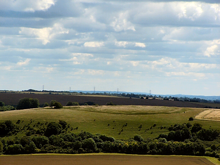
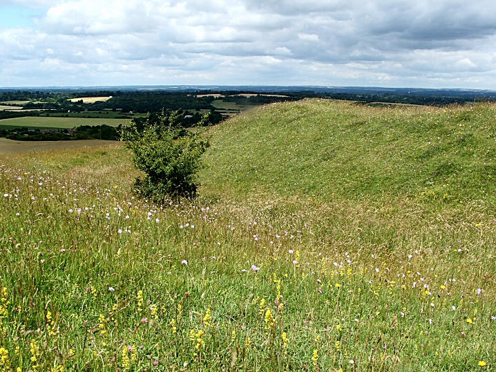
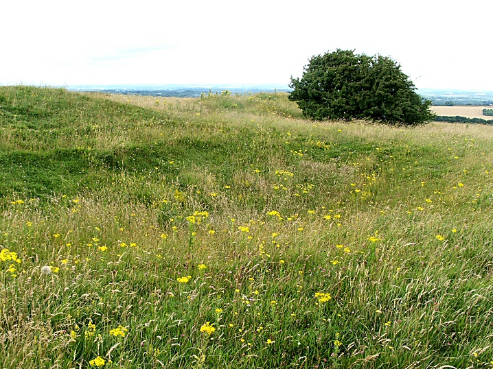
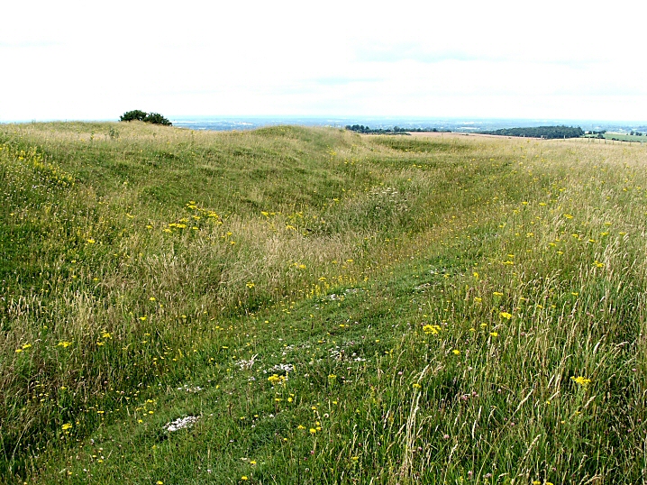
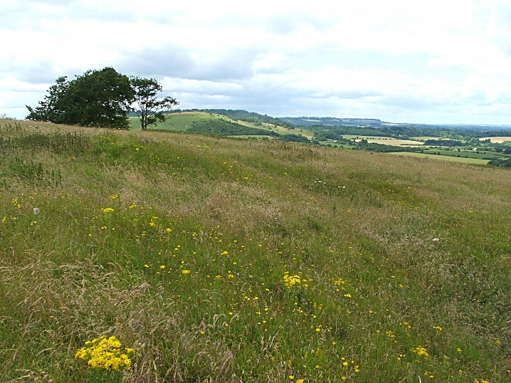
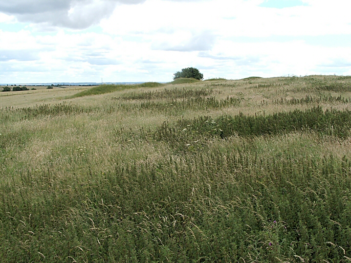
What a surprise and delight and what a curious site. As noted in the fieldnotes elsewhere, this fort/settlement/refuge was never finished. This is plainly obvious when walking around it. In some places the ditch and bank are nicely finished and contoured, then there is a break, a sort of causeway, and the next bit is quite different: a shallower ditch, a less "finished" profile and dumps of earth on top which have had no attempt to make them into a profiled bank. It looks just like a building site when everybody has just knocked off for tea! There is the strong feeling that if you were to wait a bit they'll be back. Archaeologists have suggested that each section might have been constructed by a different family. What a source of competition/arguments/backbiting that arrangement could have been! Anyway it was abandoned when almost finished. Why? Did Big Brother (Sister?) across the valley, Beacon Hill, tell them to stop/join forces/out perform them/enslave them? Internal and other external features are difficult to see as waist high grass and nettles obscure them. A winter visit might be in order. The site is not visited much and there are no worn paths anywhere. Skylarks and buzzards while I was there and it is much quieter than Beacon Hill with very little noise from the A34. Although not as high it probably has better views and is much easier to get to the top. A site for the imagination. Access Take signposts off A34 to Old Burghclere, go through village and at T junction to the left (N) park on verge on right. (2/3 cars?) Take bridleway (S), level if muddy path along valley floor, with diversions. Gentle slope right to the top. At iron gate take sharp dog-leg to the left, follow field boundary to 5-bar gate. (Private land?) |
 Posted by jimit
21st July 2008ce |
Miscellaneous |
|
|
I thought I’d dig out what information the excellent ‘Hampshire Treasures’ resource gives on this site – “Ladle Hill. Unique example of an unfinished hillfort, showing features which would be concealed in a completed work. Ditch partly dug around the perimeter with top-soil still visible as irregular shaped mounds. scheduled ancient monument, no.43”. And rather like Beacon Hill (over the road) the surrounding area is pretty much swamped with antiquity… Disc Barrow Ladle Hill Camp - SU479569 - Well preserved barrow sited on hill slope north of the camp – part of scheduled ancient monument, no.43 Barrow - SU479568 - In area of Ladle Hill Camp. Disc or saucer barrow surrounded by ditch. part of scheduled ancient monument, no.43 Bowl Barrow (Site) - SU472562 - South west of Ladle Hill Camp. Low spread barrow, almost completely ploughed out. scheduled ancient monument, no.44 Bronze Age/Iron Age Ranch Boundaries - also SU479569 - Western edge of Great Litchfield Down to Ladle Hill. Partly destroyed by ploughing, but survives in certain areas as slight ditch with bank on west side. Iron Age Pit Dwellings (Supposed) - SU477570 - Northwest of Ladle Hill Camp. Area of uneven ground, possibly settlement, preceding or contemporary with, the building of the camp. Earthwork - SU477563 - South of Ladle Hill. Roughly square outline, now reduced to slight platform with faint traces of ditch. Part of scheduled ancient monument, no.153 Bronze Age Earthwork – SU475563 - South west of Ladle Hill Camp. Situated in arable field and covered in grass and weeds. Ploughing has obliterated all traces of bank and ditch on north side. Mediaeval sherd found. Part of scheduled ancient monument, no.153 The Earthwork to the West (at SU476569) is believed to be Roman. “Sited on steep west slope of hill and formed by erection of substantial bank on down- hill side of the slope. May have been 'circus' or pond.” |
 Posted by pure joy
7th August 2003ce Edited 7th August 2003ce |
| This roughly rectangular fort enclosed 7 acres (c.2.8ha) within an embankment and ditch. A 170 ft (52m) diameter disc barrow lies just to the N, and there are several other barrows in the area, mostly ploughed-out. |
10th July 2003ce |