|
|

|
|
Dorset Cursus (North to Martins Down)
|
||||||||||||||||||||||||
|
|
|
Images (click to view fullsize) |
|
Photographs: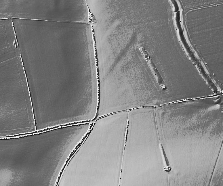
 Maps / Plans / Diagrams:
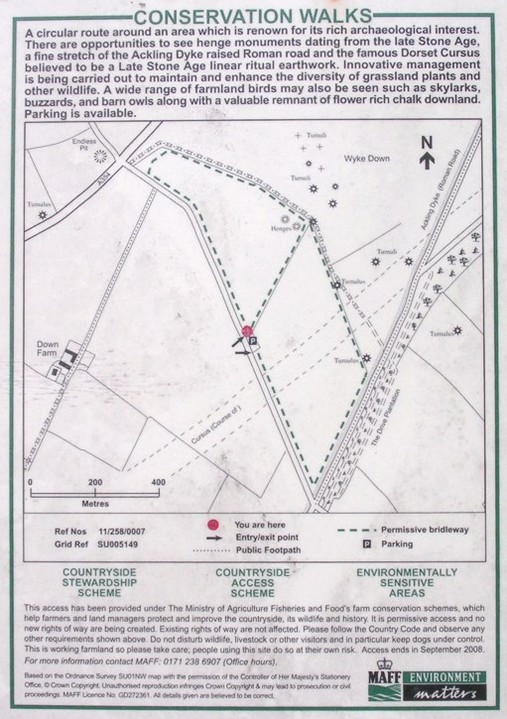
|
Fieldnotes |
|
| There is no sign of the cursus at this point, despite the markings on O.S. maps. I agree with treehouse that the long barrow here looks like one continuous barrow with a gap in it. It appears very much like Long Bredy bank barrow, the gap being at a similar place, i.e about a third of the length from the northern end, where the trees end.It cannot be much shorter in length. What the difference between a long barrow and a bank barrow I have yet to see satisfactorily explained. |
 Posted by formicaant
18th September 2007ce Edited 18th September 2007ce |
|
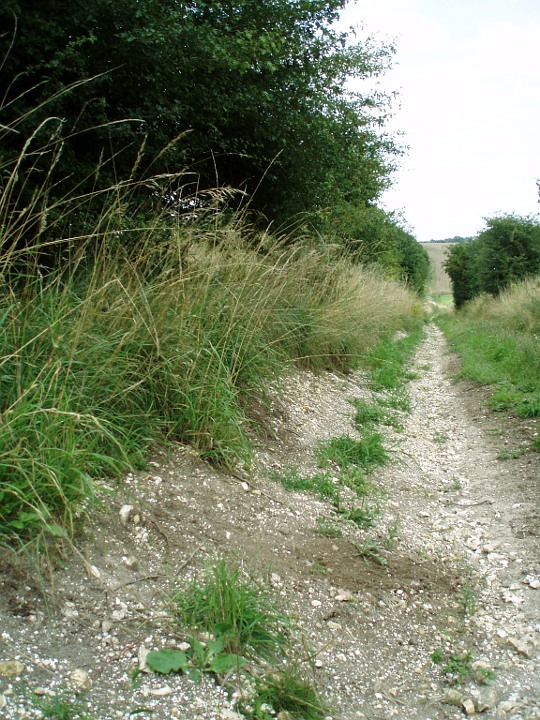
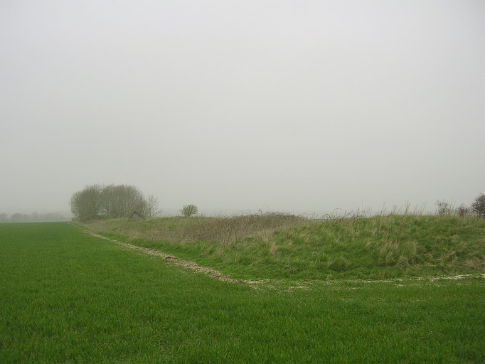
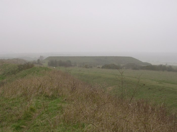
Visited 31/3/05. The long lump in the field is actually a very long long barrow, maybe a barrow of two parts, but long none the less. It is aligned with the (no longer visible) end of the Dorset Cursus. Towards the narrow corner of the field is another, ploughed down, long barrow that looks a bit like a tumulus. This too points at the cursus end-point, as does the barrow on the hillside to the south (in the neighbouring field). I approached from the car park on the far eastern side of Martin Down nature reserve. Take the lane west from the centre of Martin village, and you eventually reach the car park. Head due west along a track and soon you will see what looks like the biggest long barrow you've ever seen on the NW horizon. It is, of course, nothing so ancient: its the 'backstop' of a rifle range in use during the second world war. However, head for it and climb to the top and you'll have a splendid view in all directions: in particular of the long barrows that point to the absent cursus end earthworks and then southwest across the undulating chalklands where the cursus once ran. The massive modern earthwork is only a short distance south-east of the Martin Down car park thats just off the A354 (a safe place to park on this busy road). Theres also a Bronze Age enclosure on this part of Martin Down. Its a busy busy place, and could withstand many visits. I haven't even begun on the barrow cemetaries further down the cursus. |
 Posted by TreeHouse
1st April 2005ce |
|
[visited 10/9/4] Not much to see here that is recognisable really. As you approach from Bokerly Farm, the cursus is conspicuous by its absence on the right in a field where it once stood. And then in the next field where the goal should stand, Bokerly Ditch rises like a false dawn in the distance. Now given that the remains on the map look like a C with long barrows attached, with supposedly the earthwork of Grim's Ditch just behind, one long mound took me a bit by surprise. I contemplated for a good 10 minutes whether the elongated mound in the middle of the field was actually part of the cursus and I think on reflection it probably is. It does kinda point at the obvious long barrow on the hill to the South and does also have a couple of dips, kinda like the map. But ffs what damage and destruction the plough has wrought here. This monument was once one of the greatest ever built and I get the feeling 200 years (or even less) ago, we would have seen something of that greatness rather than the sad remains today. This field is still being ploughed, all thats left is the bizarre mound, the two sides are gone forever, as has Grim's Ditch it appears. Worth a visitish, personally though, if you only see one bit of the cursus chose the middle bit by Oakley Down. Access is on flat ground via public footpath and probably through crops in summer. I parked in Woodyates village. This post appears as part of the weblog entry One doesn't go mad in Dorset
|
 Posted by juamei
6th October 2004ce Edited 6th October 2004ce |
Miscellaneous |
|
|
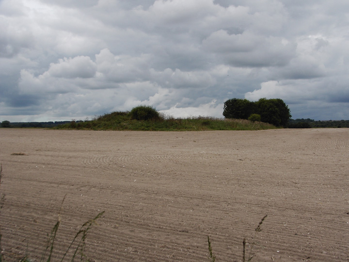
The ancient river cliff mentioned earlier by Moss is in fact right next to a very convenient car park (a glorified layby), with a gate and access to the field containing the river cliff and a section of the Cursus. (See this photo of the information board at the car park, which doesn't feature the cliff but its to the SE of the car park). If the Cursus was a processional route then the processors would have had to fall down/climb this cliff as they precessed. The land just below it (the seasonal pond, with a modern wellhead in it) would have been very boggy in the winter. Not the ideal route for a procession. If you want to read a very thorough and insightful article about the Cursus then I can recommend a book by Christopher Tilley called "A phenomenology of landscape: places, paths and monuments" published by Berg (1994). Chapter five "Ridges, Valleys and Monuments on the Chalk Downland" focuses on the neolithic monuments of Cranborne Chase and contains plenty of pictures and diagrams as well as readable prose. My local library has two copies (must be popular!). This page is titled "Dorset Cursus (End)", although Tilley's opinion is that this is the (later) Start of the Cursus, with the SW terminal on Thickthorn Down being the actual End. Read the book to find out why. |
Posted by TreeHouse 8th April 2005ce Edited 9th April 2005ce |
|
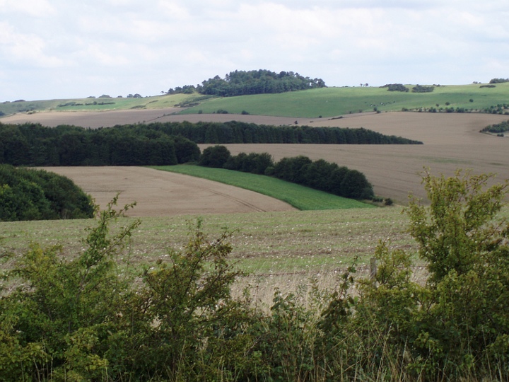
some notes from Martin Green's "A Landscape revealed" a book about this area; He says that there were two separate cursuses, both 90 metres wide and 5 kilometres long, and built end to end. -Gussage cursus descends from Thickthorn Down, crosses Gussage Valley and climbs up the next ridge - Gussage Down. It then incorporates a longbarrow at approximately its half point,then descends into the Allen Valley, before climbing up to the top of next ridge (rollercoasting) then terminates. The longbarrow on Gussage down is important in that the mid winter solstice can be viewed; the moon cresting the barrow. Also,(continuous thread?) evidence of earlier mesolithic activity can be found at either end of cursus. This area is particularly "sacred landscape", it also has two vertical shafts with offerings in, similar to the ones found on the Mendips, the so called swallet holes, and the Cursus also incorporates an ancient river cliff (swallowcliff) with a small seasonal lake at its foot.... |
 Posted by moss
1st April 2005ce |