The Modern Antiquarian. Stone Circles, Ancient Sites, Neolithic Monuments, Ancient Monuments, Prehistoric Sites, Megalithic MysteriesThe Modern Antiquarian


Caer Penrhos

Hillfort

<b>Caer Penrhos</b>Posted by juameiImage © LiDAR Composite Dataset. Contains public sector information licensed under the Open Government Licence v2.0.
Nearest Town:Aberaeron (13km SW)
OS Ref (GB):   SN552695 / Sheet: 135
Latitude:52° 18' 14.56" N
Longitude:   4° 7' 26.32" W

Added by Kammer


Discussion Topics0 discussions
Start a topic


Show map   (inline Google Map)

Images (click to view fullsize)

Add an image Add an image
<b>Caer Penrhos</b>Posted by juamei <b>Caer Penrhos</b>Posted by Kammer

Fieldnotes

Add fieldnotes Add fieldnotes
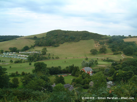
Visited 15th August 2003: I've not walked up to this fort but I've seen it many times from the road. It looks like there's a distinctive winding path leading up to it on the south side. There were people coming down it when I took the photo, but I've no idea whether there's public access or not.

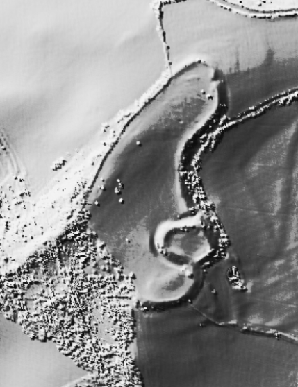
The site was adapted into a motte and bailey castle during the Middle Ages (Castell Cadwaladr).
Kammer Posted by Kammer
1st October 2003ce
Edited 1st October 2003ce

Miscellaneous

Add miscellaneous Add miscellaneous
Some ariel photos of a boomerang shaped hillfort
http://www.coflein.gov.uk/en/site/300770/images/CAER+PENRHOS/
postman Posted by postman
20th January 2012ce