|
|

|
|
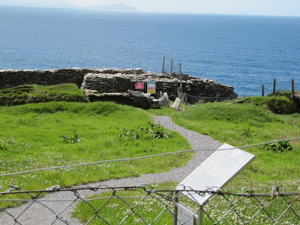
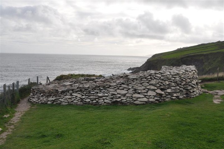
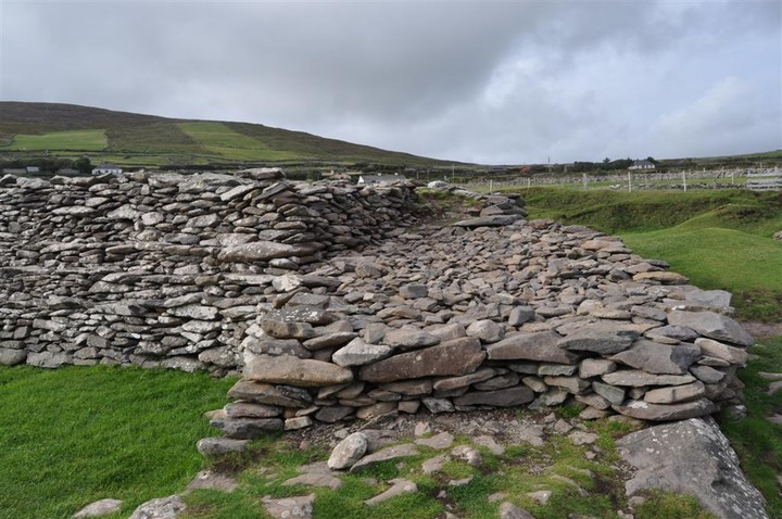
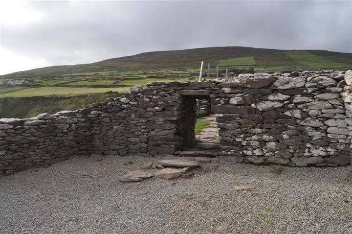
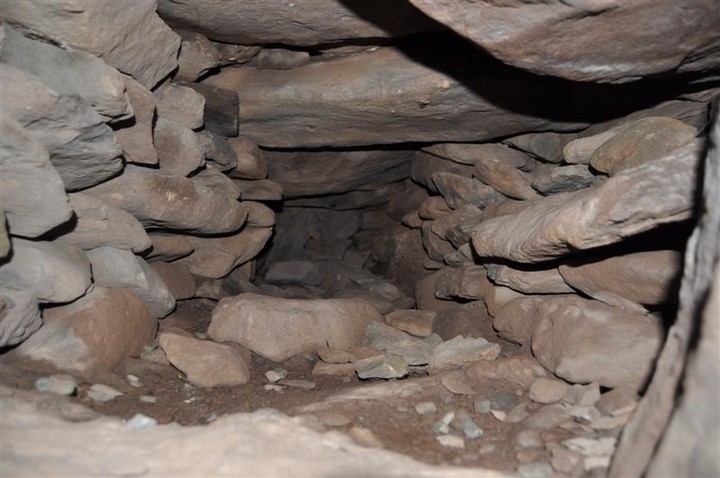
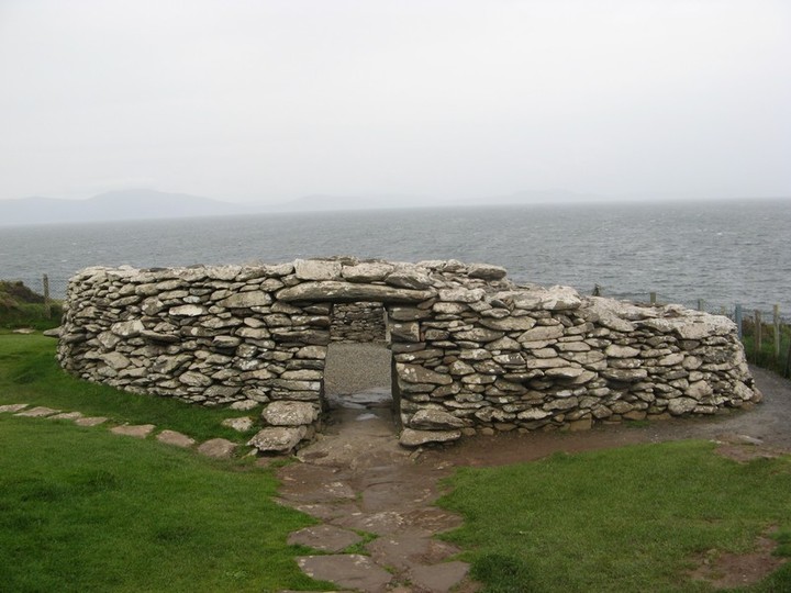
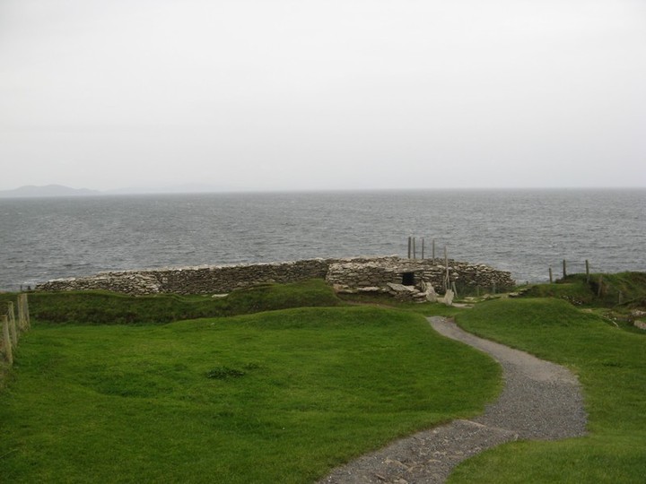
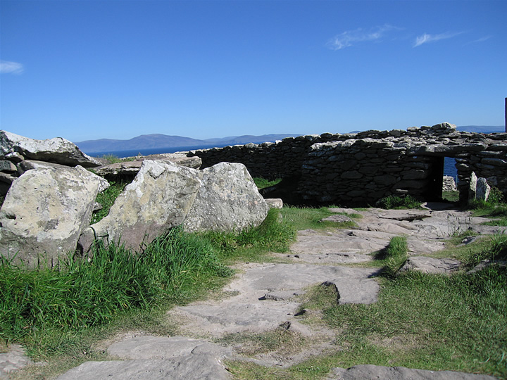
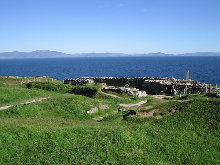
DunbegCliff Fort
|
|
|
|
News |
|
|
'We cannot stress how dangerous it is': Ancient Kerry fort closed after storm damage More serious problems at Dunbeg. Full story: http://www.thejournal.ie/kerry-fort-ancient-3781702-Jan2018/ |
 Posted by ryaner
5th January 2018ce Edited 5th January 2018ce |
Images (click to view fullsize) |
|

|
Fieldnotes |
|
|
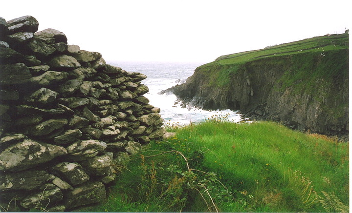
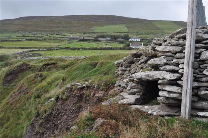
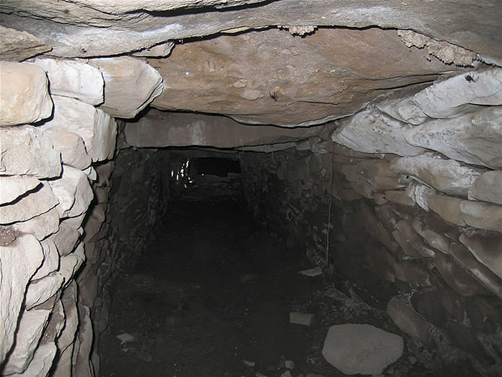
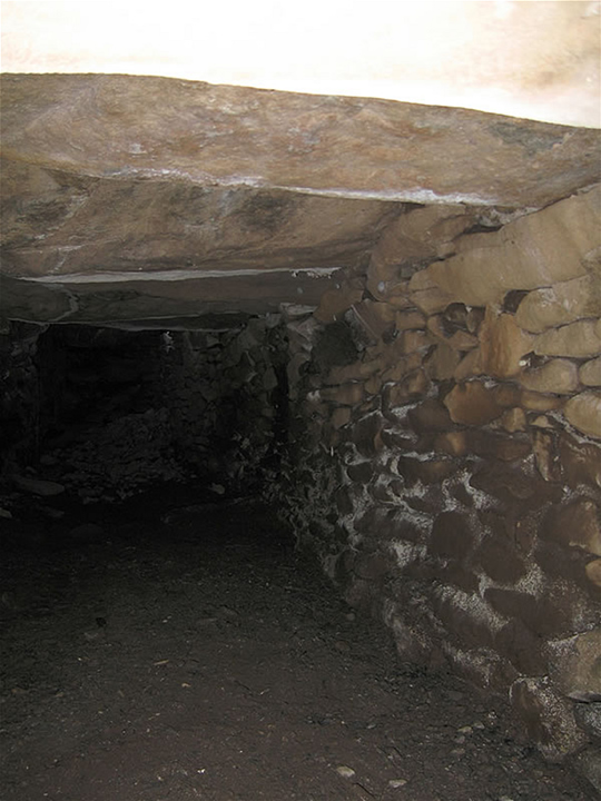
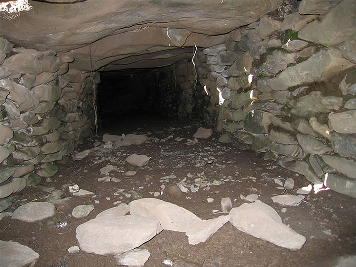
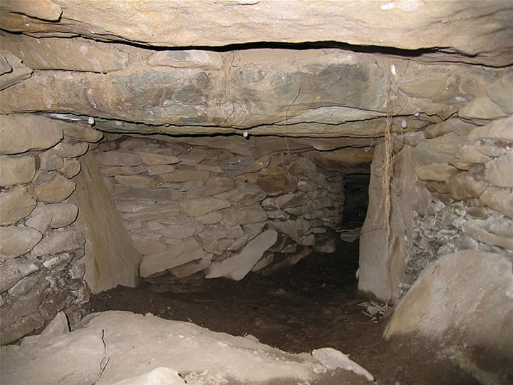
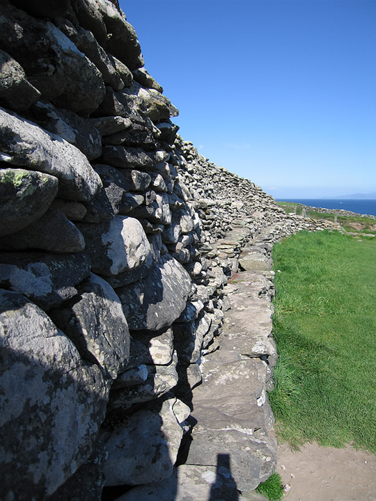
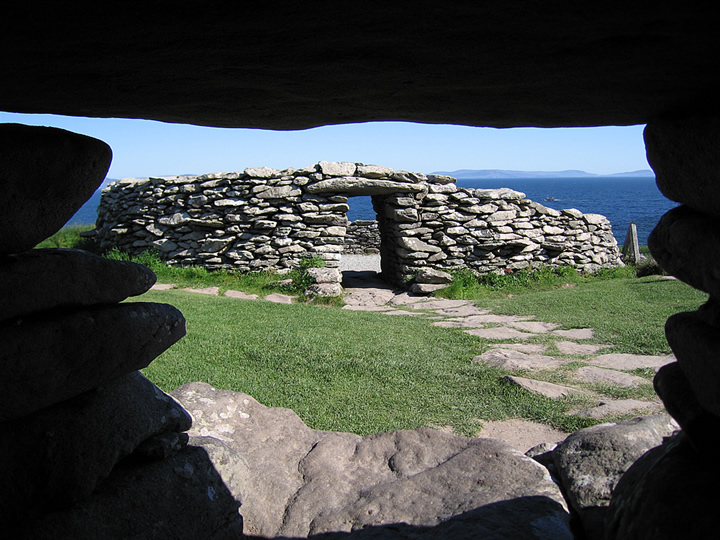
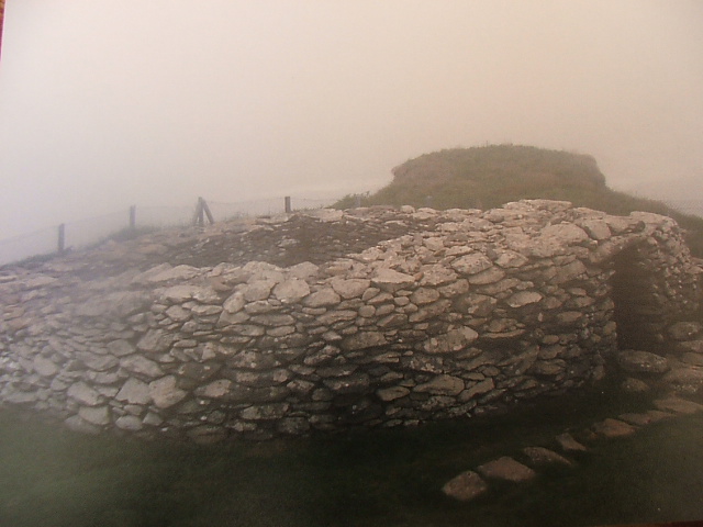
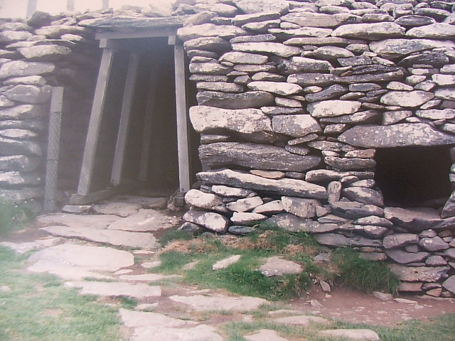
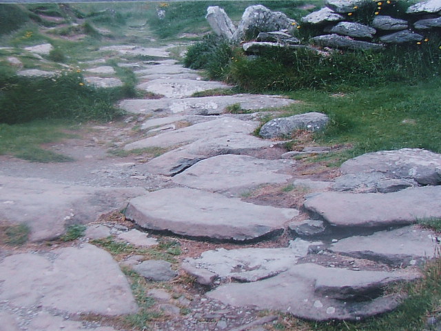
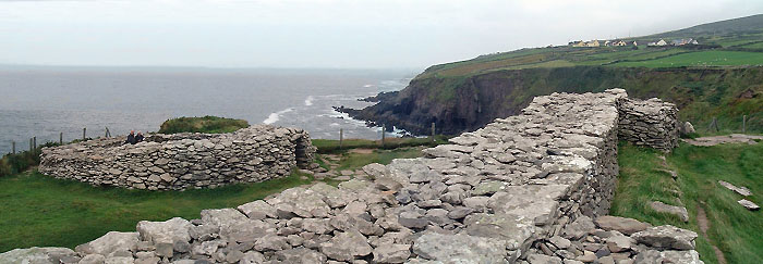
Visited 18th May 2014 Dunbeg Fort is closed to visitors at present because of the serious damage caused by the winter storms. Visitors are allowed to walk down to it but no access to the site - it is clear to try and enter would be dangerous. The woman in the audio-visual centre told us that engineers had recently undertaken a structural survey and there is hope that some of the damage can be repaired with limited access allowed later in the summer. The following information is taken from the audio-visual leaflet. "Dunbeg Fort is a small but impressive example of a promontory fort but its location makes it even more dramatic. Built on a sheer cliff, its archaeological excavation was undertaken in the late 1970s. There are two major phases of occupation recorded. The first phase was around the 8th and 9th centuries AD. Clusters of stake holes to the north and south of the fort indicated the presence of wooden tripods for supporting pots and skins over the fire. Analysis of the occupation debris suggests a diet mainly of pigs, sheep and goats with some cows. The second phase of occupation lay above the first phase and was around the 10th and 11th centuries AD. It was concentrated on two hearths in the centre of the Beehive (clochan). The bones of sheep, pig, deer, birds and fish were also recorded. But the excavation results did not reveal what the site was used for; it may have been defensive, or used for ritual or even status purposes, or it may simply have just been lived in." Some lovely examples of clochans/beehive huts nearby on the hillside. |
 Posted by tjj
5th June 2014ce Edited 5th June 2014ce |
|
This site is just off the road on the Slea Head drive. When we visited in September 2009 there was a charge of €2.50 to see it. You also get a photocopied information sheet Its a nice site but not worth that kind of cover charge. The audio-visual experience is extra, we didnt go for this however. |
23rd September 2009ce Edited 23rd September 2009ce |