|
|

|
|
St. Agnes BeaconCairn(s)
|
||||||||||||||||||||||||
|
|
|
Images (click to view fullsize) |
|

|
Fieldnotes |
|
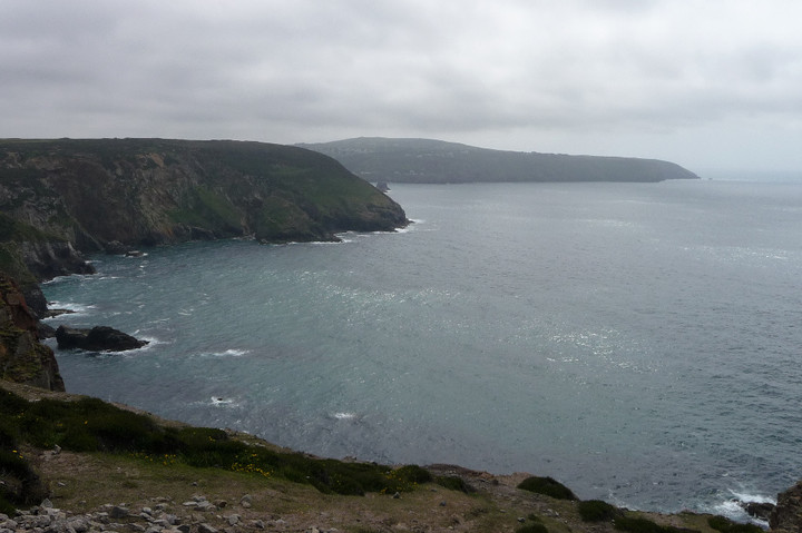
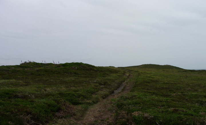
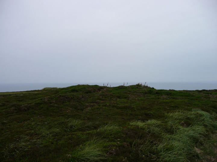
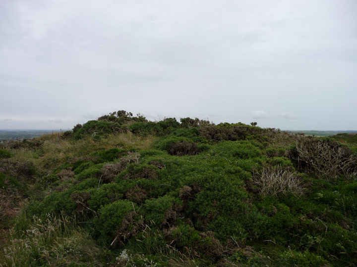
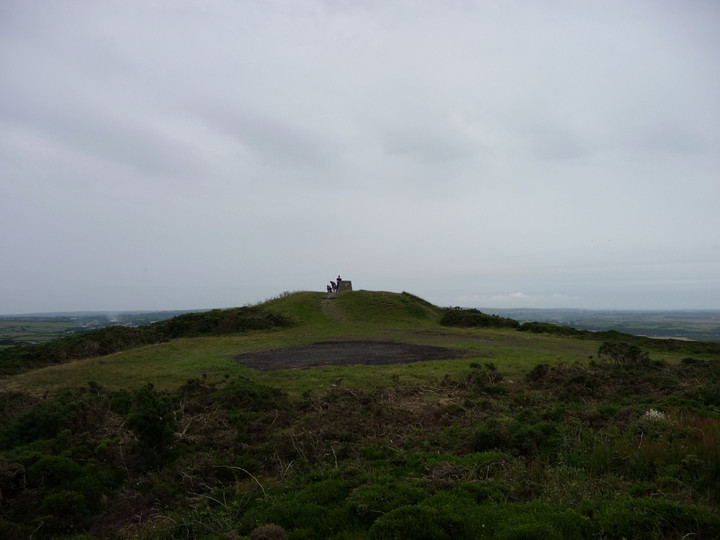
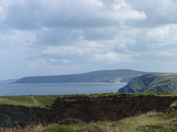
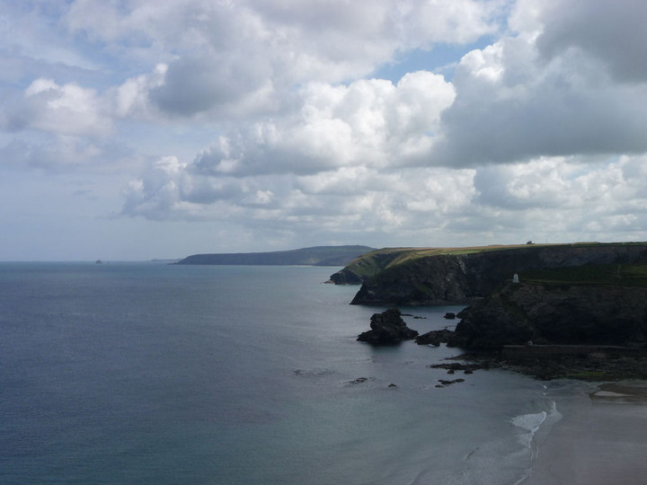
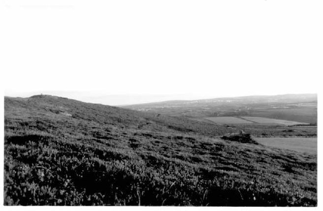
| St Agnes Beacon is a landmark for anybody driving down the A30 towards the END. Surprisingly for such a large and conspicuous hill the barrows/cairns on the summit are just the opposite. My feelings are they have been robbed not only of any remains but also of stone over the years. What is left are a few scattered mounds, and even these can be mistaken for mining remains and vice versa. The hill is great for views..but don't make a special trip for the archaeology. |
7th July 2007ce |
|
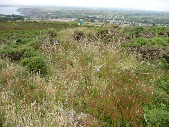
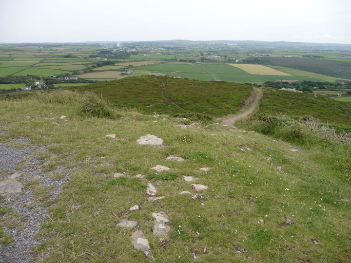
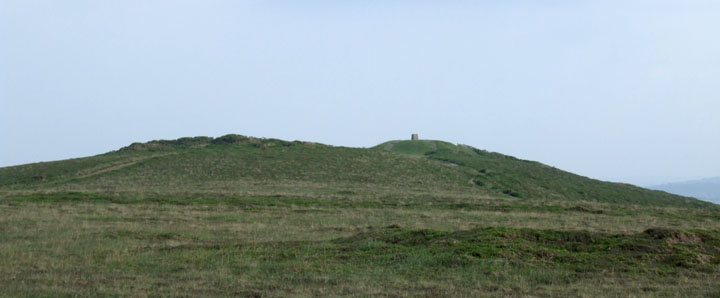
St.Agnes Beacon Cairns - 2nd October 2003 Can't really miss this hill, just west of St.Agnes village. Easy to reach, via numerous public footpaths around the area. National Trust openland. Closest place to park is at SW706507, facing a metal farm building, with room for about 8 cars. But you can also park at many other places in the area and walk to the beacon via footpaths or roads. The OS map shows 3 cairns on the summit. Two towards the highest point (at the south east end of the summit) and one at the north west end of the summit area. All are in light gorse, with the most southerly one the deepest amongst the thorns. None stand out massively, and there are many other similar mounds round the hill. I cannot believe that some of these aren't also burial cairns. The hill stands out for miles around, and the views from it are totally stunning. The highest point isn't actually a cairn, but the old beacon, which is topped with a panoramic plate showing you the landmarks for around 25kms around, including several windfarms, the china clay area around Roche (24km away) and Carn Brae (10km away). The Bolster Bank is visible to the south and southeast of the Beacon, but isn't totally obvious ( an OS map will help you orientate yourself). It is believed that originally this Dyke enclosed the whole of the coastal area around the hill, cutting it off from the surrounding land. This post appears as part of the weblog entry Kernow again - Part 2 - Land of the Giants
|
 Posted by pure joy
7th October 2003ce Edited 7th October 2003ce |
Folklore |
|
Many years ago, on Midsummer's eve, when it became dusk, very old people in the West Country would hobble away to some high ground, whence they obtained a view of the most prominent hills, such as Bartinney, Chapel Carn-brea, Sancras Bickan, Castle-an-Dinas, Carn Galver, St. Agnes Bickan, and many other beacon hills far away to north and east, which vied with each other in their Midsummer's blaze. They counted the fires and drew a presage from the number of them. There are now but few bonfires to be seen on the western heights; yet we have observed that Tregonan, Godolphin, and Carn Marth hills, with others away towards Redruth, still retain their Baal fires. We would gladly go many miles to see the wierd-looking, yet picturesque, dancers around the flames on a carn, or high hill top, as we have seen them some forty years ago.From Traditions and Hearthside Stories of West Cornwall by William Bottrell (1873). |
 Posted by Rhiannon
20th November 2012ce Edited 21st November 2012ce |
Age and neglect have done their fell work on the well; and I am indebted, through a friend, for these recollections of an intelligent old lady who knew the place in childhood, and gives sketches of what she remembers of it. I place this well among the medicinal wells on the authority of Lysons, who ascribes to it many miraculous sanitary qualities, although it was resorted to for its divinatory gifts chiefly.From 'Ancient and Holy Wells of Cornwall' by M and L Quiller-Couch (1894). "Lysons" refers to the Rev. Daniel Lysons' "Magna Britannia" here of 1806, in which he says: "Near this spot [Porth-Chapel] is St. Agnes' Well, of which many miraculous stories are told; the water is of an excellent quality, and much esteemed. ... St. Agnes Beacon, formed out of an ancient cairn or tumulus of stones, was kept ready for use a few years ago during the apprehension of invasion, and was attended by two soldiers. |
Posted by Rhiannon 10th April 2012ce Edited 10th April 2012ce |
They have a legend in Cornwall that St. Agnes "escaped out of the prison at Rome, and taking shipping, landed at St. Piran Arwothall, from whence she travelled on foot to what is now her own parish.From p240 of 'Poetical Works of Robert Southey' v1, 1843 - on Google Books. |
Posted by Rhiannon 18th October 2007ce Edited 18th October 2007ce |
|
From "Deep Down, a Tale of the Cornish Mines" by R.M. Ballantyne (1869), a slight variation on the stories below: One of these giants was a very notable fellow. He was named 'Wrath,' and is said to have been in the habit of quenching his thirst at the Holy Well under St. Agnes's Beacon, where the marks of his hands, made in the solid granite while he stooped to drink, may still be seen. This rascal, who was well named, is said to have compelled poor St. Agnes, in revenge for her refusing to listen to his addresses, to carry in her apron to the top of Beacon Hill the pile of stones which lies there.Online at: http://www.athelstane.co.uk/ballanty/deepdown/mines19.htm |
Posted by Rhiannon 8th June 2005ce Edited 8th June 2005ce |
Women can be cruel. But you expect better from a saint. There lived then in that part of the country a famous Wrath or Giant, by name Bolster, of that ilk. He got hold of the saint [Saint Agnes], and obliged her to gather up the stones on his domain; she carried them in three apron-fulls to the top of the hill, and made with them three great heaps, from which the hill is now called, sometime Carne Breanich, sometimes St. Agnes' Beacon.Found in the 'Poetical Works of Robert Southey' v1, 1843 - on Google Books. |
Posted by Rhiannon 29th April 2005ce Edited 18th October 2007ce |
|
The panoramic plate on the Beacon gives a tale about the cairns....."Legend has it the Giant Bolster could stand with one foot on St.Agnes Beacon and the other on Carn Brae. Giant Bolster's wife was made to clear the neighbouring field of stones, three aprons full are seen today as barrows (burial mounds) on top of the beacon". I've also read that the two giants on St.Agnes Beacon and Carn Brea would hurl bolders across the space between the two hills, and Bolster was able to stride from the Beacon to Carn Brea with one mighty step. |
Posted by pure joy 7th October 2003ce Edited 7th October 2003ce |
Miscellaneous |
|
|
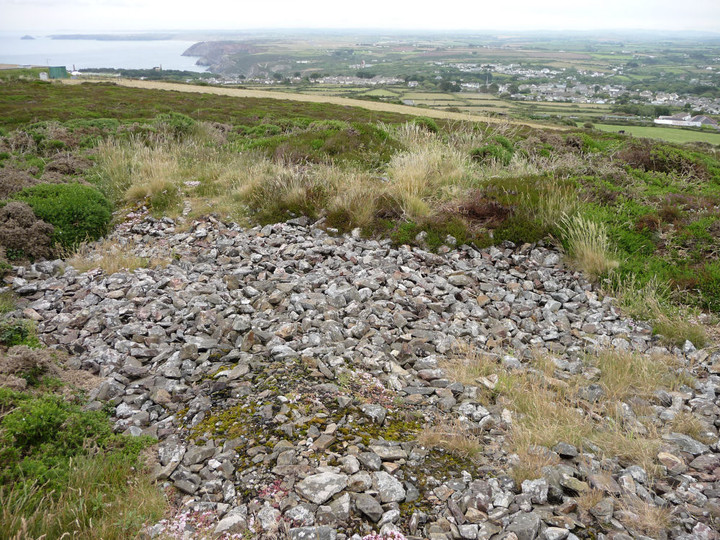
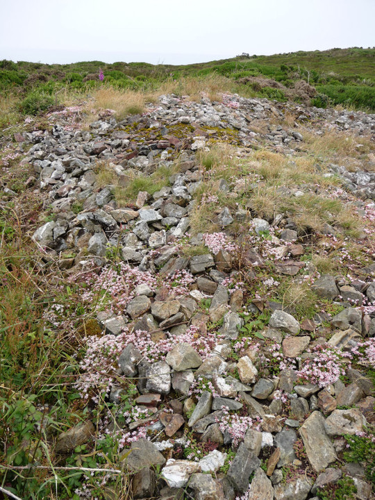
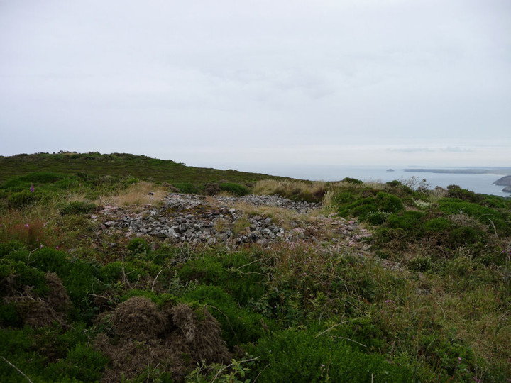
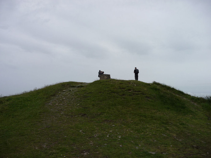
The trig-mounted "Beacon", the highest point of the hill, is considered to be a Bronze Age cairn, later used as a beacon and then a (now vanished) tower. Pastscape description: A mound or cairn on St Agnes Beacon which has been interpreted as a Bronze Age bowl barrow later used as the site of a fire beacon and, in the late 18th century, providing the platform for a prospect tower. The barrow mound, which is about 3.8 metres in height and 30 metres in diameter, was a significant feature in the landscape and stood at the end of a line of three cairns which were visible in the period 1710-20. The shape, raised position and favourable location of the mound, with its all round visibility, led to it being chosen for the site of a fire beacon. The beacon may have been set up in response to the threat of the Spanish Armada in the 1580s, although the first known record of the beacon dates from the early 1700s. The reason for the location of the beacon on the mound were also the reasons which led it to being selected for the site of a prospect tower in the late 18th century. This is considered to have caused the barrow to have a flat squarish top. The tower stood on the mound until at least 1819 when it was in a partly ruinous state and its presence must have dictated the re-siting of the beacon during the Napoleonic Wars, most probably to one of the two other nearby cairn mounds, both of which were subsequently largely destroyed. By 1846 the tower has ceased to appear on maps. The outer matrix of the mound, which is known to comprise of stones ranging from 10cms-35cms in length, is believed to represent the debris of the collapsed tower which has encased the underlying Bronze Age deposits and which has resulted in the roughly square-shaped appearance of the mound. Scheduled. The Ordnance Survey shows two cairns to the north of the Beacon cairn. Pastscape description: There are two barrows or cairns in a north-south alignment, with another further to the south which is more prominent. When the site was visited in 1996 and 1998, both mounds were covered in gorse, grass and bramble which made interpretation difficult. The central mound of the group has the appearance of a roughly hollowed out pile of stones surrounded by irregular dumps and scarps thought to result from disturbance to the mound or from nearby prospecting pits; the barrow was described in evaluation as 'a severely damaged cairn'. Loose stone from the matrix of the cairn appear to be fire blackened, perhaps as a result of the use of the mound as a fire beacon. The northernmost mound of the group appears as a very irregular stony spread about 30m by 19m in an area of rough ground characterised by a series of low roughly shaped mounds; it was described in evaluation as 'an elongated amorphous mound'. |
 Posted by thesweetcheat
15th July 2012ce Edited 27th July 2012ce |