|
|

|
|
Randwick Long BarrowLong Barrow
|
||||||||||||||||||||||||
|
|
|
Images (click to view fullsize) |
|
Photographs: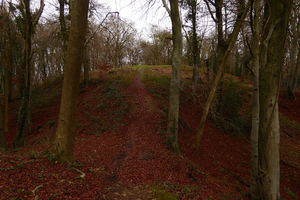
 Maps / Plans / Diagrams:
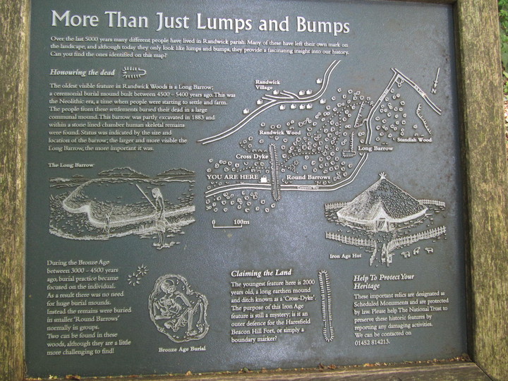
|
Fieldnotes |
|
|
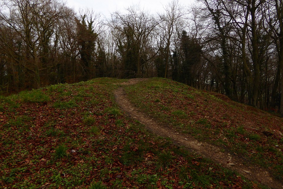
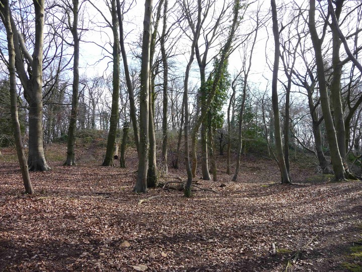
Directions for round barrows: See directions for Randwick Long Barrow. The Barrows can be found in the trees to the right of the information board. The information board states that finding the two Round Barrows is ‘challenging’ – not to your average TMAer I would say! Although to be fair most people would walk right past not knowing what they were. The larger of the two Barrows is approximately 0.5m high x 5m across The smaller one is about 0.3m high x 4m across. They are right next to each other. Worth a quick look when visiting the Long Barrow and Dyke. |
Posted by CARL 7th October 2013ce Edited 8th October 2013ce |
|
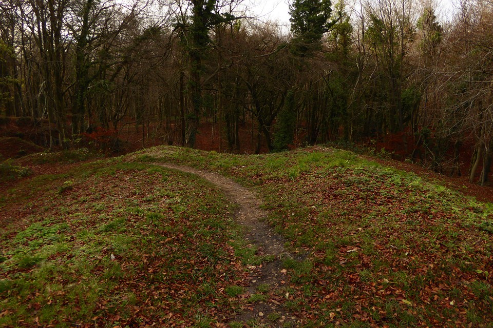
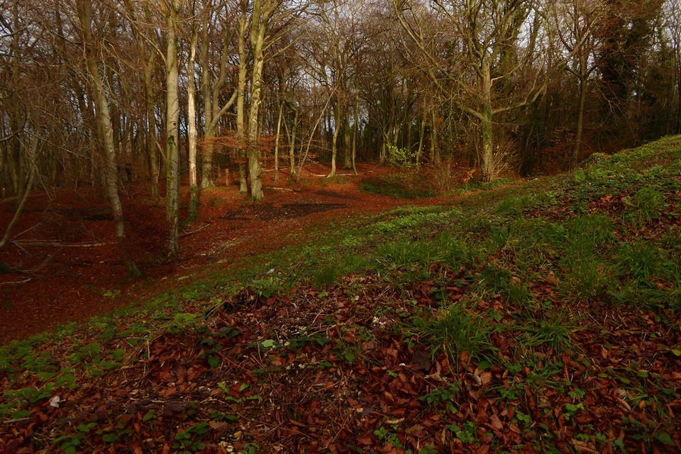
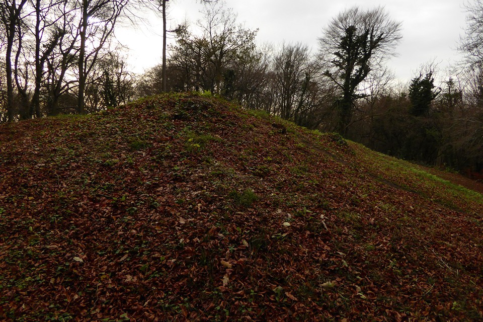
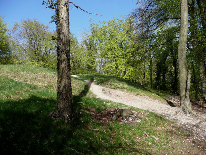
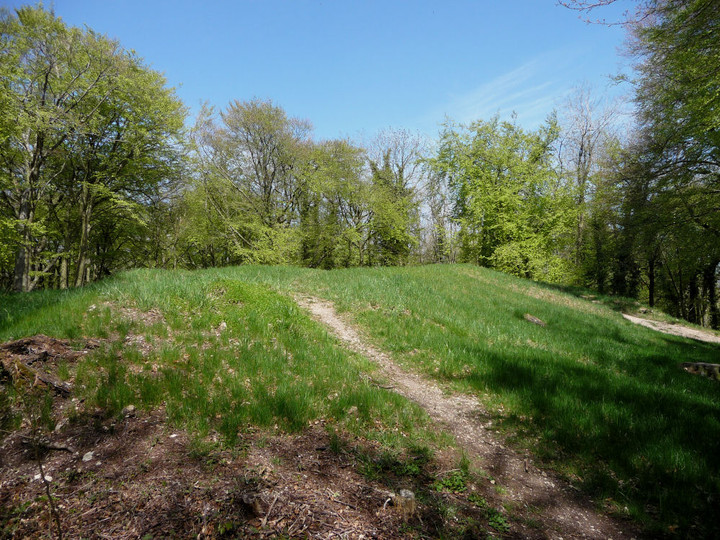
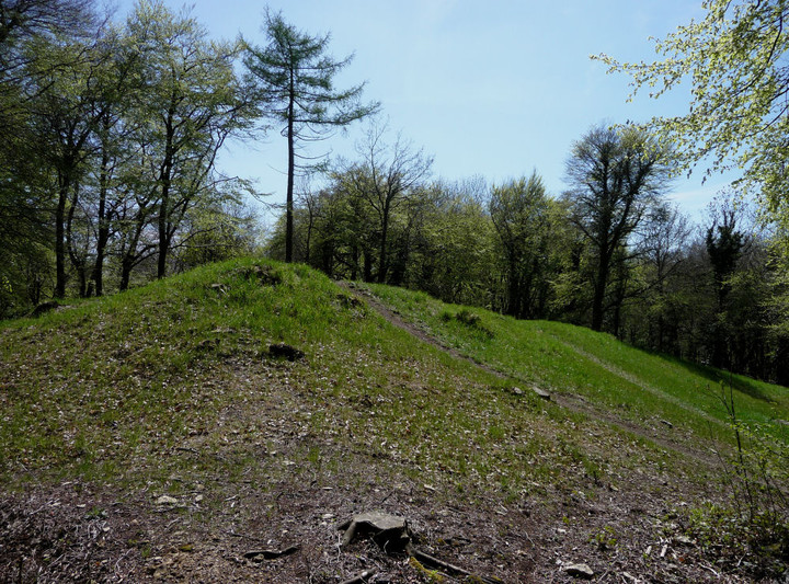
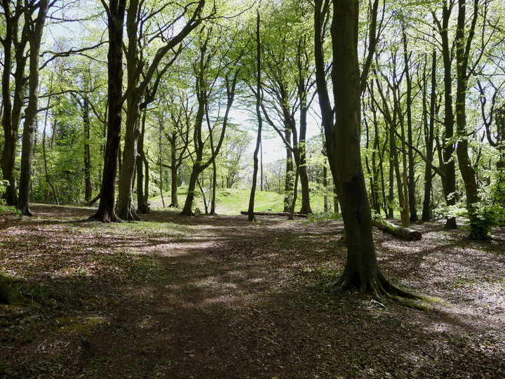
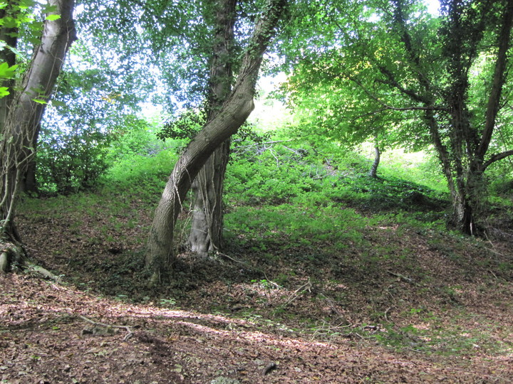
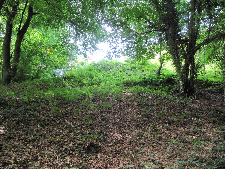
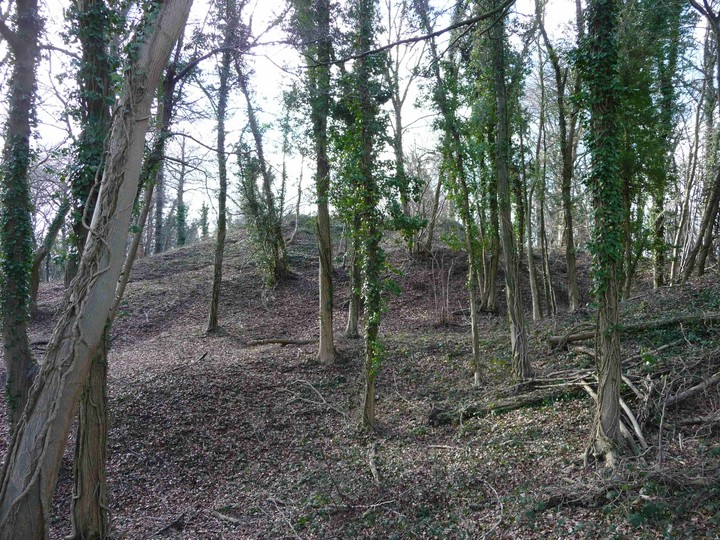
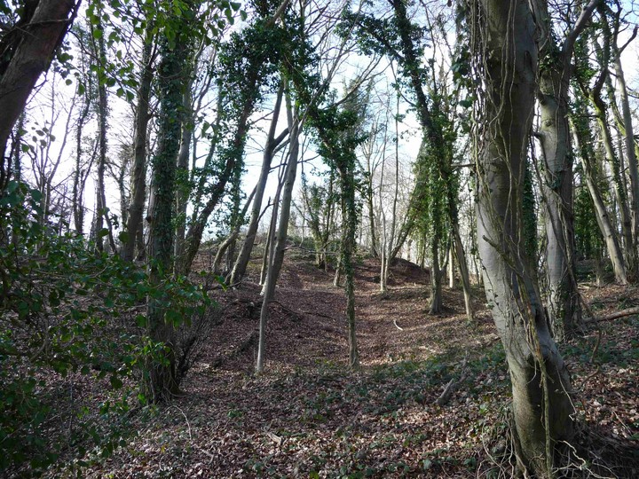
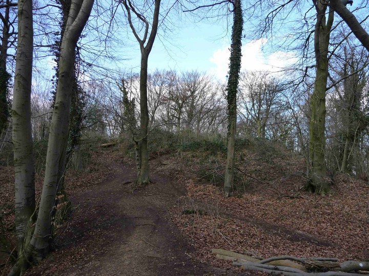
Visited 6.10.13 Directions: From Junction 13 of the M5 take the A419 towards Stroud. Just before entering Stroud follow the signs north for Randwick. Drive through Randwick and as you come out of the other side you will come to a bus stop / parking area for Standish Wood (N.T. site). Park here and walk along the old road (past the metal barrier) which runs through the woods. The Long Barrow / Round Barrows / Dyke can all be found along this path (all on the left). Please note – there is no vehicle access from the west via the B4008 / Stroud Green – as we discovered! Standish Wood is not the easiest place to find but the effort is well worthwhile. The weather was glorious, the sky blue, sun shining and not a hint of wind. Fantastic for early October. Perhaps the last day of summer weather this year? (let’s hope not!) Karen and the children went exploring in the woods while I went to do my own type of searching – ‘old stone’ hunting! It was a very pleasant walk along the old, long disused road through the delightful woods. The floor of the woods was carpeted in leaves and the leaves on the trees were starting to turn to the tell tale colours of autumn – brown, red and yellow. The old drystone wall either side of the road had tumbled in many places and nature had started to take control – all adding to the experience. There were lots of families out and about enjoying the weather and (as you do) we smiled and said ‘hello’ as we passed each other. Isn’t it funny how when you are in the countryside it is the ‘norm’ to say ‘hello’ to anyone you meet whereas in the city you would only get strange looks if you did the same thing? Another reason why I much prefer the countryside. After about 5 minutes of walking along the road you will see a handy N.T. information board on your left. This gives details of the history of the Long Barrow / Round Barrows and Dyke. The Dyke is right next to the info board and you can’t fail to spot it. For the Long barrow keep walking down the road a little further and then head up the slope / through the trees to your left. Just head for the highest point. You will very soon come out into an open ‘oasis’ with a very large Long Barrow sat in splendid isolation. This part of the wood had clearly been de-forested at some point and is now an open grassy area surrounded by woodland. Perhaps a scene our Mesolithic ancestors would have approved of as they waited to catch their prey? (Minus the Long Barrow of course!) The Long Barrow is about 3m high x 50m long. Covered in grass and cut down tree stumps. Someone had recently made a fire on top of it. The woodland on the far side of the Barrow had been dug down and this gives the Barrow a much greater height from that side – perhaps 5m high. The information board states that the Barrow was excavated in 1883 and that a skeleton had been found inside a cist. You can see where it had been dug into although no sign of the cist. Unfortunately, because of the trees, there are no views to be had. However, a section of trees has been cut away opposite the information board and you get a good idea of how good the views would be without the trees. This is a lovely (if a little awkward) place to visit and well worth the effort. |
Posted by CARL 7th October 2013ce Edited 7th October 2013ce |
|
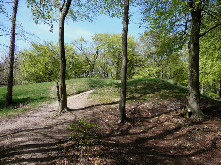
Met up with friend MM today (something an expert on the Cotswolds) pointed car towards Stroud and the village of Whiteshill; parked up at Shortwood car park just off the Harefield Road. Having read a bit about the Randwick long barrow hidden in Randwick/Standish Wood we abandoned our planned circular walk and set off to see if we could find the barrow. Not an easy task as, having once been quarried, Randwick Wood is the full of small mounds and dips. We had climbed over a few wooded bumps before we came across a metal National Trust information plaque which was actually headed "More Than Just Lumps and Bumps" (I have posted a photograph of this beautifully made plaque as it is one of the best I have encountered). It helped us to identify the Iron Age Cross-Dyke, a 2000 year old earthen mound and ditch, the purpose of which can only be guessed at as either defensive or a boundary marker. And finally with the help of OS Explorer map 179 we found the long barrow – only really identifiable by its alignment of east to west. A Neolithic long barrow dated 4500 – 5400 years old; it was partly excavated in 1883 when human skeletons were found in stone lined chambers. The Cotswold Way runs through Randwick Wood and I have to say it is one of the most atmospheric and unusual woods I have yet to walk through – apparently full of bluebells in the spring. |
 Posted by tjj
2nd September 2010ce Edited 3rd September 2010ce |
|
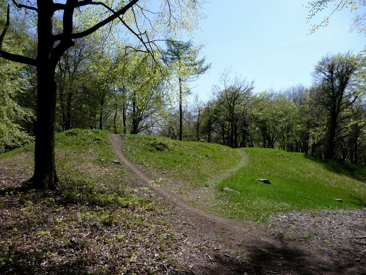
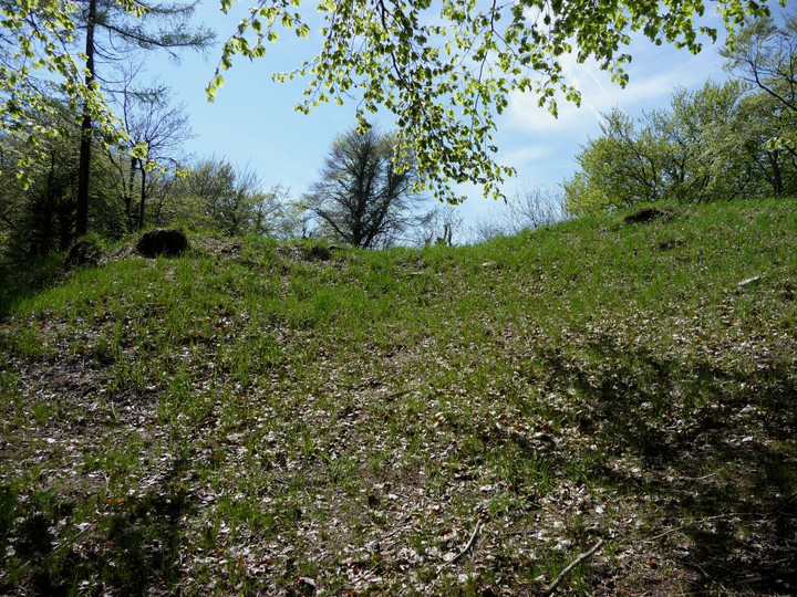
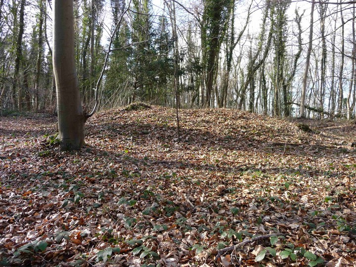
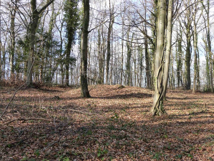
Visited early spring (1.3.2009), hoping that the lack of vegetation would make this multi-phase site easier to see (which it did). Approached from Haresfield Camp hillfort, along the Cotswold Way, a pleasant walk through the woods on a fairly level route. Standish Woods are in NT care, and the first feature is a notice board headed "More Than Just Lumps and Bumps", next to a low Iron Age cross-dyke running NW-SE into the wood. The board has a nice picture of a typical forecourted long barrow. I had anticipated a close cousin (or at least a recognisable relative) of West Tump, as Randwick Long Barrow also lies hidden in the heart of a wood. However, there the similarity ended. Randwick, unusually, is on the summit of the hill - most Cotswold Long Barrows lie down-slope. The interior of the wood has been extensively altered by quarrying, and the barrow seems too high, too big. I walked around it several times to make sure that this was the barrow and not some other feature: summit of hill? check. North end of quarrying site? check. Recognisable long barrow? ...erm. The mound itself is overgrown with brambles and doesn't have the feel of a long barrow, with no sign of forecourt or real shape. I left feeling disappointed, almost hoping I would find the 'real' barrow over the next lump. Sadly I didn't. I did however pass two nicely shaped round barrows, quite small and low. I imagine these will be hidden once the undergrowth returns in the summer. |
 Posted by thesweetcheat
1st March 2009ce Edited 1st March 2009ce |
Miscellaneous |
|
|
This long barrow lies in Standish Wood above Randwick. It was dug into in the 1880s by a Mr G B Witts, when it had two cotswold-severn style horns and a single corbelled chamber with a mass of bones inside. He also found some skeletons just outside the south-west end of the barrow which he took to be 'slaves buried with their chief'. The aptly named owner, Mrs Barrow, demanded that the walls and chambers exposed should be covered up again to protect them from damage, which they were. There are also some later round barrows and other earthworks on the hill. Nearby lie areas (now of the outskirts of Stroud) called 'Puckshole' and 'Paganhill', should you think this relevant in illuminating past beliefs. (arch. info from James Dyer's regional archaeology of the Cotswolds and Upper Thames) |
 Posted by Rhiannon
12th November 2003ce |
Links |
|
Internet ArchiveG B Witts' article about the excavation of the barrow. In 'The Proceedings of the Cotteswold Naturalists' Field Club' 1881-82. |
Posted by Rhiannon 25th January 2017ce |