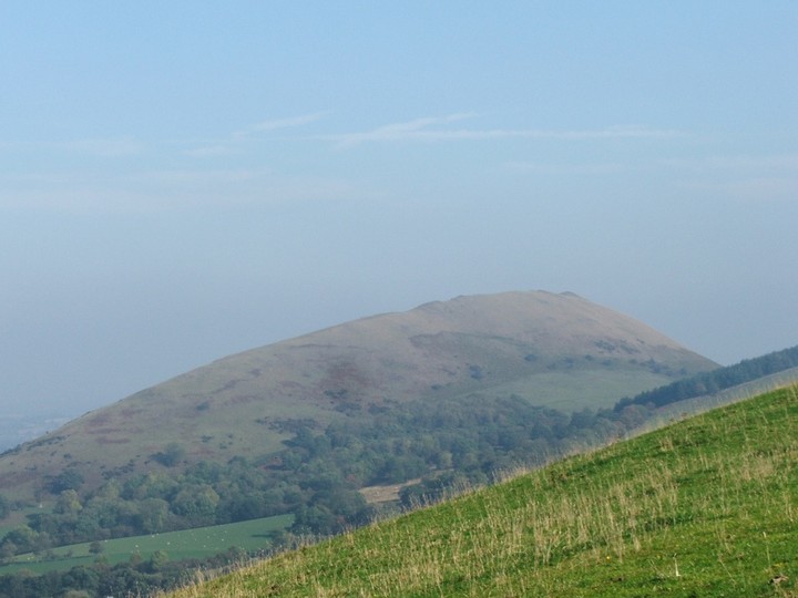
The Lawley is a long ridge shaped hill of about 1240 feet situated to the North of Caer Caradoc Hillfort. At first glance the hill appears to have no ancient earthworks of any note, however look closely enough and ideally with a light dusting of snow, three distinctive ringed enclosures can be made out, The largest and clearest is located on the summit, another is located about 400 yards North, a bit lower on the ridge. And a third is slightly oscured by trees another 200 yards North and slightly lower down the ridge again. Their purpose is unclear and not much is known about them, but they look prehistoric, likely to be bronze age settlements or primitive hillforts in my opinion.
A small probably Iron Age settlement situated, at 250.0m above OD, upon the northern high point of the Lawley, a very steep-sided pasture and bracken-covered ridge running NE to SW. The enclosed area measures 85.0m in length, and from 12.0m at its waist to 18.0m at the ends, in width.
The site is bounded on the NW and SE by a simple scarping along the head of the steep natural slopes. At the northern end it is enclosed by a bank 5.0m wide, 0.3m high internally, with an outer ditch, 4.0m wide, 1.0m deep internally, and at the southern end, by a ditch 5.0m wide, 1.7m deep internally with an outer bank, 5.0m wide and 0.5m high. Through the centre, is a simple causewayed entrance, 2.0m in width. The banks and ditches at both ends of the enclosures, turn at either end onto the natural slopes and fade out.
There are no signs of internal occupation.
Southern earthwork:
SO 494974: An Iron Age defended settlement situated at 370.0m OD upon the highest part of The Lawley, a very steep-sides grass-covered ridge, running north-east to south-west. The enclosed area measures 150.0m by 70.0m, and is bounded on the north-west and south-east sides by a simple scarping along the head of the steep natural slopes, and presumably by the slopes themselves around the northeast end, where no certain traces of scarping could be detected. Across the ridge at the south-west end, there is a rock-cut ditch 6.0m wide, 1.0m deep, between ramparts, 6.0m wide and 0.3 to 0.9m in height. Ditch and ramparts extend some 50.0m fading out at both ends upon steepening side slopes. The entrance was probably around the southern end of the ramparts.
Towards the northern end of the site is a probable hut site upon a platform, scooped out of the south-east facing slope, which measures 11.0m by 7.0m. No other signs of occupation were found.


 Posted by thesweetcheat