|
|

|
|
Ringstone Edge Cairn CircleCairn circle
|
|
|
|
Images (click to view fullsize) |
|
|
Fieldnotes |
|
|
I had a good look at this place last week. This would have made a very impressive site if the stones had still been there. My grandfather used to tell me that a local farmer pulled down the last of the stones sometime in the 1940s. Apparently he remembered this site from his childhood years when there was more to see. Still a nice place to visit in nice weather. |
Posted by Comus 29th August 2008ce |
|
I had a closer shufty around here today and found what could be an inscribed stone. It is broken but has a definite cross with a border around it. I have a picture and it will appear here shortly. I found four large stones today, one at least five foot tall but laying prostrate. The other three were between 2 and a half and three foot tall, again, laying prostrate. |
 Posted by daveyravey
7th December 2005ce Edited 7th December 2005ce |
|
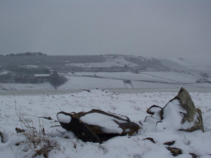
'Ruinous remains of what on the map is called a 'cairn circle'. 35 paces across; various clumps of stones dotted around it, one fallen stone about 3.5' long; one pile of stones larger than anything else at its southern end; a distinctively sized stone at its centre; enother, oblong, fallen stone travelling clockwise from there about 2' long; another small but distinctive clump a little further round again; a clump of stones at the centre. The whole thing is perhaps embanked.' - 28 February 2004 |
Posted by FlopsyPete 14th March 2004ce |
|
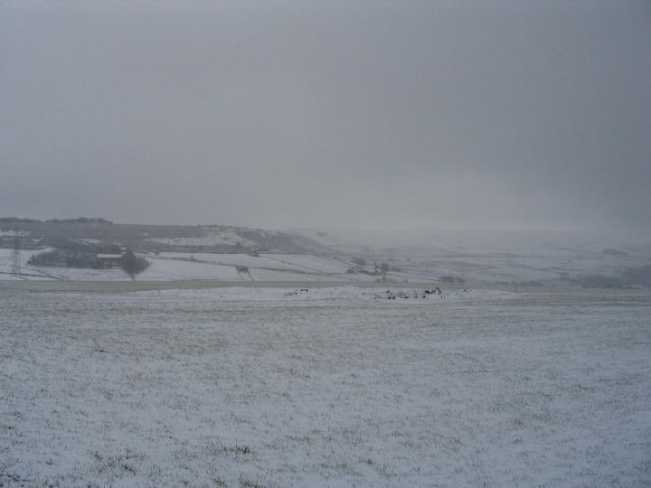
Walk up a concrete bridleway and past a dilapidated farm building. When you reach the gate climb over and follow the wall on the right. Be careful as this field is used for radio controlled aeroplanes. Upon reaching the right-hand corner of the wall, the ring-cairn is off to the left over a brow of the hill. The run way is just before you get to it. The cairn itself is in the middle of a cultivated grass field but the interior is unblemished. It has a low rubble bank, around 27 yards in diametre enclosing a large 4 foot prostrate stone near the centre and there are other big stones. Other sources suggest that this is the remains of a stone circle that was desturbed by the building of a reservoir very nearby. The cairn is visible fom a long way off and can be seen from the road at the south end of the reservoir. Dave 28th December 2003 |
Posted by daveyravey 28th December 2003ce |
Miscellaneous |
|
|
"On top of a flat plateau on this moor, with an extensive view on all sides save on the north, where there is a gentle slope for some hundreds of yards up to the summit of the hill, there are distinct traces of a circular ring of small stones. Pygmie flints have been picked up within a yard or two, but the only other fact to be noted about this earthwork is that there is a tradition to the effect that much earth has been removed from this site. It is not altogether impossible that this is a scanty remnant of a round barrow" The Ancient History Of Huddersfield: Early Man In The District of Huddersfield by James A. Petch 1921 |
Posted by daveyravey 9th March 2005ce |
| John Watson, an eighteenth century local historian and antiquarian, writes about druidical stones called the "Wolf Stones". Barkisland, a nearby village translates to "wolf country". In 1905, five sets of cremated remains and an urn were reported to have been found within a small mound at the centre of the circle. |
Posted by daveyravey 28th December 2003ce Edited 29th December 2003ce |
Links |
|
Old MapsAn old map of the site lends weight to the idea that this "cairn-circle" may have been a stone circle. This map says that that in 1854 this site was "supposed driudical" and calls it a "ring of stones". There is also a track running past it that is not visible from the ground, as the field has been cultivated |
Posted by daveyravey 28th December 2003ce |
MultiMapAerial Photograph of Ringstone Edge Cairn Circle |
Posted by daveyravey 28th December 2003ce Edited 28th December 2003ce |