|
|

|
|
RoosdycheAncient Village / Settlement / Misc. Earthwork
|
|
|
|
News |
|
|
Bronze Age axe found in Whaley Bridge As reported in the Buxton Advertiser, a good quality find of a Bronze Age axe 1100-1600 BC was found in Whaley Bridge in January. |
Posted by brigantian 8th February 2005ce Edited 8th February 2005ce |
Images (click to view fullsize) |
|
Photographs: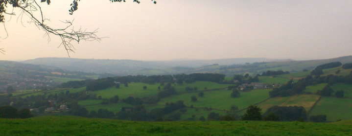
 Maps / Plans / Diagrams:
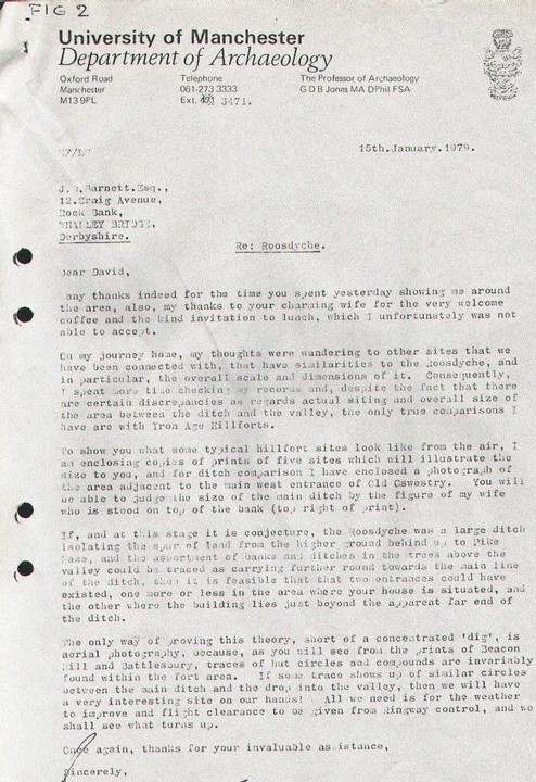
|
Fieldnotes |
|
|
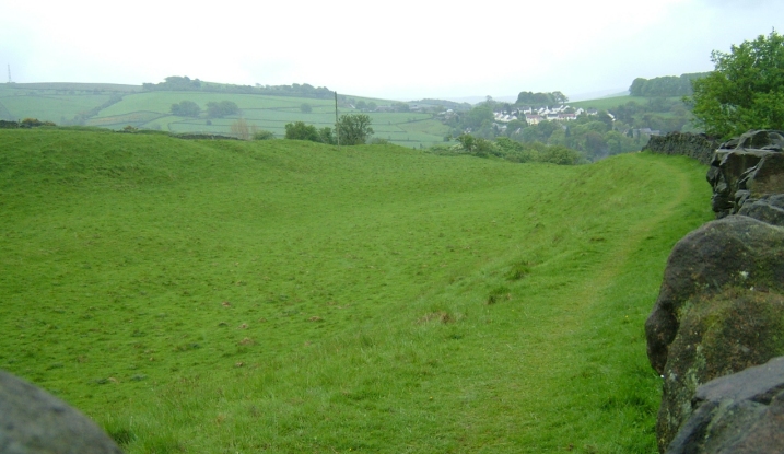
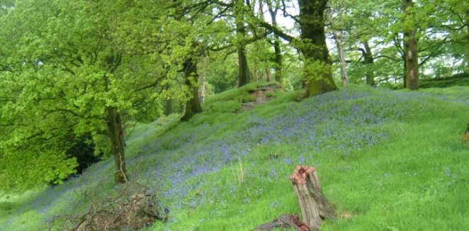
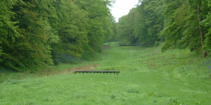
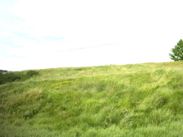
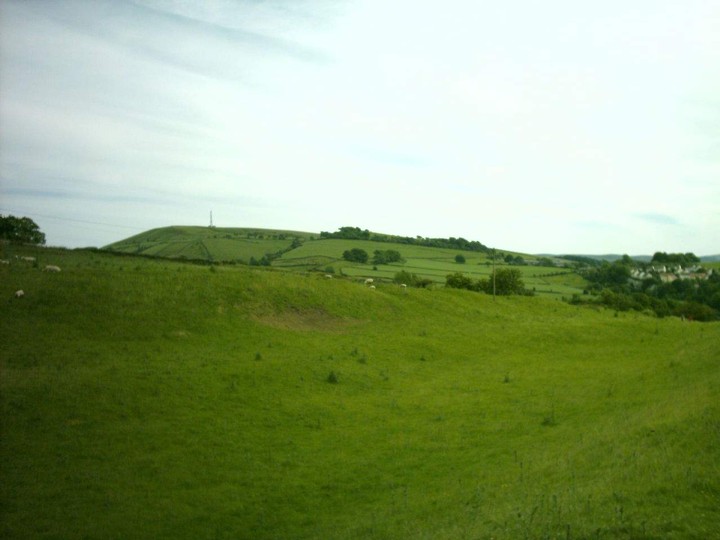
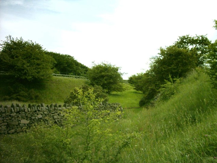
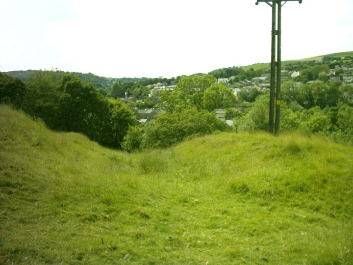
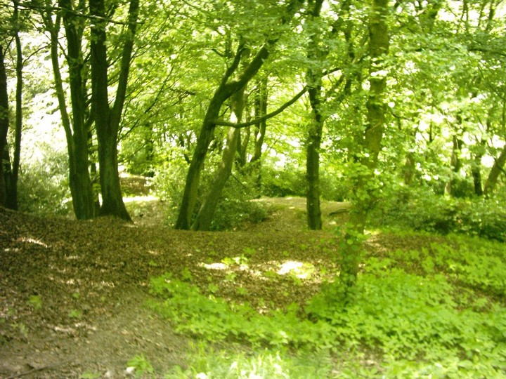
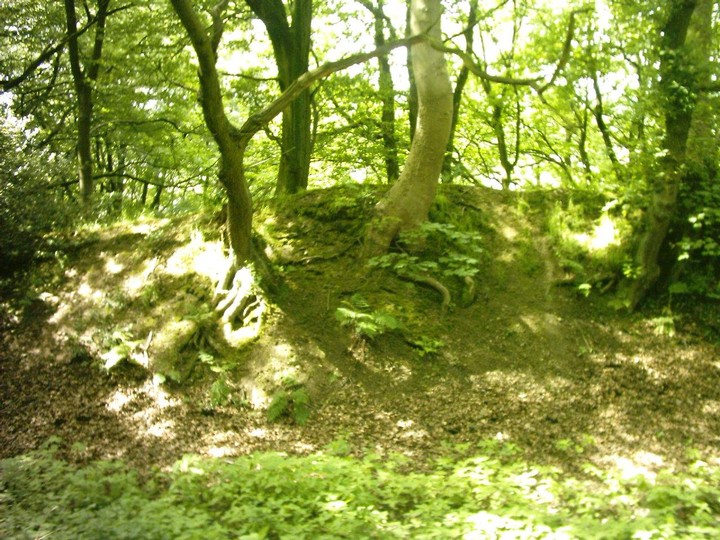
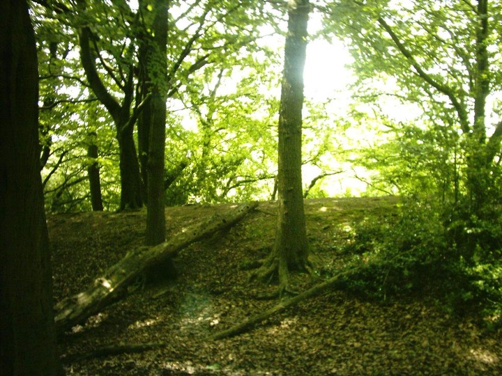
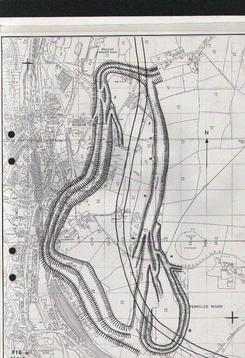
[visited 22/4/11] Widely accepted by academics as glacial but a vocal minority insist its man made and prehistoric, so I thought I'd have a walk about, over and round to see what I could see. So er, this is not a hill fort at least not in any classic sense. I've been to a couple of the Peak forts and quite a few more in the rest of the country and not one looks like this. However, there are parts and hints which point to this being more than a glacial feature. I should say though, I am no expert on or amateur obsessive of glacial features... I started on the Chapel road and headed for the new cricket pitch (nice and level). The end of the Roosdyche (henceforth known as RD) starts not long along the footpath, I followed it to the new cricket ground and then along the footpath which runs parallel to the RD (which is private property keep out!), up to the Northern end of RD. The overriding fact of walking this part is that the land to the West drops off and that the land to the East on the other side of RD from me, rises appreciably. A couple of peaks over the 5'8'' stone wall as I walked revealed no bank on the western side of RD, the land on the western side going up to the edge. These facts lead me to categorically believe any fort or defended enclosure cannot be to the West and so the conjectured map on here is wrong. Another discrepancy to hillfort normality is that the sometimes large undulations of the floor of RD do not follow the contours of the land and so are perhaps symptomatic of bedrock changes being reflected in the erosion caused by water. However, I then continued the walk starting at the Northern end of RD heading east to Mosley Hall Farm, then past the old cricket pitch (on a slope), onto a sneaky 30 yards of RD, to the lane by the new cricket pitch, up the lane past Horwich House and Horwich Farm, then finally back down the road to my car by the Chapel road. This where the weirdness and hints of prehistory start. As I crossed the RD I am sure you can detect a hint off a bank on the Eastern edge, though certainly not all the way along. Nothing sprung out at me until Mosley Hall Farm, there the track to the North East of the farm follows a ditch, then as you are given the option of the farm to the right, look left and what could be an earthworked rampart looks at you. Back at the RD, on the track that heads East past the new cricket ground, on the East side of RD, there is what seems to be the spitting image of a mutivalate hillfort entrance. Looking south through the barbed wire fence along Dingle Wood a bank ditch bank combo can be seen, but not accessed. East of Horwich house a track runs North to South, in a ditch. Finally on the West side of the road which heads South from Horwich Farm, a bank could be veering West back towards the Southern end of RD. So, what's going on? Certainly any of the ditches and banks to the east of RD taken individually, with the exception of the possible entrance, could just be geology or sunken ways or all sorts of other later features. But taken together I think there is a real possibility, that this was enclosed at some point in the past. Issues would be geography and size. Frankly the high ground further west would be much more likely for a hillfort, even with Eccles pike looking over it. Size-wise, the area enclosed would be larger than (say) Maiden Castle, so this would be a massive enclosure. Another issue is that Castle Naze is only 2-3 miles to the South East and the peak's forts don't tend to be that densely located. Personally, I think this could be a status symbol, a great and effectively undefendable folly, aimed to the North. Using the existing glacial RD to enhance the front which would be well protected whilst it's sides and back could be a small bank and palisade. It does lie on or near a tribal boundary and would be clearly visible from the North for several miles. It also sits on the Goyt, one of the major tributaries of the mersey. |
 Posted by juamei
22nd April 2011ce Edited 28th August 2013ce |
|
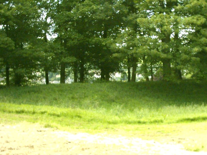
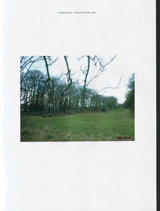
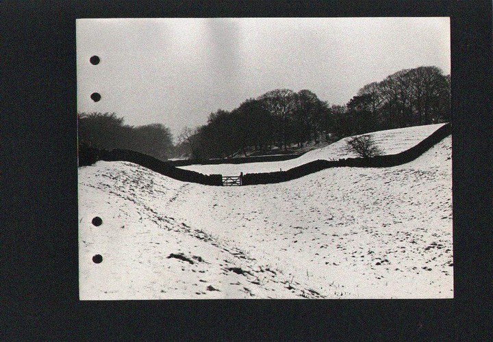
The Roosdyche is a large trench on the Western slopes of Eccles Pike .The dyche runs North-South and is approximately 740 metres long with a maximum width of 32 metres and a maximum depth of 12.5 metres.The name Roosdyche was marked as an antiquity in the Ordnance survey sheet no 81 N.W quarter published 21 st march 1842 and is the earliest reference to the site that can be found . What it might be is a subject of conjecture older locals will remember that it was described as a Roman chariot course very unlikey accept it does suggest the site was a one time circular or oval . The Roosdyche has been investigated by R .H Johnson in 1962 and students of Manchester University who concluded that it was probably of glacial origin with some modification by man . There are however several signs of occupation finds of stone domestic hand tools have been made I have two authenticated specimens . Traces of earthworks exist in the Northern and Southern ends of the Dyche turning Westwards .However in The Bings Wood area very well preserved ditches can be found . The defences extending westwards from the Roosdyche appear to be of classic Iron Age multivallate type and they are defending higher ground .The Roosdyche section of the defences is unusual in that this defended area is lower than the surounding ground and that a multivallate ditch systems would not give any advantage to the defender . The required defence against slingshot and spears etc would be a flat bottomed ditch wide enough to make missiles from the higher Eastern ground ineffective and to create a killing zone for any attackers venturing in to the bottom of the ditch . Venutius was believed to employ different ditch defences to the Iron age norm .His expirience fighting with the Romans prior to the rebellion may have led him to do this .This ditch could have been modelled on those lines. The single rampart defence would have been strengthened by a wooden pallisade . Iron Age forts had an entrance maze to keep any attackers at a disadvantage .One can be reconstructed out of the remaining ditches that Johnson thought were tributeries to a glacial meltwater stream .These ditches are broken straight through by the road that goes up to the Old Cricket ground and though Johnson concludes the Western rim is man made ,how did he conclude that the other ditches that interlock there including the Dingle which is multivallate were of glacial origin . The Dingle ditches turn round the back of the main Roosdyche almost linking up near the old pig stys .they probably did as we Know this is where there was an old coal mine and just as the ditches at the Bings/Buggesworth end were quaried away so were these . The Dingle ditches leave a flat plateux between themselves and the main Roosdyche and therefore we have a multienclosure site consisting of main miliatary defences and living area with possibly Animal Enclosure or special persons residence such as at Stanwick |
Posted by brigantian 20th March 2004ce |
Folklore |
|
| Legend has it that the Roosdyche was a Roman chariot race track with banks for spectators to sit and watch the spectacle |
Posted by brigantian 17th March 2004ce |
Miscellaneous |
|
| The Roosdyche lies to the south of Whaley Bridge between the new and old cricket grounds on New Horwich road. Originally listed as an Antiquity or an Earthworks it appeared as such in the ordnance surveyfrom the 1840s to the 1960s when a University of Manchester field study was printed declaring that the site was of glacial origin. The site is huge and spread across two main sites and consists of several banked ditches resembling a low level iron age oppidum found in the south of England. In 1979 the University of Manchester investigated the site again and this time with caution claimed that it as indeed a huge iron age complex, probably of a fortified mining quarrying nature. Its situation close to an area where 2 rivers meet and where the coal seam outcrops on the surface as well as being in the border of Brigantia and Corritanni lands suggests that this could be a very important site if proved at the moment the glacial origin holds sway, though there are several inconsistencies in that. Also finds of stone tools and a horde of Roman coins has been discovered in the area, the profusion of ancient sites in the area suggest there was something large that would sustain a sizeable population. |
Posted by brigantian 17th March 2004ce Edited 17th March 2004ce |