With the benefit of hindsight - ah, a wondrous thing - perhaps a sojourn at this pair of monuments beneath the soaring, eastern profile of Beinn na Caillich wasn't exactly conducive to a nice, relaxing evening following on from pretty intense visits to Shiel Bridge and nearby Achadh a'Chuirn?
Now this is not to insinuate that such an obscure location, one lying well out of sight of prying eyes within forestry - in fact only actually visible from upon the dominating mountain itself - doesn't possess all the necessary constituents for the optimum vibe. Quite the contrary, in fact. To clarify, let's just say that when even an authority such as Audrey Henshall [1972] was confused by the form of these monuments, to the point of even questioning their assumed funerary function, this Citizen Cairn'd's brain wasn't exactly going to be able to simply chill out. It wants answers! Now! Which, needless to say, were not forthcoming... I'd like to attribute this failure to the overgrown nature of the site, but perhaps that's mere wishful thinking?
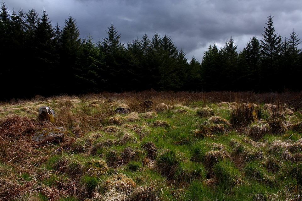
Thankfully I'm on much firmer ground - metaphorically speaking, since the physical terrain is very waterlogged indeed - as I attempt to 'walk the talk' (as our erstwhile revolutionaries across the Atlantic might well say) and follow my own previously posted directions. Yeah, parking opposite the electricity sub station the gaunt lattice work of a power pylon highlights the entrance to a wide forest break, this allowing the passage of its cable-slung companions through trees to the approx south-east. A lateral wire fence needs to be negotiated before, upon passing two further pylons, a gap in the trees will be discerned to the right leading unerringly to the relevant clearing. Pretty simple, to be honest. However interpreting the archaeology located within the clearing is anything but.
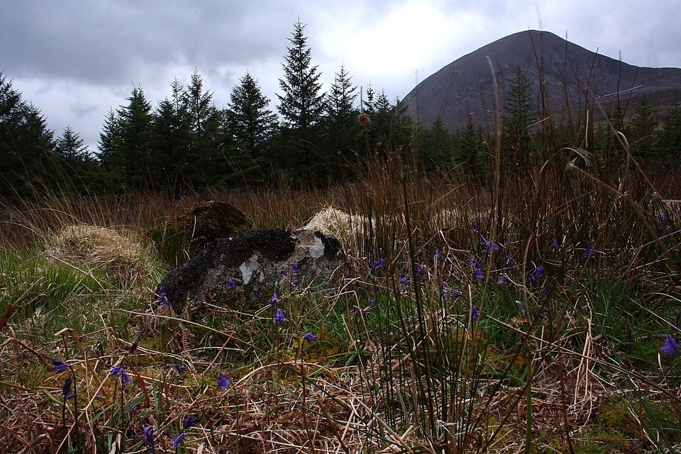
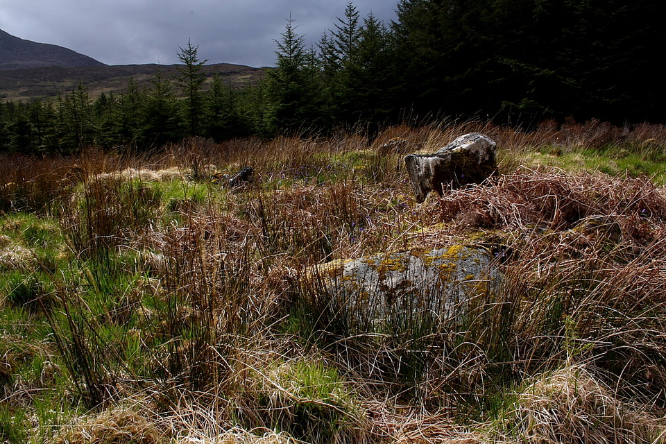
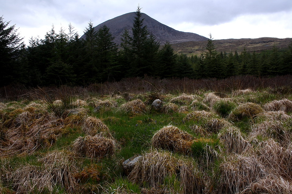
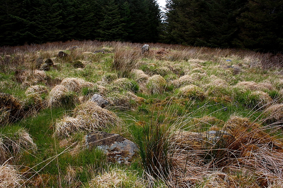
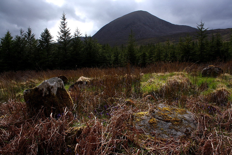
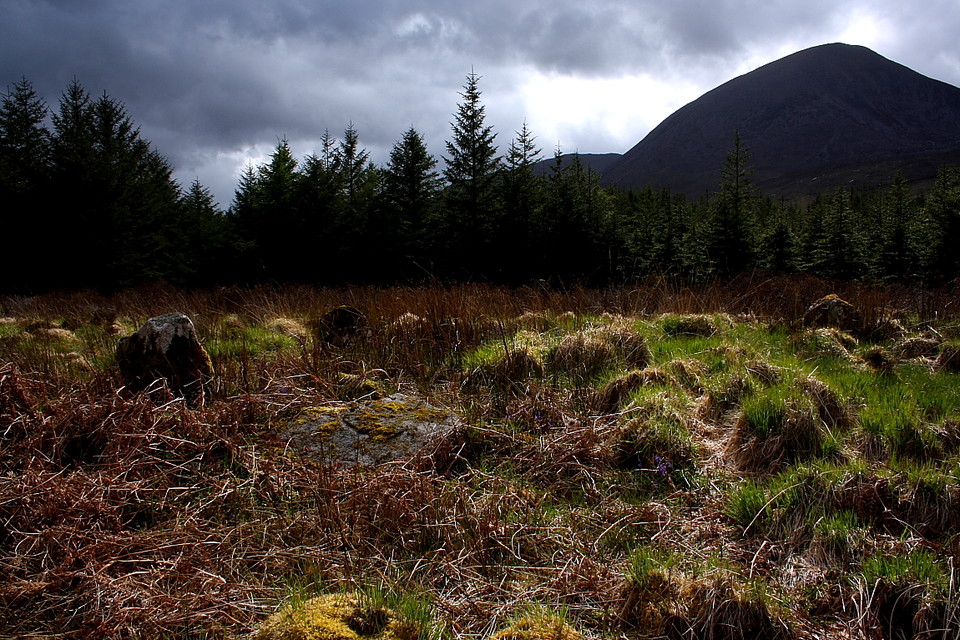
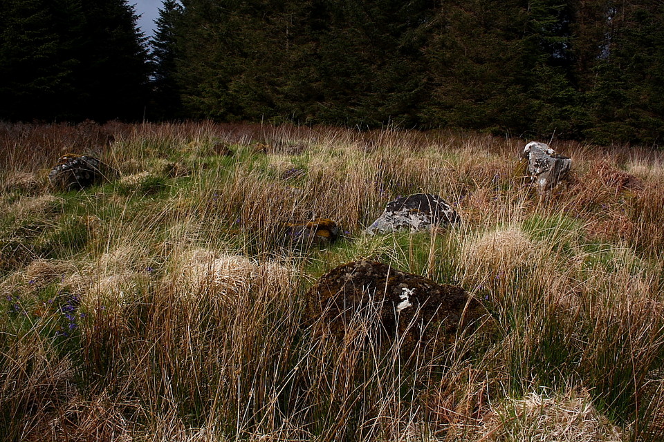
Initial observations are pretty standard, assuming any inspection incorporating the imposing mass of Beinn na Caillich filling the available skyline can be described as such, suggesting the presence of two disturbed chambered cairns subsumed within the long grass and aligned upon a roughly north-south axis. Closer examination, however, reveals not only what appears to be the welcome remains of a substantial kerb encircling the larger, northern monument... but also a distinct lack of 'cairn'. The latter, of course, is easily explained away since many an ancient stone pile has been severely reduced - or destroyed - by locals pilfering building material for dry stone walls and such-like. And Nature has been pretty thorough reclaiming the stones for herself, possibly obscuring a lingering residue in the process.
What is not so easily explained is the apparent 'horse shoe' ground plan of the internal grouping of orthostats, the assumed 'chamber'. Yeah, what was that all about? Why just pinch the cairn and chamber door... and leave the rest. Unless there was never a 'door' in the first place and the stones formed a free-standing arrangement within a kerb, or proto-circle? Supposition, naturally, but one can appreciate why Miss Henshall had her doubts back in 1962, perhaps? The southern monument is much less substantial but (tentatively) seems to follow the same pattern.
Somewhat perplexed, I decide to lie back in my self-imposed, albeit temporary obscurity and enjoy the moment under the watchful gaze of whoever - if anyone... 'Saucy Sue', perhaps? - still resides within Beinn na Caillich's great cairn looming overhead. I'm hoping the subliminal workings of my subconscious will bring enlightenment. However they do not. Aside from the realisation that, for more or less the first time this trip, conditions are ideal for the midges which are now making their presence felt. Little bastards! Time to retrieve the head net from the rucksack and give them the proverbial 'two fingers', allowing me to drift off for a while. OK, I might not be enlightened... but I'm nevertheless illuminated by a sun seemingly intent upon doing its thang before finally dropping below the razor-sharp skyline. So, time to go, having decided to spend the night below An Sithean.
So who's correct about the nature of what is to be found here in this wondrously quiet spot? The post WW1 RCAHMS... or Audrey Henshall visiting at the beginning of the swinging 60's? For what it's worth I would suggest both authorities have a point and perhaps these are idiosyncratic monuments. Not classic chambered cairns, but maybe incorporating hybrid elements? Guess the best course of action for those who might be intrigued is to come and have a look for themselves.
Unfortunately missed these... I would say due to the somewhat misleading RCAHMS nomenclature... but that would be unfair since I was in no fit state to visit anyway back in May, following a day upon the sacred summit towering above.
To reiterate the discussion findings, note that this site has nothing to do with the great cairn crowning Beinn Na Caillich, but - according to 1:25K OS map (they are not depicted upon the 1:50k) - consists of two chambered cairns within forestry at the co-ordinates given, that is in the vicinity of the Broadford River.
I'd suggest taking the Old Corry road just outside of Broadford and, parking near the Electricity Sub Station, it would appear an audience can be gained by following the pylons beyond (to the approx south-east), keeping a little to their right. Perhaps. Might need to cross a water course, so happy hunting!

 Posted by GLADMAN