|
|

|
|
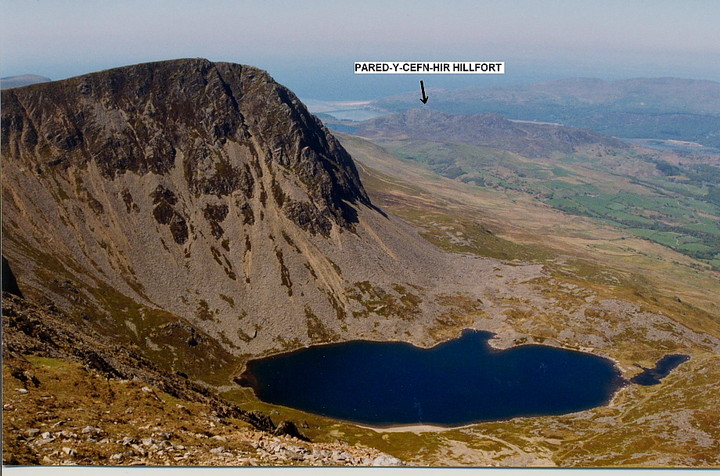
Pared-y-Cefn-HirHillfort
|
||||||||||||||||||||||||
|
|
|
Images (click to view fullsize) |
|
Photographs: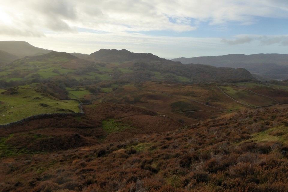


 Artistic / Interpretive:
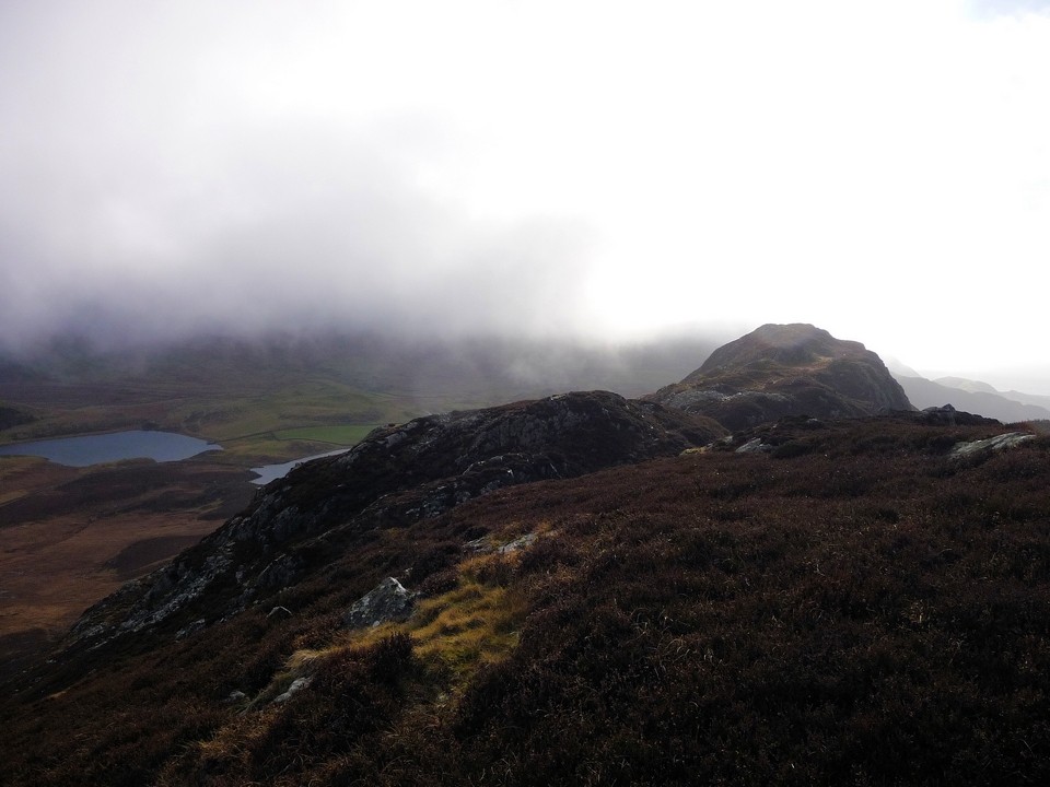
|
Fieldnotes |
|
|
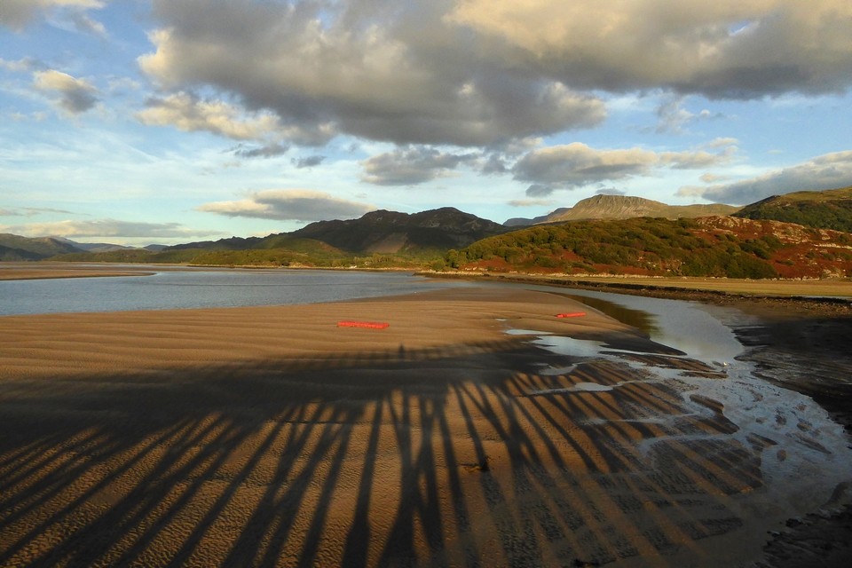
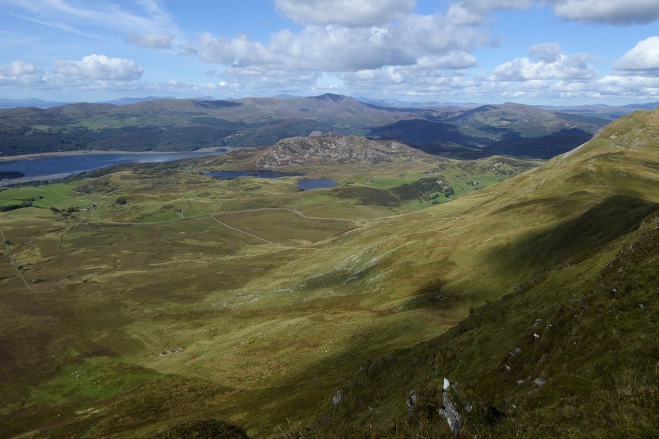
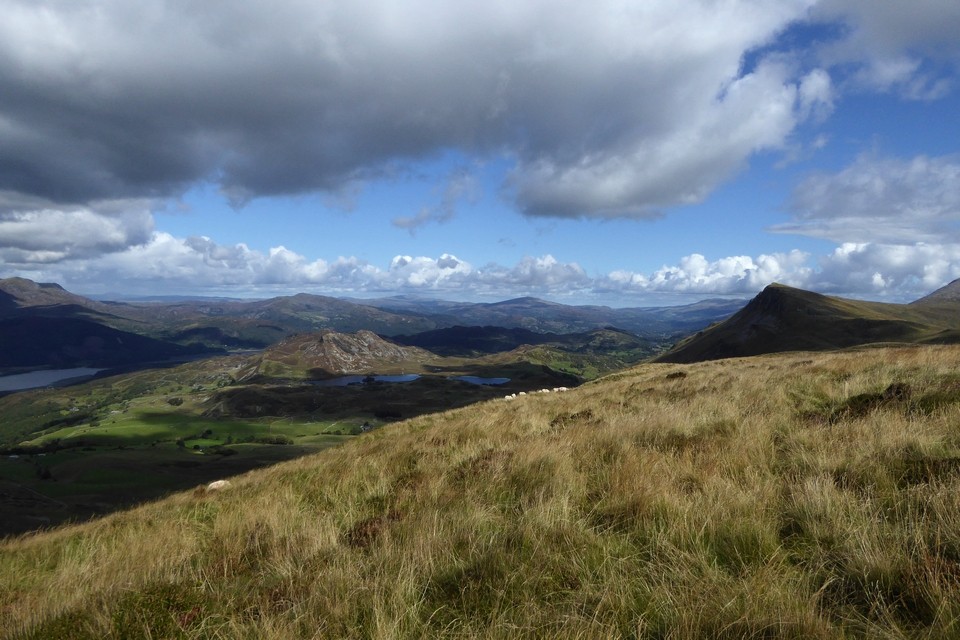
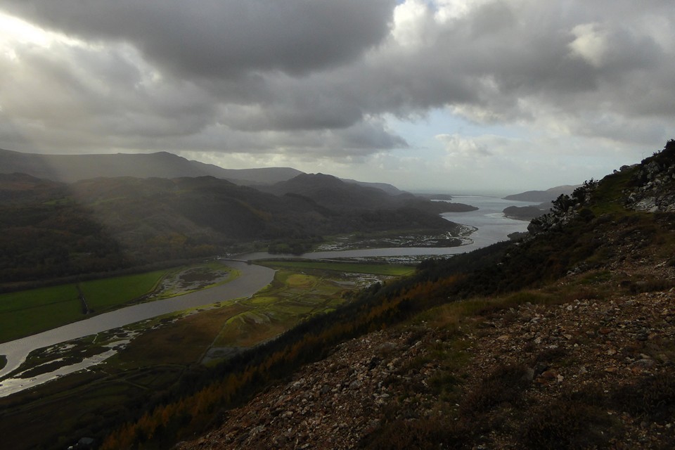
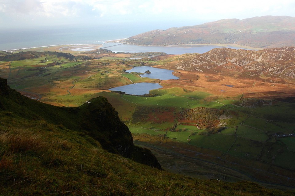
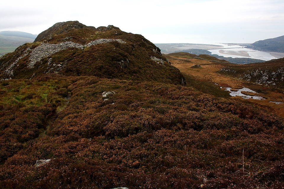
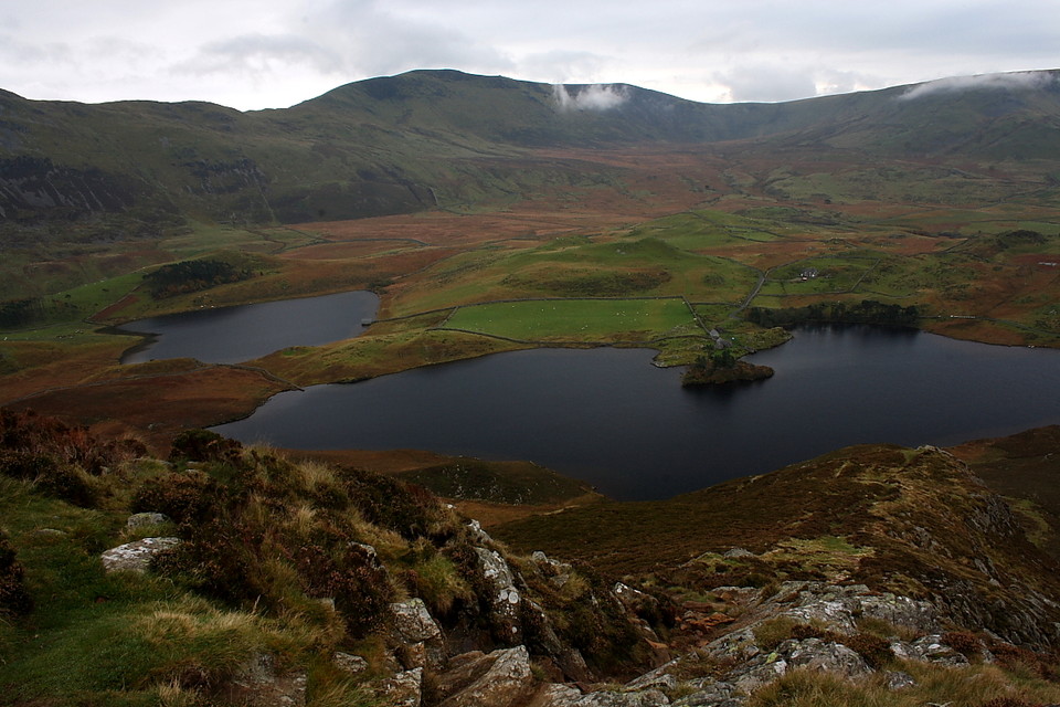
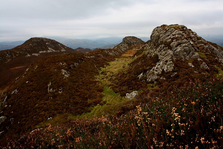
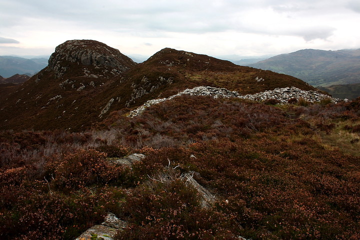
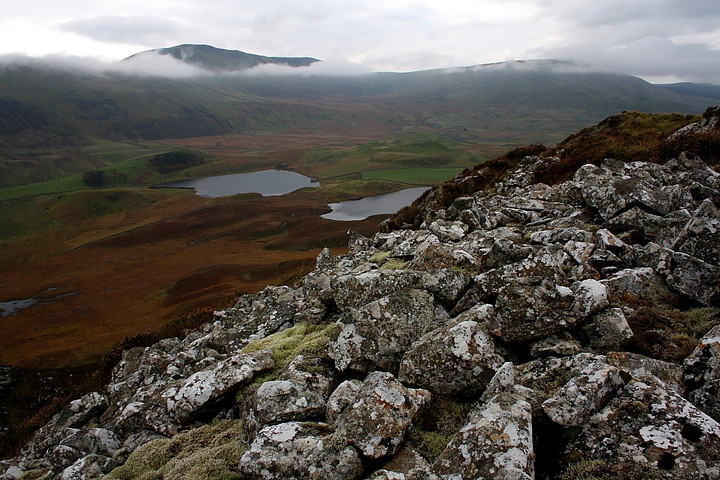
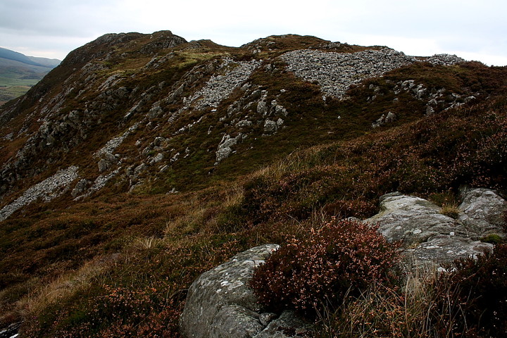
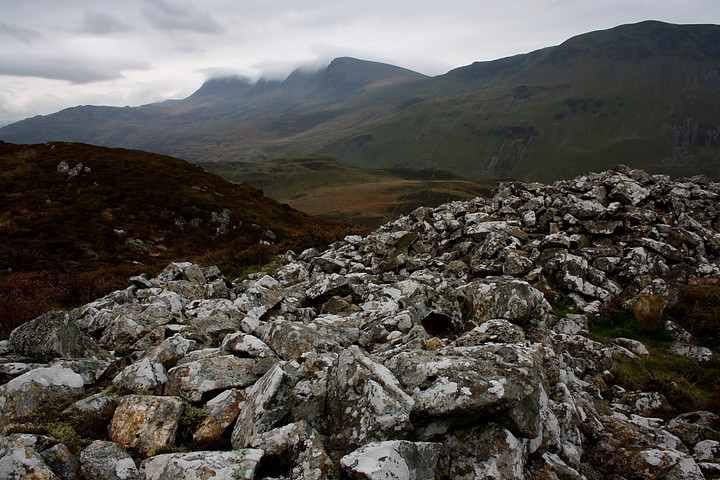
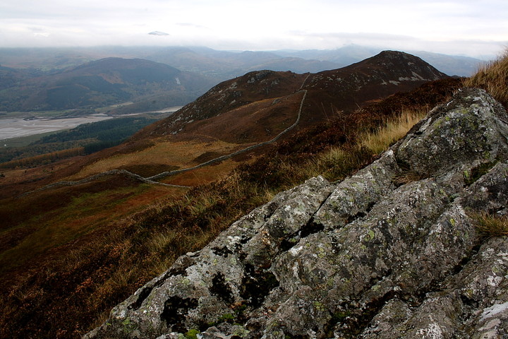
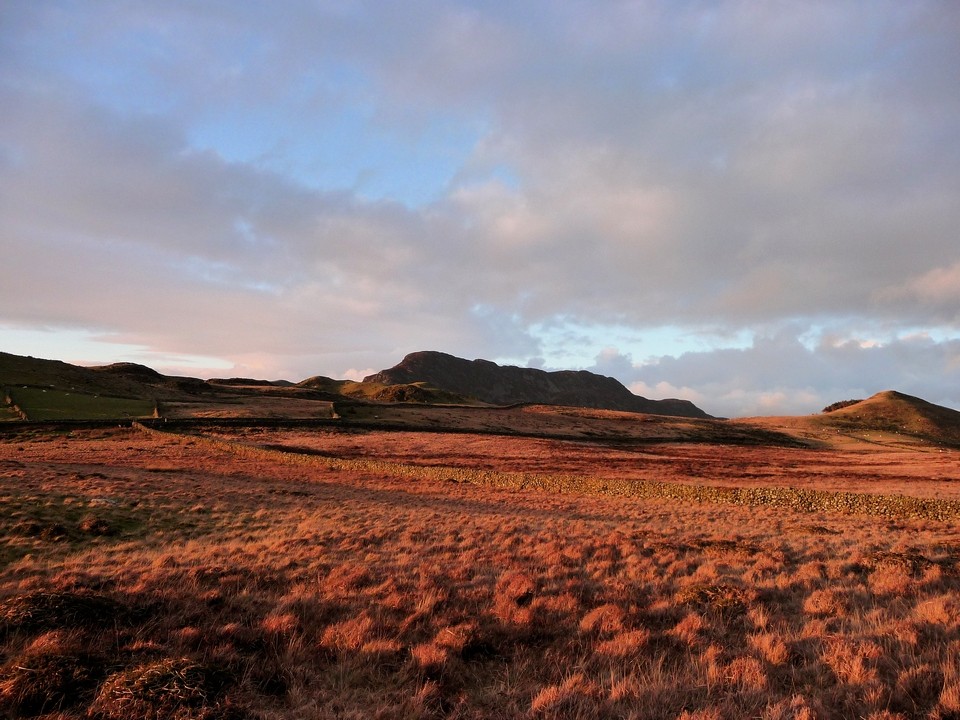
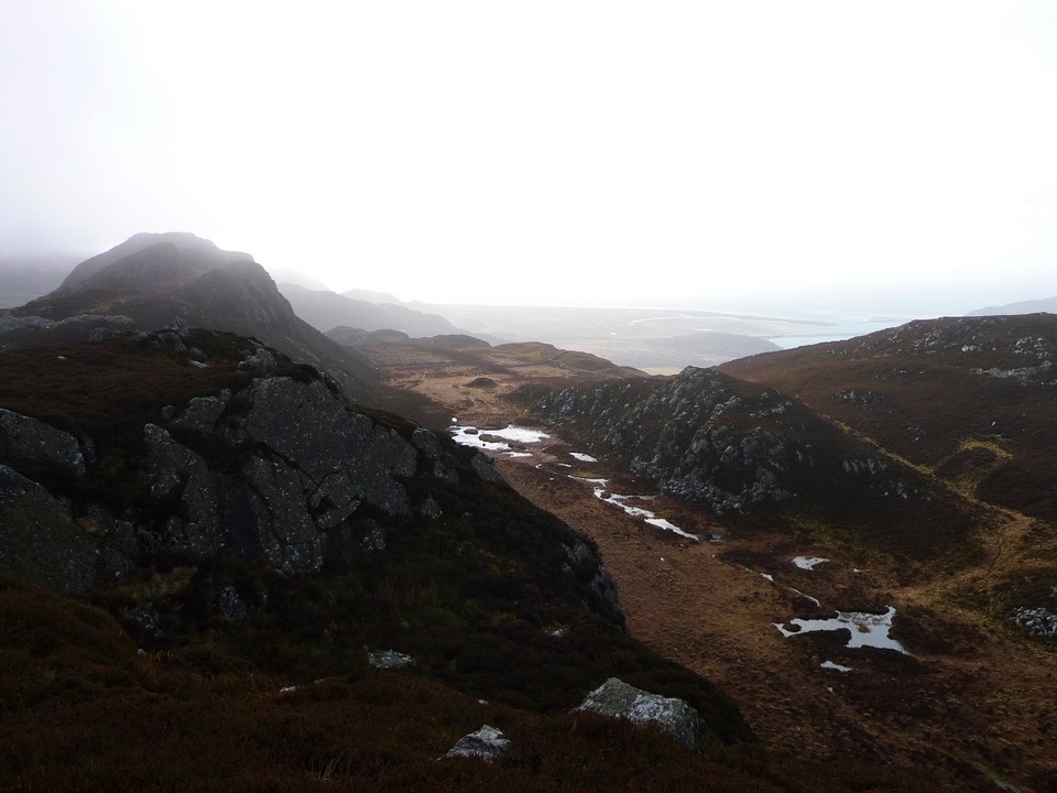
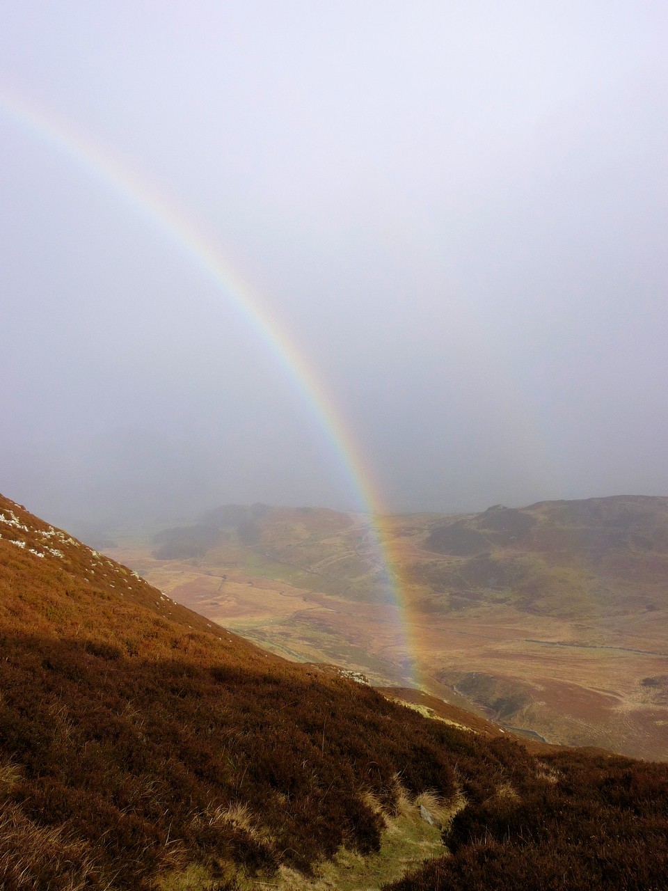
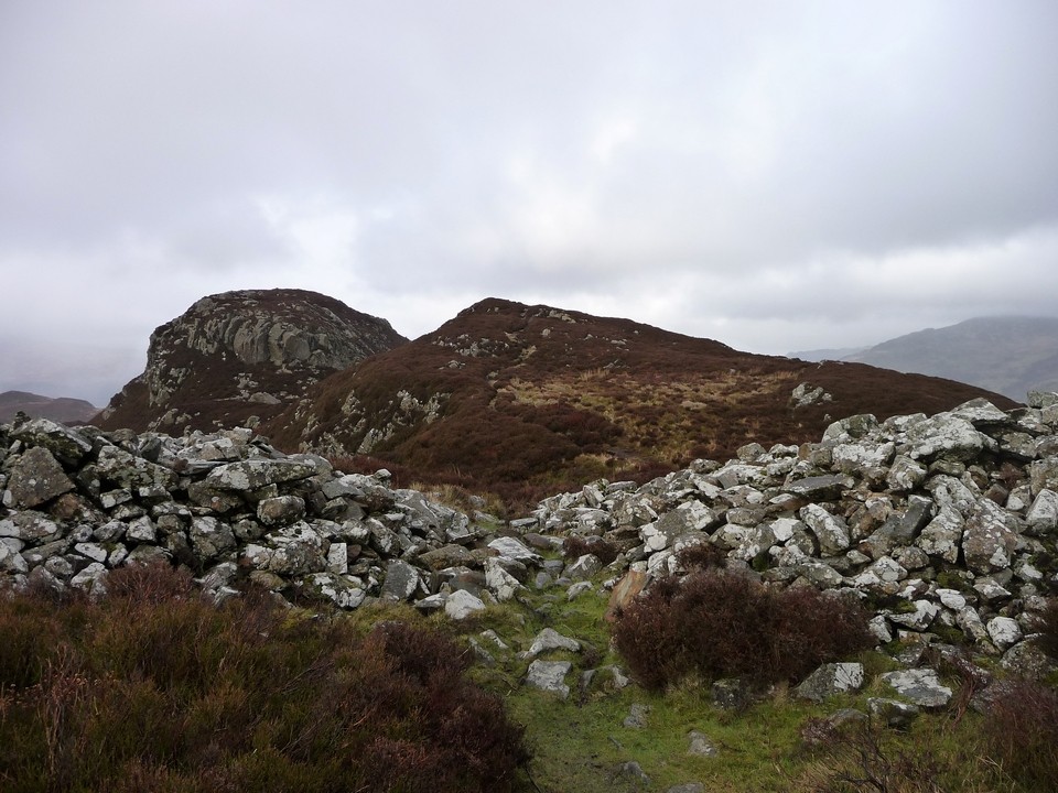
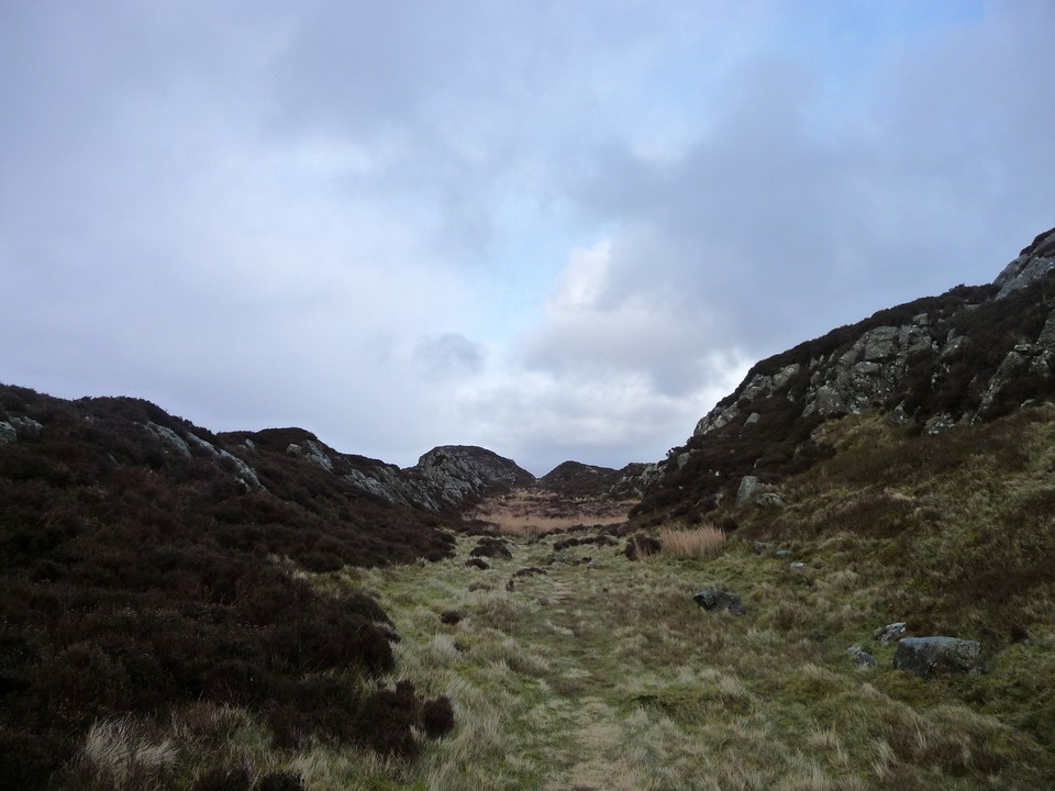
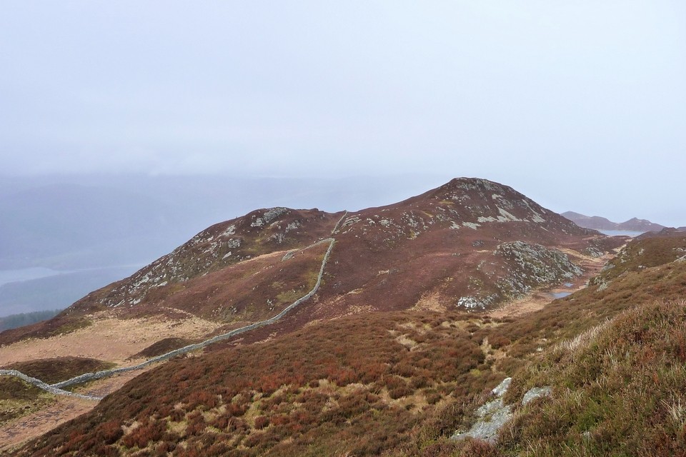
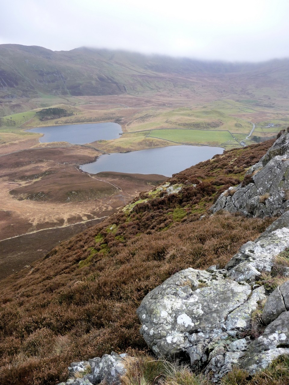
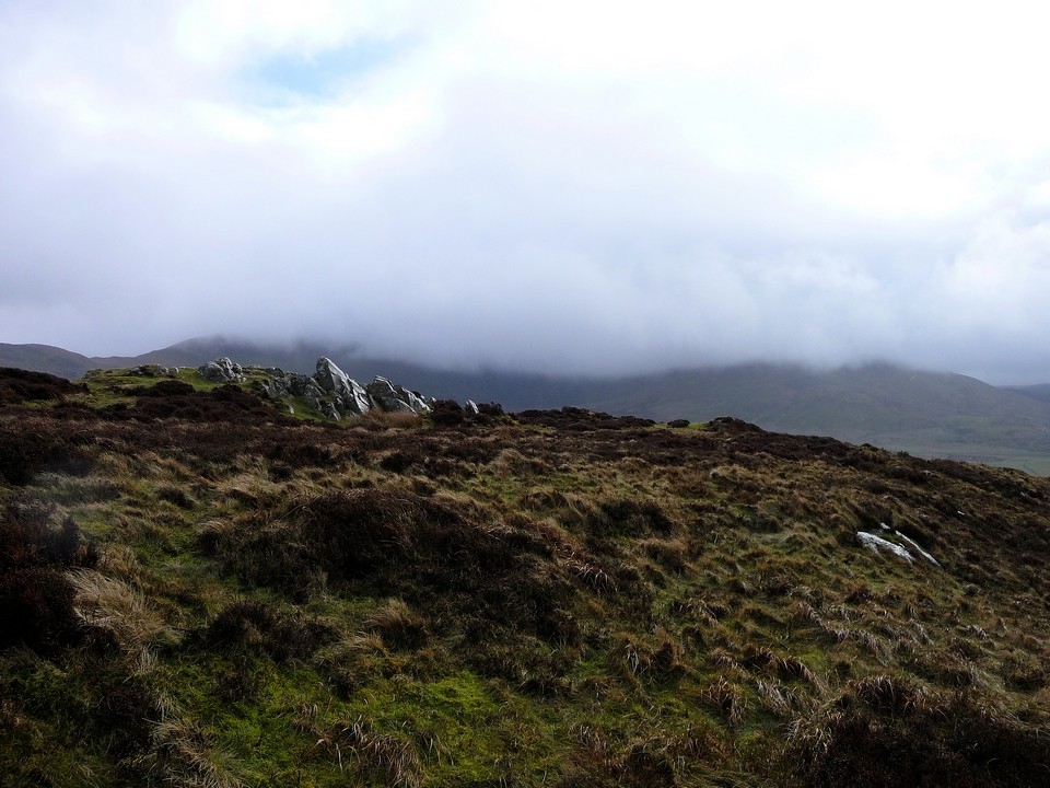
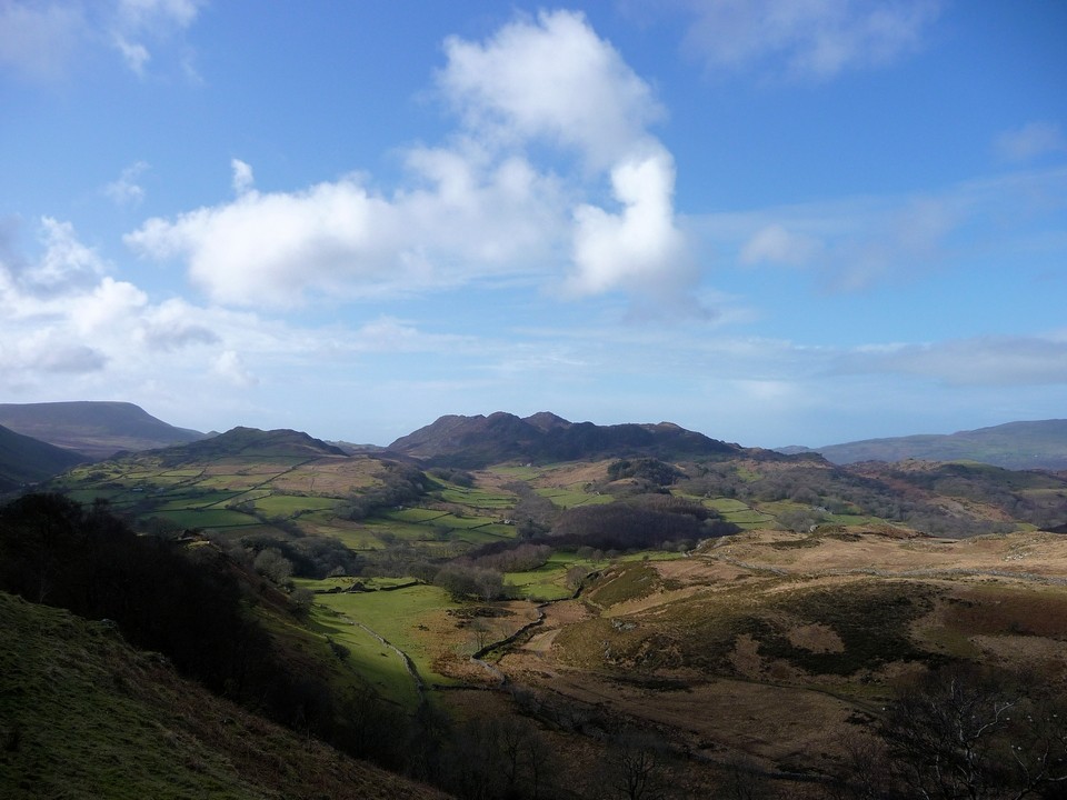
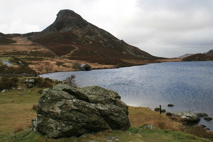
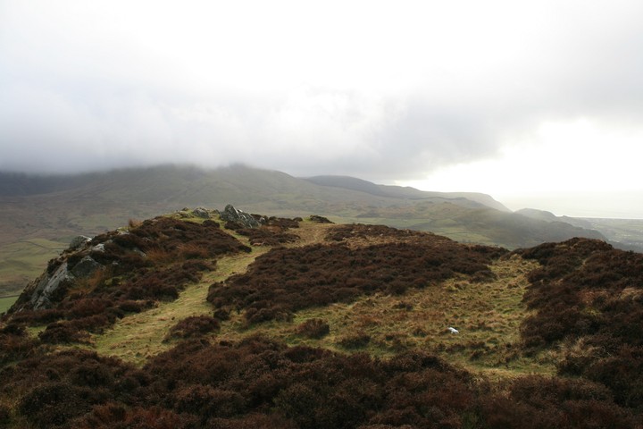
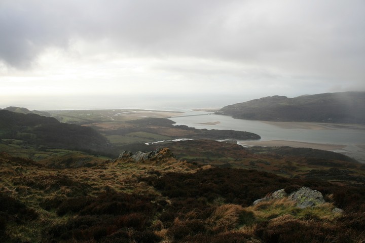
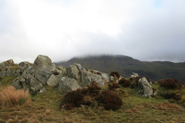
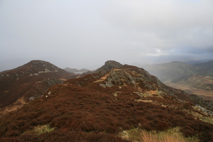
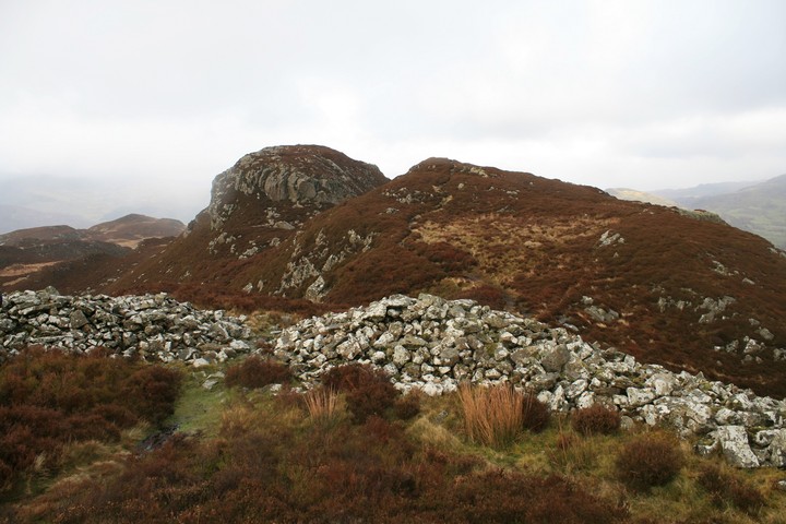
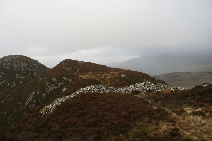
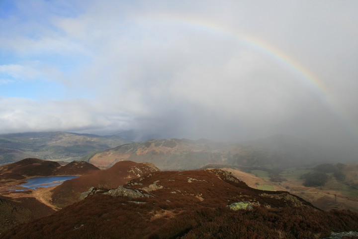
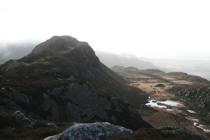
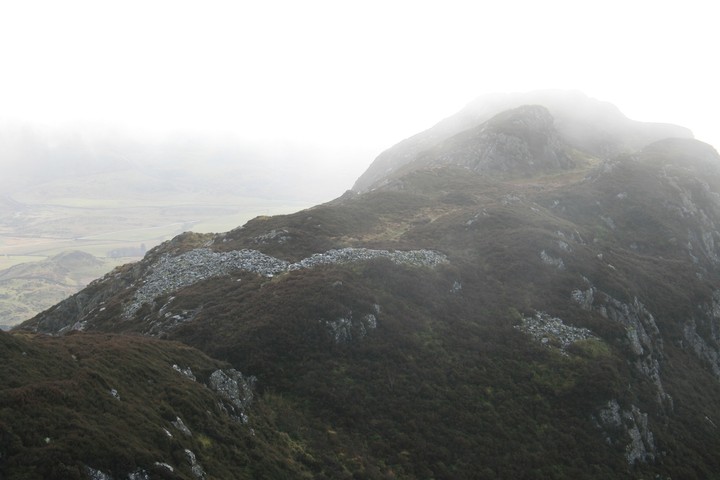
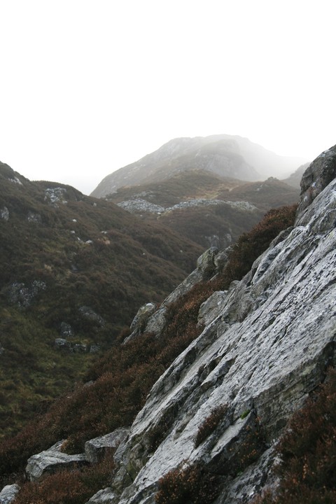
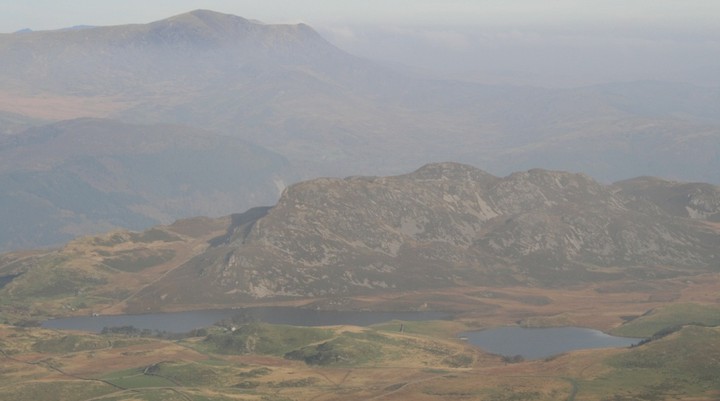
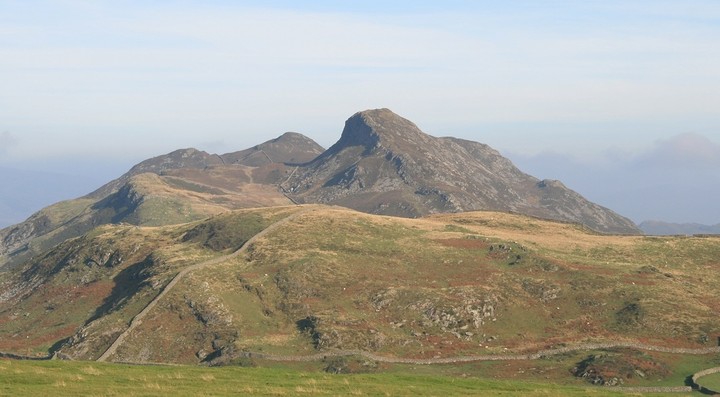
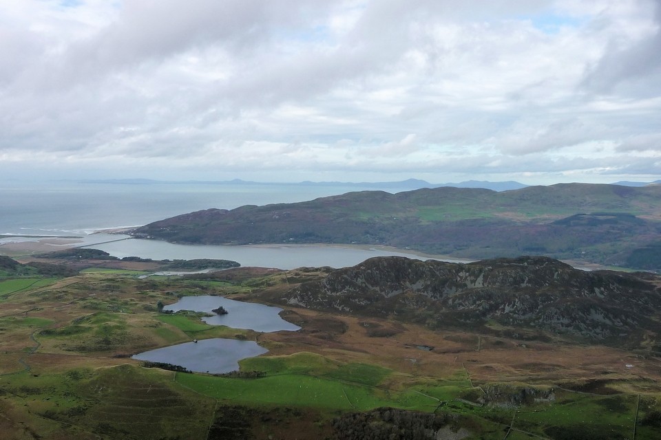
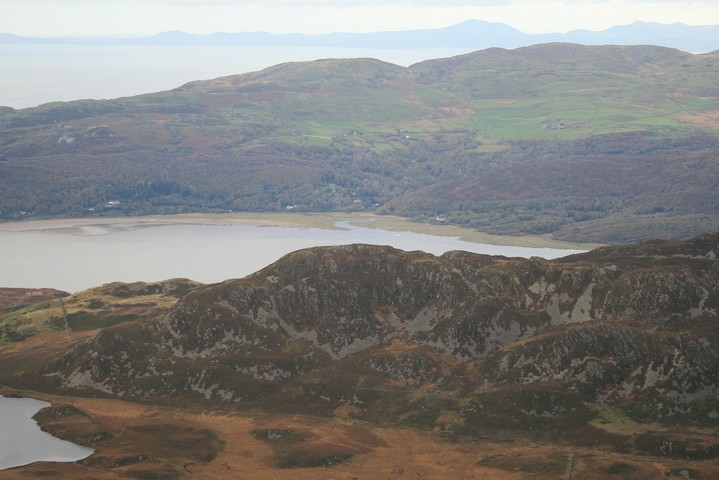
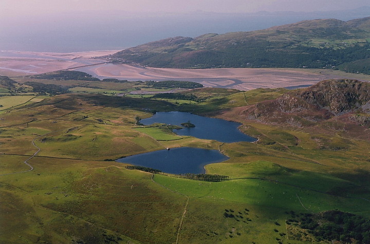
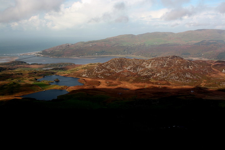
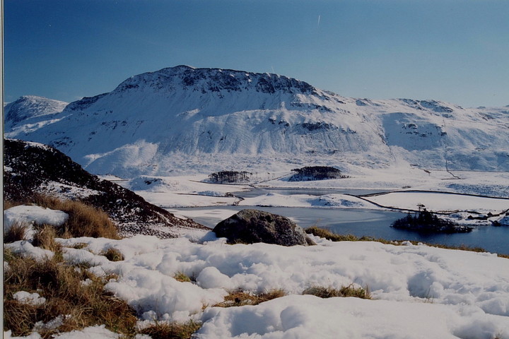
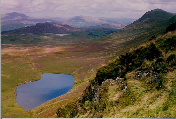
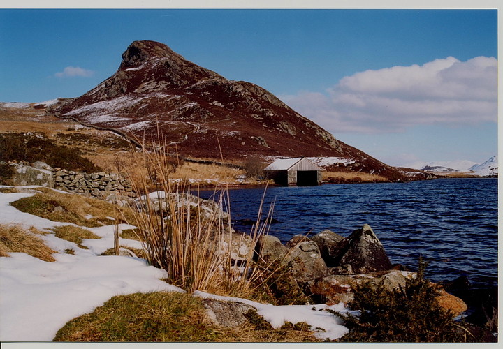
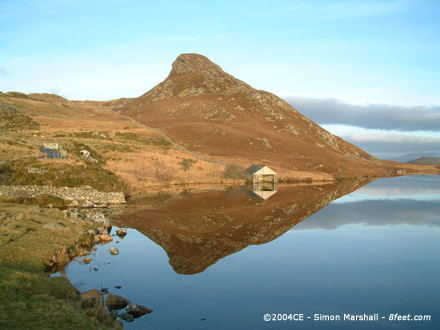
There’s a handily placed (and free) carpark next to the picturesque Llynnau Cregennen. From here the hillfort takes on a daunting aspect, what Postie describes as a mini-Matterhorn. An obvious path winds up from the lakeshore, looking like a fairly straightforward ascent. And so it turns out to be, although steep enough to leave me puffing and panting as we get near to the summit ridge. The views are lovely, the twin lakes below us and the Mawddach estuary away to the west, crossed by its neat rail/foot bridge. The higher we climb the more we find ourselves entering the drizzly mist that clings to the much higher ground of the Cadair massif to our south. A choice of paths, little more than sheep tracks takes us up to the top of the ridge. The name of this hilltop, “the Wall of the Long Ridge” I think it translates roughly as, is certainly apt. There is little to show in the way of a fort, even the interior space is cramped and rocky. I get the impression this would a place of desperate refuge, somewhere to make a last stand after abandoning homesteads and farmland in the fertile valleys below. For all its wild desolation, there is a compelling grandeur, even in the wind-lashed rain that prevents photography in most directions. The views on all sides are stunning, from the mountains, past lakes to the still-shining sea. To the east, serried ranks of lower hills, including Craig y Castell where we were earlier, march away into the gloom. The ground drops away vertiginously over slick black rocks. We have a good nose about the interior, but at this western end of the ridge there are no signs of any ramparts. Postie suggests we make for the next mini-summit eastwards, for a retrospective of the fort. The path now takes us along a gully between rocky walls, slightly odd but at least sheltered from the rain and wind. Emerging from the other end we realise that we haven’t left the fort at all, as in front of us is the first tangible proof of manmade defences. A clear rampart of rubble cuts across the neck of the hill, with a gap in the centre, now partially choked with collapsed stones, indicating the (presumably) original entrance. Rather better than we had been expecting! We decide to carry on eastwards along the ridge, as there is a cairn and hut circle shown on the map to look for below the hill’s slopes. As we turn away from the rampart, we are rewarded with a spectacular rainbow arcing over the eastern end of the hill, its pot of gold ending somewhere below us. A breathtaking display of nature. She comes in colours, indeed. A final climb up to another mini-summit (this ridge sure ain’t level) gives us yet another perfect retrospective, the hill behind now a near-black mass before the bleached-out seaboard beyond. We finally make our way down, as the clouds are lifting and the slopes below are lit up, revealing what appears to be the patterns of a small field system, very like the “British” fields you find in rural Cornwall. As we descend, we also come across the ruins of a circular structure, which could easily be a hut circle, or maybe it’s just a sheepfold. Neither of us can say for sure. There is no clear path down, or at least if there is we’re not on it, instead it’s a matter of cutting through knee-deep heather while trying not to fall flat over the slippery rock hidden beneath. I’m tired by the time I get to the bottom! This post appears as part of the weblog entry In the kingdom of the Brenin Llwyd – around Cader and Arthog 3 March 2012 (2)
|
 Posted by thesweetcheat
7th March 2012ce Edited 9th March 2012ce |
|
We parked in the big free car park, walked a little down the road to take in the view across the lake to the mini mountain from a tumble of boulders, amongst them was a simple memorial to a dad, to a 54 year old man who loved this view, and who can blame him, I love it too, but it was all a bit more poignant as thesweetcheat was next to me and we were both born in the same month as our fallen comrade, it would be a few minutes before our immediate reality took back hold of me. Though this big sharp rock looks intimidating to climb from the car park it is less so on the way up, no scrambling, no slipping, hands were deeply in pockets, except when holding camera to eye. All the way up to the top there was no sign of fortifications, it is only the very top that has anything that one can pinpoint as being fortish. The high summit is a narrow plateau punctuated by rock outcropping, the highest of which is like a throne looking out to all points but most definately regarding the mountain most highly. Heading east off the high flat ground we are funneled through a narrow area between two rocky walls, through here I imagined a throng of iron age people, thronging in places and talking excitedly, only for a second or two then we were onto another long wide top shelf and in front of us was definate iron age fortifications. Two wide and high spread of stones blocked off egress along the mountain ridge, funneling people through the narrow entrance in the middle. We didn't expect this, and it made me at least childishly excited, just like finding kerb stones on a cairn earlier on, it's silly the things that can excite me. Through the entrance and along the ridge to it's eastern summits we were able to look back at the fort on its mountain top, through the entrance, to the narrow corridor through walls of rock and up to the throne stones outcrop, whilst also taking in the view of high moutains and down to the sea, I turn around and there is a rainbow only half is lit the invisble half sinks silently into Llyn Pen Moelyn. This is too much, it doesnt get much better than this. We blaze our own trail down, straight to another cairn on the map, but its gorse covered, less than a meter high and only sparse cairn material can be detected. we leave it and head back to the car whilst looking right for hut circles but the map is quite unclear about their exact whereabouts and we pass them by unnoticed, Back down at road side my camera battery goes, phew that was lucky. |
 Posted by postman
4th March 2012ce Edited 4th March 2012ce |
|
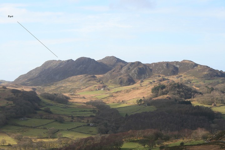
Set upon a minor, outlying ridge of Cadair Idris, above the wondrous Llynnau Cregennen, this defended enclosure - presumably of Iron Age origin - is probably not the finest example of the type you'll ever encounter....if the only criteria considered are archaeological. Landscape context, however, is always of major importance when visiting any monument - not to mention a bit of a fixation of mine - this particularly being so with regards hillforts. In Pared-y-Cefn-Hir's case the siting is second to none, both militarily and aesthetically speaking. Some location! Truly, the scenery is absolutely first rate. Nevertheless there's more. The enclosure, perched upon its rocky eminence, overlooks the nearby ancient Ffordd Ddu trackway (flanked by numerous standing stones) and is in turn overlooked by mountain top burial cairns upon Tyrrau Mawr and Craig-y-Llyn, western sentinels of Cadair Idris. There are also the Arthog stones within a short radius...... |
 Posted by GLADMAN
6th December 2009ce Edited 30th December 2010ce |
Miscellaneous |
|
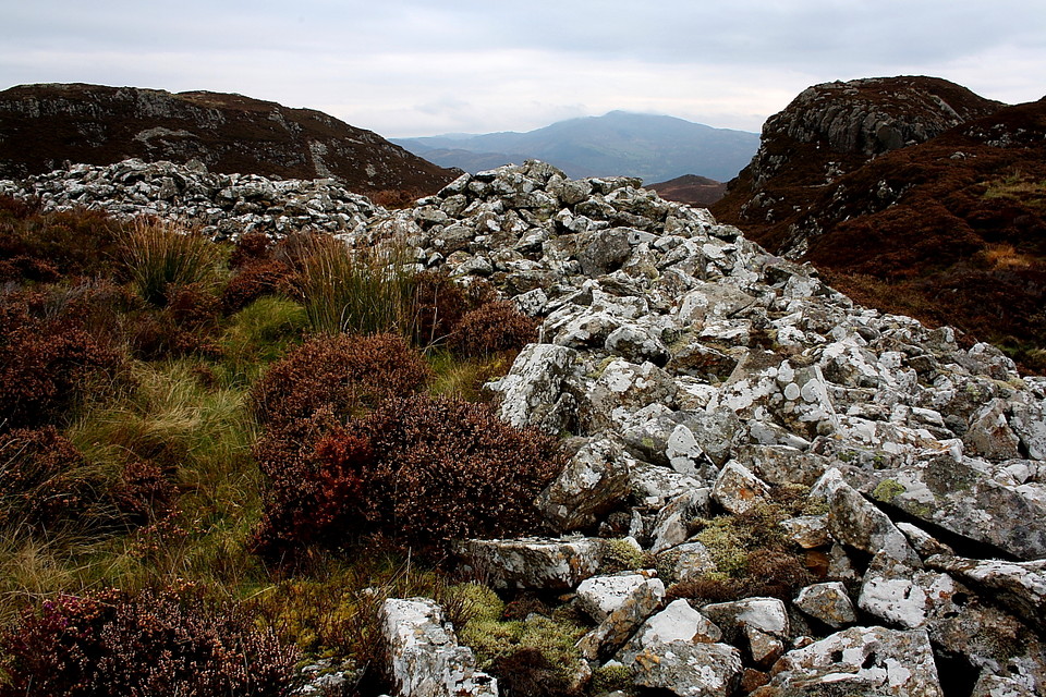
Coflein gives a brief description of the hillfort:A curving stone rampart, c.8.0m across, with a central NE-facing entrance, cuts off a c.350m extent of ridge-crest to the SW, resting on precipitous craggs on the NW. An outer walled enclosure, 60m NE-SW by 30m, beyond a coll, c.25m to the NE. A detached c.50m length rampart, runs S from a point c.50m SE of the outer enclosure. |
 Posted by Kammer
23rd June 2004ce |