This site is of disputed antiquity. If you have any information that could help clarify this site's authenticity, please post below or leave a post in the forum.
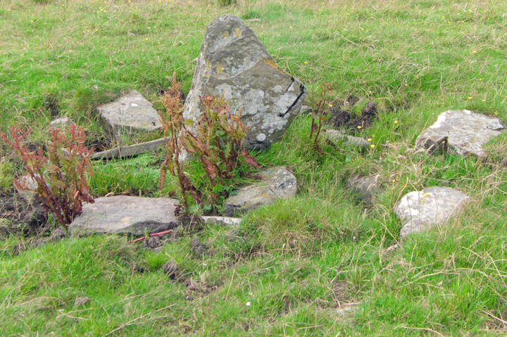
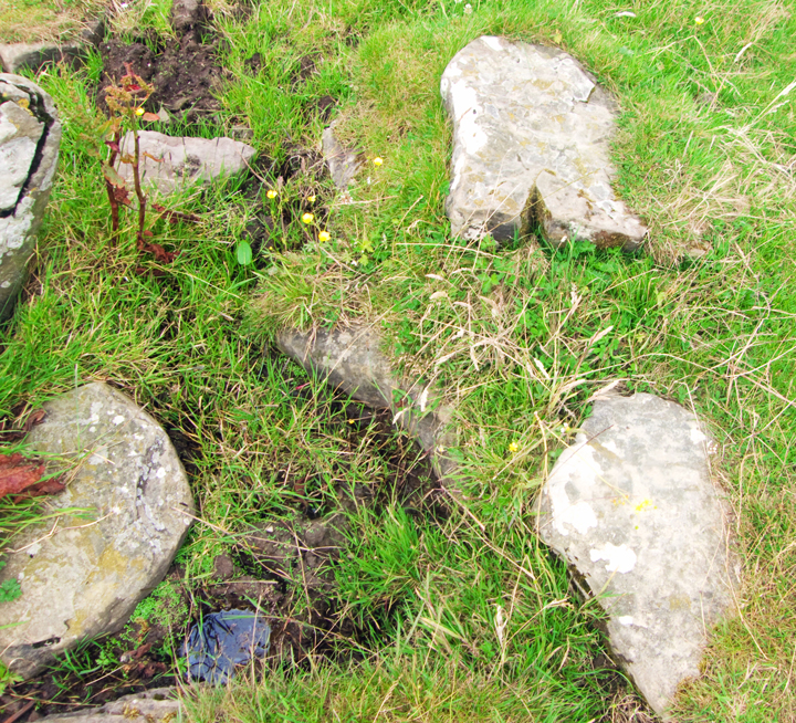
On your left hand side going west to Kirbuster the Burn of Kirbuster which connects the Loch of Hundland to the Loch of Boardhouse is part of a long narrow field, look down the line of the fence and you can just make out the standing stone in the preceding field. Having seen it on visits to the Kirbuster Fsrm Museum it was good to finally visit the site. As CANMORE mentions, site HY22NE 10 is in a marshy area, don't go through the damp bits (I tried) but around. The depression in which it sits varies from 2.5m to 3m across. The stone as it stands now is at an angle, the longer side 1.1m the shorter 0.5m and the top 0.6m long with a thickness of 0.25m. Yes there are several big stones along with it in the water-filled depression, but rather than the stone looking 'modern' the feeling you get is that it is part of a larger whole (it is another matter as to if the stone be original or planted later). Looking to see if the stone could have been part of a 'standing stone fence' all I could find was a few metres away two large stones face down in the ground, one larger than the other. When I turned back to the stone it is evident that at least part of the depression is rimmed, stones peeking out from the side. I do know of the traditional Orkney connection between standing stones and wells/springs, but none appear here on the map
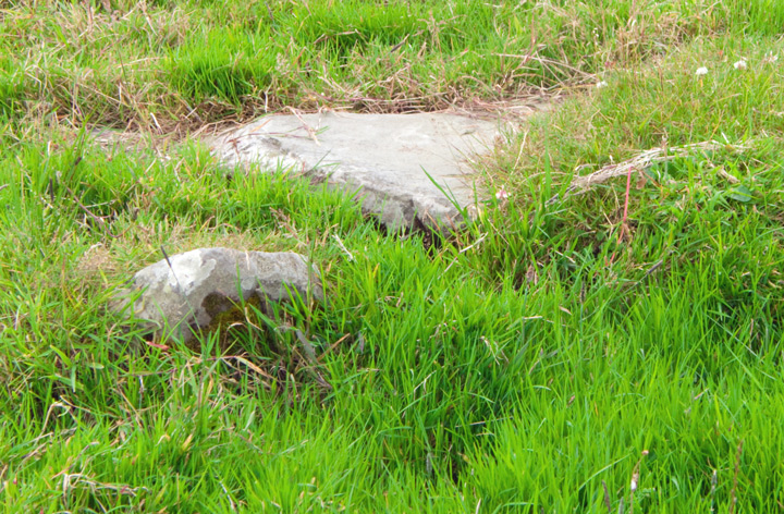
Seen from afar roadside as it appears to be in a marshy area and the waterloving plants are rather lush at the moment. Stands at the loch edge a little to the west of where the loch connects with the Burn of Kirbuster.
On the mainland or in England there would be fewer doubters of its antiquity, we just have so many candidates to accept more than a few now! But perhaps the antiquarians thought it might be more than a standing stone, because some have seen more stones in the depression in which it sits. I assume that like the Loch of Tankerness this lochan's borders have increased since at least the Bronze Age, and there are marshy areas abouts. Stone circles aside not a few of our acknowledged standing stones have turned out to be stood on, or the remains of, cairns [e.g. Stanerandy] or tombs [e.g. Redland North]. On a small promontory a few hundred metres north of Kirbuster are the remains of a prehistoric settlement which produced Iron Age tools etc - the Knowe of Nesthouse, HY22NE 6 at HY27942568, is [IIRC] near a small 'caravan park'.