Bog material reveals 11,500 years of Scottish history at prehistoric hillforts near Edinburgh
Evidence of prehistoric man and the woodland clearances of the Iron Age are found at the site of two hillforts near Edinburgh
Peat from a bog near Edinburgh contains 11,500-year-old vegetation and glimpses of the impact made by humans on the landscape from as far back as the Neolithic period, say experts who have foraged seven metres i... continues...
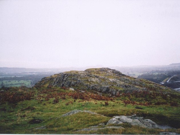
Dalmahoy Hill Fort and Cup Marked Rock
Wednesday 21/11/01
(see also Kaimes Hill notes)
I crossed the horrendous place that is now Kaimes Hill to make it here. I headed for the trig point on the summit and the wind almost blew me off my feet. I found the cup marked rock fairly easily, just north of the trig. There are 5 cups, all quite deep. The view was cool, but the weather was just so bad that I didn't hang about long enough to appreciate it!
From the RCAHMS (Royal Commission on the Ancient and Historical Monuments of Scotland) web database;
On the cup marks, 'On exposed rock on the summit of Dalmahoy Hill by the triangulation point (at NT13536692) are at least 5 cups; outcrops on the W side have natural ovaloid pit marks.'
On the hill fort, 'The remains of this fort occupy the twin eminence to that upon which the Kaimes Hill Fort stands. They represent two structural periods, the earlier of which is very difficult to interpret. Briefly, the craggy and uneven hill was enclosed by a system of stone walls which defended and area measuring 1200ft in length by a maximum of about 400 ft in width, bordered on the NW by the precipitous face of the hill. The second phase structure is an oval enclosure on the very summit of the hill, which measures 140ft by 85ft. This enclosure must occupy the same ground as did the central feature of the fort.
While there is no reason to suppose that the earlier works are not of pre-Roman Iron Age date, the period at which the later enclosure was built has not yet been established. There is reason to believe that it may be of post-Roman date as it belongs to a class of monuments which are almost always found to overlie pre-Roman forts and which have, in some cases, produced relics of early medieval (Dark Age) date.
A gold stud cap 1/5 inch in diameter was picked up in the Dalmahoy secondary enclosure, as were several fragments of moulds, all of which can be assigned to that late period. Only the excavation could answer the problem satisfactorily.
In the area centred NT13436673 are the remains of a hut circle, with an internal diameter of 19ft. There is an inner facing of stones set on edge. The entrance has been from the east.'

 Posted by moss