|
|

|
|
Hillock of BreaknaAncient Village / Settlement / Misc. Earthwork
|
||||||||||||||||||||||||
|
|
|
Images (click to view fullsize) |
|


|
Fieldnotes |
|
|
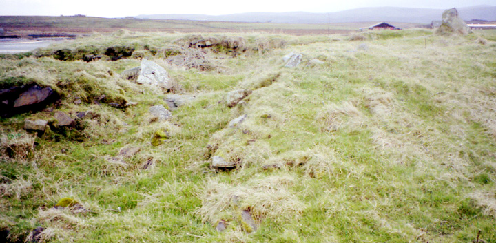
One of many sites you can make nothing of in summer. Went yesterday and the mound had vanished beneath nettle soldiers and tribes of grass over knee-high, so even having been before I saw only the occasional glimpse of stone. Best reached through the field above that of the mound, just after the track to Swanbister House. In that first field went to look at the bridge the track goes over but it is only a nave-type. A few yards away (HY35200519) the stream on one side has a short stretch of low wall comprising edge-up slabs ending in a chunky stone on the northern end. On reaching this I saw a straight-edged piece of rock pavement (I see no reason not to think this is other than natural) and realised I was looking at a diminutive ford, the cutest thing. Though the banks of the stream are not that high this is the only point at which the ground is at water-level both sides. Had a careful potter around and over the broch before going to the lower right corner of the field where the rocky outcrop is at its clearest, almost like a low staggered cliff. Was surprised to find what looked like a track about half-a-metre across going down towards the water's edge that feels as if it has been cut out of the rock. From the stream looking back up at this field corner one wonders about possible alterations to the natural. This includes one white slab of rock about a metre long and a foot deep. Does this extend further into the hillock or is it from the hand of man ? Coming up from the Hillock of Breakna and look across to Swanbister House you see a bridge with metal barrier, the triangle of land between here and the road is all that remains of a burnt mound that the road was cut through. |
30th June 2005ce Edited 17th July 2005ce |
|
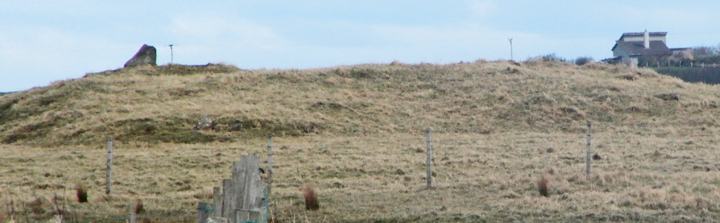
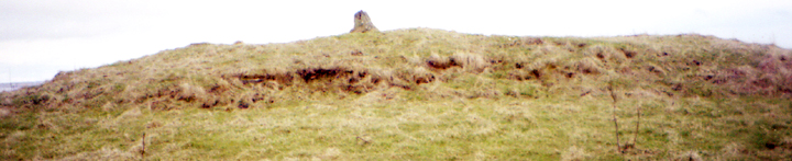
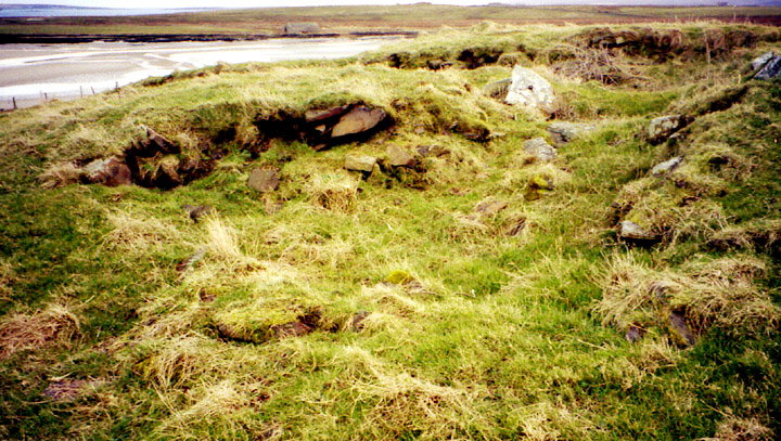
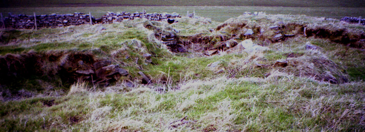
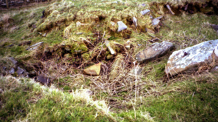
I have always been put off the trek to this site by what sounded like meagre remains. On Thursday I attended a FOAT lecture by Anne Brundle of Orkney Museum on the Bu of Orphir. At this a map showing fieldnames and archaeology in Orphir. I was 6p shy of the asking price so took the chance for a close look then. Looking at the name Hillock of Breakna there was beneath the notation "poss. broch". And directly below that I was startled to see the notation ' Earl's Palace'. Which turned it around into a must-see. Today, fortuitiously, Dave Lynn popped by to see me during a visit to Orkney and offered to take me. Out to Orphir and down the unmarked Swanbister road, past Swanbister House down to where the road turns right opposite the shore. At first all I see is a mound of man-height with an angular stone sticking out the top (made me think briefly of the NE mound at the Taing of Beeman, though that was only an earthfast slab). My fellow brochaholic was strongly confident of its broch identity despite all the accretions. From the top looking down you can see the circular edge resulting from ploughing most of the way round. The terracing effect, especially on the seaward downhill side, brought me in mind of Wideford Hill Cairn. Probably a fancy on my part ( though at both Quanterness and The Howe roundhouses were 'smashed through' earlier chambered tombs). Wish we had known about the First World War construction when we were there, to help make sense of things. The stone that was clearly visible from the road had a fairsized anchorpoint and short length of chain, both rusty, attached to it. Across the way another rusty anchorpoint is attached to an only slightly smaller stone. So the hollow leading down seawards would appear to be where boats had been secured in modern times, well away from the shore. There are many visible wall traces but it is far from easy to assign periods to these. Similarly with the various stones sticking up through the turf. Dave thought he could make out at least a domestic structure at the seaward end. The cliff geology extends its rocky outcrops around and up the dyke below the RH-side of the site. It certainly bears out the Orcadian fondness for putting their settlements in places we now consider a little too damp. Between the site and the dyke peaty (as Dave said) waters came to the surface and reached for the burn. |
28th February 2005ce |
Miscellaneous |
|
|
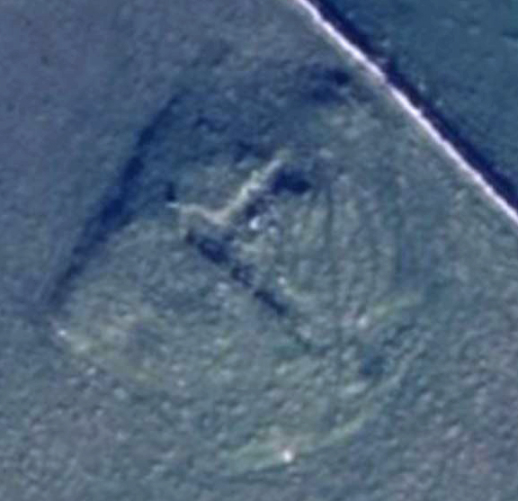
Some info not on NMRs from P.S.A.S. Volume XXXVII P.27 :- In 1797 descibed as a circular tower of about 180' circumference. The author of the P.S.A.S. chapter made it about 170' in circumference, with walls 12' thick and an int. diameter of roughly 30'. His investigations in 1879 & 1901 would explain the NMRS "an apparently old excavation" reference. Also called The Brough, but known by locals as the Hillock of Brecknay after a nearby farm. In 1797 associated with a Sveinn Breastrope. Site then erronaeously labelled Earl Sveinn's Castle, which then became ruins of Earl's Palace on the map. Could it originally have simply been called the Castle, one of many in Orkney ? |
7th March 2005ce |
| RCAHMS NMRS No. HY30NE 13 at HY35330508 is down as a possible broch, with a Great War flagpole or wireless mast showing as what looks like a cist. Since 1946 it has reduced from 103x92x6 feet to 30x24x1.7m. What seemed like the remains of an old dig indicated a wall thickness of 11' at a height above ground level. It is orientated E-W N-S. Farming has squared the NW corner. |
28th February 2005ce Edited 28th February 2005ce |