|
|

|
|
Giant's GraveStanding Stones
|
|
|
|
Images (click to view fullsize) |
|
Photographs: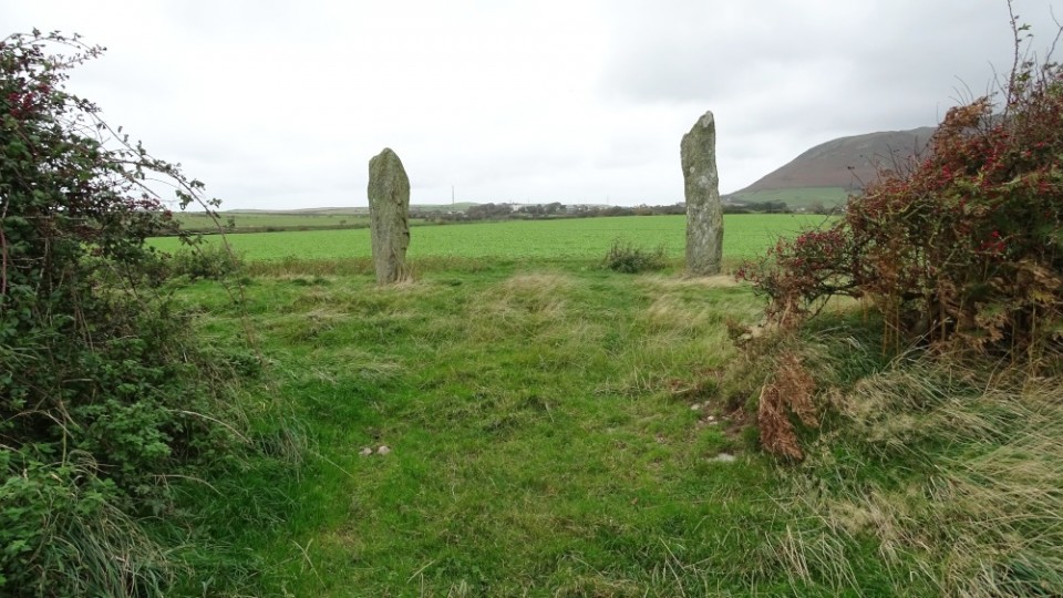

 Artistic / Interpretive:
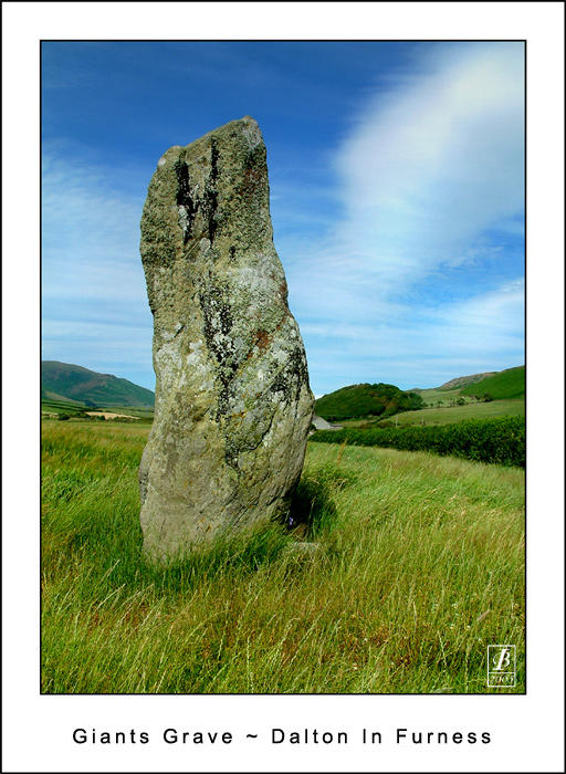
|
Fieldnotes |
|
|
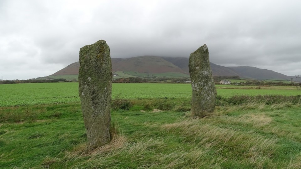
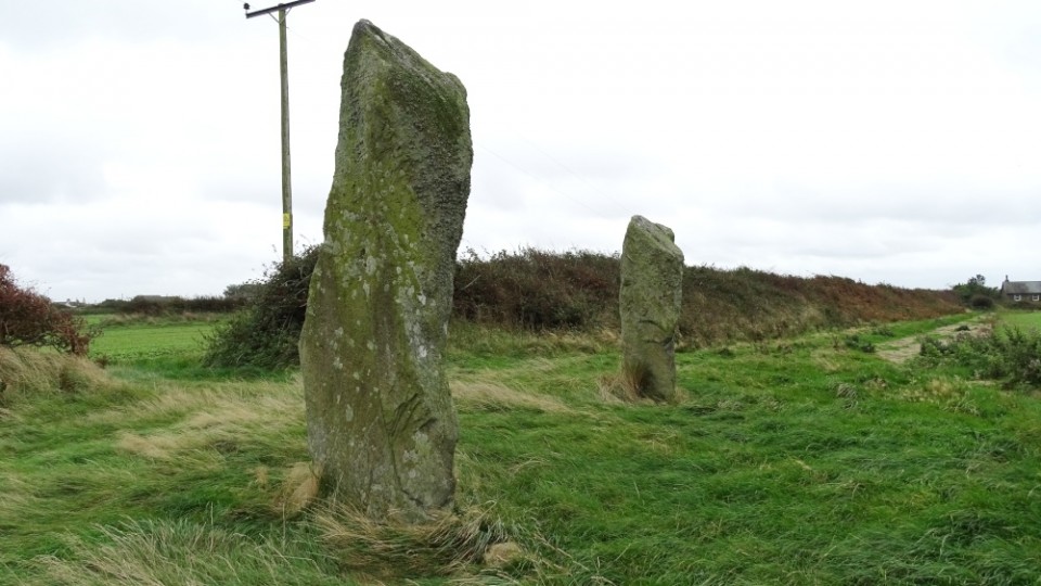
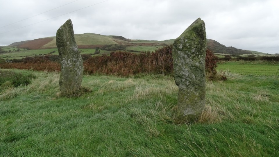
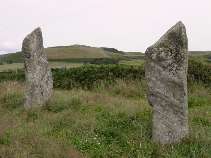
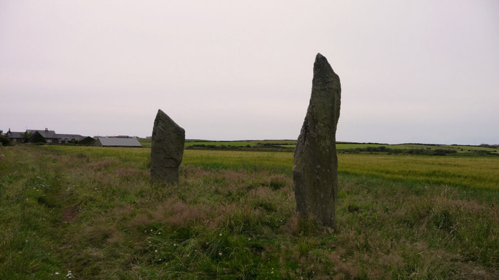
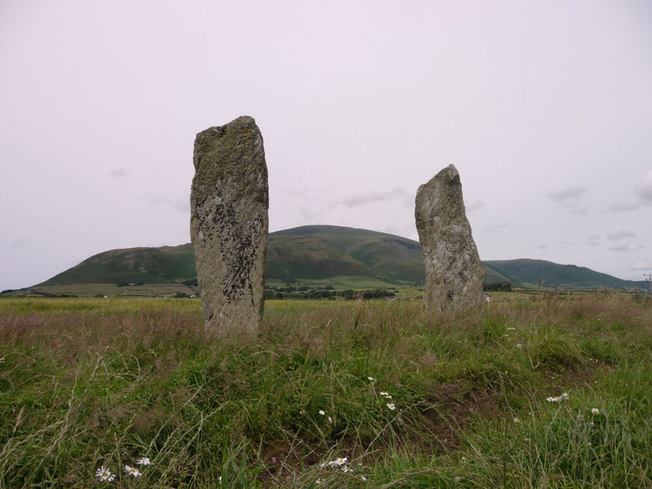
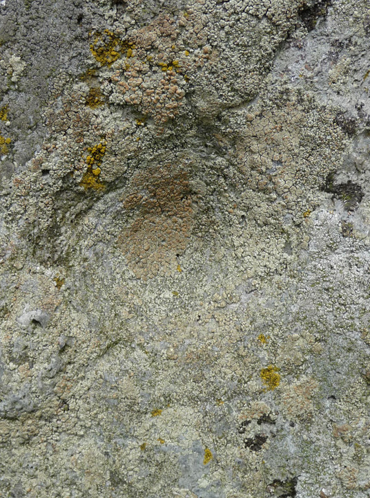
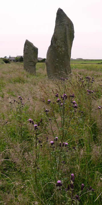
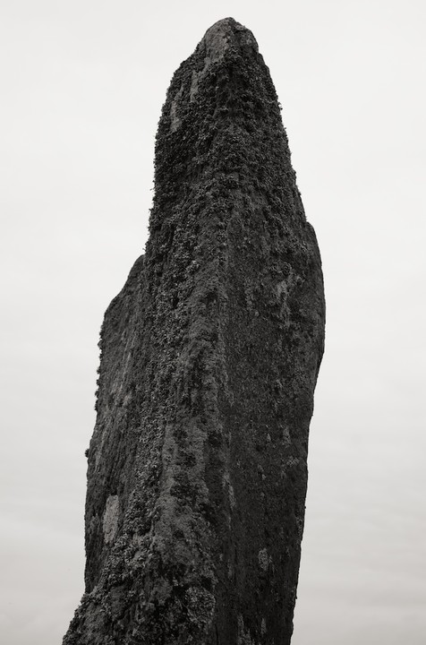
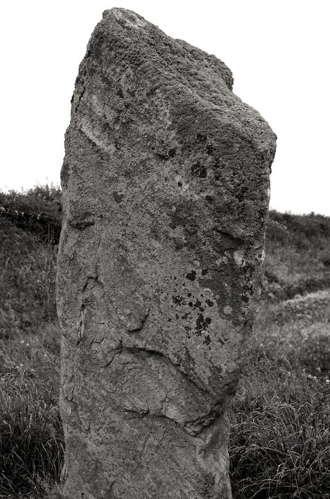
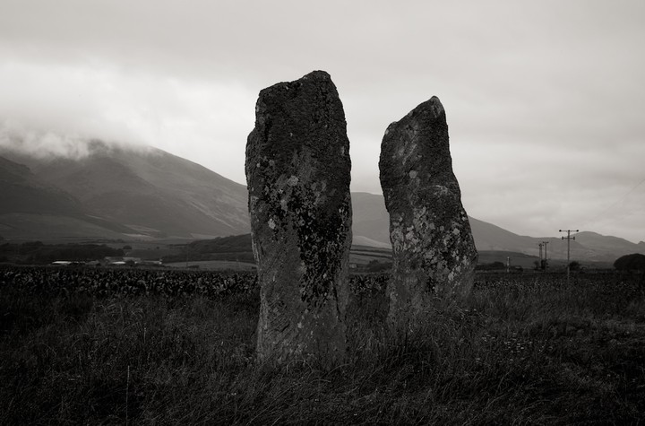
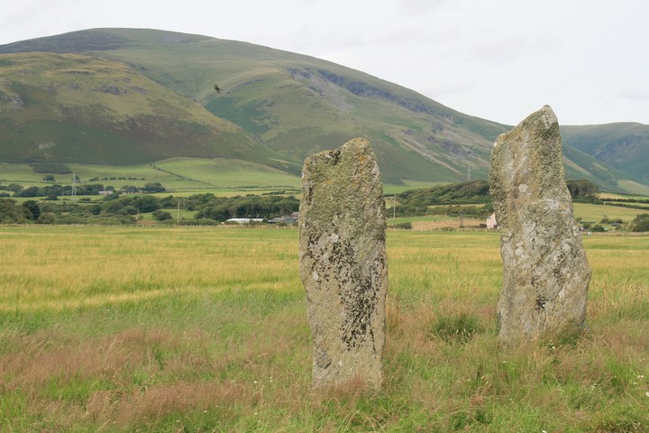
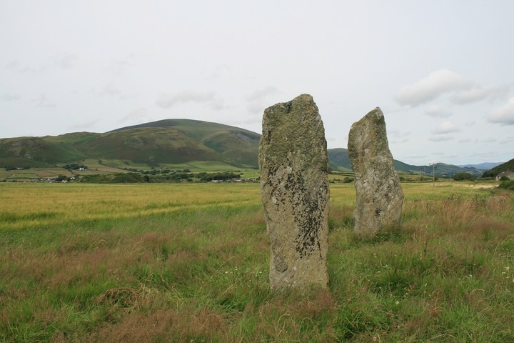
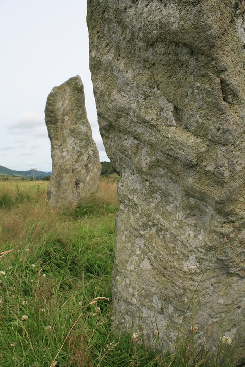
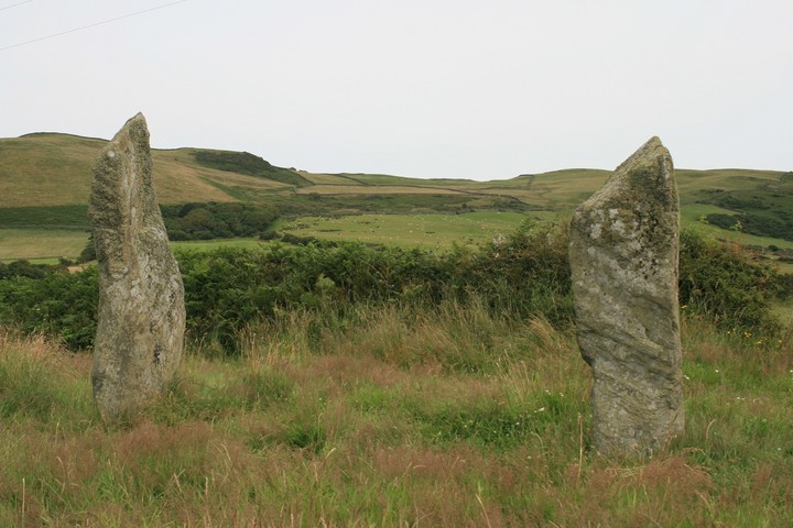
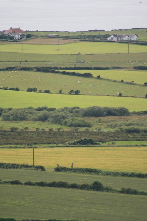
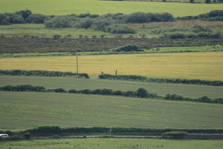
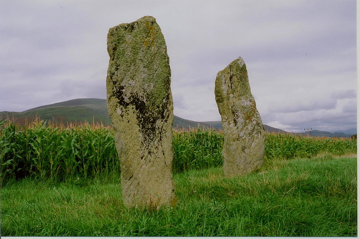
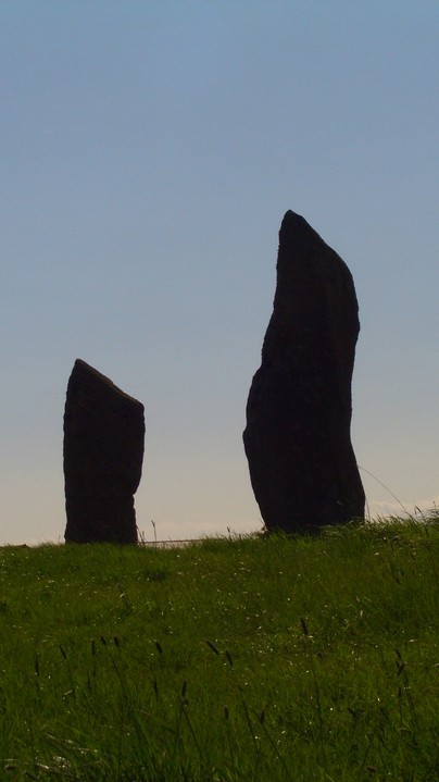
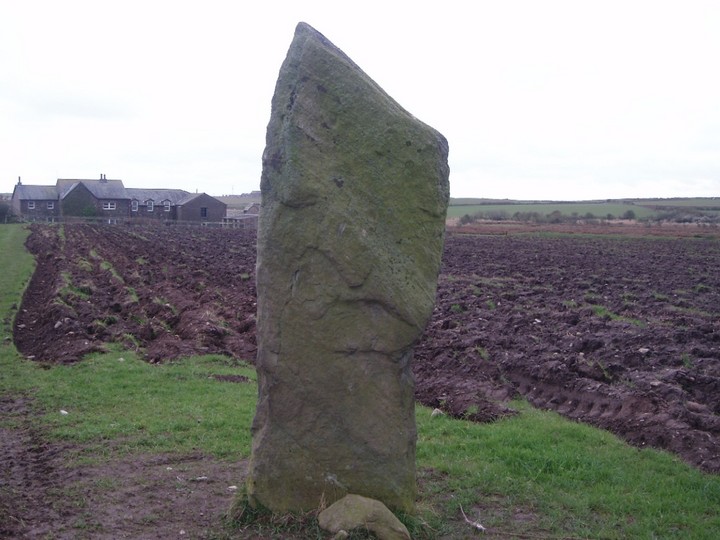
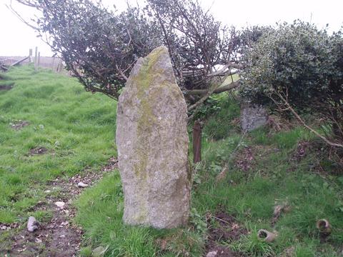
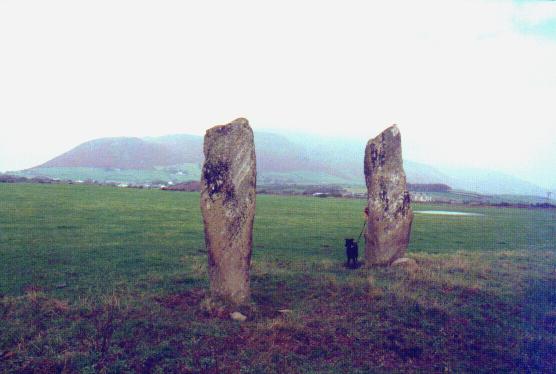
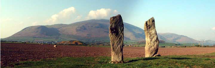
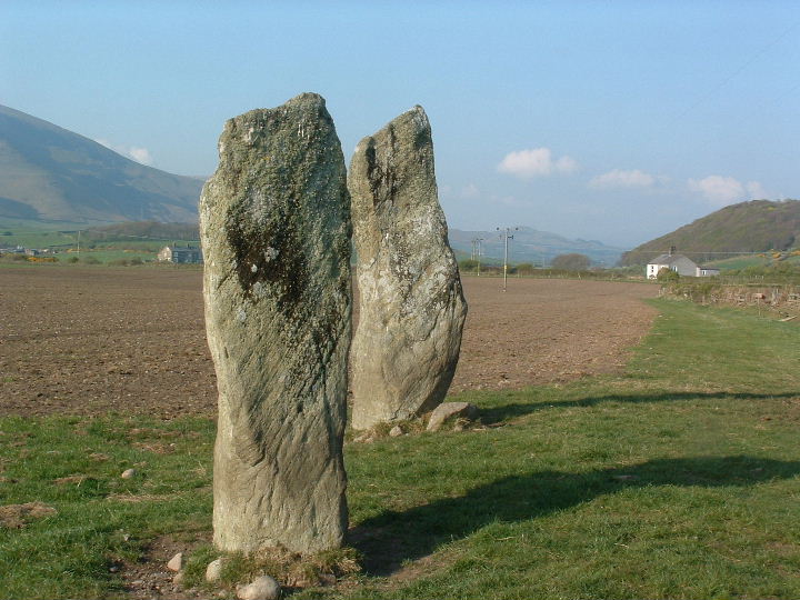
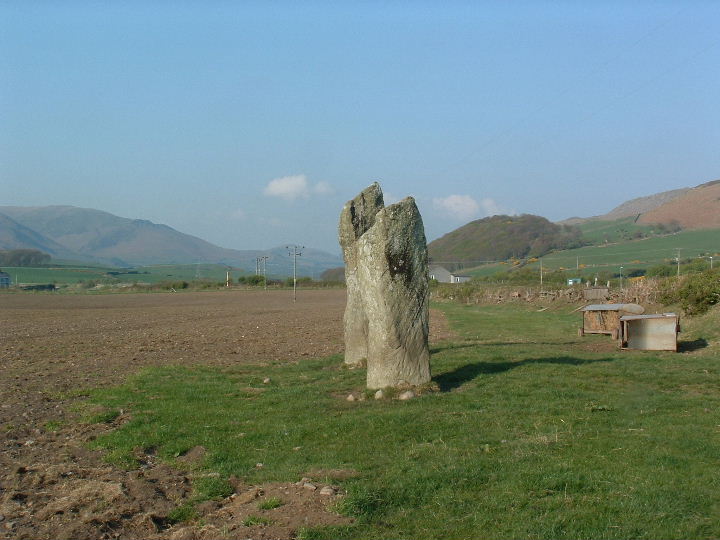
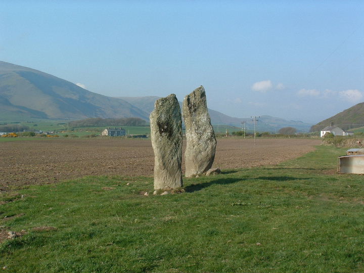
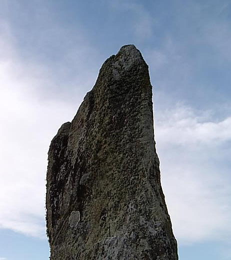
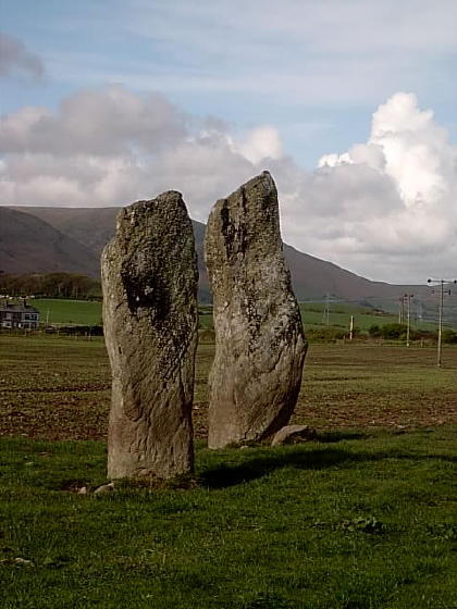
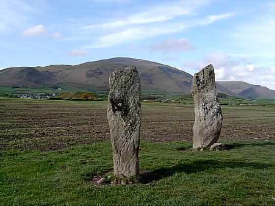
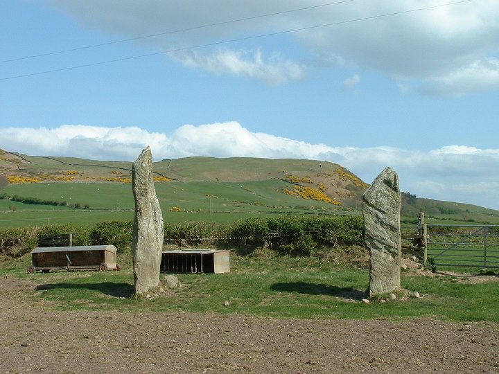
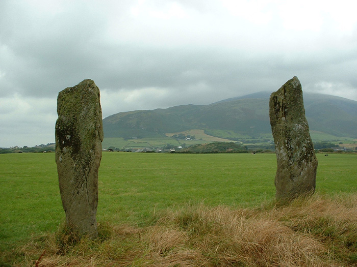
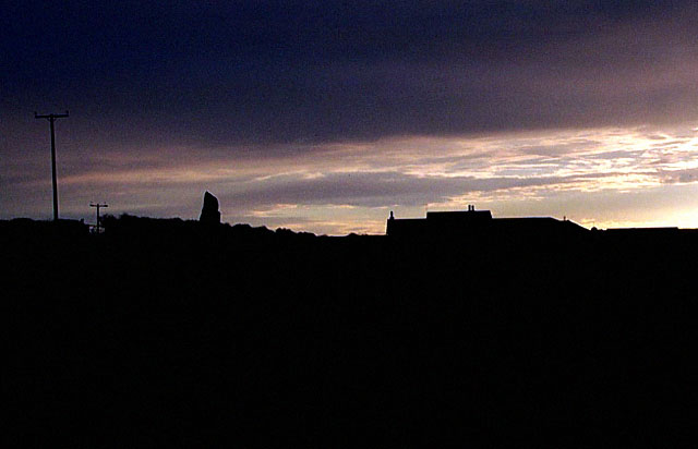
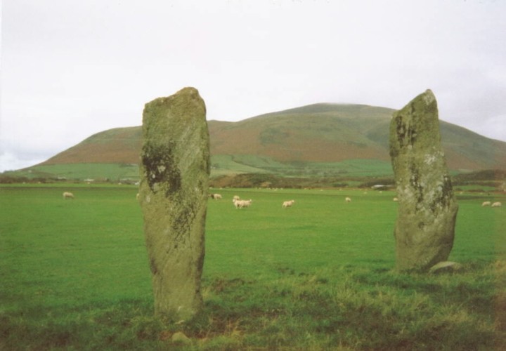
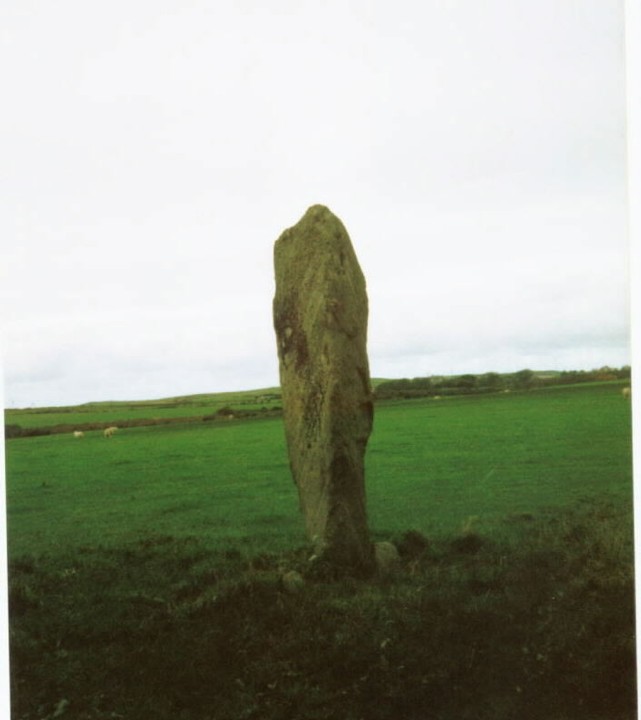
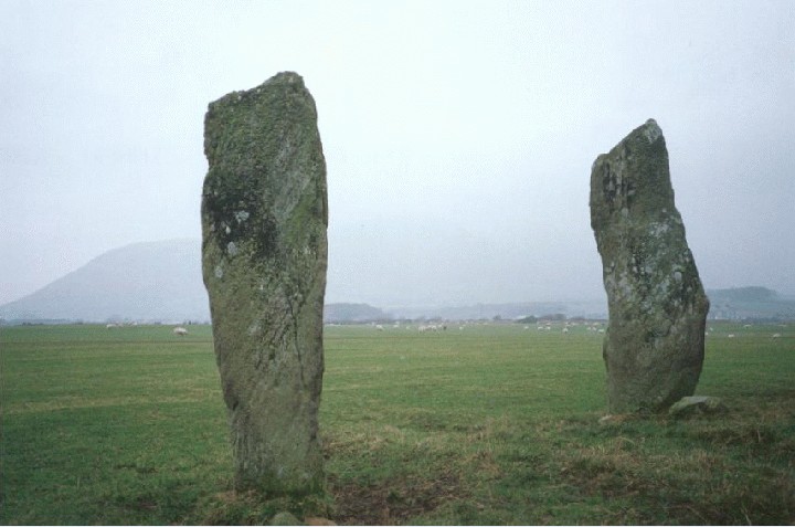
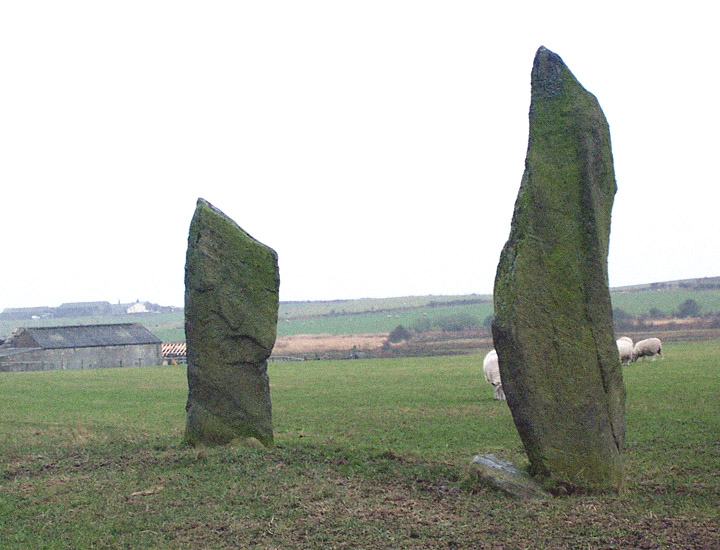
Very easily found by the road/rail track crossing, just a two minute walk along the field edge. Do they really mark the site of a burial ? I've seen nothing that points that way, Eight and a half miles north east is a proper Giants grave, that one is definitely a burial site. But these are just two standing stones . Just ? ....... heck no . These are two of the best standing stones in England, or rather, the best pair of standing stones in England, the only thing like them to my mind are the Piper stones in Cornwall, but they are so far apart to be hardly a pair. With the grassy fields leading down to the coast there is even a Cornish feel to the place, only the considerable bulk of Black Combe gives away our northern location. There are cup marks on them as well, large and small, but I don't think I saw them all, though I looked, perhaps the sun at a lower angle could reveal more. Highly visible just out to sea was a long island, at the time I didnt know where it was, Piel island ? or some other equaly little known place, upon my home return I saw that it could only be the Isle of Man, but it looked soooo close, thirty six miles at their closest, but it looked much closer, no more than ten at least. Lacra hill is close to and also highly visible from here, I wonder if the stones can be seen from up there, only one way to find out, and off we go to find at least three stone circles. |
 Posted by postman
22nd July 2012ce Edited 22nd July 2012ce |
|
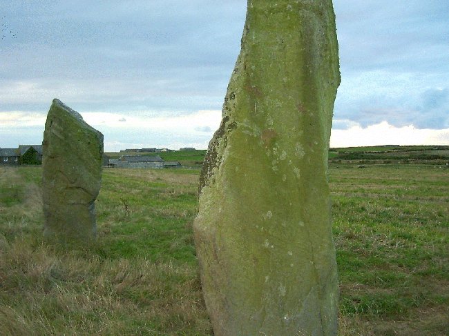
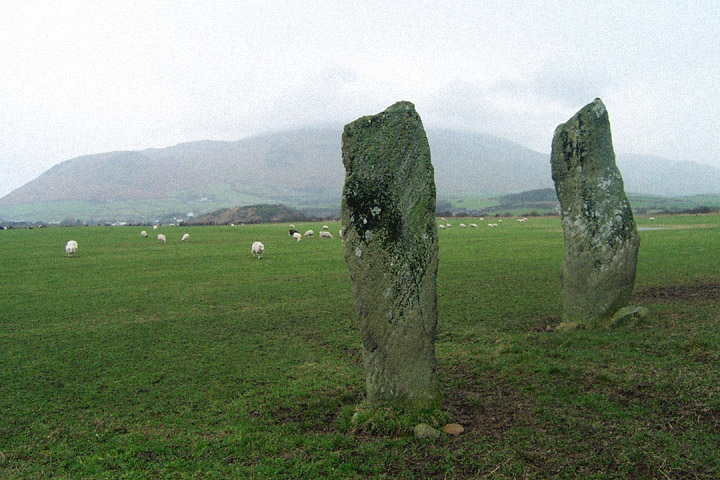
I took the short walk here from Kirksanton. This pair of beautiful stones on the edge of a stoney field appear to point to the Whicham valley and a possible route into the central fells via the Duddon valley and the Wrynose pass. More importantly, they should also be seen as part of group of coastal monuments that include the nearby lost circles of Kirkstones, Hall Foss and Annaside. Beckensall in Prehistoric Rock Art of Cumbria quotes J. Ecclestone (1872) as reporting 'six stone circles, a Giants Grave, and a huge cairn south of the Esk.' In his recent book Prehistoric Monuments of the Lake District, Tom Clare reports a buried landscape around these stones including what appears to be a ring of pits around the stones and other cropmarks which include 'timber henges or roughly circular palisaded enclosures with internal and concentric pits.' I find it rather sad that these stones are all that's left of this once magnificent landscape, but then again at least they are still there and have not been destroyed, unlike many of our lowland prehistoric monuments. Access is very good. It's possible to park at the field gate beside the level crossing and then it's just a short walk down a bumpy field margin footpath. This post appears as part of the weblog entry The swift terriers bovine blues
|
 Posted by fitzcoraldo
13th June 2008ce Edited 28th June 2008ce |
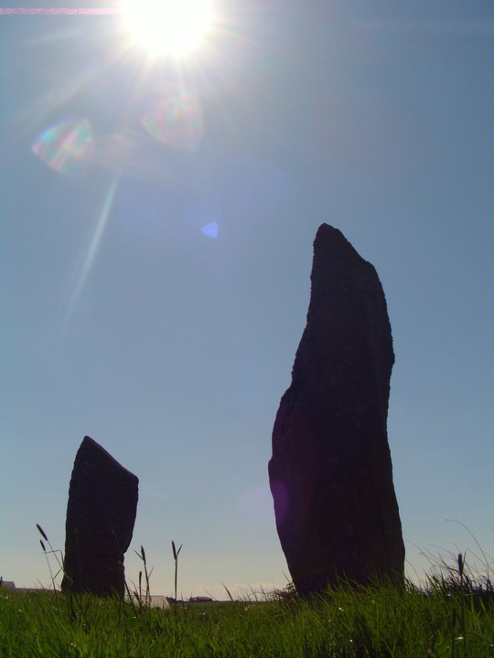
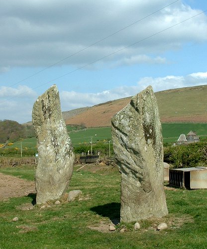
| Didn't anybody else see the faces in one of the stones??? We only saw them after we looked at the photos on the digital camera and it was pretty freaky - depending on your interpretation, there was a grumpy old man or a malevolent old hag....Vicky screamed and ran around the field when she saw it!!!! |
 Posted by Vicster
18th April 2005ce |
|
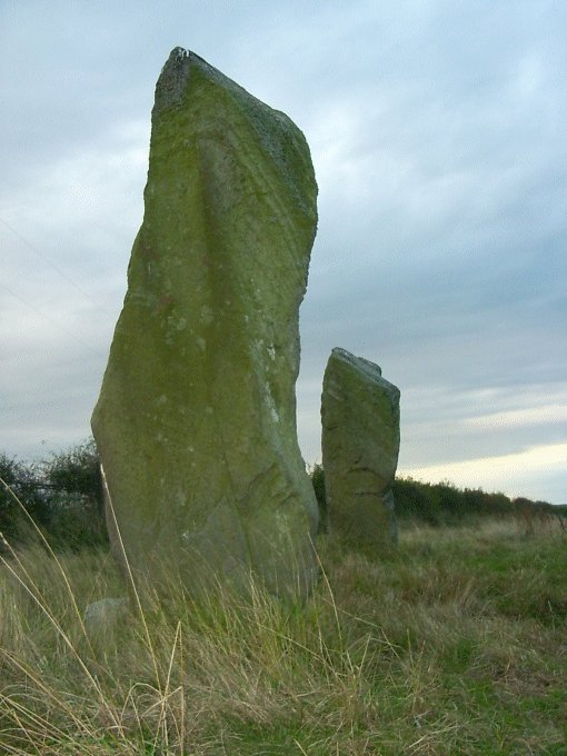
We parked at the end of the lane leaving a walk on flat ground of only 200 metres or so to reach this elegant pair of beautiful standing stones. The taller one is about 10 feet high and slimline like a blade. Their shape and grace reminded me of the shape of stones I had seen pictures of on Orkney, which I haven't (yet) experienced. Hauntingly lonely, this pair's angled tops seem to be pointing, but to what is unclear. I wished we'd had more time. This post appears as part of the weblog entry Big bullocks in 100% Lacra
|
 Posted by Jane
4th October 2003ce Edited 5th October 2003ce |
|
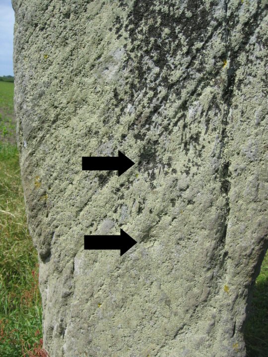
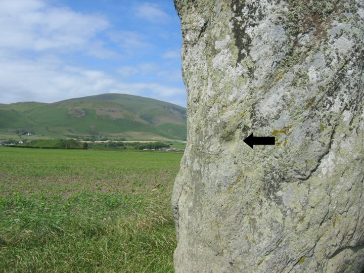
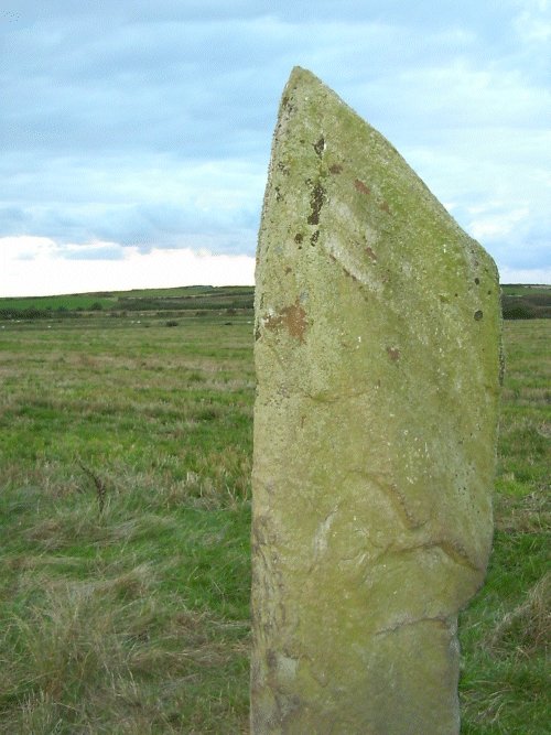
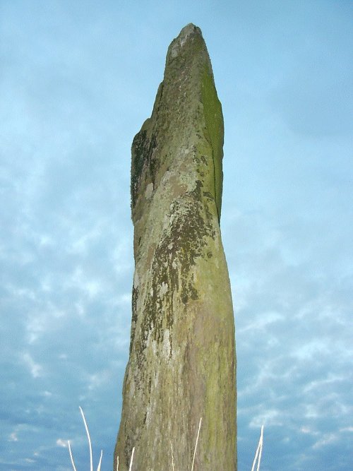
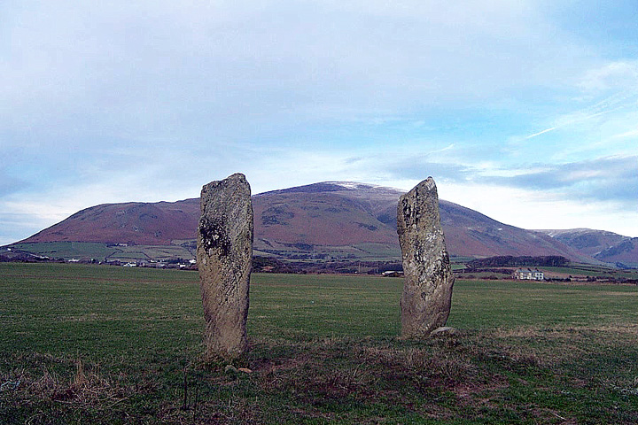
These stone baffle me. Yes, they stand in the foreground of Black Combe which conjures up such terms as ‘ominous’ and ‘looming’, but I’m not sure they have anything to do with it. That mass of rock lurks to the north and the smaller hill that contain the Lacra circles is just to the east, and at first I thought the two stones may be pointing in that direction but now I’m not sure of that either. A report from the late 18th century suggests that they originally stood as part of a burial mound which has now gone but if they are in their original position and orientation then the axis of alignment is roughly southwest-northeast, either pointing out to sea or in the direction of the valley of Whitcham Beck – were they indicating a safe route between the hills or were they just grave markers? If the direction of the narrow edges of the stones is taken into consideration, then its northwest-southeast marking the lowland plain between the sea and the hills – another possible trackway or route? Then there’s the angled tops of the stones – are they meant to be looked along to some celestial phenomenon, or were they meant to channel something down to the tumulus? As for the figures, the tallest stone to the NE is 3 metres tall while the other is about 2.5 metres high and they stand around 4.5 apart. There are said to be cup marks on the stones including Julian’s pubic triangle (!) but err… I forgot to look for them. |
 Posted by Chris Collyer
23rd April 2003ce |
| ...over a year now since we visited the lonely Giant's Grave, but it has stayed with me. It really just is two rocks in a field but shouldn't be ignored. As we walked away up to the Lacra complex I felt the presence of the two stones all the way, and kept checking back to see them, tiny but eminently visible in the landscape, as we trekked up the hill. Not much left to see at the Lacra circles except the views of the sea and Black Combe's westerly looming - a pleasant spot to hang out though. The pull of the Giant's Grave clung on; I can't help but feel we should have gone the other way - from the hilltop down to the gate way like stones and on to where... |
Posted by fat elvis 2nd October 2001ce |
Folklore |
|
I don't know if this truly has to do with the stones. But there are so many stones round here. And the very name Kirksanton suggests the sort of sacred nature of the spot. So I don't know where this refers to exactly.. perhaps you do. But I inflict the story on you in the interests of landscape folklore - and that there are circles like Sunkenkirk with a similar sunken story, and also barrows like the Music Barrow where you must listen to the earth.Another tradition associated with West Cumberland is that at Kirksanton. There is a basin, or hollow, in the surface of the ground, assigned as a place where once stood a church that was swallowed up by the earth opening, and then closing over it bodily. It used to be believed by the country people that on Sunday mornings the bells could be heard far down in the earth, by the simple expedient of placing the ear to the ground.In 'Bygone Cumberland and Westmorland' by Daniel Scott (1899). |
 Posted by Rhiannon
24th September 2009ce Edited 24th September 2009ce |
Miscellaneous |
|
|
Details of Long Barrow on Pastscape Two standing stones, both cup-marked; recorded as standing on a barrow in the 18th century and possibly part of a stone circle. (SD 13608110) Standing Stones (NR) known as Giants Grave (NAT) (1) Two standing stones, 10ft and 8ft high, known as the Giants' Grave, with a cup-mark on the taller one, are situated half mile west of Lacra. (2-3) Formerly eight massive columns forming a circle 23 yards in diameter. (4) The remains of a stone circle as described, see photograph. Published survey (25") correct. (5) (SD 13608110) Giants Grave (NAT) Standing Stones (NR) (6) The earliest reference to these stones states that "At a place called Kirksanton, is a small tumulus, on the summit of which are two huge stones... near adjoining to this monument, several large stones stood lately....." (b). The adjacent stones were possibly those of a circle, since destroyed. There is now no trace of a tumulus on the site of the two standing stones. (7) SD 136811 Giants' Graves Standing Stones, Kirksanton, scheduled. (8) Giant's Grave standing stones; two standing stones, both with cup-marks and described in the 18th century as being located on a barrow. (9) -------------------------------------------------------------------------------- SOURCE TEXT -------------------------------------------------------------------------------- ( 1) Ordnance Survey Map (Scale / Date) OS 6" (Prov) 1956 ( 2) General reference Trans Cumberland and Westmorland Antiq and Archaeol Soc 1 1874 pp280-1 sketch map (J Eccleston) ( 3) General reference Trans Cumberland and Westmorland Antiq and Archaeol Soc 23 1923 p270 (W Collingwood Bruce) ( 4a) General reference Beauties of England & Wales 3 p232 ( 4) General reference Trans Cumberland and Westmorland Antiq and Archaeol Soc 26 1926 p58 (W Collingwood Bruce) ( 5) Field Investigators Comments F1 RWE 21-JAN-69 ( 6) General reference OS 1:10000 1977 ( 7b) General reference The History of Cumberland 1794 (W Hutchinson) ( 7) edited by C L N Ruggles and A W R Whittle 1981 Astronomy and society in Britain during the period 4000-1500 BC BAR British series1 (1974) - 88 Page(s)208 ( 8) General reference DOE(IAM) Record Form 29 5 86 illust ( 9) General reference English Heritage SAM Amendment 21.7.94 |
 Posted by Chance
9th August 2012ce |
| According to the Mighty Stan Beckensall in his new book, there are 2 small cups on the north face of north stone and 1 large cup on its south face. There are 2 cups on the south stone on the south and south-west faces and 2 cups on the north face |
Posted by fitzcoraldo 23rd November 2002ce |