|
|

|
|
PenycloddiauHillfort
|
||||||||||||||||||||||||
|
|
|
Images (click to view fullsize) |
|


|
Fieldnotes |
|
|
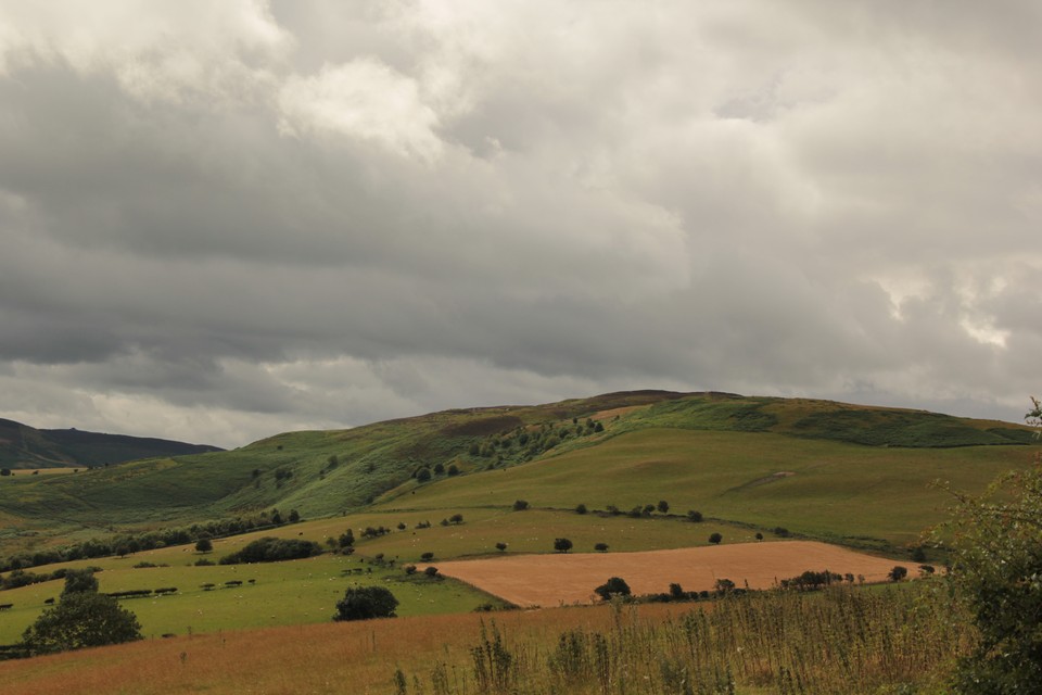
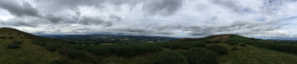
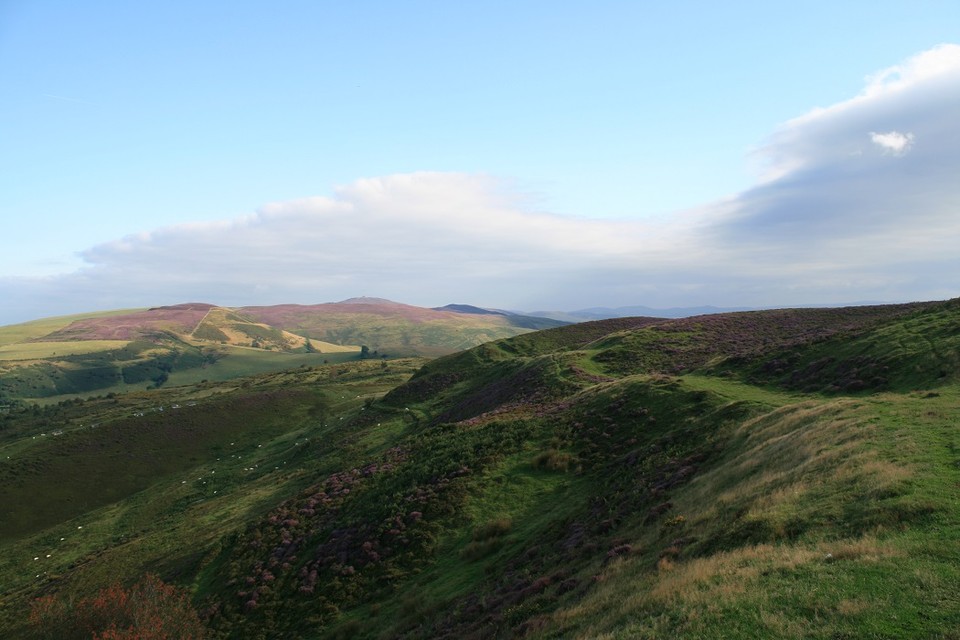
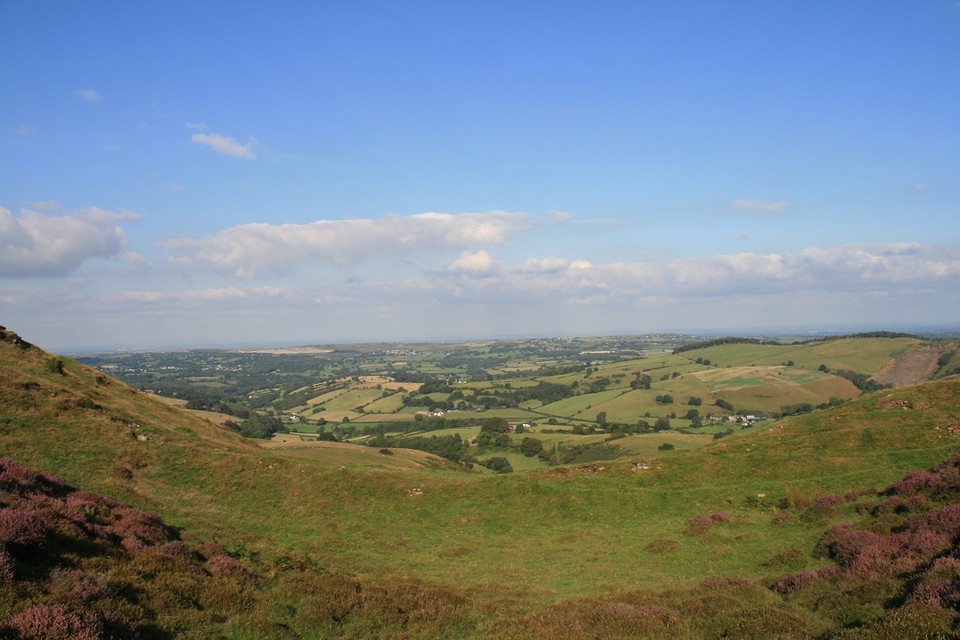
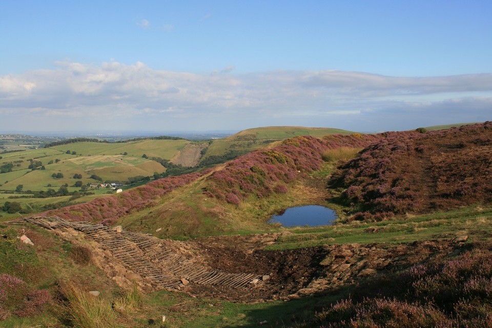
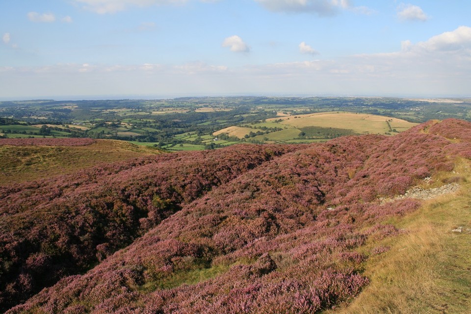
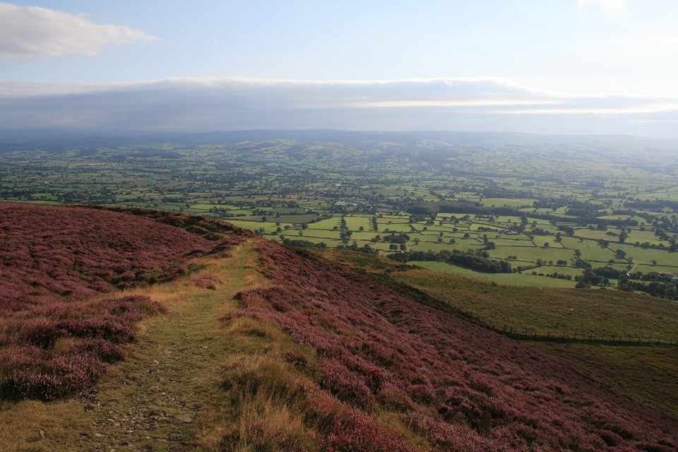
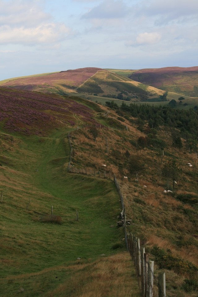
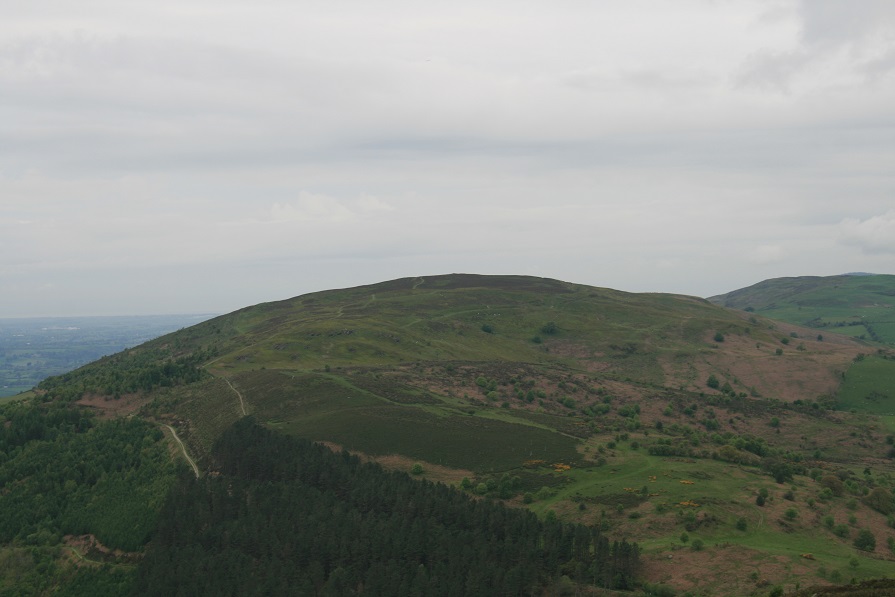
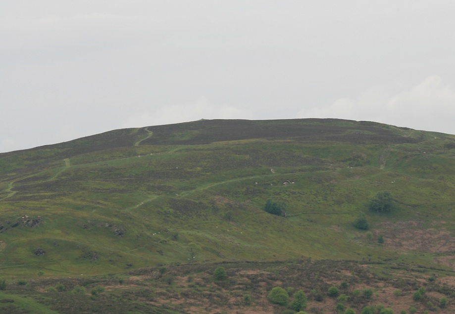
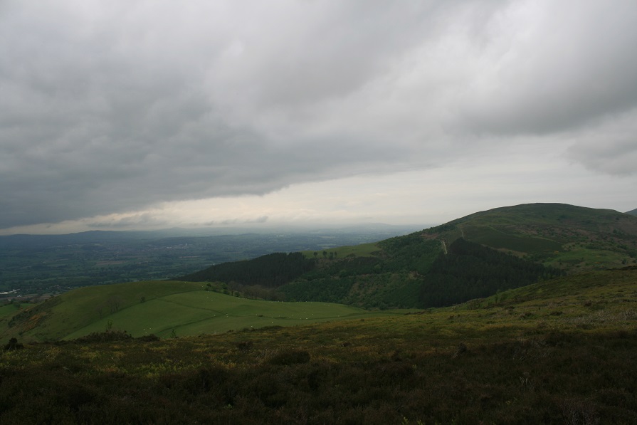
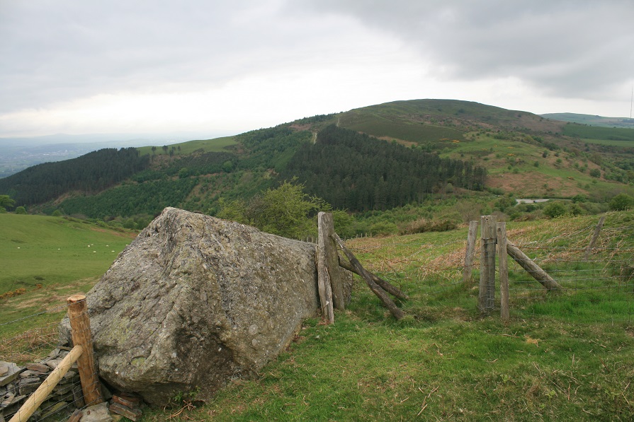
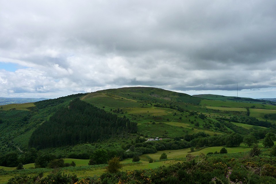
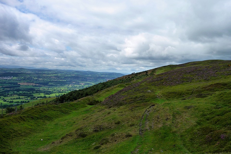
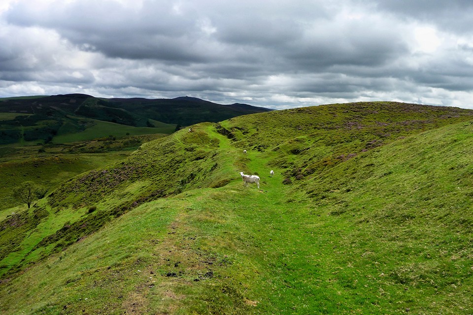
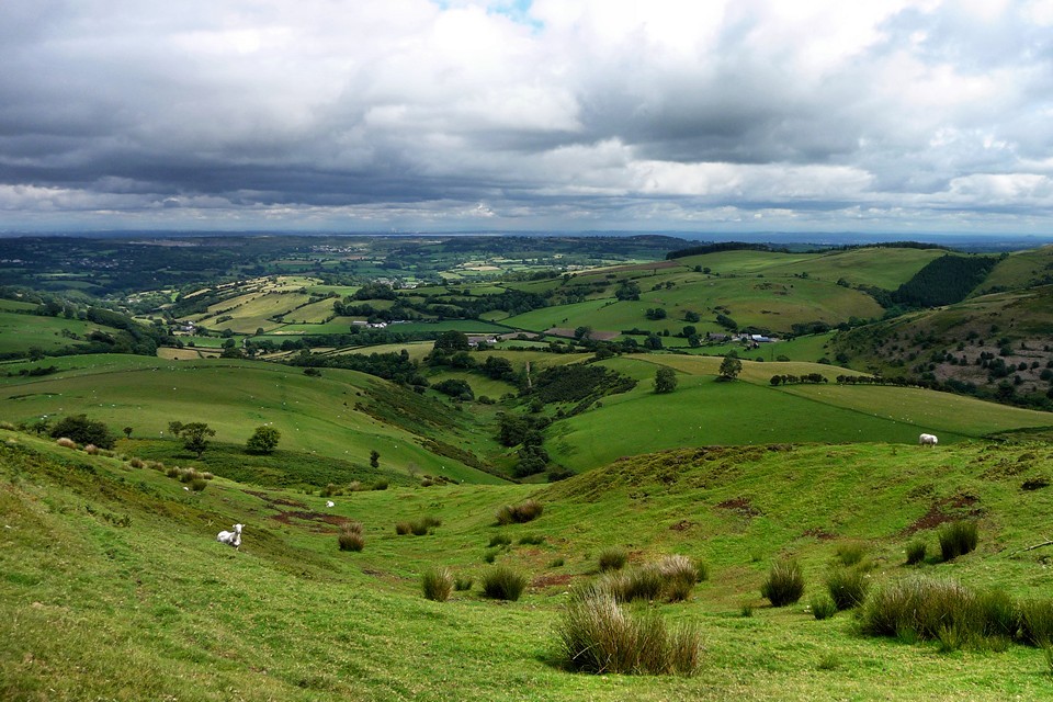
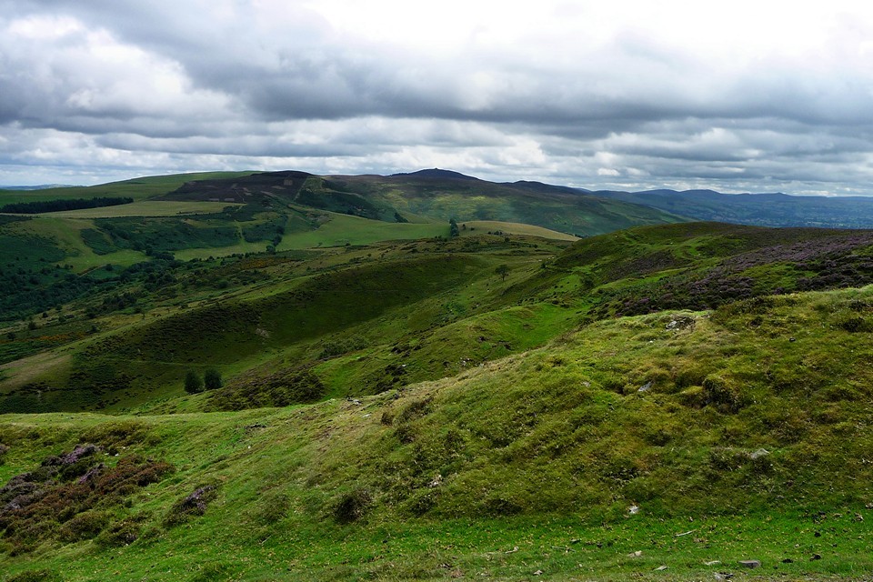
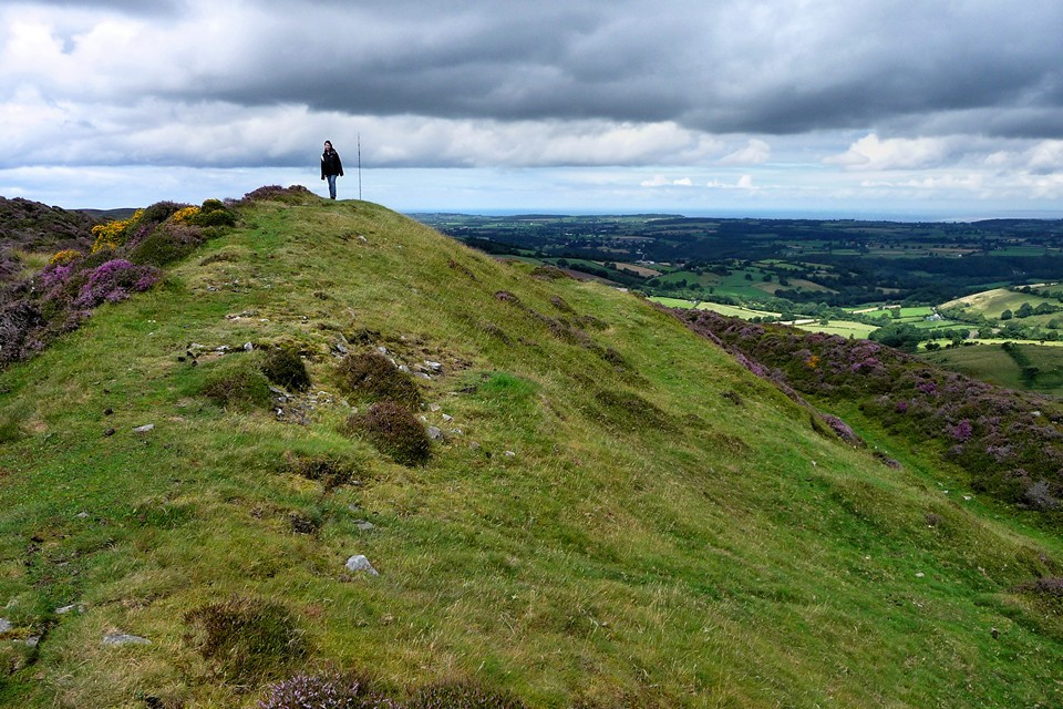
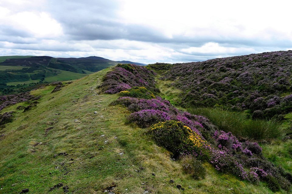
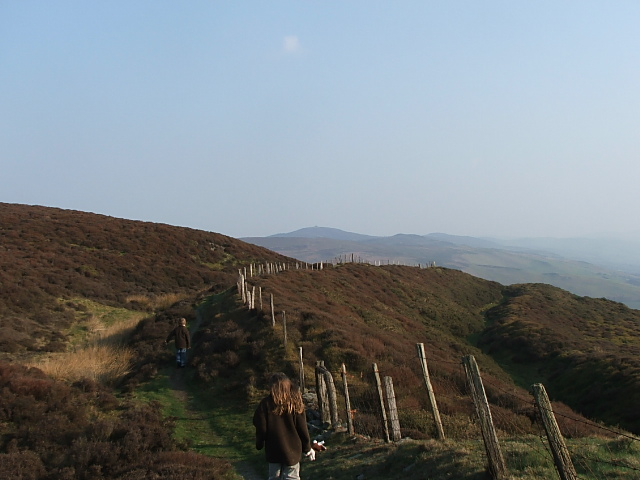
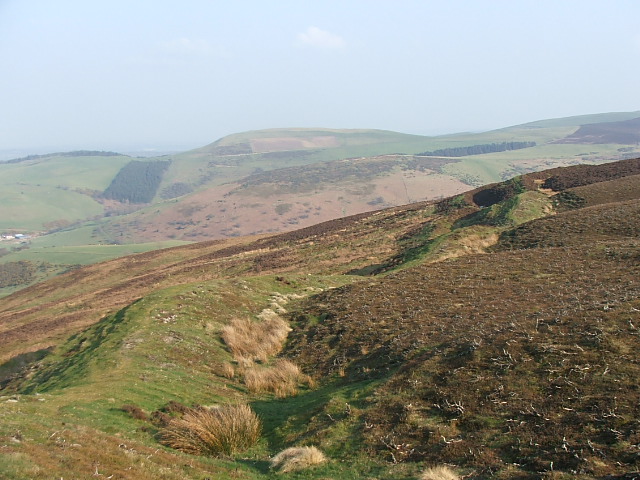
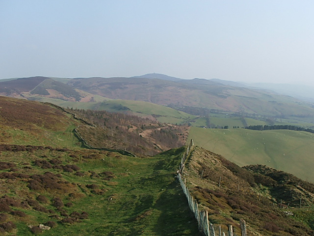
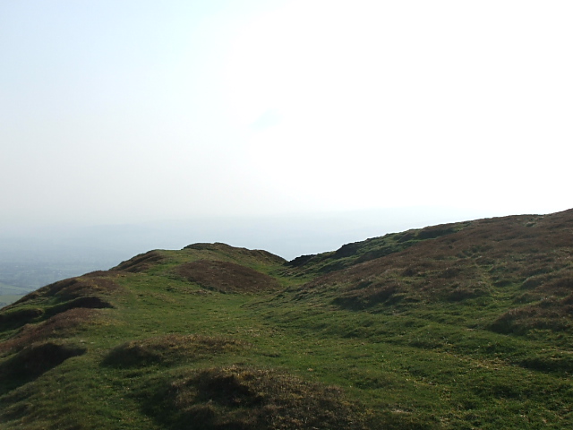
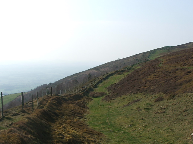
My first time here was slightly hampered by small children and knock 'em over winds, seven years later in thick sunshine I'm back for a full circuit, and a gander at that restored cairn. The walk from car to hill fort entrance is no more than fifteen minutes, it's all up and the views expand accordingly. The entrance to the fort isn't as impressive and imposing as the rest of the fort would suggest, that's mainly because it isn't the actual entrance, but rather the route of the Offas Dyke path. There are two entrances, both on the east side, so that's the route I take, counter clockwise. The single bank starts off quite low and mellow, steadfastly it follows the edge of the hill up and over hillocks and spurs, in one place a massive hollow is come across, but the bank carries on. But by the time I reach the only entrance I can say is definitely an entrance they have grown to at least six feet in height. Some shenanigans have taken place here at the entrance, a massive strip of grass has been removed and covered in a wooden fence, laying horizontal over the scar, a big pile of plastic covered something has been placed in the inner ditch, from the rubble taken from the forts defences someone has created a small throne, shenanigans I tell you. The walk along the eastern ramparts is now gaining in some more height, the views to the east are long but a bit flat and farmy, there are also two banks now. Wheeling in the far distant sky is a Red Kite, an unmistakeable silhouette against the deep blue of the sky, this is the farthest north I've seen them. Now the north end of the fort has been achieved the ramparts have grown in number again, four there are now, and very good they look too covered in unusually bright pink heather, in fact, over half the fort is covered in pink heather. From here I can just see the trig point on Moel Y Parc, behind which is a barrow and a cairn, I'll have to go there one day and see if there's much difference between the two. I stop off here for a look at the restored cairn, and decide that it is a very loose restoration, it looks good but longevity has eluded it's restorers. Turning south I retrace the kids and mine steps from seven years ago, two large banks make it most of the journey down the west end, punctuated by a slight and possibly modern entrance with a stile, and some fairly convincing round house platforms. Then it's back up to the false entrance at the south end and the view beckons us on to the next hill fort over Moel Arthur, but I went up there not long ago and it's almost tea time ive gotta go. So I go. This is a superb hill fort, one of the largest in Wales I suspect, and that cairn needs to be seen before it fades back into the well trodden hill top. |
 Posted by postman
15th September 2014ce Edited 15th September 2014ce |
|
Once we hit the 300m mark, the climb becomes less steep and it's a steady climb up to the northern ramparts of the fort, via a couple of false crests. Green grass gives way to purple heather as we approach. The multiple lines of defence are immediately apparent, in what would have been a pretty off-putting sight to any would-be attackers. One of the ditches is deep and sufficiently intact to be filled with a scummy green "moat" (presumably not an original feature?). Having crossed four lines of defensive banks, we emerge into the fort interior, where a rather immaculate cairn greets us. I assume (mistakenly) that it's modern as it's not marked on the map, but a post-trip check of Coflein reveals it to be a genuine, albeit heavily restored, Bronze Age cairn. It marks the highest point of the fort, at around 440m above sea level. The wind here is pretty fierce, making for a fairly inhospitable stop and we don't hang around very long before electing to take the eastern rampart of the fort. I have the usual delusions of doing a complete circuit, but this is a big fort! From its northern end, the eastern rampart sets off in an impressive triple-line of banks, with a sharp drop away to the east beyond (the drop on the west side of the fort is much steeper though). Moel Famau, highest point in the Clwydian Range, looms into view to the south, but we won't be getting near that today. The rampart steadily drops away from the northern end of the fort and just before the halfway point the triple banks end, presumably at what would have been an entrance. South of here the rampart drops further and is marked by a single (still impressive) rampart. The nearest neighbouring fort, Moel Arthur, is now in sight, its height comparable with our own. We eventually reach the southern end of the fort, and walk a little way along the (very windy) western rampart before rejoining The Path as it starts its descent from the hill. This post appears as part of the weblog entry Offa's Dyke Path II – Rhuallt to Denbigh
|
 Posted by thesweetcheat
13th December 2010ce Edited 26th December 2010ce |
|
From the car park walk north and follow the thin path through the trees, quite a long but pleasant walk with what would have been spectacular views to the west had it not been so hazy, as you approach the hillfort turn around and take a look at Moel Arthur the next fort south along the range. Penycloddiau is the biggest and most impressive hillfort in the Clwyddian mountains at 430m the views are extensive to say the least. The strong cold wind coming from the east pretty much prevented us from having a good look along those ramparts (the wind whipped the lens cap right in my eye, ouch)but the other side was well preserved double ditches at the north east end and to the north triple. There may have been two entrances to the east, at least that's what Coflein says, we didn't go up the wind torn eastern side. I do not know why I put off coming here so long it's just awesome even the kids (My hill fort groupies)loved it only two or three Clwyd mountains hill forts to go now. |
Posted by postman 2nd April 2007ce Edited 15th September 2014ce |
Miscellaneous |
|
|
Early discovery from this year's Penycloddiau dig, courtesy of Dr Rachel Pope: "A bit of new info. from Penycloddiau is that as early as the Early Iron Age, they’re using clay as a bonding material in construction, and also lime for weatherproofing. Something we didn’t know, we’d assumed all that was Roman invention." |
Posted by thesweetcheat 1st August 2018ce |
Links |
|
Why prehistoric Welsh people built so many forts on hills"The language of these things was established in the early 20th Century when we were fighting a lot of wars: hillforts, guard chambers," Gale says, a little ruefully. "We're stuck with these terms. But I think they were much more complicated than just being military or defensive." |
 Posted by moss
22nd May 2016ce |