|
|

|
|
The ChestersHillfort
|
||||||||||||||||||||||||
|
|
|
Images (click to view fullsize) |
|


|
Fieldnotes |
|
|
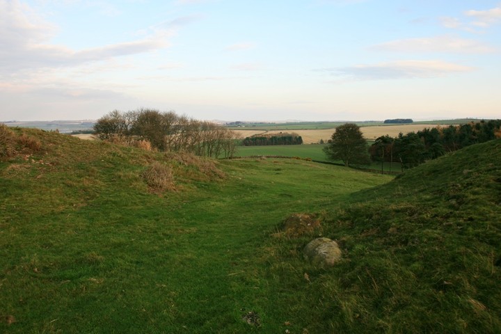
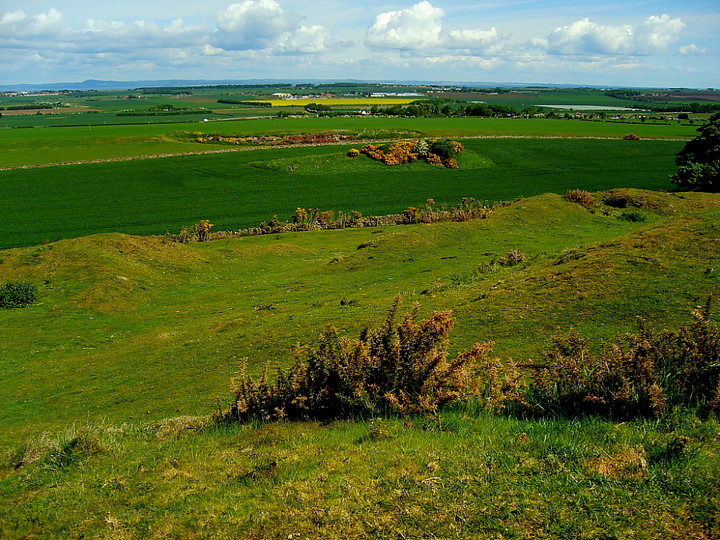
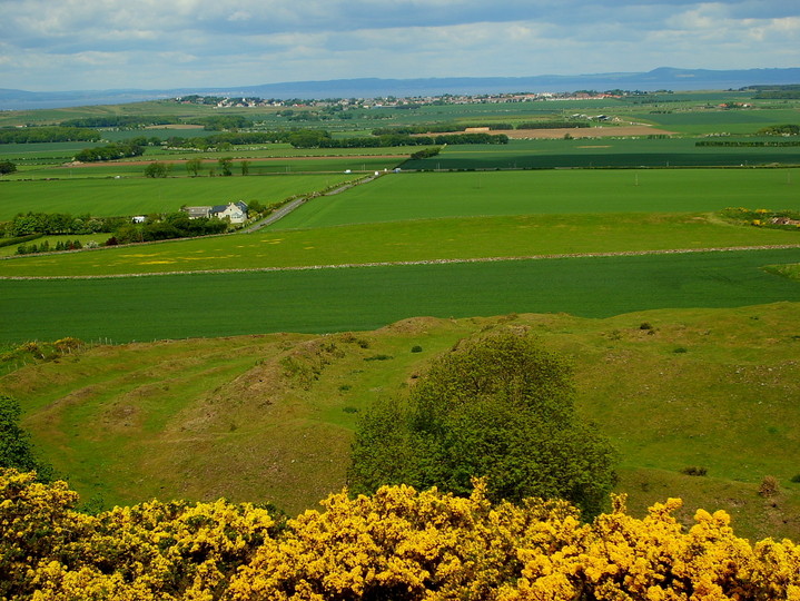
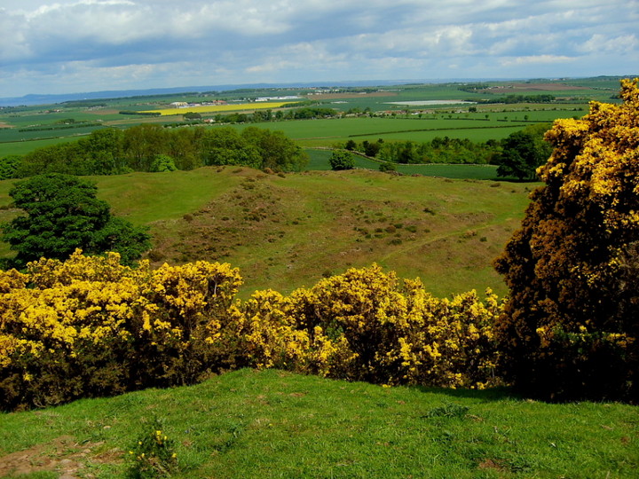
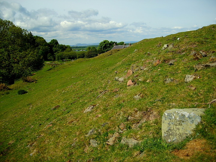
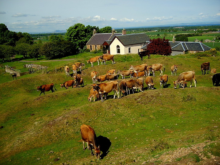
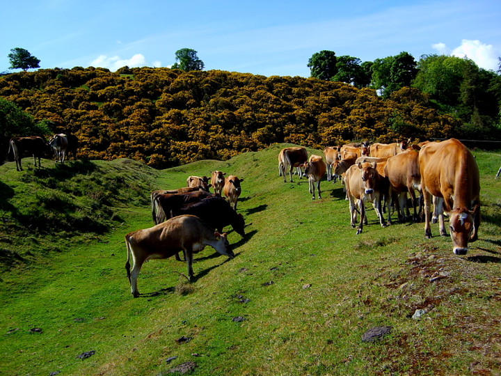
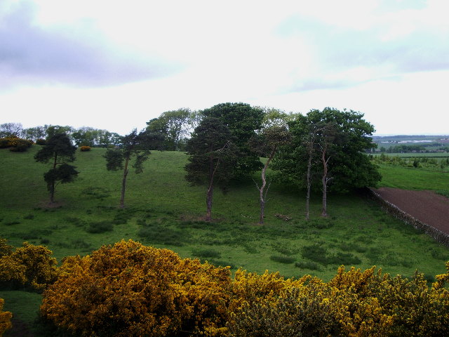
Visited 30.7.14 We followed the signs and parked in the small parking area next to the approach road to the farm. A sign states that the parking area closes at 6.30pm in summer and 4.30pm in winter. The weather was bright although there were dark, threatening rain clouds on the horizon. The children were asleep in the car so I followed the path to the hillfort alone. The path runs parallel to the farm access road before crossing a small field of cows and the start of the outer ramparts. (200m walk) The information board states that the hillfort is unexcavated which I found surprising. There are many stones sticking out of the grass on the ramparts which no doubt is what the banks were originally made up of. The site is large but not huge and it doesn’t take long to walk around the entire perimeter. There are good coastal views and in the distance Arthur’s Seat can be seen. Nearby Traprain Law stood out like a beacon as it was lit up by the evening sunshine. On my way back to the car a family arrived with two young children. It is always nice to see children being shown these ancient sites and they will (hopefully) gain a better understanding of their forebears and an appreciation of the importance of these special places. This is a very easy hillfort to access and is well worth a visit if in the area. Another Historic Scotland site knocked off the list! |
Posted by CARL 19th August 2014ce |
|
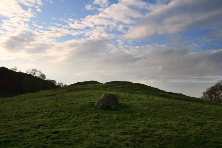
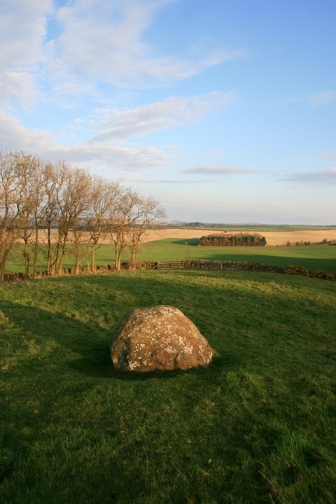
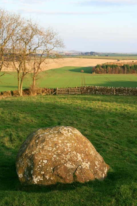
Visited here last weekend, and noticed an interesting alignment. If you stand in the centre of the fort with Arthur's Seat behind you on the horizon, then you find yourself pointing at a small hill on the horizon to the east. I haven't figured out what it is yet though - it may of course just be a natural hill! This alignment roughly passes through the entrance, beyond which is a large boulder. |
 Posted by BigSweetie
30th November 2011ce |
|
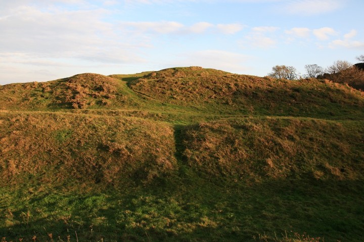
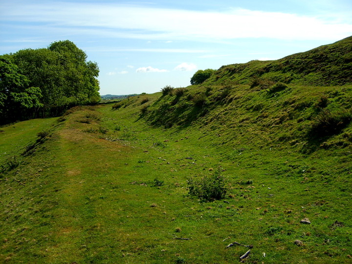
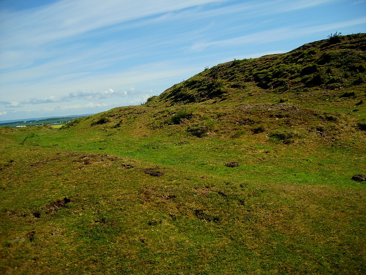
Chester minute... what do we have here? A large Iron Age hillfort, protected by impressive, multivallate ramparts seemingly straight outta Wessex, not lowland Scotland. I would suggest one Iron Age warlord may well have travelled 'down south' and picked up a few ideas, in much the same way Crusaders returned to these shores, straining at the bit to employ the ideals of concentric fortification in stone. Then again, perhaps not. Whatever the truth, the fundamentals of the great Wessex hillforts are present and correct in the shape of towering ramparts, with attendant ditches, and lavishly protected entrance ways, here to east and west. There would appear to be two main ramparts, supplemented by additional defences where thought necessary. I count four to the north, but then that could just be my lamentable arithmetic. As mentioned, the architects really pulled out the stops at the entrances, although whether the over-riding factor here was to overawe and impress the visitor, or actually thwart a surprise assault is a moot point. Accusations of all-important symbolism are given credence by the very siting of the fortress at the mercy of extensive high ground to the south. This begs a simple question. Why? I go and take a look, concluding that there would appear to be no obvious reason why a large, very powerful fortress could not have been built up here instead. Having said that it must be emphasised that Chester is a 'proper' fortress, albeit an ill-placed one where the owner was either a) stark, raving bonkers or b) reckoned he was too powerful to ever be challenged and therefore didn't want the inconvenience of living on a hill. The site also raises ongoing questions about the ritualistic function of hillforts, too. Was defence ever the prime factor, or did the very act of enclosing an area with earthern banks represent an Iron Age attempt to update the symbolism inherent in the Neolithic henge? Leaving these big questions aside - for now - I simply enjoy a stroll around the circumference, noting the sites of many former round houses, some overlaying the main ramparts so therefore obviously later additions. It is a good place to be. |
 Posted by GLADMAN
23rd June 2010ce Edited 23rd June 2010ce |
|
Despite the name, this hillfort dates from the Iron Age. Huge, 'stepped' ramparts on the north side (most visible and impressive, as you might expect, at sunset). On the south side, there is (rather inexplicably) a hill taller than the one the fort stands on. Excellent views, particularly at dusk, in one direction all the way to Arthur's Seat, across the Firth of Forth, to the Forth Bridge and beyond to Fife, and in the other to Berwick Law and Bass Rock. To get there, if you're walking, take the North Berwick train or bus from Edinburgh, and get off at the small village of Drem. Cross the railway road bridge and climb over the fence, then follow the tree-lined road up the hill. The Chesters is on the right and very visible. By car: the hillfort is well-signposted (it's looked after by Historic Scotland) and has a small, unobtrusive car park below the W side. |
Posted by taras 4th August 2006ce Edited 4th August 2006ce |
Links |
|
Undiscovered ScotlandSome great photographs and further information on this site. |
Posted by taras 4th August 2006ce |