The Modern Antiquarian. Stone Circles, Ancient Sites, Neolithic Monuments, Ancient Monuments, Prehistoric Sites, Megalithic MysteriesThe Modern Antiquarian


Kernic

Allee-Couverte

<b>Kernic</b>Posted by KammerImage © Simon Marshall
Also known as:
  • Guinivrit
  • Roc'hou Bras

Latitude:48° 39' 24.49" N
Longitude:   4° 12' 57.44" W

Added by Kammer


Discussion Topics0 discussions
Start a topic


Show  |  Hide
Web searches for Kernic
Show map   (inline Google Map)

Images (click to view fullsize)

Add an image Add an image
<b>Kernic</b>Posted by costaexpress <b>Kernic</b>Posted by costaexpress <b>Kernic</b>Posted by costaexpress <b>Kernic</b>Posted by costaexpress <b>Kernic</b>Posted by CianMcLiam <b>Kernic</b>Posted by CianMcLiam <b>Kernic</b>Posted by Moth <b>Kernic</b>Posted by Moth <b>Kernic</b>Posted by Moth <b>Kernic</b>Posted by Moth <b>Kernic</b>Posted by Moth <b>Kernic</b>Posted by Jane <b>Kernic</b>Posted by Jane <b>Kernic</b>Posted by Jane <b>Kernic</b>Posted by Jane <b>Kernic</b>Posted by Kammer <b>Kernic</b>Posted by Kammer

Fieldnotes

Add fieldnotes Add fieldnotes
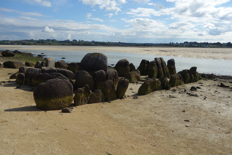
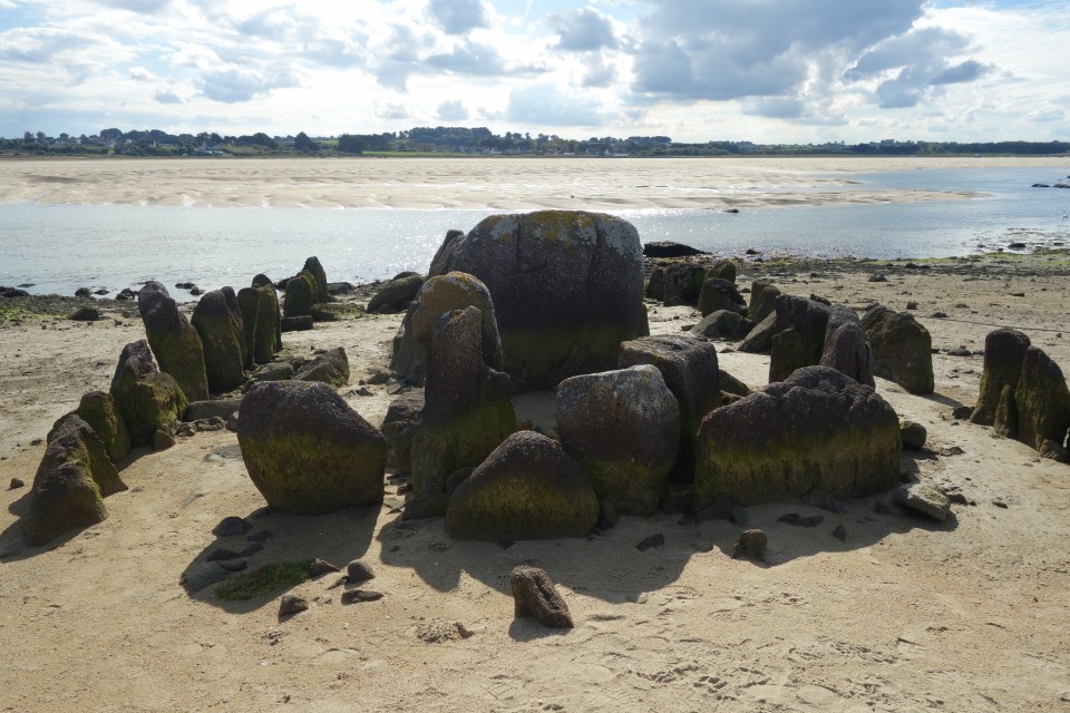
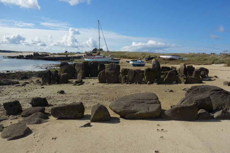
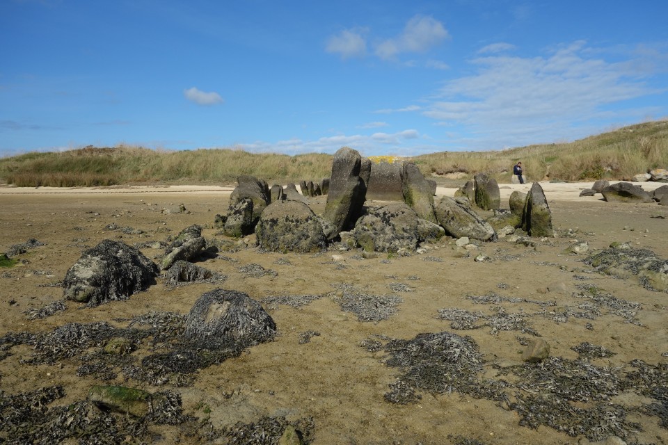
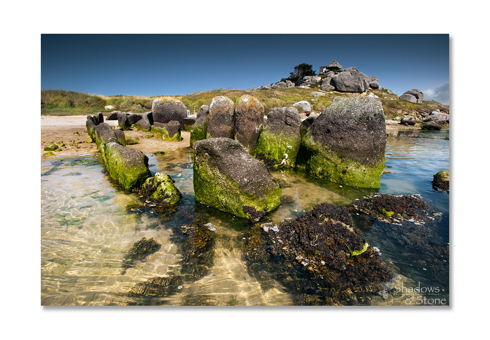
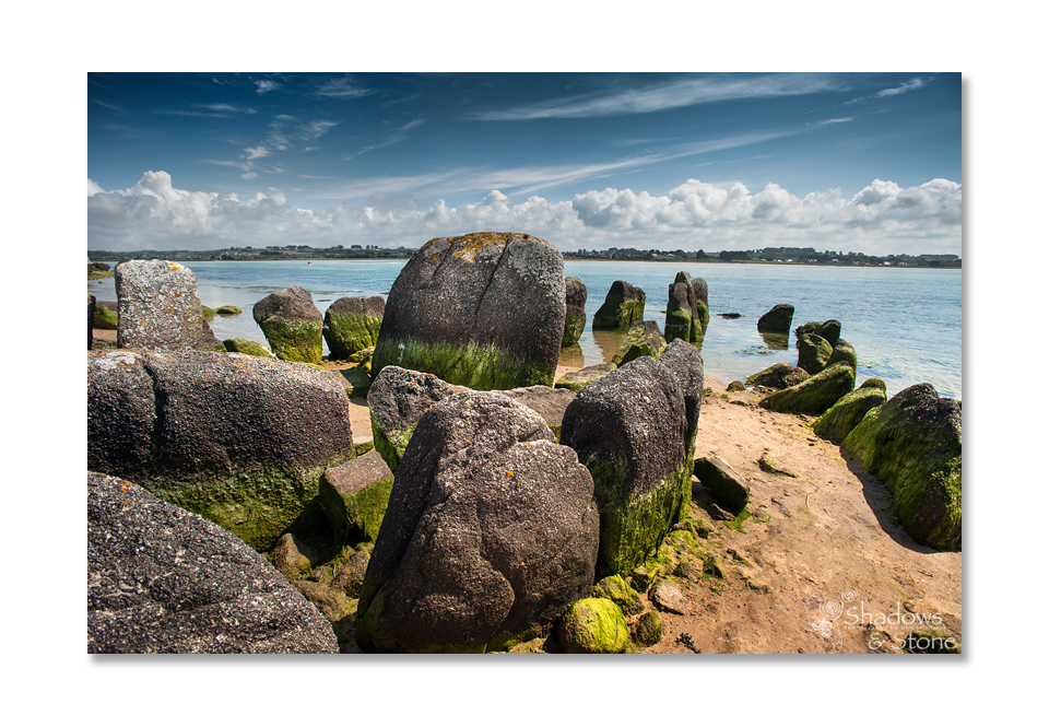
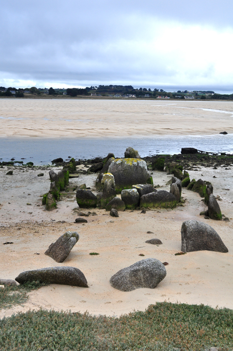
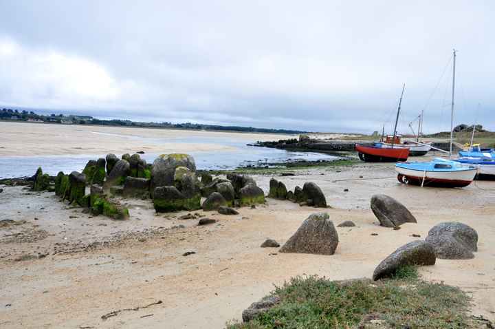
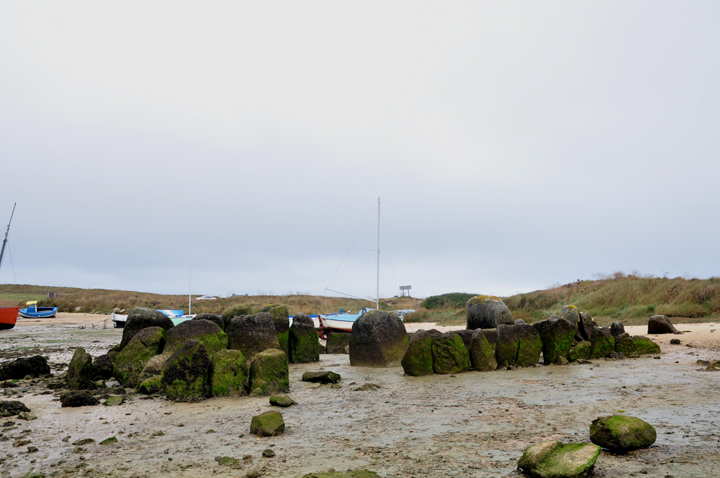
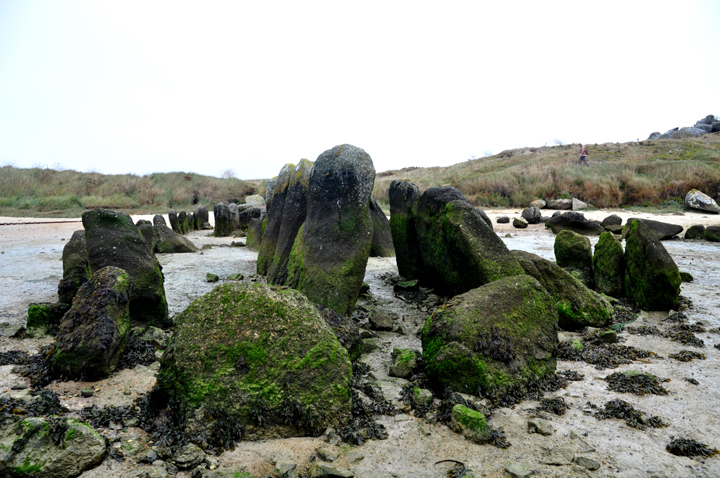
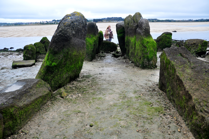
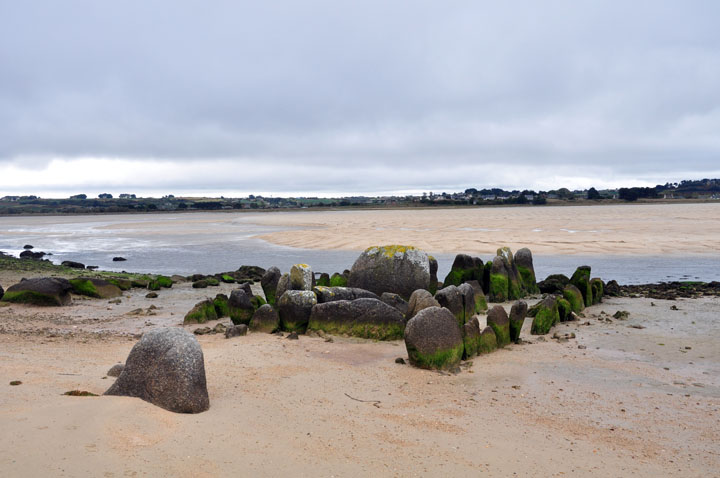
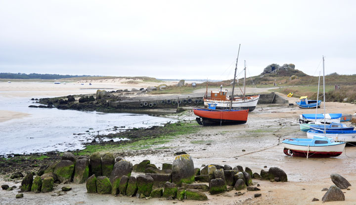
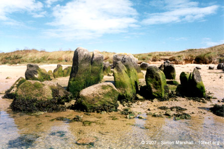
We'd seen the skeletal remains of Kernic in books and always been impressed with it, not least because it's right on the beach, and at high tide gets (mostly) covered by the sea.

As sea levels have risen since ancient times, it's left Kernic stranded (in the literal sense of that word, at the strand line), so you can only see all that is left of the monument at low tide.

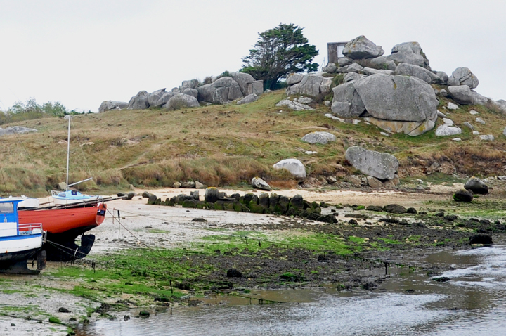
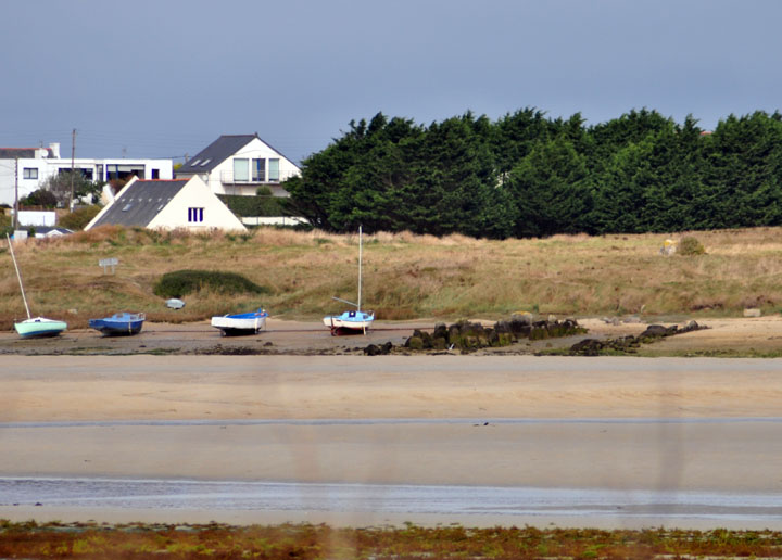
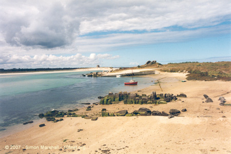
Climb down from the dunes and among the tethered boats on the beach, below some rocky tors overlooking the estuary, the 'bones' of the monument are easy to spot; the passage and some kerbstones.

The mound and capstones have long ago been washed away and seaweed covers the lower portions of the stones. It's very cool. A must-see.
Jane Posted by Jane
13th October 2009ce
Edited 13th October 2009ce