Offa’s Dyke VIII – Four Crosses to Buttington Bridge 16.7.2011
It’s unusual for one of my walks to avoid the hills, but that’s exactly what this section of Offa’s Dyke Path will do. Since leaving the Clwydian range we've crossed several major watercourses on their way down from the Welsh uplands, but today we'll meet the mightiest of them all.
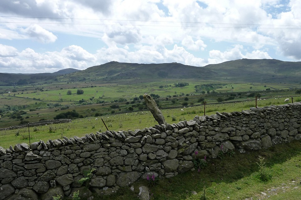
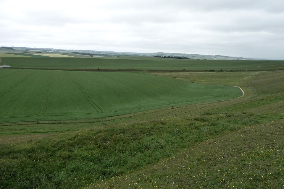
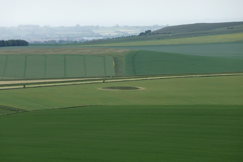
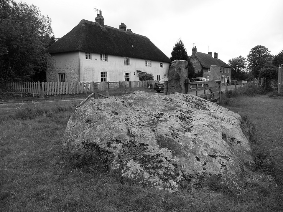
The bus from Welshpool drops us at Four Crosses, where we finished our last section back in May. This is a very low-lying settlement, not much more than 50m above sea-level on a wide plain stretching from Llanymynech Hill and Afon Efyrnwy to the north to the Breiddins to the southeast. The Dark Ages earthwork of Offa’s Dyke crosses this plain, but there was once much more going on here than the patchwork of fields now suggests.
The northern part of the village is called Llandysilio, one of many Welsh locations associated with St Tysilio, who died about 100 years before King Offa was born. In the fields to the east a huge complex of cropmarks has revealed a Bronze Age cemetery, now flattened, together with ring ditches and traces of field systems. There’s nothing to see now, but back in the Bronze Age this was clearly a place of some significance.
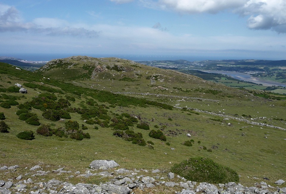
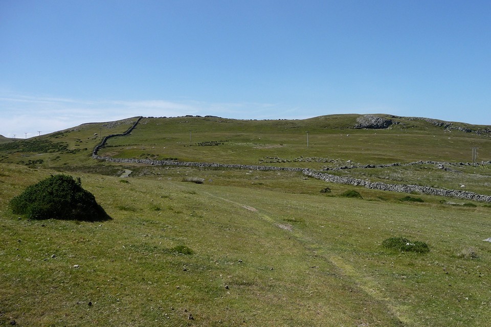
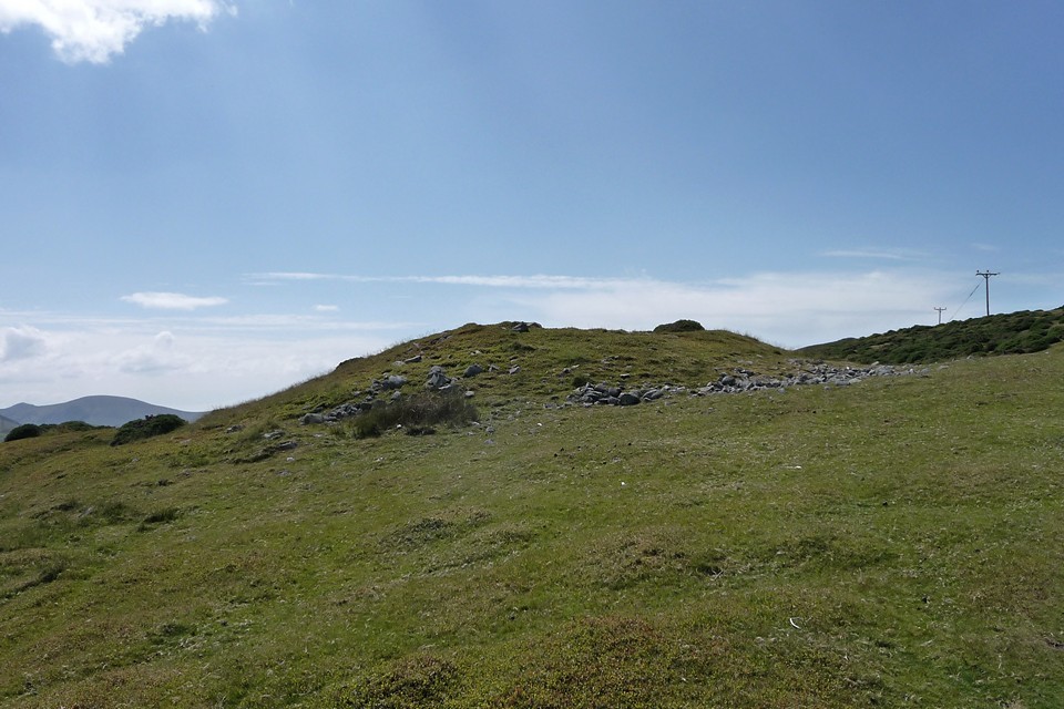
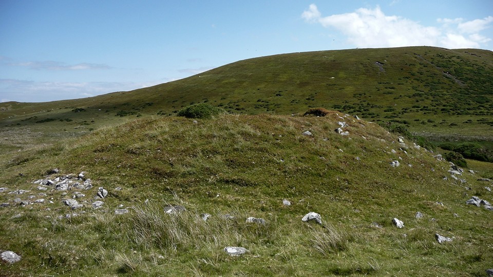
We follow the dyke itself southeast out of the village centre. It’s much reduced here, generations of ploughing cutting its height to barely a metre tall. Straight ahead is a dark bulk of hills. These are the Breiddins, rising near-vertically from the plain and site of a number of Iron Age earthworks that will be watching over our whole route today.
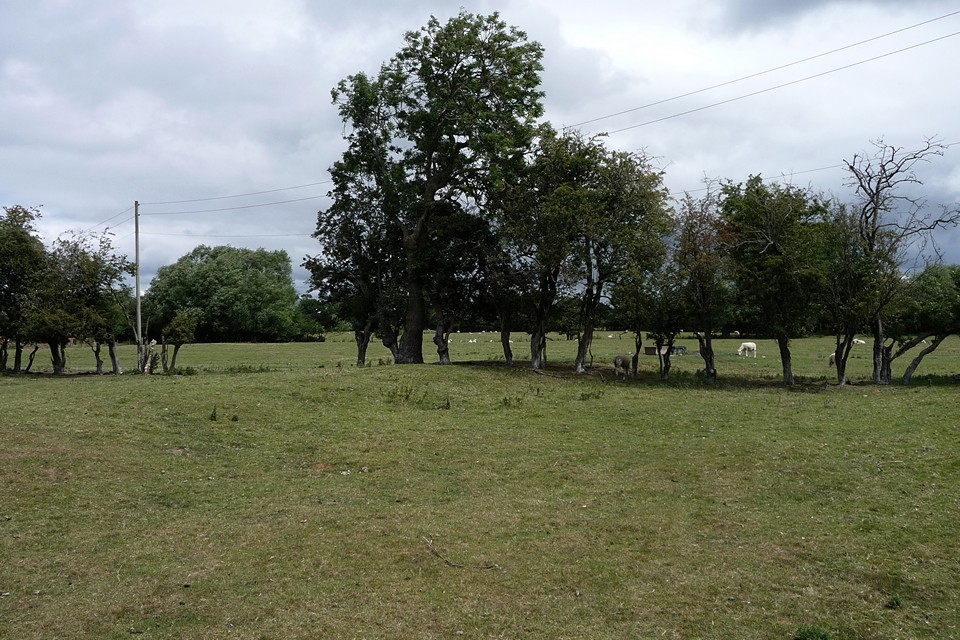
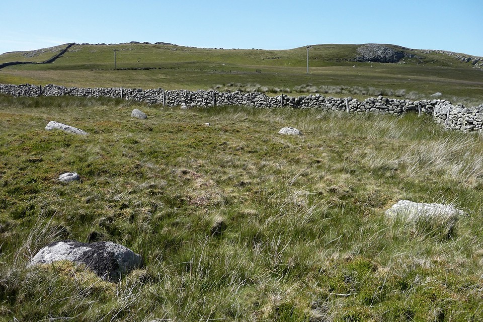
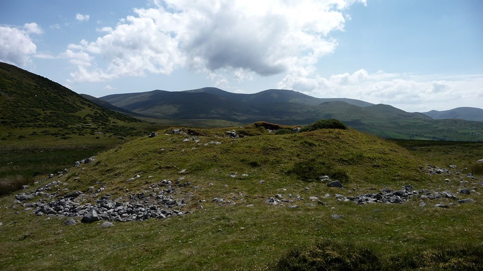
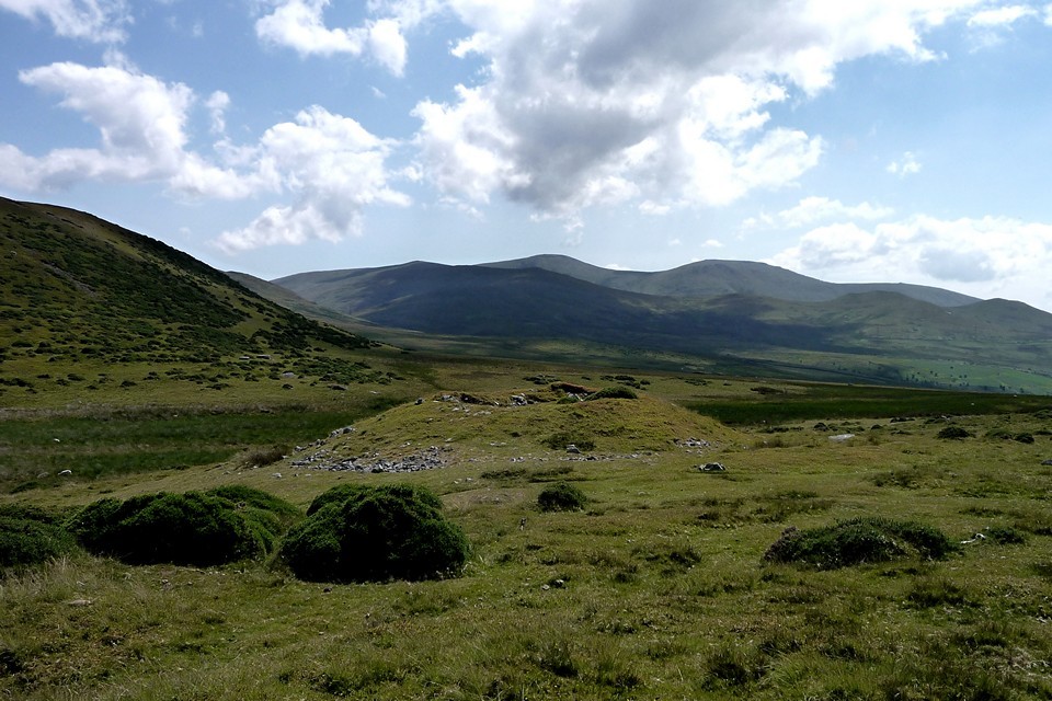
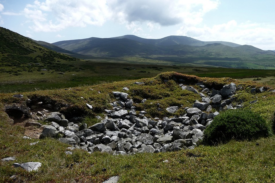
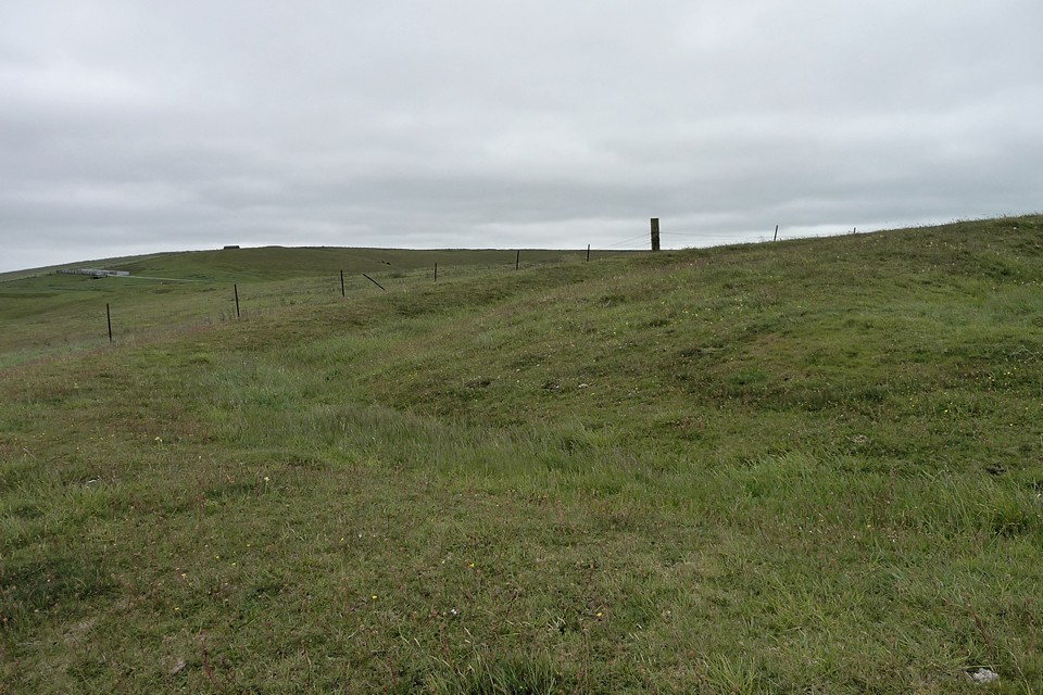
The section of dyke north of Rhos is very attractive, planted with a double row of oak trees. From here we have a nice retrospective view of Bryn Mawr hillfort, yet another prominent site overlooking this flat landscape that we're traversing. But our first – indeed only – site of the day lies just a couple of hundred yards away to the east. Crosswood enclosure could be seen as part of the complex of sites around Four Crosses and Llandysilio. It’s a circular enclosure with an internal ditch, bisected by the road from Rhos to Llandrinio. The road crosses the site about a third of the way from the northern part of the arc, so it’s not an obvious re-use of any original entrances. Sadly the earthwork has been much reduced by ploughing, rather similarly to the nearby line of Offa’s Dyke. It’s best preserved at the northwest, where both the bank and the internal ditch can be made out clearly, albeit not the easiest thing to photograph. Running east the bank gets even further reduced, to the point of near-disappearance.
On the south of the road we couldn't see anything at all, but this did involve trying to peer through a pretty thick hedge!
Not the most impressive place to visit, but as pretty much the only visible remains of the numerous sites on this flat plan, it’s worth a quick hello.
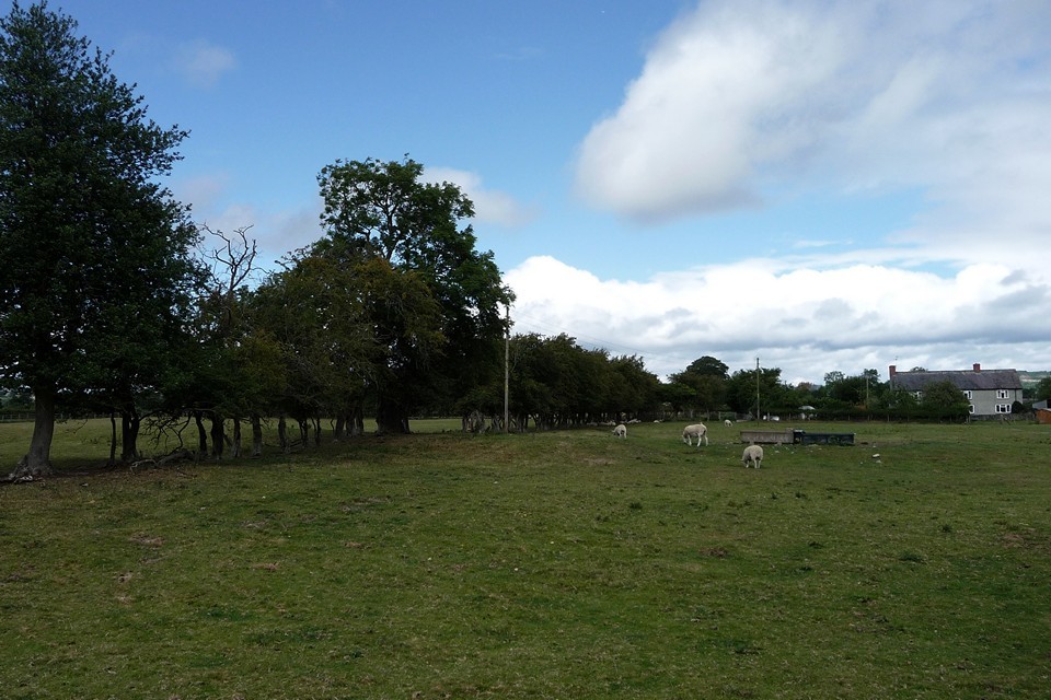
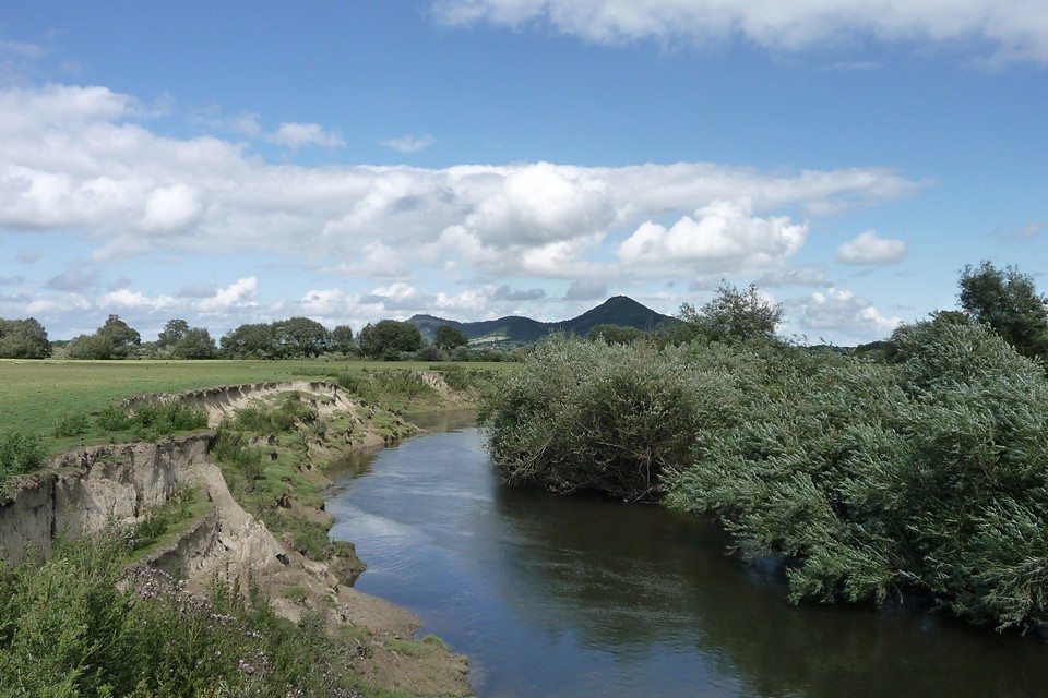
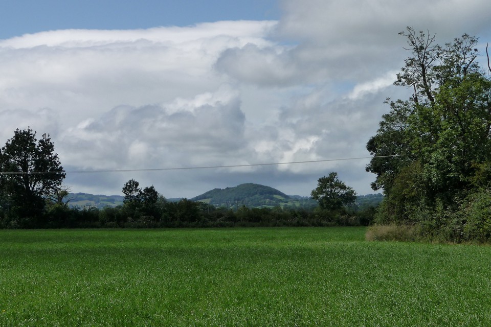
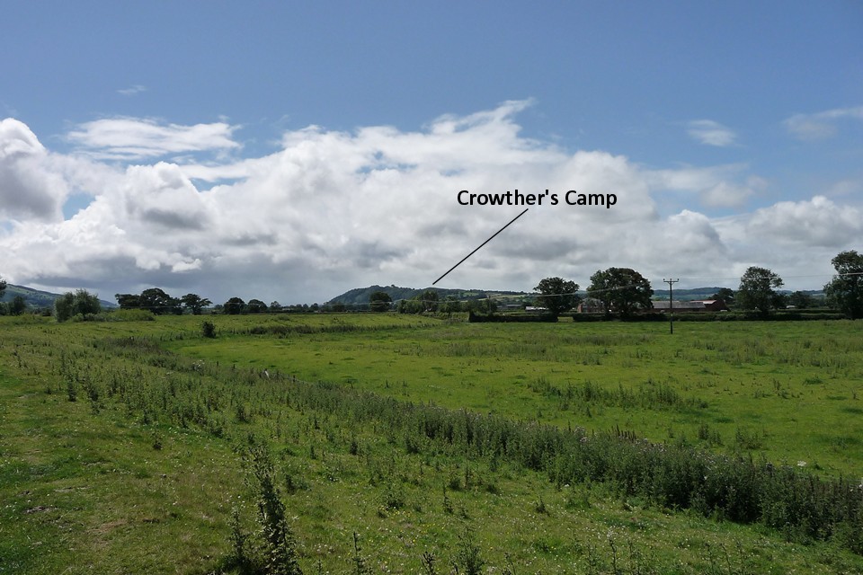
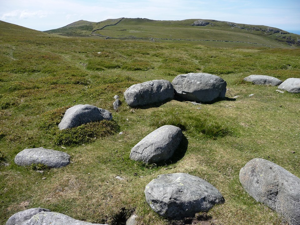
Leaving Rhos we rejoin the line of the dyke, heading arrow-straight across the flatlands. From here, the enormous brooding bulk of Breiddin Hill Camp increasingly fills our view as we cross the meadows. Quarrying has blighted the side of the hill, but nevertheless the positioning of the fort on its top is pretty formidable. It blocks views to the other forts beyond. Way over to the southwest, a further wooded hillfort, Gaer Fawr (Welshpool) rises prominently, with Crowther’s Camp another to the south. We are surrounded by these monuments to status and power, down here in the fertile land that sustained them.
The hedgerows burst with cow parsley and the waving stalks of grass that’s too far out of reach of the cows that graze most of this landscape. The surroundings are increasingly marked with drainage cuts, keeping the fields dry from the overspill of the great river that we’re approaching.
The River Severn, or Afon Hafren, has made its way from its mountain source on Pumlumon and is now a fast-flowing obstacle, cutting across the broad plain between the rolling hills of Mid-Wales and the mini-mountains of the Breiddins. We will meet it again, at the very end of the Offa’s Dyke walk over a hundred miles away. By then it will be the mightiest of all British rivers, forcing its way out to sea against one of the most extreme tidal reaches anywhere on the planet. For now though, it will be our gentler companion for several miles south, as we search for a bridge to the other side.
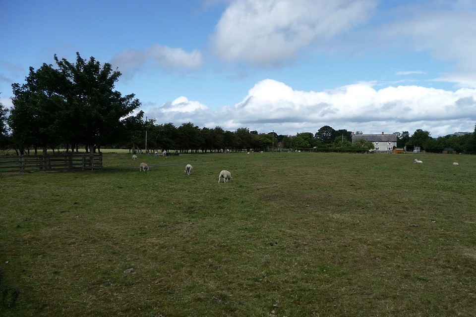
A more pressing obstacle comes in the form of a huge lump of beef however. Our path follows the Tirymynach embankment, built to stop the river from bursting its banks and flooding the fields of the plain. This is dairy cattle country, and in summer bulls often share the fields with their families. One such bull has chosen to lie down bang up against one of the stiles along the embankment, blocking a narrow gap in a thick hedge. He seems unconcerned by our presence, but our only way onward would involve climbing over his back. This doesn't seem like the action of a sane person and we reluctantly have to turn back to Red House, adding unwanted extra miles and taking us away from the river temporarily.
From Pool Quay we follow the Montgomery Canal, now restored and navigable, outliving the dismantled railway that supplanted it. This low-lying plain has long been a transport route, just as the Hafren/Severn itself must have provided a terrific highway for the prehistoric people who built the hillforts, and even further back to those who laid their dead in the cemetery at Four Crosses.
The river crossing finally comes at Buttington Bridge, but this is also the end of our Offa’s Dyke mileage for today and instead we head westwards to Welshpool. A strange walk for me, avoiding the hills that stand so prominent to either side of us. But a useful new perspective, to view the forts from below, as the prehistoric farmers viewed them in their heyday. Did they see the suspicious eyes of warlike overlords, or a lofty place of refuge in times of trouble? I guess we'll never know, but down here the mother river flows on and on, untroubled by such concerns.
|
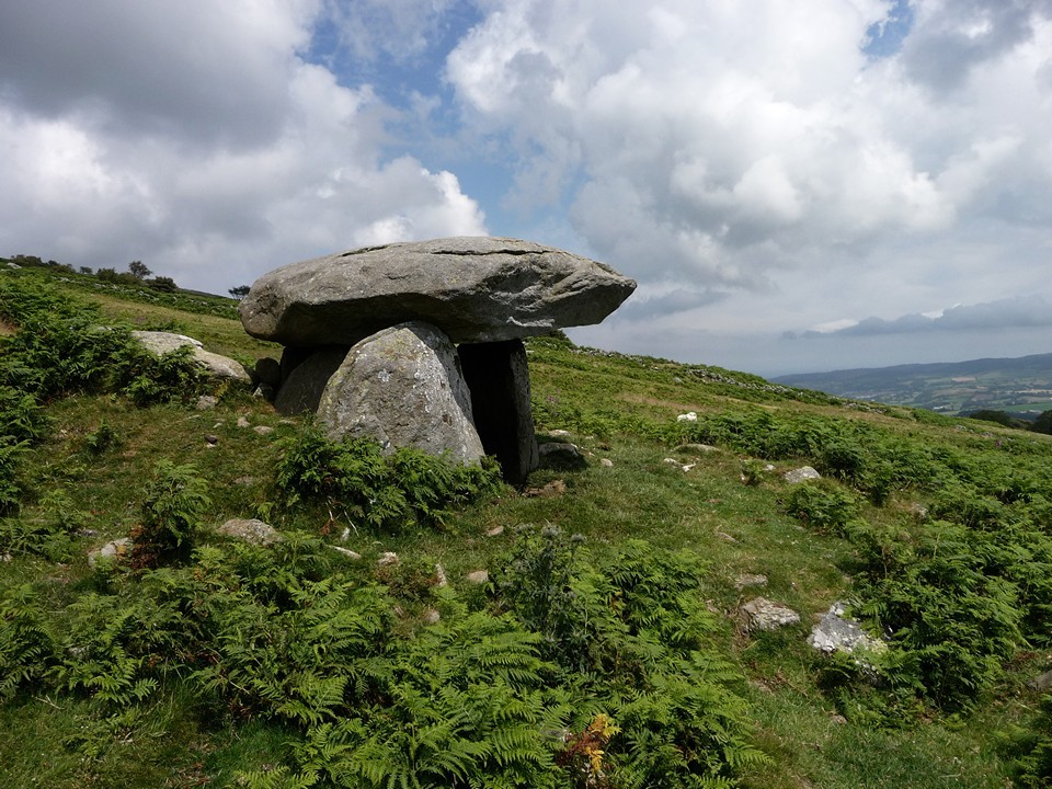
Stone out of song – Bwlch y Ddeufaen and Maen y Bardd 9 July 2011
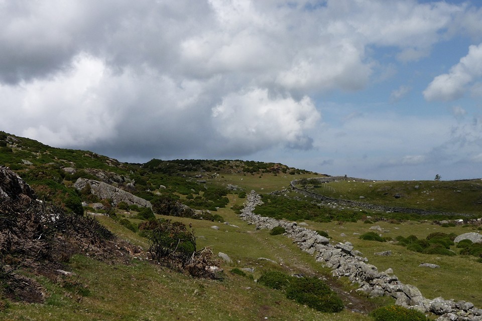
Leaving the broad plain of the Conwy Valley, lanes wind steadily upwards, bound tight by stone walls and occasionally gated against errant stock.
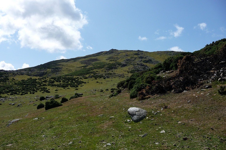
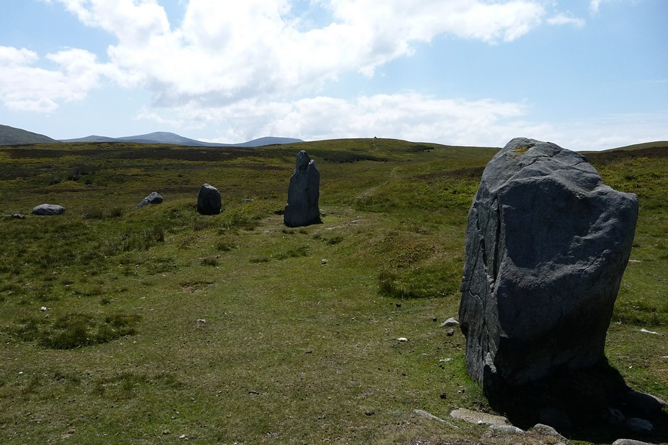
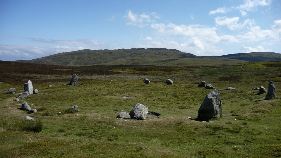
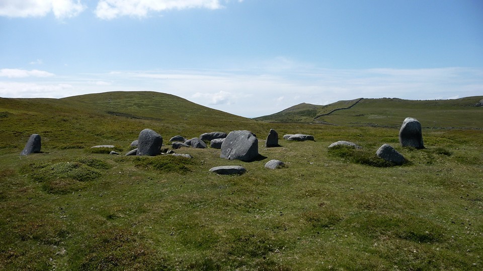
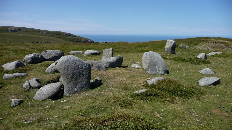
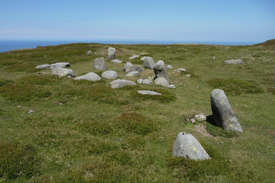
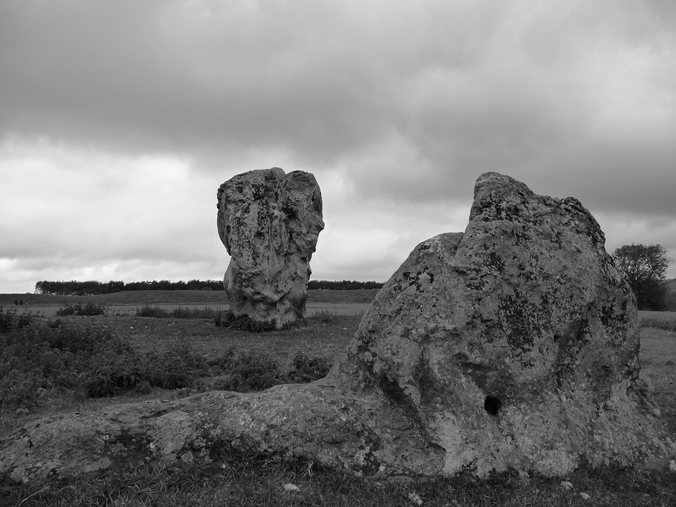
The blunt form of Pen-y-Gaer (Caerhun) rises steep on the right, but that will wait for another day. Today Blossom and I head towards the lower slopes of Tal y Fan, a mountain separated from the massive bulk of Y Carneddau by an upland pass. The pass was used by the Romans, but its name and origins are much older – Bwlch y Ddeufaen (“Pass of the Two Stones”). The sites we’ve come to see today line the track that heads east from the pass, contouring the southern flank of the mountain. They come in a rich profusion, an elongated string of megalithic jewels, in a concentration to rival any you might find in West Cornwall or North-east Scotland.It’s always exciting to start the day with a stone circle, especially one you’ve not been to before. Composed of diminutive stones, Cerrig Pryfaid is certainly no Avebury in purely megalithic terms. But the setting elevates it to something quite special.
The near-perfect circle sits in an amphitheatre of rock, broken only to the southeast where Pen y Gaer overlooks the wide sweep of the fertile Conwy Valley. Even here the longer view is filled with rank upon rank of high hills. The southwestern prospect is entirely blocked by the towering wall of the Carneddau mountains, crowned by Bronze Age cairns on the summits of Carnedd y Ddelw and Drum. To the north Foel Lwyd, the western buttress of the Tal y Fan ridge, rises in a jagged jumble of boulders and outcrops.
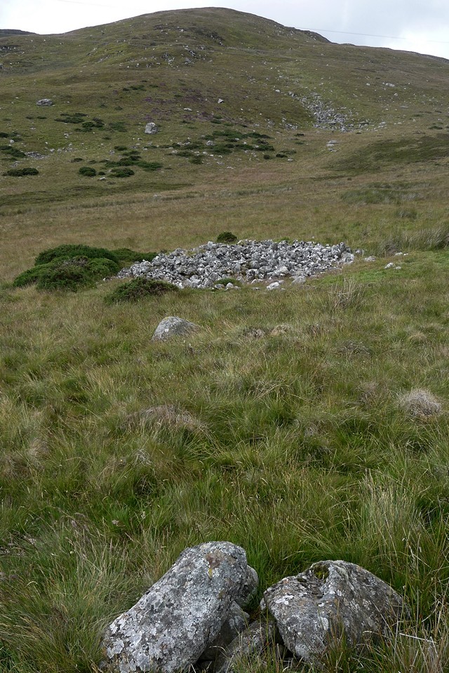
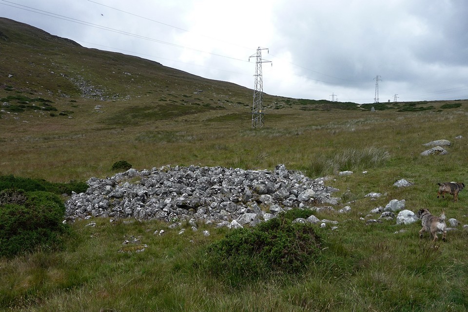
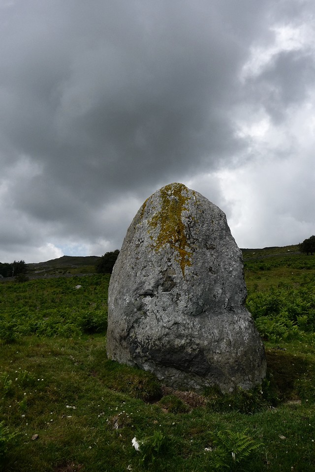
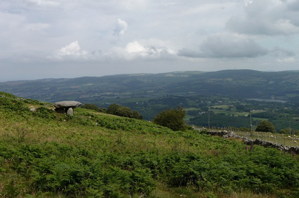
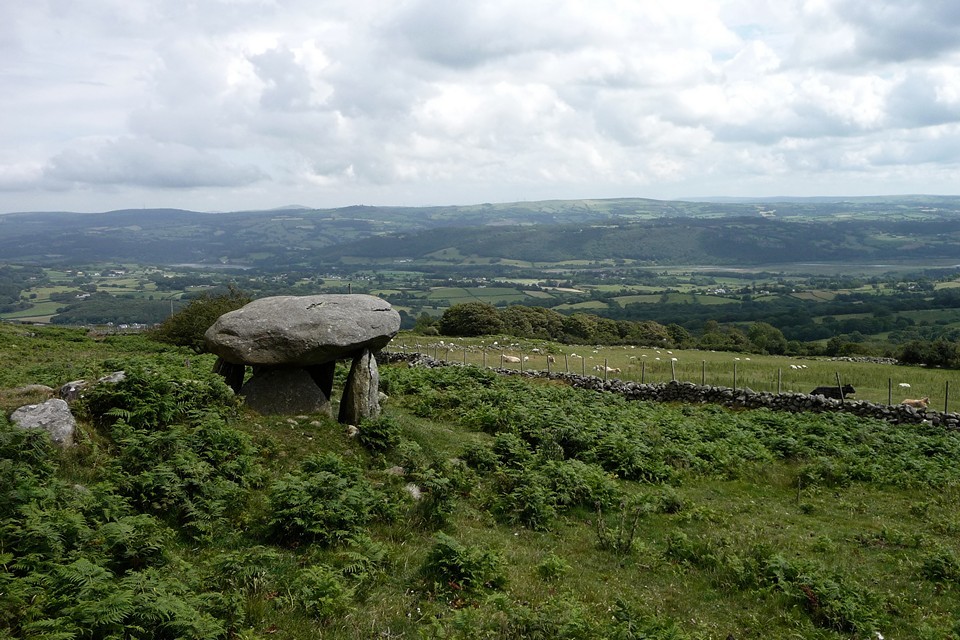
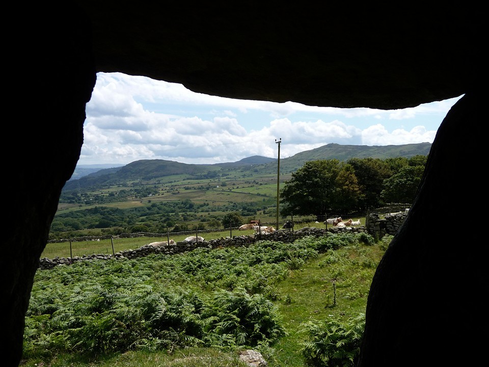
Two small outliers stand to the west of the circle, both with tantalising sunrise alignments (midwinter, autumn equinox). But today it’s getting towards midday, in July. So we make do with the earthlier delights of the landscape and views before heading back towards the Pass and our next site. From stone circle to cairn. Barclodiad y Gawres is a good size (15-20m irregular diameter), composed of large cobbles with a central scoop. It’s dotted here and there with clumps of stonecrop, the pink-white five pointed flowers a splash of summer brightness against the grey stones. We entirely fail to see the cist, or either of the other cairns that are supposedly close by. A little way to the southeast we come across a small arrangement of stones, which look like they’ve been placed deliberately but not as anything obviously identifiable. Blossom’s dogs find nice big boulders to stand on and survey the area.
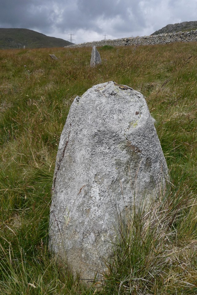
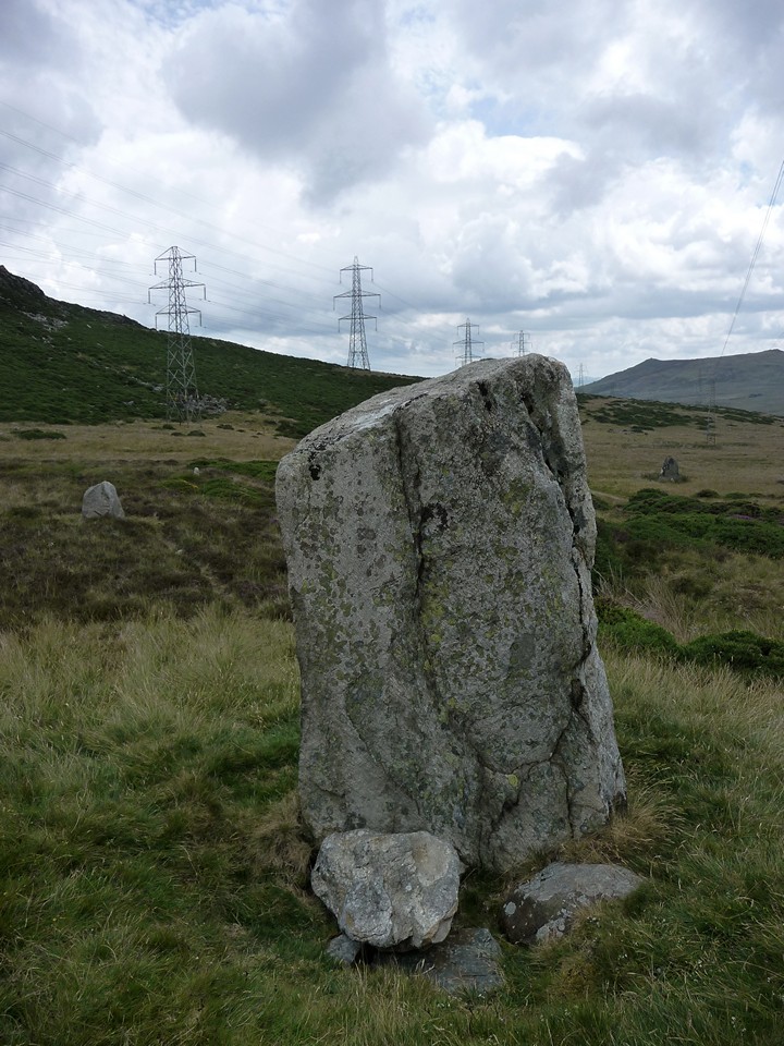
The visual focus is the prominent Bwlch-y-Ddeufaen standing stones, visible from here, nestled in the v-shaped pass between the ridges of the Carneddau and Foel Lwyd. The flanking pylons fail to detract from the setting, despite their best efforts.
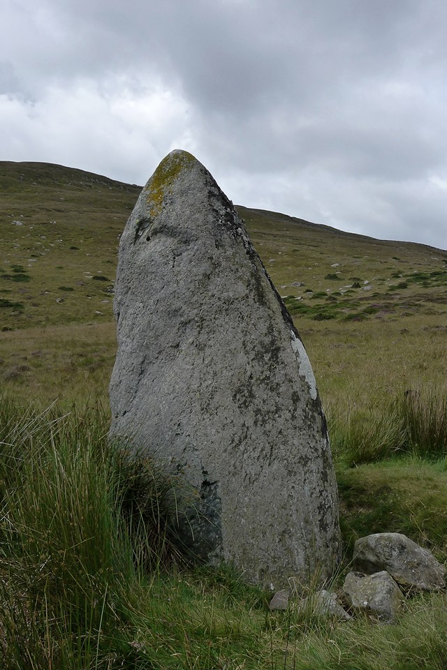
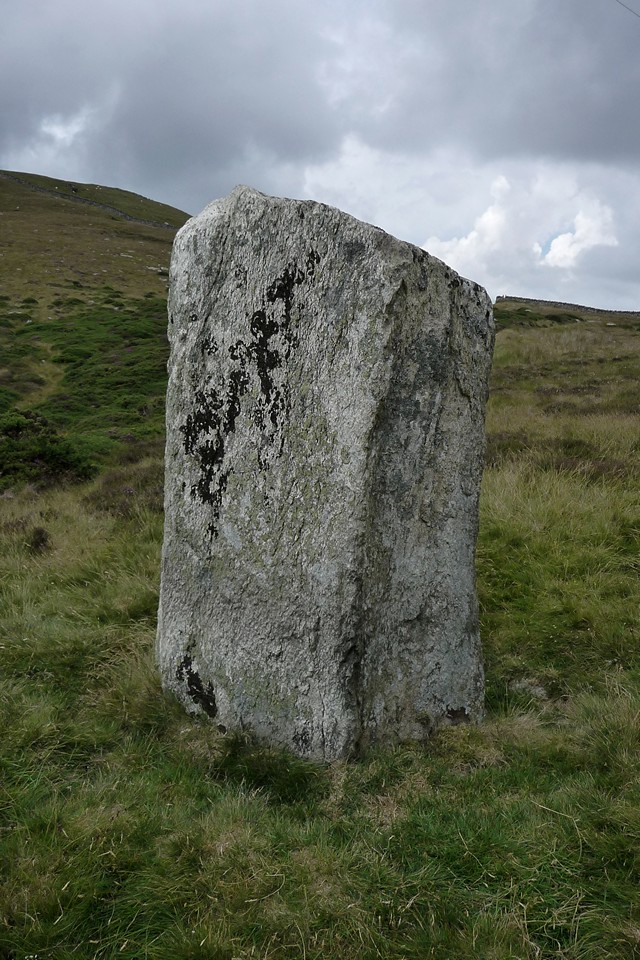
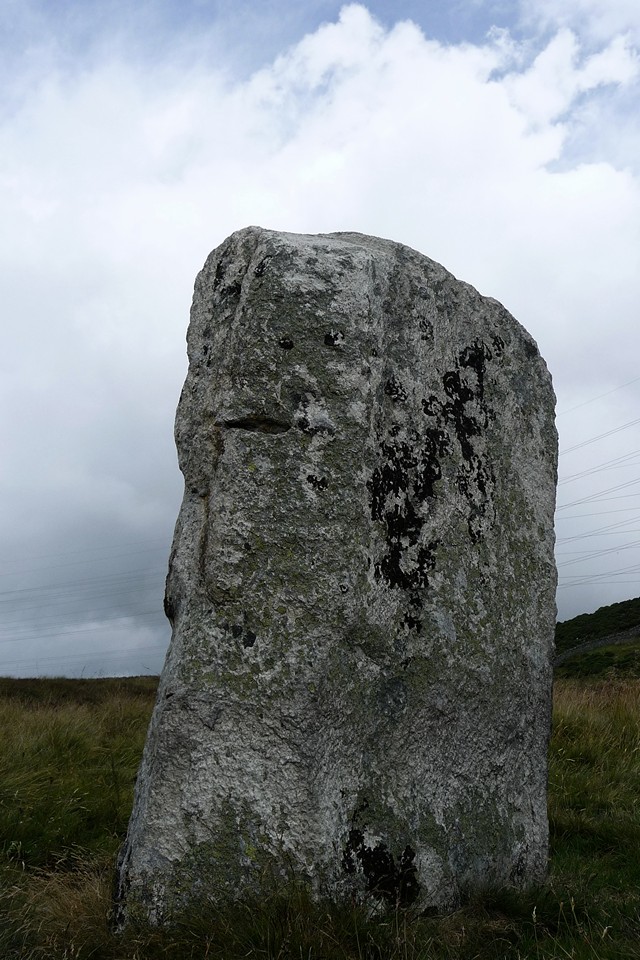
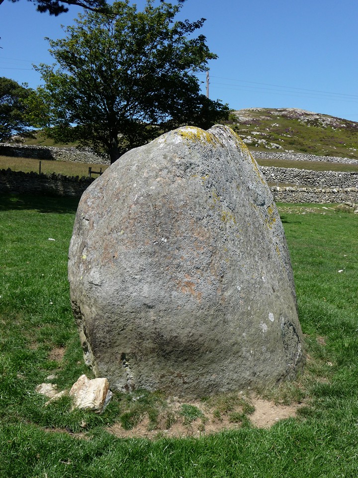
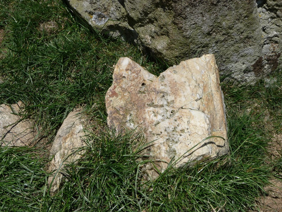
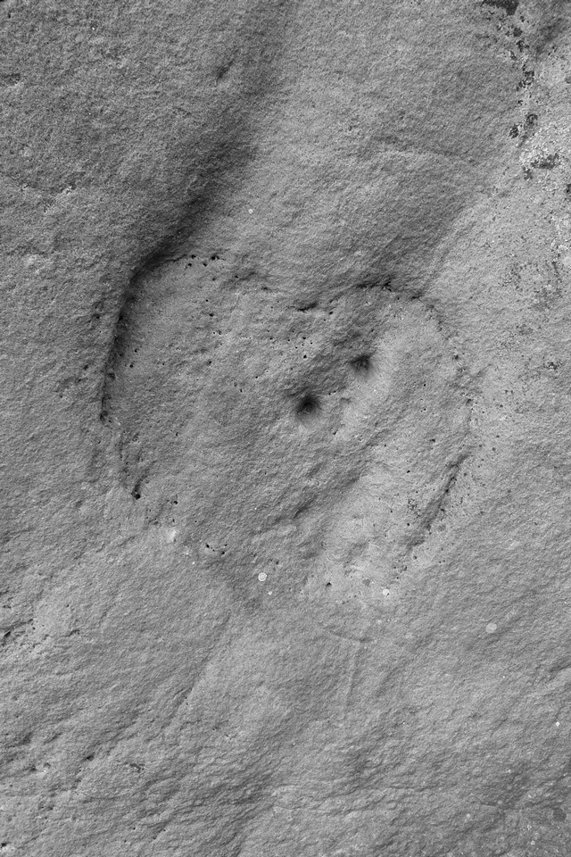
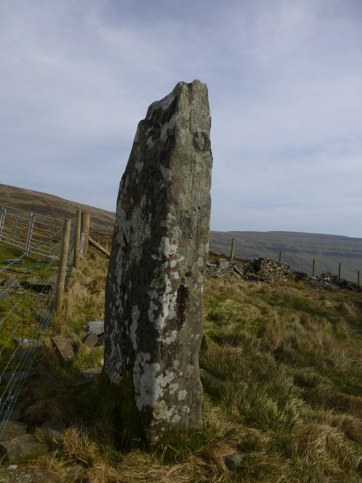
Elsewhere this cairn would be worth a proper stop, but here it’s probably the least arresting of the day’s sites. And we can see the next one already, so it’s time to head off. The two stones that give the pass its name are a big step up in size from the ankle biters of Cerrig Pryfaid. Both are taller than me, and there’s some serious girth going on too. The tapering southern stone is a beauty, Blossom and I struggle to reach round it with our combined outstretched arms. There’s a small, shallow drill hole on one side, as if someone foolishly attempted to convert this into a gatepost and was struck dead for their temerity before getting very far. I’ll leave Rhiannon to find some suitably doomy folkore to confirm the point.
By contrast, the northern stone is flat-topped and appears to shine out its whiteness against the dark heather. On closer inspection, the whiteness is entirely illusory, the stone isn’t quartz at all but a light grey. There are two further, shorter uprights close to the northern stone, one of which is indeed a quartzy rock. Their placement isn’t obvious but reminds me somewhat of a scaled-up version of the little followers of Maen Mawr in South Wales. In amongst the chocks at the base of the northern stone is one very dark rock, a matt coal black in colour. It’s not clear whether this is a later addition as it doesn’t seem to be doing much chocking.
We don’t realise that there’s a fan of much smaller uprights close to the southern stone, and in truth a visit in summer vegetation isn’t the best time to look for them. It is a great time to admire the purple flowers adorning the heather though.
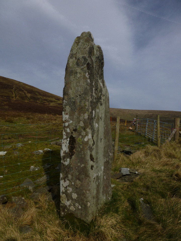
Once again, the setting is excellent. The views are similar to those from Cerrig Pryfaid, but with added elevation giving a fresh perspective to the outcrops of Pen y Castell. The stones are not set on the crest of the pass, so there’s no view northwards to speak of. Instead they turn their impassive faces resolutely southeast, looking down the valley of the Tafalog, heading off to join the great Afon Conwy three or four miles away. Surrounded now by pylons and cables, yet they retain their dignity against these huge, transitory metal giants. Time is on their side after all.
I’m really taken with these stones. The sense of deep time seems to hang around them, from the ageless mountains, through the monument builders, the tramp of Roman soldiers, into a hinterland of iron and wire. Rather than detracting, the pylons add to this sense that we’re standing in the midst of a palimpsest, layers of time and people still there, just below the surface. And perhaps we’re a shadowy presence in earlier and later times, too.
Reluctantly we head back to the car for a very short trip eastwards. It’s blue skies and sunshine as we get out again a mile on. The ribbon of sites continues on along the southern flank of Tal y Fan, a mountain almost completely encircled by cairns, standing stones, burial chambers and stone circles, yet itself devoid of monuments. Surely a deliberate omission?Cae Coch standing stone is first, just a short pull up a bracken and grass covered slope from the track. It’s one of those eternally pleasing stones with a completely different aspect depending on which side you view it from. The broad face is turned towards the track and is perpendicular to Pen-y-Gaer (Caerhun) hillfort, but side-on the profile is slender with a bend in the middle. The views across the Conwy valley are worth the visit alone. An unexpectedly good site.
As we approached the stone the blue sky had turned unexpectedly dark, and now looks like night has arrived early. It rains, just for a moment. And then it’s gone, so that by the time we regain the track much of the blue has returned.  |
Even the track feels ancient, a deep green channel between collapsing drystone walls enlivened by vibrant purple foxgloves at this time of year. We pass Ffon-y-cawr, leaning crazily on the other side of the wall. Another one to save for a proper visit, because from here we can see the main objective for today.
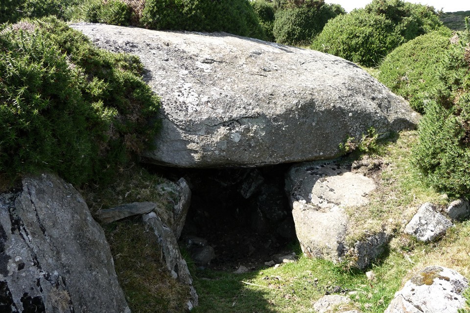
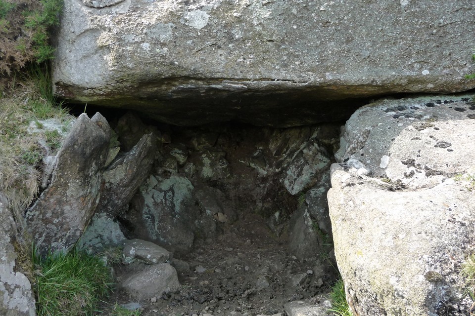
Maen-y-Bardd is at once bigger and smaller than I expected it to be. It’s perfectly proportioned and looks out over the wide valley of Afon Conwy, the river itself winding lazily through the centre. And there are mountains, and hills, and little fields, and a huge cloud-filled sky. What a place.
“Stone out of song” goes a poem I hold very close to my heart. But did the song come first, or the stone? Was a bard buried here, or did the place make poets of its visitors?
We stop for a good while. Even the dogs seem content to sit here.
At length an interruption comes in the form of a farmer in his tractor, cutting the bracken in the field next door. The spell is broken. We head uphill. Climbing directly up the grassy slopes of Tal y Fan’s southern flank, we pass a ruined homestead and regain a proper path. The map shows some cairns here, but we fail to see anything obvious. [Postie’s subsequent visit shows we weren’t missing much.]
Caer Bach now rises in front of us, flat-topped and dotted with gorse. Just before we get there, we come across a very strange “structure”, consisting of a huge oval boulder apparently placed over some supporting stones to form a small open-fronted chamber, which appears to have been lined with smaller stones. It looks constructed rather than natural, but what it is we have no idea. There’s so much going on in this area that it’s difficult not to imagine it having some significance.
Tal-y-Fan’s summit, crossed by a typically improbable drystone wall, now looms directly above us. It looks almost within touching distance from here, but it’s not on the menu today. Instead we head for the fort. The earthworks aren’t the most impressive, but as with every other place we’ve been today the setting is superb. The views extend to Pen-y-Gaer (Caerhun) and Cerrig-y-Ddinas, so whether the occupants were friend or foe they were certainly observable. It’s a neat and compact site, feeling quite sheltered in the lea of the mountain’s flank, despite its lofty position.
We have a belated lunch, overlooking the Conwy valley. The lonely mountain watches over it all, serene within its encirclement of prehistoric riches. One day I’ll climb it, but today it’s enough to rest in its shelter for a while. The poet dreams on, of the song, and of the stone.
|
The Mountains Are Singing - Penmaenmawr 2 July 11
Dammit, this train is getting later and later. Sometimes a delay is nothing, but today’s a big day of prehistoric excitement, if only I can ever get there. Last night a discussion on the forum led to an offer of a meet up at Penmaenmawr, in a part of Wales I’ve never been to, for a walk to the Druid’s Circle before a climb of Tal-y-Fan.
I ring my companion for the day, to tell her that Arriva are doing what they can to stop me ever getting there. Luckily the voice at the other end is one of calm reassurance, unphased by the changing timetable. This is my first contact with Blossom, who has offered the meet up.
By the time I get to Penmaenmawr, an hour and a half late, it’s shaping up to be a glorious summer’s day. Blossom is waiting on the platform, her dogs are waiting in the car, and without much ado off we head up the steep and winding road that leads to the Two Pillars carpark, at the top of the prosaically named Mountain Lane.
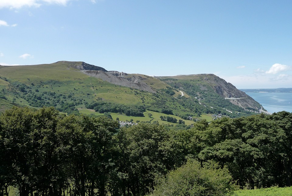
A broad and easy track climbs steadily from the carpark, carefully hiding the views south behind the flanking Foel Lus but providing a grand vista of the quarried and scarred Graig Llwyd and across to Ynys Mon – these are places I’ve longed to see, now laid out between azure sky and blue-green sea.
We emerge onto a hillside of well-made drystone walls and cropped grass. The long summit ridge of Tal-y-Fan is the principal backdrop, far off and high above.
After passing Red Farm stone circle without a proper look, the impressive boulder of Maen Crwn is the first proper stop on the walk up towards the Druid's Circle.
Set in the V of a valley between higher hills, the long views are restricted. But it feels like a stone-on-the-way-to-somewhere stone, the kind you often find marking your path in upland Wales when on the way to exciting destinations. And given what waits above, it certainly performs that function beautifully.
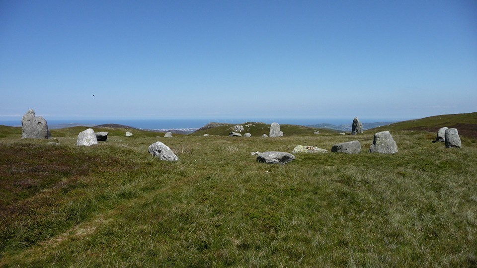
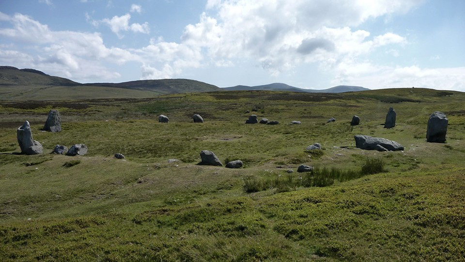
The pull of the circles is too much to linger though... It’s a further steady slog of a climb up from Maen Crwn, and the excitement levels really ramp up from here on. Druid's Circle is already visible on the skyline above, but it's still worth restraining the urge to get there for a while with a pause at this lovely little circle.
Like something someone might build around a campfire, a simple ring of smooth stones, with a wonderful sea view. The dogs are very taken, sniffing around the inside of the ring. If it weren't for the fact that the Big Attraction is so visibly close, it would be easy to stop here for a good while.
But we don't. It’s not much more of a pull upwards to reach the circle. There’s no-one else about so I can savour this beauty properly. The setting is as good as any stone circle I’ve been to, particularly on such a wondrous summer’s day. The sea to the north, the high peaks of the Carneddau mountains to the south. It’s a bit special this.
The stones are big, certainly bigger than you’d find in many Welsh circles. Each has character and there are veins of quartz here and there. Although some of the stones have fallen, it doesn’t detract from the overall impression.
Mountains, stones, silence, sea and sky.
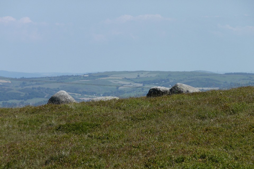
I could write a few pages of superlatives, but really you should come and see for yourself. In the meantime, we have some lunch and take it all in. Blossom has Frances Lynch’s excellent Gwynedd guide with her and we have a quick look to see what else there is around here. The prominent jumble of upright stones visible to the west is the most obvious place to head next. Unfortunately we don’t realise that Circle 278 is hidden away over a little crest and miss it completely. Drat.
Monument 280 (these numbers suggest a spectacular profusion of other sites crowding around us) is very difficult to get a handle on, even when you’re standing in its midst. A row of four uprights run north-south across the monument, while on the west an apparent kerb forms its edge. Shapes and patterns can be discerned, but are contradicted by other patterns. Truly an enigma. Having singularly failed to realise we’d missed Circle 278, we continue west along the main track. Cors y Carneddau circle is supposedly on the north side of the track. Surely this should be easy to find?
Well, no. Part of the problem lies in the fact that there are quite of lot of random stones in the grass here. Which ones do you choose?
Eventually we decide that a group quite near to the drystone wall, just east of a corner, is the best bet. There are at least four stones in a sort-of arc, with a couple of additional possibles close by. But I could be persuaded otherwise…   |
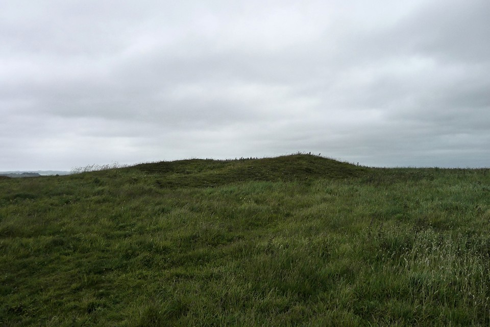
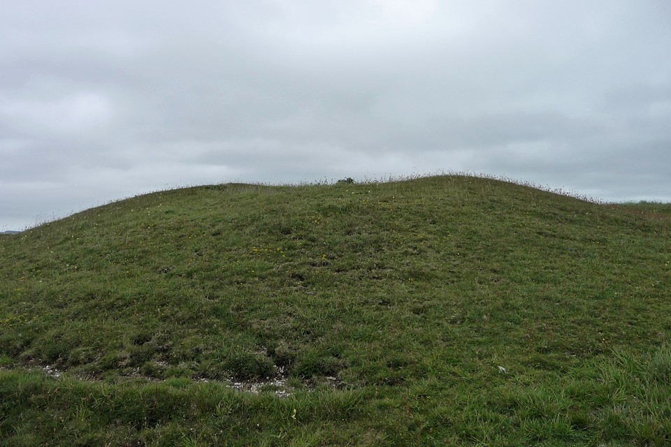
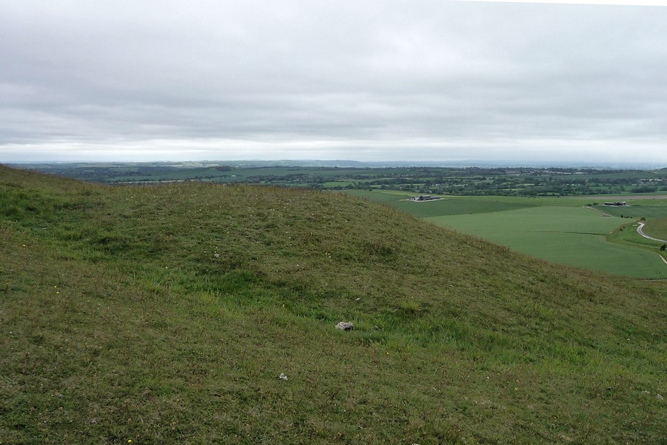
What is entirely certain though, is the massive Cefn Coch (“Red Ridge”) cairn. It would be impressive anywhere, but what sets it apart from comparable sites is the stunning backdrop of the Carneddau.
Turning its face resolutely from the sea hidden behind a ridge to the north, the cairn unquestionably looks inland towards the mountains. The very highest peaks of the range are hidden from here, but the skyline is filled with an array of summits all well above the 2000ft mark, several of which boast contemporary monuments.
It's a breathtaking sight and we sit in awe for quite a while.
This stunning place will be our final outpost of the day. It’s getting on and my plans to head on to Tal-y-Fan, already compromised by the train delays, were abandoned as soon as I reached the circles. A first visit to this wonderful complex in such amazing weather deserves time to savour. Today I’ve had good company to savour it in.
We retrace our steps to the car and I know I will surely be back. What a perfect day.
|
49 Adventures - Wansdyke Wandering 28 May 2011
The previous weekend I used the 49 bus service to walk to Avebury from the north, so a walk from the south seems a fitting follow-up.
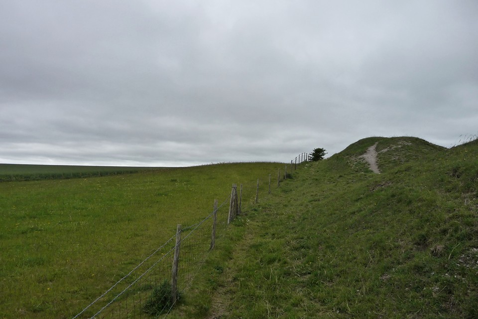
I get off at Shepherds Shore, the handy point where the post-Roman Wansdyke crosses the A361. There’s a gentle climb up the shoulder of Roughridge Hill, following the earthwork and allowing an unfolding view of Cherhill Down and Oldbury and the extensive North Down barrow cemetery.
The first stop off is Roughridge Hill long barrow. Well-defined on the OS map, the reality is rather less impressive. Unless you know it’s there, you’d pass by without a glance. All that remains is a low rise in the grassy field, hard up against the edge of the much bigger Wansdyke. The proximity of the dyke may suggest that the long barrow was a reasonably obvious landmark, perhaps a boundary feature, made use of by the earthwork builders when they were planning their route. Sadly it’s not so prominent now, not really worthy of much of a pause as I head across the hill.
Two lithe brown shapes dart into my path, then rise on hind legs to survey their route – it’s the first hares I’ve seen this year, always a great pleasure to encounter. I briefly contemplate a proper look at Easton Down long barrow, which appears as a much more prominent and upstanding feature than its nearest contemporary. However, it’s a bit off my route for today, so I head south instead, off the Wansdyke and across fields of dusty earth and white chalk. A lonely reservoir tower, stark and angular, is the only trace of modern presence here. Reaching the southern slopes of Kitchen Barrow Hill, rows of Medieval strip lynchets provide evidence of earlier occupations.From the strip fields there is a great view of Kitchen Barrow Hill to the east. The south-facing scarp is steep and the presence of an intervening dry valley heightens the impression that Kitchen Barrow was placed to be seen from the neighbouring slopes. The area around the barrow is open access land, so there are no complications in getting to the site.
Pastscape records show a round barrow to the north of the long barrow, at a point where the fence changes direction. However, although there are several bumps alongside the fenceline, none is particularly obvious or convincing as the round barrow depicted on the OS map.
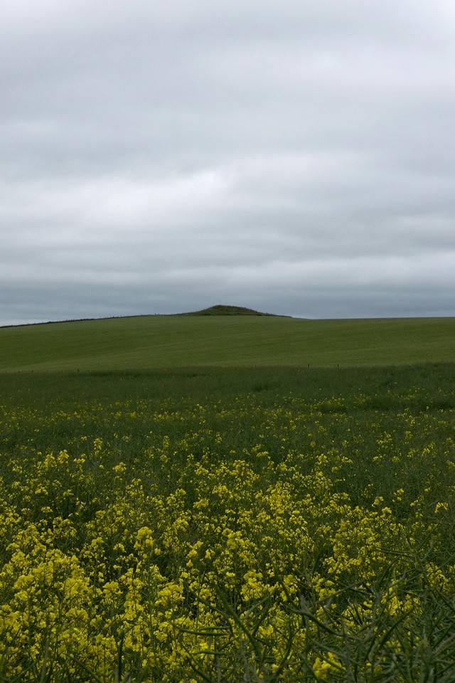
The long barrow is certainly obvious though, 30m or so long and a couple of metres high at its southern tip, with well defined flanking ditches. It lies along the sloping crest of the ridge, with its northeastern end almost blending into the hillside. The views south are extensive, as the ground drops sharply to the farmland and the valley of the Kennet & Avon Canal below. To the west there’s a great view of the multi-phase west end of Tan Hill, where more strip fields lie below a linear prehistoric earthwork and a group of Bronze Age round barrows are silhouetted on the skyline.
A good place to stop for a while and let the world turn, especially on a Wiltshire big skies day of fast-moving cloud. Regrettably today’s visit is under a rather more leaden variety.   |
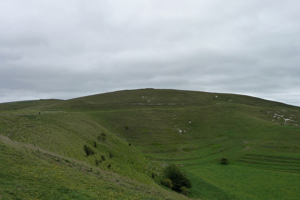
Leaving Kitchen Barrow it’s an easy walk around the rim of the escarpment to the western flank of Tan Hill. The first encounter is with the linear earthwork running just below the top of the slope. Presumably part of the same thinking that constructed a much longer section of bank and ditch on the northwestern side of the hill, it’s pretty well-preserved, with the hillside falling steeply away below it.
A bit of further uphill huff and puff and I’m in the midst of the round barrow group that crowns the western spur of Tan Hill, a promontory separated by a narrower neck from the main bulk of the hill to the east.
Tan Hill is the second highest hill in Wiltshire, only fractionally lower than nearby Milk Hill and part of the same long east-west ridge. As you’d perhaps expect from such a prominent place, looking out across the downs in all directions, the ridge is covered in a timespan of prehistoric sites from the Neolithic long barrows of Kitchen Barrow at the western end and Adam’s Grave at the eastern end, through numerous round barrows and Iron Age earthworks, with Rybury hillfort on a southern spur. There’s a great view westwards, taking in King’s Play Hill and Morgan’s Hill, each topped with further barrows, as well as the unmistakable Cherhill Down and Olbury with its obelisk.
The barrow group includes three bowl barrows, in a NW-SE line, with a much larger disc barrow close to the two northern bowl barrows. All are clearly visible, if rather reduced by ploughing. The bowl barrows (particularly the one at the SE) bear clear excavation damage. They are all covered by sheep-cropped grass, so there’s no seasonal vegetation problem to contend with in a visit.
Although it’s the most damaged, the SE barrow is still pretty impressive and boasts very extensive views. The central barrow is bigger, well over a metre high despite the ravages of time and barrow diggers. The NW barrow is the runt of the litter, clinging to its sloping setting like a barnacle. All have well defined surrounding ditches. The adjoining disc barrow is great too, almost 20m across, including its outer bank. All in all well worth the effort of the walk.
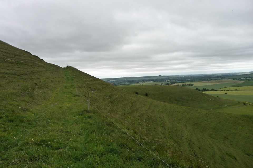
Wansdyke is most impressive here, snaking its way across the northern slopes of Tan Hill. There’s also a decent view of a single, large round barrow on Horton Down, surrounded by gallops but covered in a darker green mantle. Sadly the barrows on Allington Down have been rather less well-treated than their neighbours up on the ridge. Once a group of six, there’s nothing to see of all but one now. The plough has taken care of the rest. However, the one that does remain is very decent. It’s quite overgrown with nettles and long grass, topped with three shrubby May Trees in bloom, making it difficult to see whether there’s damage to its top.
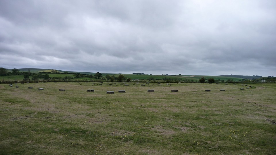
I can see Silbury, peaking out from trees and indicating how far I still have to go to get to Avebury today. So I go. I visited The Sanctuary once before, on my first trip to Avebury. On a day of first contact with heart-stopping monuments, the concrete-marked circle seemed an anticlimax, a curio and little more. Today I’m more receptive, especially after the long, peaceful walk over the downs to get here.
The place is deserted when I arrive, allowing a better appreciation of the layout and in particular the size of the rings. The outer circle is a wide 40m across, as big as almost any stone circle I’ve been to. Although the little concrete blocks are no substitute for stately sarsens or hefty timbers, there’s still much to enjoy here, if you can block out the steady roar of the busy A4 just over the hedge. Looking south across the low Avebury 23 round barrow, the tree-covered form of East Kennett long barrow can be seen from the circles. Such a shame that the original grandeur is lost forever though. From The Sanctuary, a permissive path allows access to the remnants of West Kennett Avenue on the south side of the A4. This part of the monument seems to receive little attention, probably because of its separation from the better preserved section running northwestwards to Avebury.
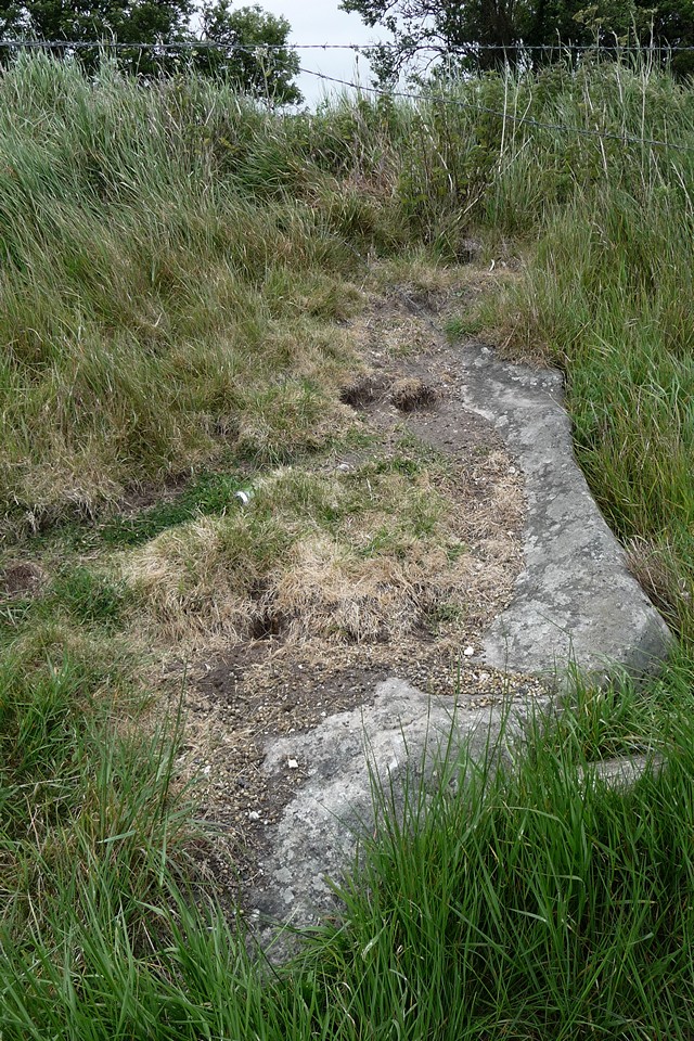
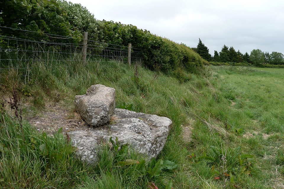
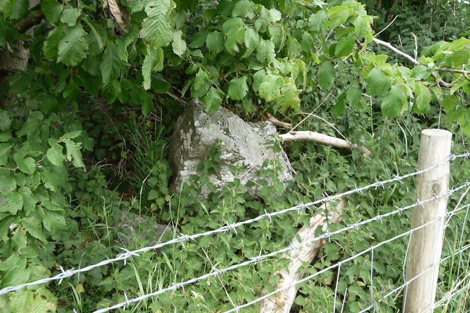
However, it’s well worth a visit to make sense of the relationship of The Sanctuary and the henge complex. The first stone encountered is an enormous fallen slab, jutting out from the hedgeline. Beyond that is another fallen stone, apparently broken with a smaller piece placed on its top. The final stone in this group still stands, buried in the hedge and trapped behind barbed wire. It has been broken, leaving a short stump in place. Screened from the busy A4 by the thick hedge, this is a hidden spot, remarkably quiet for somewhere so close to the Avebury tourist hub. It doesn’t have the atmosphere or obvious draw of the well-known northern section of the Avenue, but it’s another part of the jigsaw that makes up this fascinating landscape.
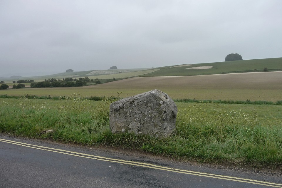
Risking life and limb I cross the A4 onto the B4003, a narrow but busy road that runs parallel with the Avenue on its way to the henge. It’s worth stopping off at the single upright stone, separated from its companions by the road and hedges, looked down upon by the linear cemetery of massive round barrows along the Overton Hill ridge to the east. By now the threatening skies of earlier have turned to a persistent drizzle, and contact with any vegetation leads to an immediate soaking. I decide to leave the road and Avenue and instead head east to look for the scant remains of Falkner’s Circle.
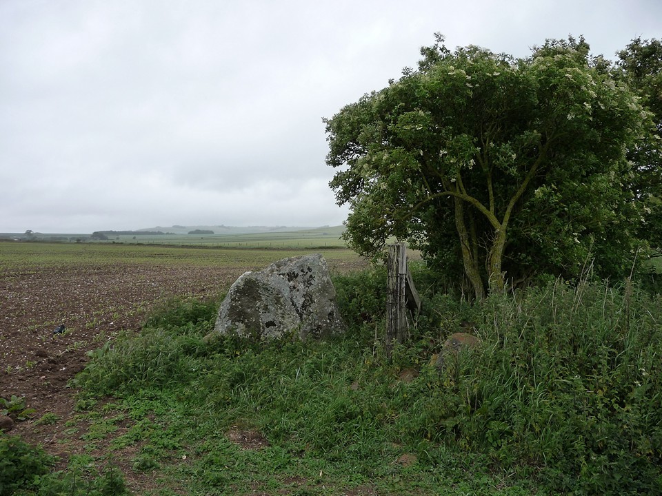
A path leads round the margin of the field, eventually reaching a gateway where a single standing stone marks the position of the poor old circle. Nettles surround it, neglected and lost, a sad survivor with no-one to talk to. I’d like to come back on a less gloomy day, perhaps in the winter when the nettles have gone. It doesn’t feel like a place to linger today though. I’m on the last leg now, following increasingly wet and muddy tracks towards the village. Last week I sat in the sunshine and watched people in the circles, but today the wet doesn’t encourage sitting still. Even in the rain, Avebury is compelling; the massive stones silent and unmoving sentinels, watchful beneath the lowering skies.
A final embrace with the Cove, and the 49 is back, to take me homewards from another glimpse of the vast landscape surrounding the beating heart of Avebury.
|
Red stones, blue stones and Black Mountains 8 March 2014
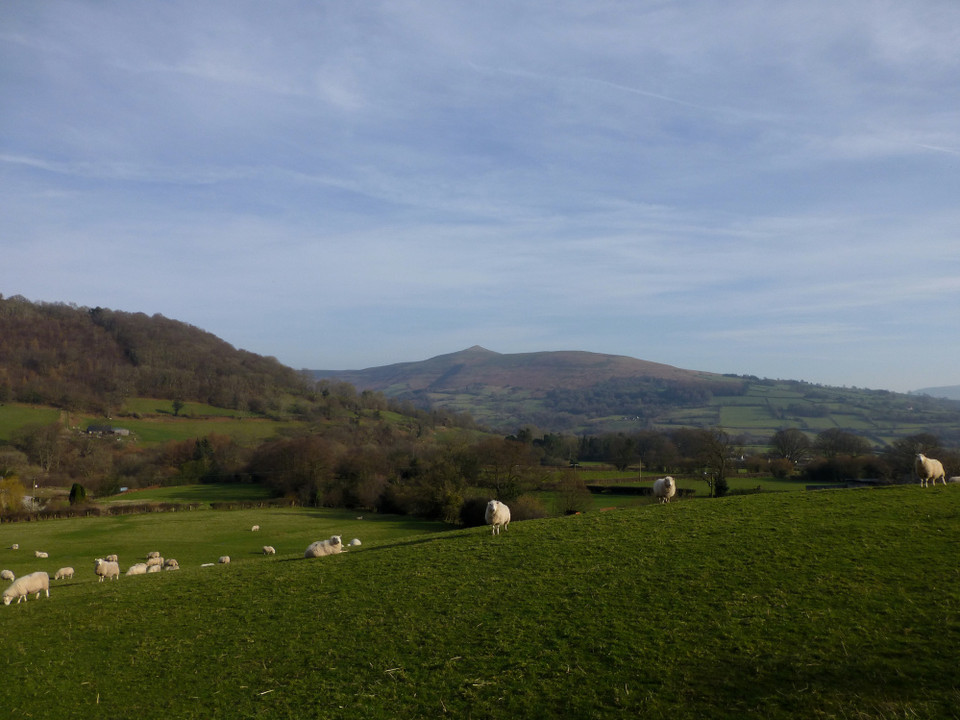
A long walk walked, today. I’ve not been to the Black Mountains for too long, but the call of the high ridges has finally got my attention again. By the time the obliging bus driver lets me out at Glangrwyney, the last drops and drips of the morning’s early rain have given way to low cloud, hiding the hills and cloaking the valley beneath a dull and deadening blanket.
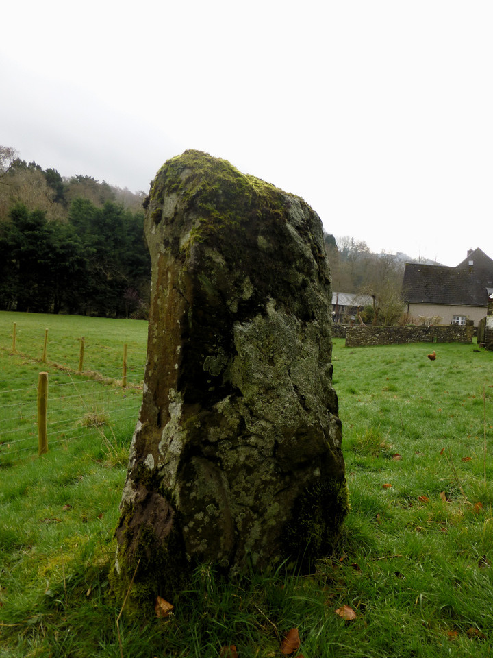
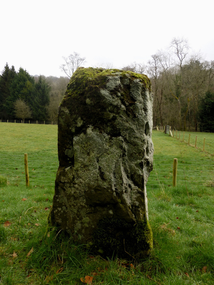
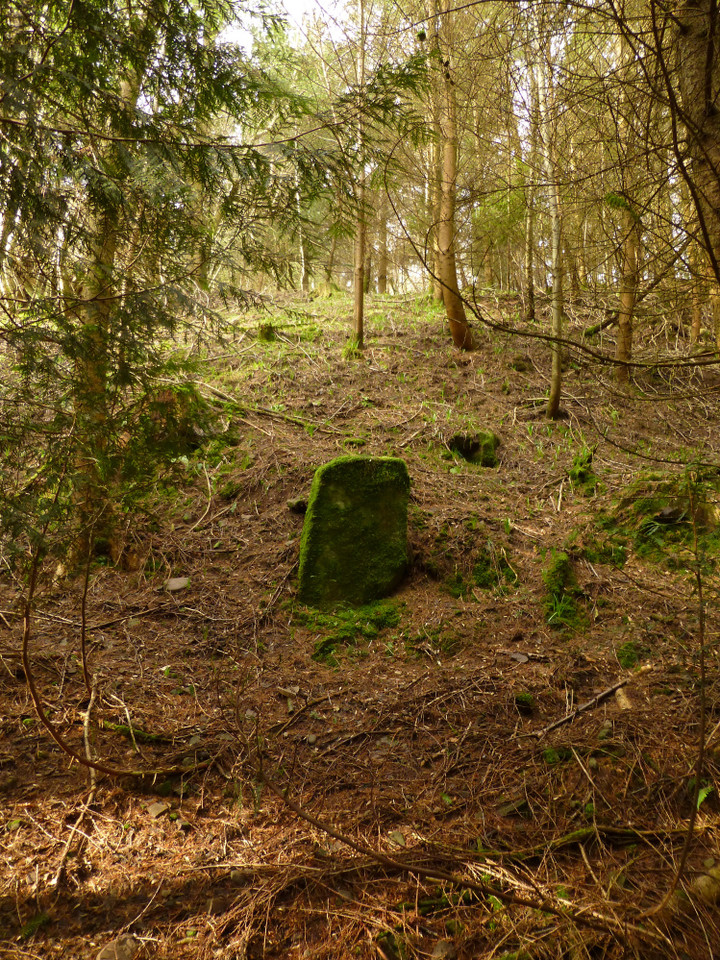
I walk the quiet lanes to Llangenny, crossing the lovely old bridge over the Grwyne Fawr, rushing and tumbling towards its confluence with the Usk/Wysg, into a pretty village seemingly marred with an abundance of “private keep out” signs, which dampens my spirit more than the rain ever can. I’ve come here for my first site of the day, a small standing stone that’s been on my radar for a few years but never sufficiently prominent to warrant a journey. Until today, when I plan to combine it with a few other local delicacies. Llangenny/Llangenau standing stone is smaller than I was expecting, a rather grey sandstone with a small, irregular and presumably natural hole near its top. It is set on a small rise, below a much steeper slope, a little to the west of the Grwyne Fechan – another of South Wales’ many waterside stones then. Chickens abound, belonging to the house next to the stone, which has been kept obligingly unfenced although a lot of new fencing has appeared since Elderford’s earlier picture. Despite this, I don’t feel overly at ease here. Perhaps it’s the oppressive cloud cover, perhaps it’s all the signs proliferating in the village, but I don’t feel like lingering. Perhaps just as well, because I have more stones to visit and a big hill to climb. Following the Grwyne Fawr valley north, the next village is Llanbedr, but before that there is the small matter of a pair of standing stones in a little wood, once again a little to the west of the river. The Coflein record suggests that the smaller, southern stone of the pair may have been destroyed or lost during tree felling some decades ago. I passed here once before, in very deep snow on my way back down from a visit to the wonderful Crug Hywel fort. On that occasion everything was hidden beneath a mantle of snow, with black tree stumps punctuating the pristine surface – not really ideal conditions to look for little stones and I went by without stopping.
Today presents a much better chance. The undergrowth that will carpet the woodland floor come the late spring and summer is only just beginning to make its presence felt, so despite some bramble-tangling to negotiate, it’s reasonably easy to get through the trees. Taking the OS map at face value, I head into the wood and straight uphill in the direction of where I hope the smaller “lost” stone would be. The sun has started to get through the cloud now, filtering through the light foliage in a way that never fails to lift the heart.
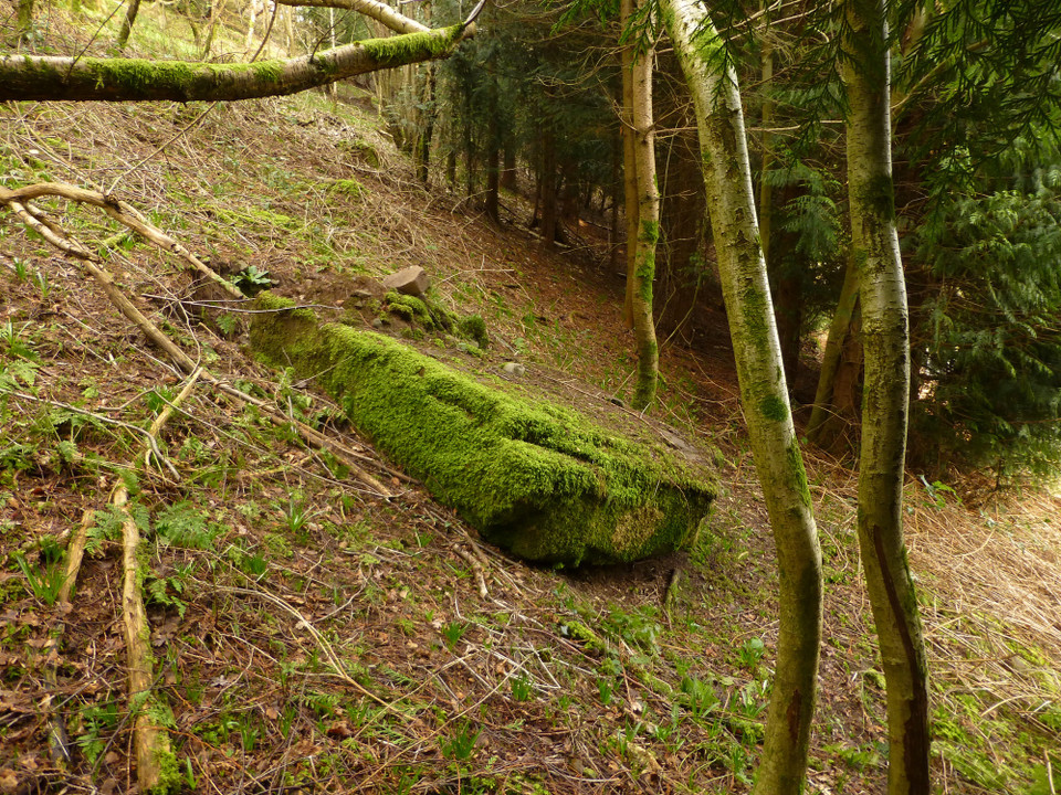
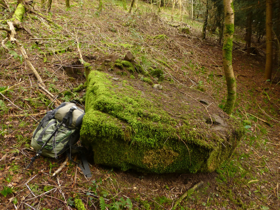
And, halfway up the slope, there it is! Not lost, not destroyed, but exactly where the map shows it to be. To find this stone, lost but found, will be enough to make my day worthwhile even if all else fails. It’s a very small stone, rather less than a metre tall and embedded into a bank with what looks like a old trackway running down to it from the southwest. A slab of old red sandstone, almost completely covered in moss and easy to miss as a tree stump. It is particularly angular for a prehistoric stone and it would be easy enough to believe that it might have a later date. Having said that, the abundance of other standing stones along the valleys of the Grwyne Fawr and Fechan give credence to it being part of the same family, aspected to the watercourse.
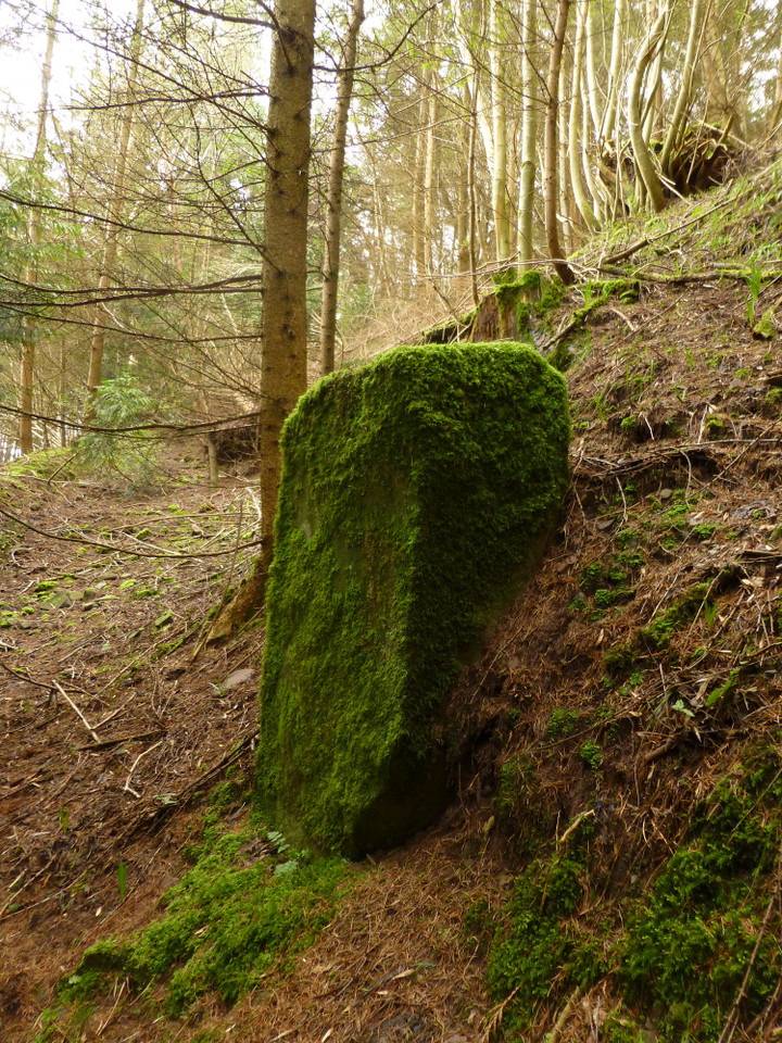
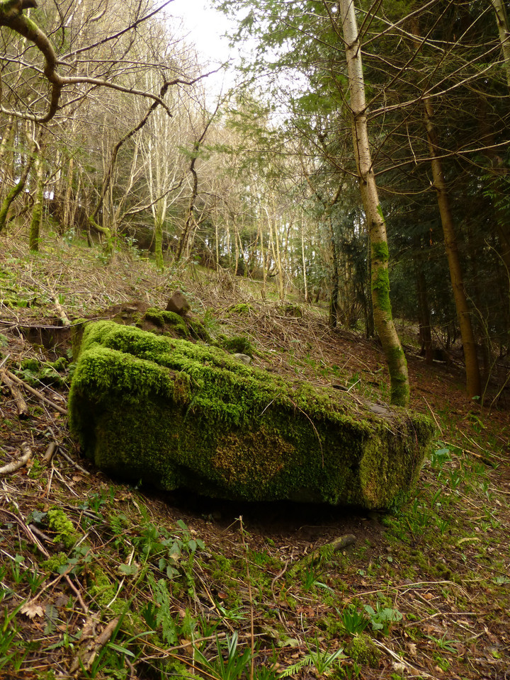
I head north below the tree cover, angling slightly downhill and closer to the road as I pick my way under the low branches. Not far on, I see a regular shape below me, nearer to the road than I expected. Closer inspection reveals that it is indeed a large, recumbent slab. Carl records that the northern stone has fallen and it looks to me as though this is a fairly recent occurrence. The scar left as it tore away from the sloping setting is still visible, and small stones and earth lie on top of the stone’s base, presumably left from its fall. It’s a shame, as this would be a fine stone if put back up again. Like its southern partner it’s a slab, much wider than thick. Its top is pyramidal, very similar to the shape of other stones in the Brecon Beacons National Park, the nearest example being at Standard Street, only a mile or so distant from this site.
The northern stone is visible from the road, through a gap in the trees.  |
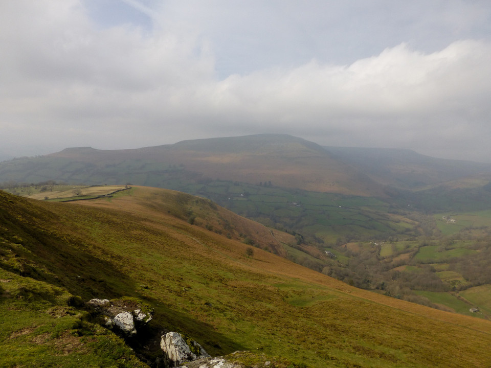
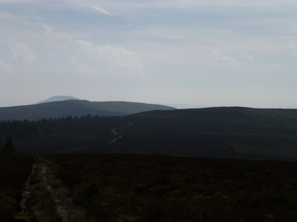
I head up to the top of Blaen-yr-Henbant, ignoring the more obvious scar of the Beacons Way to get the best of the views. The breeze up here is very stiff, but worth enduring to reveal the nearby hillfort of Twyn y Gaer Camp and the unmistakeable summit of The Sugarloaf/Pen y Fal. The best view is behind me, where Crug Hywel and the domed summit of becairned Pen Cerrig-calch form the backdrop to the valley now far below. The route drops briefly before rising again, steeper now as it reaches the final pull to the summit of Crug Mawr, at 550m OD the fingertip of the Gadair ridge, the third and highest of the five ridges forming the “hand” of the Black Mountains.
It is very blowy at the summit trig, so I press straight on – the principle objective of today’s walk is now directly ahead. Dropping from the top, the path turns darker and wetter, grassy slopes replaced with peat and a surrounding cover of heather, mercifully low at this time of the year. A trio of ponies block the path, but they are young and skittish, scampering away as I prepare to divert around them.
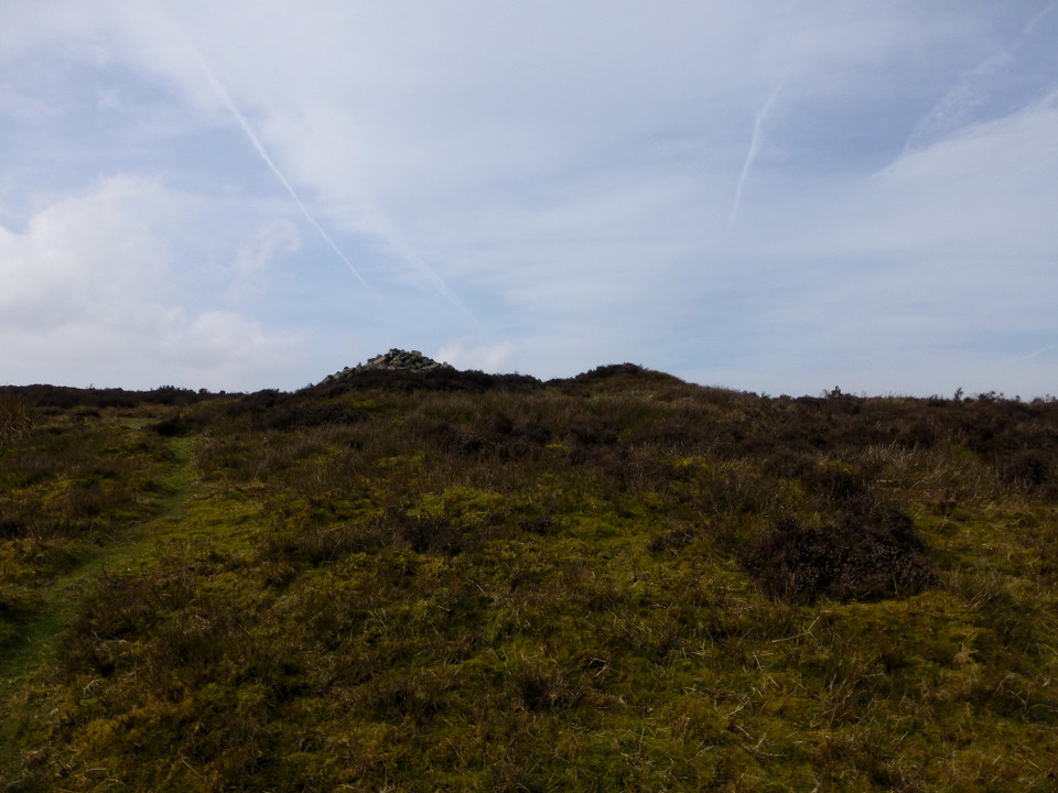
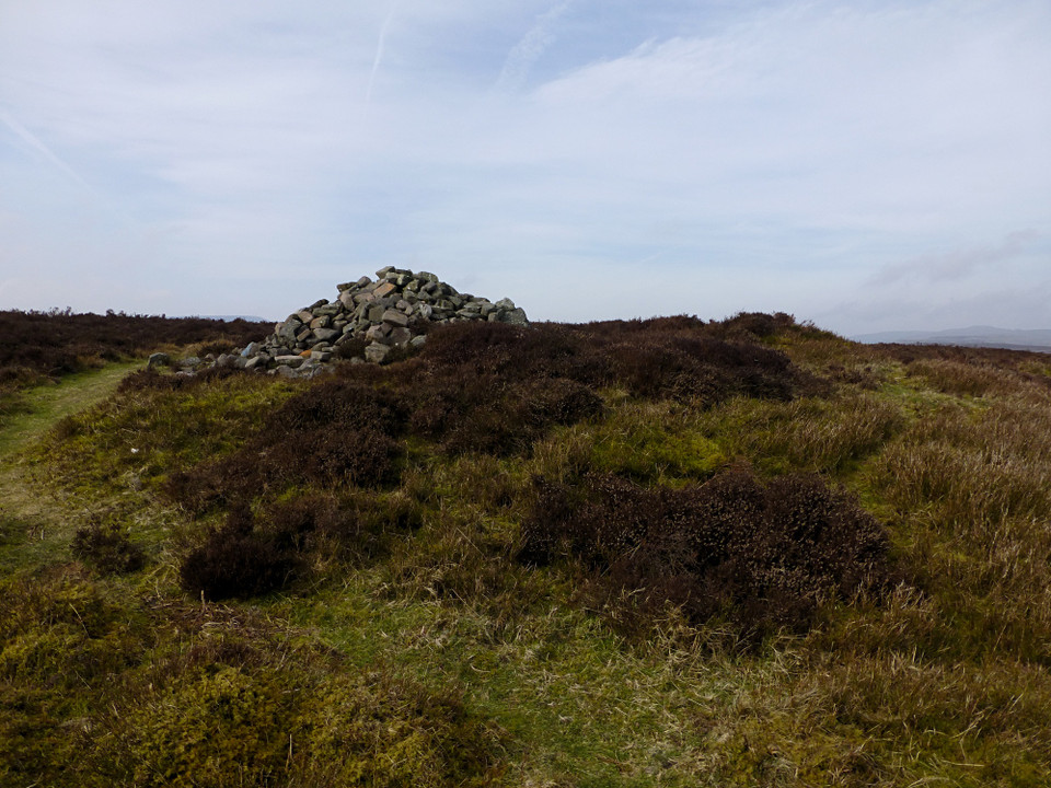
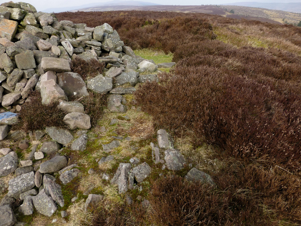
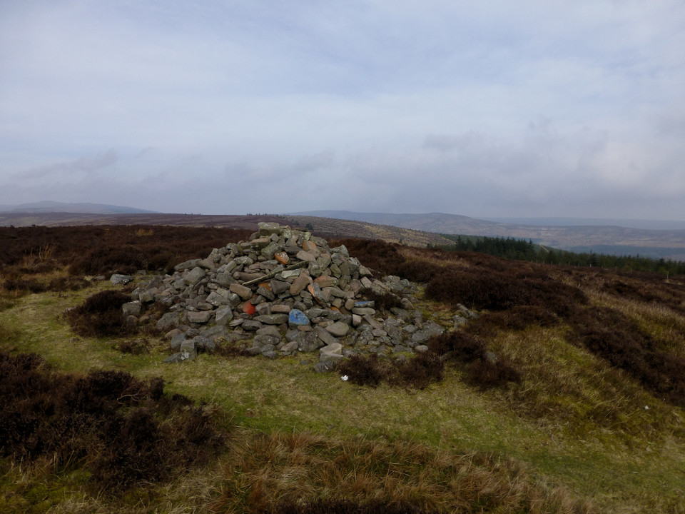
It’s not far from Crug Mawr to the Disgwylfa cairn, though I miss the turn off the main path slightly, as the cairn disappears from view briefly, blocked by the intervening ground. As I cut across the heather, the stone pile atop the cairn appears first. Some of the boulders in the pile have been painted red or blue, inexplicably. But the mound beneath is much bigger, prominent despite the covering vegetation. The centre has been scooped out and presumably provides the majority of the material for the stone pile. There is no sign of a cist or central structure. The views are brilliant, taking in the splendid summit of Pen-y-Gadair Fawr along the ridge, while the beehive’d cairn of Garn Wen can be seen on the next ridge to the east. The top of the Sugarloaf peaks out behind Crug Mawr, although the hazy sunlight makes visibility limited in that direction.
I decide that the bus timetable will let me fit in a climb of Pen Twyn Mawr at least, so I find myself carrying on northwards along the ridge. The distance between the Disgwylfa cairn and the various “piles of stones” marked on the map seems too long, despite the easy walking involved. One of the piles looks like a candidate for an older cairn, although Coflein doesn’t agree. By contrast, I pass what turns out to be the Nant yr Ychen cairn with barely a glance. There is no sign of an obvious mound and the pile marks the junction of footpaths. There are yet more terrific views though, except to the north where my day’s highpoint, Pen Twyn Mawr, blocks off everything beyond. I’m pleased to reach the summit, one that I’ve only previously visited with a friend, so this is the first time I’ve made it up here using public transport. It’s a featureless and rather flat top, but does enjoy a great view of Pen y Gadair Fawr, looking almost within touching distance. A mad thought involving carrying on up the ridge forms briefly, but I have no idea about the buses from Talgarth and it wouldn’t be a great place to be stuck. Every step north takes me further from Crickhowell, so I reluctantly – and belatedly – decide to stop going upwards and start going down.
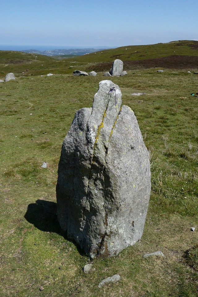
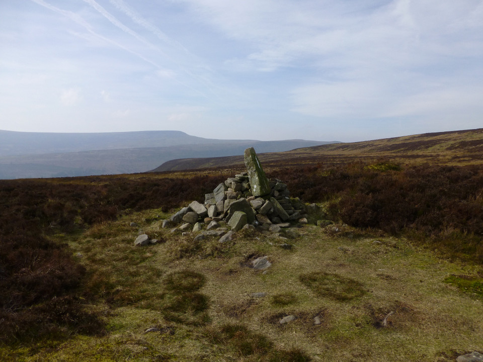
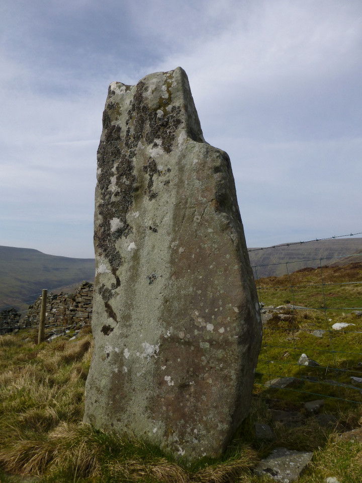
Instead of returning back to the last footpath junction, I elect to pay a visit to the lovely Maen Llwyd, my favourite site in the spread fingers of the Black Mountains. I head straight to it, angling down the side slopes of the ridge using barely-there sheep tracks, losing height quickly and fairly easily. A deeper fold in the land with a bubbling stream at its centre provides the only obstacle, a drop and re-ascent and I’m there.Since my last visit, almost four years ago, the stone has been penned behind a new barbed wire fence. But nothing really detracts here. The stone itself is tall and shapely, interesting with its hollow shoulder. The setting, in the amphitheatre of the ridges, is sublime. It’s taken a little over four hours to get here from Glangrwyney, including earlier stops on the way. I settle with my back to stone and let the peace and beauty of the place sink in. With a jolt I realise that half an hour has passed in the blink of an eye and that I only have a couple of hours now to get back to Crickhowell to catch the bus, so I leave with all haste. It’s a dash down through the forest, aiming for its southwestern tip. The tracks deteriorate and soon I’m stumbling over the pits and stumps of a great expanse of old felling. A muddy patch takes my foot from under me and I fall very disgracefully on my arse, stupidly sticking my arm out and jarring my wrist in the process. Thankfully nothing is broken, but I curse my stupidity nonetheless. An accident alone in this remote spot would be a very bad idea and the incident is a sobering reminder of how close to disaster one can be, how easy it is to take for granted safety from harm.
Leaving the forest I join a muddy bridleway down to the road at the old hermitage, apparently once home to the mistress of a wealthy local landowner. It stands in ruins beside a bridge and ford across the Grwyne Fechan now, though no doubt ghosts re-enact the dramas played out within its walls. After this it’s five miles of twisting, turning lanes to negotiate against a clock that gets less forgiving with each aching step. For all that, adrenalin and a bus timetable give you wings and I have time to enjoy the view of the Sugarloaf dominating the village of Llanbedr and the wonder of Crug Hwyel fort, prominent as a flat-topped Silbury commanding the Usk valley falling away to the south.Finally I’m back in Crickhowell, a bustling and friendly town I like very much. Aside from lead-heavy legs and a painful arm, I’ve survived the long walk up and down the third finger of the Black Mountains. This sais remains obsessed with Wales, no doubt about that.
|
|
"The fleeting hour of life of those who love the hills is quickly spent, but the hills are eternal. Always there will be the lonely ridge, the dancing beck, the silent forest; always there will be the exhilaration of the summits. These are for the seeking, and those who seek and find while there is still time will be blessed both in mind and body." Alfred Wainwright
"The movers move, the shakers shake, the winners write their history. But from high on the high hills, it all looks like nothing." Justin Sullivan
Elsewhere: Mastodon
|