Showing 1-50 of 130 posts. Most recent first | Next 50         
|
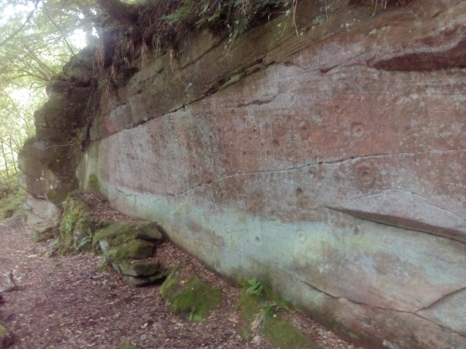
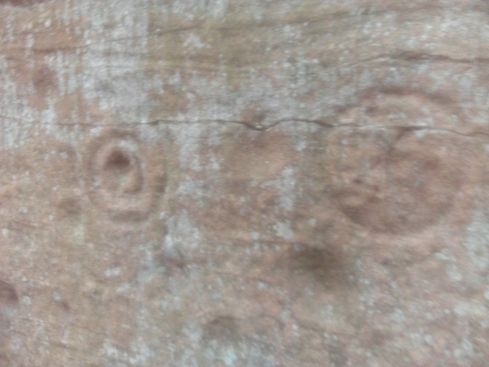
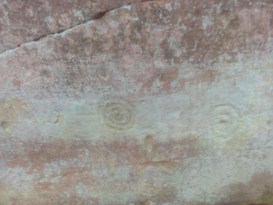
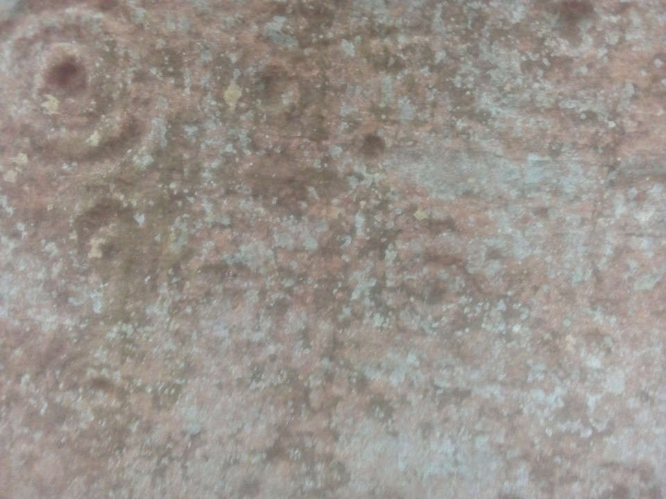
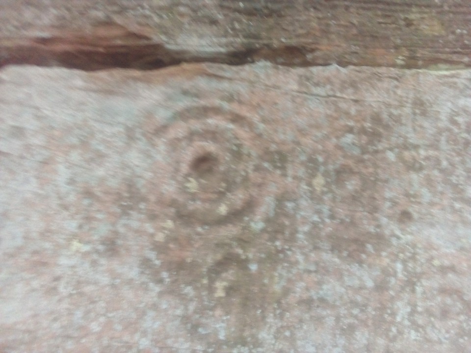
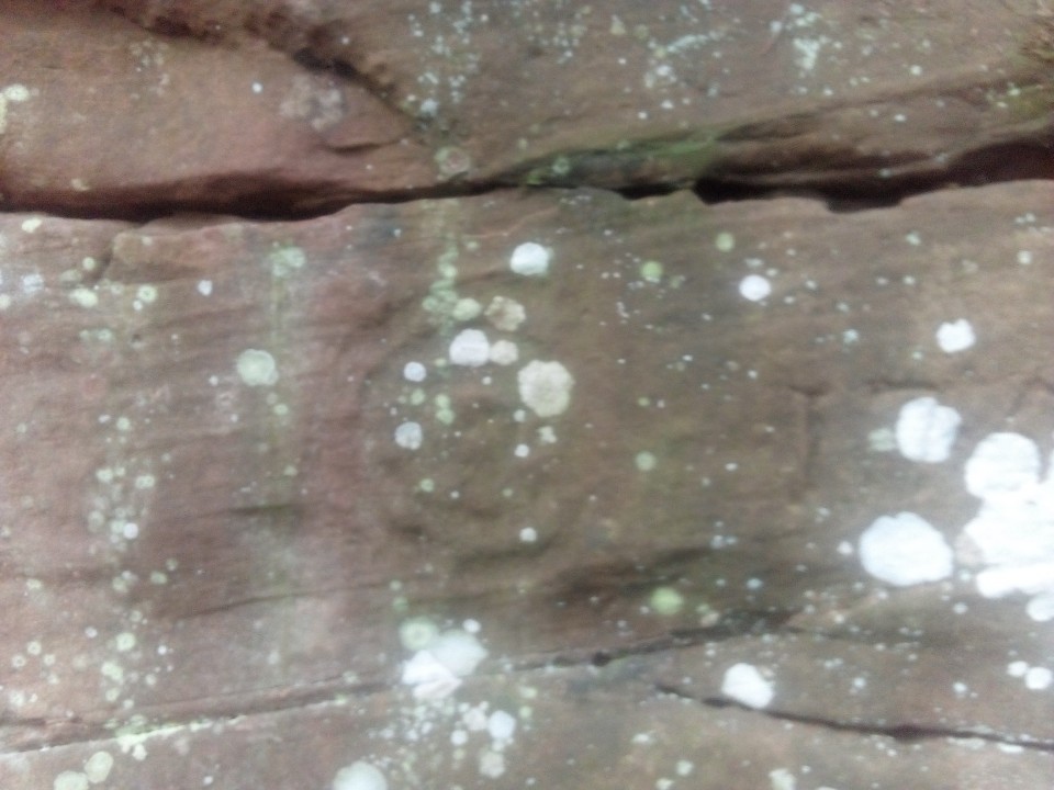
I have been visiting this site for over 15 years. 5 years ago I could see that they had noticeably worn since my first visit. Sadly last month (Aug 2019) they were barely visible any more - see photos. The sun symbol and the cross (plus shape) symbol have pretty much vanished. The walls still look reasonable when photographed in landscape panorama but close up the individual cups and rings are extremely faint. So get here quick before they vanish completely.
To assist your visit do not follow the path from the gate diagonally across the field and over the wee bridge then right up through the tricky brush, fallen trees and steep muddy slopes as per the old directions. Just park as described and go through the field gate then head straight across the field to the piece of fence/stile on the other side sprayed yellow. There is a photo of this stile/fence among the photos - dated 2007. Climb over it and cross the small muddy burn and the walls are straight across from you up a slight rise. Much, much easier than the other way but wear boots or wellies anyway.
|
|
While there is good parking and a loo at the car park mentioned, the single track road up is actually public as far as the cattle grid (about half way) and there is a pull-in there for one car at least and another spot just before that. Not many passing places though. So, if you are lucky you can avoid the worst of a reasonably steep 1.25 mile walk uphill. Whatever, it is certainly worth the effort to view this important stone, the remains of the WWII anti-air craft battery and the great views.
|
 
|
|
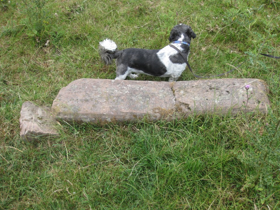
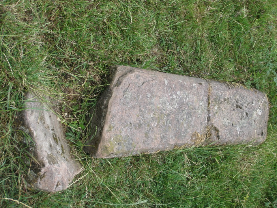
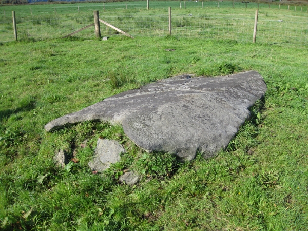
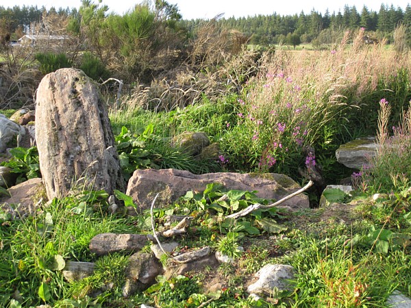
This stone is marked on the online 1850 OS map of Dumfries. It now lies prostrate and broken and may have done so for a very long time, It is 4'6" long and it may well have been a 'coo scratcher'. Nevertheless, it is still there and deserves to be recorded. It is easily accessible on signposted walking route along the flat west bank of the River Nith opposite Nunholm Rd. The photos show it's position in relation to the opposite bank and it is close to an existing large tree. Though the field often has cows and sheep - they are generally friendly enough. Just wave your arms if they get too nosey and keep any dogs under close control.
|

|
|
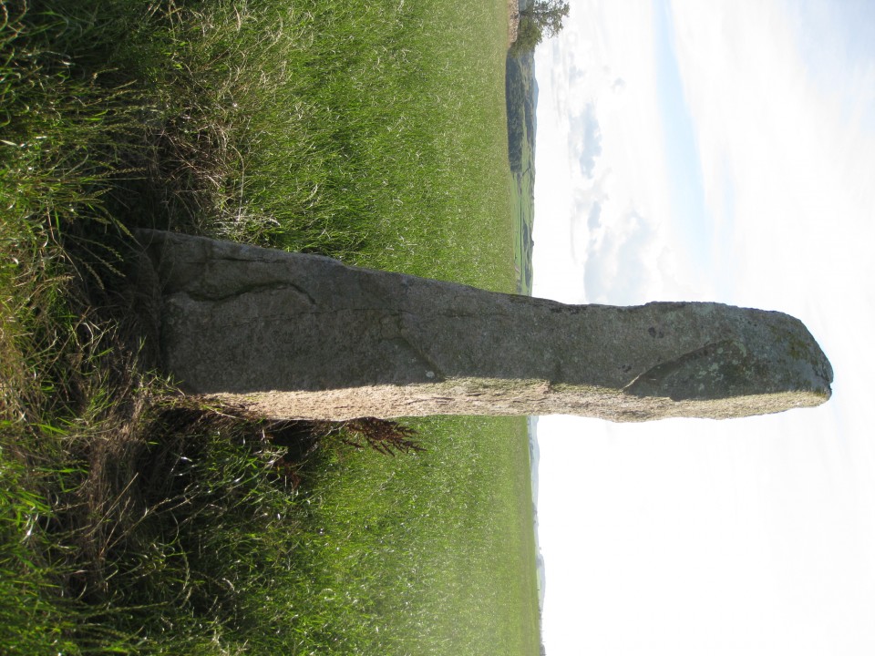
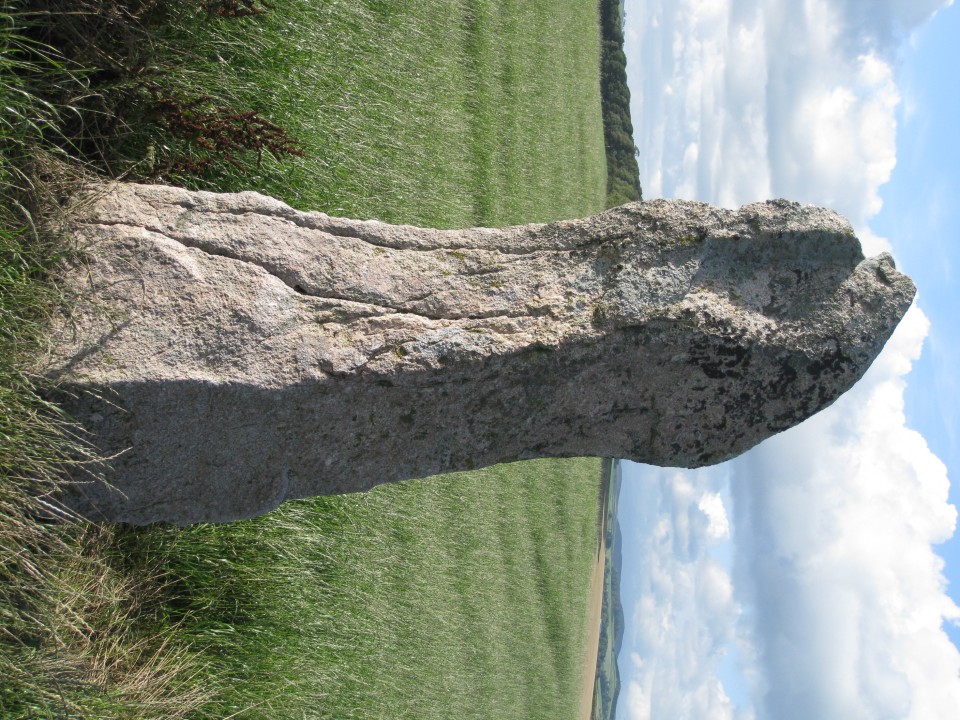
Made a few abortive attempts to reach this 8.5 - 9ft stone in the past by other routes - it is surrounded by farms and fields - the latter often with cattle in them. Finally got lucky yesterday using the road closest to the stone. Great weather and no cows in the four fields that have to be entered. Convenient tractor tracks through the new grass made walking easy. Take the minor road off the A711 about a mile outside Dalbeattie. Use OS explorer 313 and you will see Edingham Loch at the start of this road. About 2.6km up is the entrance to Townhead of Culloch farm on the right. Shortly after that on the left is a long passing-place with a field gate. Most of the passing places on this road are unusually long and it is certainly possible to park a small-med car at the end of this one without compromising the space or obstructing the field gate even for a tractor and trailer. Enter field and head up to the top right hand corner with a cattle trough. Enter field to the right via gate (it was open) and keeping to the left, head up alongside the fenced in track to the top of that field. Go through or over two more gates to get into the field beyond the stone wall. Follow the outside line of the farm buildings and the small wood which points across the field to the stone - just inside the next field. The wall in between is topped by barbed wire but a few yards along from the stone a section has collapsed and a field gate has been propped there with barbed wire along it. It is not hard to get over and back along to the stone.
|
    
|
|
Visited today with the Extreme Stonefeelers. Just beyond the end of the lay-by (not the end by the bridge) there is a gap between two bushes and in there the barbed wire ends and there is a bit of a wooden fence that can be climbed over with only a little difficulty. There are some strands of wire through it but not barbed. The wood rails slope a bit and could be slippery but easy enough with a little care and sensible footwear.
|
|
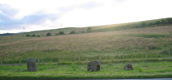
This pair are hidden from the road by a thick hedge. Heading west on the Solway Coast road (A710) from Dumfries, pass through the hamlet of Mainsriddle. after the bend in the road there, pull into the first lane on the right. There should be enough space to park there. Enter the field across the road by the field gate, turn right and walk up to the opening in the dyke into the next field, turn left and head down towards the sea. The stones should be visible after a few yards. They are about 100 yards apart. The first is a boulder of only a couple of feet in height and the second is a block about three feet high. Not spectacular but not hard to tick off if on your Galloway list. A couple of fields away on the other side of the road there is another stone - Kells farm - not seen it yet.
|
   
|
|
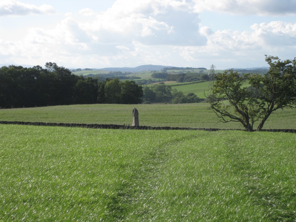
If leaving Castle Douglas on the A745 Dalbeatie Road, slow down after passing the last houses and look for a small access road on the left and pull in. this is a field access lane but there is lots of room to park at the start of it without obstructing anything. The stones should be visible across the field ahead. Walk up the lane a fie yards to the gate to the adjacent field. Walk up that one then cross into the stones field at the gate. There is probably closer access from the other side of the field where new houses have been built but this route was easy enough.
|
|
Head for the southern pair of stones visible from the lay-by on the main road. At the corner of the field across the little burn and copse of trees there is a short, gated public pathway between the two fields. At the end of this the two standing stones are down on the right. Enter the field on the left by the gate and the cairn is visible. Head for it and to the left among the weeds lie the two large fallen stones.
|
|
Only one of the stones is still standing, one having fallen since the photos here were taken. The remaining upright is visible from the southern pair that can be got to easy enough from the lay-by on the main road. At the end of the field there are two fences, a tricky, boggy ditch and a steep bank to be negotiated. Make sure to take a stick and poke the ground to check how firm it is before attempting to cross the ditch. One wellie boot sunk into the mud though the ground had looked stable. Water got in over the top before it could be extracted. Fortunately spare socks were soon to hand. The experience was nearly repeated on the return as well. Watch out - but worth it.
|
|
Click on the streetmap link to check out the directions. You will see that the site lies on a semi circular little road with two entry points from the main road. Take the northern entry and drive along towards Barbreck House and park by the buildings at the end of the road. The stones are round the back of the old manor house. We asked a bloke we saw when we parked up if we could go round and have a look and permission was willingly given. Two nice stones but surely in the saddest setting of any. Probably once holding pride of place in the back garden of a grand house they now rub shoulders with abandoned vehicles and every conceivable sort of junk. They really needed that hug.
|
|
Leave the car park and head back to the road. Enter the field by the bridge by the gate with the sign warning of danger of death - to fly fishers from electric power lines. Head diagonally across this small field to the gate into the next field. Turn right along the inside of the fence and the stone is visible on the ground near the end of the fence. No distance.
|
 
|
|
A worthwhile stone to visit and a fair bit of an 'extreme stonefeeling' experience to get there. Barnashaig stone can be visited at the same time as they are only a couple of hundred yards apart. We parked on a small grass verge - be careful it's tight - almost opposite the entrance to the track that starts from the road below. It's easy enough getting up the track to the old sheds of Upper Frenoch if a bit muddy and slightly boggy in parts. From the buildings it is a steep uphill climb beside the fence line. There is a bit of a path but obviously no one had been for ages as big ferns obscured everything but keep near the fence and be careful with your footing and you should be fine. Keep following the fence along the top until it stops at a field gate. Turn left when through the gate and strike up to the top of the nearby ridge. To get to Upper Fernoch, descend the few yards to the lower ground in front of you, turn left (south) and skirt round the next ridge for a few steps and the stone should become visible a hundred yards away. To get to Barnashaig from the first ridge, go right (north) along the top for 20 yards or so to its end and the stone should become visible 50 yards-ish away on the lower ground.
|
|
A truly great stone to visit and a fair bit of an 'extreme stonefeeling' experience to get there. Upper Fernoch stone can be visited at the same time as they are only a couple of hundred yards apart. We parked on a small grass verge - be careful it's tight - almost opposite the entrance to the track that starts from the road below. It's easy enough getting up the track to the old sheds of Upper Frenoch if a bit muddy and slightly boggy in parts. From the buildings it is a steep uphill climb beside the fence line. There is a bit of a path but obviously no one had been for ages as big ferns obscured everything but keep near the fence and be careful with your footing and you should be fine. Keep following the fence along the top until it stops at a field gate. Turn left when through the gate and strike up to the top of the nearby ridge. To get to Upper Fernoch, descend the few yards to the lower ground in front of you, turn left (south) and skirt round the next ridge for a few steps and the stone should become visible a hundred yards away. To get to Barnashaig from the first ridge, go right (north) along the top for 20 yards or so to its end and the stone should become visible 50 yards-ish away on the lower ground.
|
|
We could not find anything as good as the photo here. The 9 years since greyweather's visit has seen a moss carpet grow over everything. There were signs of other stone hunters having recently pulled up some moss here and there without success. We did eventually find a patch of rock with about 4 cup marks but only after pulling back quite a large section of moss carpet. We replaced it afterwards of course. This was down on the slope as described - and it is steep and tricky there. We poked about every other rock surface within 50 yards as well to no avail. Good luck.
|
|
Though the stone is visible up on the rise from the road we found that the easiest way to get to this big fella was to drive on into the hamlet and park legitimately by the bus stop under the hillock with the cist visible on its top - a bonus there - and walk back a couple of hundred yards to the field gate in the field adjacent to the field containing the stone which has another convenient gate just by the stone.
|
|
This excellent stone is now being surrounded by new build houses but a path to it has been retained and it has not been incorporated in someone's garden. drive a few yards up the street off the 'main' road and look for the start of the fence in the photo. Park round the corner and the stone should be visible. The cross is on the side facing away from the house and you should be able to get all the way round it at a distance far enough away to take a full height photo. We could anyway.
|
|
Get ready for this one if driving north. The parking place is directly opposite but out of sight just round a bend as the stone comes into sight. So if following a map slow down and start indicating before you get to the bottom of the hill so as not to surprise the inevitable car that will be right behind you - as luck will doubtless have it. The new kissing gate that Greyweather mentions is now old, broken and tied up and largely hidden behind some bushes. Enter via the adjacent field gate. Great site.
|
|
Great stone. You can park on the 'main' road at a field gate opposite the farm lane; there's plenty of space. Stone is visible from the road but you have to cross a couple of easy fields - about 3 gates. Well worth it.
|
|
If you drive up to and park at the local cemetery and walk through to the back gate and turn left you will pass Stane Alane. The fallen stone is a hundred yards or so along the path in a field on the left with a pond. Easy to see and photograph from the fence.
|
|
Visited September 2013. Drove up the lane and parked at the cemetery. Walked through to the back gate, turned left and the stone was a few yards along. Well looked after by the local groundsman. A further hundred yards or so on the left in a field with a pond is the Achnabreck fallen stone. Easy to photograph from the fence.
|
We visited the site on 16.09.10. It was certainly at the coordinates given by Greywether and we followed the path on the OS map though there are several others within yards. Still it's hard to square our pics with his and Pigmyshrews. Several intervening years, a different season and some wanton destruction may explain this.
Several large stones around the edge, that from the weathering evident on their tops had once stood for centuries, had been fired and split - possibly only a few weeks before our visit as the smell of burning was still faintly noticeable. A very sad sight indeed so only a few pics of the damage are shown here.
|
| |