|
The henge is clearly visible in this aerial photo from multimap
|
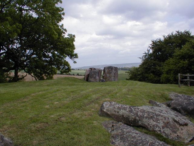
A belated visit, but thought that after 'Discover Avebury' I should pay it a trip myself, to make sure that they weren't telling us lies. Yes it was there.
An epic Trip, left home in Essex with the kids at 10am expecting to arrive at midday, however M4 was closed so spent 8 hours in the car with the kids, isn't Reading one-way sytem wonderful ! Eventually abandoned the trip and crashed out at my Sisters in Stroud (but managed to sneak in Minchinhampton), finally arrived in Avebury Midday Sunday. A nice way to spend an afternoon strolling round with the crowds !
Next time I'll go mid week - mid winter
|
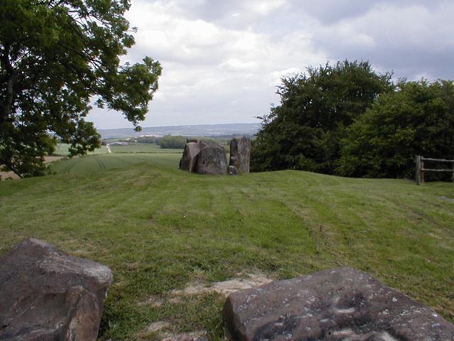
I read the posts about this stone, consulted my maps, thought whats the problem.
Minchinhampton is indeed a maze, the kids in the back questioning every U turn and stating the obvious ' Didn't we just go here ?'
Anyway got my act together, and its easy to find, Take the road across the common, follow the lane down the side of the pub 'The Ragged Cot' about 3/4mile down this road the stone stands in a field, but its hard to spot as its at right angles to you and only abouut 20cm thick. Anyway take the right fork signed ' Minchinhampton Only' and there is a small wood on the junction and then after about 50m the stone is easy to spot through the gate.
Spent a good half hour in the sun , poking our arms and faces through the holes.
|

|

|
Decription of the work of the council's Archaeology unit, in particular, Neolithic settlements and Bronze Age causeways that have been discovered in the intertidal deposits along the coastal regions.
|
   
|
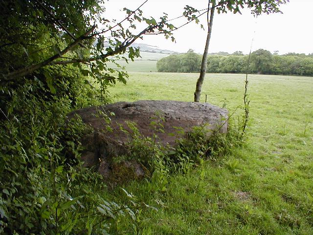
The names Ingatestone and Fryerning probably have a common origin which may go back to the earliest days of the Saxon settlement of Essex, perhaps in the 6th century AD. Generally, place names including 'ing' are thought to refer to groups or tribes of Saxon settlers who had crossed the North Sea to colonise Britain.
Historians have suggested that Ingatestone and Fryerning refer to a Saxon leader called Giga whose group settled in the area of these villages.
Ingatestone got its name from Giga's people with 'stone' added to it. The stone stood once in the modern recreation ground by the church, and is now in three pieces, one by the south door of the church and two on either side of the entry to Fryerning Lane.
If it is asked what a stone should give its name to a village, it should be remembered that there are no big stones to be found in this part of Essex; a stone left by the Ice Age about three feet high and three feet round is quite rare enough to be used to distinguish the village where it lay from the other 'ing' villages.
|
|
Legend has it that in AD 61 Queen Boudicca made a gallant last stand against the Romans at Ambresbury Banks
|
 
|
Skeleton may be Stonehenge king
This was in the 'Metro' this morning
http://www.thisislondon.co.uk/dynamic/news/top_story.html?in_review_id=585366&in_review_text_id=552901
Skeleton may be Stonehenge 'king'
by Geraint Smith Science Correspondent
The richest early Bronze Age burial site ever found has been discovered within a short walk of Stonehenge, archaeologists revealed today.
It is possibly the grave of the man who ordered the rebuilding of the previously wooden monument in stone. It contains the earliest metal knives yet known in Britain, as well as finely-crafted arrowheads, gold ornaments, butchery tools and ritual stone versions of an archer's tools.
The grave was discovered near the village of Boscombe Down during work on a new school.
The shapes of the objects suggest strongly that it was dug in about 2,300BC - exactly contemporary with the rebuilding of Stonehenge, which lies less then 30 minutes' walk away.
In all, 100 objects were found with the skeleton of a mature, well-built man. "We don't know whether there were kings at this time in Britain," said Dr Andrew Fitzpatrick, of Wessex Archaeologythe unit which found the grave. "It is possible, though, that this man was alive when the stones were added to Stonehenge.
"This would have been a small community in which appearance was everything, and this man would have been like a peacock," he says. The knives predate by several hundred years the oldest metal tools known in this country, said Dr Fitzpatrick, who added: "The arrowheads were scattered in the grave, not as though they had been laid onto his body by the mourners."
|
A history of the site and access details
|
|
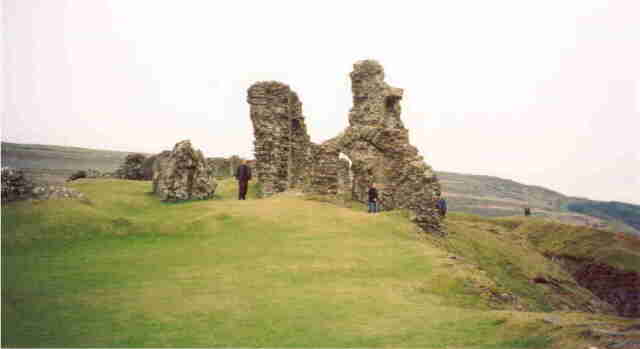
The magnificent ruins of this 13th century Castle, sit high above the Town of Llangollen, overlooking the river Dee. The castle was built on the site of an Iron Age hill fort.
|
|
Remains of Iron Age Earthworks.
|
This is the remains of Iron age Earthworks. As is common with similar sites in the forest, there is evidence of mountain Bike damage .
These are easily accessed, being just off the 'Wakes Arms' roundabout on the road to Theydon Bois, about a mile from the M25.
|
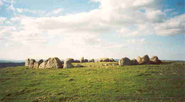
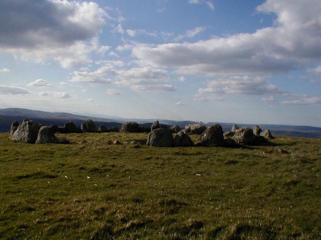
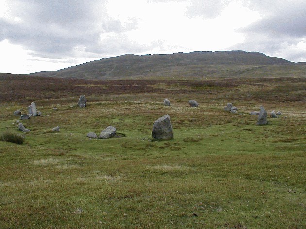
Took the 50 minute or so walk up from Llandrillo on Saturday 13/4/02. Wrapped up well following warnings from other contributers that it was always cold at the top. How wrong could they have been, it was glorious up there, sun was shining and there was virtually no wind.
A breathtaking view over to the mountains, where we could see a huge fire burning on a hillside.
The circle itself is magnificent, more than worth the walk. There was an incredible stillness in the air and we rested (or rather slept) for a good 1/2 hour before making the decent. Killed me knees on the way down.
This is another site so remote that you just wonder how the materials were brought up and what inspired them to built it there ?
|
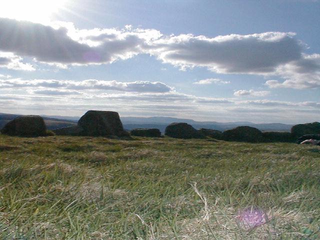
Some more of my pictures of Druids Circle can be found here
|
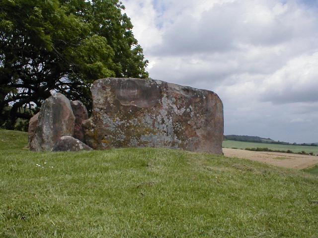
Some more images of Pentre Ifan are to be found hidden amongst my site
|

|
Took a walk up here on 7-9-01. A friend who lives locally knew the way, ( if you are driving there is a small carparking area about 1/2 way up from the village. This leaves about a 40 minute climb.) this was helpfull as it was not particularilly well signposted.
A glorious sunny morning, however you turn a corner and the wind coming from the sea hits you. Take a hat.
The walk is more than worthwhile, an excellent circle with stunning views. We sat around for 1/2 hour taking it in before the wind got too much. It makes you think as to how much effort went into creating these works.
|
Killer hasn't added a profile
|
|