Showing 1-20 of 48 miscellaneous posts. Most recent first | Next 20 
Site 16 in the Anglezarke and Rivington Moors - Archaeological Survey 1986.
"This is a relatively well defined cairn in an area of peat erosion. It comprises small to medium field stones, some of which are earthfast. There is a possible kerb. It is in the vicinity of the PRN 4064 flake working area. Size: length 1.7m width 1.7m height 0"
|
http://www.pastscape.org.uk/hob.aspx?hob_id=117437
A Neolithic promontory enclosure comprising a projecting spur of Birdlip Hill with two curving concentric earthworks cutting across the axis of the promontory. The site was surveyed by RCHME in 1996 as part of the Industry and Enclosure in the Neolithic Project. Quarrying has lowered the tip of the promontory and eroded the north and south sides; the east area is intact. The promontory is cut off by two earthworks across the spur, about 90 metres apart, with vestigial banks which appear virtually continuous. The outer would originally have enclosed an area of more than a hectare. The inner earthwork consists of a bank; the outer, 55 metres to the south east, is a bank with slight external ditch. The area narrows in width from 95 metres at the south eastern end to 15 metres on the northwest. Excavations were undertaken by T Darvill (who referred to the site as Peak Camp) in 1980-1, comprising a trench across the outer earthwork and a small trench towards the western end of the promontory. The outer earthwork comprised a single rock-cut ditch with an internal bank of limestone rubble. The ditch featured at least one causeway, and had seen at least four phases of recutting. Finds included flints, animal bones, and pottery. The second trench revealed a ditch or gulley, which contained further Neolithic pottery, flints and a quantity of bone. The lithic material included leaf-shaped arrowheads and a flake from a polished axe. Research into the dating of Early Neolithic enclosures indicates a construction date for the outer circuit of probably of 3655-3540 cal BC. The enclosure at Peak Camp may have been used into the 33rd century cal BC, although this late date is dependent on a single measurement. The research also highlighted the relationship with the Crickley Hill enclosure nearby, suggesting they were probably built within a generation of each other and were in concurrent use, at least until the destruction of Crickley in the mid-35th century cal BC.
|
http://www.pastscape.org.uk/hob.aspx?hob_id=1075209
The site of a probable Neolithic causewayed enclosure at Springfield Lyons, visible as cropmarks and tested by small-scale excavation. The cropmarks were transcribed and interpreted by RCHME in 1997 as part of the Industry and Enclosure in the Neolithic Project. See the archive report for full details. The existence of the enclosure was realised following excavation of the adjacent Late Bronze Age enclosure (TL 70 NW 86). Excavation in 1990 and 1991 plus air photographs indicate the presence of an arc of pits and/or ditch segments immediately to the east of the Late Bronze Age site, and which appear to cut off a small gravel promontory between two streams which run into the River Chelmer. Trial trenching so far has recovered around 2000 sherds of Mildenhall-style plain bowl sherds, plus Grooved Ware and Beaker sherds from superficial deposits and pits. Much of the Neolithic material appears to have been deliberately placed. Of the two fully-excavated features along the enclosure circuit, one comprised an almost shaft-like pit, and contained deposits of Mildenhall pottery often comprising up to half a complete vessel. One of the pits had a narrow slot associated with Beaker pottery cut into its upper fills. A by-product of the excavation of the Late Bronze Age enclosure is that it is clear that much activity associated with the causewayed enclosure was occurring outside the ditch circuit. It is also intriguing to note that the Late Bronze Age enclosure is itself causewayed, and its principal entrance directly faces the Neolithic enclosure.
|
http://www.pastscape.org.uk/hob.aspx?hob_id=879402
A circular enclosure c60m in diameter was examined. Pottery and bronze metal-working moulds from the primary ditch silts indicate a Late Bronze Age date. Later features include a Saxon cremation and inhumation cemetery and Saxon or later post-hole building. (1)
Further grass and cremations were located bringing the total of burials to c150. One of the inhumations was enclosed by a small ring-ditch. Four more Saxon buildings were identified, belonging to at least two phases, together with a number of pits and other features. (2)
Excavation of a circular cropmark enclosure at Springfield, confirmed a Late Bronze Age date for the enclosure. The interior of the enclosure was totally excavated, providing a good plan of all features which had survived subsequent activity at the site. Late Bronze Age features included several post-hole structures, and the post-holes of the revetment for an internal bank. Also located were features and finds of Neolithic/Early Bronze Age and Roman date, an Early Saxon cemetery and a Late Saxon settlement. (3)
|
Its interesting to look back at my notes from years past on the ground, staring in a state of confusion at the earthworks. Turns out this hill was a massive neolithic complex. 2 definite, 1 probable and 1 maybe causewayed enclosures (1 central, then 1 on each spur) plus 3 causewayed cross banks sepearating the spurs from the central enclousre. Plus 2 long barrows. Then they abandoned it and headed North-West to build a gert large cursus.
Have a look at the link I've added for (many) further details.
|
https://historicengland.org.uk/listing/the-list/list-entry/1020710
The monument includes the best surviving part of a prehistoric field system, comprising a number of field banks and associated clearance cairns, all surviving as low earthworks located on a gently sloping clifftop overlooking Lyme Bay. Although not precisely dated, the fields are small and roughly square which suggests an Iron Age origin, with usage perhaps continuing into the Roman period, before the fields were encapsulated within larger medieval or post-medieval field boundaries. The fields lie just to the west of Berry Cliff Camp, a hillfort which is believed to date from the Late Bronze Age to the Early Iron Age, and the subject of a separate scheduling (SM29637). The field system is defined to the south by lynchets (field banks and scarps resulting from prehistoric cultivation techniques). These lynchets occupy a narrow strip of clifftop about 270m in length with a maximum width away from the cliff edge of about 100m. Although it is likely that the field system once extended further inland, modern farming techniques have removed all upstanding traces apart from those close to the cliff. The visible remains also include a series of scarps and banks with many of the scarps lying parallel to the cliff edge whilst the banks lie for the most part at right angles to it. Where surveyed in 1989 by the Royal Commission on the Historical Monuments of England (RCHME), the banks were found to be between 2m-4.5m long and 0.5m-2m wide. Together, the banks and scarps define five or six small fields. Associated with the fields are a number of stone cairns some of which lie on the field banks. These cairns, of which there are about a dozen, are considered to be the result of field clearance and are probably contemporary with the prehistoric working of the fields; they survive as low earth covered piles of flint and stone. Previous commentators have suggested that they might be prehistoric barrows or burial mounds but there is no evidence to support this view. The prehistoric fields have been worked at later periods, perhaps into the medieval and early post-medieval periods, and incorporated into larger rectilinear fields as is evidenced by a long field bank which runs from the monument to a position to its east and a bank and ditch which clearly cuts across the earlier prehistoric field system where it survives on its western side. All fencing, gateposts, and coastal path waymarkers are excluded from the scheduling, although the ground beneath these features is included.
|
http://www.heritagegateway.org.uk/Gateway/Results_Single.aspx?uid=MCO8203&resourceID=1020
A near circular univallate camp approximately 90m by 80m first recorded by McLauchlan (b1). The OS found an extremely well preserved, near circular univallate defended enclosure, situated on Lower Helland Down, a spur south of the River Camel (b2). It enclosed approx 1 hectare and has a simple entrance on the east side. A 25m outwork extends from the south-east side to protect the entrance (h1). The enclosure is visible on air photos (p1) and was recorded as part of the NMP.
|
http://www.pastscape.org.uk/hob.aspx?hob_id=34733
A large circular earthwork is visible on Parracombe Common consisting of a bank and internal ditch which has been interpreted as a henge or a disc barrow. The earthwork forms an enclosure measuring 40 metres in diameter with a bank 3.4 metres wide by 0.4 metres high. It has an internal ditch 0.3 metres deep, and has been bisected by a hedge bank. There was no visible evidence of an entrance during field investigation in 1993. The monument is clearly visible on aerial photographs taken in 1952, but by 1972 it has been severely damaged by ploughing and other agricultural activity. Too much of the monument has been either obscured or destroyed to allow the various claims as to the monument's nature to be evaluated purely on the basis of the surviving field evidence. On the aerial photographs from 1952, however, it most closely resembles a disc or saucer barrow.
|
An Inventory of the Historical Monuments in Dorset, Volume One
by the Royal Commission on Historical Monuments in 1952:
Earthwork on Shipton Hill (565 ft. above O.D.), ¾ m. N.E. of the church, forms an enclosure of about ¾ acre. The hill-top has been artificially steepened on the N. and S. sides and the two ends form natural ramped causeways leading up to the summit. At the base of the hill on both the N. and S. sides is a ditch with outer rampart of no great strength, and at the present time, for part of their length, both have almost disappeared. Both the ditch and rampart stop short of the E. and W. ends of the hill.
Between the base of the mound and the outer ditch at the eastern half of the S. side is a berm, but it seems probable that it is merely a natural outcrop of rock. The two pathways leading up the slope on the N. and S. are probably modern. On the top of the enclosure near the middle is a cross hedge-bank which appears to have been formed along the eastern scarp of a ditch to an earlier bank, traces of which can be seen immediately E. of the existing hedge-bank. Near the middle of the enclosure is a circular mound, of about 28 ft. diameter and 14in. high.
Beyond the rampart on the N. side, and to a much lesser degree on the S. also, are a series of rough terraces. They would seem to be a natural formation though their surfaces in one or two places show signs of disturbance. Warne (see above) mentions the disturbed nature of the N. E. part of the field immediately to the N.E of this camp and suggests the possibility of its being a Celtic village. This disturbance is still visible but is quite indeterminate.
From this very nice website about the hill: http://www.shiptongorge.org.uk/index.php/about-shipton/85-shipton-hill-and-hammiton-hill
|
Just been past both sides of this going up to Cheetham Circle and back. If you look around as you do this and ideally with a local, you'll realise this whole side of the hill was one long quarrying area which didnt completely stop until the 70s or so.
As such I'm pretty much convinced this is a spoil heap especially given its size, shape and location.
|
2 out of 3 barrows are currently extant, the third disappeared under a road then the BP petrol station.
Church Lawton North is two phase, the first was a sand mound containing a central boat shaped pit, all surrounded by a ditch. The second phase enlarging the mound considerably.
Church Lawton South is a small sand mound surrounded by a 20 metre ish stone circle made up of large glacial erratics. The whole lot then covered with a larger mound again.
|
|
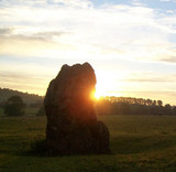
This stone and others like it on the plateau are considered to be millstone roughs propped up with little stones. (Anglezarke and Rivington Moors - Archaeological Survey 1986)
|
Listed in Jodie Lewis' The long barrows and long mounds of West Mendip (UBSS Proceedings, 24(3) , pp 187-206 Lewis,J., 2009.) this mound wasn't discovered or noted until the 80s. Its 63m x 30m, remains up to 2.5m high and is oriented ENE/WSW.
No excavations have taken place but Jodie Lewis seems to fall on the more likely than not opinion of the site.
|
The following comment was left on "Anglezarle Misc 8" which I think describes this stone. Explains the carvings and that the stone was standing 100 odd years ago...
"Sadly, much nonsense has been talked about with regard to these stones.
There was a man called Andrew Mather who would have been about 120 if he was still alive today. Some 45-50 years ago he told me that when he was a boy, he had two friends and they called themselves 'The Triangle Gang.'
One of their favourite places to meet and camp was a small depression towards the southern end of Stronstrey Bank where there was a fairly tall upright stone. One of the boys carved a small triangle on the face of the rock as a symbol of their 'club.' Some time later, they carved a much larger triangle on the same rock."
|
Excavations by Salt and Ward found romano-british remains of at least 4 people. One skeleton found with an iron spearhead in stone lined grave near the front. Artefacts now to be found in Buxton museum.
See "Derbyshire Cavemen" by Cliffe for more cavey type facts.
|
Listed on the scheduled monuments register as the following:
"The monument is situated on the limestone plateau of Derbyshire, north of Wye Dale, and includes a Bronze Age bowl barrow and a Neolithic long barrow within a single constraint area. The bowl barrow is a roughly circular mound with a diameter of c.15m and a height of c.1m. It is superimposed on the south-eastern end of the long barrow which is c.0.5m high and measures c.40m long from north-west to south-east and ranges from c.20m at the wider, south-eastern end to c.10m at the narrower, north-western end. There has been no definitely recorded excavation of the monument but both barrows have been identified by their form and by their similarity to other known examples, by which the monument can be dated to the Neolithic and Bronze Age periods. Both barrows have been somewhat disturbed by stone robbing, either for walling at the time of the Enclosures or to feed the limekiln in the adjacent field. The drystone wall crossing the northern edge of the monument is excluded from the scheduling but the ground underneath is included."
Another Peak District bronze age insertion on an older neolithic barrow.
|
The HER says
"A large barrow at Ludworth Intakes was destroyed by 'treasure- hunters' when it became known it was to be excavated. According to information volunteered, ashes, bones, etc. were found and also a cinerary urn which was broken and its contents lost. The barrow was alleged to have been divided into three paralled circles one within the other, the centre one containing the urn. "
Its not destroyed, just mangled like a lot of barrows about these parts.
|
The SMR has this listed as "A Late Bronze Age or Early Iron Age palisaded hilltop enclosure lying on a gently sloping shelf to the south of the summit of Eldon Hill. The enclosure forms an irregular 'D' shape and is defined by a clearly visible stony bank."
I'd go for stock enclosure as opposed to habitation purely because this site is undefendable being abutted by higher ground to the North.
|
Listed on the Derbyshire HER (I paraphrase):
"A twin humped mound marked as barrow on OS 1" 1838. "
Apparently mentioned in the 1977 edition of "The Burial Mounds of Derbyshire", but I can't seem to find it in the 1994 edition.
However, it stands out from the Disley to Whaley back road about 100m from it and is in a similar landscape location to Cow Low near Dove Holes. I've yet to get close and personal but it seems genuine.
|
Showing 1-20 of 48 miscellaneous posts. Most recent first | Next 20 |
Rumours I found one folklore piece to complete my rainbow are true
|