|
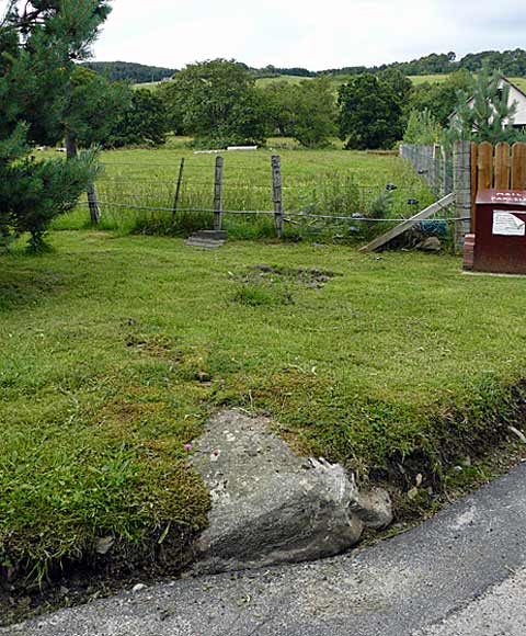
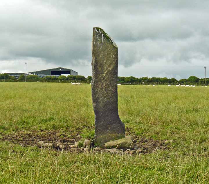
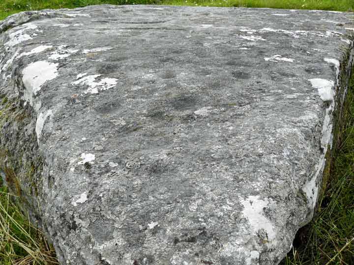
Back in 1887, five cup marks were seen on this stone; by 1997 only two were visible. When I visited in 2010 none could be seen as most of the stone was covered in grass.
|

|
|
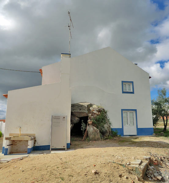
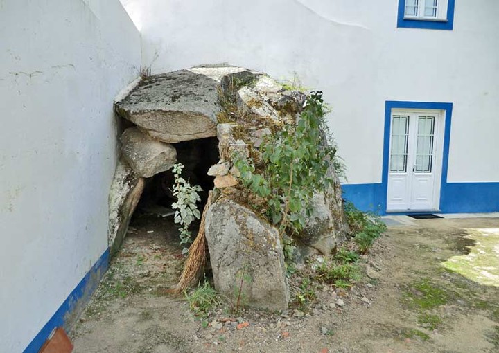
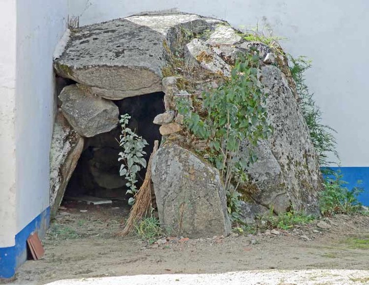
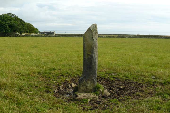
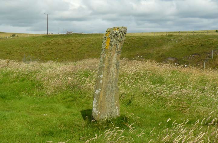
I drove down the lane to Culnakirk steading in search of this panel and encountered a fairly new house named 'Clachmhor' on my left. The owner was pottering about in his yard so I asked him about the whereabouts of the stone. He amiably pointed over a fieldgate leading from his driveway to a large block just a few yards away.
|
  
|
     
|
       
|
 
|
      
|
 
|
 
|

|
   
|

|
Council worker stumbles across 3,000-year-old carving
From The Star (South Yorkshire):
"PREHISTORIC art 3,000 years old was discovered by chance in woodland by a council worker while carrying out routine maintenance work.
John Gilpin, a woodlands officer in the Parks and Countryside department, stumbled upon the find in Ecclesall Woods.
He discovered a boulder with a series of markings, lines and cuts - which, after being examined by experts, has been declared a significant archaeological find.
Jim McNeil, of South Yorkshire Archaeological Service, said: "I was called in and recorded the discovery, taking photographs.
"I have taken advice from a specialist who considers this to be an important piece of prehistoric rock art. This is the second example of such rock art from Ecclesall Woods, although other examples are known from the Peak District and further north in the Pennines."
Read more
|
From the Clifton Antiquarian Club
|

|

|

|
British ancient forests were patchy
From PlanetEarth online
What were Britain's primordial forests like before humans started tampering with the environment? The latest clues from a study of fossil beetles suggest that the ancient forest was patchy and varied in density across Britain.
Scientists have long debated the nature of Europe's ancient landscape and hesitated between a nightmarish, close-canopied forest and a pasture woodland of oak and hazel trees, similar to the modern New Forest, which is kept open by grazing animals.
This is not just an academic question. 'If we want to manage our forests and species to keep them as natural as possible, we have to know what natural is,' says Dr Nicki Whitehouse, a palaeoecologist at Queens University Belfast.
'The traditional view is that the original Holocene woodland in Europe was quite dense with a closed canopy,' she says. 'But this is probably too simplistic and nowadays the debate is more about the degree of openness of the ancient forest and the role of grazing animals in maintaining this structure.'
Together with Dr David Smith, a specialist on environmental archaeology at the University of Birmingham, Whitehouse decided to look for clues in an overlooked source: ancient beetle remains.
Beetles are a good source of environmental data because it's easy to tell species apart and each type of beetle is specific to a given habitat. Some thrive in dense forests, others prefer sparse woodlands and grassland areas, while dung beetles are usually found in areas grazed by large herbivores. The proportion of beetle species in a given period of time 'allows us to reconstruct past habitats with detail,' explains Whitehouse.
Whitehouse and Smith looked at 26 beetle assemblages from different parts of Britain, from Thorne Moors in Yorkshire to Silbury in Hampshire, and looked at how beetle communities changed over 7000 years, since the end of the Ice Age until 4000 years ago.
They found that the history of the original British forest is not as straightforward as previously thought.
Between 9500 and 6000 BC, the fossils were mostly from open and pasture beetle species, with moderate contributions from forest types and hardly any dung beetles. This suggests open patches of oak, hazel, birch and pine forests of variable tree density, similar to modern pasture woodland.
Around 6000 BC forest beetles become more abundant, grassland species decline and 'we see an overall closing of the forest canopy in the insect record,' says Whitehouse.
By 4000 BC, everything changes. This was the time that humans started pursuing an agricultural way of life, raising animals for meat and dairy products. Dung beetles become more abundant, while the other types of beetles decrease.
'The transition to the Neolithic was rather abrupt,' says Whitehouse. The dense forest gave way to pasture woodlands and open landscapes, kept open by the increasing number of grazing animals feeding on saplings.
The beetles turn the history of the British forest into a complex tale. Instead of a continuous closed canopy forest, Britain was covered by uneven patches of forest, with different levels of openness driven by local phenomena such as storms, forest fires or floods. But grazing animals apparently did not play a role until the beginning of agriculture.
The beetle findings, published last week in Quaternary Science Reviews, largely agree with the data collected from the study of ancient pollen. But 'pollen studies have probably over-estimated the abundance of closed canopy trees and under-estimated the more heterogeneous nature of the landscape at this time,' says Whitehouse. 'The Holocene forest was probably patchier than we though: open areas were of local significance and important features of the landscape.'
|
 
|
Images of the Ringlemere Gold Cup by Sue White, who was commissioned by the finder to produce a reconstruction.
|
Clickable images of the interpretation boards at South Creake.
|
Here's a novelty: at just two metres above sea level, the lowest hillfort in Britain.
If you're in the area, I recommend you go and take a look. You wont see massive earthworks, but you will find well-defined banks and ditches within the flat, Fenland landscape.
Drive along the B1093 between Wimblington and Manea and you'll see a signpost pointing down a farm track, passing Stitches Farm, to Stonea Camp.
There are information boards to read scattered amongst the defences as you wonder if Boudicca walked on this site 2,000 years ago.
|
baza lives on the West Pennine Moors in Lancashire.
|
|