|
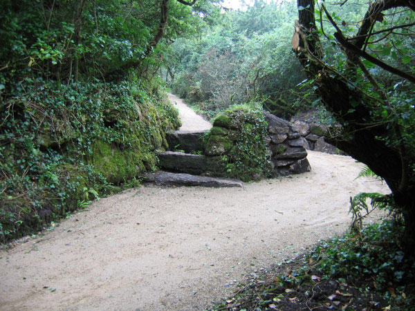
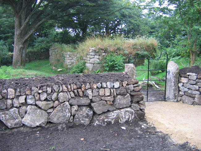
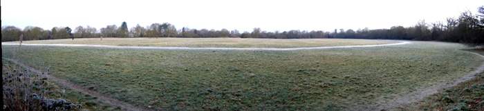
Remedial work at Madron is 'well' under way. The area around the baptistry has been relandscaped, and a gated wall has been built up. The stonework at the cloutie tree has been improved (though the well is some way off, this is where most people think the well is), and the path from the car park has been widened, cleared and laid, making the whole site wheelchair accessible at last (see photos).
The car park is still being relaid and landscaped, and work should be completed in a few weeks time.
It still rains every time I come here though, so some things don't change!
|

|

|
|
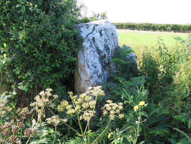
Grubbing around today, I found a couple of stones in the surrounding hedge (see photos). The vicar arrived at the same time, but knew nothing about a possible circle. As a service was due to start, I didn't get a chance to get a good look around the church itself, which apparently has some Green Man roof bosses.
|

|
 
|
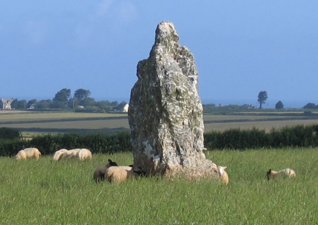
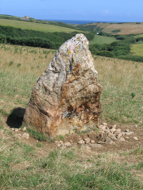
Found a reference to this in Meyn Mamvro, so thought I'd check it out. It's best to approach this from Engollan, as the road from the main coast road B3276 is gated.
Access to the stone is straightforward: park by the farmhouse, cross the road and walk along the footpath to within 50 yards of the stone. I had to duck under an electrified fence, and the field had plenty of evidence of ruminant activity.
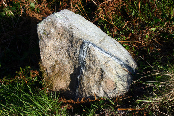
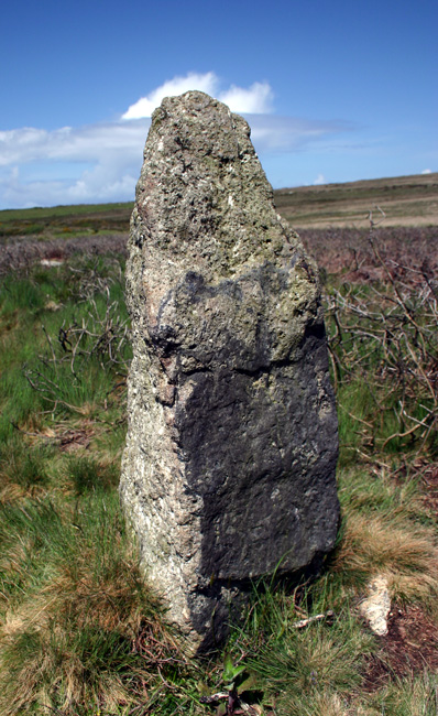
The stone, which stands around 5 feet, looks a bit precarious, as the packing stones are exposed and there is an evident lean, but the stone itself has a wonderful shape and colouring.
There is a nice view of the Atlantic along the valley to the nearby coast, but otherwise, not much in the way of obvious sight alignments.
|
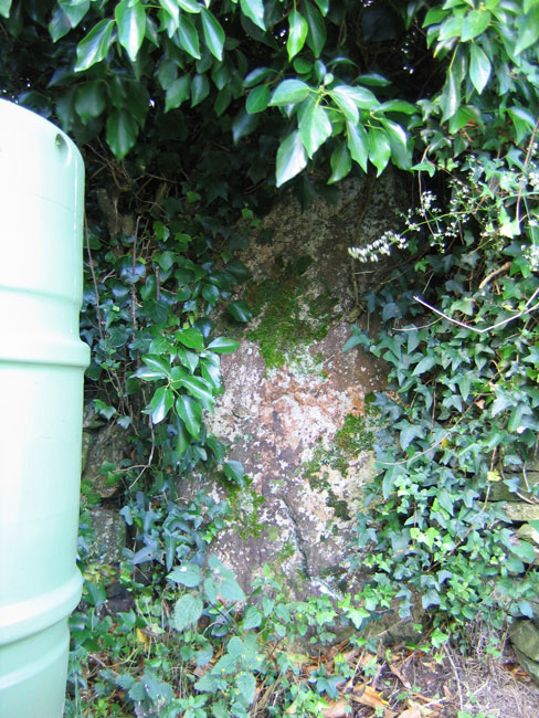
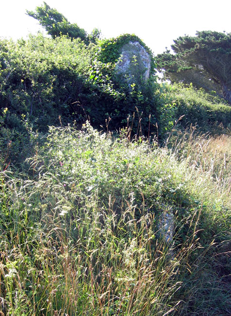
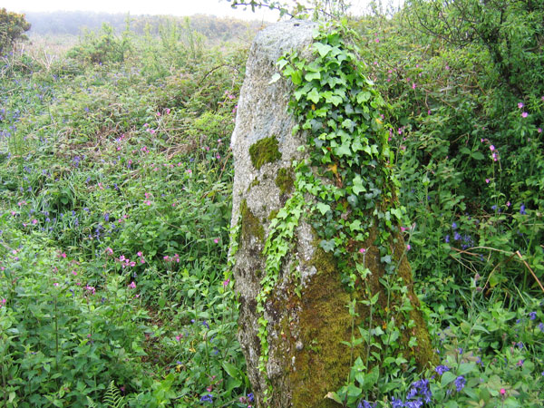
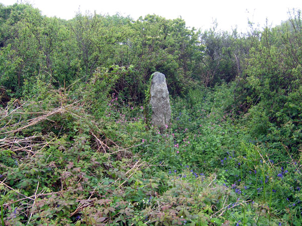
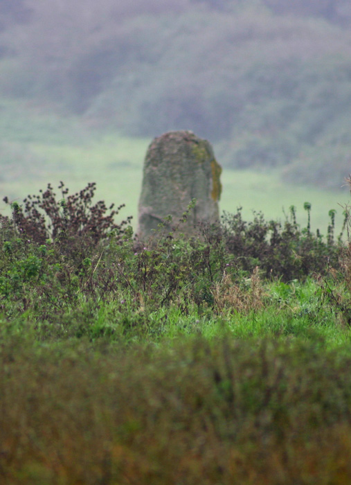
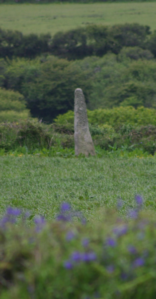
I was up here today, having a poke around. As can be seen from the photo, the stone is now almost invisible in the undergrowth. I'd like to have seen the stone properly, it looks a monster.
Parking is easy, as there's a pull-in right next to the junction.
|

|
 
|
  
|
Just for the record, it's still raining up there! The horizontal stuff that soaks you right through...
The bracken was only just sprouting, so I had no problem in finding it, though for some reason I had some doubts until a passing(!) farmer confirmed that this was indeed what I was looking for.
I can only re-iterate Mr Hamhead's directions - it's actually a relatively easy walk up the hill, with a couple of streams to cross, but the upright stone is quite distinctive and easily spotted from below.
|
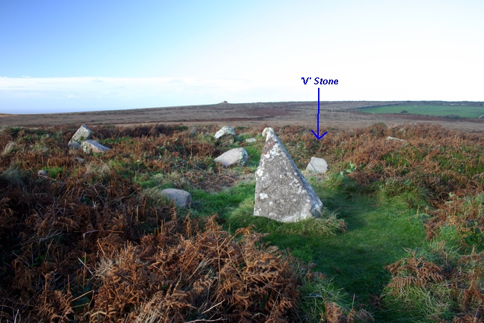
Found it! The 1:7500 print I took from MAGIC helped! Basically, go up the path by the side of the house, and continue until you get to another gate. Go through this gate. On the right is a smallish enclosed field. The hut circles (as far as I could see) are in the next field beyond this. Stay on the path.
The hedge on the right eventually opens up to an area of bracken and gorse. There was a trodden path through this that I followed, that led directkly to a large upright stone, hidden in the far hedge.
Take care, as the disused quarry starts in the adjoining 'field', and may be the various stones that purejoy found.
|

|

|
 
|

|
|
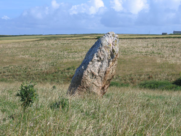
Easily visible from the road, I'm surprised I've not noticed this one before. Parking in the farm driveway is possible without blocking access, so I risked it for a quick grab shot, as no-one was around though the weather was closing in.
|

|

|
Managed to get here last Friday, on a glorious day (heavy rain was forecast but never appeared).
Builders were working on the farm buildings, the first time in many vists that I've seen anyone here. I asked them for permission to visit, they thought I wanted Chun, or Lanyon Quoit. As the farmer wasn't around, and I had a copy of the map from Magic, they were happy for me to whizz across and take a look.
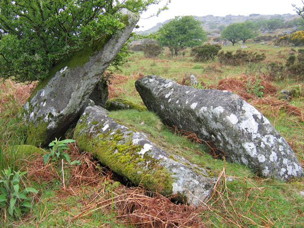
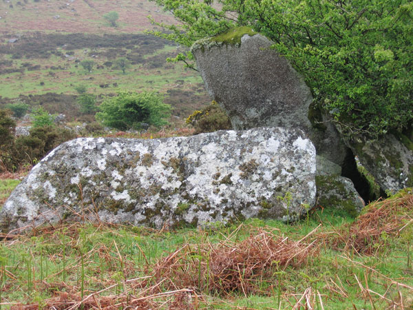
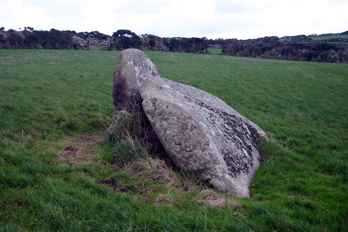
Into the field to the right of the farmhouse, and over the gate to the rear. On into the next field back from the farm (another gate), then turn right to the bottom of the long field. Over the last gate, and the quoit remains are in the field. Basically, two large stones, one leant against the other with many packing stones at the base.
Magic shows a 'settlement' in the corner of this field also, but before I could investigate, a brief shower started up. As I was carrying my camera without a bag, I hurried back to the car before it could get too soaked.
|
 
|
|
The Cornish Ancient Sites Protection Network have recently done some clearance work at the cairn, uncovering a stone on the cairn with an amazing quartz vein. See Meyn Mamvro #58 for details.
|

|
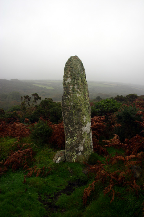
Thanks to Mr Hamhead's instructions below, I finally found this at the third time of trying! All I'd add is that the wall on the right is located just after the stream on the left (which tends to make the pathway extremely muddy), and there's a minor barbed wire fence to navigate at the top of the wall. Once in the clearing of the field, just follow the pathway up the hill.
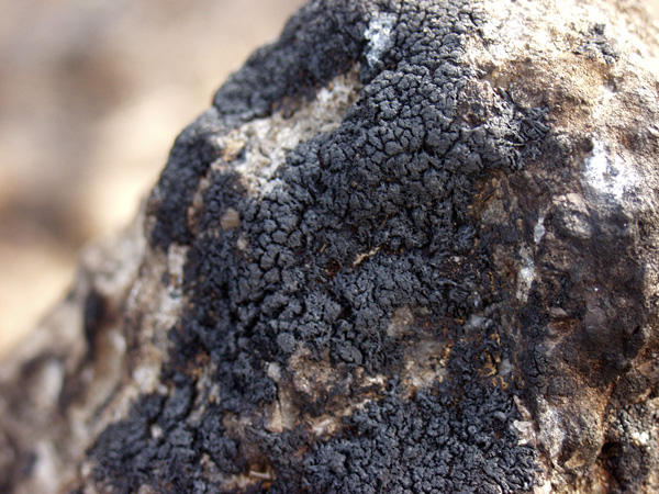
A massive stone, covered in that hairy lichen. Due to the weather I didn't tarry long, or look for the other nearby stones. Another day maybe, now I know how to get here!
|

|
Bid to help Dorset folk love 'lumps and bumps'
A new project aims to increase people's awareness, knowledge and appreciation of the amazing landscape between Weymouth and Dorchester.
It is being launched on November 5 by the Dorset Area of Outstanding Natural Beauty team which hopes the project will appeal to everyone who enjoys the countryside, including artists, photographers and amateur historians.
Among outstanding features of the area are the strange `lumps and bumps' which litter the skyline between Broadmayne and Hardy's Monument - and which few realise are round barrows that have been there 4,000 years.
See http://www.thisisdorset.net/dorset/weymouth/news/WEYMOUTH_NEWS_NEWS3.html for details.
|
 
|

|

|

|

|
Visited 22/5/5
It's a stiff old walk up from the bottom of the village, but just over a year on from the unintentional scorching the stones received (see News), they appear to be healing well. Most of the burnt lichen has been removed, and the stones look in good condition. I didn't notice any obvious cracking on the stones I inspected closely.This post appears as part of the blog post " Well Cross in Kernow (1)" |
Visited 21/5/5
I parked the car at Chysauster car park and walked along the road to the footpath at SW465347. The woman at the house next to the footpath advised me to avoid the horses in the field as they can become a 'bit too friendly'. Following the footpath across the first stile (into a roped off corner of the horse's field), this was easily done by jinking into the next field through a gate (horses in field), and returning at the far corner by dodging under the fence which appears to have been designed for exactly that purpose.
After the second stile, the footpath is poorly defined, but I headed straight across the meadow as depicted on the map to a stile hidden in the undergrowth of the hedge. After this third stile, the stone can be seen on the far side of the second field on the left. I couldn't find a way into this field (the footpath carries on up to Try Farm, but is very poorly defined from here).
Sadly, in the evening I found that the photos I'd taken had mysteriously disappeared from the camera! This meant I had to return later in the week, when it was much dryer than the 8am dew flood I'd encountered this time round.This post appears as part of the blog post " Well Cross in Kernow (1)" |
Visited 21/5/5
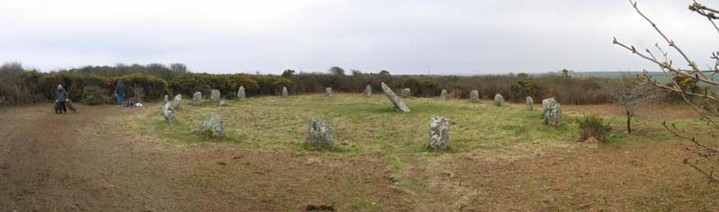
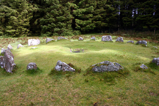
This is a neat little 'fairy' circle on the edge of the plantation with a stone cist in the centre. Plonkers had lit a fire within the cist. FFS why?This post appears as part of the blog post " Well Cross in Kernow (1)" |
Visited 21/5/5
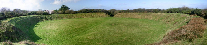
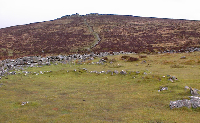
What a fantastic place! From the layby, walk up the steps then keep up the hill till the stream is heard. Keep the stream on the right until a 'stone path' is seen. Follow the path to the settlement - the path continues on up to Hookney Tor.
There's a real sense of loss here – it's easy to imagine the bustling community that once existed within the encircling wall with its three entrances.This post appears as part of the blog post " Well Cross in Kernow (1)" |
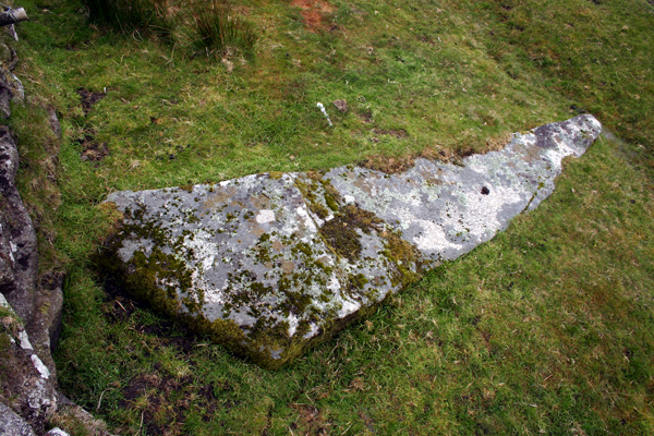
Visited 21/5/5. Noted elsewhere as 'Meacombe Cist'.
Parking is difficult. Best places seem to be the next gate up to the north, or a bit further to the south, by the farm entrance.
I couldn't get close to the actual chamber without trespassing into a field full of a quantity of bovine population with young, so I chickened out and contented myself with the long view through the herd.This post appears as part of the blog post " Well Cross in Kernow (1)" |
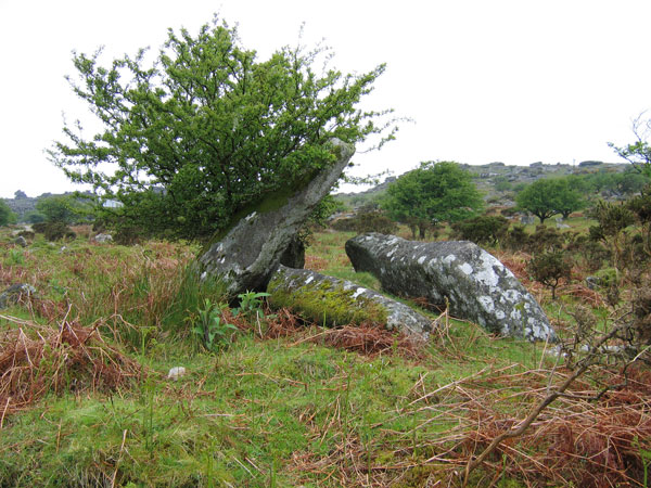
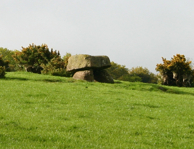
After a stroll with Mr Hamhead (Mark) across Bodmin to see King Arthur's Hall, just a short way east from the King Arthur's Down circle (following the field wall), we came across this fallen menhir.
The stone is almost certainly fallen, as the shape is ideal for a 'stander', and the base is thicker and shaped for support, being much thicker in width as well as breadth.
Mark shoved his trusty walking pole under the thin end, and ascertained that the stone is no more than about 9 inches thick at the pointy end.
There is a possibility that this is part of a fallen stone row, as at least two more large granite blocks were seen directly in line with this one on the other side of the wall. Barbed wire and long-horn cattle prevented closer inspection of these other stones.
As it lays, the stone is pointing directly to Rough Tor.
|

|
An ex-Londoner based in West Cornwall, any sites on the wrong side of the Tamar are now effectively out of reach as time marches on for me.
I was usually accompanied on trips by my partner and soulmate Mikki, who is disabled and unable to walk far. I'm indebted to her for her patience and understanding.
Favourite place? Cornwall without a doubt. West Penwith in particular, Trencrom Hill as a prime example. The peninsular is so rich in sites and has an amazing atmosphere. Every trip there is like going home... Avebury currently comes a close second, but is starting to go the way of Stonehenge (see below) and Glastonbury for me - over-used and over-rated.
Most overrated? Stonehenge - I can't understand the excitement that this totally spoiled site induces in people. I first went there in the 1960's with school and have been back several times since. Each was an anti-climax.
|
|